Highter Bojewyan

Settlement in Cornwall

England

Highter Bojewyan

OS Flush Bracket S7040 - Higher Boscaswell, St John's Church <span class="nowrap"><a title="https://www.bench-marks.org.uk/bm11683" rel="nofollow ugc noopener" href="https://www.bench-marks.org.uk/bm11683">Link</a><img style="margin-left:2px;" alt="External link" title="External link - shift click to open in new window" src="https://s1.geograph.org.uk/img/external.png" width="10" height="10"/></span>
OS Flush Bracket S7040 - Higher Boscaswell, St John's Church Credit: thejackrustles

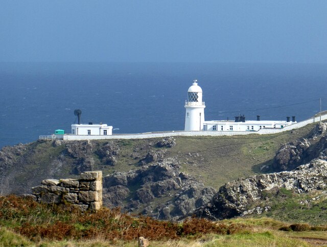
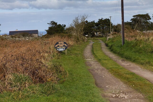
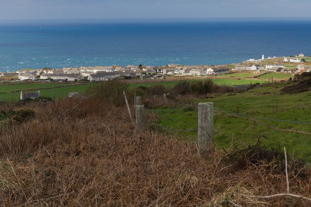
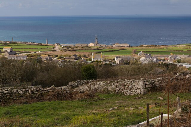
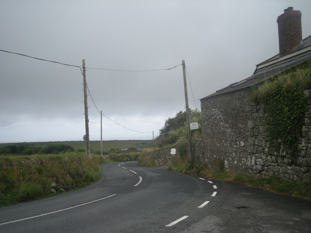
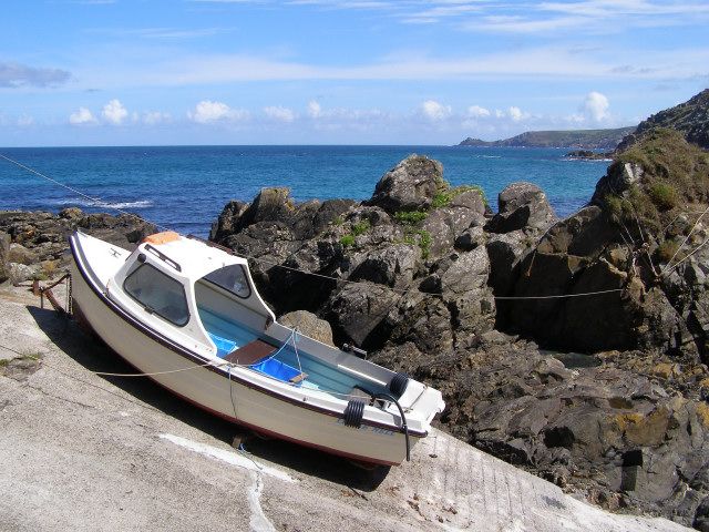
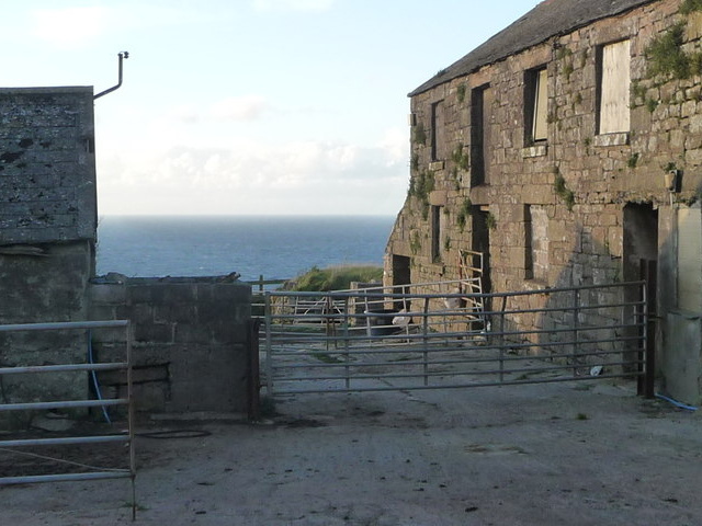
Higher Bojewyan is a small hamlet located in the county of Cornwall, England. Situated on the rugged and picturesque coastline of the Land's End peninsula, it is part of the civil parish of St Just. The hamlet is surrounded by stunning natural beauty, with rolling hills, moorland, and dramatic cliffs overlooking the Atlantic Ocean.

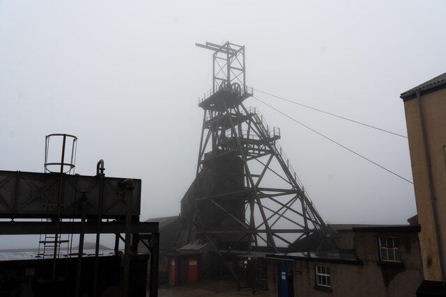
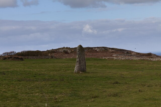
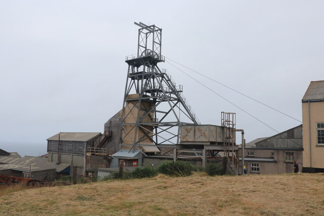
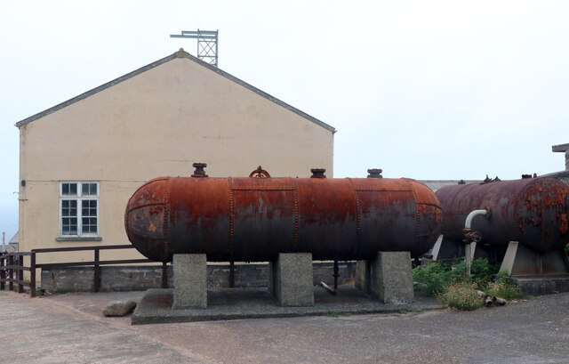
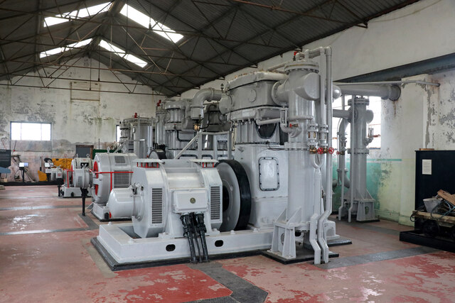
Despite its small size, Higher Bojewyan has a rich history. It was once a thriving mining community during the 19th century, with copper and tin mines operating in the area. The remnants of these mining activities can still be seen today, adding to the charm and character of the hamlet.

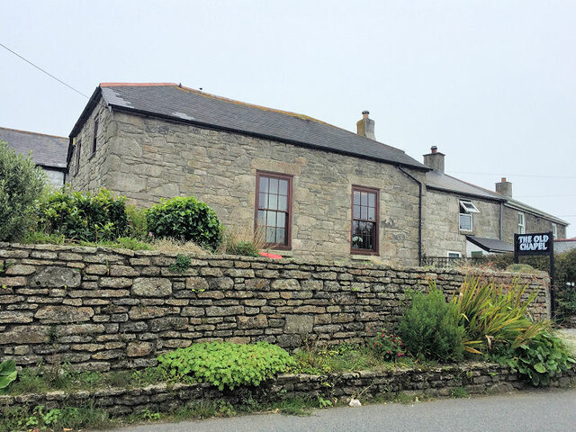
The architecture in Higher Bojewyan reflects its mining heritage, with traditional stone cottages and buildings that have been well-preserved over the years. The hamlet is known for its peaceful and tranquil atmosphere, making it an ideal destination for those seeking a quiet retreat or a scenic stroll along the coastal paths.

The nearby coastal area provides ample opportunities for outdoor activities such as hiking, birdwatching, and photography. The stunning cliffs and rocky coves also attract visitors interested in geology and wildlife. Higher Bojewyan is a popular spot for nature enthusiasts who appreciate the abundance of flora and fauna in the area.

While the hamlet itself does not have many amenities, the nearby town of St Just offers a range of facilities including shops, cafes, and a selection of accommodation options for visitors. Overall, Higher Bojewyan is a hidden gem in Cornwall, offering visitors a glimpse into its mining history and the chance to explore the breathtaking natural landscape of the Land's End peninsula.

If you have any feedback on the listing, please let us know in the comments section below.

Highter Bojewyan Images

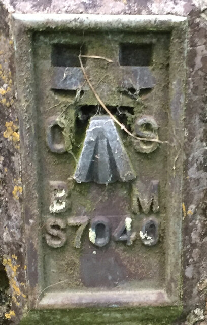
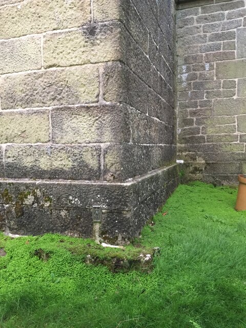
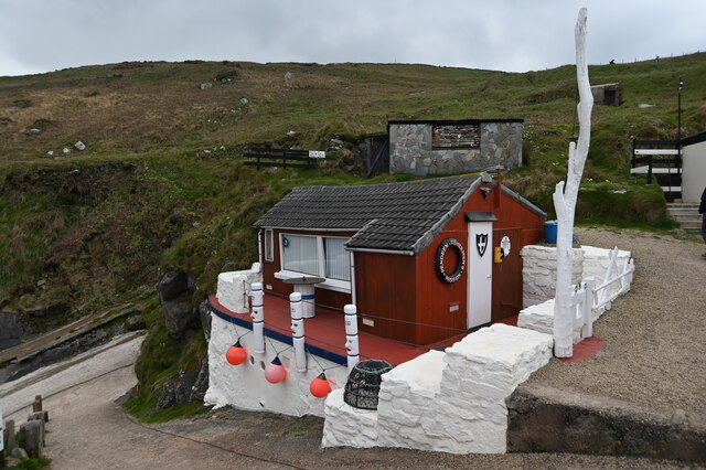
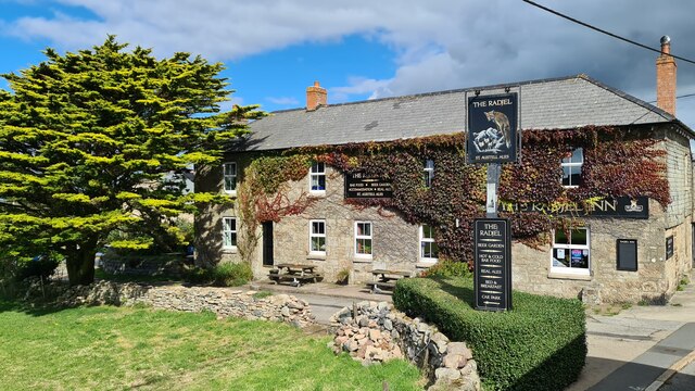
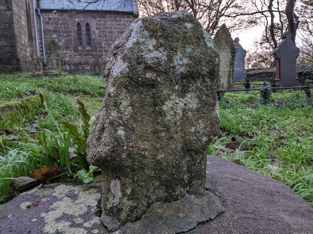
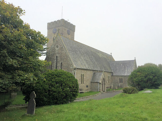
Images are sourced within 2km of 50.154932/-5.6519711 or Grid Reference SW3934. Thanks to Geograph Open Source API. All images are credited.

OS Flush Bracket S7040 - Higher Boscaswell, St John's Church <span class="nowrap"><a title="https://www.bench-marks.org.uk/bm11683" rel="nofollow ugc noopener" href="https://www.bench-marks.org.uk/bm11683">Link</a><img style="margin-left:2px;" alt="External link" title="External link - shift click to open in new window" src="https://s1.geograph.org.uk/img/external.png" width="10" height="10"/></span>
OS Flush Bracket S7040 - Higher Boscaswell, St John's Church
Location of OS Flush Bracket S7040 - Higher Boscaswell, St John's Church
Pendeen Lighthouse from the Levant Mine Looking along the western coast of Cornwall from the clifftop Levant Mine to Penlee Lighthouse a couple of miles distant.
Pendeen Lighthouse from the Levant Mine
Looking along the western coast of Cornwall from the clifftop Levant Mine to Penlee Lighthouse a couple of miles distant.
Headframe and surrounding buildings at Geevor Tin Mine
Fishermen's hut at Boat Cove, Portheras This hut and associated buildings have been built and maintained by the Pendeen Fishermen's Mission. A steep slipway allows boats to be lowered into the cove below.
Fishermen's hut at Boat Cove, Portheras
This hut and associated buildings have been built and maintained by the Pendeen Fishermen's Mission. A steep slipway allows boats to be lowered into the cove below.
Geevor Tin Mine
Geevor Tin Mine
The Radjel Inn, Boscaswell, Pendeen
Old Cross in Pendeen Churchyard Portherras Cross, the old head and neck of a wayside cross. Moved to the northeast side of Pendeen Churchyard and set close to the gate of the vicarage. St Just parish. A Scheduled Monument <span class="nowrap"><a title="https://historicengland.org.uk/listing/the-list/list-entry/1019166" rel="nofollow ugc noopener" href="https://historicengland.org.uk/listing/the-list/list-entry/1019166">Link</a><img style="margin-left:2px;" alt="External link" title="External link - shift click to open in new window" src="https://s1.geograph.org.uk/img/external.png" width="10" height="10"/></span>. 

Milestone Society National ID: CWPW_SJP05
Old Cross in Pendeen Churchyard
Portherras Cross, the old head and neck of a wayside cross. Moved to the northeast side of Pendeen Churchyard and set close to the gate of the vicarage. St Just parish. A Scheduled Monument LinkExternal link. Milestone Society National ID: CWPW_SJP05
St John The Baptist Church
The Old Chapel
The Old Chapel
Wheal Bal Farm Looking at the buildings of Wheal Bal Farm from the public bridleway.
Wheal Bal Farm
Looking at the buildings of Wheal Bal Farm from the public bridleway.
Farm access track The access track to Higher Trewellard Hill Farm forks off the public bridleway.
Farm access track
The access track to Higher Trewellard Hill Farm forks off the public bridleway.
Standing stone This standing stone was placed here comparatively recently.
Standing stone
This standing stone was placed here comparatively recently.
View from track 1 As the track rounds the hill there is a view to houses at Lower Boscaswell and the top of Pendeen lighthouse. See also <a href="https://www.geograph.org.uk/photo/7416881">SW3833 : View from track 2</a>.
View from track 1
As the track rounds the hill there is a view to houses at Lower Boscaswell and the top of Pendeen lighthouse. See also SW3833 : View from track 2.
View from track 2 In this view the winding tower of Geevor mine and the chimneys of Levant can be seen. See also <a href="https://www.geograph.org.uk/photo/7416877">SW3833 : View from track 1</a>.
View from track 2
In this view the winding tower of Geevor mine and the chimneys of Levant can be seen. See also SW3833 : View from track 1.
Geevor Mine - Victory Shaft A former tin mine that is now a museum.
Geevor Mine - Victory Shaft
A former tin mine that is now a museum.
Geevor Mine - winding engine house Electric winding engine house with air receivers in front. A former tin mine that is now a museum.
Geevor Mine - winding engine house
Electric winding engine house with air receivers in front. A former tin mine that is now a museum.
Geevor Mine - compressor house A former tin mine now a museum. The three compressors are by Alley & McLellan and are two stage with intercooling and aftercooling.
Geevor Mine - compressor house
A former tin mine now a museum. The three compressors are by Alley & McLellan and are two stage with intercooling and aftercooling.
Show me another place!

Highter Bojewyan is located at Grid Ref: SW3934 (Lat: 50.154932, Lng: -5.6519711)

Unitary Authority: Cornwall

Police Authority: Devon and Cornwall

What 3 Words

///glorified.dried.fine. Near St Just, Cornwall

Nearby Locations

Bojewyan Highter Bojewyan

Related Wikis

Bojewyan

Bojewyan is a settlement on the Penwith Peninsula in west Cornwall, England, United Kingdom. The village lies along the B3306 road which runs along the...

Pendeen

Pendeen (from Cornish: Penn Din meaning "headland fort", previously known as Cornish: Boskaswal Wartha, meaning "Caswal's high dwelling") is a village...

Higher Boscaswell

Higher Boscaswell is a hamlet near Pendeen in west Cornwall, England. It is east of Pendeen and on the B road from St Ives to St Just. Higher Boscaswell...

Pendeen Vau

Pendeen Vau is a fogou on the Cornish coast of England, near the village of Pendeen. It is situated at Pendeen (Manor) farm, once the home of the renowned...

Nearby Amenities

Located within 500m of 50.154932,-5.6519711
Bojewyan
Is In: Cornwall, England, UK
Is In Country: England
Is In Country Code: GB
Is In County: Cornwall
Name Kw: Bosywyon
Place: village
Source: npe
Wikidata: Q4938666
Lat/Long: 50.1547143/-5.6526382
Bus Stop
Bojewyan Stennack
Naptan AtcoCode: 0800COD40185
Naptan Bearing: S
Naptan CommonName: Bojewyan Stennack
Naptan NaptanCode: coradgtd
Naptan Street: Ponds Hill
Naptan Verified: no
Shelter: no
Source: naptan_import
Lat/Long: 50.1543859/-5.6547325
Portherras Cross
Place: locality
Lat/Long: 50.1529371/-5.6578571
Yew Tree Gallery
Tourism: artwork
Lat/Long: 50.1557096/-5.6453151
Post Box
Brand: Royal Mail
Brand Wikidata: Q638098
Collection Times: Mo-Fr 11:00; Sa 11:00
Operator: Royal Mail
Operator Wikidata: Q638098
Post Box Type: lamp
Ref: TR19 5
Royal Cypher: EIIR
Royal Cypher Wikidata: Q33102113
Source: survey
Survey Date: 2015-09-29
Lat/Long: 50.154192/-5.6548086
Direction: SE
Generator Method: photovoltaic
Generator Output Electricity: small_installation
Generator Source: solar
Generator Type: solar_photovoltaic_panel
Location: roof
Power: generator
Source: bing
Lat/Long: 50.1549928/-5.653245
Direction: SW
Generator Method: photovoltaic
Generator Output Electricity: small_installation
Generator Source: solar
Generator Type: solar_photovoltaic_panel
Location: roof
Power: generator
Source: bing
Lat/Long: 50.155071/-5.6522258
Power: pole
Transformer: distribution
Lat/Long: 50.1547737/-5.6529205
Power: pole
Lat/Long: 50.1543458/-5.6532946
Power: pole
Lat/Long: 50.1536171/-5.6529298
Power: pole
Lat/Long: 50.15385/-5.6515995
Power: pole
Transformer: distribution
Lat/Long: 50.1540674/-5.6503455
Portherras Cross
Power: pole
Transformer: distribution
Lat/Long: 50.1521958/-5.6573468
Power: pole
Lat/Long: 50.1520042/-5.654617
Power: pole
Lat/Long: 50.1537013/-5.6538633
Power: pole
Lat/Long: 50.1534177/-5.6550407
Power: pole
Transformer: distribution
Lat/Long: 50.1533954/-5.65514
Power: pole
Lat/Long: 50.1527097/-5.6548181
Power: pole
Lat/Long: 50.1520145/-5.6545191
Power: pole
Lat/Long: 50.151388/-5.6542401
Power: pole
Lat/Long: 50.150747/-5.6540872
Power: pole
Transformer: distribution
Lat/Long: 50.1547591/-5.6449999
Power: pole
Lat/Long: 50.1593413/-5.6507505
Power: pole
Transformer: distribution
Lat/Long: 50.1591506/-5.6522164
Power: pole
Lat/Long: 50.1590578/-5.6531337
Power: pole
Lat/Long: 50.1589375/-5.6541047
Power: pole
Lat/Long: 50.1587957/-5.6553398
Public Bookcase
Defibrillator
Access: yes
Booth: K6
Defibrillator Location: inside old red phone box that is now used as book exchange in Portherras Cross
Disused Amenity: telephone
Emergency: defibrillator
Man Made: telephone_box
Public Bookcase Type: phone_box
Lat/Long: 50.1521917/-5.657451
Stop
Direction: forward
Lat/Long: 50.1527329/-5.6578889
Give Way
Direction: backward
Lat/Long: 50.1527882/-5.6579388
The data included in this document is from www.openstreetmap.org. The data is made available under ODbL.

Have you been to Highter Bojewyan?

Leave your review of Highter Bojewyan below (or comments, questions and feedback).