Highgate

Settlement in Norfolk King's Lynn and West Norfolk

England

Highgate

King's Lynn station The northern terminus of the Great Northern electrified Fen line from Kings Cross, with additional trains by Greater Anglia from Liverpool Street. This building dates to 1871-2.
King's Lynn station Credit: Chris Morgan

Highgate is a charming village located in the county of Norfolk, England. It is nestled amidst picturesque countryside, with rolling hills and lush green fields as far as the eye can see. Situated approximately 15 miles northwest of Norwich, Highgate is a peaceful and idyllic retreat away from the hustle and bustle of city life.

The village itself is small but full of character, with a population of around 500 residents. It boasts a delightful mix of traditional cottages and Georgian-style houses, which add to its timeless appeal. Highgate also features a beautiful parish church, St. Mary's, which dates back to the 14th century and stands as a testament to the village's rich history.

Surrounding the village are several acres of open countryside, offering ample opportunities for outdoor activities such as hiking, cycling, and birdwatching. The landscape is dotted with charming footpaths and bridleways, allowing visitors to explore the area's natural beauty.

Despite its peaceful setting, Highgate is conveniently located near a range of amenities. The nearby market town of Aylsham offers a variety of shops, cafes, and restaurants, ensuring that residents and visitors have easy access to everyday essentials and leisure facilities.

In conclusion, Highgate is a picturesque and tranquil village, perfect for those seeking a rural retreat. With its stunning countryside, historic charm, and close proximity to amenities, it is an ideal destination for nature lovers and those looking to escape the fast pace of modern life.

If you have any feedback on the listing, please let us know in the comments section below.

Highgate Images

Images are sourced within 2km of 52.755764/0.40532642 or Grid Reference TF6220. Thanks to Geograph Open Source API. All images are credited.

King's Lynn station The northern terminus of the Great Northern electrified Fen line from Kings Cross, with additional trains by Greater Anglia from Liverpool Street. This building dates to 1871-2.
King's Lynn station
The northern terminus of the Great Northern electrified Fen line from Kings Cross, with additional trains by Greater Anglia from Liverpool Street. This building dates to 1871-2.
St James' Park, King's Lynn Part of the larger Walks, see the Friends of the Walks website: <span class="nowrap"><a title="http://www.thewalks.uk/history-of-the-walks/" rel="nofollow ugc noopener" href="http://www.thewalks.uk/history-of-the-walks/">Link</a><img style="margin-left:2px;" alt="External link" title="External link - shift click to open in new window" src="https://s1.geograph.org.uk/img/external.png" width="10" height="10"/></span>
St James' Park, King's Lynn
Part of the larger Walks, see the Friends of the Walks website: LinkExternal link
Captain George Vancouver in front of the Custom House The Custom House was built in 1684/5 and would have been familiar to Vancouver who was born in King's Lynn in 1757. He joined the Royal Navy at the age of 13 and appears to have retired when only about 38.

Vancouver's voyages and discoveries seem to have been downplayed at the end of his life, maybe not unrelated to his dispute with Pitt the Younger's violent cousin, Thomas Pitt, 2nd Baron Camelford, see: <span class="nowrap"><a title="https://en.wikipedia.org/wiki/George_Vancouver" rel="nofollow ugc noopener" href="https://en.wikipedia.org/wiki/George_Vancouver">Link</a><img style="margin-left:2px;" alt="External link" title="External link - shift click to open in new window" src="https://s1.geograph.org.uk/img/external.png" width="10" height="10"/></span>
Captain George Vancouver in front of the Custom House
The Custom House was built in 1684/5 and would have been familiar to Vancouver who was born in King's Lynn in 1757. He joined the Royal Navy at the age of 13 and appears to have retired when only about 38. Vancouver's voyages and discoveries seem to have been downplayed at the end of his life, maybe not unrelated to his dispute with Pitt the Younger's violent cousin, Thomas Pitt, 2nd Baron Camelford, see: LinkExternal link
Navigation buoys beside the River Great Ouse At King's Lynn
Navigation buoys beside the River Great Ouse
At King's Lynn
Marriott's Warehouse, King's Lynn Grade II listed and possibly dating to the late 1500s using materials that may be older.
Marriott's Warehouse, King's Lynn
Grade II listed and possibly dating to the late 1500s using materials that may be older.
King's Lynn Town Hall
High Water Marks, St Margaret's Church, King's Lynn
Priory and Parish church of St Margaret Dedicated as King's Lynn's Minster in 2011. Apparently one tower is for the local parish and community, and one tower is for the priory and monks.
Priory and Parish church of St Margaret
Dedicated as King's Lynn's Minster in 2011. Apparently one tower is for the local parish and community, and one tower is for the priory and monks.
Purfleet Quay and Custom House, King's Lynn The Custom House was designed by Henry Bell and built in 1683.
Purfleet Quay and Custom House, King's Lynn
The Custom House was designed by Henry Bell and built in 1683.
Guannock Gate and town wall, King's Lynn
King's Lynn Minster The parish church of St Margaret was elevated to become King's Lynn Minster <span class="nowrap"><a title="https://kingslynnminster.org/" rel="nofollow ugc noopener" href="https://kingslynnminster.org/">Link</a><img style="margin-left:2px;" alt="External link" title="External link - shift click to open in new window" src="https://s1.geograph.org.uk/img/external.png" width="10" height="10"/></span> in 2011, one of a wave of churches which gained Minster status around that time.  

On the right can be seen Hanse House <span class="nowrap"><a title="http://www.hansehouse.co.uk/history/" rel="nofollow ugc noopener" href="http://www.hansehouse.co.uk/history/">Link</a><img style="margin-left:2px;" alt="External link" title="External link - shift click to open in new window" src="https://s1.geograph.org.uk/img/external.png" width="10" height="10"/></span> ; this incorporates a mediaeval warehouse once owned by the Hanseatic League, which used the town as a trading post. Today the building has a variety of uses, including offices, an indoor market, three flats, function rooms and a wine bar <span class="nowrap"><a title="https://www.therathskeller.co.uk/" rel="nofollow ugc noopener" href="https://www.therathskeller.co.uk/">Link</a><img style="margin-left:2px;" alt="External link" title="External link - shift click to open in new window" src="https://s1.geograph.org.uk/img/external.png" width="10" height="10"/></span> .
King's Lynn Minster
The parish church of St Margaret was elevated to become King's Lynn Minster LinkExternal link in 2011, one of a wave of churches which gained Minster status around that time. On the right can be seen Hanse House LinkExternal link ; this incorporates a mediaeval warehouse once owned by the Hanseatic League, which used the town as a trading post. Today the building has a variety of uses, including offices, an indoor market, three flats, function rooms and a wine bar LinkExternal link .
Ferry terminal, West Lynn Ferry There cannot be many river ferries left now in Britain, but West Lynn Ferry Ltd. operates this one on the Great Ouse, for foot passengers only.  Today it was mostly being used by locals to get around; it is advertised to visitors as "an ideal way to view the beautiful historic quayside of King's Lynn from the other side of the River Great Ouse at West Lynn." <span class="nowrap"><a title="https://www.west-norfolk.gov.uk/info/20007/people_and_communities/441/public_transport" rel="nofollow ugc noopener" href="https://www.west-norfolk.gov.uk/info/20007/people_and_communities/441/public_transport">Link</a><img style="margin-left:2px;" alt="External link" title="External link - shift click to open in new window" src="https://s1.geograph.org.uk/img/external.png" width="10" height="10"/></span> . West Lynn, seen here across the river, is assumed not to have attractions of its own.
Ferry terminal, West Lynn Ferry
There cannot be many river ferries left now in Britain, but West Lynn Ferry Ltd. operates this one on the Great Ouse, for foot passengers only. Today it was mostly being used by locals to get around; it is advertised to visitors as "an ideal way to view the beautiful historic quayside of King's Lynn from the other side of the River Great Ouse at West Lynn." LinkExternal link . West Lynn, seen here across the river, is assumed not to have attractions of its own.
Customs House in 1990 View from the west along Purfleet Quay
Customs House in 1990
View from the west along Purfleet Quay
Millfleet Burial Ground A small brick enclosure used for the burial of a community of Dutch Jews who lived in Lynn from the mid eighteenth to the mid nineteenth centuries. The walls of the enclosure, however, date from the sixteenth century <span class="nowrap"><a title="https://historicengland.org.uk/listing/the-list/list-entry/1298159?section=official-list-entry" rel="nofollow ugc noopener" href="https://historicengland.org.uk/listing/the-list/list-entry/1298159?section=official-list-entry">Link</a><img style="margin-left:2px;" alt="External link" title="External link - shift click to open in new window" src="https://s1.geograph.org.uk/img/external.png" width="10" height="10"/></span>
Millfleet Burial Ground
A small brick enclosure used for the burial of a community of Dutch Jews who lived in Lynn from the mid eighteenth to the mid nineteenth centuries. The walls of the enclosure, however, date from the sixteenth century LinkExternal link
King's Lynn Railway Station Built for the Great Eastern Railway 1871-2 <span class="nowrap"><a title="https://historicengland.org.uk/listing/the-list/list-entry/1389399?section=official-list-entry" rel="nofollow ugc noopener" href="https://historicengland.org.uk/listing/the-list/list-entry/1389399?section=official-list-entry">Link</a><img style="margin-left:2px;" alt="External link" title="External link - shift click to open in new window" src="https://s1.geograph.org.uk/img/external.png" width="10" height="10"/></span>
King's Lynn Railway Station
Built for the Great Eastern Railway 1871-2 LinkExternal link
Red Mount Chapel, King's Lynn Late fifteenth century Pilgrimage Chapel <span class="nowrap"><a title="https://historicengland.org.uk/listing/the-list/list-entry/1195403?section=official-list-entry" rel="nofollow ugc noopener" href="https://historicengland.org.uk/listing/the-list/list-entry/1195403?section=official-list-entry">Link</a><img style="margin-left:2px;" alt="External link" title="External link - shift click to open in new window" src="https://s1.geograph.org.uk/img/external.png" width="10" height="10"/></span>
Red Mount Chapel, King's Lynn
Late fifteenth century Pilgrimage Chapel LinkExternal link
The Gaywood River, King's Lynn Looking from St. John's Walk towards the culvert beneath the railway.
The Gaywood River, King's Lynn
Looking from St. John's Walk towards the culvert beneath the railway.
Mayor's Avenue, The Walks, King's Lynn Follows the line of the town walls.
Mayor's Avenue, The Walks, King's Lynn
Follows the line of the town walls.
Show me another place!

Highgate is located at Grid Ref: TF6220 (Lat: 52.755764, Lng: 0.40532642)

Administrative County: Norfolk

District: King's Lynn and West Norfolk

Police Authority: Norfolk

What 3 Words

///belt.gold.buns. Near King's Lynn, Norfolk

Nearby Locations

Highgate Long Pond

Related Wikis

King's Lynn railway station

King's Lynn railway station is the northern terminus of the Fen line in the east of England, serving the town of King's Lynn, Norfolk. It is 41 miles 47...

The Walks

The Walks is the premier urban park in King's Lynn, Norfolk. == History == The Walks were originally established in the 18th century. == Landmarks... ==

King's Lynn

King's Lynn, known until 1537 as Bishop's Lynn and colloquially as Lynn, is a port and market town in the borough of King's Lynn and West Norfolk in the...

King Edward VII Academy

King Edward VII Academy (known as KES Academy) is a large, mixed comprehensive secondary school in Gaywood Road (A148), King's Lynn, Norfolk, England with...

King's Lynn and West Norfolk

King's Lynn and West Norfolk is a local government district with borough status in Norfolk, England. Its council is based in the town of King's Lynn. The...

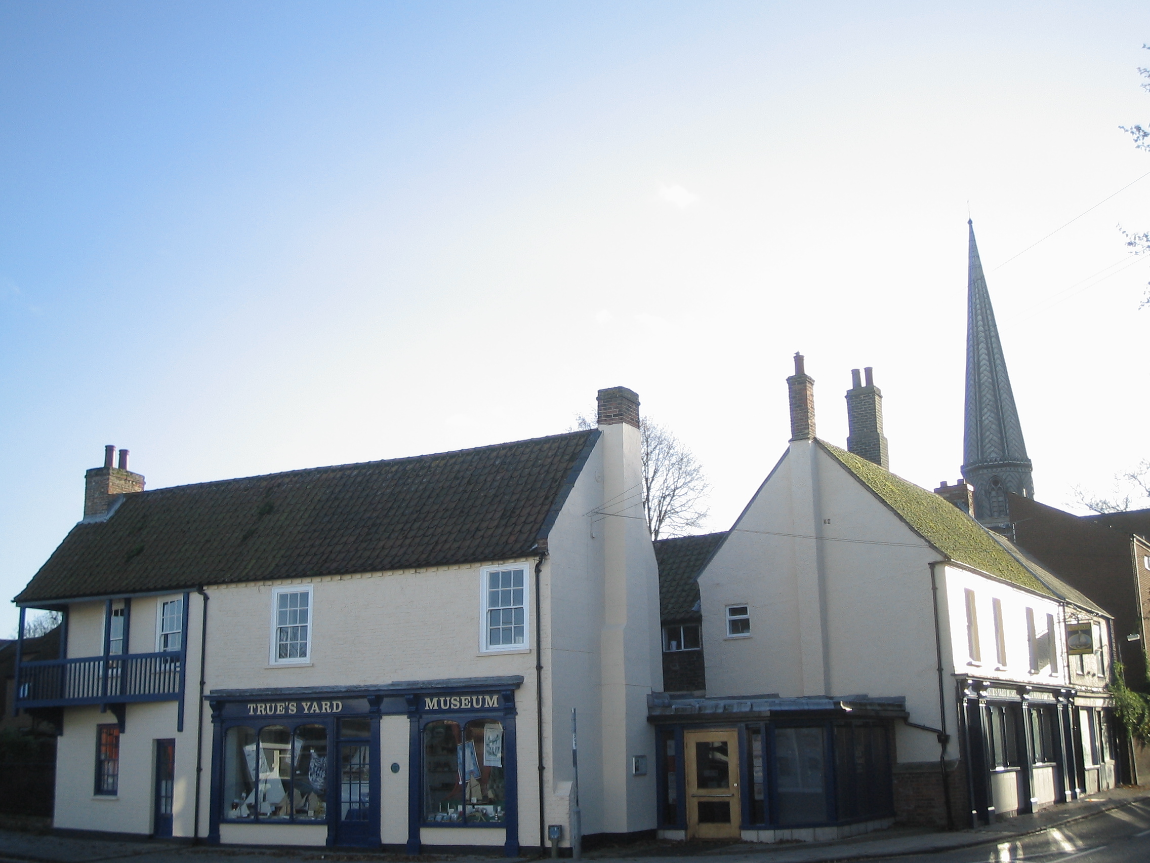
True's Yard Fisherfolk Museum

True’s Yard Fisherfolk Museum is a social history museum in King's Lynn, Norfolk. It is an independent museum run almost entirely by volunteers and depicts...

King's Lynn Town F.C.

King's Lynn Town Football Club is a football club based in King's Lynn, Norfolk, England. Nicknamed 'The Linnets', they are currently members of the National...

King's Lynn F.C.

King's Lynn Football Club was an English association football club based in King's Lynn, Norfolk. The club was founded in 1881 and they were wound up at...

Nearby Amenities

Located within 500m of 52.755764,0.40532642
Traffic Signals
Lat/Long: 52.7567145/0.4000195
Railway: switch
Lat/Long: 52.7535311/0.4066245
Crossing Barrier: yes
Crossing Bell: yes
Crossing Light: yes
Railway: level_crossing
Supervised: no
Lat/Long: 52.7529906/0.4097178
Railway: switch
Lat/Long: 52.7528418/0.410192
Crossing
Bicycle: yes
Crossing: traffic_signals
Crossing Ref: toucan
Segregated: no
Lat/Long: 52.7537423/0.402756
Turning Circle
Lat/Long: 52.7552515/0.408548
Priority: equal
Lat/Long: 52.7549657/0.4088199
Mini Roundabout
Direction: clockwise
Lat/Long: 52.7547575/0.4044168
Turning Circle
Lat/Long: 52.7566277/0.4060573
Traffic Signals
Lat/Long: 52.7547558/0.4008512
Mini Roundabout
Direction: clockwise
Lat/Long: 52.7594604/0.4071632
Traffic Signals
Lat/Long: 52.7576428/0.4077594
Traffic Signals
Lat/Long: 52.7531724/0.4007765
Traffic Signals
Lat/Long: 52.7566827/0.4007196
Barrier: bollard
Bicycle: yes
Foot: yes
Lat/Long: 52.758624/0.4010897
Holmwood House Nursing Home
Landuse: residential
Lat/Long: 52.7570544/0.4034386
Colour: gray
Material: metal
Power: tower
Structure: lattice
Lat/Long: 52.7583709/0.4027407
Colour: gray
Material: metal
Power: tower
Structure: lattice
Lat/Long: 52.7574386/0.40009
Colour: gray
Material: metal
Power: tower
Structure: lattice
Lat/Long: 52.7583056/0.4054012
Sport: 5-a-side
Lat/Long: 52.758871/0.4022669
Sport: multi
Lat/Long: 52.7588507/0.4017135
Barrier: bollard
Lat/Long: 52.7597676/0.4048204
Bus Stop
Townsend Terrace, adj
Bus: yes
Naptan AtcoCode: 2900K1376
Naptan Bearing: E
Naptan CommonName: Townsend Terrace
Naptan Indicator: adj
Naptan Locality: North Lynn
Naptan NaptanCode: nfodatag
Naptan PlusbusZoneRef: KLYNN
Naptan Street: Loke Road
Naptan Verified: no
Public Transport: platform
Source: naptan_import
Lat/Long: 52.7593016/0.4045876
Colour: gray
Material: metal
Power: tower
Structure: lattice
Lat/Long: 52.7588599/0.4078663
Raby Avenue, opp
Disused: yes
Disused Highway: bus_stop
Naptan AtcoCode: 2900K1378
Naptan Bearing: SE
Naptan BusStopType: CUS
Naptan CommonName: Raby Avenue
Naptan Indicator: opp
Naptan Landmark: Smith Avenue
Naptan Locality: North Lynn
Naptan NaptanCode: nfodatam
Naptan ShortCommonName: Raby Avenue
Naptan Street: Raby Avenue
Naptan Verified: no
Source: naptan_import
Lat/Long: 52.7599532/0.406846
Bus Stop
Highgate School, adj
Bus: yes
Naptan AtcoCode: 2900K1372
Naptan Bearing: E
Naptan CommonName: Highgate School
Naptan Indicator: adj
Naptan Landmark: Highgate Infants School
Naptan Locality: King's Lynn
Naptan NaptanCode: nfodapwm
Naptan PlusbusZoneRef: KLYNN
Naptan Street: Gaywood Road
Naptan Verified: no
Public Transport: platform
Source: naptan_import
Lat/Long: 52.7577078/0.4083451
Post Box
Collection Times: Mo-Fr 16:00; Sa 12:30; Su off
Operator: Royal Mail
Operator Wikidata: Q638098
Post Box Type: pillar
Ref: PE30 1
Royal Cypher: EIIR
Royal Cypher Wikidata: Q33102113
Lat/Long: 52.7537887/0.4030218
Bicycle Parking
Bicycle Parking: two-tier
Capacity: 34
Covered: yes
Fee: no
Lat/Long: 52.7536984/0.4031001
Bicycle Parking
Albion Street
Bicycle Parking: stands
Capacity: 12
Covered: no
Operator: west-norfolk.gov.uk
Lat/Long: 52.7546415/0.400055
King's Lynn Swiss Terrace
Operator: UK Power Networks
Operator Wikidata: Q7864927
Power: substation
Ref: F6270 2010G
Lat/Long: 52.7541375/0.4094226
Crossing
Crossing: traffic_signals
Crossing Ref: puffin
Tactile Paving: yes
Lat/Long: 52.7557091/0.4110411
Post Box
Ref: PE30 22
Lat/Long: 52.7554978/0.411091
Bus Stop
Bus Station, Stand B
Bus: yes
Local Ref: 2
Naptan AtcoCode: 2900K13138
Naptan Bearing: N
Naptan CommonName: Bus Station
Naptan Indicator: Bay 2
Naptan Locality: King's Lynn
Naptan NaptanCode: nfodamgw
Naptan PlusbusZoneRef: KLYNN
Naptan Street: Bus Station
Naptan Verified: no
Public Transport: platform
Source: naptan_import
Lat/Long: 52.7542405/0.3990804
Bus Stop
Bus Station, Stand C
Bus: yes
Local Ref: 3
Naptan AtcoCode: 2900K13139
Naptan Bearing: N
Naptan CommonName: Bus Station
Naptan Indicator: bay 3
Naptan Locality: King's Lynn
Naptan NaptanCode: nfodamja
Naptan PlusbusZoneRef: KLYNN
Naptan Street: Bus Station
Naptan Verified: no
Public Transport: platform
Source: naptan_import
Lat/Long: 52.7542827/0.3991072
Bus Stop
Bus Station, Stand D
Bus: yes
Local Ref: 4
Naptan AtcoCode: 2900K13140
Naptan Bearing: NE
Naptan CommonName: Bus Station
Naptan Indicator: Bay 4
Naptan Locality: King's Lynn
Naptan NaptanCode: nfodamjd
Naptan PlusbusZoneRef: KLYNN
Naptan Street: Bus Station
Naptan Verified: no
Public Transport: platform
Source: naptan_import
Lat/Long: 52.7543249/0.399134
Bus Stop
Bus Station, Stand E
Bus: yes
Local Ref: 5
Naptan AtcoCode: 2900K13141
Naptan Bearing: NE
Naptan CommonName: Bus Station
Naptan Indicator: Bay 5
Naptan Locality: King's Lynn
Naptan NaptanCode: nfodamjg
Naptan PlusbusZoneRef: KLYNN
Naptan Street: Bus Station
Naptan Verified: no
Public Transport: platform
Source: naptan_import
Lat/Long: 52.7543655/0.3991608
Bus Stop
Bus Station, Stand F
Bus: yes
Local Ref: 6
Naptan AtcoCode: 2900K13142
Naptan Bearing: S
Naptan CommonName: Bus Station
Naptan Indicator: Bay 6
Naptan Locality: King's Lynn
Naptan NaptanCode: nfodamjm
Naptan PlusbusZoneRef: KLYNN
Naptan Street: Bus Station
Naptan Verified: no
Public Transport: platform
Source: naptan_import
Lat/Long: 52.7544061/0.399185
Bus Stop
Bus Station, Stand G
Bench: yes
Bus: yes
Local Ref: 7
Naptan AtcoCode: 2900K13143
Naptan Bearing: S
Naptan CommonName: Bus Station
Naptan Indicator: Bay 7
Naptan Locality: King's Lynn
Naptan NaptanCode: nfodamjp
Naptan PlusbusZoneRef: KLYNN
Naptan Street: Bus Station
Naptan Verified: no
Public Transport: platform
Shelter: yes
Source: naptan_import
Lat/Long: 52.7544516/0.3993969
Bus Stop
Bus Station, Stand H
Bench: yes
Bin: yes
Bus: yes
Local Ref: 8
Naptan AtcoCode: 2900K13144
Naptan Bearing: S
Naptan CommonName: Bus Station
Naptan Indicator: Bay 8
Naptan Locality: King's Lynn
Naptan NaptanCode: nfodamjt
Naptan PlusbusZoneRef: KLYNN
Naptan Street: Bus Station
Naptan Verified: no
Public Transport: platform
Shelter: yes
Source: naptan_import
Lat/Long: 52.7545149/0.399716
Bus Stop
Bus Station, Stand A
Bus: yes
Local Ref: 1
Naptan AtcoCode: 2900K132
Naptan Bearing: NW
Naptan CommonName: Bus Station
Naptan Indicator: Bay 1
Naptan Locality: King's Lynn
Naptan NaptanCode: nfodapap
Naptan PlusbusZoneRef: KLYNN
Naptan Street: Bus station
Naptan Verified: no
Public Transport: platform
Source: naptan_import
Lat/Long: 52.7541999/0.3990535
Bus Stop
Railway Station
Bus: yes
Naptan AtcoCode: 2900K1322
Naptan Bearing: S
Naptan CommonName: Railway Station
Naptan Indicator: adj
Naptan Landmark: forecourt
Naptan Locality: King's Lynn
Naptan NaptanCode: nfodapda
Naptan PlusbusZoneRef: KLYNN
Naptan Street: Blackfriars Road
Naptan Verified: no
Public Transport: platform
Ref Tiploc: KLYNBUS
Source: naptan_import
Lat/Long: 52.7541993/0.4028798
College of West Anglia, adj
Naptan AtcoCode: 2900K1330
Naptan Bearing: E
Naptan BusStopType: CUS
Naptan CommonName: College of West Anglia
Naptan Indicator: adj
Naptan Landmark: College grounds
Naptan Locality: King's Lynn
Naptan NaptanCode: nfodapdj
Naptan PlusbusZoneRef: KLYNN
Naptan Street: Tennyson Avenue
Naptan Verified: no
Source: naptan_import
Lat/Long: 52.7570093/0.4097486
Princes Way, adj
Naptan AtcoCode: 2900K1360
Naptan Bearing: S
Naptan BusStopType: CUS
Naptan CommonName: Princes Way
Naptan Indicator: adj
Naptan Landmark: No. 58 Tennyson Ave
Naptan Locality: King's Lynn
Naptan NaptanCode: nfodapmw
Naptan PlusbusZoneRef: KLYNN
Naptan Street: Tennyson Avenue
Naptan Verified: no
Source: naptan_import
Lat/Long: 52.7541023/0.4107589
Bus Stop
Princes Way, opp
Bus: yes
Naptan AtcoCode: 2900K1361
Naptan Bearing: N
Naptan CommonName: Princes Way
Naptan Indicator: opp
Naptan Landmark: No. 85 Tennyson Ave
Naptan Locality: King's Lynn
Naptan NaptanCode: nfodapta
Naptan PlusbusZoneRef: KLYNN
Naptan Street: Tennyson Avenue
Naptan Verified: no
Public Transport: platform
Source: naptan_import
Lat/Long: 52.7541679/0.4106291
Bus Stop
Woolpack, adj
Bus: yes
Naptan AtcoCode: 2900K1371
Naptan Bearing: NW
Naptan CommonName: Woolpack
Naptan Indicator: adj
Naptan Landmark: Woolpack
Naptan Locality: King's Lynn
Naptan NaptanCode: nfodapwj
Naptan PlusbusZoneRef: KLYNN
Naptan Street: Gaywood Road
Naptan Verified: no
Public Transport: platform
Source: naptan_import
Lat/Long: 52.7573434/0.4101227
Bus Stop
St Katherines Court, adj
Bus: yes
Naptan AtcoCode: 2900K1373
Naptan Bearing: SW
Naptan BusStopType: CUS
Naptan CommonName: St Katherines Court
Naptan Indicator: adj
Naptan Landmark: St Katherines Court
Naptan Locality: King's Lynn
Naptan NaptanCode: nfodapwp
Naptan PlusbusZoneRef: KLYNN
Naptan Street: Gaywood Road
Naptan Verified: no
Public Transport: platform
Source: naptan_import
Lat/Long: 52.7570455/0.4057488
Bus Stop
Kettlewell Lane, adj
Bus: yes
Naptan AtcoCode: 2900K1374
Naptan Bearing: SW
Naptan CommonName: Kettlewell Lane
Naptan Indicator: adj
Naptan Landmark: Bridge
Naptan Locality: King's Lynn
Naptan NaptanCode: nfodapwt
Naptan PlusbusZoneRef: KLYNN
Naptan Street: Littleport Street
Naptan Verified: no
Public Transport: platform
Source: naptan_import
Lat/Long: 52.756457/0.4037304
Bus Stop
Austin Fields, opp
Bus: yes
Naptan AtcoCode: 2900K1375
Naptan Bearing: N
Naptan CommonName: Austin Fields
Naptan Indicator: opp
Naptan Landmark: North Street
Naptan Locality: King's Lynn
Naptan NaptanCode: nfodatad
Naptan PlusbusZoneRef: KLYNN
Naptan Street: John Kennedy Road
Naptan Verified: no
Public Transport: platform
Source: naptan_import
Lat/Long: 52.7573236/0.3986796
Bus Stop
Harecroft Parade, adj
Bus: yes
Naptan AtcoCode: 2900K1377
Naptan Bearing: W
Naptan CommonName: Harecroft Parade
Naptan Indicator: adj
Naptan Locality: North Lynn
Naptan NaptanCode: nfodataj
Naptan PlusbusZoneRef: KLYNN
Naptan Street: Loke Road
Naptan Verified: no
Public Transport: platform
Source: naptan_import
Lat/Long: 52.7591992/0.4046374
Bus Stop
Raby Avenue, adj
Bus: yes
Naptan AtcoCode: 2900K1379
Naptan Bearing: NW
Naptan CommonName: Raby Avenue
Naptan Indicator: adj
Naptan Landmark: Smith Avenue
Naptan Locality: North Lynn
Naptan NaptanCode: nfodatap
Naptan PlusbusZoneRef: KLYNN
Naptan ShortCommonName: Raby Avenue
Naptan Street: Raby Avenue
Naptan Verified: no
Public Transport: platform
Source: naptan_import
Lat/Long: 52.7601945/0.4063089
Railway: buffer_stop
Source: survey
Lat/Long: 52.7577799/0.4059914
Railway: switch
Lat/Long: 52.7562634/0.4072752
Railway: switch
Lat/Long: 52.7532537/0.4087087
King's Lynn
Network: National Rail
Operator: First Capital Connect
Public Transport: stop_position
Railway: buffer_stop
Train: yes
Lat/Long: 52.7538789/0.4034575
King's Lynn
Public Transport: stop_position
Railway: buffer_stop
Train: yes
Lat/Long: 52.7537806/0.4034427
King's Lynn
Public Transport: stop_position
Railway: buffer_stop
Source: survey
Train: yes
Lat/Long: 52.753898/0.4043118
Crossing
Bicycle: yes
Crossing: traffic_signals
Lat/Long: 52.7565362/0.4043549
Railway: switch
Lat/Long: 52.7533832/0.4090198
Traffic Signals
Lat/Long: 52.7571016/0.4112104
Toilets
Transport Interchange
Opening Hours: 24/7
Lat/Long: 52.7539844/0.3989384
King's Lynn
Network: National Rail
Operator: First Capital Connect
Public Transport: stop_position
Railway: buffer_stop
Train: yes
Lat/Long: 52.7538282/0.4034433
Traffic Signals
Lat/Long: 52.7539462/0.4028214
Fountain
Lat/Long: 52.7525858/0.4013074
Traffic Signals
Lat/Long: 52.7549671/0.4028206
Traffic Signals
Lat/Long: 52.7548576/0.4030658
Crossing
Bicycle: yes
Crossing: uncontrolled
Crossing Ref: tiger
Lat/Long: 52.7538253/0.3997212
Bus Station
Bus: yes
Public Transport: stop_position
Lat/Long: 52.7543324/0.3994877
Bus Station
Bus: yes
Public Transport: stop_position
Lat/Long: 52.754194/0.3994273
SC Autos
Addr City: King's Lynn
Addr Country: GB
Addr Housenumber: 26
Addr Postcode: PE30 1NF
Addr Street: Railway Road
Shop: car_repair
Lat/Long: 52.7540582/0.4005658
Traffic Signals
Lat/Long: 52.7531327/0.400955
Crossing
Crossing: traffic_signals
Tactile Paving: yes
Lat/Long: 52.7548535/0.4030197
Crossing
Crossing: traffic_signals
Tactile Paving: yes
Lat/Long: 52.7549377/0.4029677
Traffic Signals
Lat/Long: 52.7549568/0.4029261
Barrier: bollard
Bicycle: yes
Lat/Long: 52.7552457/0.4029749
Traffic Calming: bump
Lat/Long: 52.7582439/0.4025055
Austin Fields, adj
Naptan AtcoCode: 2900K1311
Naptan Bearing: SE
Naptan BusStopType: CUS
Naptan CommonName: Austin Fields
Naptan Indicator: adj
Naptan Landmark: Austin Fields
Naptan Locality: King's Lynn
Naptan NaptanCode: nfodajtp
Naptan PlusbusZoneRef: KLYNN
Naptan Street: John Kennedy Road
Naptan Verified: no
Source: naptan_import
Lat/Long: 52.7571686/0.3992343
Crossing
Crossing Island: yes
Lat/Long: 52.7544012/0.4108284
Railway: switch
Lat/Long: 52.7531838/0.4090037
Crossing Barrier: yes
Crossing Bell: yes
Crossing Light: yes
Railway: level_crossing
Supervised: no
Lat/Long: 52.7529638/0.409796
Crossing Barrier: yes
Crossing Bell: yes
Crossing Light: yes
Railway: level_crossing
Supervised: no
Lat/Long: 52.753022/0.4098103
Crossing Barrier: yes
Crossing Bell: yes
Crossing Light: yes
Railway: level_crossing
Supervised: no
Lat/Long: 52.7530463/0.4097494
Bicycle Parking
St James Pool Cycle Park
Bicycle Parking: stands
Capacity: 20
Covered: yes
Lat/Long: 52.7528486/0.4000948
Bicycle Parking
Morrisons Cycle Park
Bicycle Parking: stands
Capacity: 54
Covered: no
Lat/Long: 52.7546803/0.4066039
Bicycle Parking
The Walks Cafe Cycle Park
Bicycle Parking: stands
Capacity: 6
Covered: no
Operator: west-norfolk.gov.uk
Lat/Long: 52.7526576/0.4064966
Bicycle Parking
Matalan Cycle Park
Bicycle Parking: stands
Capacity: 20
Covered: no
Lat/Long: 52.7544566/0.4050124
Bicycle: dismount
Lat/Long: 52.753058/0.4010115
Traffic Signals
Lat/Long: 52.7531027/0.40089
Bus Stop
Bus Station, Drop Off
Bus: yes
Public Transport: platform
Lat/Long: 52.7539094/0.399362
Crossing
Bicycle: yes
Crossing: uncontrolled
Crossing Ref: tiger
Lat/Long: 52.7546389/0.4002352
Bicycle Parking
Lynn Museum
Bicycle Parking: stands
Capacity: 26
Covered: no
Operator: west-norfolk.gov.uk
Lat/Long: 52.7537361/0.3995901
Bicycle Parking
Bicycle Parking: stands
Covered: yes
Fee: no
Lat/Long: 52.7537196/0.4036995
Entrance: yes
Lat/Long: 52.7528549/0.3997966
Railway: switch
Lat/Long: 52.7535668/0.4086438
Traffic Signals
Lat/Long: 52.7557556/0.4004739
Crossing
Crossing: traffic_signals
Crossing Ref: pelican
Tactile Paving: yes
Lat/Long: 52.7561771/0.4026621
Traffic Signals
Lat/Long: 52.7561908/0.402338
Crossing
Lat/Long: 52.7561981/0.4024011
Traffic Signals
Lat/Long: 52.7561995/0.4027265
Crossing
Crossing: traffic_signals
Crossing Ref: pelican
Tactile Paving: yes
Lat/Long: 52.7562673/0.402449
Crossing
Crossing: traffic_signals
Crossing Ref: pelican
Tactile Paving: yes
Lat/Long: 52.756302/0.4026266
Traffic Signals
Lat/Long: 52.7563025/0.4024172
Traffic Signals
Lat/Long: 52.7563188/0.4025601
Traffic Signals
Lat/Long: 52.7565719/0.4001425
Crossing
Crossing: traffic_signals
Crossing Ref: pelican
Tactile Paving: yes
Lat/Long: 52.7566065/0.4001572
Traffic Signals
Lat/Long: 52.7566085/0.3999856
Crossing
Crossing: traffic_signals
Crossing Ref: pelican
Tactile Paving: yes
Lat/Long: 52.756638/0.3999512
Crossing
Crossing: traffic_signals
Crossing Ref: pelican
Tactile Paving: yes
Lat/Long: 52.7566974/0.4000839
Fixme: Does another path continue WSW from here?
Lat/Long: 52.7558634/0.4014917
Crossing
Crossing: traffic_signals
Crossing Ref: pelican
Tactile Paving: yes
Lat/Long: 52.7577785/0.4077175
Crossing
Crossing: traffic_signals
Crossing Ref: pelican
Tactile Paving: yes
Lat/Long: 52.7576412/0.4075026
Crossing
Crossing: traffic_signals
Crossing Ref: pelican
Tactile Paving: yes
Lat/Long: 52.7576467/0.4080217
Give Way
Lat/Long: 52.7581988/0.4021892
Traffic Signals
Traffic Signals Direction: backward
Lat/Long: 52.7538066/0.4006292
Traffic Signals
Lat/Long: 52.7536621/0.4008028
Traffic Signals
Lat/Long: 52.7539503/0.4027373
Traffic Signals
Lat/Long: 52.753743/0.4027039
Traffic Calming: chicane
Lat/Long: 52.7537563/0.4016575
Give Way
Lat/Long: 52.7592506/0.4036182
Give Way
Lat/Long: 52.759375/0.4036433
Entrance: yes
Lat/Long: 52.7517776/0.4057363
Entrance: main
Lat/Long: 52.75178/0.4057756
Entrance: main
Lat/Long: 52.7530597/0.402444
Entrance: yes
Lat/Long: 52.7531405/0.4026647
St John's Walk
Board Type: history
Information: board
Tourism: information
Lat/Long: 52.7532753/0.4029167
Blackfriars Antiques
Addr City: King's Lynn
Addr Street: Blackfriars Street
Fixme: Is this still here? https://www.blackfriarsantiques.co.uk/ has address on Tower Street.
Shop: antiques
Lat/Long: 52.753341/0.3999079
Images
Shop: hairdresser
Lat/Long: 52.7533201/0.4008981
Red Mount Chapel
Board Type: history
Information: board
Tourism: information
Lat/Long: 52.7520911/0.405397
A.J. Coggles
Addr City: King's Lynn
Addr Housenumber: 1
Addr Postcode: PE30 1NN
Addr Street: Blackfriars Street
Fixme: Check precise location
Shop: funeral_directors
Website: https://ajcoggles.co.uk/
Lat/Long: 52.753377/0.3993564
Give Way
Lat/Long: 52.759849/0.4036792
Give Way
Lat/Long: 52.759845/0.4037972
Give Way
Direction: backward
Lat/Long: 52.7568773/0.399459
Atm
Lat/Long: 52.7543597/0.3988748
Atm
Lat/Long: 52.7543558/0.3988492
Taxi
Lat/Long: 52.7545453/0.3990916
Bench
Lat/Long: 52.7515029/0.406365
Bench
Lat/Long: 52.7517386/0.4065172
Bench
Lat/Long: 52.7519121/0.4062093
Post Box
Collection Times: Mo-Fr 09:00; Sa 07:00
Operator: Royal Mail
Operator Wikidata: Q638098
Post Box Type: wall
Ref: PE30 20D
Royal Cypher: GVIR
Royal Cypher Wikidata: Q33102169
Survey Date: 2018-09-15
Lat/Long: 52.755876/0.4000193
Post Box
Collection Times: Mo-Fr 18:45; Sa 13:00
Operator: Royal Mail
Operator Wikidata: Q638098
Post Box Type: wall
Ref: PE30 6004
Royal Cypher: EIIR
Royal Cypher Wikidata: Q33102113
Survey Date: 2018-09-15
Lat/Long: 52.7574187/0.4007924
Post Box
Collection Times: Mo-Fr 09:00; Sa 07:00
Operator: Royal Mail
Operator Wikidata: Q638098
Post Box Type: pillar
Ref: PE30 17D
Royal Cypher: GR
Royal Cypher Wikidata: Q33102273
Survey Date: 2018-09-15
Lat/Long: 52.7564364/0.4045683
Vending Machine
Vending: parking_tickets
Lat/Long: 52.7565679/0.3982135
Vending Machine
Vending: parking_tickets
Lat/Long: 52.7560766/0.398418
Vending Machine
Vending: parking_tickets
Lat/Long: 52.7567219/0.3992041
Information: board
Tourism: information
Lat/Long: 52.7564047/0.3979848
Information: board
Tourism: information
Lat/Long: 52.756596/0.3982125
Drinking Water
Bottle: yes
Fee: no
Fountain: bottle_refill
Operator: Borough Council of King's Lynn and West Norfolk
Lat/Long: 52.7540498/0.3990235
King's Lynn
Naptan AtcoCode: 9100KLYNN
Network: National Rail
Network Website: https://www.nationalrail.co.uk/stations/kln/
Network Wikidata: Q26334
Operator: First Capital Connect
Platforms: 2
Public Transport: station
Railway: station
Ref Crs: KLN
Train: yes
Wikidata: Q285604
Wikipedia: en:King's Lynn railway station
Lat/Long: 52.7538147/0.4040158
Kings Lynn Junction
Railway: junction
Wikidata: Q124253563
Lat/Long: 52.7530376/0.4096538
Crossing
Bicycle: yes
Crossing: uncontrolled
Crossing Ref: tiger
Lat/Long: 52.7539005/0.3997491
Crossing
Bicycle: yes
Crossing: traffic_signals
Crossing Ref: toucan
Lat/Long: 52.7536843/0.4008035
Place Of Worship
The Salvation Army - King's Lynn
Addr City: King's Lynn
Addr Country: GB
Addr Housenumber: 5
Addr Postcode: PE30 1QD
Addr Street: Wellesley Street
Denomination: salvation_army
Fhrs Id: 137823
Religion: christian
Lat/Long: 52.7546637/0.4016903
Telephone
Booth: KX100
Lat/Long: 52.7536174/0.4028965
Entrance: yes
Wheelchair: yes
Lat/Long: 52.7538303/0.4030535
Crossing
Lat/Long: 52.7558075/0.400449
Capelli
Addr City: King's Lynn
Addr Housenumber: 96
Addr Postcode: PE30 1AQ
Addr Street: Norfolk Street
Shop: hairdresser
Lat/Long: 52.755908/0.4000421
Fast Food
Hot Pot
Addr City: King's Lynn
Addr Housenumber: 95
Addr Postcode: PE30 1AQ
Addr Street: Norfolk Street
Cuisine: indian
Fhrs Id: 1435449
Source Addr Postcode: FHRS Open Data
Lat/Long: 52.755919/0.4001527
Nonné
Addr City: King's Lynn
Addr Housenumber: 97
Addr Postcode: PE30 1AQ
Addr Street: Norfolk Street
Shop: beauty
Lat/Long: 52.7558906/0.3999254
Fast Food
Charcoal Grill
Addr City: King's Lynn
Addr Housenumber: 98
Addr Postcode: PE30 1AQ
Addr Street: Norfolk Street
Fhrs Id: 60498
Source Addr: FHRS Open Data
Lat/Long: 52.7558776/0.3998262
VIP Barber
Addr City: King's Lynn
Addr Housenumber: 99
Addr Postcode: PE30 1AQ
Addr Street: Norfolk Street
Shop: hairdresser
Lat/Long: 52.755867/0.3997457
Nightclub
One Hundred
Addr City: King's Lynn
Addr Housenumber: 100
Addr Postcode: PE30 1AQ
Addr Street: Norfolk Street
Fhrs Id: 773345
Source Addr Postcode: FHRS Open Data
Lat/Long: 52.7558553/0.3996518
Recruitment Agency
Addr City: King's Lynn
Addr Housenumber: 101
Addr Postcode: PE30 1AQ
Addr Street: Norfolk Street
Office: employment_agency
Lat/Long: 52.7558484/0.3995761
Sean's Boad Art Studio
Addr City: King's Lynn
Addr Housenumber: 102
Addr Postcode: PE30 1AQ
Addr Street: Norfolk Street
Shop: tattoo
Lat/Long: 52.7558431/0.3995197
No 103 Hair Design
Addr City: King's Lynn
Addr Housenumber: 103
Addr Postcode: PE30 1AQ
Addr Street: Norfolk Street
Shop: hairdresser
Lat/Long: 52.7558386/0.3994574
Elegant Nails
Addr City: King's Lynn
Addr Housenumber: 104
Addr Postcode: PE30 1AQ
Addr Street: Norfolk Street
Beauty: nails
Shop: beauty
Lat/Long: 52.755833/0.3993849
105 Preloved Clothing
Addr City: King's Lynn
Addr Housenumber: 105
Addr Postcode: PE30 1AQ
Addr Street: Norfolk Street
Shop: clothes
Lat/Long: 52.7558236/0.3992857
Fast Food
Flames
Addr City: King's Lynn
Addr Housenumber: 106
Addr Postcode: PE30 1AQ
Addr Street: Norfolk Street
Fhrs Id: 135653
Source Addr: FHRS Open Data
Lat/Long: 52.7558171/0.3991932
Atm
Lat/Long: 52.7557714/0.3990975
Lynn Express
Addr City: King's Lynn
Addr Housenumber: 107
Addr Postcode: PE30 1AQ
Addr Street: Norfolk Street
Fhrs Id: 908955
Shop: convenience
Source Addr: FHRS Open Data
Lat/Long: 52.7558066/0.3990953
Van Pelt
Addr City: King's Lynn
Addr Housenumber: 108
Addr Postcode: PE30 1AQ
Addr Street: Norfolk Street
Fhrs Id: 135714
Shop: butcher
Source Addr: FHRS Open Data
Lat/Long: 52.7557936/0.3990054
Entrance: main
Lat/Long: 52.7556994/0.3985278
Defibrillator
Defibrillator Location: On exterior wall of Youngers World toy shop, just to the left of the main entrance on Norfolk Street.
Emergency: defibrillator
Ref GB The Circuit: 5D7526F2-9AF9-4D29-AB50-AD4800CE5698
Lat/Long: 52.7556958/0.3985077
St James Bed Centre
Addr City: King's Lynn
Addr Housenumber: 119
Addr Postcode: PE30 1AP
Addr Street: Norfolk Street
Shop: bed
Website: https://www.stjamesbedcentre.co.uk/
Lat/Long: 52.7555984/0.3980405
Fast Food
Pera Grill
Addr City: King's Lynn
Addr Housenumber: 120
Addr Postcode: PE30 1AP
Addr Street: Norfolk Street
Fhrs Id: 1561745
Lat/Long: 52.7555708/0.3979493
Loft Studio
Addr City: King's Lynn
Addr Housenumber: 118
Addr Postcode: PE30 1AP
Addr Street: Norfolk Street
Shop: beauty
Lat/Long: 52.7556097/0.3981196
Cafe
Canto Da Rosinha
Addr City: King's Lynn
Addr Housenumber: 78A
Addr Postcode: PE30 1AD
Addr Street: Norfolk Street
Contact Facebook: https://www.facebook.com/Cantodarosinha/
Fhrs Id: 1071508
Source Addr: FHRS Open Data
Lat/Long: 52.7561678/0.4015414
Dentist
Smiles Better Dental & Implant Clinic
Addr City: King's Lynn
Addr Postcode: PE30 1AD
Addr Street: Norfolk Street
Healthcare: dentist
Lat/Long: 52.7561937/0.4017681
One Studio
Addr City: King's Lynn
Addr Housenumber: 75
Addr Postcode: PE30 1AD
Addr Street: Norfolk Street
Shop: hairdresser
Website: https://onestudioonline.com/
Lat/Long: 52.7562148/0.4019532
Magpie Locksmiths & Safe Engineers
Addr City: King's Lynn
Addr Housenumber: 73
Addr Postcode: PE30 1AD
Addr Street: Norfolk Street
Shop: locksmith
Website: https://www.magpielocksmiths.co.uk/
Lat/Long: 52.7562319/0.4021114
TaxAssist Accountants
Addr City: King's Lynn
Addr Postcode: PE30 1AD
Addr Street: Norfolk Street
Brand: TaxAssist Accountants
Brand Wikidata: Q122459380
Office: accountant
Website: https://www.taxassist.co.uk/accountants/kings-lynn
Lat/Long: 52.7562562/0.4022616
Restaurant
Grants
Addr City: King's Lynn
Addr Housenumber: 61
Addr Postcode: PE30 1AG
Addr Street: Norfolk Street
Contact Facebook: https://www.facebook.com/Norfolkstreet61/
Fhrs Id: 1609943
Source Addr: FHRS Open Data
Lat/Long: 52.7559795/0.4014744
The Hair Shop
Addr City: King's Lynn
Addr Housenumber: 53
Addr Street: Norfolk Street
Contact Facebook: https://www.facebook.com/people/The-hair-shop/100044143883759/
Shop: hairdresser
Lat/Long: 52.7558963/0.4009775
Polished to Perfection
Addr City: King's Lynn
Addr Housenumber: 51
Addr Postcode: PE30 1AG
Addr Street: Norfolk Street
Beauty: nails
Shop: beauty
Website: https://polished-2-perfection-nail-salon.business.site/
Lat/Long: 52.7558679/0.4008025
The Care Company Ltd
Addr City: King's Lynn
Addr Housenumber: 50
Addr Postcode: PE30 1AG
Addr Street: Norfolk Street
Office: care
Lat/Long: 52.755852/0.4007026
Restaurant
Rajasthan
Addr City: King's Lynn
Addr Housenumber: 61
Addr Postcode: PE30 1NE
Addr Street: Railway Road
Cuisine: indian
Fhrs Id: 1045999
Source Addr: FHRS Open Data
Lat/Long: 52.7555939/0.4007307
Everybody Hair & Beauty
Addr City: King's Lynn
Addr Housenumber: 63-64
Addr Street: Railway Road
Shop: hairdresser
Lat/Long: 52.7556885/0.4006778
Flower Corner
Addr City: King's Lynn
Addr Housenumber: 49
Addr Postcode: PE30 1AG
Addr Street: Norfolk Street
Shop: florist
Website: https://www.fandabbydaisy.florist/flower-corner
Lat/Long: 52.7558297/0.4006161
Addr City: King's Lynn
Addr Housenumber: 43
Addr Postcode: PE30 1AH
Addr Street: Norfolk Street
Disused Shop: yes
Lat/Long: 52.7557725/0.4000998
Fast Food
Lynn Peri Peri
Addr City: King's Lynn
Addr Housenumber: 42
Addr Postcode: PE30 1AH
Addr Street: Norfolk Street
Fhrs Id: 1430198
Source Addr: FHRS Open Data
Website: https://lynnperiperi.com/
Lat/Long: 52.7557587/0.4000052
Labas Mini Market
Addr City: King's Lynn
Addr Housenumber: 41
Addr Postcode: PE30 1AH
Addr Street: Norfolk Street
Contact Facebook: https://www.facebook.com/people/Labas-Minimarket/pfbid02LRdhjF5dVsjQGLMMch9AtvbBwPgeLBKA85ksAM1Ym97HUkgwdpgvTj2qaCKrjrSDl/
Fhrs Id: 1647548
Shop: convenience
Lat/Long: 52.7557497/0.3999321
J.T. Furnishing & Clearance
Addr City: King's Lynn
Addr Postcode: PE30 1AH
Addr Street: Norfolk Street
Shop: furniture
Lat/Long: 52.7556929/0.3994198
Kings Abbey Taxis
Addr City: King's Lynn
Addr Postcode: PE30 1AH
Addr Street: Norfolk Street
Contact Facebook: https://www.facebook.com/KingsAbbeyTaxis/
Office: taxi
Lat/Long: 52.7556869/0.3993595
Metric Carpets
Addr City: King's Lynn
Addr Housenumber: 36
Addr Postcode: PE30 1AH
Addr Street: Norfolk Street
Shop: carpet
Website: https://www.metriccarpets.co.uk/
Lat/Long: 52.7556743/0.3992797
Harvey Wallhanger
Addr City: King's Lynn
Addr Housenumber: 34-36a
Addr Postcode: PE30 1AH
Addr Street: Norfolk Street
Shop: interior_decoration
Website: https://www.harveywallhanger.co.uk/
Lat/Long: 52.7556564/0.399163
Five Star Nails
Addr City: King's Lynn
Addr Housenumber: 33
Addr Postcode: PE30 1AH
Addr Street: Norfolk Street
Contact Facebook: https://www.facebook.com/people/Five-Star-Nails-Kings-Lynn/100067747548358/
Shop: beauty
Lat/Long: 52.7556471/0.3990544
Modelling Hairstyles
Addr City: King's Lynn
Addr Postcode: PE30 1AL
Addr Street: Norfolk Street
Shop: hairdresser
Lat/Long: 52.7556028/0.398764
All that Glitters
Addr City: King's Lynn
Addr Postcode: PE30 1AL
Addr Street: Norfolk Street
Shop: beauty
Lat/Long: 52.7555886/0.3987037
Tasty Bytes
Addr City: King's Lynn
Addr Postcode: PE30 1AL
Addr Street: Norfolk Street
Shop: computer
Lat/Long: 52.7555777/0.398642
Viva Vintage
Addr City: King's Lynn
Addr Housenumber: 28
Addr Postcode: PE30 1AL
Addr Street: Norfolk Street
Old Name: Smok Shop
Shop: clothes
Lat/Long: 52.7555627/0.3985843
CCS
Addr City: King's Lynn
Addr Street: Norfolk Street
Office: employment_agency
Website: https://www.csspeople.co.uk/contact-us/kings-lynn
Lat/Long: 52.7554292/0.3980452
Social Facility
King's Lynn Men's Shed
Leisure: social_club
Lat/Long: 52.7565573/0.4026237
Heart & Soul Tattoo Studio
Addr City: King's Lynn
Addr Housenumber: 70a
Addr Street: Norfolk Street
Contact Facebook: https://www.facebook.com/heartandsoultattoostudio/
Shop: tattoo
Lat/Long: 52.7561227/0.4023629
Bicycle Parking
Capacity: 6
Lat/Long: 52.7539913/0.3990765
Defibrillator
Defibrillator Location: On exterior wall of bus station toilet block.
Emergency: defibrillator
Ref GB The Circuit: 668058D8-39AE-44ED-B557-AD5000FD0FCC
Lat/Long: 52.7540429/0.3990208
Active Life Physiotherapy Centre
Addr City: King's Lynn
Addr Housenumber: 15
Addr Postcode: PE30 1NN
Addr Street: Blackfriars Street
Healthcare: physiotherapist
Website: http://www.physio-centre.co.uk/
Lat/Long: 52.7533221/0.400533
Geoffrey Collings
Addr City: King's Lynn
Addr Housenumber: 17
Addr Postcode: PE30 1NN
Addr Street: Blackfriars Street
Office: estate_agent
Website: https://geoffreycollings.co.uk/our-offices/kings-lynn/branch
Lat/Long: 52.7533204/0.4006577
Barrier: lift_gate
Bicycle: yes
Foot: yes
Motor Vehicle: no
Lat/Long: 52.7543382/0.4034823
Crossing
Crossing: unmarked
Crossing Markings: no
Lat/Long: 52.7541448/0.4041256
Crossing
Crossing: uncontrolled
Crossing Markings: yes
Lat/Long: 52.7544221/0.404767
Communication Mobile Phone: yes
Man Made: mast
Material: metal
Operator: O2-UK;Vodafone UK
Tower Construction: freestanding
Tower Type: communication
Lat/Long: 52.7579639/0.4041546
Communication Mobile Phone: yes
Layer: 1
Level: 4
Man Made: mast
Material: metal
Operator: O2-UK;Vodafone UK;Three UK;EE
Tower Construction: guyed_tube
Tower Type: communication
Lat/Long: 52.7560728/0.4086667
Communication Mobile Phone: yes
Layer: 1
Man Made: mast
Material: metal
Operator: EE
Tower Construction: freestanding
Tower Type: communication
Lat/Long: 52.7528293/0.3997564
Railway: switch
Lat/Long: 52.7574162/0.4064413
The data included in this document is from www.openstreetmap.org. The data is made available under ODbL.

Have you been to Highgate?

Leave your review of Highgate below (or comments, questions and feedback).