Higher Batson

Settlement in Devon South Hams

England

Higher Batson

Salcombe : Bay Scenery Looking out into the bay.
Salcombe : Bay Scenery Credit: Lewis Clarke

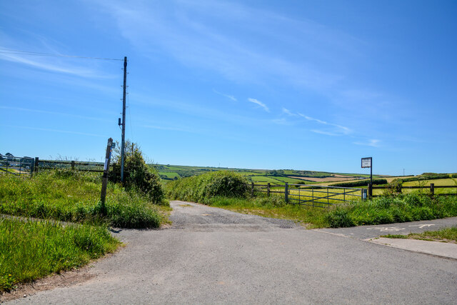
Higher Batson is a small rural hamlet located in the South Hams district of Devon, England. Situated approximately 2 miles west of the market town of Kingsbridge, it is nestled in a picturesque countryside setting. The hamlet is part of the larger Batson village, which also includes Lower Batson.

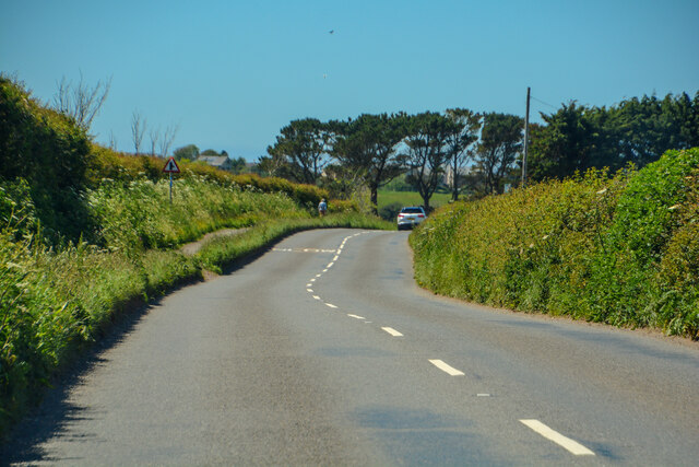
Higher Batson is characterized by its charming and traditional architecture, with several historic buildings dating back to the 17th and 18th centuries. These include cottages, farmhouses, and barns, which add to the area's rustic charm. The surrounding countryside is predominantly farmland, with rolling hills and fields creating a tranquil and idyllic atmosphere.

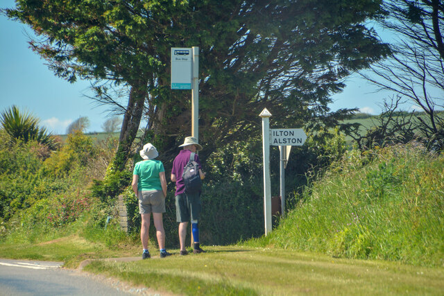
Despite its small size, Higher Batson boasts a strong sense of community. Residents enjoy a close-knit and friendly environment, organizing various social events throughout the year. The hamlet is also popular with visitors who appreciate its peaceful ambiance and stunning natural surroundings.

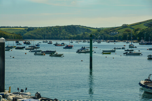
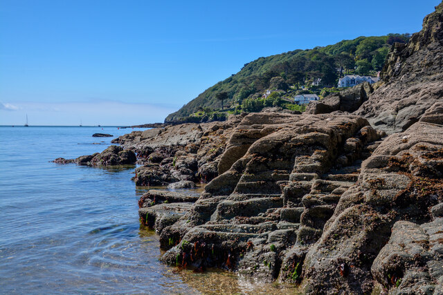
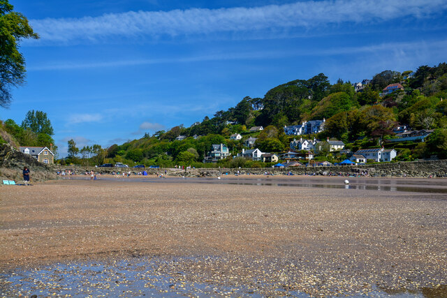
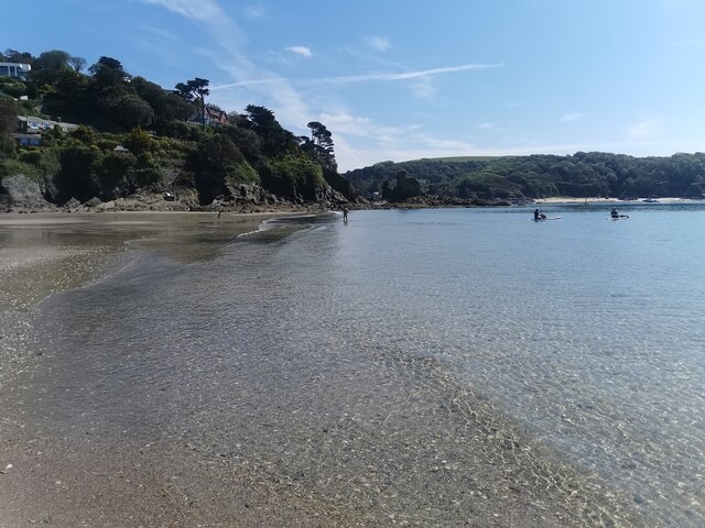
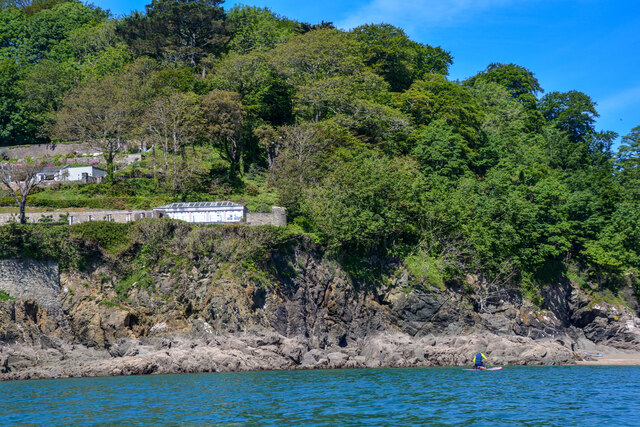
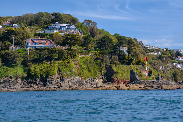
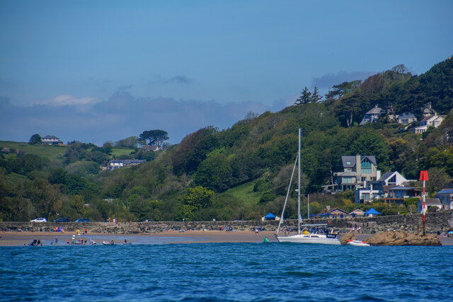
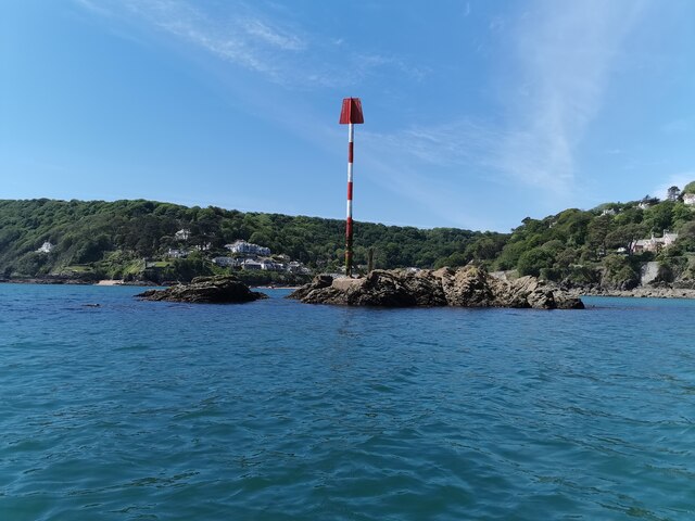
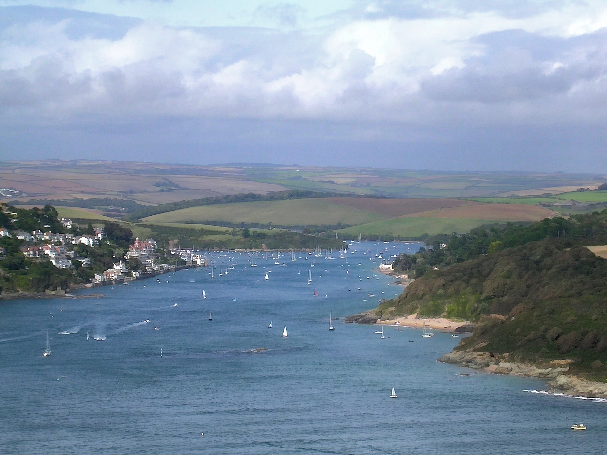
For those seeking outdoor activities, Higher Batson offers easy access to nearby coastal areas, including the beautiful South Devon coastline and the South West Coast Path. This allows for scenic walks and hikes, with breathtaking views of the sea and cliffs. The nearby Kingsbridge Estuary also provides opportunities for water sports and boating enthusiasts.

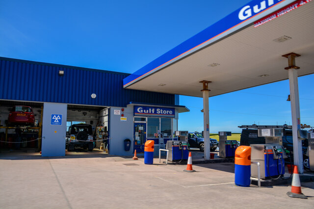
Although there are no shops or amenities within Higher Batson itself, the town of Kingsbridge provides all necessary services, including supermarkets, shops, restaurants, and schools, making it easily accessible for residents. Overall, Higher Batson offers a quintessential countryside experience, combining natural beauty, historic charm, and a tight-knit community spirit.

If you have any feedback on the listing, please let us know in the comments section below.

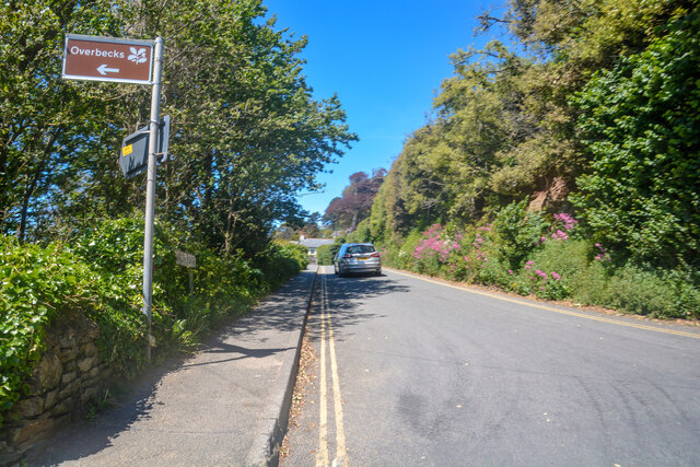
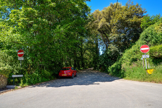
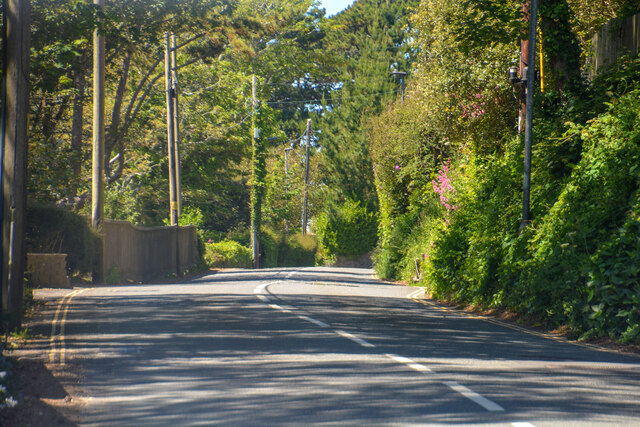
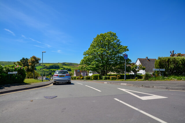
Higher Batson Images

Images are sourced within 2km of 50.242923/-3.7774288 or Grid Reference SX7339. Thanks to Geograph Open Source API. All images are credited.

Salcombe : Bay Scenery Looking out into the bay.
Salcombe : Bay Scenery
Looking out into the bay.
Salcombe : Coastal Scenery Looking across the coastline.
Salcombe : Coastal Scenery
Looking across the coastline.
Salcombe : North Sands Looking across the beach.
Salcombe : North Sands
Looking across the beach.
Salcombe : North Sands Looking across the beach.
Salcombe : North Sands
Looking across the beach.
Salcombe : Coastal Scenery Looking towards the rocky shore.
Salcombe : Coastal Scenery
Looking towards the rocky shore.
Salcombe : Coastal Scenery Looking across the coast with Poundstone in view.
Salcombe : Coastal Scenery
Looking across the coast with Poundstone in view.
East Portlemouth : Sunny Cove Looking towards a beach and cove.
East Portlemouth : Sunny Cove
Looking towards a beach and cove.
East Portlemouth : Coastal Scenery A view along the coastline.
East Portlemouth : Coastal Scenery
A view along the coastline.
Salcombe : Pound Stone A beacon on the stones.
Salcombe : Pound Stone
A beacon on the stones.
Salcombe : Beadon Road Looking along Beadon Road.
Salcombe : Beadon Road
Looking along Beadon Road.
Salcombe : Beadon Road A road with no entry to vehicles from here.
Salcombe : Beadon Road
A road with no entry to vehicles from here.
Salcombe : A381 Looking along the A381.
Salcombe : A381
Looking along the A381.
Salcombe : Tarmac A tarmac area off Main Road.
Salcombe : Tarmac
A tarmac area off Main Road.
Salcombe : Beadon Road Beadon Road off Main Road.
Salcombe : Beadon Road
Beadon Road off Main Road.
Salcombe : Gulf Petrol Station A Gulf garage off Main Road.
Salcombe : Gulf Petrol Station
A Gulf garage off Main Road.
Salcombe : Track A track to Motherhill Farm.
Salcombe : Track
A track to Motherhill Farm.
Churchill : Salcombe Road A381 Between Churchill and Salcombe.
Churchill : Salcombe Road A381
Between Churchill and Salcombe.
Churchill : Bus Stop A bus stop on Salcombe Road.
Churchill : Bus Stop
A bus stop on Salcombe Road.
Show me another place!

Higher Batson is located at Grid Ref: SX7339 (Lat: 50.242923, Lng: -3.7774288)

Administrative County: Devon

District: South Hams

Police Authority: Devon and Cornwall

What 3 Words

///cringes.each.sensibly. Near Salcombe, Devon

Related Wikis

Salcombe

Salcombe is a resort town in the South Hams district of Devon, south west England. The town is close to the mouth of the Kingsbridge Estuary, mostly built...

Salcombe Lifeboat Station

Salcombe Lifeboat Station is the base for Royal National Lifeboat Institution (RNLI) search and rescue operations at Salcombe, Devon in England. The first...

Hallowe'en (clipper)

Hallowe’en was a 920-ton iron clipper ship. She was built in 1870 by Maudslay, Son & Field at Greenwich, England, for Jock Willis & Sons (commissioned...

Salcombe Castle

Salcombe Castle or Fort Charles is a ruined fortification just off the beach of North Sands in Salcombe, Devon, England, within the South Devon Area of...

Kingsbridge Estuary

The Kingsbridge Estuary (also, erroneously, known as the 'Salcombe Estuary') in the South Hams area of Devon, England runs from Kingsbridge in the north...

East Portlemouth

East Portlemouth is a small Devon village situated at the southern end of the Kingsbridge Estuary, on the south Devon Coast. The population of this parish...

Overbeck's

Overbeck's Museum and Garden is an Edwardian house and 2.75 hectare (7 acre) garden at Sharpitor, Salcombe, Devon, England. It is named after its last...

RAF Hope Cove

Royal Air Force Hope Cove or more simply RAF Hope Cove is a former Royal Air Force radar station. It is located about 1 mile (1.6 km) south west of Salcombe...

Nearby Amenities

Located within 500m of 50.242923,-3.7774288
Source: PGS
Lat/Long: 50.2440064/-3.7707299
Higher Batson
Place: hamlet
Lat/Long: 50.2435332/-3.778172
Telephone
Addr Full: Batson, Near Salcombe
Booth: K6
Covered: booth
Listed Status: Grade II
Note: The address given in the booth was no more specific - no postcode.
Phone: +44 1548 842132
Lat/Long: 50.2439674/-3.7755024
Post Box
Brand: Royal Mail
Brand Wikidata: Q638098
Brand Wikipedia: en:Royal Mail
Collection Times: Mo-Fr 13:00; Sa 09:45; Su off
Drive Through: no
Note: Set into the side of a house! Victorian box where the slot has been widened to accept larger envelopes
Operator: Royal Mail
Operator Wikidata: Q638098
Post Box Design: type_c
Post Box Mounting: brick_pillar
Post Box Type: wall
Ref: TQ8 4
Royal Cypher: VR
Royal Cypher Wikidata: Q33102356
Source: streetlevel imagery;aerial imagery;survey
Lat/Long: 50.2437367/-3.7755542
Batson Cross
Place: locality
Source: OS OpenData StreetView
Lat/Long: 50.2406257/-3.7792324
Barrier: stile
Lat/Long: 50.24063/-3.78202
Historic: lime_Kiln
Man Made: kiln
Product: quicklime
Lat/Long: 50.2440272/-3.7706242
Lower Batson
Place: hamlet
Lat/Long: 50.2444303/-3.7762783
Motherhill Farm
Place: farm
Lat/Long: 50.23936/-3.7812092
Batson High View
Place: locality
Lat/Long: 50.2410406/-3.7778539
Source: PGS
Lat/Long: 50.2433182/-3.773174
Source: PGS
Lat/Long: 50.2433049/-3.7736219
Source: PGS
Lat/Long: 50.2437089/-3.7752938
Source: PGS
Lat/Long: 50.2438456/-3.7736596
Source: PGS
Lat/Long: 50.2439451/-3.7720569
Source: PGS
Lat/Long: 50.2443713/-3.7709478
Crossing
Crossing: unmarked
Crossing Island: no
Crossing Markings: no
Kerb: flush
Tactile Paving: no
Lat/Long: 50.239623/-3.778346
Direction: ESE
Generator Method: photovoltaic
Generator Output Electricity: yes
Generator Solar Modules: 10
Generator Source: solar
Generator Type: solar_photovoltaic_panel
Location: roof
Power: generator
Lat/Long: 50.2448331/-3.7769308
Direction: ESE
Generator Method: photovoltaic
Generator Output Electricity: yes
Generator Solar Modules: 8
Generator Source: solar
Generator Type: solar_photovoltaic_panel
Location: roof
Power: generator
Lat/Long: 50.2447885/-3.7769603
Direction: SE
Generator Method: photovoltaic
Generator Output Electricity: yes
Generator Solar Modules: 10
Generator Source: solar
Generator Type: solar_photovoltaic_panel
Location: roof
Power: generator
Lat/Long: 50.2446575/-3.7772381
Direction: S
Generator Method: photovoltaic
Generator Output Electricity: yes
Generator Solar Modules: 18
Generator Source: solar
Generator Type: solar_photovoltaic_panel
Location: roof
Power: generator
Lat/Long: 50.2440449/-3.773738
Direction: 215
Generator Method: photovoltaic
Generator Output Electricity: yes
Generator Solar Modules: 16
Generator Source: solar
Generator Type: solar_photovoltaic_panel
Location: roof
Power: generator
Lat/Long: 50.2436757/-3.7789897
Direction: SSE
Generator Method: photovoltaic
Generator Output Electricity: yes
Generator Solar Modules: 16
Generator Source: solar
Generator Type: solar_photovoltaic_panel
Location: roof
Power: generator
Lat/Long: 50.2406049/-3.7733411
Direction: 175
Generator Method: photovoltaic
Generator Output Electricity: yes
Generator Solar Modules: 16
Generator Source: solar
Generator Type: solar_photovoltaic_panel
Location: roof
Power: generator
Lat/Long: 50.2395658/-3.7749705
Direction: 165
Generator Method: photovoltaic
Generator Output Electricity: yes
Generator Solar Modules: 16
Generator Source: solar
Generator Type: solar_photovoltaic_panel
Location: roof
Power: generator
Lat/Long: 50.2401577/-3.7747599
Direction: 185
Generator Method: photovoltaic
Generator Output Electricity: yes
Generator Solar Modules: 8
Generator Source: solar
Generator Type: solar_photovoltaic_panel
Location: roof
Power: generator
Lat/Long: 50.2400042/-3.776019
Direction: 185
Generator Method: photovoltaic
Generator Output Electricity: yes
Generator Solar Modules: 8
Generator Source: solar
Generator Type: solar_photovoltaic_panel
Location: roof
Power: generator
Lat/Long: 50.2400139/-3.7761125
Direction: S
Generator Method: photovoltaic
Generator Output Electricity: yes
Generator Solar Modules: 18
Generator Source: solar
Generator Type: solar_photovoltaic_panel
Location: roof
Power: generator
Lat/Long: 50.2396137/-3.7761787
Crossing
Lat/Long: 50.2406104/-3.7793466
Bench
Lat/Long: 50.2392831/-3.7781135
Bench
Lat/Long: 50.2392981/-3.7780309
Bench
Lat/Long: 50.239088/-3.778091
Waste Basket
Lat/Long: 50.2395176/-3.7781976
Bench
Backrest: yes
Lat/Long: 50.2439334/-3.7753342
Bench
Backrest: yes
Lat/Long: 50.243906/-3.7753865
Bench
Backrest: yes
Lat/Long: 50.2438777/-3.7754254
Bench
Backrest: yes
Lat/Long: 50.2438142/-3.7754455
Bench
Backrest: yes
Survey Date: 2024-03-02
Lat/Long: 50.2430752/-3.7709076
Bench
Backrest: yes
Survey Date: 2024-03-02
Lat/Long: 50.2432588/-3.7737286
Waste Basket
Survey Date: 2024-03-02
Lat/Long: 50.2436863/-3.7754217
Fire Hydrant
Emergency: fire_hydrant
Fire Hydrant Position: lane
Fire Hydrant Type: underground
Survey Date: 2024-03-02
Lat/Long: 50.2446001/-3.7768079
Fire Hydrant
Emergency: fire_hydrant
Survey Date: 2024-03-02
Lat/Long: 50.2435678/-3.7778622
Fire Hydrant
Emergency: fire_hydrant
Fire Hydrant Position: lane
Fire Hydrant Type: underground
Survey Date: 2024-03-02
Lat/Long: 50.2440321/-3.7810009
The data included in this document is from www.openstreetmap.org. The data is made available under ODbL.

Have you been to Higher Batson?

Leave your review of Higher Batson below (or comments, questions and feedback).