Highcliffe

Settlement in Hampshire Winchester

England

Highcliffe

Path at  the back of Winchester railway station The path provides access to the car park and the bike store but doesn't lead anywhere else.
Path at the back of Winchester railway station Credit: Bill Boaden

Highcliffe is a small coastal village located on the south coast of England in the county of Hampshire. Situated between the towns of Christchurch and New Milton, it lies within the New Forest district. With a population of around 7,000 residents, Highcliffe offers a tranquil and picturesque setting for its inhabitants.

The village is renowned for its stunning beach, which stretches for approximately four miles and boasts beautiful golden sands. The beach is a popular destination for locals and tourists alike, offering opportunities for sunbathing, swimming, and watersports such as surfing and paddleboarding. The adjacent Highcliffe Castle, a Grade I listed building, adds to the charm of the area.

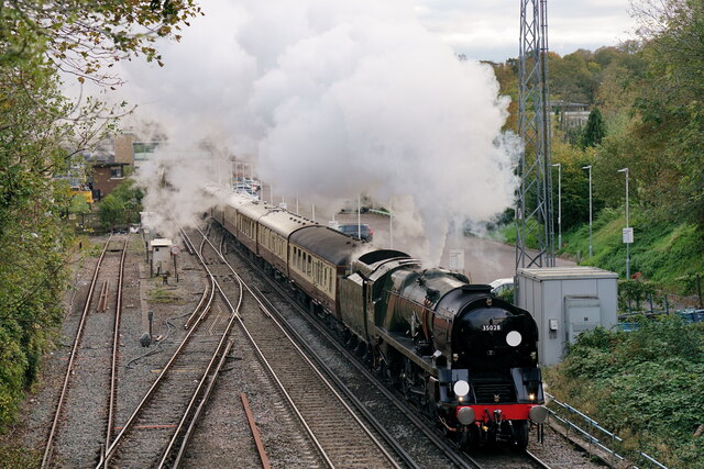
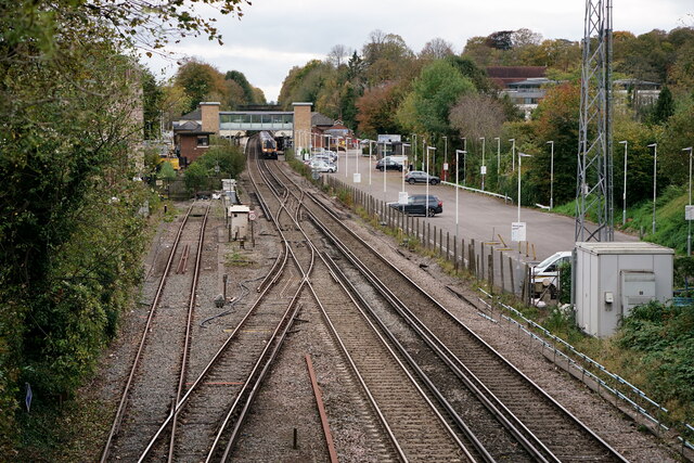
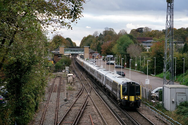
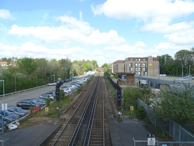
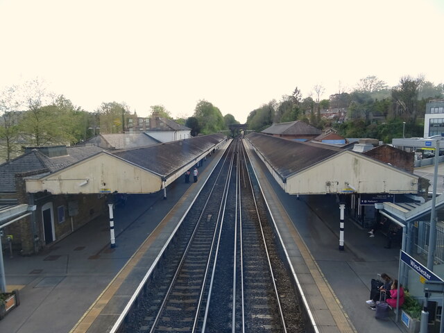
Highcliffe is well-served in terms of amenities, with a range of shops, cafes, and restaurants catering to the needs of residents and visitors. The village also benefits from excellent transport links, with regular bus services and a nearby train station providing connections to larger towns and cities in the region.

Nature enthusiasts can explore the nearby Highcliffe Cliffs, a protected area known for its diverse wildlife and stunning coastal views. The area offers numerous walking and cycling trails, allowing visitors to immerse themselves in the natural beauty of the surrounding countryside.

Overall, Highcliffe is a picturesque coastal village with a strong sense of community and a range of amenities. Its beautiful beach, historical landmarks, and access to nature make it an attractive destination for both residents and tourists seeking a peaceful and scenic location on the Hampshire coast.

If you have any feedback on the listing, please let us know in the comments section below.
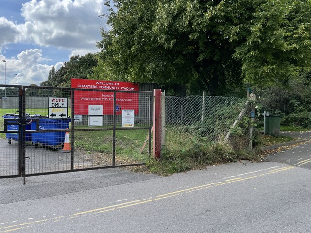
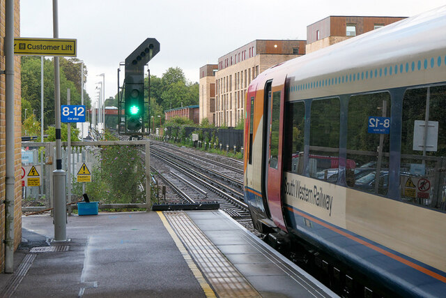
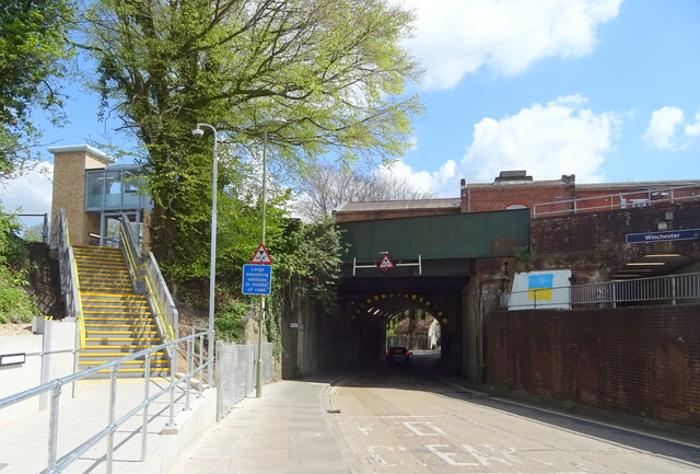
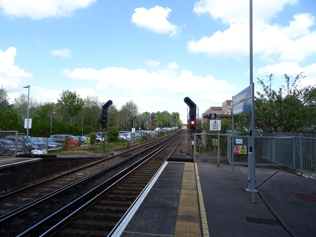
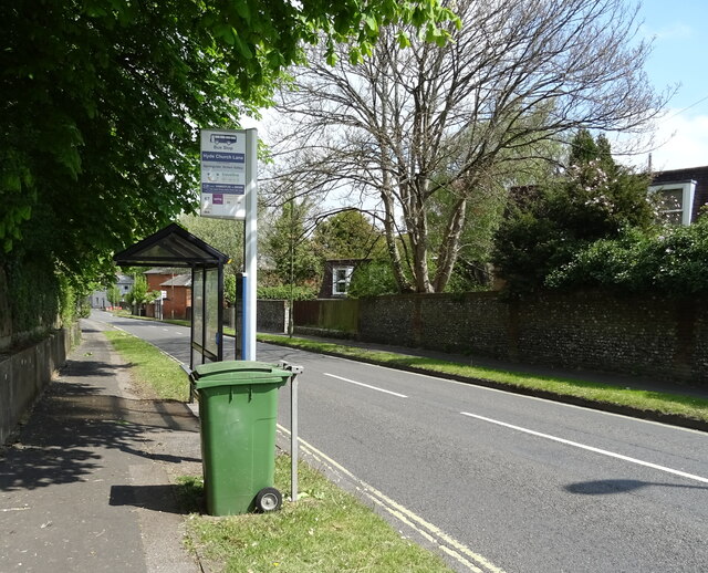
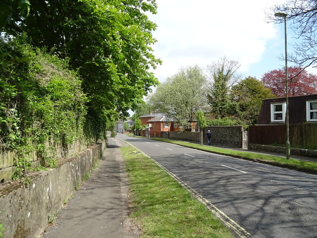
Highcliffe Images

Images are sourced within 2km of 51.057762/-1.3066683 or Grid Reference SU4828. Thanks to Geograph Open Source API. All images are credited.

Path at  the back of Winchester railway station The path provides access to the car park and the bike store but doesn't lead anywhere else.
Path at the back of Winchester railway station
The path provides access to the car park and the bike store but doesn't lead anywhere else.
Cranworth Road An area of terraced residential housing.
Cranworth Road
An area of terraced residential housing.
Covid-19 testing centre A temporary facility set up on part of Worthy Lane Car Park.
Covid-19 testing centre
A temporary facility set up on part of Worthy Lane Car Park.
Andover Road Retail Park
'Clan Line' Seen passing through Winchester with a circular tour from Victoria.
'Clan Line'
Seen passing through Winchester with a circular tour from Victoria.
Winchester View towards the railway station.
Winchester
View towards the railway station.
Winchester Class 444 unit departing in the London direction.
Winchester
Class 444 unit departing in the London direction.
Charters Community Stadium Home of Winchester City Football Club.
Charters Community Stadium
Home of Winchester City Football Club.
Main entrance - Charters Community Stadium
Green light at Winchester A Waterloo bound train prepares to depart from Winchester station.
Green light at Winchester
A Waterloo bound train prepares to depart from Winchester station.
Railway bridge over Stockbridge Road (B3044), Winchester
Winchester Railway Station Line north towards Basingstoke.
Winchester Railway Station
Line north towards Basingstoke.
Railway towards Basingstoke Looking north from the footbridge, Winchester Railway Station.
Railway towards Basingstoke
Looking north from the footbridge, Winchester Railway Station.
Winchester Railway Station From the footbridge.
Winchester Railway Station
From the footbridge.
St John House
St John House
Worthy Lane (B3045)
Worthy Lane (B3045)
Bus top and shelter on Worthy Lane (B3045)
Worthy Lane (B3045)
Worthy Lane (B3045)
Show me another place!

Highcliffe is located at Grid Ref: SU4828 (Lat: 51.057762, Lng: -1.3066683)

Administrative County: Hampshire

District: Winchester

Police Authority: Hampshire

What 3 Words

///weary.curated.recline. Near Winchester, Hampshire

Nearby Locations

Wharf Hill Highcliffe

Related Wikis

Black Rat (restaurant)

Black Rat is a restaurant located in Winchester, Hampshire, England. As of 2021, the restaurant lost its one star in the Michelin Guide that had been held...

Hampshire

Hampshire (, ; abbreviated to Hants.) is a ceremonial county in South East England. It is bordered by Berkshire to the north, Surrey and West Sussex to...

List of Sites of Special Scientific Interest in Hampshire

In England, Sites of Special Scientific Interest (SSSIs) are designated by Natural England, which is responsible for protecting England's natural environment...

List of local nature reserves in Hampshire

Local nature reserves (LNRs) in England are designated by local authorities under Section 21 of the National Parks and Access to the Countryside Act 1949...

Nearby Amenities

Located within 500m of 51.057762,-1.3066683
Barrier: kissing_gate
Lat/Long: 51.0555185/-1.3086373
Mini Roundabout
Direction: clockwise
Lat/Long: 51.0608827/-1.3072157
Turning Circle
Lat/Long: 51.0580307/-1.3110433
Barrier: bollard;kerb
Bicycle: yes
Foot: yes
Kerb: lowered
Motor Vehicle: no
Lat/Long: 51.0609621/-1.3073986
Post Box
Wolvesey
Collection Times: Mo-Fr 17:30; Sa 11:00
Operator: Royal Mail
Operator Wikidata: Q638098
Post Box Type: wall
Ref: SO23 246
Royal Cypher: GVIR
Royal Cypher Wikidata: Q33102169
Source: survey
Lat/Long: 51.058199/-1.311755
Crossing
Button Operated: yes
Crossing: traffic_signals
Crossing Island: no
Crossing Ref: pelican
Kerb: lowered
Tactile Paving: yes
Traffic Signals Sound: yes
Traffic Signals Vibration: yes
Lat/Long: 51.0606512/-1.3071082
Mini Roundabout
Direction: clockwise
Lat/Long: 51.059362/-1.3057874
Heart In Hand
Disused: yes
Disused Amenity: pub
Wikidata: Q113506266
Lat/Long: 51.0557779/-1.3060296
Bench
Tourism: viewpoint
Lat/Long: 51.0603317/-1.3046577
Crossing
Button Operated: yes
Crossing: traffic_signals
Crossing Island: no
Crossing Ref: pelican
Kerb: lowered
Tactile Paving: yes
Traffic Signals Sound: yes
Traffic Signals Vibration: yes
Lat/Long: 51.0581407/-1.3067383
Recycling
Lat/Long: 51.0592741/-1.3059569
Post Box
Brand: Royal Mail
Brand Wikidata: Q638098
Brand Wikipedia: en:Royal Mail
Collection Plate: CP1
Collection Times: Mo-Fr 17:15; Sa 11:15
Operator: Royal Mail
Operator Wikidata: Q638098
Post Box Type: wall
Ref: SO23 9
Royal Cypher: EVIIR
Royal Cypher Wikidata: Q33102324
Lat/Long: 51.0614435/-1.3103915
Crossing
Crossing: uncontrolled
Crossing Ref: zebra
Kerb: lowered
Lat/Long: 51.0614609/-1.3100518
Bus Stop
Chesil Car Park (set Down)
Bench: no
Bin: no
Bus: yes
Lit: no
Naptan AtcoCode: 1900HAA09249
Naptan Bearing: SW
Naptan BusStopType: CUS
Naptan CommonName: Chesil Car Park (set Down)
Naptan Crossing: Chesil Street
Naptan NaptanCode: hamjdjda
Naptan PlusbusZoneRef: WNCHSTR
Naptan Street: Barfield Close
Naptan Verified: no
Public Transport: platform
Shelter: no
Source: naptan_import
Tactile Paving: no
Lat/Long: 51.0590303/-1.3058245
Bus Stop
The Broadway (coach Stop)
Bus: yes
Naptan AtcoCode: 1900HA110052
Naptan Bearing: SE
Naptan CommonName: The Broadway (coach Stop)
Naptan Crossing: High Street
Naptan NaptanCode: hamdjagd
Naptan PlusbusZoneRef: WNCHSTR
Naptan Street: The Broadway
Naptan Verified: no
Public Transport: platform
Shelter: yes
Source: naptan_import
Lat/Long: 51.0614153/-1.3093345
Bus Stop
The Broadway
Bus: yes
Naptan AtcoCode: 1900HA110053
Naptan Bearing: NW
Naptan CommonName: The Broadway
Naptan Crossing: High Street
Naptan NaptanCode: hamdjagm
Naptan PlusbusZoneRef: WNCHSTR
Naptan Street: The Broadway
Naptan Verified: no
Public Transport: platform
Shelter: yes
Source: naptan_import
Lat/Long: 51.0611907/-1.3092455
Bus Stop
The Broadway
Bus: yes
Naptan AtcoCode: 1900HA110054
Naptan Bearing: NW
Naptan CommonName: The Broadway
Naptan Crossing: High Street
Naptan NaptanCode: hamdjaga
Naptan PlusbusZoneRef: WNCHSTR
Naptan Street: The Broadway
Naptan Verified: no
Public Transport: platform
Shelter: yes
Source: naptan_import
Lat/Long: 51.0612185/-1.3093735
Bus Stop
The Broadway
Bus: yes
Naptan AtcoCode: 1900HA110055
Naptan Bearing: NW
Naptan CommonName: The Broadway
Naptan Crossing: High Street
Naptan NaptanCode: hamdjadw
Naptan PlusbusZoneRef: WNCHSTR
Naptan Street: The Broadway
Naptan Verified: no
Public Transport: platform
Shelter: yes
Source: naptan_import
Lat/Long: 51.061246/-1.3094587
Bus Stop
Chesil Street
Bench: no
Bin: no
Bus: yes
Lit: yes
Naptan AtcoCode: 1900HA110069
Naptan Bearing: S
Naptan CommonName: Chesil Street
Naptan NaptanCode: hamdjapg
Naptan PlusbusZoneRef: WNCHSTR
Naptan Street: Chesil Street
Naptan Verified: no
Public Transport: platform
Shelter: no
Source: naptan_import
Tactile Paving: no
Lat/Long: 51.0589267/-1.306568
Bus Stop
Barfield Car Park
Bus: yes
Naptan AtcoCode: 1900HA110070
Naptan Bearing: NE
Naptan CommonName: Barfield Car Park
Naptan NaptanCode: hamdjajg
Naptan PlusbusZoneRef: WNCHSTR
Naptan Street: Off Barfield Close
Naptan Verified: no
Public Transport: platform
Source: naptan_import
Lat/Long: 51.0537331/-1.3072045
Bus Stop
Chesil Car Park
Bench: yes
Bin: no
Bus: yes
Lit: no
Naptan AtcoCode: 1900HA110071
Naptan Bearing: NE
Naptan CommonName: Chesil Car Park
Naptan Crossing: Chesil Street
Naptan NaptanCode: hamdjatp
Naptan PlusbusZoneRef: WNCHSTR
Naptan Street: Barfield Close
Naptan Verified: no
Public Transport: platform
Shelter: yes
Source: naptan_import
Tactile Paving: no
Lat/Long: 51.0590045/-1.3060246
Bus Stop
Dell Road
Bus: yes
Naptan AtcoCode: 1900HA110077
Naptan Bearing: N
Naptan CommonName: Dell Road
Naptan Crossing: Dell Road
Naptan NaptanCode: hamdjgjt
Naptan PlusbusZoneRef: WNCHSTR
Naptan Street: St Leonard's Road
Naptan Verified: no
Public Transport: platform
Source: naptan_import
Lat/Long: 51.0579031/-1.3007757
Bus Stop
Vale Road
Bus: yes
Naptan AtcoCode: 1900HA110078
Naptan Bearing: S
Naptan CommonName: Vale Road
Naptan Crossing: Portal Road
Naptan NaptanCode: hamdjgad
Naptan PlusbusZoneRef: WNCHSTR
Naptan Street: Vale Road
Naptan Verified: no
Public Transport: platform
Source: naptan_import
Lat/Long: 51.0570373/-1.3018732
Bus Stop
Milland Road
Bus: yes
Naptan AtcoCode: 1900HA110079
Naptan Bearing: W
Naptan CommonName: Milland Road
Naptan Crossing: Vale Road
Naptan NaptanCode: hamdjdpj
Naptan PlusbusZoneRef: WNCHSTR
Naptan Street: Milland Road
Naptan Verified: no
Public Transport: platform
Source: naptan_import
Lat/Long: 51.0561005/-1.3031001
Bus Stop
Milland Road
Bench: yes
Bin: no
Bus: yes
Lit: yes
Naptan AtcoCode: 1900HA110080
Naptan Bearing: W
Naptan CommonName: Milland Road
Naptan Crossing: Bar End Road
Naptan NaptanCode: hamdjawd
Naptan PlusbusZoneRef: WNCHSTR
Naptan ShortCommonName: Heart in Hand
Naptan Street: Milland Road
Naptan Verified: no
Public Transport: platform
Shelter: yes
Source: naptan_import
Tactile Paving: no
Lat/Long: 51.0558465/-1.3057579
Old Head of Navigation
Lat/Long: 51.0565877/-1.3092962
Motorcycle Parking
Chesil Street
Lat/Long: 51.0592654/-1.3060608
Motorcycle Parking
Colebrook Street
Lat/Long: 51.0606714/-1.3117236
Barrier: sally_port
Lat/Long: 51.060154/-1.3113048
Restaurant
Gandhi
Addr City: Winchester
Addr Housenumber: 163-164
Addr Postcode: SO23 9BA
Addr Street: High Street
Cuisine: indian
Opening Hours: 12:00-14:30; 17:30-23:30
Website: https://www.gandhirestaurant.com/
Lat/Long: 51.0616684/-1.3101799
Saint Lawrence Parish Rooms
Building: public
Lat/Long: 51.0598368/-1.3089291
Bench
Lat/Long: 51.0606122/-1.3081898
Crossing
Crossing: uncontrolled
Crossing Ref: zebra
Kerb: lowered
Lat/Long: 51.0615292/-1.310001
Alfred the Great
Artist Name: Hamo Thornycroft
Artwork Type: statue
Historic: monument
Start Date: 1899
Tourism: artwork
Wikidata: Q26461216
Lat/Long: 51.061246/-1.3090308
Parking Entrance
Lat/Long: 51.0598582/-1.3057735
Bicycle Parking
Bicycle Parking: stands
Capacity: 8
Covered: no
Lat/Long: 51.0609654/-1.311552
Bicycle Parking
Bicycle Parking: stands
Capacity: 6
Covered: no
Lat/Long: 51.0611475/-1.3090053
Bicycle Parking
Bicycle Parking: stands
Capacity: 4
Check Date Capacity: 2021-12-01
Covered: no
Lat/Long: 51.060324/-1.3068528
Turning Circle
Lat/Long: 51.0617187/-1.308819
Telephone
Booth: KX100
Covered: booth
Lat/Long: 51.0613641/-1.310117
Visitor Information Centre
Information: office
Tourism: information
Lat/Long: 51.0614581/-1.3106049
Crossing
Check Date Crossing: 2023-05-17
Crossing: uncontrolled
Crossing Ref: zebra
Tactile Paving: yes
Lat/Long: 51.0613543/-1.3083924
Crossing
Check Date Crossing: 2023-05-17
Crossing: uncontrolled
Crossing Ref: zebra
Tactile Paving: yes
Lat/Long: 51.0614013/-1.3084485
Post Box
Collection Times: Mo-Fr 09:00; Sa 07:00
Operator: Royal Mail
Operator Wikidata: Q638098
Post Box Type: pillar
Ref: SO23 71D
Royal Cypher: GVIR
Royal Cypher Wikidata: Q33102169
Lat/Long: 51.0584258/-1.3068161
Barrier: cycle_barrier
Lat/Long: 51.0579133/-1.3081621
Bicycle Parking
Bicycle Parking: stands
Capacity: 4
Covered: no
Lat/Long: 51.0579111/-1.3074374
Barrier: bollard
Lat/Long: 51.0579385/-1.3084714
Chesil
Historic Railway: station
Railway: site
Wikidata: Q8023775
Wikipedia: en:Winchester (Chesil) railway station
Lat/Long: 51.0598477/-1.3056326
Barrier: entrance
Lat/Long: 51.0581171/-1.3109784
Crossing
Button Operated: yes
Crossing: traffic_signals
Crossing Island: no
Crossing Ref: pelican
Kerb: lowered
Tactile Paving: yes
Traffic Signals Sound: yes
Traffic Signals Vibration: yes
Lat/Long: 51.0560675/-1.3061974
Bench
Backrest: yes
Material: wood
Lat/Long: 51.0596631/-1.3077203
Bench
Backrest: yes
Material: wood
Lat/Long: 51.0596971/-1.3077278
Bench
Backrest: yes
Material: wood
Lat/Long: 51.0597169/-1.3077341
Post Box
Collection Times: Mo-Fr 09:00; Sa 07:00
Post Box Type: wall
Ref: SO23 106
Royal Cypher: GR
Royal Cypher Wikidata: Q33102273
Lat/Long: 51.0551346/-1.3059931
Post Box
Ref: SO23 1
Lat/Long: 51.0573289/-1.3042162
Post Box
Ref: SO23 318
Lat/Long: 51.0560199/-1.3047816
Bench
Backrest: yes
Lat/Long: 51.0585919/-1.3082565
Bench
Backrest: yes
Lat/Long: 51.05863/-1.3082022
Bench
Backrest: yes
Lat/Long: 51.0586818/-1.3081414
Bench
Backrest: yes
Lat/Long: 51.0587154/-1.3080767
Entrance: yes
Lat/Long: 51.0587264/-1.3101705
Bench
Backrest: yes
Lat/Long: 51.0587603/-1.308001
Bench
Backrest: yes
Lat/Long: 51.0587628/-1.3080156
Bench
Backrest: yes
Lat/Long: 51.0587941/-1.3079327
Bench
Backrest: yes
Lat/Long: 51.0588321/-1.3080255
Bench
Backrest: yes
Lat/Long: 51.0588738/-1.3080581
Bench
Backrest: yes
Lat/Long: 51.058883/-1.3078275
Bench
Backrest: yes
Lat/Long: 51.0590573/-1.3076198
Bench
Lat/Long: 51.060281/-1.3047023
Bench
Lat/Long: 51.0603102/-1.3046729
Bench
Lat/Long: 51.0605406/-1.3099639
Bench
Lat/Long: 51.0605574/-1.3099174
Bench
Lat/Long: 51.0605691/-1.3098849
Bench
Lat/Long: 51.0605815/-1.3098506
Bench
Lat/Long: 51.060602/-1.3097939
Bench
Lat/Long: 51.0606364/-1.3096986
Bench
Lat/Long: 51.0606707/-1.3096039
Bench
Lat/Long: 51.0607832/-1.3095797
Bench
Lat/Long: 51.0608099/-1.3095868
Bench
Lat/Long: 51.0609029/-1.3095924
Bench
Lat/Long: 51.0609566/-1.309584
Bench
Backrest: yes
Lat/Long: 51.0585984/-1.3085739
Bench
Backrest: yes
Lat/Long: 51.0586553/-1.30846
Bench
Backrest: yes
Lat/Long: 51.058694/-1.3083863
Bench
Backrest: yes
Lat/Long: 51.0587736/-1.3082378
Bench
Lat/Long: 51.0601988/-1.3034272
Bench
Lat/Long: 51.0603518/-1.3033813
Barrier: kissing_gate
Lat/Long: 51.0538965/-1.3093345
Grit Bin
Operator: Hampshire County Council
Lat/Long: 51.0586261/-1.3016829
Barrier: bollard
Bollard: fixed
Lat/Long: 51.0537117/-1.3080344
Allan King's Way
Information: guidepost
Tourism: information
Lat/Long: 51.0589105/-1.3080084
Traffic Signals
Traffic Signals: pedestrian_crossing
Traffic Signals Direction: backward
Lat/Long: 51.060683/-1.3071216
Traffic Signals
Traffic Signals: pedestrian_crossing
Traffic Signals Direction: forward
Lat/Long: 51.0606152/-1.3070931
Crossing
Crossing: unmarked
Crossing Island: yes
Crossing Markings: no
Kerb: lowered
Tactile Paving: yes
Lat/Long: 51.0609291/-1.3069517
Nunnaminster
Alt Name: St Mary's Abbey, Winchester
Fixme: location
Historic: archaeological_site
Source Name: sign
Wikidata: Q7594237
Wikipedia: en:St Mary's Abbey, Winchester
Lat/Long: 51.0610669/-1.3103656
Cafe
eighteen71
Addr City: Winchester
Addr Country: GB
Addr Postcode: SO23 9GH
Addr Street: The Broadway, High Street
Website: https://www.guildhallwinchester.co.uk/eighteen71/
Lat/Long: 51.061375/-1.3102868
Barrier: bollard
Lat/Long: 51.0571159/-1.3083263
The Black Hole
Addr Housename: The Black Hole
Addr Housenumber: 1
Addr Street: Wharf Hill
Tourism: hotel
Website: https://www.theblackholebb.co.uk/
Lat/Long: 51.0578431/-1.3068729
Addr City: Winchester
Addr Housenumber: 1
Addr Postcode: SO23 8EB
Addr Street: Eastgate Street
Lat/Long: 51.0614379/-1.3090535
Entrance: yes
Lat/Long: 51.0614944/-1.3095454
Entrance: yes
Lat/Long: 51.0615743/-1.3096879
Bicycle Parking
Bicycle Parking: stands
Capacity: 6
Covered: no
Lat/Long: 51.0615193/-1.3098569
Bus Stop
Chesil Lodge
Bench: no
Bin: no
Bus: yes
Lit: yes
Naptan AtcoCode: 1900HAA91214
Naptan NaptanCode: hamjpmdg
Public Transport: platform
Shelter: no
Tactile Paving: no
Lat/Long: 51.0584708/-1.3068045
Grit Bin
Lat/Long: 51.0594454/-1.3058747
Vending Machine
Vending: parking_tickets
Lat/Long: 51.0614354/-1.3103529
Waste Basket
Lat/Long: 51.0614387/-1.3103653
Waste Basket
Lat/Long: 51.0615254/-1.3096852
Barrier: kerb
Kerb: lowered
Lat/Long: 51.0609777/-1.3081964
Crossing
Crossing: unmarked
Crossing Markings: no
Kerb: lowered
Lat/Long: 51.0609859/-1.3082414
Historic: castle
Lat/Long: 51.0610542/-1.3099576
Traffic Signals
Traffic Signals: pedestrian_crossing
Traffic Signals Direction: backward
Lat/Long: 51.0581872/-1.3067376
Traffic Signals
Traffic Signals: pedestrian_crossing
Traffic Signals Direction: forward
Lat/Long: 51.0581052/-1.3067398
The home of Bishop Henry
Board Type: history
Information: board
Tourism: information
Lat/Long: 51.0588305/-1.3102065
Entrance: yes
Lat/Long: 51.0587701/-1.3108686
Turning Circle
Source: Hampshire-Aerial-FCIR
Lat/Long: 51.058087/-1.3112539
Crossing
Bicycle: yes
Crossing: uncontrolled
Crossing Ref: parallel
Kerb: lowered
Tactile Paving: yes
Lat/Long: 51.0546354/-1.3061553
Traffic Signals
Source: Bing
Traffic Signals Direction: forward
Lat/Long: 51.0560408/-1.3061922
Traffic Signals
Source: Bing
Traffic Signals Direction: backward
Lat/Long: 51.0560865/-1.3062024
Crossing: informal
Lat/Long: 51.0558031/-1.3080894
Barrier: kerb
Kerb: raised
Tactile Paving: no
Lat/Long: 51.0609423/-1.3079165
Bar End
Place: suburb
Wikidata: Q4857926
Lat/Long: 51.054667/-1.305846
White & Company
Address: International House, Unit G, Bar End Road, Winchester, Hampshire, SO23 9NP, UK
Office: moving_company
Phone: +44 1962 658096
Website: https://www.whiteandcompany.co.uk/removals-winchester/
Lat/Long: 51.0544595/-1.3059905
Parking Entrance
Lat/Long: 51.059843/-1.3055844
Drinking Water
Access: yes
Bottle: yes
Fee: no
Operator: Winchester City Council.
Wheelchair: yes
Lat/Long: 51.0610661/-1.3094031
Highcliffe
Place: suburb
Wikidata: Q113703322
Lat/Long: 51.0576149/-1.3012455
Historic: archaeological_site
Lat/Long: 51.0567322/-1.3118628
Historic: archaeological_site
Lat/Long: 51.0566274/-1.3107204
Historic: archaeological_site
Lat/Long: 51.0591809/-1.3092591
Direction: ESE
Generator Method: photovoltaic
Generator Output Electricity: yes
Generator Solar Modules: 30
Generator Source: solar
Generator Type: solar_photovoltaic_panel
Location: roof
Power: generator
Lat/Long: 51.061068/-1.3113561
Direction: SSW
Generator Method: photovoltaic
Generator Output Electricity: yes
Generator Solar Modules: 11
Generator Source: solar
Generator Type: solar_photovoltaic_panel
Location: roof
Power: generator
Lat/Long: 51.0586829/-1.3064728
Direction: SSW
Generator Method: photovoltaic
Generator Output Electricity: yes
Generator Solar Modules: 12
Generator Source: solar
Generator Type: solar_photovoltaic_panel
Location: roof
Power: generator
Lat/Long: 51.0587354/-1.3062995
Direction: ESE
Generator Method: photovoltaic
Generator Output Electricity: yes
Generator Solar Modules: 36
Generator Source: solar
Generator Type: solar_photovoltaic_panel
Location: roof
Power: generator
Lat/Long: 51.0609324/-1.3111024
Direction: SSW
Generator Method: photovoltaic
Generator Output Electricity: yes
Generator Solar Modules: 12
Generator Source: solar
Generator Type: solar_photovoltaic_panel
Location: roof
Power: generator
Lat/Long: 51.0584117/-1.306458
Direction: SSW
Generator Method: photovoltaic
Generator Output Electricity: yes
Generator Solar Modules: 15
Generator Source: solar
Generator Type: solar_photovoltaic_panel
Location: roof
Power: generator
Lat/Long: 51.0585128/-1.3063991
Direction: SSW
Generator Method: photovoltaic
Generator Output Electricity: yes
Generator Solar Modules: 40
Generator Source: solar
Generator Type: solar_photovoltaic_panel
Location: roof
Power: generator
Lat/Long: 51.0584981/-1.3065609
Direction: ESE
Generator Method: photovoltaic
Generator Output Electricity: yes
Generator Solar Modules: 15
Generator Source: solar
Generator Type: solar_photovoltaic_panel
Location: roof
Power: generator
Lat/Long: 51.0607238/-1.3109028
Direction: SSW
Generator Method: photovoltaic
Generator Output Electricity: yes
Generator Solar Modules: 8
Generator Source: solar
Generator Type: solar_photovoltaic_panel
Location: roof
Power: generator
Lat/Long: 51.0586459/-1.3063387
Direction: 190
Generator Method: photovoltaic
Generator Output Electricity: yes
Generator Solar Modules: 16
Generator Source: solar
Generator Type: solar_photovoltaic_panel
Location: roof
Power: generator
Lat/Long: 51.0597847/-1.3090822
Direction: 185
Generator Method: photovoltaic
Generator Output Electricity: yes
Generator Solar Modules: 12
Generator Source: solar
Generator Type: solar_photovoltaic_panel
Location: roof
Power: generator
Lat/Long: 51.0604138/-1.3021071
Direction: 185
Generator Method: photovoltaic
Generator Output Electricity: yes
Generator Solar Modules: 22
Generator Source: solar
Generator Type: solar_photovoltaic_panel
Location: roof
Power: generator
Lat/Long: 51.0604033/-1.3016136
Direction: 185
Generator Method: photovoltaic
Generator Output Electricity: yes
Generator Solar Modules: 18
Generator Source: solar
Generator Type: solar_photovoltaic_panel
Location: roof
Power: generator
Lat/Long: 51.0603864/-1.3012548
Direction: 165
Generator Method: photovoltaic
Generator Output Electricity: yes
Generator Solar Modules: 6
Generator Source: solar
Generator Type: solar_photovoltaic_panel
Location: roof
Power: generator
Lat/Long: 51.0594692/-1.3024377
Direction: 185
Generator Method: photovoltaic
Generator Output Electricity: yes
Generator Solar Modules: 7
Generator Source: solar
Generator Type: solar_photovoltaic_panel
Location: roof
Power: generator
Tilted: no
Lat/Long: 51.0593965/-1.30227
Direction: 85
Generator Method: photovoltaic
Generator Output Electricity: yes
Generator Solar Modules: 6
Generator Source: solar
Generator Type: solar_photovoltaic_panel
Location: roof
Power: generator
Lat/Long: 51.0597291/-1.3004864
Direction: 85
Generator Method: photovoltaic
Generator Output Electricity: yes
Generator Solar Modules: 6
Generator Source: solar
Generator Type: solar_photovoltaic_panel
Location: roof
Power: generator
Lat/Long: 51.0597476/-1.3006473
Direction: 170
Generator Method: photovoltaic
Generator Output Electricity: yes
Generator Solar Modules: 6
Generator Source: solar
Generator Type: solar_photovoltaic_panel
Location: roof
Power: generator
Lat/Long: 51.057394/-1.3048228
Direction: 170
Generator Method: photovoltaic
Generator Output Electricity: yes
Generator Solar Modules: 16
Generator Source: solar
Generator Type: solar_photovoltaic_panel
Location: roof
Power: generator
Lat/Long: 51.0584893/-1.3021828
Direction: 85
Generator Method: photovoltaic
Generator Output Electricity: yes
Generator Solar Modules: 10
Generator Source: solar
Generator Type: solar_photovoltaic_panel
Location: roof
Power: generator
Lat/Long: 51.058307/-1.3009564
Direction: 260
Generator Method: photovoltaic
Generator Output Electricity: yes
Generator Solar Modules: 16
Generator Source: solar
Generator Type: solar_photovoltaic_panel
Location: roof
Power: generator
Tilted: no
Lat/Long: 51.0572323/-1.3010077
Direction: 170
Generator Method: photovoltaic
Generator Output Electricity: yes
Generator Solar Modules: 10
Generator Source: solar
Generator Type: solar_photovoltaic_panel
Location: roof
Power: generator
Tilted: no
Lat/Long: 51.0558961/-1.3039642
Direction: 170
Generator Method: photovoltaic
Generator Output Electricity: yes
Generator Solar Modules: 10
Generator Source: solar
Generator Type: solar_photovoltaic_panel
Location: roof
Power: generator
Tilted: no
Lat/Long: 51.0559378/-1.3035585
Direction: SSW
Generator Method: photovoltaic
Generator Output Electricity: yes
Generator Solar Modules: 41
Generator Source: solar
Generator Type: solar_photovoltaic_panel
Location: roof
Power: generator
Lat/Long: 51.0581547/-1.3136007
Direction: SSW
Generator Method: photovoltaic
Generator Output Electricity: yes
Generator Solar Modules: 9
Generator Source: solar
Generator Type: solar_photovoltaic_panel
Location: roof
Power: generator
Lat/Long: 51.0581387/-1.3138026
Direction: 185
Generator Method: photovoltaic
Generator Output Electricity: yes
Generator Solar Modules: 85
Generator Source: solar
Generator Type: solar_photovoltaic_panel
Location: roof
Power: generator
Lat/Long: 51.0571573/-1.3120409
Bench
Lat/Long: 51.0604398/-1.3080148
Bench
Lat/Long: 51.0604588/-1.3080174
Cafe
Crussh
Lat/Long: 51.0542475/-1.3039551
Crossing
Crossing: uncontrolled
Crossing Island: yes
Kerb: lowered
Tactile Paving: yes
Lat/Long: 51.0548371/-1.3057784
Crossing
Crossing: uncontrolled
Crossing Island: yes
Kerb: lowered
Tactile Paving: yes
Lat/Long: 51.0547996/-1.3058733
Crossing
Crossing: uncontrolled
Crossing Island: yes
Kerb: lowered
Tactile Paving: yes
Lat/Long: 51.0547495/-1.3054797
Crossing
Bicycle: yes
Crossing: uncontrolled
Crossing Island: yes
Crossing Ref: parallel
Kerb: lowered
Tactile Paving: yes
Lat/Long: 51.054441/-1.3057221
Crossing
Bicycle: yes
Crossing: uncontrolled
Crossing Island: yes
Crossing Ref: parallel
Kerb: lowered
Tactile Paving: yes
Lat/Long: 51.0544412/-1.3056154
Crossing
Crossing: uncontrolled
Crossing Island: yes
Kerb: lowered
Tactile Paving: yes
Lat/Long: 51.054704/-1.3054603
Car Wash
Automated: no
Self Service: yes
Lat/Long: 51.053854/-1.3059327
Parcel Locker
Amazon Locker: Blimber
Brand: Amazon Locker
Brand Wikidata: Q16974764
Brand Wikipedia: en:Amazon Locker
Operator: Amazon
Parcel Mail In: yes
Parcel Pickup: yes
Lat/Long: 51.0539046/-1.3057249
Charging Station
Fixme: Need more details about this charging point
Lat/Long: 51.0538532/-1.3057074
Bicycle Parking
Access: yes
Bicycle Parking: stands
Capacity: 36
Covered: yes
Fee: no
Lit: no
Operator: Everyone Active
Lat/Long: 51.0548876/-1.3044162
Charging Station
Mer Charging Station
Access: yes
Brand: Mer
Brand Wikidata: Q100821564
Capacity: 4
Operator: Mer
Lat/Long: 51.055077/-1.3041044
Remains of Roman wall
Tourism: attraction
Lat/Long: 51.0605391/-1.3080728
Winchester College
Tourism: attraction
Lat/Long: 51.0582988/-1.3127158
Bus Stop
Barfield Park and Ride
Bus: yes
Naptan AtcoCode: 1900HAA92079
Naptan NaptanCode: hampadpj
Public Transport: platform
Lat/Long: 51.0548761/-1.306488
Bus Stop
Barfield Park and Ride
Bus: yes
Public Transport: platform
Lat/Long: 51.0548846/-1.3063642
Bench
Backrest: yes
Lat/Long: 51.0577491/-1.3066902
Waste Basket
Waste: trash
Lat/Long: 51.0577746/-1.306706
The Close
Place: suburb
Lat/Long: 51.0596793/-1.3120159
The Soke
Place: suburb
Lat/Long: 51.0599907/-1.3062707
Charging Station
Mer
Access: yes
Brand: Mer
Brand Wikidata: Q100821564
Capacity: 8
Operator: Mer
Lat/Long: 51.0545429/-1.3072253
Crossing
Crossing: zebra
Lat/Long: 51.0540641/-1.3047772
Door: revolving
Entrance: yes
Wheelchair: no
Lat/Long: 51.0544981/-1.3042257
Door: revolving
Entrance: yes
Wheelchair: no
Lat/Long: 51.0544248/-1.304205
Door: automatic
Entrance: yes
Wheelchair: yes
Lat/Long: 51.0543678/-1.3041888
Crossing
Lat/Long: 51.055074/-1.3032484
Entrance: exit
Lat/Long: 51.0542464/-1.304036
Crossing
Crossing: zebra
Lat/Long: 51.0547774/-1.304807
Crossing
Crossing: marked
Crossing Island: no
Crossing Markings: zebra
Crossing Ref: zebra
Lat/Long: 51.0547124/-1.3050735
Crossing
Crossing: zebra
Lat/Long: 51.0544382/-1.3046203
Crossing
Crossing: zebra
Lat/Long: 51.0543756/-1.3048883
Crossing
Crossing: zebra
Lat/Long: 51.0543092/-1.3051678
Crossing
Crossing: zebra
Lat/Long: 51.0541185/-1.304499
Crossing
Crossing: zebra
Lat/Long: 51.054004/-1.305054
Crossing
Crossing: zebra
Lat/Long: 51.0538409/-1.3043937
Crossing
Crossing: zebra
Lat/Long: 51.0537929/-1.3046738
Crossing
Crossing: zebra
Lat/Long: 51.0537443/-1.3049337
Crossing
Crossing: zebra
Lat/Long: 51.054906/-1.3047524
Crossing
Crossing: zebra
Lat/Long: 51.0550148/-1.3033179
Crossing
Lat/Long: 51.0610268/-1.3067653
Barrier: kerb
Kerb: lowered
Tactile Paving: yes
Lat/Long: 51.054846/-1.305763
Barrier: kerb
Kerb: lowered
Tactile Paving: yes
Lat/Long: 51.0546785/-1.3054494
Barrier: kerb
Kerb: lowered
Tactile Paving: yes
Lat/Long: 51.0547732/-1.3054898
Barrier: kerb
Kerb: lowered
Tactile Paving: yes
Lat/Long: 51.0547165/-1.3054656
Barrier: kerb
Kerb: lowered
Tactile Paving: yes
Lat/Long: 51.0547363/-1.3054741
Barrier: kerb
Kerb: lowered
Tactile Paving: yes
Lat/Long: 51.054807/-1.3058509
Barrier: kerb
Kerb: lowered
Tactile Paving: yes
Lat/Long: 51.0548224/-1.3058036
Barrier: kerb
Kerb: lowered
Tactile Paving: yes
Lat/Long: 51.054441/-1.3057465
Barrier: kerb
Kerb: lowered
Tactile Paving: yes
Lat/Long: 51.0544411/-1.305695
Barrier: kerb
Kerb: lowered
Tactile Paving: yes
Lat/Long: 51.0544411/-1.3056496
Barrier: kerb
Kerb: lowered
Tactile Paving: yes
Lat/Long: 51.0544412/-1.3055844
Barrier: kerb
Kerb: lowered
Tactile Paving: yes
Lat/Long: 51.0546126/-1.3061501
The data included in this document is from www.openstreetmap.org. The data is made available under ODbL.

Have you been to Highcliffe?

Leave your review of Highcliffe below (or comments, questions and feedback).