High Wickham
Settlement in Sussex Hastings
England
High Wickham

High Wickham is a small village located in the county of Sussex, England. Situated approximately 4 miles north of the historic town of Lewes, High Wickham rests within the South Downs National Park, offering picturesque views of the surrounding rolling hills and beautiful countryside.
The village is known for its quaint charm and tranquil atmosphere, making it an ideal destination for those seeking a peaceful retreat. The architecture in High Wickham reflects its rich heritage, with many traditional cottages and buildings dating back centuries.
Despite its small size, High Wickham offers a range of amenities for residents and visitors alike. There is a local village shop providing essential groceries, as well as a charming pub that serves delicious food and beverages. The village also benefits from excellent transport links, with regular bus services connecting it to nearby towns and villages.
High Wickham is surrounded by natural beauty, making it a haven for outdoor enthusiasts. The South Downs Way, a popular long-distance footpath, passes through the village, providing ample opportunities for walking, hiking, and cycling. Additionally, the nearby Ashdown Forest offers further exploration possibilities, with its extensive network of trails and wildlife-rich landscapes.
Overall, High Wickham is a delightful village that offers a tranquil setting, stunning surroundings, and a strong sense of community, making it an idyllic place to live or visit in the heart of Sussex.
If you have any feedback on the listing, please let us know in the comments section below.
High Wickham Images
Images are sourced within 2km of 50.862236/0.5987535 or Grid Reference TQ8210. Thanks to Geograph Open Source API. All images are credited.


High Wickham is located at Grid Ref: TQ8210 (Lat: 50.862236, Lng: 0.5987535)
Administrative County: East Sussex
District: Hastings
Police Authority: Sussex
What 3 Words
///item.claim.switch. Near Hastings, East Sussex
Nearby Locations
Related Wikis

Windycroft
Windycroft is a Grade II* listed house in Hastings, East Sussex, England. It was built between 1883 and 1891 for Alex and Constantine Alexander Ionides...
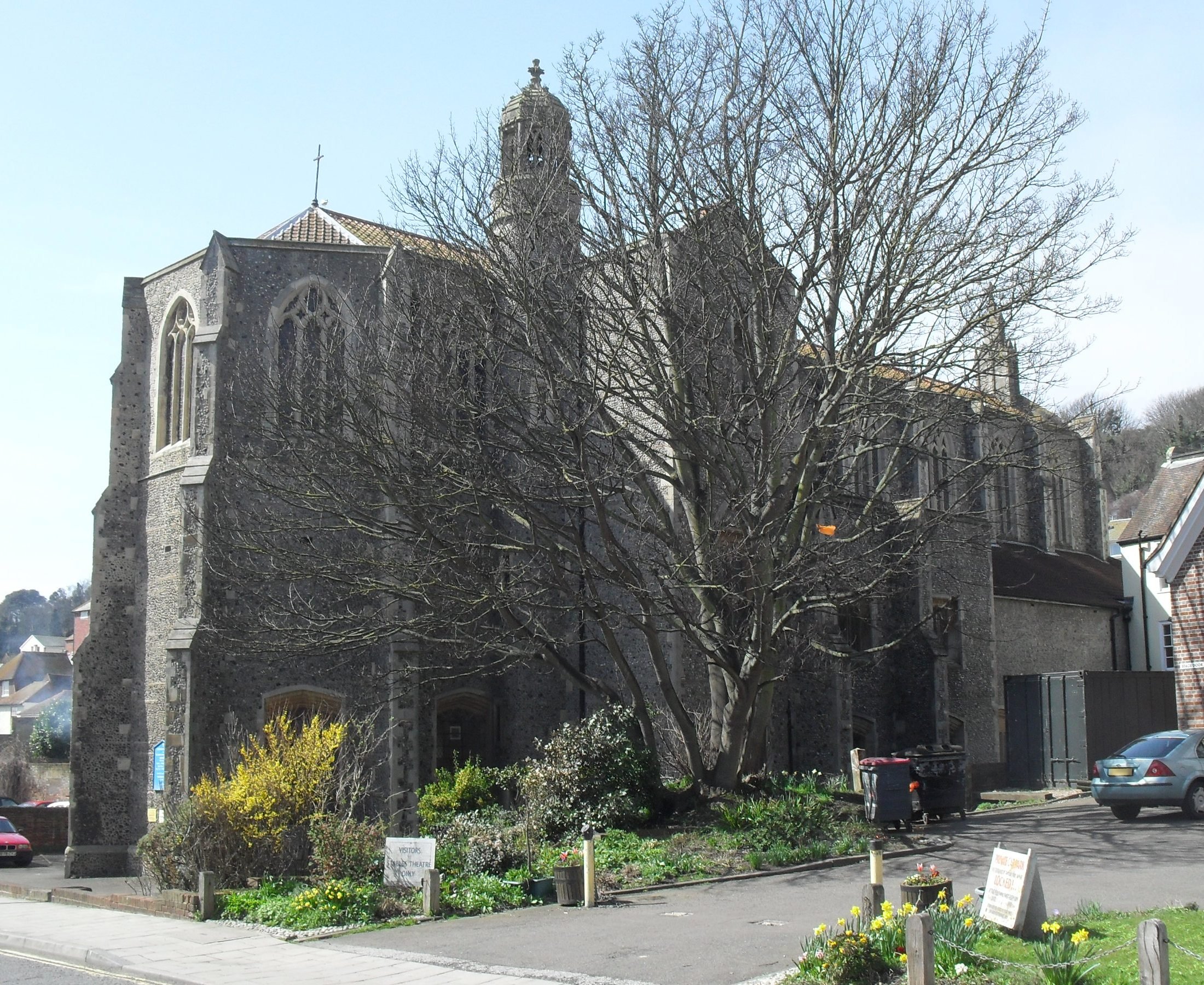
St Mary Star of the Sea Church, Hastings
St Mary Star of the Sea Church is a Roman Catholic Parish church in Hastings, East Sussex, England. It was built from 1882 to 1883 and designed by Basil...
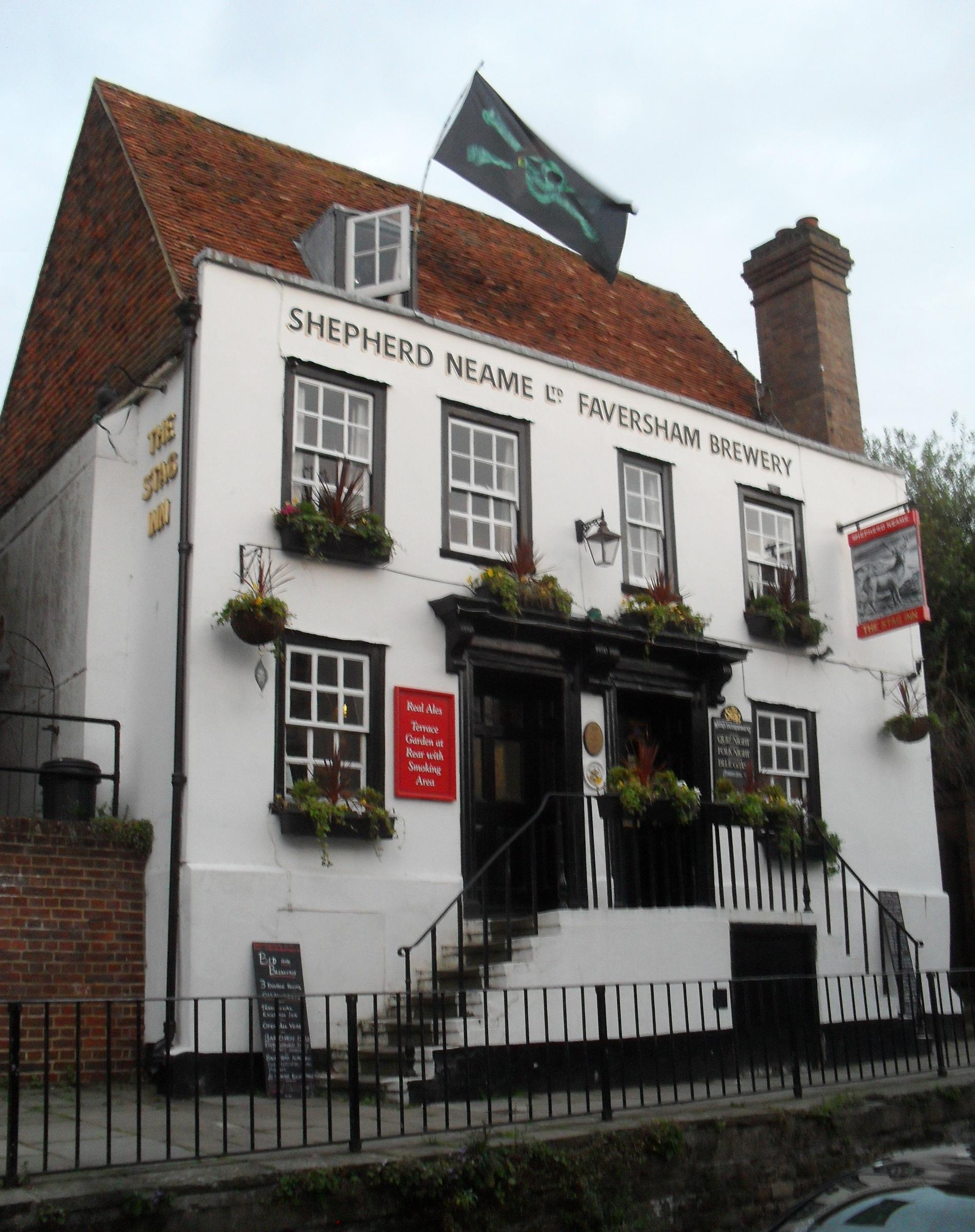
Stag Inn, Hastings
The Stag Inn is a public house in the Old Town area of Hastings, a port and seaside resort in East Sussex, England. One of many ancient buildings on All...
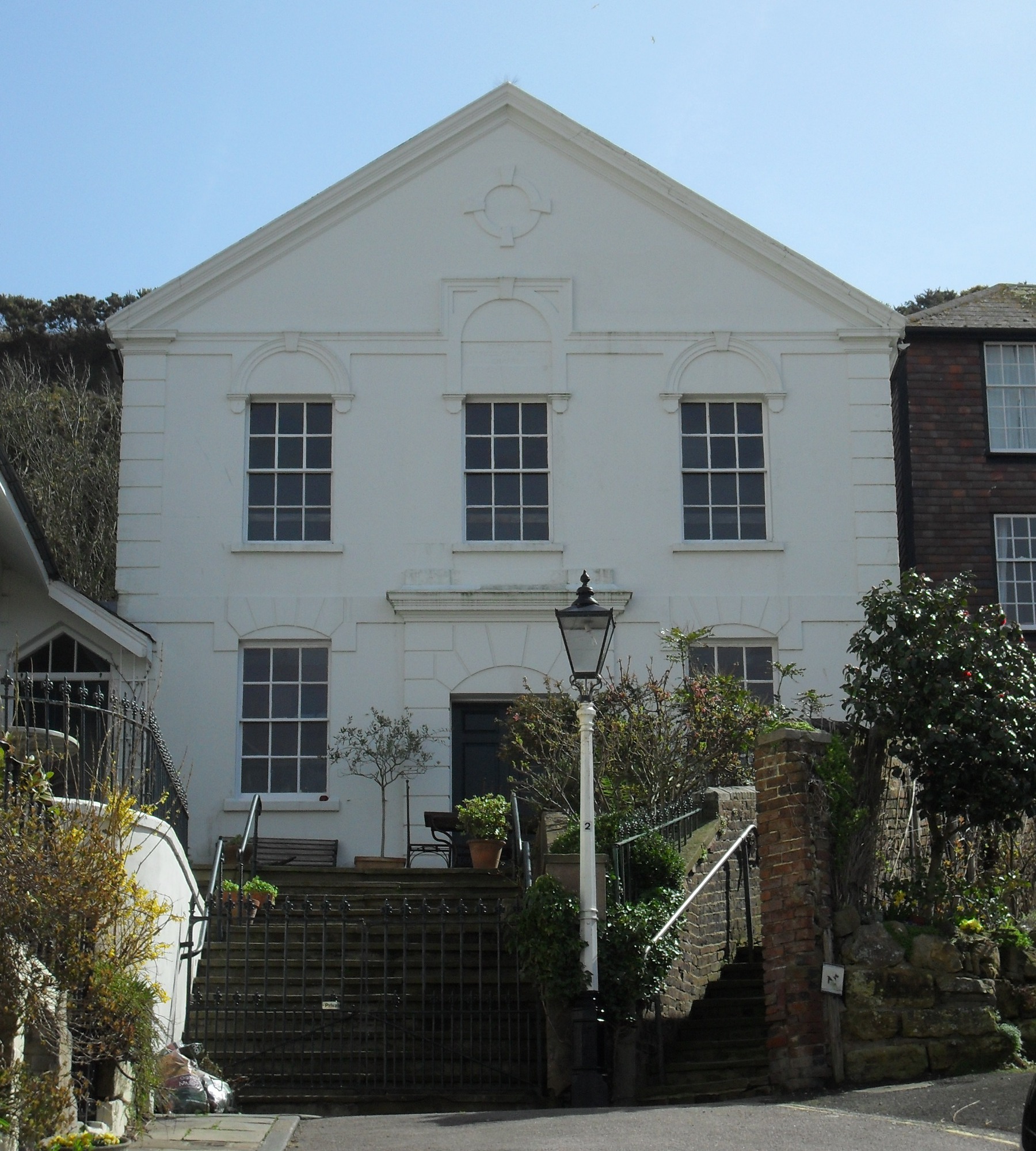
Ebenezer Particular Baptist Chapel, Hastings
Ebenezer Particular Baptist Chapel is a former Strict Baptist place of worship in Hastings, East Sussex, England. Founded in 1817 by members of the congregation...
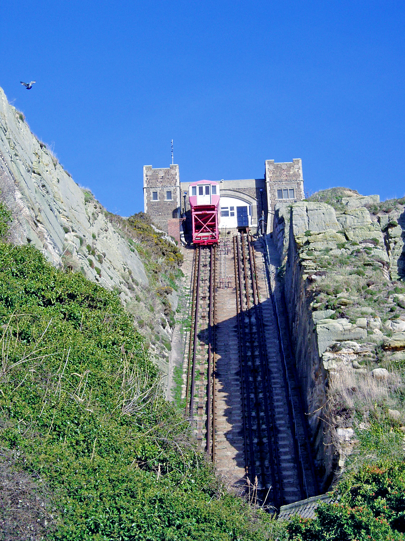
East Hill Cliff Railway
East Hill Cliff Railway, or East Hill Lift, is a funicular railway located in the English seaside town of Hastings. It provides access to Hastings Country...

Belmont, East Sussex
Belmont is a suburb of Hastings in East Sussex, England. The village falls within the Borough of Hastings.
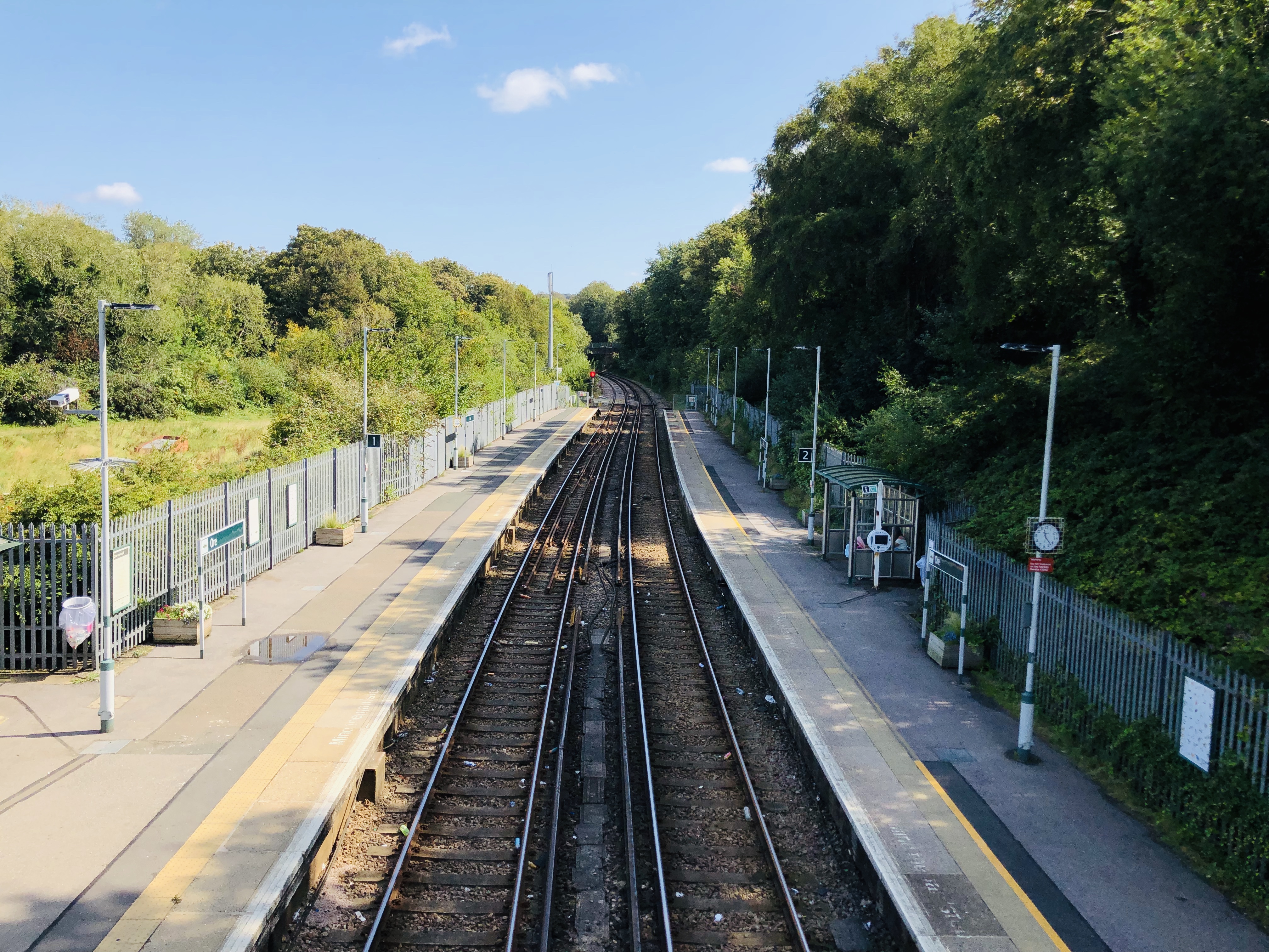
Ore railway station
Ore railway station serves Ore in East Sussex, England. It is on the Marshlink Line, and train services are provided by Southern, with a single peak hour...
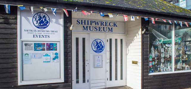
Shipwreck Museum
The Shipwreck Museum is an independent charitable museum in the historic Old Town of Hastings, UK. The museum has artefacts from many ships wrecked in...
Nearby Amenities
Located within 500m of 50.862236,0.5987535Have you been to High Wickham?
Leave your review of High Wickham below (or comments, questions and feedback).