High Farnhill

Settlement in Yorkshire Craven

England

High Farnhill

Bainbridge Wharf, Kildwick
Bainbridge Wharf, Kildwick Credit: Des Blenkinsopp

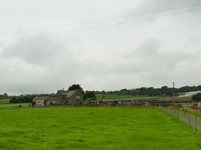
High Farnhill is a charming village situated in the county of Yorkshire, England. It is located in the Craven district, just a few miles away from the town of Skipton. Nestled in the beautiful Yorkshire Dales, High Farnhill is known for its picturesque countryside and captivating landscapes.

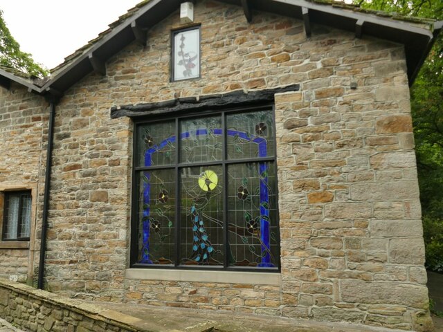
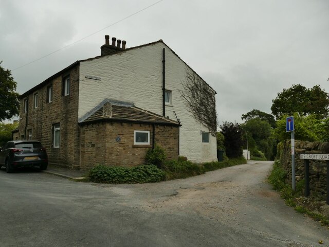
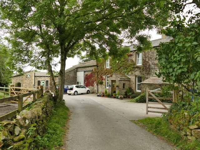
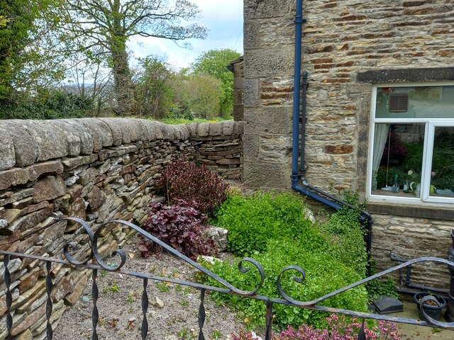
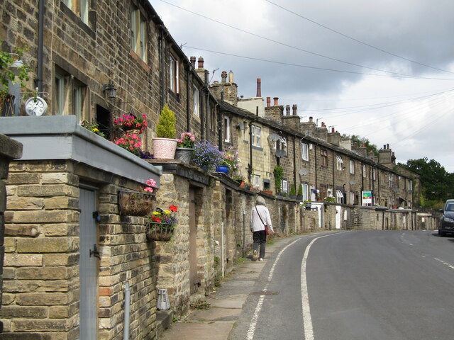
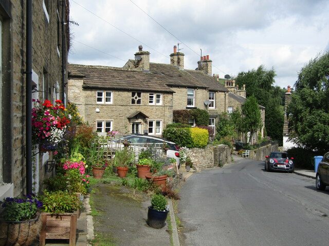
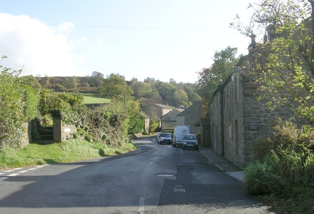
The village itself is characterized by its traditional stone cottages and historic buildings, giving it a quaint and timeless feel. The community is tight-knit and friendly, with a population of around 500 residents. The village is well-connected, with good road links to Skipton and nearby towns, making it easily accessible for both residents and visitors.

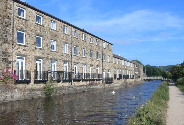
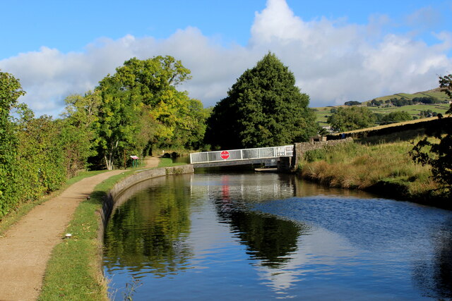
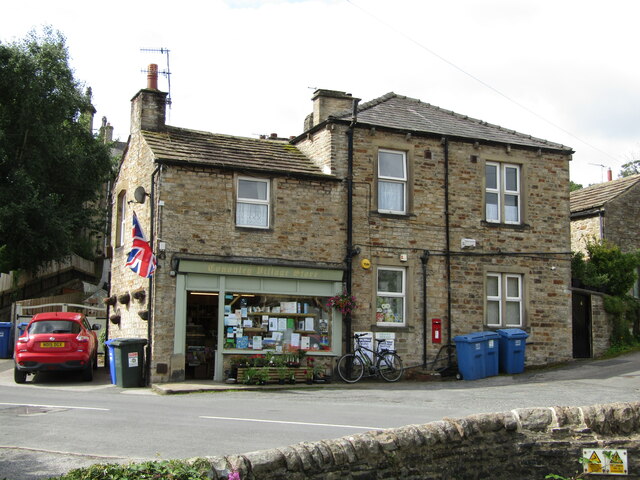
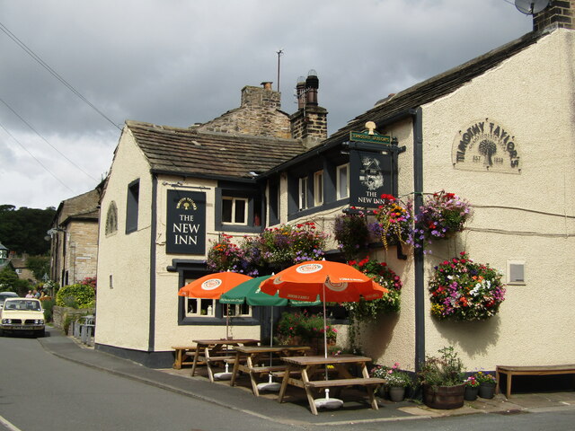
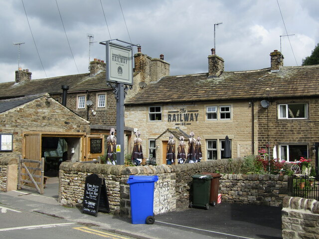
High Farnhill boasts a range of recreational activities and amenities. The village is home to a local pub, offering a warm and welcoming atmosphere for locals and tourists alike. The surrounding countryside provides ample opportunities for outdoor pursuits such as hiking, cycling, and horse riding. The nearby Leeds and Liverpool Canal also offers leisurely walks and boating activities.

The village is well-served in terms of education, with a primary school that caters to the local children. Additionally, the nearby town of Skipton provides a wider range of educational facilities and services.

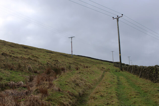
Overall, High Farnhill is a peaceful and idyllic village that showcases the scenic beauty of the Yorkshire Dales. Its close-knit community, stunning surroundings, and convenient location make it an attractive place to live or visit.

If you have any feedback on the listing, please let us know in the comments section below.

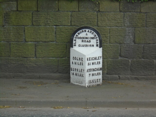
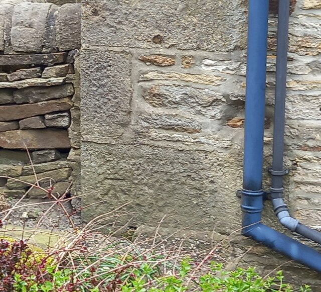
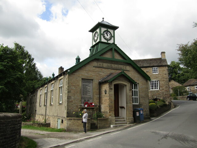
High Farnhill Images

Images are sourced within 2km of 53.915529/-1.9928539 or Grid Reference SE0046. Thanks to Geograph Open Source API. All images are credited.

Bainbridge Wharf, Kildwick
Peacock window at Ryecroft This is not the main, grade II listed farmhouse (which I didn't photograph as there were children outside) but a building across the lane from it.
Peacock window at Ryecroft
This is not the main, grade II listed farmhouse (which I didn't photograph as there were children outside) but a building across the lane from it.
The start of Ryecroft Road The junction with Green Lane; the group of houses to the left is called Glusburn Green.
The start of Ryecroft Road
The junction with Green Lane; the group of houses to the left is called Glusburn Green.
Buckett Farm An unusually named farm near Glusburn.
Buckett Farm
An unusually named farm near Glusburn.
Binns Lane Farm
Binns Lane Farm
View from Binns Lane Looking across the valley to the ridge with two monuments either end, Lund's Tower or the 'pepperpot' at left <a href="https://www.geograph.org.uk/photo/1747397">SD9943 : Lund's Tower</a>, and Wainman's Pinnacle or the 'saltpot' at right <a href="https://www.geograph.org.uk/photo/4932502">SD9842 : Wainman's Pinnacle near Cowling</a>.
View from Binns Lane
Looking across the valley to the ridge with two monuments either end, Lund's Tower or the 'pepperpot' at left SD9943 : Lund's Tower, and Wainman's Pinnacle or the 'saltpot' at right SD9842 : Wainman's Pinnacle near Cowling.
Hamblethorpe Bridge Revisited Approaching the swing bridge along the Leeds/Liverpool Canal towpath. The Polish Airmen's Memorial is on the opposite side of the waterway, near the bridge.
Hamblethorpe Bridge Revisited
Approaching the swing bridge along the Leeds/Liverpool Canal towpath. The Polish Airmen's Memorial is on the opposite side of the waterway, near the bridge.
Cononley Village Institute Located on Main Street
Cononley Village Institute
Located on Main Street
Footpath on the Flanks of Gib Side Footpath ascending from the village of Cononley towards the farms at Great and Little Gib
Footpath on the Flanks of Gib Side
Footpath ascending from the village of Cononley towards the farms at Great and Little Gib
Old milestone This section of the road from Addingham to Blackburn (in Lancashire), is now in North Yorkshire but was, when these milestones were set up in 1893/94 part of the extensive West Riding.  The milestone is on the south side of Colne Road in Glusburn.   Over the years the pavement has been built up, hiding the mileage to Ilkley which is 10¼ miles.  It is painted occasionally.
Old milestone
This section of the road from Addingham to Blackburn (in Lancashire), is now in North Yorkshire but was, when these milestones were set up in 1893/94 part of the extensive West Riding. The milestone is on the south side of Colne Road in Glusburn. Over the years the pavement has been built up, hiding the mileage to Ilkley which is 10¼ miles. It is painted occasionally.
Lothersdale, Spring Well Farm The benchmark is cut into a left cornerstone of the farmhouse.
Lothersdale, Spring Well Farm
The benchmark is cut into a left cornerstone of the farmhouse.
Lothersdale, Spring Well Farm There is a benchmark cut into a left cornerstone of the farmhouse.
Lothersdale, Spring Well Farm
There is a benchmark cut into a left cornerstone of the farmhouse.
Cononley - Aire View Terraced housing built for loom workers on Crosshills Road in this old cotton / wool mill village which also had lead mining. Roadside brick sheds probably once held coal but today contain bins which periodically line the road.
<span class="nowrap"><a title="www.cononleypc.org.uk" rel="nofollow ugc noopener" href="http://www.cononleypc.org.uk">Link</a><img style="margin-left:2px;" alt="External link" title="External link - shift click to open in new window" src="https://s1.geograph.org.uk/img/external.png" width="10" height="10"/></span>
Cononley - Aire View
Terraced housing built for loom workers on Crosshills Road in this old cotton / wool mill village which also had lead mining. Roadside brick sheds probably once held coal but today contain bins which periodically line the road. LinkExternal link
Cononley - St John's Cross Picturesque corner with old stone houses on Crosshills Road in this old mill / mining village.
<span class="nowrap"><a title="www.cononleypc.org.uk" rel="nofollow ugc noopener" href="http://www.cononleypc.org.uk">Link</a><img style="margin-left:2px;" alt="External link" title="External link - shift click to open in new window" src="https://s1.geograph.org.uk/img/external.png" width="10" height="10"/></span>
Cononley - St John's Cross
Picturesque corner with old stone houses on Crosshills Road in this old mill / mining village. LinkExternal link
Cononley - Village Store A village hub at the corner of Main Street and Crosshills Road.
<span class="nowrap"><a title="www.cononleypc.org.uk" rel="nofollow ugc noopener" href="http://www.cononleypc.org.uk">Link</a><img style="margin-left:2px;" alt="External link" title="External link - shift click to open in new window" src="https://s1.geograph.org.uk/img/external.png" width="10" height="10"/></span>
Cononley - Village Store
A village hub at the corner of Main Street and Crosshills Road. LinkExternal link
Cononley - Village Institute The belfried historic village hall today hosts a range of modern activities, clubs and societies. Note the war memorial on the gable wall.
<span class="nowrap"><a title="www.cononleypc.org.uk" rel="nofollow ugc noopener" href="http://www.cononleypc.org.uk">Link</a><img style="margin-left:2px;" alt="External link" title="External link - shift click to open in new window" src="https://s1.geograph.org.uk/img/external.png" width="10" height="10"/></span>
Cononley - Village Institute
The belfried historic village hall today hosts a range of modern activities, clubs and societies. Note the war memorial on the gable wall. LinkExternal link
Cononley - The New Inn Historic village pub (17th or early 18th century) on Cononley's Main Street and in the Timothy Taylor's stable.
<span class="nowrap"><a title="www.cononleypc.org.uk" rel="nofollow ugc noopener" href="http://www.cononleypc.org.uk">Link</a><img style="margin-left:2px;" alt="External link" title="External link - shift click to open in new window" src="https://s1.geograph.org.uk/img/external.png" width="10" height="10"/></span>
Cononley - The New Inn
Historic village pub (17th or early 18th century) on Cononley's Main Street and in the Timothy Taylor's stable. LinkExternal link
Cononley - The Railway Inn Free house on Cononley's Main Street, practically opposite the railway station.
<span class="nowrap"><a title="www.cononleypc.org.uk" rel="nofollow ugc noopener" href="http://www.cononleypc.org.uk">Link</a><img style="margin-left:2px;" alt="External link" title="External link - shift click to open in new window" src="https://s1.geograph.org.uk/img/external.png" width="10" height="10"/></span>
Cononley - The Railway Inn
Free house on Cononley's Main Street, practically opposite the railway station. LinkExternal link
Show me another place!

High Farnhill is located at Grid Ref: SE0046 (Lat: 53.915529, Lng: -1.9928539)

Division: West Riding

Administrative County: North Yorkshire

District: Craven

Police Authority: North Yorkshire

What 3 Words

///snapper.stylists.remotest. Near Cross Hills, North Yorkshire

Related Wikis

Farnhill

Farnhill is a village and civil parish in the Craven district of North Yorkshire, England. It is situated near Sutton-in-Craven and about 4 miles (6.4...

Kildwick

Kildwick, or Kildwick-in-Craven, is a village and civil parish of the district of Craven in North Yorkshire, England. It is situated between Skipton and...

Cononley railway station

Cononley railway station serves the village of Cononley in North Yorkshire, England. The station, and all trains serving it, are operated by Northern....

Kildwick and Crosshills railway station

Kildwick and Crosshills [sic] was a railway station off Station Road in Cross Hills, North Yorkshire (formerly West Riding of Yorkshire), England. It served...

Aire View

Aire View is a linear settlement in the civil parish of Cononley, North Yorkshire, England. It lies 5 miles (8 km) north-west from Keighley and less than...

Glusburn

Glusburn is a village and electoral ward in Craven in North Yorkshire, England. Historically part of the West Riding of Yorkshire, the village is situated...

Bradley, North Yorkshire

Bradley is a village in North Yorkshire, England. It is situated between Skipton and Keighley, approximately 1⁄2 mile (800 m) from the A629 and 2 miles...

Cononley

Cononley ( or ) is a village and civil parish in the Craven district of North Yorkshire, England. Historically part of the West Riding of Yorkshire, Cononley...

Nearby Amenities

Located within 500m of 53.915529,-1.9928539
Created By: Merkaartor 0.12
Lat/Long: 53.9113169/-1.99288
Created By: Merkaartor 0.12
Lat/Long: 53.913225/-1.9981079
Created By: Merkaartor 0.12
Lat/Long: 53.9123488/-1.9958638
Parking
Lat/Long: 53.91735/-1.9978436
Bus Stop
Departures Board: timetable
Kerb: raised
Naptan AtcoCode: 3200YNF10060
Naptan NaptanCode: 32010060
Shelter: yes
Source: photograph
Lat/Long: 53.9167323/-1.9985176
Barrier: kissing_gate
Lat/Long: 53.9139441/-1.9933314
Bench Mark 985
Man Made: survey_point
Lat/Long: 53.9158317/-1.9986453
Bench
Lat/Long: 53.9137697/-1.9932486
Direction East: Leeds 25.25
Direction West: Liverpool 102
Waterway: milestone
Lat/Long: 53.9131341/-1.9976744
Historic: milestone
Lat/Long: 53.9135093/-1.992239
Bus Stop
Departures Board: timetable
Lat/Long: 53.9166228/-1.9983613
The data included in this document is from www.openstreetmap.org. The data is made available under ODbL.

Have you been to High Farnhill?

Leave your review of High Farnhill below (or comments, questions and feedback).