Hen Bentref Llandegfan

Settlement in Anglesey

Wales

Hen Bentref Llandegfan

A shelter roof on Bangor Pier Currently the shelter structure is dismantled for repairs, leaving a visually curious arrangement of an onion dome on wheels. Beside this is the outdoor seating of the newly-opened Pavilion Cafe.
A shelter roof on Bangor Pier Credit: Oliver Mills

Hen Bentref Llandegfan, located on the picturesque island of Anglesey in Wales, is a small village that exudes charm and tranquility. Nestled in a rural setting, it offers a glimpse into the rich history and culture of the area.

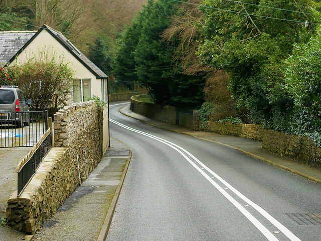
The village is characterized by its traditional stone cottages, which date back several centuries. These dwellings, with their thatched roofs and whitewashed walls, provide a glimpse into the architectural heritage of the region. Walking through the narrow lanes of Hen Bentref Llandegfan, visitors can immerse themselves in the atmosphere of a bygone era.

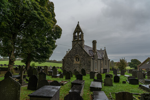
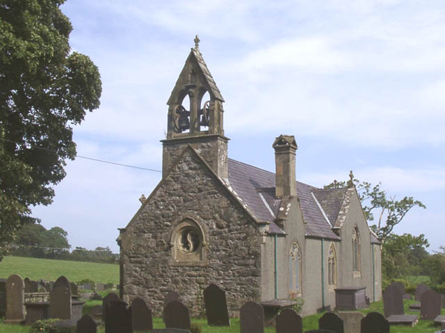
The village is also home to St. Tegfan's Church, a notable landmark that has stood for over a thousand years. This ancient place of worship showcases beautiful stained glass windows and intriguing Celtic stone carvings, attracting history enthusiasts and architecture admirers alike.

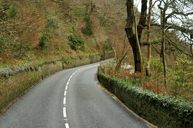
Surrounded by rolling green hills and lush farmland, the village offers a peaceful retreat for those seeking to escape the hustle and bustle of modern life. Its idyllic location also makes it a popular base for outdoor activities, such as hiking and cycling, with numerous trails and paths meandering through the surrounding countryside.

While Hen Bentref Llandegfan may be small in size, its close-knit community prides itself on its warm hospitality. The village is home to a handful of local businesses, including a cozy pub and a charming tearoom, where visitors can sample traditional Welsh cuisine and experience the friendly atmosphere that epitomizes this rural community.

In conclusion, Hen Bentref Llandegfan is a hidden gem on the island of Anglesey, offering a glimpse into the past while providing a tranquil haven for visitors. Its historic buildings, stunning natural surroundings, and welcoming community make it a must-visit destination for those seeking an authentic Welsh experience.

If you have any feedback on the listing, please let us know in the comments section below.

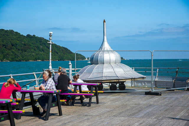
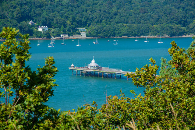
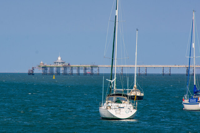
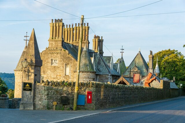
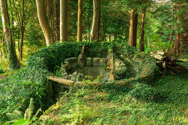
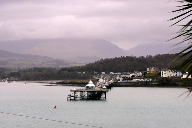
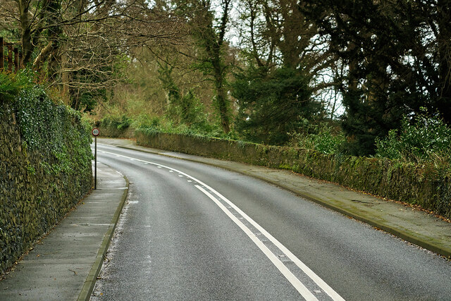
Hen Bentref Llandegfan Images

Images are sourced within 2km of 53.250995/-4.1439662 or Grid Reference SH5774. Thanks to Geograph Open Source API. All images are credited.

A shelter roof on Bangor Pier Currently the shelter structure is dismantled for repairs, leaving a visually curious arrangement of an onion dome on wheels. Beside this is the outdoor seating of the newly-opened Pavilion Cafe.
A shelter roof on Bangor Pier
Currently the shelter structure is dismantled for repairs, leaving a visually curious arrangement of an onion dome on wheels. Beside this is the outdoor seating of the newly-opened Pavilion Cafe.
Bangor Pier, viewed from the "Roman Camp" One of the most elevated local areas in Bangor. Some structural restoration of the Pier is ongoing.
Bangor Pier, viewed from the "Roman Camp"
One of the most elevated local areas in Bangor. Some structural restoration of the Pier is ongoing.
Bangor Pier A very distant view of the Pier from another; St George's Pier in Menai Bridge.
Bangor Pier
A very distant view of the Pier from another; St George's Pier in Menai Bridge.
Bangor Pier from Chateau Rhianfa An excellent viewpoint across the Menai Strait is accessible by a steep footpath beside Chateau Rhianfa; evidently a public right of way, according to the maps.

This viewpoint during the early morning reliably provides visual delight, assuming no injuries take place whilst navigating the wet seaweed on the shore. Sadly today a floating object rudely intrudes against the reflections and acts to distract. Never mind - what is a mere distraction to a photographer will certainly be the pride of a local mariner.
Bangor Pier from Chateau Rhianfa
An excellent viewpoint across the Menai Strait is accessible by a steep footpath beside Chateau Rhianfa; evidently a public right of way, according to the maps. This viewpoint during the early morning reliably provides visual delight, assuming no injuries take place whilst navigating the wet seaweed on the shore. Sadly today a floating object rudely intrudes against the reflections and acts to distract. Never mind - what is a mere distraction to a photographer will certainly be the pride of a local mariner.
Chateau Rhianfa, Menai Bridge Located on Beaumaris Road, close to the shore of the Menai Strait.
Chateau Rhianfa, Menai Bridge
Located on Beaumaris Road, close to the shore of the Menai Strait.
An ice house near Craig-y-Don, Menai Bridge Located in dense woodland between Beaumaris Road and the shore of the Menai Strait. This ice house seemingly served Craig-y-Don House, located a fair distance Eastwards.
An ice house near Craig-y-Don, Menai Bridge
Located in dense woodland between Beaumaris Road and the shore of the Menai Strait. This ice house seemingly served Craig-y-Don House, located a fair distance Eastwards.
St Sadwrn's Church Llansadwrn, Anglesey
Bangor Garth Pier Garth Pier is a Grade II* listed structure at Bangor (Cadw reference 3987 <span class="nowrap"><a title="http://cadwpublic-api.azurewebsites.net/reports/listedbuilding/FullReport?lang=en&id=3987" rel="nofollow ugc noopener" href="http://cadwpublic-api.azurewebsites.net/reports/listedbuilding/FullReport?lang=en&id=3987">Link</a><img style="margin-left:2px;" alt="External link" title="External link - shift click to open in new window" src="https://s1.geograph.org.uk/img/external.png" width="10" height="10"/></span> ). At 1,500 feet (460 m) in length, it is the longest** surviving pier in Wales and the ninth longest in the British Isles. It was opened to the public on 14 May 1896.

This view is looking across the Menai Strait from the A545 road, behind the Gazelle Hotel, between Menai Bridge and Beaumaris.

** Although Cadw list Bangor Pier as the longest in Wales (<span class="nowrap"><a title="https://cadwpublic-api.azurewebsites.net/reports/listedbuilding/FullReport?lang=en&id=3987" rel="nofollow ugc noopener" href="https://cadwpublic-api.azurewebsites.net/reports/listedbuilding/FullReport?lang=en&id=3987">Link</a><img style="margin-left:2px;" alt="External link" title="External link - shift click to open in new window" src="https://s1.geograph.org.uk/img/external.png" width="10" height="10"/></span> ) others claim that Llandudno Pier (2295ft/700m if the extension is included) holds that distinction <span class="nowrap"><a title="https://www.llandudnopier.com/" rel="nofollow ugc noopener" href="https://www.llandudnopier.com/">Link</a><img style="margin-left:2px;" alt="External link" title="External link - shift click to open in new window" src="https://s1.geograph.org.uk/img/external.png" width="10" height="10"/></span> .
Bangor Garth Pier
Garth Pier is a Grade II* listed structure at Bangor (Cadw reference 3987 LinkExternal link ). At 1,500 feet (460 m) in length, it is the longest** surviving pier in Wales and the ninth longest in the British Isles. It was opened to the public on 14 May 1896. This view is looking across the Menai Strait from the A545 road, behind the Gazelle Hotel, between Menai Bridge and Beaumaris. ** Although Cadw list Bangor Pier as the longest in Wales (LinkExternal link ) others claim that Llandudno Pier (2295ft/700m if the extension is included) holds that distinction LinkExternal link .
Beaumaris Road (A545) The A545 runs for 4½ miles along the south coast of Anglesey, connecting Menai Bridge with Beaumaris.
Beaumaris Road (A545)
The A545 runs for 4½ miles along the south coast of Anglesey, connecting Menai Bridge with Beaumaris.
A545 Beaumaris Road The A545 runs for 4½ miles along the south coast of Anglesey, connecting Menai Bridge with Beaumaris.
A545 Beaumaris Road
The A545 runs for 4½ miles along the south coast of Anglesey, connecting Menai Bridge with Beaumaris.
Beaumaris Road (A545) The A545 runs for 4½ miles along the south coast of Anglesey, connecting Menai Bridge with Beaumaris.
Beaumaris Road (A545)
The A545 runs for 4½ miles along the south coast of Anglesey, connecting Menai Bridge with Beaumaris.
Bangor Pier from an extraordinarily long way away This relatively uninteresting view of the Pier, taken from the landing stage beside the Menai Suspension Bridge, was submitted here since it records the loss of the so-called "Linkspan" onto the landing stage of the pier. The landing stage was constructed at low cost during the 1980s restoration of the pier, and its rudimentary specification resulted in it being deemed unsuitable for use by the public, so has remained unused for most of its existence. Its declining condition has necessitated the removal of the connecting gangway, presumably to eliminate any risk of damage to the pier in the event of a failure of the landing stage. Presumably the rest of the landing stage will be removed at some point.
Bangor Pier from an extraordinarily long way away
This relatively uninteresting view of the Pier, taken from the landing stage beside the Menai Suspension Bridge, was submitted here since it records the loss of the so-called "Linkspan" onto the landing stage of the pier. The landing stage was constructed at low cost during the 1980s restoration of the pier, and its rudimentary specification resulted in it being deemed unsuitable for use by the public, so has remained unused for most of its existence. Its declining condition has necessitated the removal of the connecting gangway, presumably to eliminate any risk of damage to the pier in the event of a failure of the landing stage. Presumably the rest of the landing stage will be removed at some point.
Bangor Pier Garth Pier is a Grade II* listed structure at Bangor (Cadw reference 3987 <span class="nowrap"><a title="http://cadwpublic-api.azurewebsites.net/reports/listedbuilding/FullReport?lang=en&id=3987" rel="nofollow ugc noopener" href="http://cadwpublic-api.azurewebsites.net/reports/listedbuilding/FullReport?lang=en&id=3987">Link</a><img style="margin-left:2px;" alt="External link" title="External link - shift click to open in new window" src="https://s1.geograph.org.uk/img/external.png" width="10" height="10"/></span> ). At 1500 feet (460 m) in length, it is the longest** surviving pier in Wales and the ninth longest in the British Isles. It was opened to the public on 14 May 1896.
 
** Although Cadw list Bangor Pier as the longest in Wales (<span class="nowrap"><a title="https://cadwpublic-api.azurewebsites.net/reports/listedbuilding/FullReport?lang=en&id=3987" rel="nofollow ugc noopener" href="https://cadwpublic-api.azurewebsites.net/reports/listedbuilding/FullReport?lang=en&id=3987">Link</a><img style="margin-left:2px;" alt="External link" title="External link - shift click to open in new window" src="https://s1.geograph.org.uk/img/external.png" width="10" height="10"/></span> ) others claim that Llandudno Pier (2295ft/700m if the extension is included) holds that distinction <span class="nowrap"><a title="https://www.llandudnopier.com/" rel="nofollow ugc noopener" href="https://www.llandudnopier.com/">Link</a><img style="margin-left:2px;" alt="External link" title="External link - shift click to open in new window" src="https://s1.geograph.org.uk/img/external.png" width="10" height="10"/></span> .
Bangor Pier
Garth Pier is a Grade II* listed structure at Bangor (Cadw reference 3987 LinkExternal link ). At 1500 feet (460 m) in length, it is the longest** surviving pier in Wales and the ninth longest in the British Isles. It was opened to the public on 14 May 1896. ** Although Cadw list Bangor Pier as the longest in Wales (LinkExternal link ) others claim that Llandudno Pier (2295ft/700m if the extension is included) holds that distinction LinkExternal link .
Bangor (Garth) Pier Garth Pier is a Grade II* listed structure at Bangor (Cadw reference 3987 <span class="nowrap"><a title="http://cadwpublic-api.azurewebsites.net/reports/listedbuilding/FullReport?lang=en&id=3987" rel="nofollow ugc noopener" href="http://cadwpublic-api.azurewebsites.net/reports/listedbuilding/FullReport?lang=en&id=3987">Link</a><img style="margin-left:2px;" alt="External link" title="External link - shift click to open in new window" src="https://s1.geograph.org.uk/img/external.png" width="10" height="10"/></span> ). At 1500 feet (460 m) in length, it is the longest** surviving pier in Wales and the ninth longest in the British Isles. It was opened to the public on 14 May 1896.
 
** Although Cadw list Bangor Pier as the longest in Wales (<span class="nowrap"><a title="https://cadwpublic-api.azurewebsites.net/reports/listedbuilding/FullReport?lang=en&id=3987" rel="nofollow ugc noopener" href="https://cadwpublic-api.azurewebsites.net/reports/listedbuilding/FullReport?lang=en&id=3987">Link</a><img style="margin-left:2px;" alt="External link" title="External link - shift click to open in new window" src="https://s1.geograph.org.uk/img/external.png" width="10" height="10"/></span> ) others claim that Llandudno Pier (2295ft/700m if the extension is included) holds that distinction <span class="nowrap"><a title="https://www.llandudnopier.com/" rel="nofollow ugc noopener" href="https://www.llandudnopier.com/">Link</a><img style="margin-left:2px;" alt="External link" title="External link - shift click to open in new window" src="https://s1.geograph.org.uk/img/external.png" width="10" height="10"/></span> .
Bangor (Garth) Pier
Garth Pier is a Grade II* listed structure at Bangor (Cadw reference 3987 LinkExternal link ). At 1500 feet (460 m) in length, it is the longest** surviving pier in Wales and the ninth longest in the British Isles. It was opened to the public on 14 May 1896. ** Although Cadw list Bangor Pier as the longest in Wales (LinkExternal link ) others claim that Llandudno Pier (2295ft/700m if the extension is included) holds that distinction LinkExternal link .
Garth (Bangor) Pier Garth Pier is a Grade II* listed structure at Bangor (Cadw reference 3987 <span class="nowrap"><a title="http://cadwpublic-api.azurewebsites.net/reports/listedbuilding/FullReport?lang=en&id=3987" rel="nofollow ugc noopener" href="http://cadwpublic-api.azurewebsites.net/reports/listedbuilding/FullReport?lang=en&id=3987">Link</a><img style="margin-left:2px;" alt="External link" title="External link - shift click to open in new window" src="https://s1.geograph.org.uk/img/external.png" width="10" height="10"/></span> ). At 1500 feet (460 m) in length, it is the longest** surviving pier in Wales and the ninth longest in the British Isles. It was opened to the public on 14 May 1896.
 
** Although Cadw list Bangor Pier as the longest in Wales (<span class="nowrap"><a title="https://cadwpublic-api.azurewebsites.net/reports/listedbuilding/FullReport?lang=en&id=3987" rel="nofollow ugc noopener" href="https://cadwpublic-api.azurewebsites.net/reports/listedbuilding/FullReport?lang=en&id=3987">Link</a><img style="margin-left:2px;" alt="External link" title="External link - shift click to open in new window" src="https://s1.geograph.org.uk/img/external.png" width="10" height="10"/></span> ) others claim that Llandudno Pier (2295ft/700m if the extension is included) holds that distinction <span class="nowrap"><a title="https://www.llandudnopier.com/" rel="nofollow ugc noopener" href="https://www.llandudnopier.com/">Link</a><img style="margin-left:2px;" alt="External link" title="External link - shift click to open in new window" src="https://s1.geograph.org.uk/img/external.png" width="10" height="10"/></span> .
Garth (Bangor) Pier
Garth Pier is a Grade II* listed structure at Bangor (Cadw reference 3987 LinkExternal link ). At 1500 feet (460 m) in length, it is the longest** surviving pier in Wales and the ninth longest in the British Isles. It was opened to the public on 14 May 1896. ** Although Cadw list Bangor Pier as the longest in Wales (LinkExternal link ) others claim that Llandudno Pier (2295ft/700m if the extension is included) holds that distinction LinkExternal link .
Menai Strait from Garth pier
The Pavilion at the end of Garth Pier Not a soul to be seen on a bitterly cold February day.
The Pavilion at the end of Garth Pier
Not a soul to be seen on a bitterly cold February day.
Whistlestop on the Pier Polygonal kiosk, Garth Pier
Whistlestop on the Pier
Polygonal kiosk, Garth Pier
Show me another place!

Hen Bentref Llandegfan is located at Grid Ref: SH5774 (Lat: 53.250995, Lng: -4.1439662)

Unitary Authority: Isle of Anglesey

Police Authority: North Wales

What 3 Words

///fatigued.tall.catapult. Near Bangor, Gwynedd

Nearby Locations

Hen Bentref Llandegfan

Related Wikis

Hen Bentref Llandegfan

Hen Bentref Llandegfan is a village in the community of Cwm Cadnant, Anglesey, Wales, which is 128.9 miles (207.5 km) from Cardiff and 207.8 miles (334...

Cwm Cadnant

Cwm Cadnant is a community and former electoral ward in Anglesey, north Wales. Named after the local river, Afon Cadnant, which flows through it, the community...

Bryn-minceg

Bryn-minceg is a settlement in Cwm Cadnant, Anglesey, Wales. == References == == See also == List of localities in Wales by population

Cytir Mawr

Cytir Mawr (also written as Cyttir Mawr) is a local nature reserve in Llandegfan, Anglesey, Wales. == History == In July 2006, the site was designated...

Dindaethwy

Dindaethwy was in medieval times one of two commotes of the cantref of Rhosyr, in the south-east of the Isle of Anglesey. It was between the Menai Strait...

Llandegfan

Llandegfan (Welsh: [ɬan'dɛɡvan]; ; meaning The Church of St Tegfan) is a village on the east of island of Anglesey in Wales. It is part of the community...

Chateau Rhianfa

Chateau Rhianfa is a Grade II*-listed hotel and former mansion in Anglesey, North Wales. Its gardens are also listed as Grade II* on the Cadw/ICOMOS Register...

Llansadwrn, Anglesey

Llansadwrn (; Welsh: [ɬanˈsadʊn]; ) is a small village in the community of Cwm Cadnant in south-east Anglesey, in north-west Wales. It lies between Menai...

Nearby Amenities

Located within 500m of 53.250995,-4.1439662
Barrier: kissing_gate
Foot: yes
Lat/Long: 53.2478776/-4.1467467
Barrier: kissing_gate
Foot: yes
Lat/Long: 53.2489258/-4.1437732
Barrier: kissing_gate
Foot: yes
Lat/Long: 53.2487557/-4.139258
Barrier: kissing_gate
Foot: yes
Lat/Long: 53.2489741/-4.1379346
Barrier: kissing_gate
Foot: yes
Lat/Long: 53.2481746/-4.1426268
Barrier: kissing_gate
Foot: yes
Lat/Long: 53.2483778/-4.1410095
Barrier: kissing_gate
Foot: yes
Lat/Long: 53.2483937/-4.1397867
Barrier: kissing_gate
Foot: yes
Lat/Long: 53.2483715/-4.1394238
Barrier: kissing_gate
Foot: yes
Lat/Long: 53.247512/-4.1408009
Hen Bentref Llandegfan
Place: village
Source: survey
Source Name: OS OpenData StreetView
Wikidata: Q16037022
Lat/Long: 53.251163/-4.1433052
Post Box
Collection Times: Mo-Fr 10:30; Sa 10:00
Operator: Royal Mail
Post Box Type: lamp
Ref: LL59 182
Royal Cypher: EIIR
Royal Cypher Wikidata: Q33102113
Lat/Long: 53.2510662/-4.1437805
Direction: WSW
Generator Method: photovoltaic
Generator Output Electricity: yes
Generator Solar Modules: 4
Generator Source: solar
Generator Type: solar_photovoltaic_panel
Location: roof
Power: generator
Lat/Long: 53.2522052/-4.1420777
Direction: WSW
Generator Method: photovoltaic
Generator Output Electricity: yes
Generator Solar Modules: 4
Generator Source: solar
Generator Type: solar_photovoltaic_panel
Location: roof
Power: generator
Lat/Long: 53.2522301/-4.1420958
Direction: 215
Generator Method: photovoltaic
Generator Output Electricity: yes
Generator Solar Modules: 16
Generator Source: solar
Generator Type: solar_photovoltaic_panel
Location: roof
Power: generator
Lat/Long: 53.2520756/-4.1447975
Direction: SW
Generator Method: photovoltaic
Generator Output Electricity: yes
Generator Solar Modules: 18
Generator Source: solar
Generator Type: solar_photovoltaic_panel
Location: roof
Power: generator
Lat/Long: 53.2499874/-4.1425753
Direction: 125
Generator Method: photovoltaic
Generator Output Electricity: yes
Generator Solar Modules: 9
Generator Source: solar
Generator Type: solar_photovoltaic_panel
Location: roof
Power: generator
Lat/Long: 53.2501623/-4.1432337
Direction: 215
Generator Method: photovoltaic
Generator Output Electricity: yes
Generator Solar Modules: 18
Generator Source: solar
Generator Type: solar_photovoltaic_panel
Location: roof
Power: generator
Lat/Long: 53.2507264/-4.1437809
The data included in this document is from www.openstreetmap.org. The data is made available under ODbL.

Have you been to Hen Bentref Llandegfan?

Leave your review of Hen Bentref Llandegfan below (or comments, questions and feedback).