Harrop Green

Settlement in Yorkshire

England

Harrop Green

View of St Chad Church, Saddleworth Link to Church Website <span class="nowrap"><a title="https://www.cofeinsaddleworth.org.uk/st-chad-saddleworth-parish-church" rel="nofollow ugc noopener" href="https://www.cofeinsaddleworth.org.uk/st-chad-saddleworth-parish-church">Link</a><img style="margin-left:2px;" alt="External link" title="External link - shift click to open in new window" src="https://s1.geograph.org.uk/img/external.png" width="10" height="10"/></span>
View of St Chad Church, Saddleworth Credit: Philip Cornwall

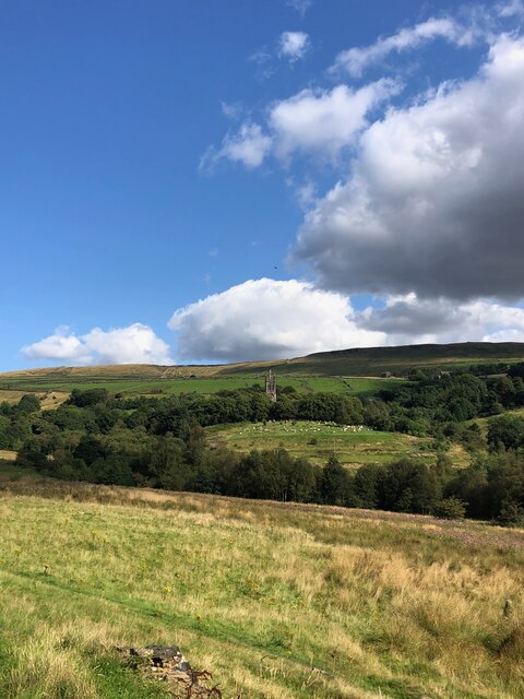
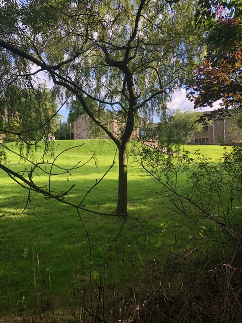
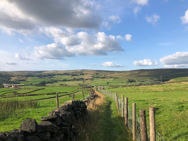
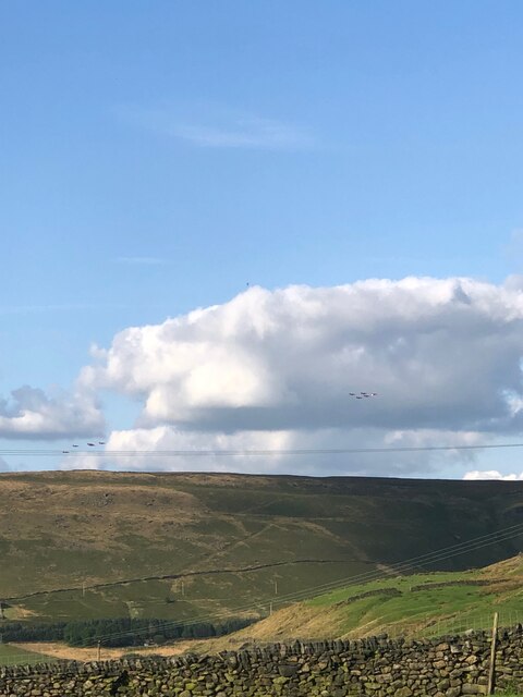
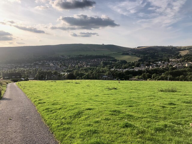
Harrop Green is a picturesque village located in the county of Yorkshire, England. Situated in the heart of the countryside, it is known for its idyllic rural setting and charming character. The village lies within the administrative district of Yorkshire and is surrounded by rolling hills and lush green fields, offering breathtaking views to residents and visitors alike.

With a population of around 500 people, Harrop Green is a close-knit community that prides itself on its strong community spirit. The village is home to a range of amenities, including a local pub, a primary school, and a village hall, which serves as a hub for various social events and activities. The village also has a small but thriving local economy, with a handful of independent shops and businesses catering to the needs of the residents.

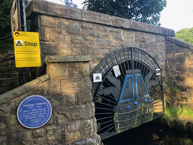
Harrop Green boasts a rich history, with evidence of human habitation dating back to ancient times. The village is dotted with historic buildings, including a beautiful medieval church that stands as a testament to the village's heritage. The surrounding countryside offers plenty of opportunities for outdoor activities such as hiking, cycling, and horse riding, making it a popular destination for nature enthusiasts.

Overall, Harrop Green is a charming and peaceful village that offers a tranquil escape from the hustle and bustle of city life. Its natural beauty, strong sense of community, and rich history make it a truly special place to live or visit in Yorkshire.

If you have any feedback on the listing, please let us know in the comments section below.
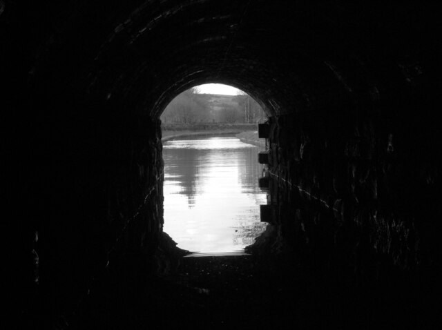
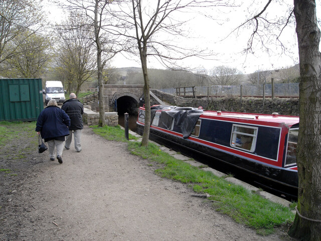
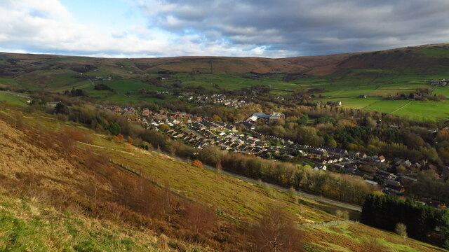
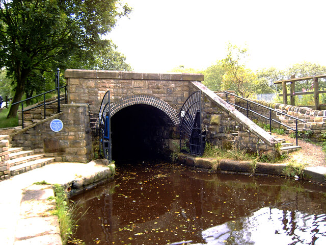
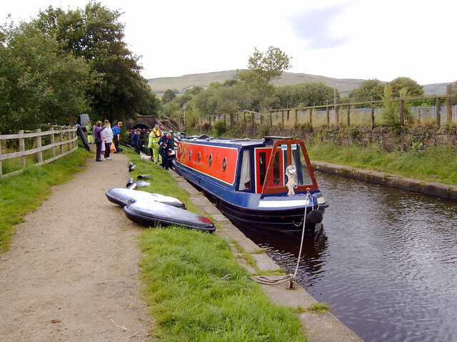
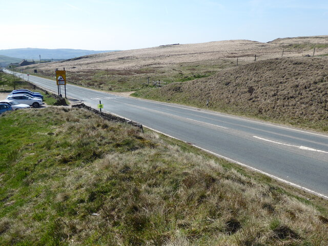
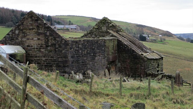
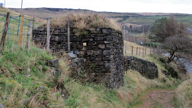
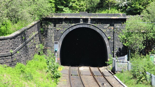
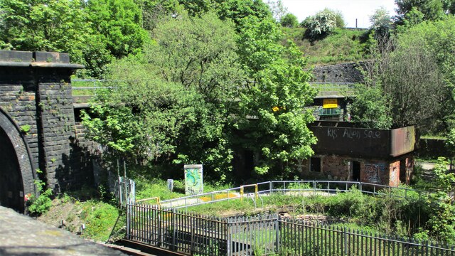
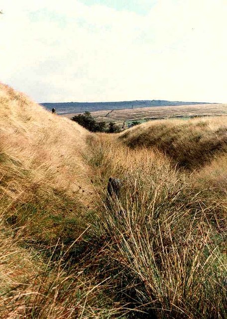
Harrop Green Images

Images are sourced within 2km of 53.569867/-1.9925175 or Grid Reference SE0008. Thanks to Geograph Open Source API. All images are credited.

View of St Chad Church, Saddleworth Link to Church Website <span class="nowrap"><a title="https://www.cofeinsaddleworth.org.uk/st-chad-saddleworth-parish-church" rel="nofollow ugc noopener" href="https://www.cofeinsaddleworth.org.uk/st-chad-saddleworth-parish-church">Link</a><img style="margin-left:2px;" alt="External link" title="External link - shift click to open in new window" src="https://s1.geograph.org.uk/img/external.png" width="10" height="10"/></span>
View of St Chad Church, Saddleworth
Link to Church Website LinkExternal link
Grounds of Running Hill Head Farm
Footpath descending from Running Hill Head
The Red Arrows over Round Hill On their way home after performing at an airshow at the Isle of Man
The Red Arrows over Round Hill
On their way home after performing at an airshow at the Isle of Man
View over Diggle from track connecting Back o'th Lee Farm to Lee Side
Entrance to Standedge Canal Tunnel, Diggle The Huddersfield Narrow Canal opened in 1811. It runs for just under 20 miles from Lock 1E, where it joins the Huddersfield Broad Canal at the rear of the University of Huddersfield campus, to the junction with the Ashton Canal at Whitelands Basin in Ashton-under-Lyne. It crosses the Pennines by means of 74 locks and the Standedge Tunnel.
Entrance to Standedge Canal Tunnel, Diggle
The Huddersfield Narrow Canal opened in 1811. It runs for just under 20 miles from Lock 1E, where it joins the Huddersfield Broad Canal at the rear of the University of Huddersfield campus, to the junction with the Ashton Canal at Whitelands Basin in Ashton-under-Lyne. It crosses the Pennines by means of 74 locks and the Standedge Tunnel.
Sculpture by the Huddersfield Narrow Canal near Diggle The Huddersfield Narrow Canal opened in 1811. It runs for just under 20 miles from Lock 1E, where it joins the Huddersfield Broad Canal at the rear of the University of Huddersfield campus, to the junction with the Ashton Canal at Whitelands Basin in Ashton-under-Lyne. It crosses the Pennines by means of 74 locks and the Standedge Tunnel.
Sculpture by the Huddersfield Narrow Canal near Diggle
The Huddersfield Narrow Canal opened in 1811. It runs for just under 20 miles from Lock 1E, where it joins the Huddersfield Broad Canal at the rear of the University of Huddersfield campus, to the junction with the Ashton Canal at Whitelands Basin in Ashton-under-Lyne. It crosses the Pennines by means of 74 locks and the Standedge Tunnel.
Approaching the West Portal of the Standedge Tunnel The Huddersfield Narrow Canal opened in 1811. It runs for just under 20 miles from Lock 1E, where it joins the Huddersfield Broad Canal at the rear of the University of Huddersfield campus, to the junction with the Ashton Canal at Whitelands Basin in Ashton-under-Lyne. It crosses the Pennines by means of 74 locks and the Standedge Tunnel.
Approaching the West Portal of the Standedge Tunnel
The Huddersfield Narrow Canal opened in 1811. It runs for just under 20 miles from Lock 1E, where it joins the Huddersfield Broad Canal at the rear of the University of Huddersfield campus, to the junction with the Ashton Canal at Whitelands Basin in Ashton-under-Lyne. It crosses the Pennines by means of 74 locks and the Standedge Tunnel.
The Huddersfield Narrow Canal seen through the West Portal of the Standedge Tunnel The Huddersfield Narrow Canal opened in 1811. It runs for just under 20 miles from Lock 1E, where it joins the Huddersfield Broad Canal at the rear of the University of Huddersfield campus, to the junction with the Ashton Canal at Whitelands Basin in Ashton-under-Lyne. It crosses the Pennines by means of 74 locks and the Standedge Tunnel.
The Huddersfield Narrow Canal seen through the West Portal of the Standedge Tunnel
The Huddersfield Narrow Canal opened in 1811. It runs for just under 20 miles from Lock 1E, where it joins the Huddersfield Broad Canal at the rear of the University of Huddersfield campus, to the junction with the Ashton Canal at Whitelands Basin in Ashton-under-Lyne. It crosses the Pennines by means of 74 locks and the Standedge Tunnel.
The West Portal of the Standedge Tunnel, Huddersfield Narrow Canal The Huddersfield Narrow Canal opened in 1811. It runs for just under 20 miles from Lock 1E, where it joins the Huddersfield Broad Canal at the rear of the University of Huddersfield campus, to the junction with the Ashton Canal at Whitelands Basin in Ashton-under-Lyne. It crosses the Pennines by means of 74 locks and the Standedge Tunnel.
The West Portal of the Standedge Tunnel, Huddersfield Narrow Canal
The Huddersfield Narrow Canal opened in 1811. It runs for just under 20 miles from Lock 1E, where it joins the Huddersfield Broad Canal at the rear of the University of Huddersfield campus, to the junction with the Ashton Canal at Whitelands Basin in Ashton-under-Lyne. It crosses the Pennines by means of 74 locks and the Standedge Tunnel.
Diggle from Harrop Edge
The West Portal of the Standedge Tunnel, Huddersfield Narrow Canal The Standedge Tunnels are four parallel tunnels through the Pennines between Marsden, West Yorkshire and Diggle, Greater Manchester. Three of them are railway tunnels and the fourth, and earliest, carries the Huddersfield Narrow Canal.
The canal tunnel was built between 1794 and 1811; initial work was supervised by Benjamin Outram but it was completed under the direction of Thomas Telford. It only allows one-way traffic but it is the longest (4984m), deepest and highest canal tunnel in Britain.
The three railway tunnels were built in 1848 (single track), 1871 (single track) and 1894 (double track). Only the last of these remains in use.
All four tunnels are connected to each other by cross-tunnels.
The West Portal of the Standedge Tunnel, Huddersfield Narrow Canal
The Standedge Tunnels are four parallel tunnels through the Pennines between Marsden, West Yorkshire and Diggle, Greater Manchester. Three of them are railway tunnels and the fourth, and earliest, carries the Huddersfield Narrow Canal. The canal tunnel was built between 1794 and 1811; initial work was supervised by Benjamin Outram but it was completed under the direction of Thomas Telford. It only allows one-way traffic but it is the longest (4984m), deepest and highest canal tunnel in Britain. The three railway tunnels were built in 1848 (single track), 1871 (single track) and 1894 (double track). Only the last of these remains in use. All four tunnels are connected to each other by cross-tunnels.
Narrowboats outside the West Portal of the Standedge Tunnel, Huddersfield Narrow Canal The Huddersfield Narrow Canal opened in 1811. It runs for just under 20 miles from Lock 1E, where it joins the Huddersfield Broad Canal at the rear of the University of Huddersfield campus, to the junction with the Ashton Canal at Whitelands Basin in Ashton-under-Lyne. It crosses the Pennines by means of 74 locks and the Standedge Tunnel.
Narrowboats outside the West Portal of the Standedge Tunnel, Huddersfield Narrow Canal
The Huddersfield Narrow Canal opened in 1811. It runs for just under 20 miles from Lock 1E, where it joins the Huddersfield Broad Canal at the rear of the University of Huddersfield campus, to the junction with the Ashton Canal at Whitelands Basin in Ashton-under-Lyne. It crosses the Pennines by means of 74 locks and the Standedge Tunnel.
The Pennine Way by the A62
Barn at Higher Castleshaw Awaiting renovation?
Barn at Higher Castleshaw
Awaiting renovation?
World War II Pillbox A well disguised strong point overlooking the A62
World War II Pillbox
A well disguised strong point overlooking the A62
Standedge Railway Tunnel Portal The double track tunnel that is used, nearby are unused single bore tunnels
Standedge Railway Tunnel Portal
The double track tunnel that is used, nearby are unused single bore tunnels
Railway Water Tower Between the tunnel portals for Standedge Tunnels. In front of the tower is the Diggle Brook which is culverted between man-made channels to pass the railway and canal
Railway Water Tower
Between the tunnel portals for Standedge Tunnels. In front of the tower is the Diggle Brook which is culverted between man-made channels to pass the railway and canal
Show me another place!

Harrop Green is located at Grid Ref: SE0008 (Lat: 53.569867, Lng: -1.9925175)

Division: West Riding

Unitary Authority: Oldham

Police Authority: Greater Manchester

What 3 Words

///freezers.inkjet.suitcase. Near Diggle, Manchester

Related Wikis

Diggle railway station

Diggle railway station was a station that served the village of Diggle on the Huddersfield Line to the north of Uppermill. Immediately to the west of the...

Diggle, Greater Manchester

Diggle is a village in the civil parish of the Saddleworth in Metropolitan Borough of Oldham, in Greater Manchester, England. The village is situated on...

Castleshaw

Castleshaw is a hamlet in the Saddleworth parish of the Metropolitan Borough of Oldham in Greater Manchester, England. It lies amid the Pennines, 2.4 miles...

Castleshaw Roman Fort

Castleshaw Roman fort was a castellum in the Roman province of Britannia. Although there is no evidence to substantiate the claim, it has been suggested...

Saddleworth railway station

Saddleworth railway station, on the Huddersfield Line in Dobcross to the north of Uppermill, opened in August 1849 and closed to passengers in October...

Dobcross

Dobcross is a village in the civil parish of Saddleworth in the Metropolitan Borough of Oldham in Greater Manchester, England. It is in a valley in the...

Delph

Delph (Old English (ge)delf a quarry) is a village in the civil parish of Saddleworth in the Metropolitan Borough of Oldham, in Greater Manchester, England...

Delph railway station

Delph railway station served the village of Delph, Oldham, in what is now Greater Manchester, United Kingdom, between 1851 and 1955. == History == The...

Nearby Amenities

Located within 500m of 53.569867,-1.9925175
Diggle
Is In: Saddleworth, Oldham, Greater Manchester, England, UK
Name Ur: ڈگل
Place: village
Source: npe
Wikidata: Q5275671
Lat/Long: 53.5685864/-1.9935635
Bus Stop
Diggle, Huddersfield Road / near Sunfield Lane
Bus: yes
Naptan AtcoCode: 1800ED13401
Naptan Bearing: NE
Naptan CommonName: Huddersfield Road/Sunfield Lane
Naptan Indicator: Nr House 329
Naptan Landmark: BUNGALOW 329
Naptan NaptanCode: manapamg
Naptan PlusbusZoneRef: MNCRPIC
Naptan ShortCommonName: Sunfield Lane
Naptan Street: Huddersfield Road
Naptan Verified: no
Network: TfGM
Operator: TfGM
Public Transport: platform
Source: naptan_import
Lat/Long: 53.5678593/-1.9969046
Bus Stop
Diggle, Huddersfield Road / adjacent Carr Lane
Bus: yes
Naptan AtcoCode: 1800ED12691
Naptan Bearing: N
Naptan CommonName: Huddersfield Road/Carr Lane
Naptan Indicator: Field
Naptan Landmark: FIELD
Naptan NaptanCode: mantjapd
Naptan PlusbusZoneRef: MNCRPIC
Naptan ShortCommonName: Carr Lane
Naptan Street: Huddersfield Road
Naptan Verified: no
Network: TfGM
Operator: TfGM
Public Transport: platform
Source: naptan_import
Lat/Long: 53.5700524/-1.9951377
Bus Stop
Diggle, Huddersfield Road / opposite Sunfield Lane
Bus: yes
Naptan AtcoCode: 1800ED13391
Naptan Bearing: SW
Naptan CommonName: Huddersfield Road/Sunfield Lane
Naptan Indicator: Warth Mill
Naptan Landmark: WARTH MILL
Naptan NaptanCode: manapamd
Naptan PlusbusZoneRef: MNCRPIC
Naptan ShortCommonName: Sunfield Lane
Naptan Street: Huddersfield Road
Naptan Verified: no
Network: TfGM
Operator: TfGM
Public Transport: platform
Source: naptan_import
Lat/Long: 53.5674548/-1.9972368
Turning Circle
Lat/Long: 53.5688473/-1.9982038
Noexit: yes
Lat/Long: 53.5704266/-1.9983084
Noexit: yes
Lat/Long: 53.5690324/-1.9992459
Turning Circle
Lat/Long: 53.5693479/-1.9935647
Turning Circle
Lat/Long: 53.5693865/-1.9918664
Diggle
Historic Railway: station
Railway: site
Wikidata: Q5275672
Wikipedia: en:Diggle railway station
Lat/Long: 53.5692324/-1.9905144
Railway: switch
Lat/Long: 53.5664035/-1.9942605
Railway: switch
Lat/Long: 53.568823/-1.9910193
Generator Method: photovoltaic
Generator Output Electricity: yes
Generator Source: solar
Generator Type: solar_photovoltaic_panel
Location: roof
Power: generator
Lat/Long: 53.569286/-1.9931416
Generator Method: photovoltaic
Generator Output Electricity: yes
Generator Source: solar
Generator Type: solar_photovoltaic_panel
Location: roof
Power: generator
Lat/Long: 53.5695823/-1.992868
Generator Method: photovoltaic
Generator Output Electricity: yes
Generator Source: solar
Generator Type: solar_photovoltaic_panel
Location: roof
Power: generator
Lat/Long: 53.5672433/-1.9905249
Noexit: yes
Lat/Long: 53.5668442/-1.9955897
Noexit: yes
Lat/Long: 53.5672072/-1.9956279
Noexit: yes
Lat/Long: 53.5673377/-1.9954804
Waste Basket
Lat/Long: 53.568677/-1.9941066
Playground: swing
Lat/Long: 53.5662044/-1.9968857
Material: wood
Power: pole
Lat/Long: 53.5720162/-1.986654
Material: wood
Power: pole
Lat/Long: 53.5721305/-1.9878556
Material: wood
Power: pole
Lat/Long: 53.5703762/-1.9957253
Power: pole
Lat/Long: 53.56998/-1.9950719
Material: wood
Power: pole
Lat/Long: 53.5707772/-1.9955798
Material: wood
Power: pole
Lat/Long: 53.5714844/-1.9954058
Material: wood
Power: pole
Lat/Long: 53.5721458/-1.9953334
Material: wood
Power: pole
Lat/Long: 53.5728026/-1.9952656
Power: pole
Lat/Long: 53.5730522/-1.9962428
Power: pole
Transformer: distribution
Voltage Primary: 11000
Voltage Secondary: 240
Lat/Long: 53.5731862/-1.9967856
Power: pole
Lat/Long: 53.5729761/-1.9976373
Power: pole
Lat/Long: 53.5732839/-1.9963526
Material: wood
Power: pole
Lat/Long: 53.5667707/-1.9874483
Material: wood
Power: pole
Lat/Long: 53.5668359/-1.9887299
Material: wood
Power: pole
Lat/Long: 53.5668769/-1.9895755
Material: wood
Power: pole
Lat/Long: 53.5669131/-1.9909313
Bench
Lat/Long: 53.5698624/-1.9920492
Grit Bin
Lat/Long: 53.5699404/-1.9920302
Grit Bin
Lat/Long: 53.5670984/-1.9912467
Defibrillator
Access: yes
Defibrillator Location: on wall outside front door
Emergency: defibrillator
Indoor: no
Lat/Long: 53.5680598/-1.9908204
Water Point
Diggle Water Point
Access: permissive
Centralkey: crt_watermate
Drinking Water: yes
Man Made: water_tap
Operator: Canal and River Trust
Waterway: water_point
Lat/Long: 53.5678161/-1.9927074
Entrance: main
Lat/Long: 53.5676397/-1.9957441
Bus Stop
Diggle, NW-bound Sunfield Lane
Bus: yes
Naptan AtcoCode: 1800EDH3121
Naptan Bearing: NW
Naptan CommonName: Sunfield Lane
Naptan Indicator: NW-bound
Naptan Street: Sunfield Lane
Naptan Verified: no
Network: TfGM
Public Transport: platform
Source: naptan;bing;naptan_compare_tool
Lat/Long: 53.5681248/-1.9974704
Cafe
Diggle Lock
Website: https://www.digglelock.co.uk/
Lat/Long: 53.5669649/-1.9959571
Saddleworth Country Store
Contact Facebook: saddleworthcountrystore
Shop: pet
Lat/Long: 53.5670772/-1.9963957
Just Plain Carpets
Phone: +44 1457 810242
Shop: carpet
Website: https://justplaincarpets.com/
Lat/Long: 53.567434/-1.9970112
Thomas Telford
Colour: blue
Direction: 215
Historic: memorial
Inscription: Thomas Telford 1757-1834 whose skills ensured the completion of the Diggle Flight and the Standedge Tunnel
Material: metal
Memorial: plaque
Note: located on butress of bridge
Openplaques Id: 39413
Operator: The Newcomben Society;Huddersfield Canal Society;British Waterways;Oldham MBC
Start Date: 2007-05-29
Lat/Long: 53.5679642/-1.9924338
Railway: switch
Lat/Long: 53.5668136/-1.9937518
The data included in this document is from www.openstreetmap.org. The data is made available under ODbL.

Have you been to Harrop Green?

Leave your review of Harrop Green below (or comments, questions and feedback).