Harrowby

Settlement in Lincolnshire South Kesteven

England

Harrowby

Disused malthouse Disused malthouse at Grantham
Disused malthouse Credit: Steve Edge

Harrowby is a small village located in Lincolnshire, England. Situated approximately two miles south of Grantham, it is surrounded by picturesque countryside and offers a peaceful and idyllic setting. With a population of around 1,500 residents, Harrowby is known for its close-knit community and friendly atmosphere.

The village is steeped in history, with evidence of human settlement dating back to the Roman era. It is home to several historic buildings, including St. Catherine's Church, which dates back to the 13th century. The church features beautiful stained glass windows and an impressive tower, making it a focal point of the village.

Despite its small size, Harrowby boasts a range of amenities to cater to the needs of its residents. These include a primary school, a village hall, and a local pub, providing a sense of community and a place for social gatherings. The village also benefits from being close to Grantham, which offers a wider range of services, including shops, supermarkets, and healthcare facilities.

The surrounding countryside provides ample opportunities for outdoor activities, such as walking and cycling. Harrowby is also conveniently located near several nature reserves and parks, allowing residents to explore the natural beauty of the area.

Overall, Harrowby is a charming and historic village that offers a tranquil and welcoming environment for its residents. With its rich history, strong sense of community, and beautiful surroundings, it is a desirable place to live for those seeking a peaceful and picturesque lifestyle.

If you have any feedback on the listing, please let us know in the comments section below.
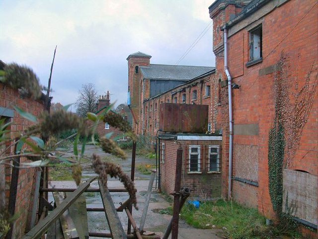
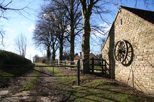
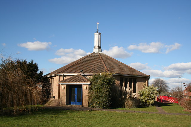
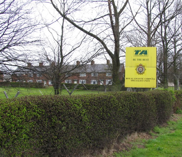
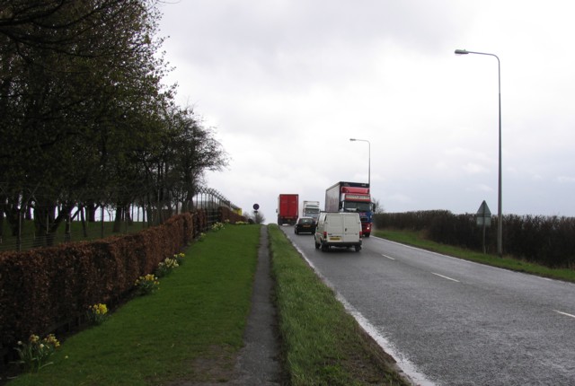
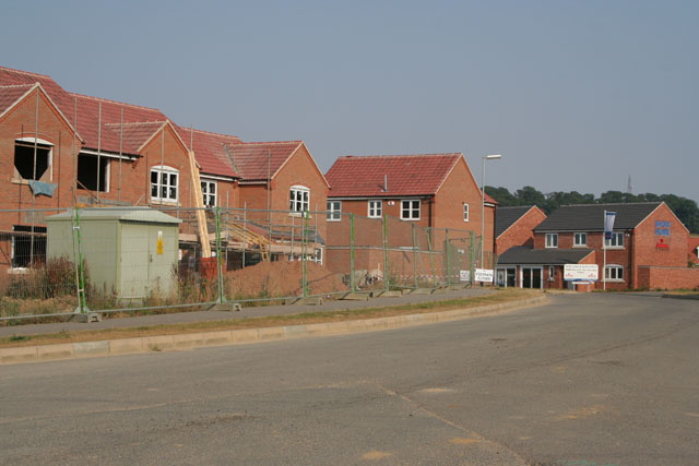
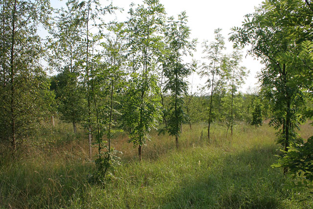
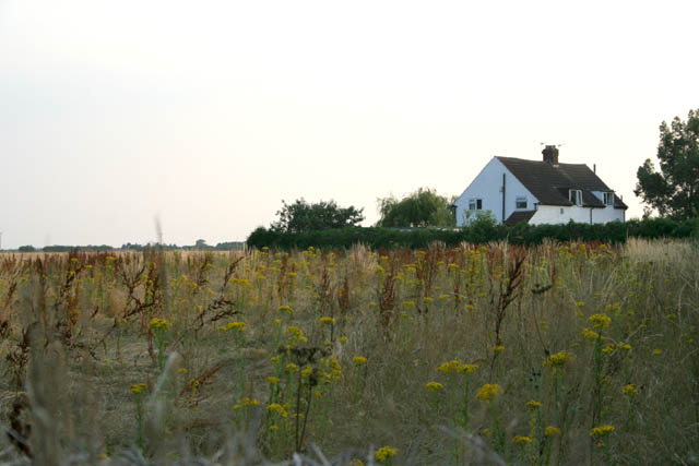
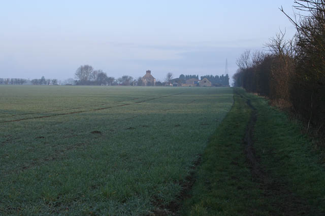
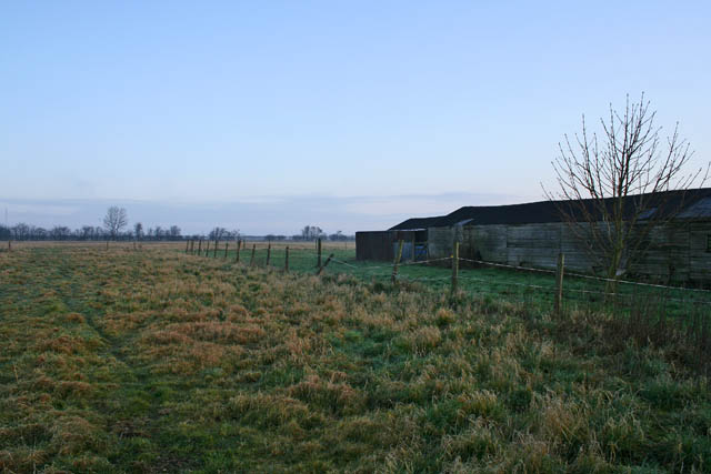
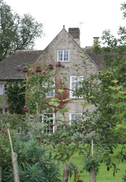
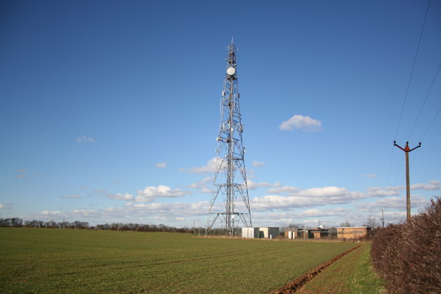
Harrowby Images

Images are sourced within 2km of 52.914725/-0.60151653 or Grid Reference SK9436. Thanks to Geograph Open Source API. All images are credited.

Disused malthouse Disused malthouse at Grantham
Disused malthouse
Disused malthouse at Grantham
Radio mast On the cliff between Harrowby and Londonthorpe
Radio mast
On the cliff between Harrowby and Londonthorpe
Lane at Harrowby Hall Heading SW towards Beacon Hill
Lane at Harrowby Hall
Heading SW towards Beacon Hill
Church of the Ascension, Harrowby Modern church in housing estate
Church of the Ascension, Harrowby
Modern church in housing estate
Harrowby Lane Methodist church The church was an old hut until recently when this new multi-purpose building was erected by its enthusiastic congregation <span class="nowrap"><a title="http://www.users.zetnet.co.uk/harrowbylane/" rel="nofollow ugc noopener" href="http://www.users.zetnet.co.uk/harrowbylane/">Link</a><img style="margin-left:2px;" alt="External link" title="External link - shift click to open in new window" src="https://s1.geograph.org.uk/img/external.png" width="10" height="10"/></span>
Harrowby Lane Methodist church
The church was an old hut until recently when this new multi-purpose building was erected by its enthusiastic congregation LinkExternal link
Army Housing Large Army Barracks and housing on A52 east of Grantham.
Army Housing
Large Army Barracks and housing on A52 east of Grantham.
A52 Somerby Hill The driver of the large red HGV must have been a Geograph enthusiast as he enthusiastically waved his arms around and sounded his horn as he paused behind the photographer's parked car on the hill.
A52 Somerby Hill
The driver of the large red HGV must have been a Geograph enthusiast as he enthusiastically waved his arms around and sounded his horn as he paused behind the photographer's parked car on the hill.
New housing, off Londonthorpe Lane, Grantham
Londonthorpe Wood To the south of Londonthorpe Lane the woodland is mature but to the north the Woodlands Trust and Landlife have planted mixed ash, birch and oak with wild flower undergrowth.
Londonthorpe Wood
To the south of Londonthorpe Lane the woodland is mature but to the north the Woodlands Trust and Landlife have planted mixed ash, birch and oak with wild flower undergrowth.
Cottage on Harrowby Lane The field here has a wide margin of indigenous flowering plants.
Cottage on Harrowby Lane
The field here has a wide margin of indigenous flowering plants.
A cold foggy morning at Cold Harbour This small community, near Grantham, consists of few cottages and a couple of farms. It sits at the junction of the A52 and the B6403, Ermine Street. It is thought that an old Midlands salt transport route, known as Salter's gate, intersects Ermine Street at Cold Harbour, and proceeds to the eastern coast of Lincolnshire. The sun was making vain attempts at breaking through the fog.
A cold foggy morning at Cold Harbour
This small community, near Grantham, consists of few cottages and a couple of farms. It sits at the junction of the A52 and the B6403, Ermine Street. It is thought that an old Midlands salt transport route, known as Salter's gate, intersects Ermine Street at Cold Harbour, and proceeds to the eastern coast of Lincolnshire. The sun was making vain attempts at breaking through the fog.
Farmland off Turnor Road Heath Farm in the distance with the early morning sun struggling to burn off the mist.
Farmland off Turnor Road
Heath Farm in the distance with the early morning sun struggling to burn off the mist.
Farmland off Turnor Road Looking northwards  from Turnor Road towards Harrowby Lane in <a href="https://www.geograph.org.uk/gridref/SK9436">SK9436</a> which runs along the horizon.
Farmland off Turnor Road
Looking northwards from Turnor Road towards Harrowby Lane in SK9436 which runs along the horizon.
Turnor Road The land to the left is on the edge of the disused Spittlegate Airfield and belongs to the Ministry of Defence, see <a href="https://www.geograph.org.uk/gridref/SK9334">SK9334</a>. The Territorial Army uses this area for training. The land on the right is <a href="https://www.geograph.org.uk/photo/341104">SK9435 : Farmland off Turnor Road</a>.
Turnor Road
The land to the left is on the edge of the disused Spittlegate Airfield and belongs to the Ministry of Defence, see SK9334. The Territorial Army uses this area for training. The land on the right is SK9435 : Farmland off Turnor Road.
House on Turnor Road This is the first house on Turnor Road as you turn off from the B6403. The grid square boundary passes about a hundred metres further on and the hedge in the distance is in <a href="https://www.geograph.org.uk/gridref/SK9435">SK9435</a>.
House on Turnor Road
This is the first house on Turnor Road as you turn off from the B6403. The grid square boundary passes about a hundred metres further on and the hedge in the distance is in SK9435.
Strip woodland on High Dike This shows the beginning of a narrow strip on mixed woodland that borders the B6403, High Dike, for at least a kilometre. High Dike, on the right of the photograph, follows the line of the old Roman road, Ermine Street.
Strip woodland on High Dike
This shows the beginning of a narrow strip on mixed woodland that borders the B6403, High Dike, for at least a kilometre. High Dike, on the right of the photograph, follows the line of the old Roman road, Ermine Street.
Grantham Crematorium
Show me another place!

Harrowby is located at Grid Ref: SK9436 (Lat: 52.914725, Lng: -0.60151653)

Division: Parts of Kesteven

Administrative County: Lincolnshire

District: South Kesteven

Police Authority: Lincolnshire

What 3 Words

///take.trim.spend. Near Grantham, Lincolnshire

Related Wikis

Harrowby Hall

Harrowby Hall is a Grade II* listed building in Harrowby, Lincolnshire, England. The Hall was the family home of the Ryder family and the former home of...

Londonthorpe and Harrowby Without

Londonthorpe and Harrowby Without is a civil parish in the South Kesteven district of Lincolnshire, England. According to the 2001 Census it had a population...

Harrowby, Lincolnshire

Harrowby is a hamlet in the South Kesteven district of Lincolnshire, England. It lies 2 miles (3 km) east of the market town of Grantham. Harrowby was...

Harrowby United F.C.

Harrowby United Football Club is a football club representing the parish of Harrowby in Grantham, Lincolnshire. They are currently members of the United...

RAF Belton Park

RAF Belton Park was established in 1942 as the Royal Air Force Regiment Depot, for training RAF Regiment personnel in airfield defence. Belton Park is...

RAF Spitalgate

Royal Air Force Spitalgate or more simply RAF Spitalgate formerly known as RFC Grantham and RAF Grantham was a Royal Flying Corps and Royal Air Force station...

Londonthorpe

Londonthorpe is a village to the east of Grantham, in the civil parish of Londonthorpe and Harrowby Without, in South Kesteven district of Lincolnshire...

Prince William of Gloucester Barracks

Prince William of Gloucester Barracks is a British Army installation near Grantham in Lincolnshire. It is set to close in 2028. == History == The barracks...

Nearby Amenities

Located within 500m of 52.914725,-0.60151653
Bus Stop
Ninth Avenue
Bus: yes
Naptan AtcoCode: 270000008450
Naptan Bearing: SW
Naptan CommonName: Ninth Avenue
Naptan Indicator: opp
Naptan Landmark: Ninth Avenue
Naptan NaptanCode: lingtagj
Naptan Street: Fifth Avenue
Naptan Verified: no
Public Transport: platform
Source: naptan_import
Lat/Long: 52.9177195/-0.6044266
Bus Stop
Hall Road
Bus: yes
Naptan AtcoCode: 270002700257
Naptan Bearing: E
Naptan CommonName: Hall Road
Naptan Indicator: opp
Naptan Landmark: Hall Road
Naptan Street: Harrowby Lane
Naptan Verified: no
Public Transport: platform
Source: naptan_import
Lat/Long: 52.9147117/-0.6001804
Bus Stop
Hall Road
Bus: yes
Naptan AtcoCode: 270002700258
Naptan Bearing: NW
Naptan CommonName: Hall Road
Naptan Indicator: adj
Naptan Landmark: Hall Road
Naptan Street: Harrowby Lane
Naptan Verified: no
Public Transport: platform
Source: naptan_import
Lat/Long: 52.9147984/-0.6022003
Bus Stop
Chatsworth Avenue
Bus: yes
Naptan AtcoCode: 2700LGKR1310
Naptan Bearing: SW
Naptan CommonName: Chatsworth Avenue
Naptan Indicator: adj
Naptan Landmark: Chatsworth Avenue
Naptan NaptanCode: linajpam
Naptan Street: Kenilworth Road
Naptan Verified: no
Public Transport: platform
Source: naptan_import
Lat/Long: 52.9157522/-0.607628
Turning Circle
Lat/Long: 52.9184142/-0.6047819
Power: tower
Lat/Long: 52.9191951/-0.6016623
Power: tower
Lat/Long: 52.9188239/-0.6031356
Belton View Farm
Place: farm
Source: Bing
Lat/Long: 52.9141454/-0.5994858
Building: house
Lat/Long: 52.9145107/-0.5960564
Place: farm
Lat/Long: 52.9157657/-0.5972795
Building: yes
Lat/Long: 52.9138378/-0.6020002
Building: yes
Lat/Long: 52.9141225/-0.6037383
Building: yes
Lat/Long: 52.912725/-0.6042747
Building: yes
Lat/Long: 52.9119098/-0.6059699
Natural: spring
Lat/Long: 52.913631/-0.6038929
Generator Method: photovoltaic
Generator Output Electricity: yes
Generator Source: solar
Generator Type: solar_photovoltaic_panel
Location: roof
Power: generator
Lat/Long: 52.915511/-0.6087464
Generator Method: photovoltaic
Generator Output Electricity: yes
Generator Source: solar
Generator Type: solar_photovoltaic_panel
Location: roof
Power: generator
Lat/Long: 52.9161963/-0.6069466
Generator Method: photovoltaic
Generator Output Electricity: yes
Generator Source: solar
Generator Type: solar_photovoltaic_panel
Location: roof
Power: generator
Lat/Long: 52.9161332/-0.6070914
Generator Method: photovoltaic
Generator Output Electricity: yes
Generator Source: solar
Generator Type: solar_photovoltaic_panel
Location: roof
Power: generator
Lat/Long: 52.9165439/-0.606964
Generator Method: photovoltaic
Generator Output Electricity: yes
Generator Source: solar
Generator Type: solar_photovoltaic_panel
Location: roof
Power: generator
Lat/Long: 52.9167315/-0.6074254
Generator Method: photovoltaic
Generator Output Electricity: yes
Generator Source: solar
Generator Type: solar_photovoltaic_panel
Location: roof
Power: generator
Lat/Long: 52.9174932/-0.6056605
Generator Method: photovoltaic
Generator Output Electricity: yes
Generator Source: solar
Generator Type: solar_photovoltaic_panel
Location: roof
Power: generator
Lat/Long: 52.9171908/-0.6064142
Generator Method: photovoltaic
Generator Output Electricity: yes
Generator Source: solar
Generator Type: solar_photovoltaic_panel
Location: roof
Power: generator
Lat/Long: 52.9183303/-0.6054553
Generator Method: photovoltaic
Generator Output Electricity: yes
Generator Source: solar
Generator Type: solar_photovoltaic_panel
Location: roof
Power: generator
Lat/Long: 52.9182397/-0.6055894
Generator Method: photovoltaic
Generator Output Electricity: yes
Generator Source: solar
Generator Type: solar_photovoltaic_panel
Location: roof
Power: generator
Lat/Long: 52.9181395/-0.6048947
Generator Method: photovoltaic
Generator Output Electricity: yes
Generator Source: solar
Generator Type: solar_photovoltaic_panel
Location: roof
Power: generator
Lat/Long: 52.9180715/-0.605053
Generator Method: photovoltaic
Generator Output Electricity: yes
Generator Source: solar
Generator Type: solar_photovoltaic_panel
Location: roof
Power: generator
Lat/Long: 52.9181184/-0.6032961
Generator Method: photovoltaic
Generator Output Electricity: yes
Generator Source: solar
Generator Type: solar_photovoltaic_panel
Location: roof
Power: generator
Lat/Long: 52.9183263/-0.6038098
Generator Method: photovoltaic
Generator Output Electricity: yes
Generator Source: solar
Generator Type: solar_photovoltaic_panel
Location: roof
Power: generator
Lat/Long: 52.9183594/-0.6038017
Generator Method: photovoltaic
Generator Output Electricity: yes
Generator Source: solar
Generator Type: solar_photovoltaic_panel
Location: roof
Power: generator
Lat/Long: 52.9179713/-0.6043636
Generator Method: photovoltaic
Generator Output Electricity: yes
Generator Source: solar
Generator Type: solar_photovoltaic_panel
Location: roof
Power: generator
Lat/Long: 52.9185312/-0.6033082
Generator Method: photovoltaic
Generator Output Electricity: yes
Generator Source: solar
Generator Type: solar_photovoltaic_panel
Location: roof
Power: generator
Lat/Long: 52.9189274/-0.6039063
Generator Method: photovoltaic
Generator Output Electricity: yes
Generator Source: solar
Generator Type: solar_photovoltaic_panel
Location: roof
Power: generator
Lat/Long: 52.918971/-0.6039814
Location Transition: yes
Power: pole
Lat/Long: 52.9190416/-0.6028453
The data included in this document is from www.openstreetmap.org. The data is made available under ODbL.

Have you been to Harrowby?

Leave your review of Harrowby below (or comments, questions and feedback).