Hanchett End

Settlement in Suffolk West Suffolk

England

Hanchett End

Roundabout on the Haverhill Bypass
Roundabout on the Haverhill Bypass Credit: David Howard

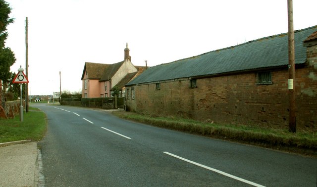
Hanchett End is a small village located in the county of Suffolk, England. It is situated approximately 12 miles southwest of the town of Ipswich and 3 miles north of Hadleigh. The village is nestled in a rural setting, surrounded by picturesque countryside and farmland.

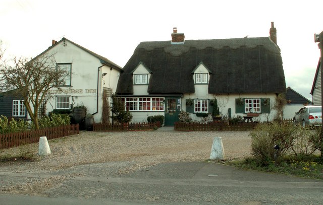
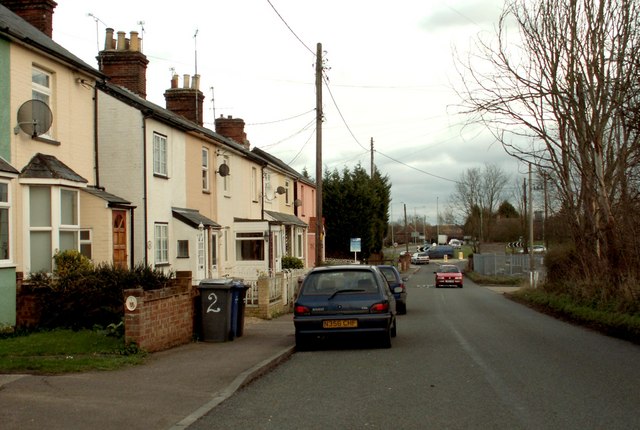
Hanchett End has a population of around 200 residents, making it a close-knit and tight community. The village is known for its quaint and traditional English charm, with many of its buildings dating back several centuries. The architecture predominantly consists of traditional Suffolk timber-framed houses, giving the village a distinctive and historic feel.

Despite its small size, Hanchett End offers a range of amenities and services to its residents. These include a village hall, a local pub, and a church. The village hall serves as a community hub, hosting various events and activities such as social gatherings, meetings, and local clubs.

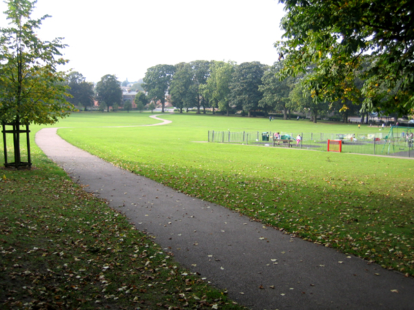
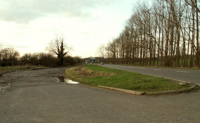
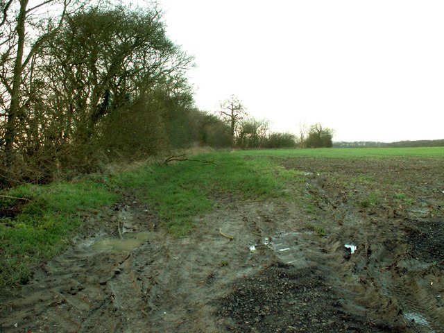
The surrounding countryside provides ample opportunities for outdoor activities and exploration. There are several footpaths and bridleways that crisscross the area, allowing residents and visitors to enjoy scenic walks and bike rides. The village is also within close proximity to Dedham Vale, an Area of Outstanding Natural Beauty, which offers stunning landscapes and wildlife.

Overall, Hanchett End is a charming and idyllic village that offers a peaceful and rural lifestyle to its residents. Its rich history, beautiful surroundings, and strong sense of community make it an attractive place to live or visit.

If you have any feedback on the listing, please let us know in the comments section below.
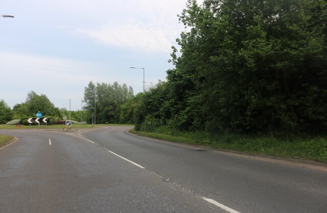
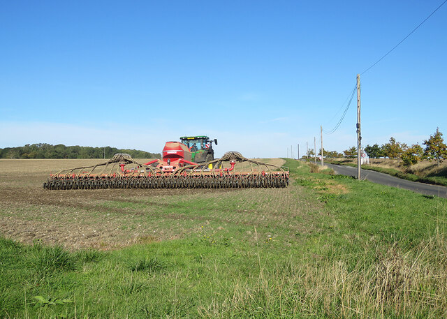
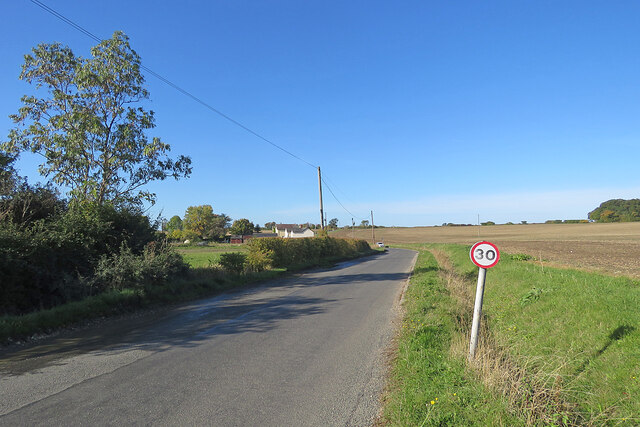
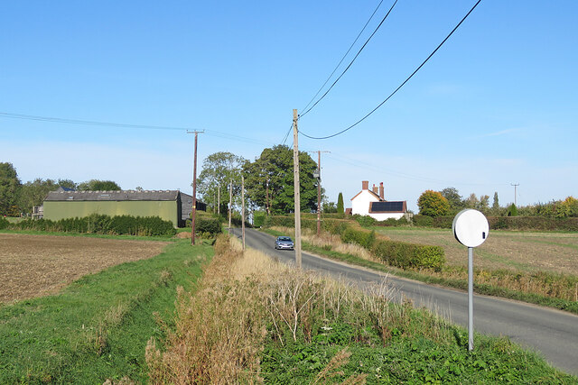
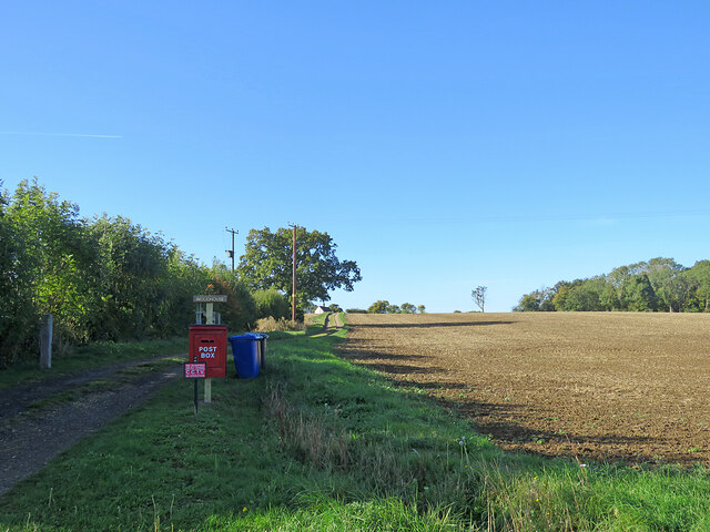
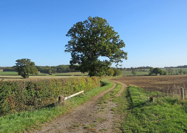
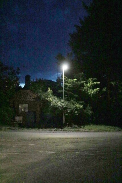
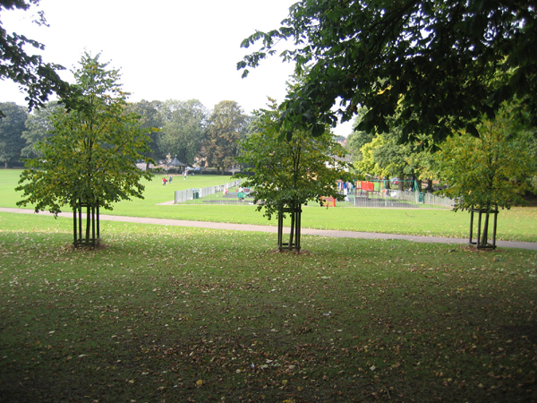
Hanchett End Images

Images are sourced within 2km of 52.091174/0.40768863 or Grid Reference TL6546. Thanks to Geograph Open Source API. All images are credited.

Roundabout on the Haverhill Bypass
Withersfield: autumn harrowing Seen from Horseheath Road on a bright October morning. Skipper's Lane, leading to West Wratting and Six Mile Bottom, is on the right.
Withersfield: autumn harrowing
Seen from Horseheath Road on a bright October morning. Skipper's Lane, leading to West Wratting and Six Mile Bottom, is on the right.
Withersfield: Horseheath Road Photographed from the corner of Skipper's Lane on a sunny October morning.
Withersfield: Horseheath Road
Photographed from the corner of Skipper's Lane on a sunny October morning.
Skipper's Lane near Lawn Farm A bright morning in mid October.
Skipper's Lane near Lawn Farm
A bright morning in mid October.
Path, postbox and a cloudless sky The postbox serves Woodhouse, glimpsed on the skyline beyond the tree to the left of centre. The lane to the house is shared by a public footpath to Horseheath Road.
Path, postbox and a cloudless sky
The postbox serves Woodhouse, glimpsed on the skyline beyond the tree to the left of centre. The lane to the house is shared by a public footpath to Horseheath Road.
A farm track in south-west Suffolk Across the shallow valley of Stour Brook, a tributary of the River Stour, on a bright October morning.
A farm track in south-west Suffolk
Across the shallow valley of Stour Brook, a tributary of the River Stour, on a bright October morning.
Queen Street, Withersfield
The recreation ground and bandstand, Haverhill, Suffolk The rec was presented to the community of Haverhill by the Gurteen family at the end of the 19th century; the Millennium Bandstand was opened in June 1999 <span class="nowrap"><a title="http://www.haverhill-uk.com/photo/rec.shtml" rel="nofollow ugc noopener" href="http://www.haverhill-uk.com/photo/rec.shtml">Link</a><img style="margin-left:2px;" alt="External link" title="External link - shift click to open in new window" src="https://s1.geograph.org.uk/img/external.png" width="10" height="10"/></span>.
The recreation ground and bandstand, Haverhill, Suffolk
The rec was presented to the community of Haverhill by the Gurteen family at the end of the 19th century; the Millennium Bandstand was opened in June 1999 LinkExternal link.
The recreation ground, Haverhill, Suffolk
The town of Haverhill, Suffolk View from Chivers Road with small wetland in foreground, rooftops of the town in the middle distance and water tower in the far distance <a href="https://www.geograph.org.uk/gridref/TL6747">TL6747</a>.
The town of Haverhill, Suffolk
View from Chivers Road with small wetland in foreground, rooftops of the town in the middle distance and water tower in the far distance TL6747.
Looking across Burton Green, Withersfield, Suffolk
St. Mary's church, Withersfield, Suffolk This is a fine 15th century church with many interesting features inside, which include many carved poppyheads on the benches and a fine screen.
St. Mary's church, Withersfield, Suffolk
This is a fine 15th century church with many interesting features inside, which include many carved poppyheads on the benches and a fine screen.
Hazel Stub Farm This is the road from Nosterfield End looking towards Haverhill.
Hazel Stub Farm
This is the road from Nosterfield End looking towards Haverhill.
The Haverhill Roundabout Sculpture This 11 metre high sculpture was designed by Rob Olins from London.  It was erected in 2002 and at night it is lit by blue sodium lights and a laser. The roundabout stands at the junction where the A.1017 meets the A.1307
The Haverhill Roundabout Sculpture
This 11 metre high sculpture was designed by Rob Olins from London. It was erected in 2002 and at night it is lit by blue sodium lights and a laser. The roundabout stands at the junction where the A.1017 meets the A.1307
The A.1307 plus a muddy lay-by This is the road from Haverhill to Cambridge
The A.1307 plus a muddy lay-by
This is the road from Haverhill to Cambridge
A very muddy public footpath
'The White Horse Inn' at Withersfield
The end of the road from Withersfield
Show me another place!

Hanchett End is located at Grid Ref: TL6546 (Lat: 52.091174, Lng: 0.40768863)

Administrative County: Suffolk

District: West Suffolk

Police Authority: Suffolk

Also known as: Hanchet End

What 3 Words

///knots.rally.huts. Near Haverhill, Suffolk

Related Wikis

Castle Manor Academy

Castle Manor Academy (formerly Castle Manor Business and Enterprise College) is a secondary phase converter academy school in Haverhill, Suffolk. ��2...
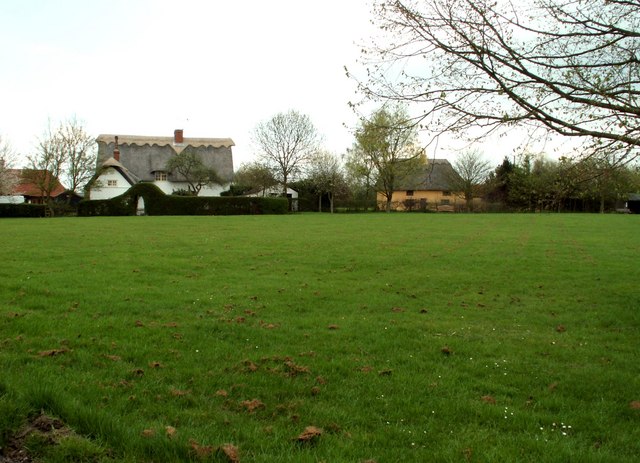
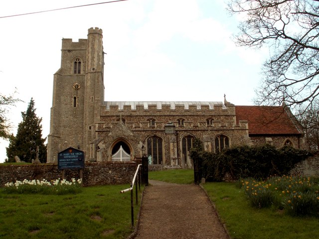
Withersfield

Withersfield is a village and civil parish in the West Suffolk district of Suffolk in eastern England. In 2011 its population was 450. It has a public...

Corn Exchange, Haverhill

The Corn Exchange is a commercial building in Withersfield Road in Haverhill, Suffolk, England. The structure, which is currently vacant and deteriorating...

Haverhill railway station (England)

Haverhill railway station was a station in Haverhill, Suffolk, on the Stour Valley Railway, which opened in 1865 and closed in 1967. It was sometimes known...

Over and Lawn Woods

Over and Lawn Woods is a 43.3-hectare (107-acre) biological Site of Special Scientific Interest north-west of Haverhill in Suffolk. It is listed by Natural...
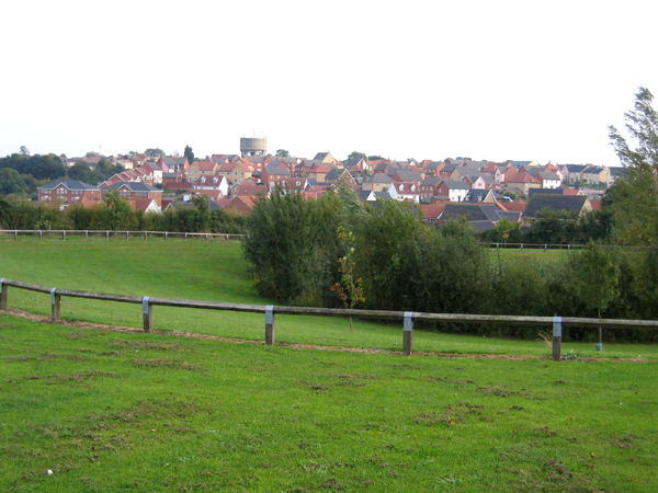
Haverhill, Suffolk

Haverhill ( HAY-vər-hil, HAYV-ril) is a market town and civil parish in the county of Suffolk, England, next to the borders of Essex and Cambridgeshire...

Haverhill South railway station

Haverhill South railway station was located in Haverhill, Suffolk. It was a terminus on the Colne Valley and Halstead Railway. In 1924 passenger services...

Samuel Ward Academy

Samuel Ward Academy (formerly Samuel Ward Arts and Technology College) is a coeducational secondary school and sixth form located in Haverhill in the English...

Related Videos

morning walk🌄

appuchuu zz morning walk through the wheat field.

Timber decking restoration | Area Transformation | #Exteriorcleaning | soft wash #pressurewashing

This timber decking area had totally lost it's grip, so much so the client didn't feel safe walking on it anymore. We cleaned it, killed ...

Nearby Amenities

Located within 500m of 52.091174,0.40768863
Crossing
zebra
Lat/Long: 52.0889893/0.4088876
Crossing
Crossing: uncontrolled
Crossing Ref: zebra
Lat/Long: 52.0912506/0.411042
Post Box
Postal Code: CB9
Ref: CB9 55
Lat/Long: 52.0918483/0.4124528
Bus Stop
Sainsburys
Bus: yes
Naptan AtcoCode: 390050220
Naptan Bearing: W
Naptan CommonName: Sainsburys
Naptan Indicator: adj
Naptan Landmark: Sainsburys
Naptan NaptanCode: sufgdpmw
Naptan Street: Hanchett End
Naptan Verified: no
Public Transport: platform
Source: naptan_import
Lat/Long: 52.0923402/0.413142
Bus Stop
Notley Drive
Bus: yes
Naptan AtcoCode: 390050221
Naptan Bearing: N
Naptan CommonName: Notley Drive
Naptan Indicator: adj
Naptan Landmark: Notley Drive
Naptan NaptanCode: sufgdpta
Naptan Street: Haycocks Road
Naptan Verified: no
Public Transport: platform
Source: naptan_import
Lat/Long: 52.0895321/0.4085716
Bus Stop
Notley Drive
Bus: yes
Naptan AtcoCode: 390050222
Naptan Bearing: S
Naptan BusStopType: CUS
Naptan CommonName: Notley Drive
Naptan Indicator: opp
Naptan Landmark: Notley Drive
Naptan NaptanCode: sufgdptd
Naptan Street: Haycocks Road
Naptan Verified: no
Public Transport: platform
Source: naptan_import
Lat/Long: 52.0893486/0.4087657
Bus Stop
Shardlow Close
Bus: yes
Naptan AtcoCode: 390050223
Naptan Bearing: NE
Naptan CommonName: Shardlow Close
Naptan Indicator: adj
Naptan Landmark: Shardlow Close
Naptan NaptanCode: sufgdptg
Naptan Street: Haycock Drive
Naptan Verified: no
Public Transport: platform
Source: naptan_import
Lat/Long: 52.090832/0.409367
Bus Stop
Shardlow Close
Bus: yes
Naptan AtcoCode: 390050224
Naptan Bearing: SW
Naptan BusStopType: CUS
Naptan CommonName: Shardlow Close
Naptan Indicator: opp
Naptan Landmark: Shardlow Close
Naptan NaptanCode: sufgdptj
Naptan Street: Haycock Drive
Naptan Verified: no
Public Transport: platform
Source: naptan_import
Lat/Long: 52.0907694/0.4094354
Bus Stop
Brybank Road
Bus: yes
Naptan AtcoCode: 390050256
Naptan Bearing: E
Naptan CommonName: Brybank Road
Naptan Indicator: adj
Naptan Landmark: Brybank Road
Naptan NaptanCode: sufgdtja
Naptan Street: Apple Acre Road
Naptan Verified: no
Public Transport: platform
Source: naptan_import
Lat/Long: 52.0881741/0.412104
Bus Stop
Brybank Road
Bus: yes
Naptan AtcoCode: 390050257
Naptan Bearing: W
Naptan BusStopType: CUS
Naptan CommonName: Brybank Road
Naptan Indicator: opp
Naptan Landmark: Brybank Road
Naptan NaptanCode: sufgdtjd
Naptan Street: Apple Acre Road
Naptan Verified: no
Public Transport: platform
Source: naptan_import
Lat/Long: 52.0881187/0.412174
Bus Stop
Sainsburys
Bus: yes
Naptan AtcoCode: 390051210
Naptan Bearing: E
Naptan CommonName: Sainsburys
Naptan Indicator: opp
Naptan Landmark: Sainsburys
Naptan NaptanCode: sufjptaw
Naptan Street: Hanchett End
Naptan Verified: no
Public Transport: platform
Source: naptan_import
Lat/Long: 52.0924374/0.4133522
Crossing
Crossing: marked
Lat/Long: 52.0914604/0.4117744
Crossing: unmarked
Crossing Island: yes
Lat/Long: 52.0911059/0.4103066
Noexit: yes
Lat/Long: 52.0890576/0.4095757
Traffic Calming: hump
Lat/Long: 52.0882326/0.4130735
Traffic Calming: hump
Lat/Long: 52.0881532/0.4121311
Fixme: incomplete
Lat/Long: 52.0930159/0.4083663
Post Box
Brand: Royal Mail
Brand Wikidata: Q638098
Brand Wikipedia: en:Royal Mail
Collection Times: Mo-Fr 17:15; Sa 12:15
Operator: Royal Mail
Operator Wikidata: Q638098
Post Box Design: type_k
Post Box Type: pillar
Ref: CB9 60
Royal Cypher: EIIR
Royal Cypher Wikidata: Q33102113
Source: survey
Lat/Long: 52.0887473/0.4088894
Noexit: yes
Lat/Long: 52.0908307/0.4132814
Post Office
Hanchette Village Post Office
Addr Housenumber: 2
Addr Postcode: CB9 7GN
Addr Street: Grove Court
Brand: Post Office
Brand Wikidata: Q1783168
Contact Website: https://www.postoffice.co.uk/branch-finder/2781131/hanchette-village
Ref Pol Id: 136710
Lat/Long: 52.0883971/0.4103825
Pharmacy
Lloyds Pharmacy
Addr Postcode: CB9 7YL
Brand: Lloyds Pharmacy
Brand Wikidata: Q6662870
Brand Wikipedia: en:LloydsPharmacy
Healthcare: pharmacy
Note: inside Sainsburys
Lat/Long: 52.0919029/0.4133834
Crossing
Crossing: marked
Lat/Long: 52.0915715/0.4125704
Generator Method: photovoltaic
Generator Output Electricity: yes
Generator Source: solar
Generator Type: solar_photovoltaic_panel
Location: roof
Power: generator
Lat/Long: 52.0896211/0.4060006
Generator Method: photovoltaic
Generator Output Electricity: yes
Generator Source: solar
Generator Type: solar_photovoltaic_panel
Location: roof
Power: generator
Lat/Long: 52.088451/0.4045683
Bus Stop
Research Park
Naptan AtcoCode: 390051253
Naptan NaptanCode: sufmdapg
Naptan Verified: no
Public Transport: platform
Source: naptan
Lat/Long: 52.0929881/0.4063983
Bus Stop
Research Park
Bus: yes
Naptan AtcoCode: 390051254
Naptan NaptanCode: sufmdapj
Naptan Verified: no
Network: 13
Operator: Stagecoach
Public Transport: platform
Source: naptan
Lat/Long: 52.0931502/0.4063732
Crossing: unmarked
Crossing Island: yes
Lat/Long: 52.0914271/0.4106328
Generator Method: photovoltaic
Generator Output Electricity: yes
Generator Source: solar
Generator Type: solar_photovoltaic_panel
Power: generator
Lat/Long: 52.0906774/0.4128669
Crossing
Crossing: traffic_signals
Crossing Ref: puffin
Lat/Long: 52.0924054/0.4127008
Colour: red
Marker: post
Material: concrete
Utility: gas
Lat/Long: 52.0911035/0.4098507
Colour: yellow
Marker: post
Utility: gas
Lat/Long: 52.0926731/0.4079788
Colour: yellow
Inscription: GAS IP GAS PIPELINE
Marker: post
Utility: gas
Lat/Long: 52.0923164/0.4097641
Colour: yellow
Inscription: GAS IP GAS PIPELINE
Marker: post
Utility: gas
Lat/Long: 52.0921242/0.4100117
Bench
Lat/Long: 52.0899815/0.4058033
Bench
Lat/Long: 52.089215/0.4074122
Bench
Lat/Long: 52.0887579/0.4056103
Bench
Lat/Long: 52.0890753/0.4041305
Waste Basket
Waste: dog_excrement
Lat/Long: 52.0926134/0.410099
Haverhill Flood Storage Reservoir
Information: board
Operator: Environment Agency
Tourism: information
Lat/Long: 52.0926857/0.4102242
The data included in this document is from www.openstreetmap.org. The data is made available under ODbL.

Have you been to Hanchett End?

Leave your review of Hanchett End below (or comments, questions and feedback).