Halsey Lake

Settlement in Devon North Devon

England

Halsey Lake

Arlington: lane to Coombeshead Farm access road. Looking west-south-west
Arlington: lane to Coombeshead Credit: Martin Bodman

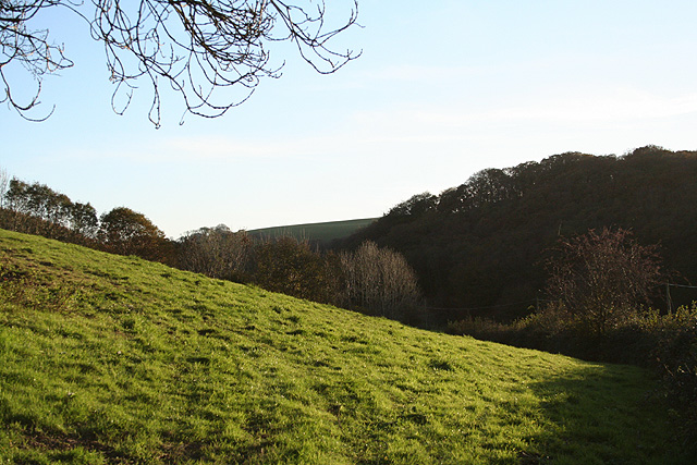
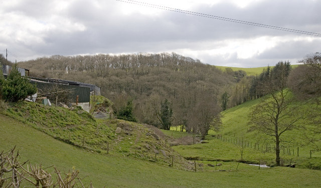
Halsey Lake is a picturesque waterbody located in the county of Devon, England. Situated amidst the rolling hills and lush greenery, this natural lake offers a serene and idyllic setting for visitors and locals alike. Spanning an area of approximately 50 acres, Halsey Lake is known for its crystal-clear waters and abundant wildlife.

The lake is surrounded by a dense forest of oak and beech trees, creating a beautiful backdrop and offering shade to those seeking refuge from the sun. It is a popular spot for nature enthusiasts and birdwatchers, as the area is home to a variety of bird species including herons, kingfishers, and ducks.

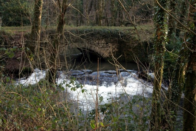
For those interested in water activities, Halsey Lake provides ample opportunities for boating, kayaking, and fishing. Anglers can try their luck at catching a variety of fish species, such as pike, perch, and roach. The lake also boasts well-maintained walking trails, offering scenic views of the surrounding countryside and providing a peaceful and tranquil atmosphere for hikers.

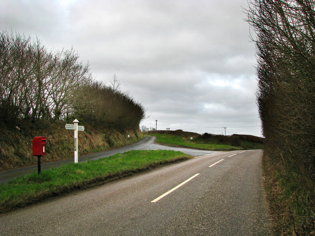
Halsey Lake is easily accessible by road, with ample parking available nearby. The area is well-maintained, with picnic spots and benches dotted along the shoreline, allowing visitors to relax and enjoy the natural beauty of the lake. Whether you are seeking a peaceful retreat or an adventurous day out, Halsey Lake in Devon promises a memorable experience for all.

If you have any feedback on the listing, please let us know in the comments section below.

Halsey Lake Images

Images are sourced within 2km of 51.12595/-3.9761262 or Grid Reference SS6138. Thanks to Geograph Open Source API. All images are credited.

Arlington: lane to Coombeshead Farm access road. Looking west-south-west
Arlington: lane to Coombeshead
Farm access road. Looking west-south-west
Bratton Fleming: river west of the village By the bridge on the public bridleway to Smythapark and Loxhore. The river is a tributary of the river Yeo and at one time powered watermills in Bratton and Loxhore parishes. Looking north-north-east
Bratton Fleming: river west of the village
By the bridge on the public bridleway to Smythapark and Loxhore. The river is a tributary of the river Yeo and at one time powered watermills in Bratton and Loxhore parishes. Looking north-north-east
Loxhore: Smythapark Wood On the edge of the wood. The bridleway leads to Smythapark and Loxhore. Looking west-north-west
Loxhore: Smythapark Wood
On the edge of the wood. The bridleway leads to Smythapark and Loxhore. Looking west-north-west
Bratton Fleming: near Bratton Mill Bratton Mill once supplied the village with its meal and flour but is now a private residence. Looking south west
Bratton Fleming: near Bratton Mill
Bratton Mill once supplied the village with its meal and flour but is now a private residence. Looking south west
Bratton Fleming: approaching Loxhore Mill Bridge Looking west-south-west on the lane to Halsey Lake and Loxhore
Bratton Fleming: approaching Loxhore Mill Bridge
Looking west-south-west on the lane to Halsey Lake and Loxhore
Loxhore: near Hill The farm on the left is Coombe: it has a restored, working, waterwheel. With Bratton Fleming village on the hill in the distance. Looking east-north-east
Loxhore: near Hill
The farm on the left is Coombe: it has a restored, working, waterwheel. With Bratton Fleming village on the hill in the distance. Looking east-north-east
Loxhore: Lower Loxhore The Old Stables, now a private residence. The lane heads for the Yeo valley. Looking south west on a November afternoon
Loxhore: Lower Loxhore
The Old Stables, now a private residence. The lane heads for the Yeo valley. Looking south west on a November afternoon
Loxhore: Halsey Lake Looking north-north-west by the hamlet of Halsey Lake
Loxhore: Halsey Lake
Looking north-north-west by the hamlet of Halsey Lake
Loxhore: Loxhore Cott Looking west on Cott Hill with Cott Down Plantation on the skyline across the valley
Loxhore: Loxhore Cott
Looking west on Cott Hill with Cott Down Plantation on the skyline across the valley
Loxhore: valley near Loxhore Cott Looking south. Nearby in the roadside is an old milestone with the inscription '6 Barnum', or in other words six miles to Barnstaple
Loxhore: valley near Loxhore Cott
Looking south. Nearby in the roadside is an old milestone with the inscription '6 Barnum', or in other words six miles to Barnstaple
Tucker's Bridge in the Arlington Court Estate
Loxhore Church
Loxhore Church
Public Telephone at Loxhore road junction Telephone kiosk on small road junction
Public Telephone at Loxhore road junction
Telephone kiosk on small road junction
Loxhore Cross This junction is on the Barnstaple to Bratten Flemming road.
Loxhore Cross
This junction is on the Barnstaple to Bratten Flemming road.
Bratton Cross
Bratton Cross
Ford Farm One of the R Yeo's head-water stream runs past the farm and through Shirwell Mills Wood.  Longtimber Wood is in the background.
Ford Farm
One of the R Yeo's head-water stream runs past the farm and through Shirwell Mills Wood. Longtimber Wood is in the background.
Smythapark Farm This reedy corner of a field indicates where a spring issues and forms a stream leading eventually to the R Yeo.
Smythapark Farm
This reedy corner of a field indicates where a spring issues and forms a stream leading eventually to the R Yeo.
Tidicombe House Why this is called the house rather than the farm up the lane is a mystery, so far.  Sloley's Wood is in the foreground and an unusually sunny view of The Chains in the far distance.
Tidicombe House
Why this is called the house rather than the farm up the lane is a mystery, so far. Sloley's Wood is in the foreground and an unusually sunny view of The Chains in the far distance.
Show me another place!

Halsey Lake is located at Grid Ref: SS6138 (Lat: 51.12595, Lng: -3.9761262)

Administrative County: Devon

District: North Devon

Police Authority: Devon and Cornwall

What 3 Words

///wiggles.theory.sprayed. Near Barnstaple, Devon

Related Wikis

Manor of Loxhore

The Manor of Loxhore was a manor in the parish of Loxhore, North Devon, England. == Descent of the manor == === de Meulles === In the Domesday Book of 1086...

Cunnilear Camp

Cunnilear Camp is an Iron Age hill fort close to the village of Loxhore in Devon, England. It is on a hillside forming a promontory above the River Yeo...

Chumhill rail accident

The Chumhill railway accident occurred 26 February 1913 in England, killing two. The Lynton & Barnstaple Railway maintained an exemplary safety record...

Smythapark

Smythapark is the site of an Iron Age hill fort, situated close to the village of Bratton Fleming in Devon, England. The site is on a hillside forming...

Nearby Amenities

Located within 500m of 51.12595,-3.9761262
Ele: 161
Lat/Long: 51.1253803/-3.9750996
Post Box
Collection Times: Mo-Fr 16:00; Sa 10:45
Post Box Type: wall
Ref: EX31 75
Royal Cypher: EIIR
Royal Cypher Wikidata: Q33102113
Lat/Long: 51.1248779/-3.9741089
Roborough Castle (Iron Age Hill Fort)
Historic: archaeological_site
Lat/Long: 51.122219/-3.9728386
Information: guidepost
Tourism: information
Lat/Long: 51.1274392/-3.9785927
Grit Bin
Lat/Long: 51.1258763/-3.9761036
Post Box
Lat/Long: 51.1292051/-3.9777784
The data included in this document is from www.openstreetmap.org. The data is made available under ODbL.

Have you been to Halsey Lake?

Leave your review of Halsey Lake below (or comments, questions and feedback).