Hale Barns

Settlement in Cheshire

England

Hale Barns

Premier Inn Manchester Airport Taken from the fourth floor of Premier Inn Runger Lane Manchester Airport.
Premier Inn Manchester Airport Credit: Ian S

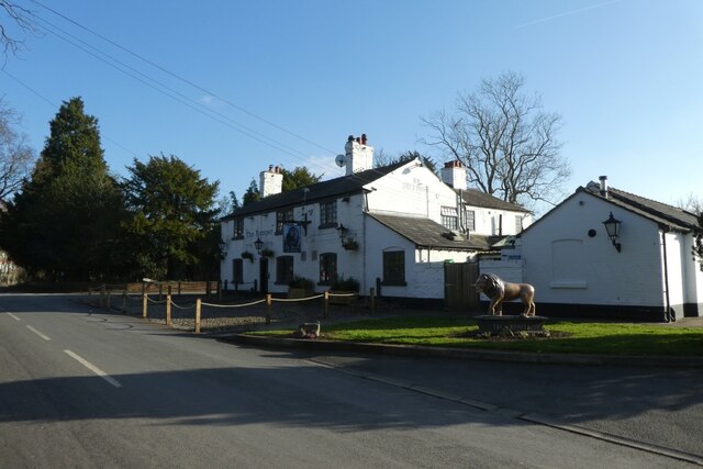
Hale Barns is an affluent suburban village located in Cheshire, England. Situated approximately 10 miles southwest of Manchester city center, it falls within the borough of Trafford. Hale Barns is renowned for its picturesque surroundings, excellent amenities, and affluent residential properties.

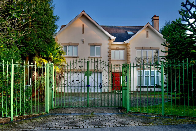
The village is characterized by its tree-lined streets and spacious, well-maintained properties. Many of the houses in Hale Barns are large detached properties, often with extensive gardens, making it a desirable location for families and professionals alike.

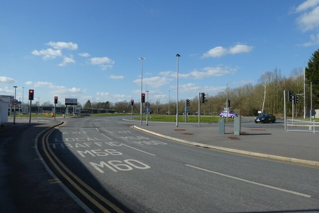
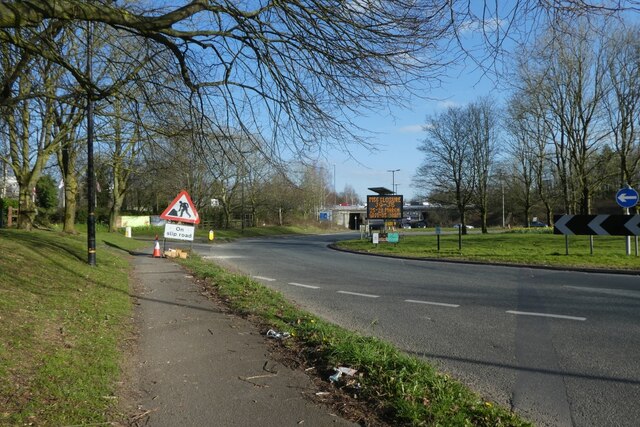
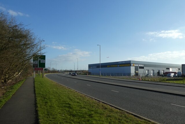
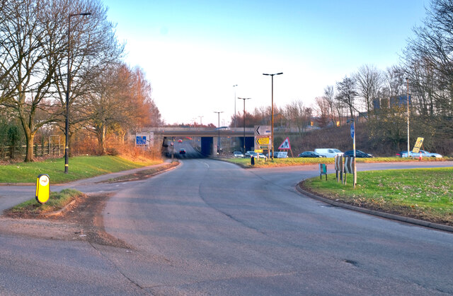
One of the key attractions of Hale Barns is its convenient transport links. The village is well-connected to major cities and towns in the region, with easy access to the M56 motorway and Manchester Airport. This makes it an ideal location for commuters working in Manchester or those who frequently travel abroad.

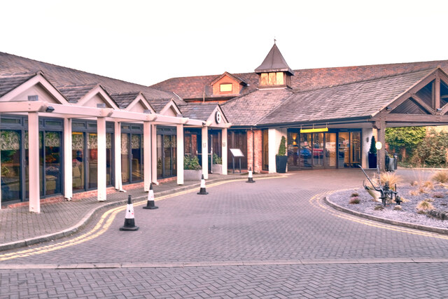
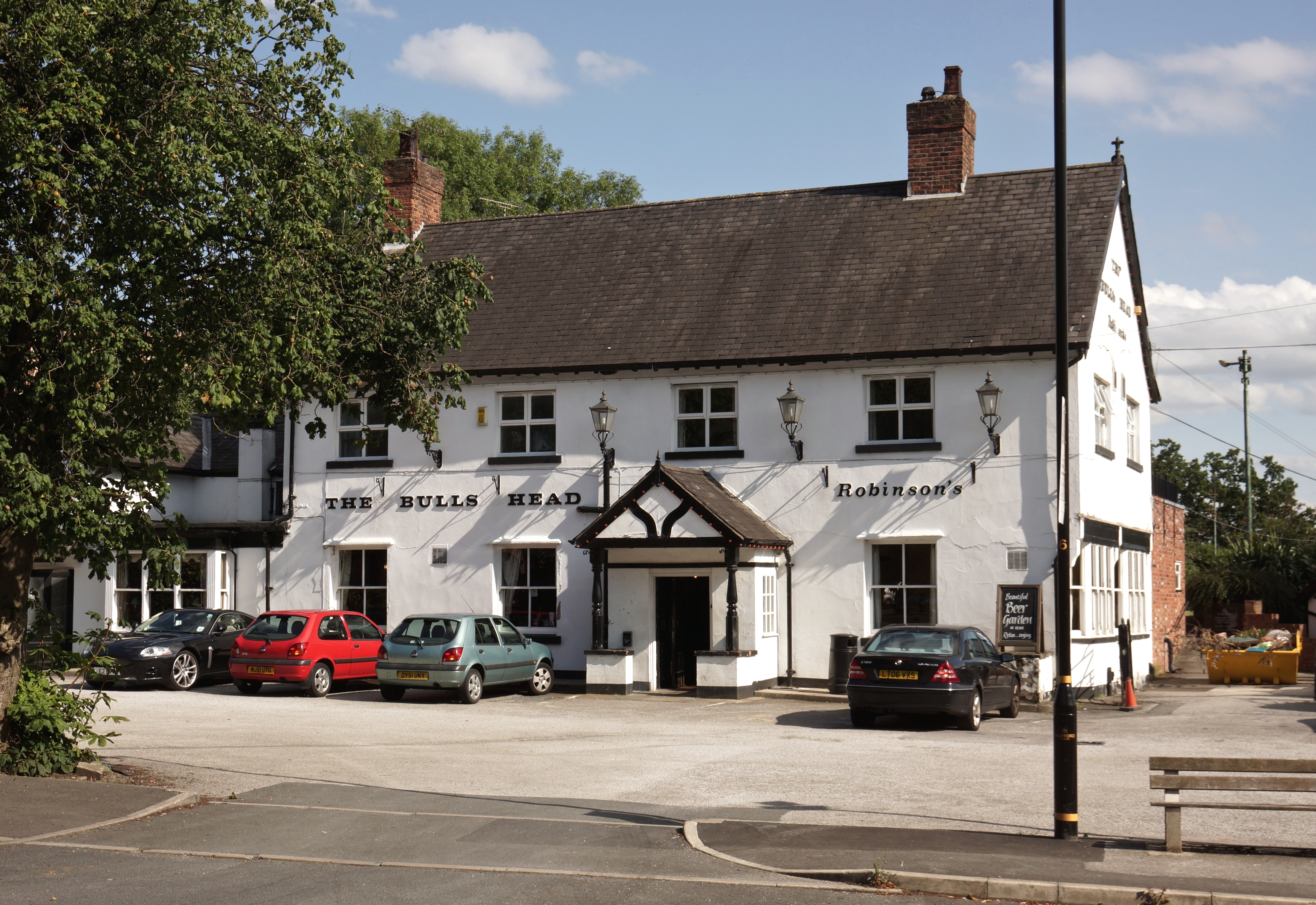
Hale Barns boasts a wide range of amenities to cater to the needs of its residents. The village has a selection of boutique shops, high-end restaurants, and cozy cafes, offering a vibrant and diverse dining and shopping experience. Additionally, there are several highly-regarded schools in the area, making it an appealing choice for families with children.

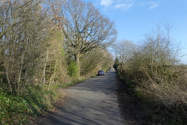
The village is also known for its green spaces and recreational facilities. Residents can enjoy the tranquility of Hale Barns Nature Reserve, a beautiful area of woodland and meadows perfect for leisurely walks. There are also various sports clubs and facilities, including a cricket club and a golf course, providing opportunities for outdoor activities.

In summary, Hale Barns is an affluent and picturesque village in Cheshire, offering a high quality of life, convenient transport links, excellent amenities, and a strong sense of community.

If you have any feedback on the listing, please let us know in the comments section below.
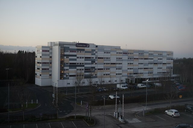
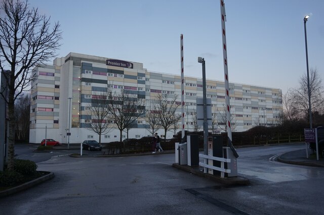
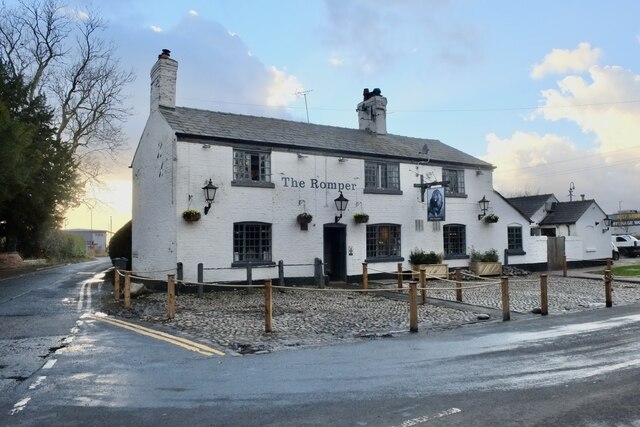
Hale Barns Images

Images are sourced within 2km of 53.366944/-2.3139434 or Grid Reference SJ7985. Thanks to Geograph Open Source API. All images are credited.

Premier Inn Manchester Airport Taken from the fourth floor of Premier Inn Runger Lane Manchester Airport.
Premier Inn Manchester Airport
Taken from the fourth floor of Premier Inn Runger Lane Manchester Airport.
Premier Inn Manchester Airport
Holiday Inn Express Manchester Airport
Back in business The historic Romper pub has survived the Virus and is open to customers.
Back in business
The historic Romper pub has survived the Virus and is open to customers.
Palma Avenue Looking towards the roundabout near Terminal 2.
Palma Avenue
Looking towards the roundabout near Terminal 2.
Hasty Lane Looking along Hasty Lane having passed under the M56.
Hasty Lane
Looking along Hasty Lane having passed under the M56.
Path beside Wilmslow Road roundabout Looking along a path beside one of the roundabouts at the M56 junction.
Path beside Wilmslow Road roundabout
Looking along a path beside one of the roundabouts at the M56 junction.
Large buildings along Wilmslow Road Looking along Wilmslow Road with a self storage unit opposite.
Large buildings along Wilmslow Road
Looking along Wilmslow Road with a self storage unit opposite.
Wilmslow Old Road Looking along the old road just after the path connecting to the new road.
Wilmslow Old Road
Looking along the old road just after the path connecting to the new road.
The Romper Public house on Wilmslow Old Road.
The Romper
Public house on Wilmslow Old Road.
Junction on Wilmslow Road Looking along Wilmslow Road towards the junction with Gannet Way.
Junction on Wilmslow Road
Looking along Wilmslow Road towards the junction with Gannet Way.
Drought? Empty 'balancing pond': would normally fill with run-off from the surrounding construction site to form a water buffer and avoid the drainage system being overwhelmed at times of heavy rainfall: no such problem at present when there has been no significant precipitation for weeks on end.
Drought?
Empty 'balancing pond': would normally fill with run-off from the surrounding construction site to form a water buffer and avoid the drainage system being overwhelmed at times of heavy rainfall: no such problem at present when there has been no significant precipitation for weeks on end.
Modern office development Adjacent to Manchester International Airport. Not many years ago, this was unspoiled farmland, with a nature reserve nearby, and a popular area for local  walkers and cyclists. The ever-growing tentacles of Airport development have steadily eroded rural Ringway with office blocks, logistics companies and overflow car parks.
Modern office development
Adjacent to Manchester International Airport. Not many years ago, this was unspoiled farmland, with a nature reserve nearby, and a popular area for local walkers and cyclists. The ever-growing tentacles of Airport development have steadily eroded rural Ringway with office blocks, logistics companies and overflow car parks.
The Garden House Hasty Lane, Hale Barns
The Garden House
Hasty Lane, Hale Barns
At Junction 6 M56, Hale Barns
At Junction 6
M56, Hale Barns
Florentine restaurant, Hale Barns The 'San Carlo' occupies the historic 'Buck Hall' - the former farm on which the adjacent Marriott Hotel was built. For details of the original building see: <a href="https://www.geograph.org.uk/photo/4598906">SJ8085 : Buck Hall Farm, Hale Barns</a>.
Florentine restaurant, Hale Barns
The 'San Carlo' occupies the historic 'Buck Hall' - the former farm on which the adjacent Marriott Hotel was built. For details of the original building see: SJ8085 : Buck Hall Farm, Hale Barns.
The Marriott Hotel At junction 6 of the M56, Hale Barns
The Marriott Hotel
At junction 6 of the M56, Hale Barns
Freight buildings beside Runger Lane Looking towards some buildings on the edge of Manchester Airport.
Freight buildings beside Runger Lane
Looking towards some buildings on the edge of Manchester Airport.
Show me another place!

Hale Barns is located at Grid Ref: SJ7985 (Lat: 53.366944, Lng: -2.3139434)

Unitary Authority: Trafford

Police Authority: Greater Manchester

What 3 Words

///typhoon.hardback.deriving. Near Hale, Manchester

Related Wikis

Hale Barns

Hale Barns is a village near Altrincham in Greater Manchester, England, 7 miles (11 km) south-west of Manchester city centre, 2 miles west of Manchester...

St Ambrose College

St Ambrose College is a Christian Brothers' Roman Catholic boys' grammar school in Hale Barns, Altrincham, Greater Manchester, England. It was founded...

Warburton Green

Warburton Green is a district of Hale Barns, Greater Manchester. It is situated to the south east of the centre of the village, close to the M56 and River...

Royd House

Royd House is a Grade I listed building in Hale, Greater Manchester. It was designed by architect Edgar Wood as his own home and was built between 1914...

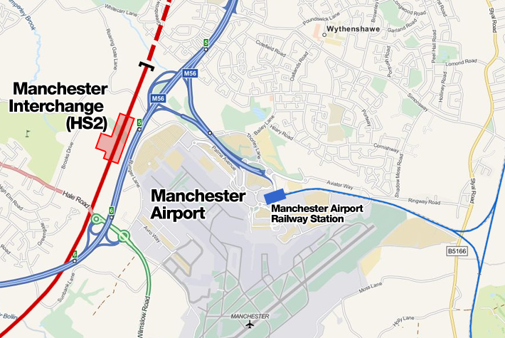
Manchester Airport High Speed station

Manchester Airport High Speed Station was a planned High Speed 2 station at Manchester Airport, on the southern boundary of Manchester, England, next to...

Ullerwood Castle

Ullerwood Castle is an early medieval castle, possibly a shell keep, in Ringway, Manchester, England (grid reference SJ800838). The castle is first referred...

Ashley railway station

Ashley railway station is in the village of Ashley in Cheshire, England. It is located on the Mid-Cheshire line 17+3⁄4 miles (28.6 km) southwest of Manchester...

Ashley, Cheshire

Ashley is a village and civil parish in Cheshire, England. At the 2001 census, it had a population of 261. The village is close to the border with Greater...

Nearby Amenities

Located within 500m of 53.366944,-2.3139434
Turning Circle
Lat/Long: 53.3650409/-2.3125144
Turning Circle
Lat/Long: 53.3644966/-2.3128091
Turning Circle
Lat/Long: 53.3642027/-2.3119171
Mini Roundabout
Direction: clockwise
Lat/Long: 53.3680271/-2.3179191
Turning Circle
Lat/Long: 53.3683086/-2.3163803
Bus Stop
Wicker Lane/Bulls Head
Bus: yes
Naptan AtcoCode: 1800SJ41041
Naptan Bearing: NE
Naptan CommonName: Wicker Lane/Bulls Head
Naptan Indicator: Opp Bulls Head
Naptan Landmark: PUBLIC HOUSE
Naptan NaptanCode: manjtjdj
Naptan PlusbusZoneRef: MNCRPIC
Naptan ShortCommonName: Bulls Head
Naptan Street: WICKER LANE
Naptan Verified: no
Network: TfGM
Public Transport: platform
Route Ref: School Buses Only
Source: naptan_import
Lat/Long: 53.3695871/-2.316188
Bus Stop
Wicker Lane/Bulls Head
Bus: yes
Naptan AtcoCode: 1800SJ41191
Naptan Bearing: SW
Naptan CommonName: Wicker Lane/Bulls Head
Naptan Indicator: Bulls Head Pub
Naptan Landmark: PUBLIC HOUSE
Naptan NaptanCode: manjtjmj
Naptan PlusbusZoneRef: MNCRPIC
Naptan ShortCommonName: Bulls Head
Naptan Street: WICKER LANE
Naptan Verified: no
Network: TfGM
Public Transport: platform
Route Ref: 286
Source: naptan_import
Lat/Long: 53.3693773/-2.3162067
Bus Stop
Hale Barns, Hale Road / outside All Saints Church
Bus: yes
Naptan AtcoCode: 1800SJ41361
Naptan Bearing: NW
Naptan CommonName: Hale Road/All Saints Church
Naptan Indicator: All Saints Ch
Naptan Landmark: BOOTHS
Naptan NaptanCode: manjtjpm
Naptan PlusbusZoneRef: MNCRPIC
Naptan ShortCommonName: All Saints Church
Naptan Street: HALE ROAD
Naptan Verified: no
Network: TfGM
Operator: TfGM
Public Transport: platform
Route Ref: 18;88;286
Source: naptan_import
Lat/Long: 53.369549/-2.3147472
Bus Stop
Hale Barns, Hale Road / opposite All Saints Church
Bus: yes
Naptan AtcoCode: 1800SJ41371
Naptan Bearing: SE
Naptan CommonName: Hale Road/All Saints Church
Naptan Indicator: House 303
Naptan Landmark: SHOPS
Naptan NaptanCode: manjtjpt
Naptan Notes: INDICATOR AMENDED
Naptan PlusbusZoneRef: MNCRPIC
Naptan ShortCommonName: All Saints Church
Naptan Street: HALE ROAD
Naptan Verified: no
Network: TfGM
Operator: TfGM
Public Transport: platform
Route Ref: 18;88;285
Source: naptan_import
Lat/Long: 53.3696748/-2.3147481
Bus Stop
Hale Barns, Hale Road / near Rydal Drive
Bus: yes
Naptan AtcoCode: 1800SJ41381
Naptan Bearing: E
Naptan CommonName: Hale Road/Rydal Drive
Naptan Indicator: Opp House 416
Naptan Landmark: HOUSE 416
Naptan NaptanCode: manjtjpw
Naptan PlusbusZoneRef: MNCRPIC
Naptan ShortCommonName: Rydal Drive
Naptan Street: HALE ROAD
Naptan Verified: no
Network: TfGM
Operator: TfGM
Public Transport: platform
Route Ref: 18;88;285
Source: naptan_import
Lat/Long: 53.367193/-2.3081924
Bus Stop
Hale Barns, Hale Road / opposite Rydal Drive
Bus: yes
Naptan AtcoCode: 1800SJ41401
Naptan Bearing: W
Naptan CommonName: Hale Road/Rydal Drive
Naptan Indicator: O/s House 402
Naptan Landmark: HOUSE 402
Naptan NaptanCode: manjtjtg
Naptan PlusbusZoneRef: MNCRPIC
Naptan ShortCommonName: Rydal Drive
Naptan Street: HALE ROAD
Naptan Verified: no
Network: TfGM
Operator: TfGM
Public Transport: platform
Route Ref: 18;88;286
Source: naptan_import
Lat/Long: 53.3674181/-2.3092648
Bus Stop
Hale Barns, Hawley Lane / near Elmsway
Bus: yes
Naptan AtcoCode: 1800SJ09501
Naptan Bearing: W
Naptan CommonName: Hawley Lane/Elmsway
Naptan Indicator: Nr House 1
Naptan Landmark: HOUSE 1
Naptan NaptanCode: manjptaw
Naptan Notes: INDICATOR AMENDED
Naptan PlusbusZoneRef: MNCRPIC
Naptan ShortCommonName: Elmsway
Naptan Street: HAWLEY LANE
Naptan Verified: no
Network: TfGM
Operator: TfGM
Public Transport: platform
Route Ref: 21;285
Source: naptan_import
Lat/Long: 53.3679936/-2.3187309
Bus Stop
Hale Barns, Hawley Lane / near Chapel Lane
Bus: yes
Naptan AtcoCode: 1800SJ11341
Naptan Bearing: E
Naptan CommonName: Hawley Lane/Chapel Lane
Naptan Indicator: Opp Elmsway
Naptan Landmark: SUB STATION
Naptan NaptanCode: manjpwta
Naptan PlusbusZoneRef: MNCRPIC
Naptan ShortCommonName: Chapel Lane
Naptan Street: HAWLEY LANE
Naptan Verified: no
Network: TfGM
Operator: TfGM
Public Transport: platform
Route Ref: 21;286
Source: naptan_import
Lat/Long: 53.368153/-2.3191404
Bus Stop
Hale Barns, Chapel Lane / near High Elm Road
Bus: yes
Naptan AtcoCode: 1800SJ11351
Naptan Bearing: S
Naptan CommonName: Chapel Lane/High Elm Road
Naptan Indicator: Brookfield Cott
Naptan Landmark: HOUSE 21
Naptan NaptanCode: manjpwtd
Naptan PlusbusZoneRef: MNCRPIC
Naptan ShortCommonName: High Elm Road
Naptan Street: CHAPEL LANE
Naptan Verified: no
Network: TfGM
Operator: TfGM
Public Transport: platform
Route Ref: 286
Source: naptan_import
Lat/Long: 53.3665955/-2.3139741
Bus Stop
Warburton Green, Chapel Lane / near Chapel Drive
Bus: yes
Naptan AtcoCode: 1800SJ11361
Naptan Bearing: E
Naptan CommonName: Chapel Lane/Chapel Drive
Naptan Indicator: Os House 59
Naptan Landmark: HOUSE 59
Naptan NaptanCode: manjpwtg
Naptan PlusbusZoneRef: MNCRPIC
Naptan ShortCommonName: Chapel Drive
Naptan Street: CHAPEL LANE
Naptan Verified: no
Network: TfGM
Operator: TfGM
Public Transport: platform
Route Ref: 286
Source: naptan_import
Lat/Long: 53.3635155/-2.3120429
Bus Stop
Warburton Green, Chapel Lane / opposite Chapel Drive
Bus: yes
Naptan AtcoCode: 1800SJ11451
Naptan Bearing: W
Naptan CommonName: Chapel Lane/Chapel Drive
Naptan Indicator: O/s House 84
Naptan Landmark: HOUSE 84
Naptan NaptanCode: manjtadp
Naptan PlusbusZoneRef: MNCRPIC
Naptan ShortCommonName: Chapel Drive
Naptan Street: CHAPEL LANE
Naptan Verified: no
Network: TfGM
Operator: TfGM
Public Transport: platform
Route Ref: 21;285
Source: naptan_import
Lat/Long: 53.3634409/-2.3120774
Bus Stop
Hale Barns, Chapel Lane / opposite High Elm Road
Bus: yes
Naptan AtcoCode: 1800SJ11461
Naptan Bearing: N
Naptan CommonName: Chapel Lane/High Elm Road
Naptan Indicator: Tennis Club
Naptan Landmark: TENNIS CLUB
Naptan NaptanCode: manjtadt
Naptan PlusbusZoneRef: MNCRPIC
Naptan ShortCommonName: High Elm Road
Naptan Street: CHAPEL LANE
Naptan Verified: no
Network: TfGM
Operator: TfGM
Public Transport: platform
Route Ref: 21;285
Source: naptan_import
Lat/Long: 53.3663121/-2.3142402
Bus Stop
Elmridge Drive/Wilton Drive
Bus: yes
Naptan AtcoCode: 1800SJ12181
Naptan Bearing: SW
Naptan CommonName: Elmridge Drive/Wilton Drive
Naptan Indicator: House No 13
Naptan Landmark: HOUSE 13
Naptan NaptanCode: manjtamw
Naptan PlusbusZoneRef: MNCRPIC
Naptan ShortCommonName: Wilton Drive
Naptan Street: ELMRIDGE DRIVE
Naptan Verified: no
Network: TfGM
Public Transport: platform
Source: naptan_import
Lat/Long: 53.3671456/-2.3125954
Bus Stop
Elmridge Drive/Wilton Drive
Bus: yes
Naptan AtcoCode: 1800SJ12211
Naptan Bearing: NE
Naptan CommonName: Elmridge Drive/Wilton Drive
Naptan Indicator: Os House 12
Naptan Landmark: HOUSE 12
Naptan NaptanCode: manjtapa
Naptan Notes: INDICATOR AMENDED
Naptan PlusbusZoneRef: MNCRPIC
Naptan ShortCommonName: Wilton Drive
Naptan Street: ELMRIDGE DRIVE
Naptan Verified: no
Network: TfGM
Public Transport: platform
Source: naptan_import
Lat/Long: 53.3673975/-2.3124921
Post Office
Best One
Addr City: Altrincham
Addr Housenumber: 313
Addr Postcode: WA15 8SS
Addr Street: Hale Road
Lat/Long: 53.3695266/-2.3142048
Defibrillator
Emergency: defibrillator
Lat/Long: 53.3689222/-2.3135608
Traffic Signals
Lat/Long: 53.3695477/-2.3145316
Hale Barns
Name Ur: ہیل بارنز
Place: village
Population: 9736
Lat/Long: 53.3691323/-2.3143148
Restaurant
Opium
Cuisine: asian
Lat/Long: 53.3695876/-2.3144943
Cheshire Eyecare
Shop: optician
Lat/Long: 53.369538/-2.3142649
S&D Kirk
Shop: butcher
Lat/Long: 53.3693708/-2.3135863
Snipz Barber
Shop: hairdresser
Lat/Long: 53.369398/-2.3136614
Fast Food
Pizza Place
Cuisine: pizza
Shop: yes
Takeaway: yes
Lat/Long: 53.3694196/-2.3137231
Oxfam
Brand: Oxfam
Brand Wikidata: Q267941
Brand Wikipedia: en:Oxfam
Contact Website: https://www.oxfam.org.uk/shops/oxfam-shop-hale-barns/
Shop: charity
Lat/Long: 53.3694532/-2.3138036
Pharmacy
Lloyds Pharmacy
Brand: Lloyds Pharmacy
Brand Wikidata: Q6662870
Brand Wikipedia: en:LloydsPharmacy
Dispensing: yes
Healthcare: pharmacy
Lat/Long: 53.3694828/-2.3138894
Tranquil Spa
Shop: beauty
Lat/Long: 53.3695108/-2.3139699
Shop: yes
Lat/Long: 53.3695388/-2.3140477
Booths
Addr City: Altrincham
Addr Country: GB
Addr Postcode: WA15 8ZN
Addr Street: The Square
Addr Unit: 1
Addr Village: Hale Barns
Brand: Booths
Brand Wikidata: Q4943949
Brand Wikipedia: en:Booths
Contact Website: https://www.booths.co.uk/store/hale-barns/
Fhrs Id: 740408
Not Addr Postcode: WA15 8ST
Shop: supermarket
Source Addr Postcode: code-point_open
Wheelchair: yes
Lat/Long: 53.3690635/-2.3141187
Restaurant
Barns Grill & Restaurant
Lat/Long: 53.3692572/-2.3144406
Fired Earth
Addr City: Altrincham
Addr Postcode: WA15 8ZN
Addr Street: The Square
Shop: interior_decoration
Source Addr Postcode: code-point_open
Lat/Long: 53.3690875/-2.3145854
Pets Corner
Brand: Pets Corner
Brand Wikidata: Q17018476
Brand Wikipedia: en:Pets Corner
Shop: pet
Lat/Long: 53.3690075/-2.3146498
Chrysalis Fitness
Leisure: fitness_centre
Lat/Long: 53.3689243/-2.3147008
Cafe
Costa
Addr City: Altrincham
Addr Housenumber: 5
Addr Postcode: WA15 8ST
Addr Street: The Square
Brand: Costa
Brand Wikidata: Q608845
Brand Wikipedia: en:Costa Coffee
Cuisine: coffee_shop
Fhrs Id: 743969
Takeaway: yes
Wheelchair: yes
Lat/Long: 53.3688139/-2.3147517
Entrance: main
Wheelchair: yes
Lat/Long: 53.3689962/-2.3143352
Golf: pin
Lat/Long: 53.3701588/-2.3113882
Golf: pin
Lat/Long: 53.3713846/-2.3151251
Man Made: flagpole
Lat/Long: 53.3711586/-2.3149984
Golf: pin
Lat/Long: 53.3682741/-2.3073864
Golf: pin
Lat/Long: 53.3707308/-2.3110292
Historic: memorial
Lat/Long: 53.3698845/-2.3155108
Majestic
Addr City: Altrincham
Addr Housenumber: 337
Addr Postcode: WA15 8SX
Addr Street: Hale Road
Brand: Majestic
Brand Wikidata: Q6737725
Brand Wikipedia: en:Majestic Wine
Opening Hours: Mo-We 10:00-19:00; Th,Fr 10:00-20:00; Sa 09:00-19:00
Operator: Majestic Wine
Shop: alcohol
Website: https://www.majestic.co.uk/stores/hale-barns
Lat/Long: 53.3687656/-2.3127789
Post Box
Post Box Type: pillar
Royal Cypher: EIIR
Royal Cypher Wikidata: Q33102113
Lat/Long: 53.3656645/-2.3144854
Turning Circle
Lat/Long: 53.3656569/-2.3069338
Barrier: lift_gate
Lat/Long: 53.3707853/-2.3158552
The data included in this document is from www.openstreetmap.org. The data is made available under ODbL.

Have you been to Hale Barns?

Leave your review of Hale Barns below (or comments, questions and feedback).