Grange Farm

Settlement in Buckinghamshire

England

Grange Farm

Shenley Dens  Farm Abandoned farm left for 20 years
Shenley Dens Farm Credit: Ryan Griffiths

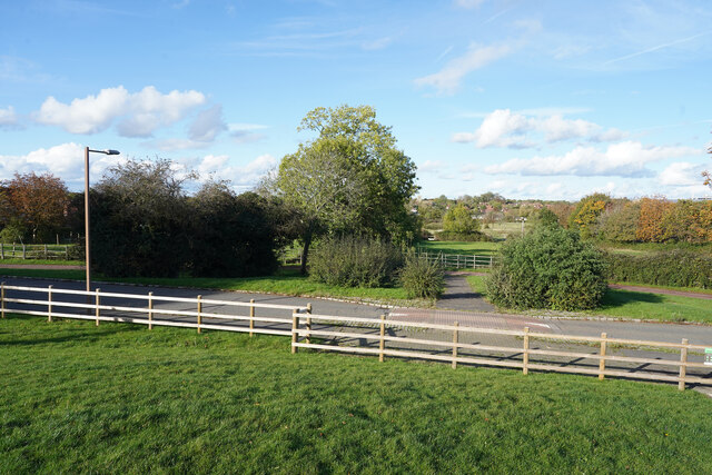
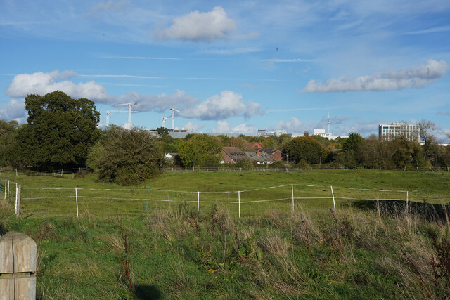
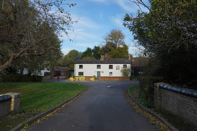
Grange Farm is a picturesque rural area located in Buckinghamshire, England. Situated amidst the rolling countryside, this charming farm offers a stunning landscape of green meadows, expansive fields, and enchanting woodlands. Its serene and idyllic surroundings make it a popular destination for nature lovers and those seeking a peaceful retreat.

The farm itself is known for its agricultural activities, with a focus on livestock farming and crop cultivation. Cows graze on the lush fields, producing high-quality dairy products, while crops such as wheat, barley, and rapeseed are grown in abundance. Grange Farm prides itself on its sustainable farming practices, ensuring the preservation of the environment and the promotion of biodiversity.

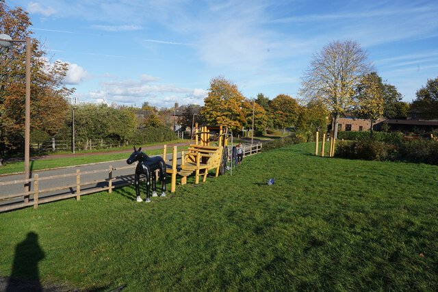
The farm also offers a range of activities and facilities for visitors to enjoy. Walking and cycling trails meander through the countryside, providing an opportunity to explore the natural beauty of the area. Families can engage in educational and interactive experiences, such as farm tours and hands-on workshops, to learn more about farming and sustainable living.

Moreover, Grange Farm has a charming farmhouse that offers accommodation for those looking to immerse themselves in the rural lifestyle. With its cozy rooms, warm hospitality, and delicious farm-to-table meals, visitors can indulge in a truly authentic countryside experience.

Overall, Grange Farm is a captivating destination that seamlessly blends agricultural practices with nature's beauty. Whether seeking a peaceful retreat, an educational experience, or a taste of rural living, this Buckinghamshire gem offers something for everyone.

If you have any feedback on the listing, please let us know in the comments section below.
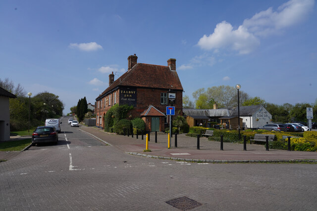
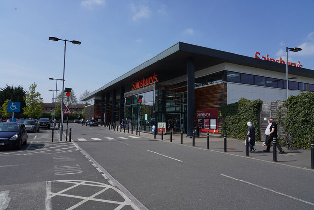
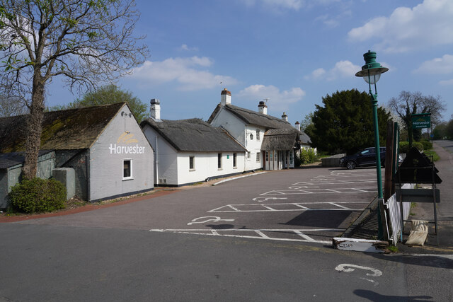
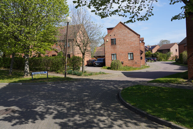
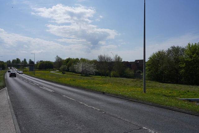
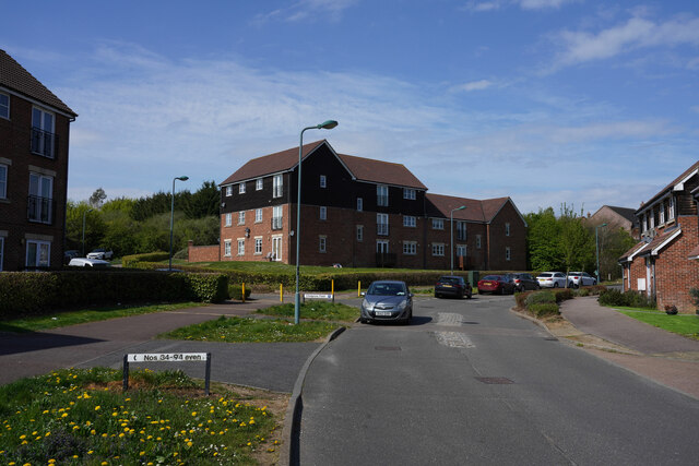
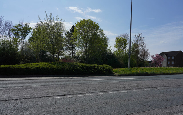
Grange Farm Images

Images are sourced within 2km of 52.024731/-0.80670533 or Grid Reference SP8136. Thanks to Geograph Open Source API. All images are credited.

Shenley Dens  Farm Abandoned farm left for 20 years
Shenley Dens Farm
Abandoned farm left for 20 years
Looking across Ashpole Furlong Standing in the small children's playground looking across the appropriately named road near the equestrian centre.
Looking across Ashpole Furlong
Standing in the small children's playground looking across the appropriately named road near the equestrian centre.
The horse themed climbing frame This is one of the children's toys in the small playground near Ashpole Furlong.
The horse themed climbing frame
This is one of the children's toys in the small playground near Ashpole Furlong.
Distant development Looking across the fields next to Whitworth Lane towards the distant tower cranes.
Distant development
Looking across the fields next to Whitworth Lane towards the distant tower cranes.
Bradwell Road Looking along Bradwell Road on a bright sunny afternoon, much improved from the heavy rain of this morning when we were further north.
Bradwell Road
Looking along Bradwell Road on a bright sunny afternoon, much improved from the heavy rain of this morning when we were further north.
The Wheatsheaf The former public house "The Wheatsheaf" is now a private residential property which may still be undergoing some renovation, judging from the builders materials in bags outside the house.
The Wheatsheaf
The former public house "The Wheatsheaf" is now a private residential property which may still be undergoing some renovation, judging from the builders materials in bags outside the house.
Milton Keynes from the air Looking north over Knowhill to the city centre from a Birmingham bound flight from Prague.
Milton Keynes from the air
Looking north over Knowhill to the city centre from a Birmingham bound flight from Prague.
Milton Keynes from the air Looking down on the Wymbush industrial area from a Birmingham bound flight from Prague.
Milton Keynes from the air
Looking down on the Wymbush industrial area from a Birmingham bound flight from Prague.
Milton Keynes from the air Looking down on the Crownhill area of the town from a Birmingham bound flight from Prague.
Milton Keynes from the air
Looking down on the Crownhill area of the town from a Birmingham bound flight from Prague.
Memorial Cottages The cottages have a date of 1897 above the door. They were built to commemorate the 60th jubilee of Queen Victoria's time on the throne.
Memorial Cottages
The cottages have a date of 1897 above the door. They were built to commemorate the 60th jubilee of Queen Victoria's time on the throne.
The Talbot Arms This is a fairly large public house with what appears to be a lot of space around it.
The Talbot Arms
This is a fairly large public house with what appears to be a lot of space around it.
Sainsbury's Supermarket A fairly modern building which for modern standards is quite a small supermarket. It was, however, very busy.
Sainsbury's Supermarket
A fairly modern building which for modern standards is quite a small supermarket. It was, however, very busy.
The Fountain The Fountain is, at least from the outside, an elegant public house which unusually has a thatched roof.
The Fountain
The Fountain is, at least from the outside, an elegant public house which unusually has a thatched roof.
Bremen Grove A cul-de-sac of modern houses in Shenley Brook End, another of the Milton Keynes suburbs.
Bremen Grove
A cul-de-sac of modern houses in Shenley Brook End, another of the Milton Keynes suburbs.
Tattenhoe Street This is V2 Tattenhoe Street. The main roads in Milton Keynes seem to have a prefix H or V followed by a single digit.
Tattenhoe Street
This is V2 Tattenhoe Street. The main roads in Milton Keynes seem to have a prefix H or V followed by a single digit.
Otterburn Crescent These three storey buildings all look as though they are blocks of flats. They seem just too large for single houses!
Otterburn Crescent
These three storey buildings all look as though they are blocks of flats. They seem just too large for single houses!
Looking across H5 Portway Waiting at a road junction of Singleton Drive and H5 Portway.
Looking across H5 Portway
Waiting at a road junction of Singleton Drive and H5 Portway.
H5 Portway At the junction with Singleton Drive looking along H5 Portway.
H5 Portway
At the junction with Singleton Drive looking along H5 Portway.
Show me another place!

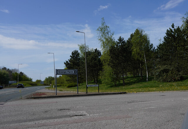
Grange Farm is located at Grid Ref: SP8136 (Lat: 52.024731, Lng: -0.80670533)

Unitary Authority: Milton Keynes

Police Authority: Thames Valley

What 3 Words

///tourist.undertook.groom. Near Shenley Church End, Buckinghamshire

Related Wikis

The Hazeley Academy

The Hazeley Academy is an 11 to 19 secondary school and sixth form located in Hazeley on the western edge of Milton Keynes, United Kingdom. == History... ==

Heart 103.3

Heart Milton Keynes (formerly Horizon Radio) was an Independent Local Radio station for Milton Keynes and North Buckinghamshire. Broadcasting on 103.3FM...

Shenley, Milton Keynes

Shenley is an area of Buckinghamshire consisting of the villages and areas Shenley Brook End, Shenley Church End, Shenley Dens, Shenley Grounds, Shenley...

Denbigh School

Denbigh School is a secondary academy school in Shenley Church End, Milton Keynes in south central England. == History == The original Denbigh School opened...

Whitehouse, Milton Keynes

Whitehouse is a neighbourhood and civil parish that covers a large new development area on the western flank of Milton Keynes, Buckinghamshire, England...

St Mary's Church, Shenley

St. Mary's Church, Shenley is an ecumenical church located in Shenley Church End, Milton Keynes, England. The church now forms part of the Watling Valley...

Watling Academy

Watling Academy is a coeducational secondary school located in the Whitehouse area of Milton Keynes, in the English county of Buckinghamshire. == History... ==

Shenley Church End

Shenley Church End is a village, district and wider civil parish in Milton Keynes, Buckinghamshire, England, about 2 miles (3.2 km) south-west of Central...

Related Videos

Nearby Amenities

Located within 500m of 52.024731,-0.80670533
Traffic Calming: table
Lat/Long: 52.0250972/-0.8058142
Turning Circle
Turning Circle: y-head
Lat/Long: 52.0270066/-0.8089628
Turning Circle
Turning Circle: circle
Lat/Long: 52.0270207/-0.8082016
Turning Circle
Turning Circle: y-head
Lat/Long: 52.0284883/-0.8085859
Turning Circle
Turning Circle: square
Lat/Long: 52.0240309/-0.8011485
Turning Circle
Turning Circle: y-head
Lat/Long: 52.0227301/-0.8030225
Turning Circle
Turning Circle: hammer
Lat/Long: 52.0250522/-0.8018136
Turning Circle
Turning Circle: square
Lat/Long: 52.0253705/-0.801397
Crownhill Supermarket
Addr City: Milton Keynes
Addr Country: GB
Addr Housenumber: 54
Addr Postcode: MK8 0AS
Addr Street: Lennon Drive
Addr Suburb: Crownhill
Brand: Premier
Brand Wikidata: Q7240340
Fhrs Authority: Milton Keynes
Fhrs Id: 199276
Fhrs Local Authority Id: 34584
Operator: Premier
Shop: convenience
Source: survey
Website: https://www.premier-stores.co.uk/our-stores/crownhill-supermarket
Lat/Long: 52.0264193/-0.8025477
Grange Farm
Is In: Milton Keynes, Buckinghamshire, England, UK
Place: suburb
Lat/Long: 52.0229147/-0.8090393
Turning Circle
Turning Circle: square
Lat/Long: 52.0257372/-0.8105579
Turning Circle
Turning Circle: square
Lat/Long: 52.0238813/-0.8098604
Turning Circle
Turning Circle: square
Lat/Long: 52.024023/-0.8113417
Turning Circle
Turning Circle: square
Lat/Long: 52.0211217/-0.8100777
The Co-operative Food
Addr City: Milton Keynes
Addr Country: GB
Addr Housenumber: 130
Addr Postcode: MK8 0LW
Addr Street: Dunthorne Way
Addr Suburb: Grange Farm
Brand: The Co-operative Food
Brand Wikidata: Q107617274
Fhrs Authority: Milton Keynes
Fhrs Id: 199051
Fhrs Local Authority Id: 71495
Operator: The Co-operative Group
Operator Wikidata: Q117202
Shop: supermarket
Website: https://www.coop.co.uk/store-finder/MK8-0LW/130-dunthorne-way-new-hill-place
Lat/Long: 52.0220557/-0.8066328
Fast Food
Ash's Fish & Chicken
Addr City: Milton Keynes
Addr Country: GB
Addr Housenumber: 31
Addr Postcode: MK8 0PX
Addr Street: Singleton Drive
Addr Suburb: Grange Farm
Fhrs Authority: Milton Keynes
Fhrs Id: 137484
Fhrs Local Authority Id: 72446
Lat/Long: 52.0218503/-0.8073181
Bus Stop
Medbourne Roundabout West
Bus: yes
Naptan AtcoCode: 049001465789
Naptan Bearing: NE
Naptan CommonName: Medbourne Roundabout West
Naptan Indicator: Eastbound
Naptan Landmark: Singleton Drive
Naptan NaptanCode: mltada
Naptan Street: Portway
Naptan Verified: no
Public Transport: platform
Shelter: no
Source: naptan_import
Lat/Long: 52.0211246/-0.8048139
Bus Stop
Medbourne Roundabout West
Bus: yes
Naptan AtcoCode: 049001465790
Naptan Bearing: SW
Naptan CommonName: Medbourne Roundabout West
Naptan Indicator: Westbound
Naptan Landmark: Singleton Drive
Naptan NaptanCode: mltadg
Naptan Street: Portway
Naptan Verified: no
Public Transport: platform
Shelter: no
Source: naptan_import
Lat/Long: 52.0206053/-0.8055742
Parking
Lat/Long: 52.0261591/-0.8026287
Turning Circle
Turning Circle: y-head
Lat/Long: 52.0247534/-0.8030008
Restaurant
The Grange
Addr City: Milton Keynes
Addr Country: GB
Addr Housenumber: 132
Addr Postcode: MK8 0LW
Addr Street: Dunthorne Way
Addr Suburb: Grange Farm
Cuisine: indian
Fhrs Authority: Milton Keynes
Fhrs Id: 137805
Fhrs Local Authority Id: 72864
Lat/Long: 52.0215891/-0.8069908
Fast Food
Star Wok
Addr City: Milton Keynes
Addr Country: GB
Addr Housenumber: 45
Addr Postcode: MK8 0PX
Addr Street: Singleton Drive
Addr Suburb: Grange Farm
Cuisine: chinese
Fhrs Authority: Milton Keynes
Fhrs Id: 137697
Fhrs Local Authority Id: 72716
Lat/Long: 52.0218077/-0.8072618
Post Box
Brand: Royal Mail
Brand Wikidata: Q638098
Brand Wikipedia: en:Royal Mail
Collection Times: Mo-Fr 17:30; Sa 12:00
Operator: Royal Mail
Operator Wikidata: Q638098
Ref: MK8 419
Royal Cypher: EIIR
Royal Cypher Wikidata: Q33102113
Source: survey
Lat/Long: 52.0264001/-0.8025937
Post Box
Brand: Royal Mail
Brand Wikidata: Q638098
Brand Wikipedia: en:Royal Mail
Collection Times: Mo-Fr 17:30; Sa 12:00
Operator: Royal Mail
Operator Wikidata: Q638098
Ref: MK8 535
Royal Cypher: EIIR
Royal Cypher Wikidata: Q33102113
Source: survey
Lat/Long: 52.0286536/-0.8075559
Post Box
Brand: Royal Mail
Brand Wikidata: Q638098
Brand Wikipedia: en:Royal Mail
Collection Times: Mo-Fr 17:30; Sa 12:00
Operator: Royal Mail
Operator Wikidata: Q638098
Post Box Type: lamp
Ref: MK8 576
Royal Cypher: EIIR
Royal Cypher Wikidata: Q33102113
Source: survey
Lat/Long: 52.0217799/-0.8063808
Cafe
Simply Good
Addr City: Milton Keynes
Addr Country: GB
Addr Housenumber: 49
Addr Postcode: MK8 0PX
Addr Street: Singleton Drive
Addr Suburb: Grange Farm
Cuisine: coffee_shop
Fhrs Authority: Milton Keynes
Fhrs Id: 143282
Fhrs Local Authority Id: 80546
Internet Access: wlan
Smoking: no
Lat/Long: 52.0217055/-0.8071327
Atm
Lat/Long: 52.0219791/-0.8066313
Communication Mobile Phone: yes
Man Made: mast
Tower Type: communication
Lat/Long: 52.0219162/-0.8030797
Bicycle Rental
Santander Cycles MK D/S #8841
Operator: Santander Cycles MK
Lat/Long: 52.0264128/-0.8027501
Bus Stop
Bus: yes
Public Transport: platform
Lat/Long: 52.0273529/-0.8118787
Bowtique Hair Beauty and Fashion
Addr City: Milton Keynes
Addr Housenumber: 50
Addr Postcode: MK8 0AS
Addr Street: Lennon Drive
Opening Hours: 10:00-21:00
Shop: hairdresser
Lat/Long: 52.0263071/-0.8022447
Hospital
PJ Care Mallard House Neurological Care Centre
No
Addr City: Milton Keynes
Addr Country: GB
Addr Housenumber: 2
Addr Postcode: MK8 0DZ
Addr Street: Dunthorne Way
Addr Suburb: Grange Farm
Emergency: no
Fhrs Authority: Milton Keynes
Fhrs Id: 135153
Fhrs Local Authority Id: 68691
Healthcare: hospital
Operator: PJ Care
Lat/Long: 52.0235883/-0.8089636
Dentist
Grange Farm Dental Practice
Addr City: Milton Keynes
Addr Housenumber: Newhill Place
Addr Postcode: MK8 0PX
Addr Street: Singleton Drive
Healthcare: dentist
Opening Hours: Mo-Sa 09:00-17:00
Lat/Long: 52.0219535/-0.8074649
ShortCuts Children's Salon (Milton Keynes)
Addr City: Milton Keynes
Addr Housenumber: 29
Addr Postcode: MK8 0PX
Addr Street: Singleton Drive
Opening Hours: Tu-Sa 09:00-17:30; Su 10:00-14:00
Phone: +44 1908 330996
Shop: hairdresser
Lat/Long: 52.0218754/-0.8073634
Community Centre
Seedlings Children's Centre
Addr City: Milton Keynes
Addr Country: GB
Addr Postcode: MK8 0PZ
Addr Street: Singleton Drive
Addr Suburb: Grange Farm
Fhrs Authority: Milton Keynes
Fhrs Id: 143154
Fhrs Local Authority Id: 80342
Lat/Long: 52.0217046/-0.8080047
Universal Hair
Shop: hairdresser
Lat/Long: 52.0217558/-0.8072054
Kindergarten
Baby Bears Day Care
Addr City: Milton Keynes
Addr Country: GB
Addr Housenumber: 128
Addr Postcode: MK8 0LW
Addr Street: Dunthorne Way
Addr Suburb: Grange Farm
Fhrs Authority: Milton Keynes
Fhrs Id: 136906
Fhrs Local Authority Id: 71433
Lat/Long: 52.022241/-0.8065
Milton Keynes Funeral Care
Shop: funeral_directors
Lat/Long: 52.0221247/-0.8065993
Social Facility
MacIntyre Care
Addr City: Milton Keynes
Addr Country: GB
Addr Housenumber: 54
Addr Postcode: MK8 0BF
Addr Street: Monro Avenue
Addr Suburb: Crownhill
Fhrs Authority: Milton Keynes
Fhrs Id: 126310
Fhrs Local Authority Id: 55237
Social Facility: assisted_living
Social Facility For: senior
Lat/Long: 52.0251813/-0.8060896
Crownhill
Place: suburb
Lat/Long: 52.0275784/-0.8029564
Parking
Lat/Long: 52.0238654/-0.8119038
Crossing
Lat/Long: 52.0243666/-0.8135949
Turning Circle
Turning Circle: y-head
Lat/Long: 52.026143/-0.8037033
Direction: 195
Generator Method: photovoltaic
Generator Output Electricity: yes
Generator Solar Modules: 30
Generator Source: solar
Generator Type: solar_photovoltaic_panel
Location: roof
Power: generator
Lat/Long: 52.0212056/-0.8084705
Direction: 145
Generator Method: photovoltaic
Generator Output Electricity: yes
Generator Solar Modules: 79
Generator Source: solar
Generator Type: solar_photovoltaic_panel
Location: roof
Power: generator
Tilt: 20
Lat/Long: 52.0210665/-0.8078967
Direction: 95
Generator Method: photovoltaic
Generator Output Electricity: yes
Generator Solar Modules: 3
Generator Source: solar
Generator Type: solar_photovoltaic_panel
Location: roof
Power: generator
Lat/Long: 52.0223168/-0.8102568
Direction: 235
Generator Method: photovoltaic
Generator Output Electricity: yes
Generator Solar Modules: 16
Generator Source: solar
Generator Type: solar_photovoltaic_panel
Location: roof
Power: generator
Lat/Long: 52.0216481/-0.8110607
Fixme: survey for slope/direction
Generator Method: photovoltaic
Generator Output Electricity: yes
Generator Solar Modules: 24
Generator Source: solar
Generator Type: solar_photovoltaic_panel
Location: roof
Power: generator
Tilted: no
Lat/Long: 52.025135/-0.8112288
Direction: 250
Generator Method: photovoltaic
Generator Output Electricity: yes
Generator Solar Modules: 8
Generator Source: solar
Generator Type: solar_photovoltaic_panel
Location: roof
Power: generator
Lat/Long: 52.0247905/-0.8088636
Direction: 160
Generator Method: photovoltaic
Generator Output Electricity: yes
Generator Solar Modules: 6
Generator Source: solar
Generator Type: solar_photovoltaic_panel
Location: roof
Power: generator
Lat/Long: 52.0247405/-0.8087705
Direction: 175
Generator Method: photovoltaic
Generator Output Electricity: yes
Generator Solar Modules: 18
Generator Source: solar
Generator Type: solar_photovoltaic_panel
Location: roof
Power: generator
Lat/Long: 52.0288863/-0.8059475
Fixme: solar panels? or skylights
Lat/Long: 52.0207054/-0.8039994
Bus Stop
Bus: yes
Naptan AtcoCode: 049000005736
Naptan NaptanCode: mltagtwt
Public Transport: platform
Lat/Long: 52.0218856/-0.8064347
Direction: forward
Traffic Calming: table
Lat/Long: 52.0214826/-0.8069106
Direction: forward
Traffic Calming: table
Lat/Long: 52.0215262/-0.8071756
Parking
Parking: layby
Lat/Long: 52.0253306/-0.8072394
Parking
Parking: layby
Lat/Long: 52.025253/-0.8073886
Direction: 220
Generator Method: photovoltaic
Generator Output Electricity: yes
Generator Solar Modules: 8
Generator Source: solar
Generator Type: solar_photovoltaic_panel
Location: roof
Power: generator
Lat/Long: 52.0246463/-0.8079195
Direction: 130
Generator Method: photovoltaic
Generator Output Electricity: yes
Generator Solar Modules: 8
Generator Source: solar
Generator Type: solar_photovoltaic_panel
Location: roof
Power: generator
Lat/Long: 52.0246545/-0.8077932
Direction: 230
Fixme: survey for panel count
Generator Method: photovoltaic
Generator Output Electricity: yes
Generator Solar Modules: 12
Generator Source: solar
Generator Type: solar_photovoltaic_panel
Location: roof
Power: generator
Lat/Long: 52.0252361/-0.8096054
Direction: 280
Generator Method: photovoltaic
Generator Output Electricity: yes
Generator Solar Modules: 12
Generator Source: solar
Generator Type: solar_photovoltaic_panel
Location: roof
Power: generator
Lat/Long: 52.0245248/-0.8106042
Direction: 190
Generator Method: photovoltaic
Generator Output Electricity: yes
Generator Solar Modules: 8
Generator Source: solar
Generator Type: solar_photovoltaic_panel
Location: roof
Power: generator
Lat/Long: 52.0242728/-0.8098707
Direction: 280
Generator Method: photovoltaic
Generator Output Electricity: yes
Generator Solar Modules: 6
Generator Source: solar
Generator Type: solar_photovoltaic_panel
Location: roof
Power: generator
Lat/Long: 52.0243012/-0.8099179
Direction: backward
Traffic Calming: table
Lat/Long: 52.0239836/-0.8097823
Direction: backward
Traffic Calming: table
Lat/Long: 52.0238982/-0.8104629
Direction: forward
Traffic Calming: table
Lat/Long: 52.0239428/-0.810811
Direction: 220
Fixme: survey for panel count
Generator Method: photovoltaic
Generator Output Electricity: yes
Generator Solar Modules: 18
Generator Source: solar
Generator Type: solar_photovoltaic_panel
Location: roof
Power: generator
Lat/Long: 52.0222554/-0.8106693
Direction: 185
Generator Method: photovoltaic
Generator Output Electricity: yes
Generator Solar Modules: 12
Generator Source: solar
Generator Type: solar_photovoltaic_panel
Location: roof
Power: generator
Lat/Long: 52.0223256/-0.8102006
Direction: 275
Generator Method: photovoltaic
Generator Output Electricity: yes
Generator Solar Modules: 12
Generator Source: solar
Generator Type: solar_photovoltaic_panel
Location: roof
Power: generator
Lat/Long: 52.0223244/-0.8103012
Direction: forward
Traffic Calming: table
Lat/Long: 52.021501/-0.8104849
Direction: backward
Traffic Calming: table
Lat/Long: 52.0213988/-0.810794
Direction: 140
Fixme: survey for panel count
Generator Method: photovoltaic
Generator Output Electricity: yes
Generator Solar Modules: 16
Generator Source: solar
Generator Type: solar_photovoltaic_panel
Location: roof
Power: generator
Lat/Long: 52.0234386/-0.81371
Turning Circle
Turning Circle: knuckle
Lat/Long: 52.0258133/-0.8058939
Turning Circle
Turning Circle: knuckle
Lat/Long: 52.0264375/-0.8046096
Direction: 175
Generator Method: photovoltaic
Generator Output Electricity: yes
Generator Solar Modules: 8
Generator Source: solar
Generator Type: solar_photovoltaic_panel
Location: roof
Power: generator
Lat/Long: 52.0265046/-0.8045555
Turning Circle
Turning Circle: knuckle
Lat/Long: 52.0264948/-0.8039624
Turning Circle
Turning Circle: square
Lat/Long: 52.0255619/-0.8019647
Direction: 125
Generator Method: photovoltaic
Generator Output Electricity: yes
Generator Solar Modules: 3
Generator Source: solar
Generator Type: solar_photovoltaic_panel
Location: roof
Power: generator
Lat/Long: 52.0251904/-0.7998401
Direction: 145
Fixme: survey for panel count
Generator Method: photovoltaic
Generator Output Electricity: yes
Generator Solar Modules: 8
Generator Source: solar
Generator Type: solar_photovoltaic_panel
Location: roof
Power: generator
Lat/Long: 52.0242415/-0.8053898
Direction: 235
Generator Method: photovoltaic
Generator Output Electricity: yes
Generator Solar Modules: 14
Generator Source: solar
Generator Type: solar_photovoltaic_panel
Location: roof
Power: generator
Lat/Long: 52.0241034/-0.8051532
Direction: 145
Generator Method: photovoltaic
Generator Output Electricity: yes
Generator Solar Modules: 3
Generator Source: solar
Generator Type: solar_photovoltaic_panel
Location: roof
Power: generator
Lat/Long: 52.0240803/-0.8051341
Direction: 160
Fixme: survey for panel count
Generator Method: photovoltaic
Generator Output Electricity: yes
Generator Solar Modules: 12
Generator Source: solar
Generator Type: solar_photovoltaic_panel
Location: roof
Power: generator
Lat/Long: 52.0245603/-0.8035708
Direction: 140
Fixme: survey for panel count
Generator Method: photovoltaic
Generator Output Electricity: yes
Generator Solar Modules: 16
Generator Source: solar
Generator Type: solar_photovoltaic_panel
Location: roof
Power: generator
Lat/Long: 52.0226875/-0.8032027
Turning Circle
Turning Circle: knuckle
Lat/Long: 52.0286188/-0.8040509
Turning Circle
Turning Circle: knuckle
Lat/Long: 52.027962/-0.8047582
Turning Circle
Turning Circle: knuckle
Lat/Long: 52.0280704/-0.8089806
Direction: 170
Fixme: survey for panel count
Generator Method: photovoltaic
Generator Output Electricity: yes
Generator Solar Modules: 18
Generator Source: solar
Generator Type: solar_photovoltaic_panel
Location: roof
Power: generator
Lat/Long: 52.0278561/-0.8093532
Direction: 155
Generator Method: photovoltaic
Generator Output Electricity: yes
Generator Solar Modules: 18
Generator Source: solar
Generator Type: solar_photovoltaic_panel
Location: roof
Power: generator
Lat/Long: 52.0274226/-0.8089086
Crossing
Lat/Long: 52.027569/-0.8079061
Turning Circle
Turning Circle: knuckle
Lat/Long: 52.0266205/-0.8066909
Turning Circle
Turning Circle: knuckle
Lat/Long: 52.0274911/-0.8053779
Direction: 120
Generator Method: photovoltaic
Generator Output Electricity: yes
Generator Solar Modules: 6
Generator Source: solar
Generator Type: solar_photovoltaic_panel
Location: roof
Power: generator
Lat/Long: 52.0285137/-0.8080808
Direction: 220
Fixme: survey for panel count
Generator Method: photovoltaic
Generator Output Electricity: yes
Generator Solar Modules: 10
Generator Source: solar
Generator Type: solar_photovoltaic_panel
Location: roof
Power: generator
Lat/Long: 52.0285754/-0.8056986
The data included in this document is from www.openstreetmap.org. The data is made available under ODbL.

Have you been to Grange Farm?

Leave your review of Grange Farm below (or comments, questions and feedback).