Goltho

Settlement in Lincolnshire West Lindsey

England

Goltho

The Ivy public house and Corndolly café
The Ivy public house and Corndolly café Credit: David Lally

Goltho is a small village located in the county of Lincolnshire, in eastern England. Situated approximately 3 miles northeast of the historic city of Lincoln, Goltho is a rural community with a population of just over 100 residents.

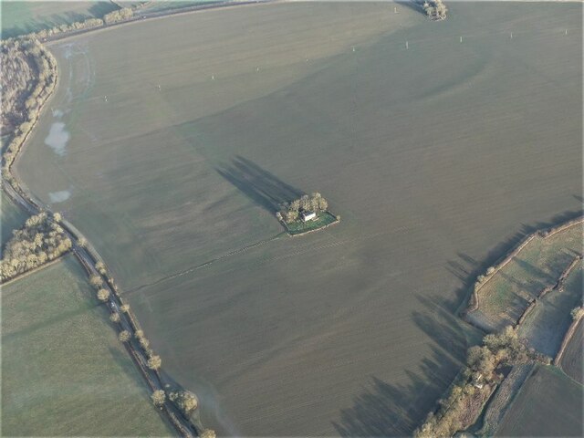
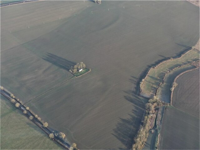
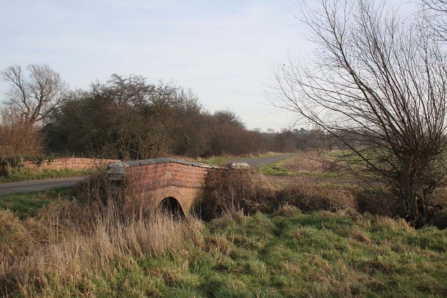
The village is known for its picturesque countryside and charming atmosphere. It is surrounded by rolling hills, lush meadows, and scenic woodlands, making it an idyllic setting for those seeking a peaceful retreat. Goltho also benefits from its proximity to Lincoln, allowing residents to enjoy both the tranquility of village life and the amenities of a larger city.

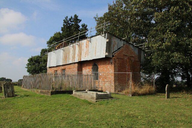
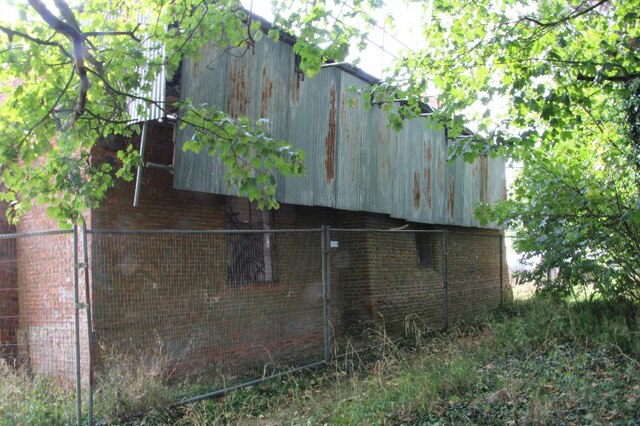
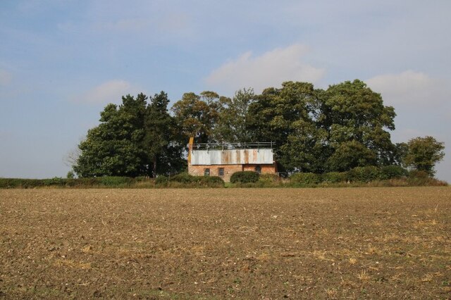
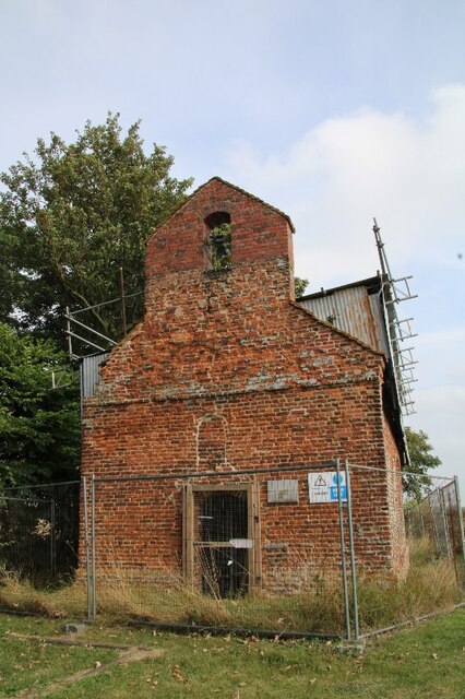
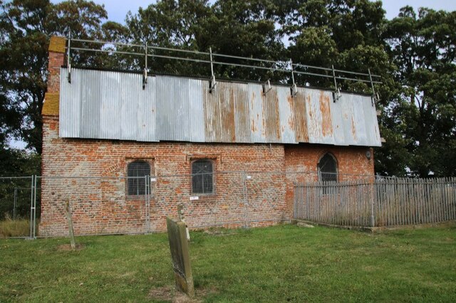
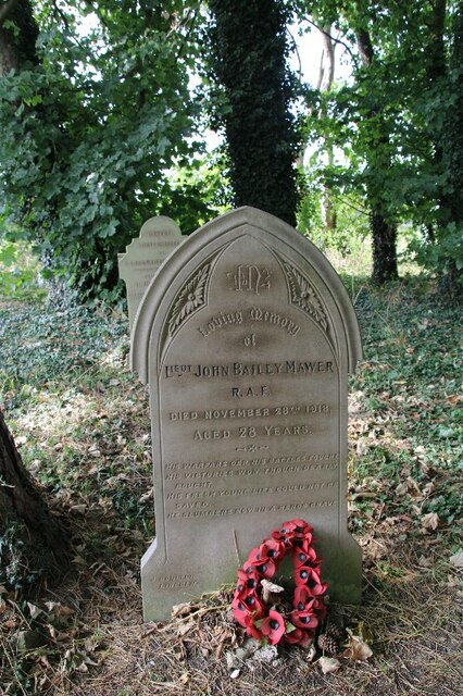
One of the notable features of Goltho is its historic church, St. George's Church, which dates back to the 12th century. This beautiful church showcases stunning medieval architecture and is often visited by tourists and history enthusiasts alike.

The village is predominantly residential, with a mix of traditional cottages and newer houses. There are no shops or amenities within the village itself, but nearby villages and towns provide necessary services. Despite its small size, Goltho has a tight-knit community and residents often organize social events and activities to foster a sense of community spirit.

Goltho's rural location also makes it an excellent destination for outdoor enthusiasts. The surrounding countryside offers numerous walking and cycling routes, providing opportunities to explore the natural beauty of the area.

In conclusion, Goltho is a charming and tranquil village in Lincolnshire, known for its picturesque countryside, historic church, and close-knit community.

If you have any feedback on the listing, please let us know in the comments section below.
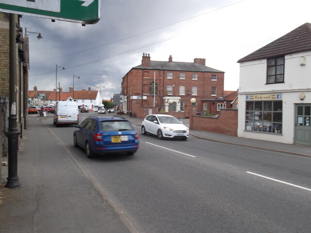
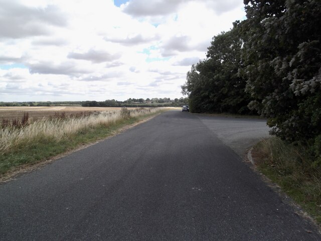
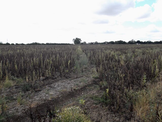
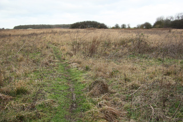
Goltho Images

Images are sourced within 2km of 53.276706/-0.32579527 or Grid Reference TF1176. Thanks to Geograph Open Source API. All images are credited.

The Ivy public house and Corndolly café
The Turnor Arms
The Turnor Arms
The sign of The Turnor Arms See: <a href="https://www.geograph.org.uk/photo/6933995">TF1378 : The Turnor Arms</a>
The sign of The Turnor Arms
The Diminutive Church of Apley, St Andrew's A charming church in well-kept grounds.  See <a title="https://www.geograph.org.uk/photo/6972672" href="https://www.geograph.org.uk/photo/6972672">Link</a> for a view of the east end.
The Diminutive Church of Apley, St Andrew's
A charming church in well-kept grounds. See Link for a view of the east end.
Apley, St Andrew's Church, East End See <a title="https://www.geograph.org.uk/photo/6972668" href="https://www.geograph.org.uk/photo/6972668">Link</a> for a view of the west end of this diminutive church.  Buried by the cement render band is believed to be a cut bench mark, detailed at <span class="nowrap"><a title="https://www.bench-marks.org.uk/bm156009" rel="nofollow ugc noopener" href="https://www.bench-marks.org.uk/bm156009">Link</a><img style="margin-left:2px;" alt="External link" title="External link - shift click to open in new window" src="https://s1.geograph.org.uk/img/external.png" width="10" height="10"/></span>.
Apley, St Andrew's Church, East End
See Link for a view of the west end of this diminutive church. Buried by the cement render band is believed to be a cut bench mark, detailed at LinkExternal link.
Goltho, St. George's Church, 2021 (1) 8 years after a disastrous fire in 2013 - See <a href="https://www.geograph.org.uk/photo/3716859">TF1177 : St.George's church</a>.
Goltho, St. George's Church, 2021 (1)
8 years after a disastrous fire in 2013 - See TF1177 : St.George's church.
Goltho, St. George's Church, 2021 (2) 8 years after a disastrous fire in 2013 - See <a href="https://www.geograph.org.uk/photo/3716859">TF1177 : St.George's church</a>.
Goltho, St. George's Church, 2021 (2)
8 years after a disastrous fire in 2013 - See TF1177 : St.George's church.
Goltho, St. George's Church, 2021 (3) 8 years after a disastrous fire in 2013 - See <a href="https://www.geograph.org.uk/photo/3716859">TF1177 : St.George's church</a>.
Goltho, St. George's Church, 2021 (3)
8 years after a disastrous fire in 2013 - See TF1177 : St.George's church.
Goltho, St. George's Church, 2021 (4) 8 years after a disastrous fire in 2013 - See <a href="https://www.geograph.org.uk/photo/3716859">TF1177 : St.George's church</a>.
Goltho, St. George's Church, 2021 (4)
8 years after a disastrous fire in 2013 - See TF1177 : St.George's church.
Goltho, St. George's Church, 2021 (5) 8 years after a disastrous fire in 2013 - See <a href="https://www.geograph.org.uk/photo/3716859">TF1177 : St.George's church</a>.
Goltho, St. George's Church, 2021 (5)
8 years after a disastrous fire in 2013 - See TF1177 : St.George's church.
War grave at Goltho, St. George's Church, 2021 8 years after a disastrous fire in 2013 - See <a href="https://www.geograph.org.uk/photo/3716859">TF1177 : St.George's church</a>.
War grave at Goltho, St. George's Church, 2021
8 years after a disastrous fire in 2013 - See TF1177 : St.George's church.
Settlement of Apley: aerial 2022 The medieval settlement of Apley was a hamlet established by the late 11th century. After the foundation of Stainfield Priory in the mid 12th century the settlement was granted to the nunnery and managed as a monastic manor or grange. Documentary references to a priest at Apley occur from the early 13th century onwards. The population of the settlement, which remained low throughout the medieval period, declined after the Dissolution when 'Apley Grange' was granted, with the rest of the Stainfield Priory estate, to Sir Robert Tyrwhitt, who enclosed large areas of land for sheep pasture. The medieval church at Apley remained standing until the beginning of the 18th century; the present St Andrew's chapel, which stands on an adjacent site and is not included in the scheduling, was constructed in 1871. The remains of the medieval settlement of Apley and the surviving parts of its open fields are visible as earthworks with associated buried remains and lie in two separate areas of protection.

See <span class="nowrap"><a title="https://www.heritagegateway.org.uk/Gateway/Results_Single.aspx?uid=MLI50506&resourceID=1006" rel="nofollow ugc noopener" href="https://www.heritagegateway.org.uk/Gateway/Results_Single.aspx?uid=MLI50506&resourceID=1006">Link</a><img style="margin-left:2px;" alt="External link" title="External link - shift click to open in new window" src="https://s1.geograph.org.uk/img/external.png" width="10" height="10"/></span>
Settlement of Apley: aerial 2022
The medieval settlement of Apley was a hamlet established by the late 11th century. After the foundation of Stainfield Priory in the mid 12th century the settlement was granted to the nunnery and managed as a monastic manor or grange. Documentary references to a priest at Apley occur from the early 13th century onwards. The population of the settlement, which remained low throughout the medieval period, declined after the Dissolution when 'Apley Grange' was granted, with the rest of the Stainfield Priory estate, to Sir Robert Tyrwhitt, who enclosed large areas of land for sheep pasture. The medieval church at Apley remained standing until the beginning of the 18th century; the present St Andrew's chapel, which stands on an adjacent site and is not included in the scheduling, was constructed in 1871. The remains of the medieval settlement of Apley and the surviving parts of its open fields are visible as earthworks with associated buried remains and lie in two separate areas of protection. See LinkExternal link
Goltho: aerial 2022 (1) St. George's Church: <span class="nowrap"><a title="https://www.heritagegateway.org.uk/Gateway/Results_Single.aspx?uid=76b2167a-05d4-432c-a931-3a659f9cdacf&resourceID=19191" rel="nofollow ugc noopener" href="https://www.heritagegateway.org.uk/Gateway/Results_Single.aspx?uid=76b2167a-05d4-432c-a931-3a659f9cdacf&resourceID=19191">Link</a><img style="margin-left:2px;" alt="External link" title="External link - shift click to open in new window" src="https://s1.geograph.org.uk/img/external.png" width="10" height="10"/></span>

Goltho Medieval Settlement Earthwork And Cropmark Site: <span class="nowrap"><a title="https://www.heritagegateway.org.uk/Gateway/Results_Single.aspx?uid=ec19aad5-49d4-4854-bafb-f065821c9129&resourceID=19191" rel="nofollow ugc noopener" href="https://www.heritagegateway.org.uk/Gateway/Results_Single.aspx?uid=ec19aad5-49d4-4854-bafb-f065821c9129&resourceID=19191">Link</a><img style="margin-left:2px;" alt="External link" title="External link - shift click to open in new window" src="https://s1.geograph.org.uk/img/external.png" width="10" height="10"/></span>

Traces of Romano-British settlement: <span class="nowrap"><a title="https://www.heritagegateway.org.uk/Gateway/Results_Single.aspx?uid=59411ede-0a52-4991-907a-6925db9d8905&resourceID=19191" rel="nofollow ugc noopener" href="https://www.heritagegateway.org.uk/Gateway/Results_Single.aspx?uid=59411ede-0a52-4991-907a-6925db9d8905&resourceID=19191">Link</a><img style="margin-left:2px;" alt="External link" title="External link - shift click to open in new window" src="https://s1.geograph.org.uk/img/external.png" width="10" height="10"/></span>

Site of defended manorial enclosure: <span class="nowrap"><a title="https://www.heritagegateway.org.uk/Gateway/Results_Single.aspx?uid=MLI50494&resourceID=1006" rel="nofollow ugc noopener" href="https://www.heritagegateway.org.uk/Gateway/Results_Single.aspx?uid=MLI50494&resourceID=1006">Link</a><img style="margin-left:2px;" alt="External link" title="External link - shift click to open in new window" src="https://s1.geograph.org.uk/img/external.png" width="10" height="10"/></span>

Site of motte and bailey castle: <span class="nowrap"><a title="https://www.heritagegateway.org.uk/Gateway/Results_Single.aspx?uid=MLI50493&resourceID=1006" rel="nofollow ugc noopener" href="https://www.heritagegateway.org.uk/Gateway/Results_Single.aspx?uid=MLI50493&resourceID=1006">Link</a><img style="margin-left:2px;" alt="External link" title="External link - shift click to open in new window" src="https://s1.geograph.org.uk/img/external.png" width="10" height="10"/></span>

Part of Middle-Saxon settlement: <span class="nowrap"><a title="https://www.heritagegateway.org.uk/Gateway/Results_Single.aspx?uid=MLI51233&resourceID=1006" rel="nofollow ugc noopener" href="https://www.heritagegateway.org.uk/Gateway/Results_Single.aspx?uid=MLI51233&resourceID=1006">Link</a><img style="margin-left:2px;" alt="External link" title="External link - shift click to open in new window" src="https://s1.geograph.org.uk/img/external.png" width="10" height="10"/></span>

Deserted settlement of Goltho or Bullington: <span class="nowrap"><a title="https://www.heritagegateway.org.uk/Gateway/Results_Single.aspx?uid=MLI51217&resourceID=1006" rel="nofollow ugc noopener" href="https://www.heritagegateway.org.uk/Gateway/Results_Single.aspx?uid=MLI51217&resourceID=1006">Link</a><img style="margin-left:2px;" alt="External link" title="External link - shift click to open in new window" src="https://s1.geograph.org.uk/img/external.png" width="10" height="10"/></span>

Romano-British farmstead and building remains: <span class="nowrap"><a title="https://www.heritagegateway.org.uk/Gateway/Results_Single.aspx?uid=MLI50713&resourceID=1006" rel="nofollow ugc noopener" href="https://www.heritagegateway.org.uk/Gateway/Results_Single.aspx?uid=MLI50713&resourceID=1006">Link</a><img style="margin-left:2px;" alt="External link" title="External link - shift click to open in new window" src="https://s1.geograph.org.uk/img/external.png" width="10" height="10"/></span>


The soilmarks are picked out by the early morning January frost, and the remains of the earthworks by the (long) early morning morning winter shadows - note the shadows of the trees around the church.
Goltho: aerial 2022 (1)
St. George's Church: LinkExternal link Goltho Medieval Settlement Earthwork And Cropmark Site: LinkExternal link Traces of Romano-British settlement: LinkExternal link Site of defended manorial enclosure: LinkExternal link Site of motte and bailey castle: LinkExternal link Part of Middle-Saxon settlement: LinkExternal link Deserted settlement of Goltho or Bullington: LinkExternal link Romano-British farmstead and building remains: LinkExternal link The soilmarks are picked out by the early morning January frost, and the remains of the earthworks by the (long) early morning morning winter shadows - note the shadows of the trees around the church.
Goltho: aerial 2022 (2) St. George's Church: <span class="nowrap"><a title="https://www.heritagegateway.org.uk/Gateway/Results_Single.aspx?uid=76b2167a-05d4-432c-a931-3a659f9cdacf&resourceID=19191" rel="nofollow ugc noopener" href="https://www.heritagegateway.org.uk/Gateway/Results_Single.aspx?uid=76b2167a-05d4-432c-a931-3a659f9cdacf&resourceID=19191">Link</a><img style="margin-left:2px;" alt="External link" title="External link - shift click to open in new window" src="https://s1.geograph.org.uk/img/external.png" width="10" height="10"/></span>

Goltho Medieval Settlement Earthwork And Cropmark Site: <span class="nowrap"><a title="https://www.heritagegateway.org.uk/Gateway/Results_Single.aspx?uid=ec19aad5-49d4-4854-bafb-f065821c9129&resourceID=19191" rel="nofollow ugc noopener" href="https://www.heritagegateway.org.uk/Gateway/Results_Single.aspx?uid=ec19aad5-49d4-4854-bafb-f065821c9129&resourceID=19191">Link</a><img style="margin-left:2px;" alt="External link" title="External link - shift click to open in new window" src="https://s1.geograph.org.uk/img/external.png" width="10" height="10"/></span>

Traces of Romano-British settlement: <span class="nowrap"><a title="https://www.heritagegateway.org.uk/Gateway/Results_Single.aspx?uid=59411ede-0a52-4991-907a-6925db9d8905&resourceID=19191" rel="nofollow ugc noopener" href="https://www.heritagegateway.org.uk/Gateway/Results_Single.aspx?uid=59411ede-0a52-4991-907a-6925db9d8905&resourceID=19191">Link</a><img style="margin-left:2px;" alt="External link" title="External link - shift click to open in new window" src="https://s1.geograph.org.uk/img/external.png" width="10" height="10"/></span>

Site of defended manorial enclosure: <span class="nowrap"><a title="https://www.heritagegateway.org.uk/Gateway/Results_Single.aspx?uid=MLI50494&resourceID=1006" rel="nofollow ugc noopener" href="https://www.heritagegateway.org.uk/Gateway/Results_Single.aspx?uid=MLI50494&resourceID=1006">Link</a><img style="margin-left:2px;" alt="External link" title="External link - shift click to open in new window" src="https://s1.geograph.org.uk/img/external.png" width="10" height="10"/></span>

Site of motte and bailey castle: <span class="nowrap"><a title="https://www.heritagegateway.org.uk/Gateway/Results_Single.aspx?uid=MLI50493&resourceID=1006" rel="nofollow ugc noopener" href="https://www.heritagegateway.org.uk/Gateway/Results_Single.aspx?uid=MLI50493&resourceID=1006">Link</a><img style="margin-left:2px;" alt="External link" title="External link - shift click to open in new window" src="https://s1.geograph.org.uk/img/external.png" width="10" height="10"/></span>

Part of Middle-Saxon settlement: <span class="nowrap"><a title="https://www.heritagegateway.org.uk/Gateway/Results_Single.aspx?uid=MLI51233&resourceID=1006" rel="nofollow ugc noopener" href="https://www.heritagegateway.org.uk/Gateway/Results_Single.aspx?uid=MLI51233&resourceID=1006">Link</a><img style="margin-left:2px;" alt="External link" title="External link - shift click to open in new window" src="https://s1.geograph.org.uk/img/external.png" width="10" height="10"/></span>

Deserted settlement of Goltho or Bullington: <span class="nowrap"><a title="https://www.heritagegateway.org.uk/Gateway/Results_Single.aspx?uid=MLI51217&resourceID=1006" rel="nofollow ugc noopener" href="https://www.heritagegateway.org.uk/Gateway/Results_Single.aspx?uid=MLI51217&resourceID=1006">Link</a><img style="margin-left:2px;" alt="External link" title="External link - shift click to open in new window" src="https://s1.geograph.org.uk/img/external.png" width="10" height="10"/></span>

Romano-British farmstead and building remains: <span class="nowrap"><a title="https://www.heritagegateway.org.uk/Gateway/Results_Single.aspx?uid=MLI50713&resourceID=1006" rel="nofollow ugc noopener" href="https://www.heritagegateway.org.uk/Gateway/Results_Single.aspx?uid=MLI50713&resourceID=1006">Link</a><img style="margin-left:2px;" alt="External link" title="External link - shift click to open in new window" src="https://s1.geograph.org.uk/img/external.png" width="10" height="10"/></span>

The soilmarks are picked out by the early morning January frost, and the remains of the earthworks by the (long) early morning morning winter shadows - note the shadows of the trees around the church.
Goltho: aerial 2022 (2)
St. George's Church: LinkExternal link Goltho Medieval Settlement Earthwork And Cropmark Site: LinkExternal link Traces of Romano-British settlement: LinkExternal link Site of defended manorial enclosure: LinkExternal link Site of motte and bailey castle: LinkExternal link Part of Middle-Saxon settlement: LinkExternal link Deserted settlement of Goltho or Bullington: LinkExternal link Romano-British farmstead and building remains: LinkExternal link The soilmarks are picked out by the early morning January frost, and the remains of the earthworks by the (long) early morning morning winter shadows - note the shadows of the trees around the church.
The Turnor Arms, Wragby
Old Lincoln Road, Goltho
Path across a field of beans
Show me another place!

Goltho is located at Grid Ref: TF1176 (Lat: 53.276706, Lng: -0.32579527)

Division: Parts of Lindsey

Administrative County: Lincolnshire

District: West Lindsey

Police Authority: Lincolnshire

What 3 Words

///yard.twit.thigh. Near Wragby, Lincolnshire

Related Wikis

Goltho

Goltho is a hamlet in the West Lindsey district of Lincolnshire, England. The population (including Bullington) was 157 at the 2011 census. It is situated...

St George's Church, Goltho

St George's Church is a redundant Anglican church in the deserted village of Goltho, Lincolnshire, England. It is recorded in the National Heritage List...

Bullington Priory

Bullington Priory was a priory in Bullington, Lincolnshire, England. The priory was a house of the Gilbertine Order and dedicated to Saint Mary. It was...

Apley

Apley is a hamlet and civil parish in the West Lindsey district of Lincolnshire, England. It is situated 1 mile (1.6 km) west from the hamlet of Kingthorpe...
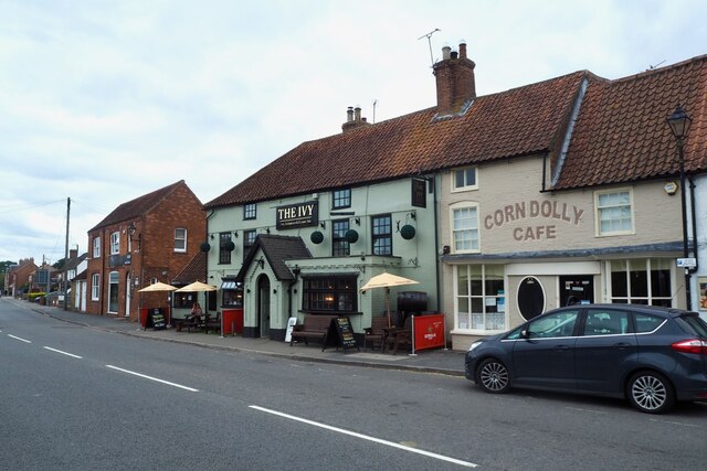
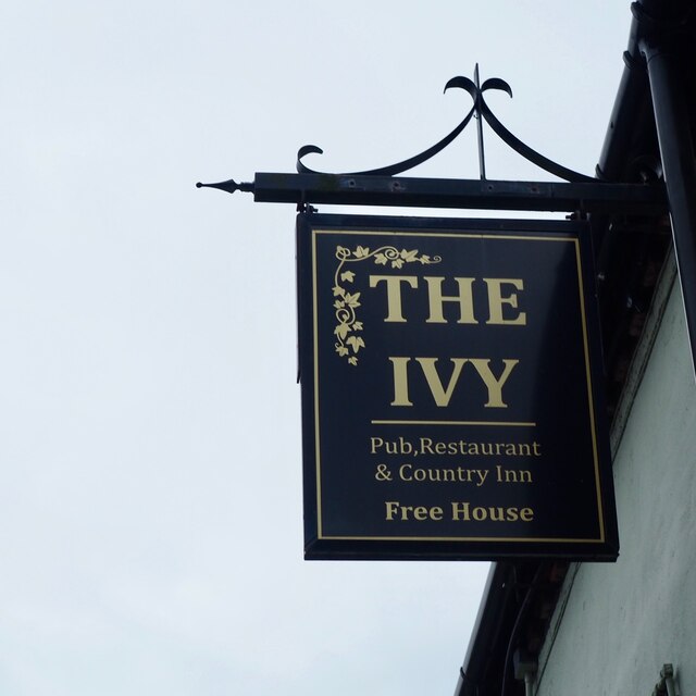
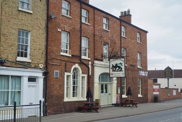
Wragby

Wragby ( RAG-bee) is a town and civil parish in the East Lindsey district of Lincolnshire, England. It is situated at the junction of the A157 and A158...

Kingthorpe

Kingthorpe is a hamlet in the West Lindsey district of Lincolnshire, England. The hamlet is in the civil parish of Apley, and is 10 miles (16 km) east...

Rand, Lincolnshire

Rand is a small village and civil parish in the West Lindsey district of Lincolnshire, England. It is situated approximately 9 miles (14 km) north-east...

Wragby railway station

Wragby railway station was a railway station that served the town of Wragby, Lincolnshire, England between 1874 and 1960, on the Louth to Bardney line...

Nearby Amenities

Located within 500m of 53.276706,-0.32579527
Goltho
Is In: Lincolnshire, England, UK
Place: hamlet
Source: NPE
Lat/Long: 53.2776806/-0.3264667
Power: pole
Lat/Long: 53.2755664/-0.3255424
Power: pole
Lat/Long: 53.2756883/-0.3239264
Power: pole
Lat/Long: 53.2758009/-0.3223136
Power: pole
Lat/Long: 53.2759086/-0.3207782
Power: pole
Lat/Long: 53.2760032/-0.3193567
Goltho Hall (archaeological site)
Addr Street: Goltho Lane
Archaeological Site: fortification
Historic: archaeological_site
Source: Bing
Lat/Long: 53.2744781/-0.3286758
Goltho Hall
Place: isolated_dwelling
Source: Bing
Lat/Long: 53.2746049/-0.3260352
Power: pole
Lat/Long: 53.272316/-0.3241674
Power: pole
Lat/Long: 53.2728496/-0.3223969
Goltho Fishing Lakes
Addr Street: Goltho Lane
Tourism: attraction
Lat/Long: 53.278784/-0.3271127
The data included in this document is from www.openstreetmap.org. The data is made available under ODbL.

Have you been to Goltho?

Leave your review of Goltho below (or comments, questions and feedback).