Gometra

Settlement in Argyllshire

Scotland

Gometra

The western tip of Ulva Paddling along the south coast of Ulva in a big swell, we are just entering the shelter from Rubha Bhrisdeadh-ramh as we approach the channel between Ulva and Gometra. There is still a decent swell, but the clapotis have got less fierce. The buildings seen in the distance are on Gometra.
The western tip of Ulva Credit: Andy Waddington

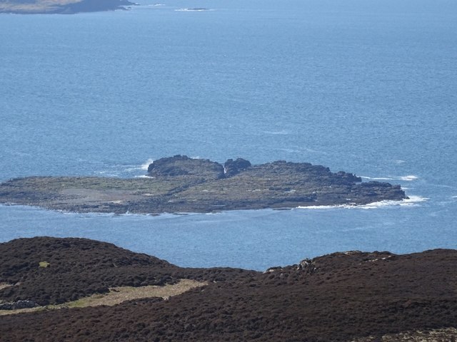
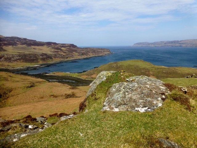
Gometra is a small, remote island located off the west coast of Scotland in Argyllshire. It is part of the Inner Hebrides archipelago and is situated between the islands of Ulva and Mull. The island covers an area of approximately 220 hectares and is home to a handful of residents.

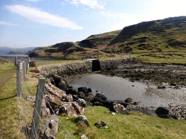
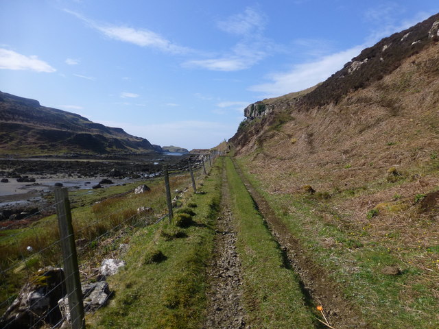
Gometra is known for its rugged and wild landscape, with rocky cliffs, sandy beaches, and rolling hills dominating the scenery. The island is largely uninhabited, with only a few houses and farms scattered throughout the landscape. The main industry on Gometra is agriculture, with sheep farming being the primary source of income for the residents.

Access to Gometra is limited, with no regular ferry service to the island. Visitors must arrange transportation by private boat or helicopter. Despite its isolation, Gometra attracts a small number of tourists each year who come to enjoy the peaceful atmosphere and stunning natural beauty of the island.

Overall, Gometra is a remote and picturesque island that offers a glimpse into a simpler way of life in the Scottish Highlands.

If you have any feedback on the listing, please let us know in the comments section below.

Gometra Images

Images are sourced within 2km of 56.482929/-6.2828522 or Grid Reference NM3640. Thanks to Geograph Open Source API. All images are credited.

The western tip of Ulva Paddling along the south coast of Ulva in a big swell, we are just entering the shelter from Rubha Bhrisdeadh-ramh as we approach the channel between Ulva and Gometra. There is still a decent swell, but the clapotis have got less fierce. The buildings seen in the distance are on Gometra.
The western tip of Ulva
Paddling along the south coast of Ulva in a big swell, we are just entering the shelter from Rubha Bhrisdeadh-ramh as we approach the channel between Ulva and Gometra. There is still a decent swell, but the clapotis have got less fierce. The buildings seen in the distance are on Gometra.
Maisgeir A flat rocky island off Gometra.
Maisgeir
A flat rocky island off Gometra.
Maisgeir Skerries to the east of the main rocky island. Off the south coast of Gometra.
Maisgeir
Skerries to the east of the main rocky island. Off the south coast of Gometra.
Paddling towards Gometra on south coast of Ulva Johnny Proud of Swaledale Outdoor Club paddles just off the south shore of Ulva, heading for the western tip and the sound that separates it from Gometra. Conditions are no more than force 3-4, but with a swell from the west making the zone close to the rocks quite a high energy one and exciting to paddle for those with the necessary skills.
Paddling towards Gometra on south coast of Ulva
Johnny Proud of Swaledale Outdoor Club paddles just off the south shore of Ulva, heading for the western tip and the sound that separates it from Gometra. Conditions are no more than force 3-4, but with a swell from the west making the zone close to the rocks quite a high energy one and exciting to paddle for those with the necessary skills.
Rubha Bhrisdeadh-ramh Typical rocky coastline on the isles of Ulva and Gometra.
Rubha Bhrisdeadh-ramh
Typical rocky coastline on the isles of Ulva and Gometra.
A yacht sailing south past the west end of Gometra
Gometra and Ulva Gometra and Loch Tuath, late afternoon from the road above Torloisk House on Mull
Gometra and Ulva
Gometra and Loch Tuath, late afternoon from the road above Torloisk House on Mull
Torr Mor Summit Fifth TuMP of a busy sunny day with Richard Tibbetts and Jim Bloomer.
Name: Torr Mor
Hill number: 102421
Height: 79m / 259ft
Area: 17E: Mull and Nearby Islands
Class: 0
Grid ref: NM366403 (est)
Drop: 42m
Col: 37m
Torr Mor Summit
Fifth TuMP of a busy sunny day with Richard Tibbetts and Jim Bloomer. Name: Torr Mor Hill number: 102421 Height: 79m / 259ft Area: 17E: Mull and Nearby Islands Class: 0 Grid ref: NM366403 (est) Drop: 42m Col: 37m
Gometra Cairn And Vanessa Trig Third TuMP of a bright sunny morning with Jim Bloomer and Richard Tibbetts.
Name: Gometra
Hill number: 1331
Height: 155m / 509ft
Area: 17E: Mull and Nearby Islands
Class: Ma
Grid ref: NM 36120 41405
Summit feature: trig point: OS measurement
Drop: 155m
Col: Sea
Gometra Cairn And Vanessa Trig
Third TuMP of a bright sunny morning with Jim Bloomer and Richard Tibbetts. Name: Gometra Hill number: 1331 Height: 155m / 509ft Area: 17E: Mull and Nearby Islands Class: Ma Grid ref: NM 36120 41405 Summit feature: trig point: OS measurement Drop: 155m Col: Sea
Cnoc Rubha Dubh First TuMP of a bright sunny day with Jim Bloomer and Richard Tibbetts after a military march from the Ulva Ferry.

Name: Cnoc Rubha Dubh
Hill number: 102451
Height: 67m / 220ft
Area: 17E: Mull and Nearby Islands
Class: 0
Grid ref: NM375412 (est)
Drop: 38m
Col: 29m
Cnoc Rubha Dubh
First TuMP of a bright sunny day with Jim Bloomer and Richard Tibbetts after a military march from the Ulva Ferry. Name: Cnoc Rubha Dubh Hill number: 102451 Height: 67m / 220ft Area: 17E: Mull and Nearby Islands Class: 0 Grid ref: NM375412 (est) Drop: 38m Col: 29m
Torr Mor NE Top Second TuMP today with Jim Bloomer and Richard Tibbetts.
Name: Torr Mor NE Top
Hill number: 102436
Height: 74m / 243ft
Area: 17E: Mull and Nearby Islands
Class: 0
Grid ref: NM370409 (est)
Drop: 31m
Col: 43m
Torr Mor NE Top
Second TuMP today with Jim Bloomer and Richard Tibbetts. Name: Torr Mor NE Top Hill number: 102436 Height: 74m / 243ft Area: 17E: Mull and Nearby Islands Class: 0 Grid ref: NM370409 (est) Drop: 31m Col: 43m
The Bridge This is the view from Gometra back across the bridge that connects it with Ulva.  Gometra is a tidal island next to Ulva.
The Bridge
This is the view from Gometra back across the bridge that connects it with Ulva. Gometra is a tidal island next to Ulva.
Farm Building Near Gometra House A busy area on Geometra around this farm near Gometra House which is sadly in need of repair.  The island is agricultural, formerly growing grain for the monastery on Iona. Once home to a population of over a hundred, it is now down to a tight-knit community of a handful of people, up to a thousand black face sheep, highland cattle, pigs, horses, a flock of feral goats, and red deer.
Farm Building Near Gometra House
A busy area on Geometra around this farm near Gometra House which is sadly in need of repair. The island is agricultural, formerly growing grain for the monastery on Iona. Once home to a population of over a hundred, it is now down to a tight-knit community of a handful of people, up to a thousand black face sheep, highland cattle, pigs, horses, a flock of feral goats, and red deer.
View Towards Gometra House Gometra House had fallen into disrepair and parts were near collapse by the 1980s, but was reoccupied and restored as a family home in the 1990s. Principal exports include blackface breeding stock, lamb, mutton, wool, venison, oysters, vegetables, art and jewellery. There are currently four households on the island, and the islanders are dedicated to a low-impact lifestyle, living off-grid, doing without electricity in their homes, washing machines or cars on the island.
Weather and tides permitting, it takes about 1 hour and 15 minutes to travel by track from the houses on the west of Gometra to the ferry landing stage on Ulva for the crossing to Mull, using a 4x4 vehicle. The same trip can be done in 50 minutes on a quad bike. By boat from Acarseid Mhòr the journey only takes 20 minutes.
View Towards Gometra House
Gometra House had fallen into disrepair and parts were near collapse by the 1980s, but was reoccupied and restored as a family home in the 1990s. Principal exports include blackface breeding stock, lamb, mutton, wool, venison, oysters, vegetables, art and jewellery. There are currently four households on the island, and the islanders are dedicated to a low-impact lifestyle, living off-grid, doing without electricity in their homes, washing machines or cars on the island. Weather and tides permitting, it takes about 1 hour and 15 minutes to travel by track from the houses on the west of Gometra to the ferry landing stage on Ulva for the crossing to Mull, using a 4x4 vehicle. The same trip can be done in 50 minutes on a quad bike. By boat from Acarseid Mhòr the journey only takes 20 minutes.
Two Highland Bulls We found these two Highland bulls happily grazing on a remote part of Gometra.  They then started banging their heads together as they put on a show for us.
Two Highland Bulls
We found these two Highland bulls happily grazing on a remote part of Gometra. They then started banging their heads together as they put on a show for us.
Track On Gometra This is the view along the track once you have stepped off the bridge between Ulva and Gometra.  It takes you on a twisted route to Gometra House.
Track On Gometra
This is the view along the track once you have stepped off the bridge between Ulva and Gometra. It takes you on a twisted route to Gometra House.
Gometra Vanessa Trig Plus Coastal View Third TuMP of a bright sunny morning with Jim Bloomer and Richard Tibbetts plus soon joined by Martin Collins and Richard Wood.
Name: Gometra
Hill number: 1331
Height: 155m / 509ft
Area: 17E: Mull and Nearby Islands
Class: Ma
Grid ref: NM 36120 41405
Summit feature: trig point: OS measurement
Drop: 155m
Col: Sea
Gometra Vanessa Trig Plus Coastal View
Third TuMP of a bright sunny morning with Jim Bloomer and Richard Tibbetts plus soon joined by Martin Collins and Richard Wood. Name: Gometra Hill number: 1331 Height: 155m / 509ft Area: 17E: Mull and Nearby Islands Class: Ma Grid ref: NM 36120 41405 Summit feature: trig point: OS measurement Drop: 155m Col: Sea
House on Gometra Gometra (Gòmastra) is an island in the Inner Hebrides, west of Mull. It lies immediately west of Ulva, to which it is linked by a bridge, and at low tide also by a beach (<span class="nowrap"><a title="https://en.wikipedia.org/wiki/Gometra" rel="nofollow ugc noopener" href="https://en.wikipedia.org/wiki/Gometra">Link</a><img style="margin-left:2px;" alt="External link" title="External link - shift click to open in new window" src="https://s1.geograph.org.uk/img/external.png" width="10" height="10"/></span> Wikipedia).
House on Gometra
Gometra (Gòmastra) is an island in the Inner Hebrides, west of Mull. It lies immediately west of Ulva, to which it is linked by a bridge, and at low tide also by a beach (LinkExternal link Wikipedia).
Show me another place!

Gometra is located at Grid Ref: NM3640 (Lat: 56.482929, Lng: -6.2828522)

Unitary Authority: Argyll and Bute

Police Authority: Argyll and West Dunbartonshire

What 3 Words

///everybody.promotion.ranch. Near Calgary, Argyll & Bute

Related Wikis

Gometra

Gometra (Scottish Gaelic: Gòmastra) is an island in the Inner Hebrides of Scotland, lying west of Mull. It lies immediately west of Ulva, to which it is...

Little Colonsay

Little Colonsay (Scottish Gaelic: Colbhasa Beag) is an uninhabited island west of the island of the Isle of Mull in Scotland. The geology of the island...

Ulva

Ulva (; Scottish Gaelic: Ulbha) is a small island in the Inner Hebrides of Scotland, off the west coast of Mull. It is separated from Mull by a narrow...

Loch Tuath

Loch Tuath (Scottish Gaelic: Loch-a-Tuath) is a sea loch in the Inner Hebrides, Scotland that separates the Isle of Mull and the island of Ulva. Loch Tuath...

Have you been to Gometra?

Leave your review of Gometra below (or comments, questions and feedback).