Gilver's Lane

Settlement in Worcestershire Malvern Hills

England

Gilver's Lane

Timber-framed barn Timber-framed barn at Welland Lodge.
Timber-framed barn Credit: Philip Halling

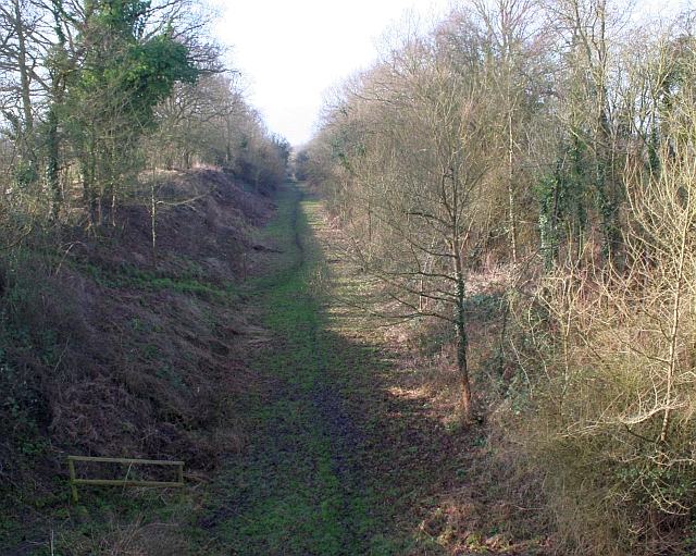
Gilver's Lane is a quaint and picturesque street situated in the heart of Worcestershire, a county in the West Midlands region of England. This narrow lane, lined with charming cottages and traditional houses, exudes a timeless beauty that attracts visitors from near and far.

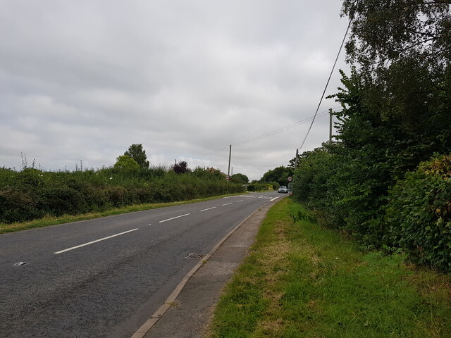
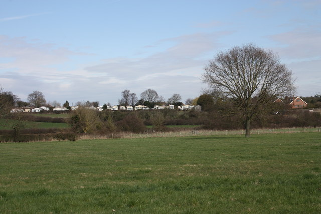
Nestled in the scenic countryside, Gilver's Lane offers a peaceful and idyllic setting for residents and tourists alike. The surrounding landscape is characterized by rolling hills, lush green fields, and meandering streams, creating a serene atmosphere that is perfect for leisurely walks and outdoor activities.

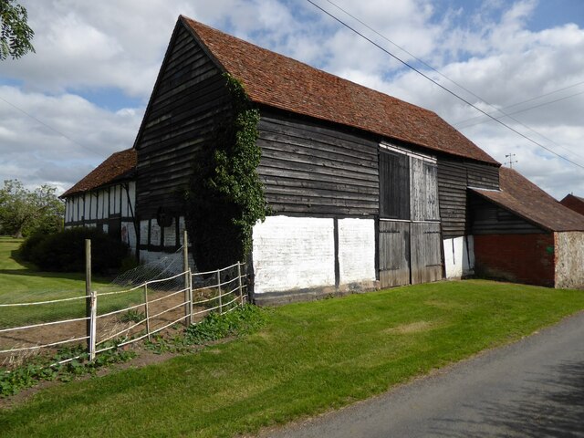
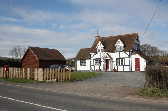
The architecture of the houses along Gilver's Lane is a delightful blend of historic and contemporary styles. Many of the buildings date back several centuries, showcasing the region's rich history and cultural heritage. The use of traditional materials such as timber and stone adds to the area's rustic charm.

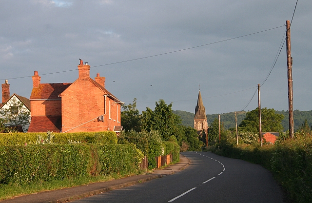
In addition to its natural beauty and architectural appeal, Gilver's Lane is also known for its sense of community. The residents here are friendly and welcoming, often organizing local events and gatherings that bring people together. The lane is home to a range of amenities, including charming cafes, boutique shops, and cozy pubs, where visitors can experience the warm hospitality of Worcestershire.

Overall, Gilver's Lane in Worcestershire is a captivating destination that offers a glimpse into the region's past while providing a peaceful and inviting environment for both residents and visitors.

If you have any feedback on the listing, please let us know in the comments section below.

Gilver's Lane Images

Images are sourced within 2km of 52.070743/-2.272085 or Grid Reference SO8141. Thanks to Geograph Open Source API. All images are credited.

Timber-framed barn Timber-framed barn at Welland Lodge.
Timber-framed barn
Timber-framed barn at Welland Lodge.
Drake Street, A 4104, leaving Welland towards Upton
The Footbridge at Welland Mill A substantial footbridge over the Marlbank Brook.
This was an important mill centuries ago with water dropping into the brook  from a leet some 3 metres above (behind the camera).
The Footbridge at Welland Mill
A substantial footbridge over the Marlbank Brook. This was an important mill centuries ago with water dropping into the brook from a leet some 3 metres above (behind the camera).
The Marlbank Brook at Welland Mill Looking downstream from the footbridge over the stream.
There is now very little left of the mill site: a leet and some brickwork where the water flowed to the mill wheel.
The Marlbank Brook at Welland Mill
Looking downstream from the footbridge over the stream. There is now very little left of the mill site: a leet and some brickwork where the water flowed to the mill wheel.
The Marlbank Brook at Welland Mill Looking upstream from the footbridge by the old mill site.
The Marlbank Brook at Welland Mill
Looking upstream from the footbridge by the old mill site.
Myrtle Cottage, Drake Street, Welland This used to be the old post office decades ago.
It has been considerably and tastefully extended.
Viewed from the footpath to the old Welland Mill site.
Myrtle Cottage, Drake Street, Welland
This used to be the old post office decades ago. It has been considerably and tastefully extended. Viewed from the footpath to the old Welland Mill site.
Young woodland in Welland On the slope of Windmill Hill trees were planted some years ago on what had been pasture for centuries. 
The land is still quite open and enjoyed by pigs and sheep.
Young woodland in Welland
On the slope of Windmill Hill trees were planted some years ago on what had been pasture for centuries. The land is still quite open and enjoyed by pigs and sheep.
Pasture in Welland Between the Anchor Inn and the Welland Steam Rally fields.
Lovely view of the Malvern Hills in the distance.
Pasture in Welland
Between the Anchor Inn and the Welland Steam Rally fields. Lovely view of the Malvern Hills in the distance.
Hook Bank Mobile Home  Park The mobile home park has 37 residential homes and caters for the retired and semi-retired.
Viewed from the footpath near the Anchor Inn. 
<span class="nowrap"><a title="http://barrparks.co.uk/hook-bank-park/" rel="nofollow ugc noopener" href="http://barrparks.co.uk/hook-bank-park/">Link</a><img style="margin-left:2px;" alt="External link" title="External link - shift click to open in new window" src="https://s1.geograph.org.uk/img/external.png" width="10" height="10"/></span>
Hook Bank Mobile Home Park
The mobile home park has 37 residential homes and caters for the retired and semi-retired. Viewed from the footpath near the Anchor Inn. LinkExternal link
The Anchor Inn Viewed from the rear.
The name of the pub derives from the pool hereabouts centuries ago known as The Lake.
From the signs outside it has been recently taken over and is closed for refurbishment.
The Anchor Inn
Viewed from the rear. The name of the pub derives from the pool hereabouts centuries ago known as The Lake. From the signs outside it has been recently taken over and is closed for refurbishment.
Welland Lodge Taken from the footpath to Brookend.
Welland Lodge
Taken from the footpath to Brookend.
Myrtle Cottage, Drake Street, Welland At one time this was the village post office.
The EIIR post box is now the only reminder.
Myrtle Cottage, Drake Street, Welland
At one time this was the village post office. The EIIR post box is now the only reminder.
Dumped material near the B4208 The footpath to the site of the old Welland Mill is made quite difficult by the dump of material which has taken place over a number of weeks.
The burnt material, on the left, appears to come from the Star Inn at Upton-upon-Severn which was subject to an arson attack.
<span class="nowrap"><a title="http://www.worcesternews.co.uk/news/8851429.Update__Man_arrested_after_pub_blaze/" rel="nofollow ugc noopener" href="http://www.worcesternews.co.uk/news/8851429.Update__Man_arrested_after_pub_blaze/">Link</a><img style="margin-left:2px;" alt="External link" title="External link - shift click to open in new window" src="https://s1.geograph.org.uk/img/external.png" width="10" height="10"/></span>
This may be a legitimate dump of material as it is unlikely that fly tippers would leave a noticeboard bearing the name of the inn.
I would prefer that the material didn't make access to the public right of way so awkward.
Dumped material near the B4208
The footpath to the site of the old Welland Mill is made quite difficult by the dump of material which has taken place over a number of weeks. The burnt material, on the left, appears to come from the Star Inn at Upton-upon-Severn which was subject to an arson attack. LinkExternal link This may be a legitimate dump of material as it is unlikely that fly tippers would leave a noticeboard bearing the name of the inn. I would prefer that the material didn't make access to the public right of way so awkward.
Stile on path to old Welland Mill site The brook runs parallel to the path (to the right of the photograph) whilst the mill leat used to flow high up on the bank on the left of the field.
Stile on path to old Welland Mill site
The brook runs parallel to the path (to the right of the photograph) whilst the mill leat used to flow high up on the bank on the left of the field.
Pasture in Welland Viewed from the path off Drake Street.
Looking towards the Malvern Hills, behind the backs of the houses.
Pasture in Welland
Viewed from the path off Drake Street. Looking towards the Malvern Hills, behind the backs of the houses.
Welland Steam Rally - going like the gallopers The young engine driver and his Savage centre engine are standing still while all is whirling furiously around them. This is the effect I was seeking. The gallopers were built by Tidmans but later fitted with a Savage centre engine (No. 638). There is also an organ engine that is no longer used. Owned by David Downs of Witham, Essex.
Welland Steam Rally - going like the gallopers
The young engine driver and his Savage centre engine are standing still while all is whirling furiously around them. This is the effect I was seeking. The gallopers were built by Tidmans but later fitted with a Savage centre engine (No. 638). There is also an organ engine that is no longer used. Owned by David Downs of Witham, Essex.
Welland Steam Rally - Wheeee! Youngsters enjoying the Chair-o-planes that were built in Germany in the 1930s. Owned by James Horton, Arundel.
Welland Steam Rally - Wheeee!
Youngsters enjoying the Chair-o-planes that were built in Germany in the 1930s. Owned by James Horton, Arundel.
Welland Steam Rally - colourful engine driver Driving Ransomes, Simms & Jeffries 6NHP traction engine Lady Diana of 1904. Owned by D Prout & Family of Dymock, Glos.
Welland Steam Rally - colourful engine driver
Driving Ransomes, Simms & Jeffries 6NHP traction engine Lady Diana of 1904. Owned by D Prout & Family of Dymock, Glos.
Show me another place!

Gilver's Lane is located at Grid Ref: SO8141 (Lat: 52.070743, Lng: -2.272085)

Administrative County: Worcestershire

District: Malvern Hills

Police Authority: West Merica

Also known as: Gilvers Lane

What 3 Words

///blackouts.urgent.cracking. Near Upton upon Severn, Worcestershire

Related Wikis

Brotheridge Green Nature Reserve

Brotheridge Green Nature Reserve is a nature reserve of the Worcestershire Wildlife Trust at Brotheridge Green, about 2.5 miles (4.0 km) west of Upton...

Hanley Swan

Hanley Swan is a small village in the English county of Worcestershire. It lies in the Malvern Hills district, between the towns of Malvern (two miles...

British National Fencing Museum

The British National Fencing Museum is the national museum for Great Britain for the sport and martial art of fencing.The museum opened during the year...

Welland, Worcestershire

Welland is a village and civil parish in the administrative district of Malvern Hills in the county of Worcestershire, England. It has a combined parish...

Nearby Amenities

Located within 500m of 52.070743,-2.272085
Post Box
Collection Times: Mo-Sa 10:30
Hanleys Tag: C
Note: At the Brotheridge Green end of Gilvers Lane
Post Box Type: lamp
Ref: WR8 110
Royal Cypher: EIIR
Royal Cypher Wikidata: Q33102113
Lat/Long: 52.0696812/-2.2663836
Power: tower
Lat/Long: 52.0691504/-2.2709154
Power: tower
Lat/Long: 52.0708913/-2.2653206
Power: tower
Lat/Long: 52.0685213/-2.2733727
Power: tower
Lat/Long: 52.070483/-2.2681665
Power: tower
Lat/Long: 52.0678944/-2.2759189
Power: tower
Lat/Long: 52.0694463/-2.2704596
Barrier: kissing_gate
Bicycle: no
Foot: yes
Lat/Long: 52.0697062/-2.2739144
Barrier: stile
Foot: yes
Lat/Long: 52.0712311/-2.2737199
Melrose Farm
Power: pole
Transformer: distribution
Voltage Primary: 11000
Lat/Long: 52.0688252/-2.2683764
Power: pole
Lat/Long: 52.0692435/-2.267917
Barley Mow Farm
Power: pole
Transformer: distribution
Voltage Primary: 11000
Lat/Long: 52.0701611/-2.2659342
Location Transition: yes
Power: pole
Lat/Long: 52.0700028/-2.2675931
Power: pole
Lat/Long: 52.0707835/-2.270494
Gilvers Lane
Power: pole
Transformer: distribution
Voltage Primary: 11000
Lat/Long: 52.0707769/-2.2712624
Power: pole
Lat/Long: 52.0707983/-2.2694331
Location Transition: yes
Power: pole
Lat/Long: 52.0708123/-2.2683683
Power: pole
Lat/Long: 52.0668808/-2.2756344
Location Transition: yes
Power: pole
Lat/Long: 52.0675947/-2.2757591
Location Transition: yes
Power: pole
Lat/Long: 52.0680226/-2.2759992
The data included in this document is from www.openstreetmap.org. The data is made available under ODbL.

Have you been to Gilver's Lane?

Leave your review of Gilver's Lane below (or comments, questions and feedback).