Gillingstool

Settlement in Gloucestershire

England

Gillingstool

Fingerpost over a village pump At the bottom of the High St, Thornbury. The location is also called  "The Plain". This fingerpost hangs over a village pump within a horseshoe of iron railings. Context (reverse) view see <a href="https://www.geograph.org.uk/photo/7020690">ST6390 : Village Pump & fingerpost, High Street</a>

Inscription: To Gloucester ☛

Milestone Society National ID: GL_ST6390
Fingerpost over a village pump Credit: Mr Red

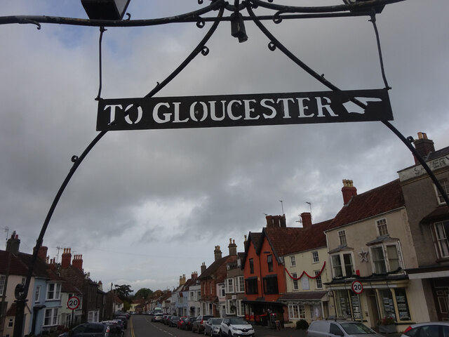
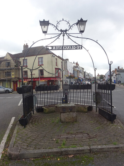
Gillingstool is a small village located in the South West of England, specifically in the county of Gloucestershire. Situated on the eastern outskirts of the town of Thornbury, Gillingstool has a population of approximately 1,500 residents.

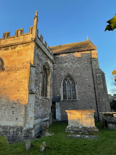
The village is characterized by its picturesque rural setting, surrounded by rolling hills and green fields. Gillingstool retains much of its traditional charm, with a mix of historic buildings and modern developments. The center of the village features a small square, where locals gather and a few shops and amenities can be found.

The village is well-connected to neighboring areas, with easy access to major roads such as the A38 and M5 motorway, providing convenient travel options for residents. The nearby town of Thornbury offers additional facilities, including schools, supermarkets, and healthcare services.

Gillingstool is known for its strong sense of community, with various social and recreational activities organized throughout the year. The village hosts an annual summer fair, bringing together residents and visitors for a day of festivities. Additionally, Gillingstool benefits from its proximity to the beautiful countryside, providing ample opportunities for outdoor activities such as hiking and cycling.

Overall, Gillingstool offers a peaceful and idyllic lifestyle in a scenic rural setting, while still providing access to essential amenities and nearby urban areas.

If you have any feedback on the listing, please let us know in the comments section below.
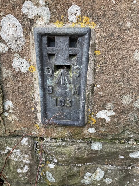
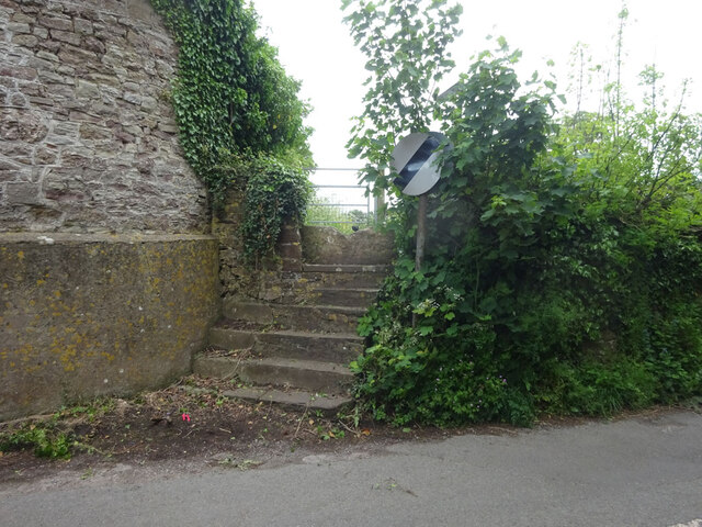
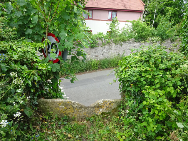
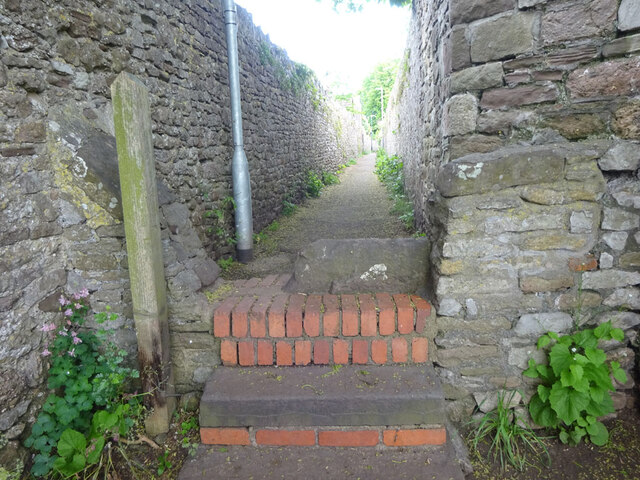
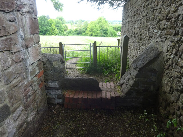
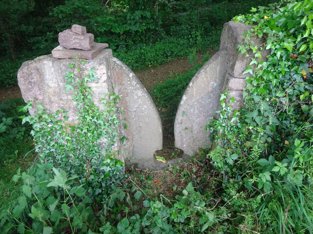
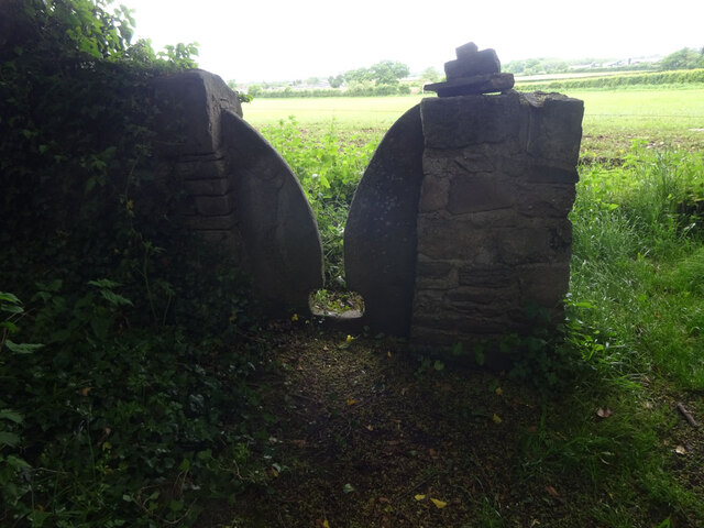
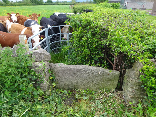
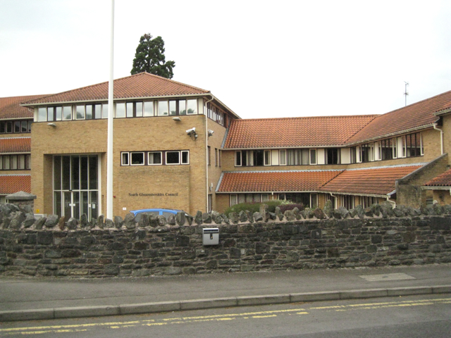
Gillingstool Images

Images are sourced within 2km of 51.607109/-2.5192025 or Grid Reference ST6489. Thanks to Geograph Open Source API. All images are credited.

Fingerpost over a village pump At the bottom of the High St, Thornbury. The location is also called  "The Plain". This fingerpost hangs over a village pump within a horseshoe of iron railings. Context (reverse) view see <a href="https://www.geograph.org.uk/photo/7020690">ST6390 : Village Pump & fingerpost, High Street</a>

Inscription: To Gloucester ☛

Milestone Society National ID: GL_ST6390
Fingerpost over a village pump
At the bottom of the High St, Thornbury. The location is also called "The Plain". This fingerpost hangs over a village pump within a horseshoe of iron railings. Context (reverse) view see ST6390 : Village Pump & fingerpost, High Street Inscription: To Gloucester ☛ Milestone Society National ID: GL_ST6390
Village Pump & fingerpost, High Street Bottom of the High Street, Thornbury. The location is also called  "The Plain". Surrounded by railings in a horseshoe pattern, with a fingerpost sign hanging above. Twin, old fashioned style lamps above. Obverse view of fingerpost see <a href="https://www.geograph.org.uk/photo/7020649">ST6390 : Fingerpost over a village pump</a>

Inscription: To Gloucester ☛

Milestone Society National ID: GL_ST6390
Village Pump & fingerpost, High Street
Bottom of the High Street, Thornbury. The location is also called "The Plain". Surrounded by railings in a horseshoe pattern, with a fingerpost sign hanging above. Twin, old fashioned style lamps above. Obverse view of fingerpost see ST6390 : Fingerpost over a village pump Inscription: To Gloucester ☛ Milestone Society National ID: GL_ST6390
Flush Bracket OSBM 102: Thornbury, St. Mary's Church This Ordnance Survey benchmark is located on a small buttress in an internal angle near the south-east corner of the church.  See <a title="https://www.geograph.org.uk/photo/7074287" href="https://www.geograph.org.uk/photo/7074287">Link</a> for a wider view and <span class="nowrap"><a title="https://www.bench-marks.org.uk/bm9770" rel="nofollow ugc noopener" href="https://www.bench-marks.org.uk/bm9770">Link</a><img style="margin-left:2px;" alt="External link" title="External link - shift click to open in new window" src="https://s1.geograph.org.uk/img/external.png" width="10" height="10"/></span> for details of the mark.
Flush Bracket OSBM 102: Thornbury, St. Mary's Church
This Ordnance Survey benchmark is located on a small buttress in an internal angle near the south-east corner of the church. See Link for a wider view and LinkExternal link for details of the mark.
Part of Thornbury Church An Ordnance Survey benchmark is located on the small buttress in the internal angle shown near the south-east corner of the church.  See <a title="https://www.geograph.org.uk/photo/7074281" href="https://www.geograph.org.uk/photo/7074281">Link</a> for a closer view and <span class="nowrap"><a title="https://www.bench-marks.org.uk/bm9770" rel="nofollow ugc noopener" href="https://www.bench-marks.org.uk/bm9770">Link</a><img style="margin-left:2px;" alt="External link" title="External link - shift click to open in new window" src="https://s1.geograph.org.uk/img/external.png" width="10" height="10"/></span> for details of the mark.
Part of Thornbury Church
An Ordnance Survey benchmark is located on the small buttress in the internal angle shown near the south-east corner of the church. See Link for a closer view and LinkExternal link for details of the mark.
Flush Bracket OSBM 103: Upper Morton Farm Ordnance Survey benchmark on a farm building then known as Upper Morton Farm but now called Manor Farm on modern maps.  See <span class="nowrap"><a title="https://www.bench-marks.org.uk/bm9771" rel="nofollow ugc noopener" href="https://www.bench-marks.org.uk/bm9771">Link</a><img style="margin-left:2px;" alt="External link" title="External link - shift click to open in new window" src="https://s1.geograph.org.uk/img/external.png" width="10" height="10"/></span> for details of the mark.
Flush Bracket OSBM 103: Upper Morton Farm
Ordnance Survey benchmark on a farm building then known as Upper Morton Farm but now called Manor Farm on modern maps. See LinkExternal link for details of the mark.
Stone Stile, Thornbury Of Kington Lane on Gloucestershire footpath OTH/43 leading ultimately to Munday Playing Fields. The view looking back to the road is <a href="https://www.geograph.org.uk/photo/7175478">ST6389 : Stone Stile, Thornbury</a>.
Stone Stile, Thornbury
Of Kington Lane on Gloucestershire footpath OTH/43 leading ultimately to Munday Playing Fields. The view looking back to the road is ST6389 : Stone Stile, Thornbury.
Stone Stile, Thornbury Of Kington Lane on Gloucestershire footpath OTH/43 leading ultimately to Munday Playing Fields. The view looking from the road is <a href="https://www.geograph.org.uk/photo/7175482">ST6390 : Stone Stile, Thornbury</a>.
Stone Stile, Thornbury
Of Kington Lane on Gloucestershire footpath OTH/43 leading ultimately to Munday Playing Fields. The view looking from the road is ST6390 : Stone Stile, Thornbury.
Stone Stile, Thornbury From Castle Street on Gloucestershire walled footpath OTH/46 as it enters the field. This is looking into the path, the view looking out is <a href="https://www.geograph.org.uk/photo/7175500">ST6390 : Stone Stile, Thornbury</a>.
Stone Stile, Thornbury
From Castle Street on Gloucestershire walled footpath OTH/46 as it enters the field. This is looking into the path, the view looking out is ST6390 : Stone Stile, Thornbury.
Stone Stile, Thornbury From Castle Street on Gloucestershire walled footpath OTH/46 as it enters the field. This is looking from the path, the view looking back is <a href="https://www.geograph.org.uk/photo/7175499">ST6390 : Stone Stile, Thornbury</a>.
Stone Stile, Thornbury
From Castle Street on Gloucestershire walled footpath OTH/46 as it enters the field. This is looking from the path, the view looking back is ST6390 : Stone Stile, Thornbury.
Stone Stile, Thornbury Beside Gloucestershire footpath OTH/35 looking SE in a copse. The view looking out of the woods is <a href="https://www.geograph.org.uk/photo/7175556">ST6290 : Stone Stile, Thornbury</a>.
Stone Stile, Thornbury
Beside Gloucestershire footpath OTH/35 looking SE in a copse. The view looking out of the woods is ST6290 : Stone Stile, Thornbury.
Stone Stile, Thornbury Beside Gloucestershire footpath OTH/35 looking NW from a copse. The view looking into the woods is <a href="https://www.geograph.org.uk/photo/7175553">ST6290 : Stone Stile, Thornbury</a>.
Stone Stile, Thornbury
Beside Gloucestershire footpath OTH/35 looking NW from a copse. The view looking into the woods is ST6290 : Stone Stile, Thornbury.
Stone Stile, Thornbury In the parish of Lower Morton, off Morton Street. On Gloucestershire footpath OTH/62 looking NW to the curious cows. The view the cows got was <a href="https://www.geograph.org.uk/photo/7175569">ST6491 : Stone Stile, Thornbury</a>.
Stone Stile, Thornbury
In the parish of Lower Morton, off Morton Street. On Gloucestershire footpath OTH/62 looking NW to the curious cows. The view the cows got was ST6491 : Stone Stile, Thornbury.
Stone Stile, Thornbury In the parish of Lower Morton, off Morton Street. On Gloucestershire footpath OTH/62 looking E from a group of curious cows. The view from the road towards the cows is <a href="https://www.geograph.org.uk/photo/7175565">ST6491 : Stone Stile, Thornbury</a>.
Stone Stile, Thornbury
In the parish of Lower Morton, off Morton Street. On Gloucestershire footpath OTH/62 looking E from a group of curious cows. The view from the road towards the cows is ST6491 : Stone Stile, Thornbury.
Stone Stile, Thornbury On Gloucestershire footpath OTH/84 from a bridge over a stream looking towards Corn Rows. The view looking back towards the stream is <a href="https://www.geograph.org.uk/photo/7175594">ST6391 : Stone Stile, Thornbury</a>.
Stone Stile, Thornbury
On Gloucestershire footpath OTH/84 from a bridge over a stream looking towards Corn Rows. The view looking back towards the stream is ST6391 : Stone Stile, Thornbury.
Stone Stile, Thornbury On Gloucestershire footpath OTH/84 from a bridge over a stream looking towards the stream. The view looking back towards Corn Rows is <a href="https://www.geograph.org.uk/photo/7175592">ST6391 : Stone Stile, Thornbury</a>.
Stone Stile, Thornbury
On Gloucestershire footpath OTH/84 from a bridge over a stream looking towards the stream. The view looking back towards Corn Rows is ST6391 : Stone Stile, Thornbury.
Thornbury Castle from the walled garden
Stone Stile, Thornbury GS9527 On Gloucestershire footpaths OTH/35 & OTH/35 looking NE from Clay Lane, the view to the road is <a href="https://www.geograph.org.uk/photo/7259261">ST6590 : Stone Stile, Thornbury GS9527</a>.
Stone Stile, Thornbury GS9527
On Gloucestershire footpaths OTH/35 & OTH/35 looking NE from Clay Lane, the view to the road is ST6590 : Stone Stile, Thornbury GS9527.
Stone Stile, Thornbury GS9527 On Gloucestershire footpaths OTH/35 & OTH/35 looking SE to Clay Lane, the view from the road is <a href="https://www.geograph.org.uk/photo/7259259">ST6590 : Stone Stile, Thornbury GS9527</a>.
Stone Stile, Thornbury GS9527
On Gloucestershire footpaths OTH/35 & OTH/35 looking SE to Clay Lane, the view from the road is ST6590 : Stone Stile, Thornbury GS9527.
Show me another place!

Gillingstool is located at Grid Ref: ST6489 (Lat: 51.607109, Lng: -2.5192025)

Unitary Authority: South Gloucestershire

Police Authority: Avon and Somerset

What 3 Words

///mini.fried.nanny. Near Thornbury, Gloucestershire

Nearby Locations

Gillingstool

Related Wikis

Northavon (UK Parliament constituency)

Northavon was, from 1983 until 2010, a constituency represented in the House of Commons of the Parliament of the United Kingdom. It elected one Member...

Northavon

Northavon was a district in the English county of Avon from 1974 to 1996. The district was formed by the Local Government Act 1972 on 1 April 1974 as part...

Thornbury (Gloucestershire) railway station

Thornbury railway station served the town of Thornbury in Gloucestershire. The station was the terminus of a short 7.5-mile (12 km) branch from Yate on...

Thornbury Town Hall

Thornbury Town Hall, is a municipal building in the High Street, Thornbury, Gloucestershire, England. The building, which is the meeting place of Thornbury...

Nearby Amenities

Located within 500m of 51.607109,-2.5192025
Mini Roundabout
Direction: clockwise
Lat/Long: 51.604928/-2.5245603
Mini Roundabout
Direction: clockwise
Lat/Long: 51.6090649/-2.5249781
Crossing
Check Date Crossing: 2022-03-18
Crossing: uncontrolled
Crossing Ref: zebra
Lat/Long: 51.6073387/-2.5260386
Traffic Calming: cushion
Lat/Long: 51.6052347/-2.5236625
Direction: both
Traffic Calming: cushion
Lat/Long: 51.6047944/-2.5197358
Traffic Calming: cushion
Lat/Long: 51.6049998/-2.5172778
Turning Circle
Lat/Long: 51.6110523/-2.5191758
Thornbury
Place: town
Postal Code: BS35
Website: http://www.mythornbury.com/
Wikidata: Q1234779
Wikipedia: en:Thornbury, Gloucestershire
Lat/Long: 51.6078094/-2.5254942
Traffic Signals
Button Operated: yes
Crossing: traffic_signals
Crossing Ref: pelican
Tactile Paving: yes
Traffic Signals Vibration: yes
Lat/Long: 51.6074977/-2.5238518
Turning Circle
Lat/Long: 51.6060421/-2.5220449
Street Lamp
Lat/Long: 51.6056546/-2.5154742
Street Lamp
Lat/Long: 51.6058362/-2.515851
Post Box
Collection Times: Mo-Fr 16:00; Sa 08:45
Operator: Royal Mail
Post Box Type: pillar
Ref: BS35 579
Royal Cypher: EIIR
Royal Cypher Wikidata: Q33102113
Survey Date: 2017-04-06
Lat/Long: 51.604962/-2.5171223
Southglos Heritagetrail: 2
Lat/Long: 51.6073816/-2.5260031
Post Box
Post Box Type: pillar
Postal Code: BS35
Ref: BS35 599
Royal Cypher: EIIR
Royal Cypher Wikidata: Q33102113
Lat/Long: 51.6034484/-2.5228515
Crossing
Check Date Crossing: 2023-04-16
Crossing: uncontrolled
Crossing Island: no
Crossing Ref: zebra
Tactile Paving: yes
Lat/Long: 51.6089552/-2.5250038
Turning Circle
Lat/Long: 51.6093923/-2.5240836
Southglos Heritagetrail: 3
Lat/Long: 51.6068687/-2.5260144
Southglos Heritagetrail: 5
Lat/Long: 51.6063986/-2.526337
Southglos Heritagetrail: 7
Lat/Long: 51.6063225/-2.5262699
Southglos Heritagetrail: 1
Lat/Long: 51.6077238/-2.5260277
Southglos Heritagetrail: 22
Lat/Long: 51.6080185/-2.5259735
Southglos Heritagetrail: 40
Lat/Long: 51.608073/-2.5261457
Post Box
Collection Times: Mo-Fr 17:30; Sa 11:15
Collection Times Checked: 2016-08-11
Operator: Royal Mail
Post Box Apertures: 2
Post Box Type: pillar
Postal Code: BS35
Ref: BS35 1006;BS35 1005
Royal Cypher: EIIR
Royal Cypher Wikidata: Q33102113
Lat/Long: 51.6087257/-2.5259139
Post Box
Collection Times: Mo-Fr 09:00; Sa 07:00
Operator: Royal Mail
Post Box Type: pillar
Ref: BS35 1115
Royal Cypher: EIIR
Royal Cypher Wikidata: Q33102113
Survey Date: 2017-02-09
Lat/Long: 51.6071256/-2.5259899
Post Box
Collection Times: Mo-Fr 16:00; Sa 10:15
Operator: Royal Mail
Post Box Type: pillar
Ref: BS35 1087
Royal Cypher: EIIR
Royal Cypher Wikidata: Q33102113
Survey Date: 2017-03-30
Lat/Long: 51.6097137/-2.5149354
Crossing
Crossing: uncontrolled
Crossing Island: no
Crossing Ref: zebra
Note: new March 2009
Tactile Paving: no
Lat/Long: 51.6051224/-2.5252664
Post Box
Collection Times: Mo-Fr 09:00; Sa 07:00
Operator: Royal Mail
Post Box Type: lamp
Ref: BS35 546D
Royal Cypher: EIIR
Royal Cypher Wikidata: Q33102113
Survey Date: 2017-03-30
Lat/Long: 51.60765/-2.5210482
Bus Stop
Raglan Place
Bus: yes
Naptan AtcoCode: 0170SGB20684
Naptan Bearing: NW
Naptan CommonName: Raglan Place
Naptan Crossing: Streamleaze
Naptan Indicator: Opp
Naptan NaptanCode: sgldgpj
Naptan Street: Raglan Place
Naptan Verified: no
Public Transport: platform
Source: naptan_import
Lat/Long: 51.6048706/-2.5222431
Bus Stop
Grovesend Road
Bench: no
Bin: no
Naptan AtcoCode: 0170SGB20689
Naptan Bearing: SE
Naptan CommonName: Grovesend Road
Naptan NaptanCode: sgldmgj
Naptan Street: N/A
Naptan Verified: no
Shelter: no
Source: naptan_import
Tactile Paving: no
Lat/Long: 51.6060282/-2.5125526
Bus Stop
Grovesend Road
Bench: no
Bin: no
Naptan AtcoCode: 0170SGB20690
Naptan Bearing: SE
Naptan CommonName: Grovesend Road
Naptan NaptanCode: sgldmja
Naptan Street: N/A
Naptan Verified: no
Shelter: no
Source: naptan_import
Tactile Paving: no
Lat/Long: 51.6061282/-2.5123226
Bus Stop
Streamleaze Court
Bench: no
Bin: no
Bus: yes
Lit: no
Naptan AtcoCode: 0170SGP90926
Naptan Bearing: N
Naptan CommonName: Streamleaze Court
Naptan Crossing: Streamleaze
Naptan NaptanCode: sgldgjg
Naptan Street: Rock Street
Naptan Verified: no
Public Transport: platform
Shelter: no
Source: naptan_import
Tactile Paving: no
Lat/Long: 51.6054005/-2.5243863
Bus Stop
Rock Street
Bench: yes
Bin: yes
Check Date Shelter: 2023-04-16
Lit: yes
Naptan AtcoCode: 0170SGP90927
Naptan Bearing: N
Naptan CommonName: Rock Street
Naptan Crossing: Pullins Green
Naptan NaptanCode: sgldgjw
Naptan Street: Rock Street
Shelter: yes
Source: naptan_import
Tactile Paving: yes
Lat/Long: 51.6078224/-2.5238078
Bus Stop
Gillingstool
Naptan AtcoCode: 0170SGP90929
Naptan Bearing: E
Naptan CommonName: Gillingstool
Naptan NaptanCode: sgldgwd
Naptan Street: Gillingstool
Naptan Verified: no
Source: naptan_import
Lat/Long: 51.6073061/-2.5204804
Bus Stop
Knapp Road
Bench: no
Bin: no
Lit: no
Naptan AtcoCode: 0170SGP90932
Naptan Bearing: E
Naptan CommonName: Knapp Road
Naptan Crossing: Oakleaze Road
Naptan NaptanCode: sgldjgt
Naptan Street: Gillingstool
Naptan Verified: no
Shelter: no
Source: naptan_import
Tactile Paving: no
Lat/Long: 51.6071659/-2.5176196
Bus Stop
Knapp Road
Bench: yes
Bin: yes
Lit: yes
Naptan AtcoCode: 0170SGP90933
Naptan Bearing: W
Naptan CommonName: Knapp Road
Naptan Crossing: Knapp Road
Naptan NaptanCode: sgldjpg
Naptan Street: Grovesend Road
Naptan Verified: no
Shelter: yes
Source: naptan_import
Tactile Paving: no
Lat/Long: 51.6068608/-2.51545
Bus Stop
Streamleaze
Naptan AtcoCode: 0170SGP90934
Naptan Bearing: SW
Naptan CommonName: Streamleaze
Naptan Crossing: Hamble Close
Naptan Indicator: Subway (to town)
Naptan NaptanCode: sgldjmt
Naptan Street: Streamleaze
Naptan Verified: no
Source: naptan_import
Lat/Long: 51.6054011/-2.5161411
Bus Stop
Streamleaze
Naptan AtcoCode: 0170SGP90935
Naptan Bearing: NE
Naptan CommonName: Streamleaze
Naptan Crossing: Ladden Court
Naptan Indicator: Nr Subway (from town
Naptan NaptanCode: sgldjmj
Naptan Street: Streamleaze
Naptan Verified: no
Source: naptan_import
Lat/Long: 51.6052372/-2.516732
Bus Stop
Avon Way
Bus: yes
Naptan AtcoCode: 0170SGP90936
Naptan Bearing: W
Naptan CommonName: Avon Way
Naptan Crossing: Coln Square
Naptan NaptanCode: sgldjdg
Naptan Street: Streamleaze
Naptan Verified: no
Public Transport: platform
Source: naptan_import
Lat/Long: 51.6047597/-2.5188485
Bus Stop
Avon Way
Bus: yes
Naptan AtcoCode: 0170SGP90937
Naptan Bearing: S
Naptan CommonName: Avon Way
Naptan Crossing: Streamleaze
Naptan NaptanCode: sgldjga
Naptan Street: Avon Way
Naptan Verified: no
Public Transport: platform
Source: naptan_import
Lat/Long: 51.6045376/-2.5182539
Bus Stop
Avon Way
Bus: yes
Naptan AtcoCode: 0170SGP90938
Naptan Bearing: N
Naptan CommonName: Avon Way
Naptan Crossing: Ladden Court
Naptan NaptanCode: sgldjdw
Naptan Street: Avon Way
Naptan Verified: no
Public Transport: platform
Source: naptan_import
Lat/Long: 51.6044561/-2.5183685
Bus Stop
Windrush
Naptan AtcoCode: 0170SGP90939
Naptan Bearing: SE
Naptan CommonName: Windrush
Naptan Crossing: Avon Way
Naptan NaptanCode: sgldjpa
Naptan Street: Medina Close
Naptan Verified: no
Source: naptan_import
Lat/Long: 51.603191/-2.5157117
Bus Stop
Gillingstool
Bench: yes
Naptan AtcoCode: 0170SGZ01515
Naptan Bearing: W
Naptan CommonName: Gillingstool
Naptan NaptanCode: sgldgtw
Naptan Street: Gillingstool
Naptan Verified: no
Shelter: yes
Source: naptan_import
Lat/Long: 51.607239/-2.520799
Traffic Signals
Button Operated: yes
Crossing: traffic_signals
Crossing Ref: puffin
Tactile Paving: yes
Traffic Signals Vibration: yes
Lat/Long: 51.6076064/-2.5221045
Bicycle Parking
Bicycle Parking: stands
Covered: no
Mapillary: 1890441714457746
Survey Date: 2020-10-18
Lat/Long: 51.6093817/-2.5154402
Entrance: yes
Lat/Long: 51.6073981/-2.5247276
Entrance: yes
Lat/Long: 51.6078212/-2.5258268
Direction: both
Traffic Calming: cushion
Lat/Long: 51.6048235/-2.5185704
Direction: both
Traffic Calming: cushion
Lat/Long: 51.6048322/-2.5211519
Direction: both
Traffic Calming: cushion
Lat/Long: 51.60496/-2.5225159
Traffic Calming: cushion
Lat/Long: 51.6054766/-2.5160671
Traffic Calming: cushion
Lat/Long: 51.6061248/-2.5152806
Barrier: bollard
Foot: yes
Lat/Long: 51.6061426/-2.5210968
Man Made: tower
Tower Type: communication
Lat/Long: 51.6093019/-2.5230246
Entrance: main
Lat/Long: 51.6086662/-2.5258775
Entrance: yes
Lat/Long: 51.6087182/-2.5258725
Entrance: main
Lat/Long: 51.6088895/-2.5258376
Atm
Operator: Lloyds
Source: survey
Lat/Long: 51.6089119/-2.5258342
Entrance: yes
Lat/Long: 51.6070932/-2.5252149
Entrance: yes
Lat/Long: 51.6071113/-2.5259344
Entrance: yes
Lat/Long: 51.607143/-2.5252182
Entrance: yes
Lat/Long: 51.6071681/-2.5259332
Entrance: yes
Lat/Long: 51.6071891/-2.5256684
Entrance: yes
Lat/Long: 51.6073287/-2.5259504
Entrance: yes
Lat/Long: 51.6073692/-2.5259537
Entrance: yes
Lat/Long: 51.6074355/-2.5259902
Entrance: yes
Lat/Long: 51.6077443/-2.5256649
Tourism: artwork
Lat/Long: 51.6077902/-2.5258767
Entrance: yes
Lat/Long: 51.608232/-2.5259205
Entrance: main
Lat/Long: 51.6078748/-2.5259543
Bench
Backrest: yes
Mapillary: 487491046039683
Survey Date: 2019-02-06
Lat/Long: 51.6064277/-2.5245201
Bench
Backrest: yes
Lat/Long: 51.6067286/-2.5242003
Waste Basket
Check Date: 2023-04-16
Lat/Long: 51.6067431/-2.5242255
Waste Basket
Check Date: 2023-04-16
Lat/Long: 51.6068443/-2.5242041
Bench
Backrest: yes
Lat/Long: 51.6068522/-2.5241741
Waste Basket
Check Date: 2023-04-16
Lat/Long: 51.6071653/-2.5240285
Waste Basket
Check Date: 2023-04-16
Lat/Long: 51.6078081/-2.523853
Waste Basket
Waste: dog_excrement
Lat/Long: 51.6078222/-2.5234434
Waste Basket
Check Date: 2023-07-01
Lat/Long: 51.6078905/-2.5228661
Waste Basket
Lat/Long: 51.6087935/-2.5223218
Johnson & Furze
Optician: optometrist
Shop: optician
Lat/Long: 51.6064178/-2.5255131
View Architects
Office: architect
Lat/Long: 51.6077459/-2.524771
Atm
Lat/Long: 51.6087398/-2.5258703
Restaurant
Thai Basil
Addr City: Thornbury
Addr Housenumber: 28
Addr Postcode: BS35 2AH
Addr Street: High Street
Fhrs Id: 144375
Wikidata: Q26421666
Lat/Long: 51.607402/-2.5263819
Man Made: street_cabinet
Lat/Long: 51.6079082/-2.5209518
Communication: outdoor_dslam
Man Made: street_cabinet
Street Cabinet: telecom
Lat/Long: 51.6074885/-2.5212602
Man Made: street_cabinet
Lat/Long: 51.6086716/-2.520524
Waste Basket
Check Date: 2023-11-23
Lat/Long: 51.607194/-2.5164792
Waste Basket
Check Date: 2023-10-26
Lat/Long: 51.6075959/-2.52226
Man Made: street_cabinet
Ref: 1
Street Cabinet: telecom
Lat/Long: 51.607518/-2.5211456
Man Made: street_cabinet
Lat/Long: 51.6090333/-2.52193
Waste Basket
Lat/Long: 51.6096142/-2.5190519
Man Made: street_cabinet
Lat/Long: 51.6101083/-2.5167603
Waste Basket
Lat/Long: 51.6073568/-2.5204376
Waste Basket
Lat/Long: 51.6079811/-2.5196598
Waste Basket
Check Date: 2024-01-13
Lat/Long: 51.6093886/-2.515381
Waste Basket
Waste: dog_excrement
Lat/Long: 51.6076167/-2.5190845
Colour: gray
Man Made: street_cabinet
Lat/Long: 51.609758/-2.5184783
Waste Basket
Waste: dog_excrement
Lat/Long: 51.6081668/-2.5194479
Southglos Heritagetrail: 14
Lat/Long: 51.6074756/-2.5218411
Colour: green
Man Made: street_cabinet
Ref: 6
Street Cabinet: telecom
Lat/Long: 51.606399/-2.5259495
Colour: green
Man Made: street_cabinet
Street Cabinet: telecom
Lat/Long: 51.6064269/-2.5250778
Colour: green
Communication: outdoor_dslam
Man Made: street_cabinet
Street Cabinet: telecom
Lat/Long: 51.607177/-2.5156459
Man Made: street_cabinet
Lat/Long: 51.6072062/-2.5157987
Man Made: street_cabinet
Lat/Long: 51.6072291/-2.5161997
Colour: green
Man Made: street_cabinet
Lat/Long: 51.6090216/-2.5166497
Colour: green
Man Made: street_cabinet
Lat/Long: 51.6086984/-2.5157495
Waste Basket
Lat/Long: 51.6097098/-2.5149264
Waste Basket
Check Date: 2023-04-16
Lat/Long: 51.6060345/-2.5245079
Colour: green
Man Made: street_cabinet
Ref: 14
Street Cabinet: telecom
Lat/Long: 51.6051991/-2.5237407
Colour: green
Communication: outdoor_dslam
Man Made: street_cabinet
Street Cabinet: telecom
Lat/Long: 51.6052445/-2.523494
Colour: green
Man Made: street_cabinet
Street Cabinet: telecom
Lat/Long: 51.6052495/-2.5235161
Barrier: yes
Foot: yes
Lat/Long: 51.6055328/-2.5197042
Colour: gray
Man Made: street_cabinet
Lat/Long: 51.6040408/-2.5199339
Colour: green
Man Made: street_cabinet
Lat/Long: 51.6046593/-2.5200371
Street Lamp
Lat/Long: 51.605072/-2.5184855
Colour: green
Man Made: street_cabinet
Lat/Long: 51.6048854/-2.5189401
Colour: green
Man Made: street_cabinet
Lat/Long: 51.6048904/-2.5189522
Waste Basket
Waste: dog_excrement
Lat/Long: 51.604915/-2.5186752
Waste Basket
Lat/Long: 51.604945/-2.5171752
Fixme: incomplete
Lat/Long: 51.6030706/-2.5177623
Colour: green
Man Made: street_cabinet
Lat/Long: 51.6042379/-2.5180392
Street Lamp
Lat/Long: 51.6063853/-2.5181335
Street Lamp
Lat/Long: 51.6065176/-2.5166575
Car Wash
Lat/Long: 51.6067706/-2.517359
Waste Basket
Lat/Long: 51.606806/-2.517471
Waste Basket
Lat/Long: 51.6039806/-2.5217237
Man Made: street_cabinet
Ref: 18
Street Cabinet: telecom
Lat/Long: 51.6041405/-2.5228067
Communication: outdoor_dslam
Man Made: street_cabinet
Street Cabinet: telecom
Lat/Long: 51.6041705/-2.5227711
Street Lamp
Lat/Long: 51.6040122/-2.5154936
Street Lamp
Lat/Long: 51.6037136/-2.5156334
Bench
Lat/Long: 51.6059288/-2.5201976
Barrier: bollard
Lat/Long: 51.6068396/-2.522513
Barrier: bollard
Lat/Long: 51.6068954/-2.5226766
Street Lamp
Lat/Long: 51.6064048/-2.5160475
Street Lamp
Lat/Long: 51.6059351/-2.5161065
Street Lamp
Lat/Long: 51.6060775/-2.5163922
Street Lamp
Lat/Long: 51.6059009/-2.5171746
Street Lamp
Lat/Long: 51.6059821/-2.5175536
Street Lamp
Lat/Long: 51.6057731/-2.5173993
Street Lamp
Lat/Long: 51.6055752/-2.5180323
Street Lamp
Lat/Long: 51.605442/-2.5182013
Street Lamp
Lat/Long: 51.6053414/-2.5186107
Street Lamp
Lat/Long: 51.6063682/-2.5136536
Street Lamp
Lat/Long: 51.6047881/-2.5137945
Street Lamp
Lat/Long: 51.6048439/-2.5144798
Street Lamp
Lat/Long: 51.6064972/-2.5141399
Man Made: street_cabinet
Ref: 8
Street Cabinet: telecom
Lat/Long: 51.6061491/-2.5134002
Communication: outdoor_dslam
Man Made: street_cabinet
Street Cabinet: telecom
Lat/Long: 51.6062651/-2.5134176
Street Lamp
Lat/Long: 51.6058526/-2.5139152
Street Lamp
Lat/Long: 51.6053354/-2.5139125
Street Lamp
Lat/Long: 51.6067705/-2.5144409
Street Lamp
Lat/Long: 51.6066705/-2.5147775
Street Lamp
Lat/Long: 51.6065539/-2.5149062
Street Lamp
Lat/Long: 51.6060742/-2.5150779
Colour: grey
Man Made: street_cabinet
Lat/Long: 51.6058409/-2.5158048
Street Lamp
Lat/Long: 51.6058992/-2.5154038
Street Lamp
Lat/Long: 51.6061908/-2.5153072
Street Lamp
Lat/Long: 51.6058934/-2.5122757
Note: tree stump
Lat/Long: 51.6060233/-2.5126337
Street Lamp
Lat/Long: 51.6061716/-2.5131199
Street Lamp
Lat/Long: 51.6050517/-2.5128356
Street Lamp
Lat/Long: 51.6060275/-2.5127283
Colour: green
Man Made: street_cabinet
Lat/Long: 51.6060379/-2.5127692
Street Lamp
Lat/Long: 51.6056219/-2.5129254
Street Lamp
Lat/Long: 51.6062874/-2.5124668
Street Lamp
Lat/Long: 51.6065214/-2.5121194
Street Lamp
Lat/Long: 51.6074176/-2.5123903
Street Lamp
Lat/Long: 51.6066164/-2.5132915
Street Lamp
Lat/Long: 51.6068687/-2.5129254
Street Lamp
Lat/Long: 51.6071819/-2.5127967
Street Lamp
Lat/Long: 51.607426/-2.5128973
Street Lamp
Lat/Long: 51.6071936/-2.513773
Street Lamp
Lat/Long: 51.6068979/-2.5141083
Colour: green
Man Made: street_cabinet
Lat/Long: 51.607331/-2.5144342
Street Lamp
Lat/Long: 51.6073943/-2.514457
Street Lamp
Lat/Long: 51.6074293/-2.5138991
Street Lamp
Lat/Long: 51.6074334/-2.5133975
Street Lamp
Lat/Long: 51.6073793/-2.5149129
Street Lamp
Lat/Long: 51.6102481/-2.5168019
Street Lamp
Lat/Long: 51.6106375/-2.5153287
Waste Basket
Waste: dog_excrement
Lat/Long: 51.6102531/-2.5144147
Waste Basket
Lat/Long: 51.6102402/-2.5143785
Street Lamp
Lat/Long: 51.6114361/-2.5193949
Telephone: pole
Lat/Long: 51.6082363/-2.5136979
Street Lamp
Lat/Long: 51.6082738/-2.5136697
Street Lamp
Lat/Long: 51.6081581/-2.5128812
Street Lamp
Lat/Long: 51.6080015/-2.5124131
Street Lamp
Lat/Long: 51.6080015/-2.5127497
Street Lamp
Lat/Long: 51.6084121/-2.513321
Swish Salon
Shop: beauty
Lat/Long: 51.6076966/-2.5263237
Foxhills Coffee & Gift Shop
Old Name: Heritage;Papilio at Heritage
Shop: gift
Lat/Long: 51.607645/-2.526319
Waste Basket
Lat/Long: 51.6072477/-2.5261172
Waste Basket
Lat/Long: 51.6071374/-2.5250047
Bench
Backrest: no
Mapillary: 323401409137471
Survey Date: 2017-09-11
Lat/Long: 51.6079602/-2.5248378
Information: guidepost
Tourism: information
Lat/Long: 51.608011/-2.5248485
Bench
Backrest: no
Mapillary: 323401409137471
Survey Date: 2017-09-11
Lat/Long: 51.6080839/-2.5248311
Bench
Backrest: no
Mapillary: 3947796481942442
Survey Date: 2017-09-11
Lat/Long: 51.6081002/-2.5249705
Waste Basket
Lat/Long: 51.6084974/-2.5259261
Jarvis Woodhouse Events
Office: company
Lat/Long: 51.6083796/-2.5258912
Bench
Backrest: yes
Mapillary: 280729763706334
Survey Date: 2019-02-06
Lat/Long: 51.608039/-2.5261661
Information: guidepost
Tourism: information
Lat/Long: 51.608036/-2.5260079
Brain Tumour Support
Office: foundation
Lat/Long: 51.6079419/-2.5259254
Waste Basket
Lat/Long: 51.6079514/-2.5261776
Bench
Backrest: yes
Mapillary: 280729763706334
Survey Date: 2019-02-06
Lat/Long: 51.6079372/-2.5262025
Board Type: notice
Information: board
Operator: Thornbury Town Council
Tourism: information
Lat/Long: 51.6079515/-2.5262066
Optimus
Healthcare: clinic
Healthcare Speciality: chiropractic
Website: https://www.optimuscp.com/
Lat/Long: 51.6070682/-2.5259247
Bicycle Parking
Capacity: 6
Covered: no
Lat/Long: 51.6073385/-2.5248975
Waste Basket
Lat/Long: 51.608024/-2.5250195
Defibrillator
Defibrillator Location: On outside wall of shops on Horseshoe Lane, between News 4 U and Bristol Carpet and Flooring
Emergency: defibrillator
Mapillary: 965840488173687
Survey Date: 2023-05-10
Lat/Long: 51.6077862/-2.5245922
Bench
Backrest: yes
Mapillary: 1858606634306758
Survey Date: 2018-09-18
Lat/Long: 51.6076704/-2.523952
Waste Basket
Lat/Long: 51.6076808/-2.5240123
Bicycle Parking
Bicycle Parking: stands
Capacity: 9
Covered: no
Lat/Long: 51.6076092/-2.5240901
Give Way
Lat/Long: 51.6058568/-2.5239392
Give Way
Direction: backward
Lat/Long: 51.6058942/-2.5243422
Bicycle Parking
Bicycle Parking: stands
Capacity: 9
Covered: no
Note: 4 hoop stand + 3 hoop stand
Lat/Long: 51.6082547/-2.5259811
Give Way
Direction: backward
Lat/Long: 51.6064093/-2.5262758
Direction: 200
Generator Method: photovoltaic
Generator Output Electricity: yes
Generator Solar Modules: 10
Generator Source: solar
Generator Type: solar_photovoltaic_panel
Location: roof
Power: generator
Lat/Long: 51.6036875/-2.5174007
Direction: 195
Generator Method: photovoltaic
Generator Output Electricity: yes
Generator Solar Modules: 16
Generator Source: solar
Generator Type: solar_photovoltaic_panel
Location: roof
Power: generator
Lat/Long: 51.6042039/-2.5157522
Direction: 180
Generator Method: photovoltaic
Generator Output Electricity: yes
Generator Source: solar
Generator Type: solar_photovoltaic_panel
Location: roof
Power: generator
Lat/Long: 51.6041583/-2.5152936
Direction: 260
Generator Method: photovoltaic
Generator Output Electricity: yes
Generator Source: solar
Generator Type: solar_photovoltaic_panel
Location: roof
Power: generator
Lat/Long: 51.605212/-2.5146908
Direction: 80
Generator Method: photovoltaic
Generator Output Electricity: yes
Generator Source: solar
Generator Type: solar_photovoltaic_panel
Location: roof
Power: generator
Lat/Long: 51.6052237/-2.5146303
Direction: 185
Generator Method: photovoltaic
Generator Output Electricity: yes
Generator Solar Modules: 10
Generator Source: solar
Generator Type: solar_photovoltaic_panel
Location: roof
Power: generator
Lat/Long: 51.6058704/-2.5130767
Direction: 205
Generator Method: photovoltaic
Generator Output Electricity: yes
Generator Solar Modules: 10
Generator Source: solar
Generator Type: solar_photovoltaic_panel
Location: roof
Power: generator
Lat/Long: 51.6062864/-2.5139951
Direction: 205
Generator Method: photovoltaic
Generator Output Electricity: yes
Generator Solar Modules: 12
Generator Source: solar
Generator Type: solar_photovoltaic_panel
Location: roof
Power: generator
Lat/Long: 51.6071347/-2.5131034
Direction: 170
Generator Method: photovoltaic
Generator Output Electricity: yes
Generator Solar Modules: 12
Generator Source: solar
Generator Type: solar_photovoltaic_panel
Location: roof
Power: generator
Lat/Long: 51.6081797/-2.5124091
Direction: 170
Generator Method: photovoltaic
Generator Output Electricity: yes
Generator Solar Modules: 18
Generator Source: solar
Generator Type: solar_photovoltaic_panel
Location: roof
Power: generator
Lat/Long: 51.6081621/-2.512548
Direction: 190
Generator Method: photovoltaic
Generator Output Electricity: yes
Generator Solar Modules: 12
Generator Source: solar
Generator Type: solar_photovoltaic_panel
Location: roof
Power: generator
Lat/Long: 51.6097377/-2.5233371
Direction: 190
Generator Method: photovoltaic
Generator Output Electricity: yes
Generator Solar Modules: 16
Generator Source: solar
Generator Type: solar_photovoltaic_panel
Location: roof
Power: generator
Lat/Long: 51.6097027/-2.5230968
Direction: 190
Generator Method: photovoltaic
Generator Output Electricity: yes
Generator Solar Modules: 16
Generator Source: solar
Generator Type: solar_photovoltaic_panel
Location: roof
Power: generator
Lat/Long: 51.6097133/-2.5228472
Direction: 240
Generator Method: photovoltaic
Generator Output Electricity: yes
Generator Solar Modules: 12
Generator Source: solar
Generator Type: solar_photovoltaic_panel
Location: roof
Power: generator
Lat/Long: 51.6097347/-2.5222174
Direction: 200
Generator Method: photovoltaic
Generator Output Electricity: yes
Generator Solar Modules: 12
Generator Source: solar
Generator Type: solar_photovoltaic_panel
Location: roof
Power: generator
Lat/Long: 51.6084635/-2.5223931
Direction: 200
Generator Method: photovoltaic
Generator Output Electricity: yes
Generator Solar Modules: 6
Generator Source: solar
Generator Type: solar_photovoltaic_panel
Location: roof
Power: generator
Lat/Long: 51.6087608/-2.520602
Direction: 200
Generator Method: photovoltaic
Generator Output Electricity: yes
Generator Solar Modules: 6
Generator Source: solar
Generator Type: solar_photovoltaic_panel
Location: roof
Power: generator
Lat/Long: 51.6087459/-2.5205334
Direction: 110
Generator Method: photovoltaic
Generator Output Electricity: yes
Generator Solar Modules: 12
Generator Source: solar
Generator Type: solar_photovoltaic_panel
Location: roof
Power: generator
Lat/Long: 51.6088349/-2.5203894
Direction: 110
Generator Method: photovoltaic
Generator Output Electricity: yes
Generator Solar Modules: 12
Generator Source: solar
Generator Type: solar_photovoltaic_panel
Location: roof
Power: generator
Lat/Long: 51.6084669/-2.5206292
Direction: 110
Generator Method: photovoltaic
Generator Output Electricity: yes
Generator Solar Modules: 13
Generator Source: solar
Generator Type: solar_photovoltaic_panel
Location: roof
Power: generator
Lat/Long: 51.6085893/-2.5193619
Direction: 175
Generator Method: photovoltaic
Generator Output Electricity: yes
Generator Solar Modules: 13
Generator Source: solar
Generator Type: solar_photovoltaic_panel
Location: roof
Power: generator
Lat/Long: 51.6090739/-2.5181153
Direction: 150
Generator Method: photovoltaic
Generator Output Electricity: yes
Generator Solar Modules: 10
Generator Source: solar
Generator Type: solar_photovoltaic_panel
Location: roof
Power: generator
Lat/Long: 51.6091673/-2.5160428
Direction: 150
Generator Method: photovoltaic
Generator Output Electricity: yes
Generator Solar Modules: 12
Generator Source: solar
Generator Type: solar_photovoltaic_panel
Location: roof
Power: generator
Lat/Long: 51.6090453/-2.5163802
Direction: 150
Generator Method: photovoltaic
Generator Output Electricity: yes
Generator Solar Modules: 13
Generator Source: solar
Generator Type: solar_photovoltaic_panel
Location: roof
Power: generator
Lat/Long: 51.6089176/-2.5156777
Direction: 185
Generator Method: photovoltaic
Generator Output Electricity: yes
Generator Solar Modules: 12
Generator Source: solar
Generator Type: solar_photovoltaic_panel
Location: roof
Power: generator
Lat/Long: 51.6089665/-2.5145556
Direction: 150
Generator Method: photovoltaic
Generator Output Electricity: yes
Generator Solar Modules: 18
Generator Source: solar
Generator Type: solar_photovoltaic_panel
Location: roof
Power: generator
Lat/Long: 51.6086031/-2.5143577
Direction: 180
Generator Method: photovoltaic
Generator Output Electricity: yes
Generator Solar Modules: 24
Generator Source: solar
Generator Type: solar_photovoltaic_panel
Location: roof
Power: generator
Lat/Long: 51.6075788/-2.5130947
Direction: 160
Generator Method: photovoltaic
Generator Output Electricity: yes
Generator Solar Modules: 12
Generator Source: solar
Generator Type: solar_photovoltaic_panel
Location: roof
Power: generator
Lat/Long: 51.6065901/-2.5175793
Direction: 180
Generator Method: photovoltaic
Generator Output Electricity: yes
Generator Solar Modules: 6
Generator Source: solar
Generator Type: solar_photovoltaic_panel
Location: roof
Power: generator
Lat/Long: 51.6066322/-2.5179799
Direction: 130
Generator Method: photovoltaic
Generator Output Electricity: yes
Generator Solar Modules: 6
Generator Source: solar
Generator Type: solar_photovoltaic_panel
Location: roof
Power: generator
Lat/Long: 51.6066503/-2.5179067
Direction: 250
Generator Method: photovoltaic
Generator Output Electricity: yes
Generator Solar Modules: 10
Generator Source: solar
Generator Type: solar_photovoltaic_panel
Location: roof
Power: generator
Lat/Long: 51.606228/-2.5177319
Direction: 70
Generator Method: photovoltaic
Generator Output Electricity: yes
Generator Solar Modules: 6
Generator Source: solar
Generator Type: solar_photovoltaic_panel
Location: roof
Power: generator
Lat/Long: 51.6062367/-2.5176903
Direction: 160
Generator Method: photovoltaic
Generator Output Electricity: yes
Generator Solar Modules: 15
Generator Source: solar
Generator Type: solar_photovoltaic_panel
Location: roof
Power: generator
Lat/Long: 51.6059392/-2.5165656
Direction: 160
Generator Method: photovoltaic
Generator Output Electricity: yes
Generator Solar Modules: 17
Generator Source: solar
Generator Type: solar_photovoltaic_panel
Location: roof
Power: generator
Lat/Long: 51.6059093/-2.5166408
Direction: 160
Generator Method: photovoltaic
Generator Output Electricity: yes
Generator Solar Modules: 12
Generator Source: solar
Generator Type: solar_photovoltaic_panel
Location: roof
Power: generator
Lat/Long: 51.6052942/-2.5170128
Direction: 160
Generator Method: photovoltaic
Generator Output Electricity: yes
Generator Solar Modules: 10
Generator Source: solar
Generator Type: solar_photovoltaic_panel
Location: roof
Power: generator
Lat/Long: 51.6055181/-2.5177461
Direction: 90
Generator Method: photovoltaic
Generator Output Electricity: yes
Generator Solar Modules: 8
Generator Source: solar
Generator Type: solar_photovoltaic_panel
Location: roof
Power: generator
Lat/Long: 51.6050202/-2.5188259
Direction: 90
Generator Method: photovoltaic
Generator Output Electricity: yes
Generator Solar Modules: 8
Generator Source: solar
Generator Type: solar_photovoltaic_panel
Location: roof
Power: generator
Lat/Long: 51.6049551/-2.5192609
Direction: 270
Generator Method: photovoltaic
Generator Output Electricity: yes
Generator Solar Modules: 8
Generator Source: solar
Generator Type: solar_photovoltaic_panel
Location: roof
Power: generator
Lat/Long: 51.605012/-2.5188971
Direction: 270
Generator Method: photovoltaic
Generator Output Electricity: yes
Generator Solar Modules: 8
Generator Source: solar
Generator Type: solar_photovoltaic_panel
Location: roof
Power: generator
Lat/Long: 51.6049501/-2.5193361
Direction: 175
Generator Method: photovoltaic
Generator Output Electricity: yes
Generator Solar Modules: 16
Generator Source: solar
Generator Type: solar_photovoltaic_panel
Location: roof
Power: generator
Lat/Long: 51.6055787/-2.5196392
Direction: 185
Generator Method: photovoltaic
Generator Output Electricity: yes
Generator Solar Modules: 18
Generator Source: solar
Generator Type: solar_photovoltaic_panel
Location: roof
Power: generator
Lat/Long: 51.60554/-2.5204868
Direction: 180
Generator Method: photovoltaic
Generator Output Electricity: yes
Generator Solar Modules: 14
Generator Source: solar
Generator Type: solar_photovoltaic_panel
Location: roof
Power: generator
Lat/Long: 51.6056144/-2.5216292
Charging Station
Capacity: 2
Fee: yes
Maxstay: 2 hours
Parking Fee: no
Lat/Long: 51.606753/-2.5251006
Bus Stop
Rock Street
Bench: yes
Bin: no
Bus: yes
Lit: yes
Public Transport: platform
Shelter: yes
Tactile Paving: yes
Lat/Long: 51.6072267/-2.5239859
Give Way
Direction: backward
Lat/Long: 51.6063915/-2.5252913
Give Way
Direction: forward
Lat/Long: 51.6063631/-2.5245092
Give Way
Direction: backward
Lat/Long: 51.6070117/-2.5228294
Give Way
Direction: backward
Lat/Long: 51.6071446/-2.5227166
Give Way
Direction: backward
Lat/Long: 51.6072956/-2.5226094
Give Way
Direction: backward
Lat/Long: 51.6074317/-2.5225012
Give Way
Direction: forward
Lat/Long: 51.6076756/-2.5235096
Give Way
Direction: forward
Lat/Long: 51.6075434/-2.5236226
Give Way
Direction: forward
Lat/Long: 51.6073869/-2.5237453
Give Way
Direction: forward
Lat/Long: 51.6072565/-2.5238541
Give Way
Direction: forward
Lat/Long: 51.6078957/-2.5230286
Give Way
Direction: forward
Lat/Long: 51.6079069/-2.523592
Give Way
Direction: backward
Lat/Long: 51.6070469/-2.5241643
Give Way
Direction: backward
Lat/Long: 51.6068721/-2.5235826
Give Way
Lat/Long: 51.607005/-2.5234642
The data included in this document is from www.openstreetmap.org. The data is made available under ODbL.

Have you been to Gillingstool?

Leave your review of Gillingstool below (or comments, questions and feedback).