Gaer

Settlement in Brecknockshire

Wales

Gaer

Tretower Castle Tretower Castle is now mainly in ruins and parts of it have been incorporated into an adjacent farm. The castle was first established by a Norman knight of the Picard family. Now under the care of Cadw.
Tretower Castle Credit: Pete Chapman

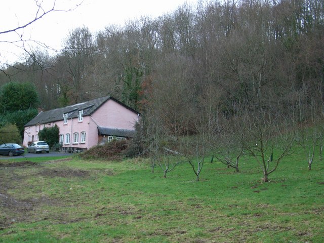
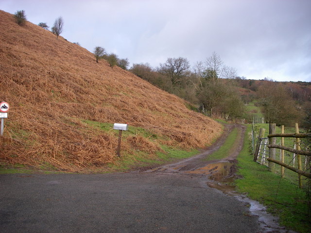
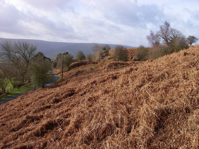
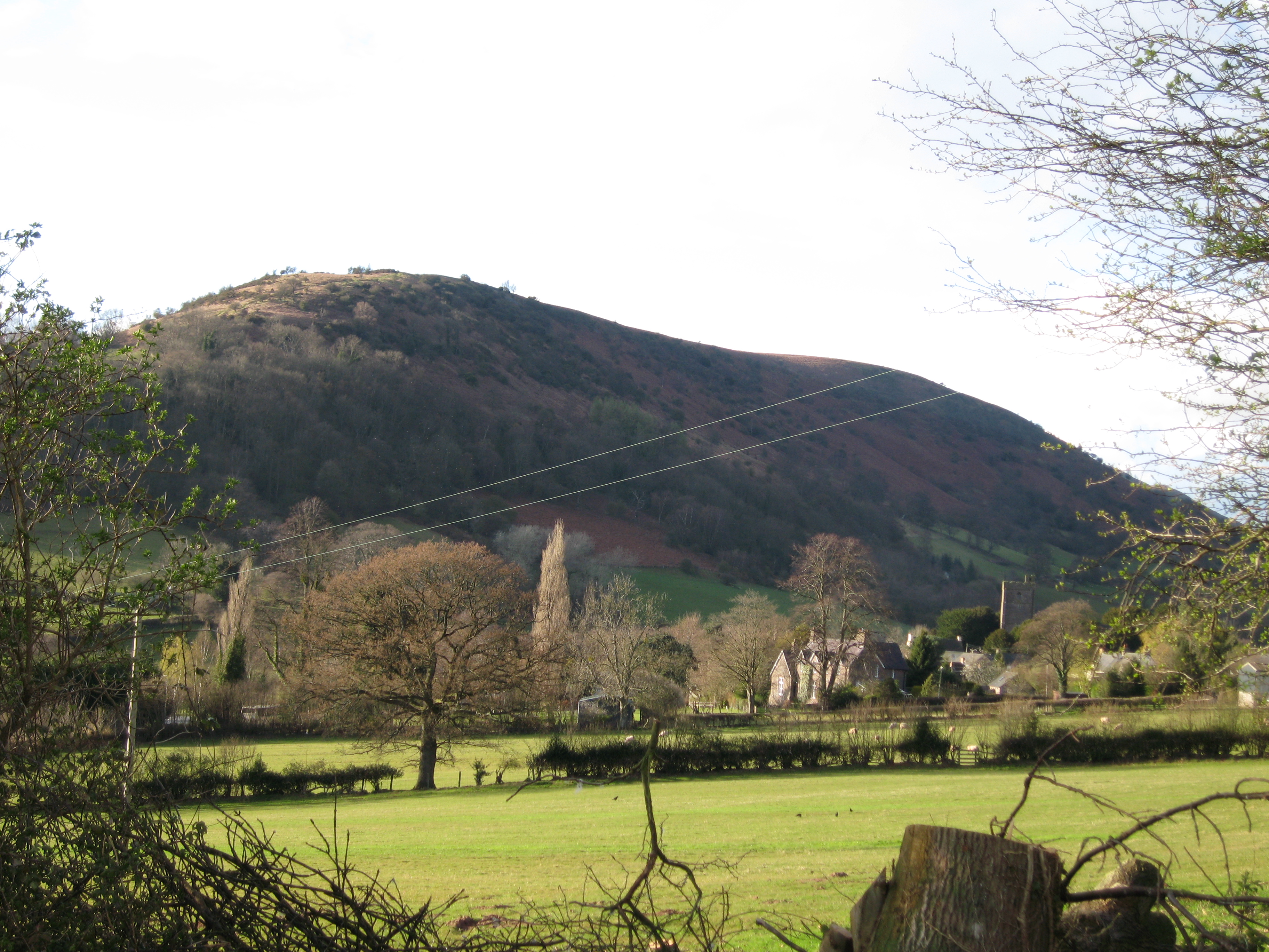
Gaer is a small village located in the historic county of Brecknockshire, now part of Powys, Wales. Situated on the eastern bank of the River Usk, Gaer enjoys a picturesque setting amidst rolling hills and lush greenery. It lies approximately 3 miles north of the town of Brecon, the county's administrative center.

The village is known for its rich history, dating back to Roman times. The name "Gaer" itself is derived from the Welsh word for fortress, reflecting the presence of a Roman fort in the area. This fort, known as Y Gaer, was a strategic stronghold guarding the Roman road that connected the forts at Brecon and Abergavenny. Today, the ruins of Y Gaer are a popular tourist attraction, offering visitors a glimpse into the area's past.

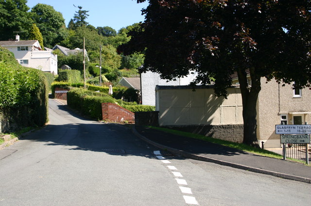
Gaer is primarily a residential village, with a close-knit community that values its rural charm and tranquility. It offers a range of amenities, including a village hall, a primary school, and a local pub. The surrounding countryside provides ample opportunities for outdoor activities such as hiking, fishing, and birdwatching.

Despite its small size, Gaer is well-connected to the wider region. The A40 road, which runs through the nearby town of Brecon, provides convenient access to major cities like Cardiff and Swansea. The village also benefits from regular bus services, ensuring easy transportation for residents and visitors alike.

In summary, Gaer is a historic and picturesque village nestled in the Brecknockshire countryside. With its Roman ruins, natural beauty, and strong sense of community, it offers a charming retreat for those seeking a slower pace of life.

If you have any feedback on the listing, please let us know in the comments section below.
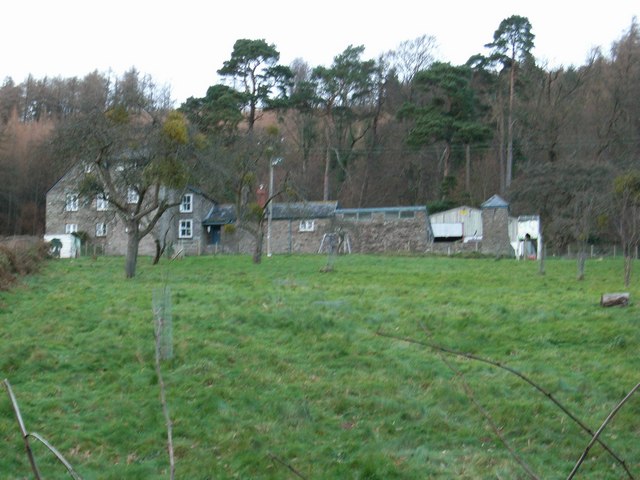
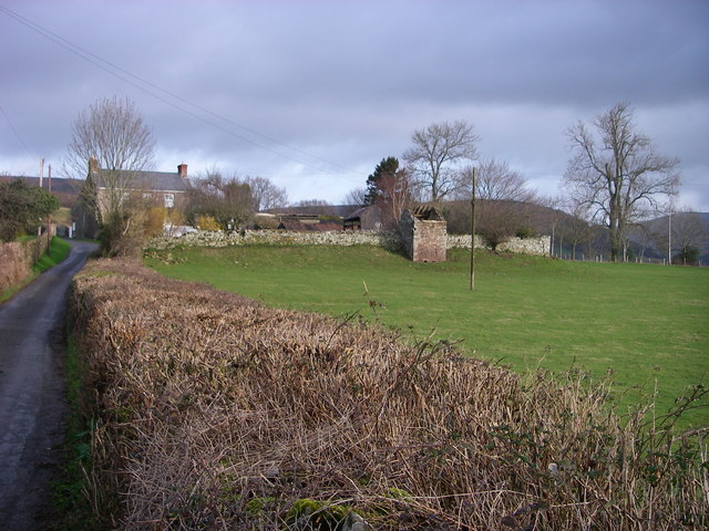
Gaer Images

Images are sourced within 2km of 51.887962/-3.2080447 or Grid Reference SO1621. Thanks to Geograph Open Source API. All images are credited.

Tretower Castle Tretower Castle is now mainly in ruins and parts of it have been incorporated into an adjacent farm. The castle was first established by a Norman knight of the Picard family. Now under the care of Cadw.
Tretower Castle
Tretower Castle is now mainly in ruins and parts of it have been incorporated into an adjacent farm. The castle was first established by a Norman knight of the Picard family. Now under the care of Cadw.
Tretower Court A 15th century manor house, rebuilt close to Tretower Castle by Sir Roger Vaughan. A manor house has occupied this site since the 14th century. Under the care of Cadw. This is the view of the west side of the manor house.
Tretower Court
A 15th century manor house, rebuilt close to Tretower Castle by Sir Roger Vaughan. A manor house has occupied this site since the 14th century. Under the care of Cadw. This is the view of the west side of the manor house.
The Kestrel Inn With Pen Cerrig-calch in the background.
The Kestrel Inn
With Pen Cerrig-calch in the background.
A40 by Llwyfen Farm With the sunlight highlighting the slopes of Pen Allt-mawr.
A40 by Llwyfen Farm
With the sunlight highlighting the slopes of Pen Allt-mawr.
Orchard Cottages
Orchard Cottages
Pen-y-gaer Roman Fort Sitting on the Roman Road between Gobannium (Abergavenny/Y Fenni) and Cicucium (west of Brecon/Aberhonddu) this ancient monument site is now occupied by a farmstead.  The southern edge of the former fortress is followed by the modern boundary wall atop a low bank.  It also extends to the west (left) over the minor road.
Pen-y-gaer Roman Fort
Sitting on the Roman Road between Gobannium (Abergavenny/Y Fenni) and Cicucium (west of Brecon/Aberhonddu) this ancient monument site is now occupied by a farmstead. The southern edge of the former fortress is followed by the modern boundary wall atop a low bank. It also extends to the west (left) over the minor road.
Bridleway to Cefn Moel This public right of way runs between bracken banks across slabby Old Red Sandstone bedrock ('Senni Beds' for the initiated) to join the Beacons Way running north from Bwlch.
Bridleway to Cefn Moel
This public right of way runs between bracken banks across slabby Old Red Sandstone bedrock ('Senni Beds' for the initiated) to join the Beacons Way running north from Bwlch.
Track at Penlan This track leaves the gated minor road between Bwlch and Felindre/Cwmdu at a hairpin above the farmstead of Penlan.  The status of the track is unclear although the bracken-covered hillside to its left (west) is depicted as access land by OS.  Walkers can gain access to Cefn Moel from here though as the sign suggests, motorcyclists are bidden not to do so.
Track at Penlan
This track leaves the gated minor road between Bwlch and Felindre/Cwmdu at a hairpin above the farmstead of Penlan. The status of the track is unclear although the bracken-covered hillside to its left (west) is depicted as access land by OS. Walkers can gain access to Cefn Moel from here though as the sign suggests, motorcyclists are bidden not to do so.
Quarries at Tremynfa, Bwlch The east facing slopes of the hillside north of Bwlch hide a number of small outcrops of the Devonian age 'Senni Beds' or Old Red Sandstone which has been quarried in several places in the past for building stone.  Bracken has now claimed these slopes, designated as open country so access is available.
Quarries at Tremynfa, Bwlch
The east facing slopes of the hillside north of Bwlch hide a number of small outcrops of the Devonian age 'Senni Beds' or Old Red Sandstone which has been quarried in several places in the past for building stone. Bracken has now claimed these slopes, designated as open country so access is available.
Quarried Senni Beds sandstone at Tremynfa This close-up shot taken in the disused and overgrown quarries in the hillside north of the village of Bwlch reveals the rich colour of this stone which is widely used for building locally.
Quarried Senni Beds sandstone at Tremynfa
This close-up shot taken in the disused and overgrown quarries in the hillside north of the village of Bwlch reveals the rich colour of this stone which is widely used for building locally.
Glasfryn terrace Bwlch Glasfryn terrace Bwlch just off the A40.
Glasfryn terrace Bwlch
Glasfryn terrace Bwlch just off the A40.
Tretower Court
Tretower Court
Tretower
Tretower
Tretower
Tretower
Tretower
Tretower
Tretower Court
Tretower Court
Felindre: pastureland, with Pen Allt-mawr in the background
Show me another place!

Gaer is located at Grid Ref: SO1621 (Lat: 51.887962, Lng: -3.2080447)

Unitary Authority: Powys

Police Authority: Dyfed Powys

What 3 Words

///distract.jots.fresh. Near Llangynidr, Powys

Nearby Locations

Gaer Pen-y-gaer

Related Wikis

Myarth

Myarth is a hill in the Usk Valley in the county of Powys in South Wales, about 2 miles west of Crickhowell. Its summit at 292 metres (958 ft) is covered...
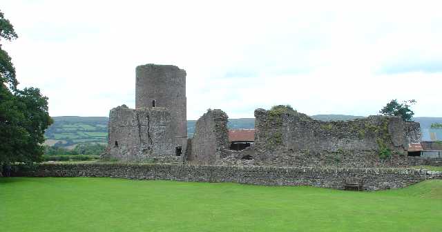
Tretower Castle

Tretower Castle (Welsh: Castell Tretŵr) is a Grade I-listed ruined castle in the village of Tretower in the county of Powys, Wales. It was built around...
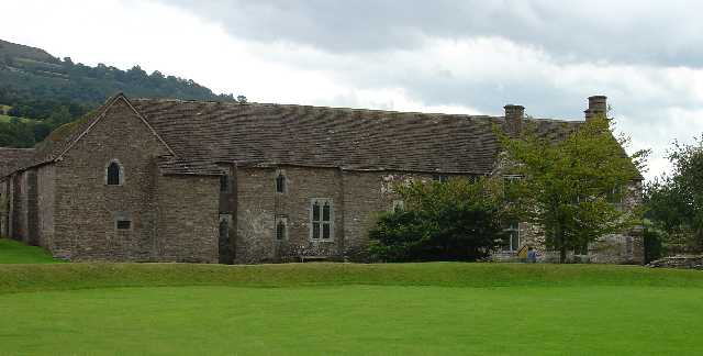
Tretower Court

Tretower Court (Welsh: Llys Tre-tŵr) is a medieval fortified manor house in Wales, situated in the village of Tretower, near Crickhowell in modern-day...

Tretower

Tretower (Welsh: Tretŵr) is a hamlet in the community of Cwmdu and District, in the southern part of the county of Powys in Wales. It lies on the A479...

Llygadwy

Llygadwy is a locality near the village of Bwlch in the county of Powys in southeast Wales. The usual meaning of llygad in Welsh is 'eye' but it can signify...

Bwlch

Bwlch (meaning a pass in Welsh) is a small village and an electoral ward in the community of Cwmdu and District, Powys, south Wales. The settlement is...

Cwmdu, Powys

Cwmdu or Llanfihangel Cwmdu is a small village in the community of Cwmdu and District, situated in the heart of the Black Mountains in Powys, Wales. Its...
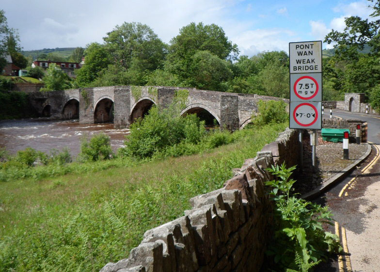
Llangynidr Bridge

Llangynidr Bridge, also known as "Coed-yr-Ynys Bridge", is an early 18th-century bridge that crosses the River Usk to the north of Llangynidr, Powys, Wales...

Nearby Amenities

Located within 500m of 51.887962,-3.2080447
Pub
The Kestrel Inn
Wikidata: Q80584178
Lat/Long: 51.8857614/-3.2066265
Natural: spring
Lat/Long: 51.8904612/-3.2127849
Pen-y-gaer Roman Camp
Historic: archaeological_site
Lat/Long: 51.8901872/-3.2096832
Ford: yes
Lat/Long: 51.8889076/-3.2051379
Direction: SSE
Generator Method: photovoltaic
Generator Output Electricity: yes
Generator Solar Modules: 12
Generator Source: solar
Generator Type: solar_photovoltaic_panel
Location: roof
Power: generator
Lat/Long: 51.8884606/-3.2045357
Direction: S
Generator Method: photovoltaic
Generator Output Electricity: yes
Generator Solar Modules: 13
Generator Source: solar
Generator Type: solar_photovoltaic_panel
Location: roof
Power: generator
Lat/Long: 51.8855602/-3.2066895
Direction: S
Generator Method: photovoltaic
Generator Output Electricity: yes
Generator Solar Modules: 10
Generator Source: solar
Generator Type: solar_photovoltaic_panel
Location: roof
Power: generator
Lat/Long: 51.8855908/-3.2067338
Direction: S
Generator Method: photovoltaic
Generator Output Electricity: yes
Generator Solar Modules: 3
Generator Source: solar
Generator Type: solar_photovoltaic_panel
Location: roof
Power: generator
Lat/Long: 51.885566/-3.2068062
Direction: S
Generator Method: photovoltaic
Generator Output Electricity: yes
Generator Solar Modules: 9
Generator Source: solar
Generator Type: solar_photovoltaic_panel
Location: roof
Power: generator
Lat/Long: 51.8855776/-3.2068639
Ford: yes
Lat/Long: 51.8884536/-3.2083687
The data included in this document is from www.openstreetmap.org. The data is made available under ODbL.

Have you been to Gaer?

Leave your review of Gaer below (or comments, questions and feedback).