Gabber

Settlement in Devon South Hams

England

Gabber

Beacon near the South West Coast Path between Bovisand and Heybrook Bay The Plymouth Breakwater can just be made out in the background to the left.
Beacon near the South West Coast Path between Bovisand and Heybrook Bay Credit: Ruth Sharville

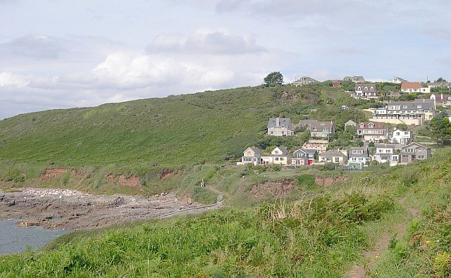
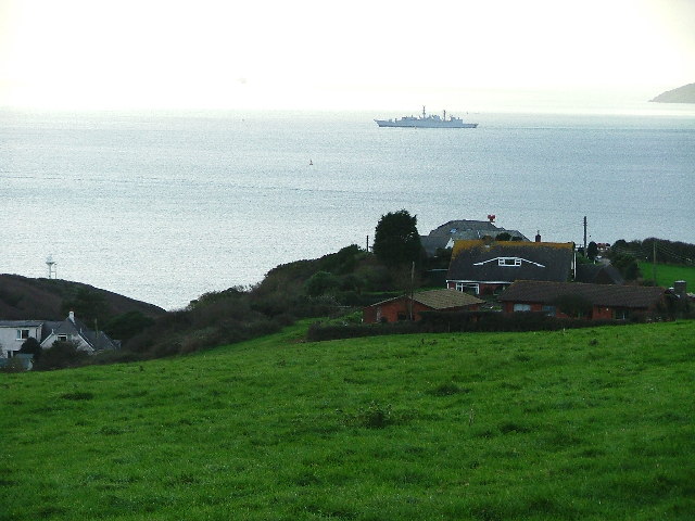
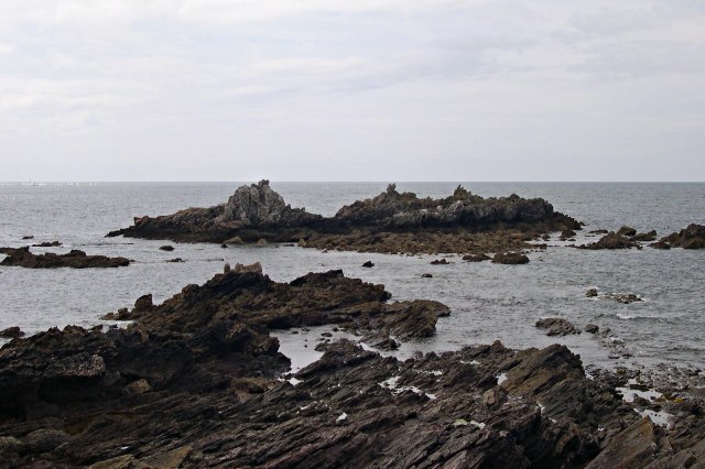
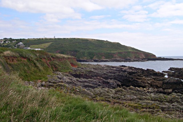
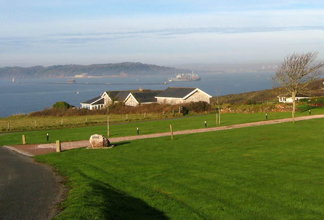
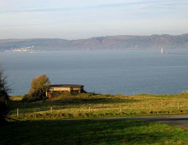
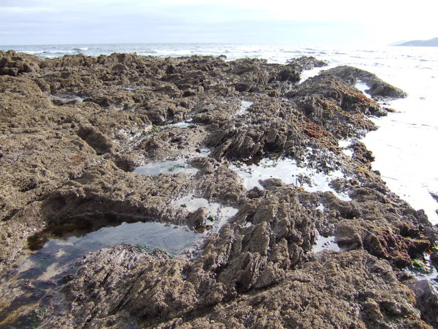
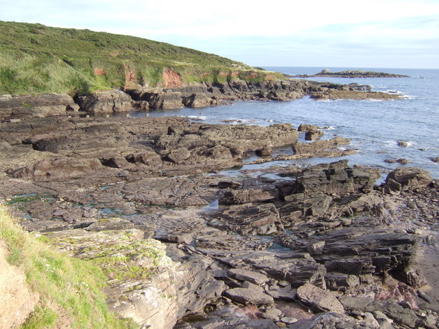
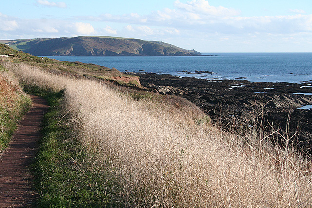
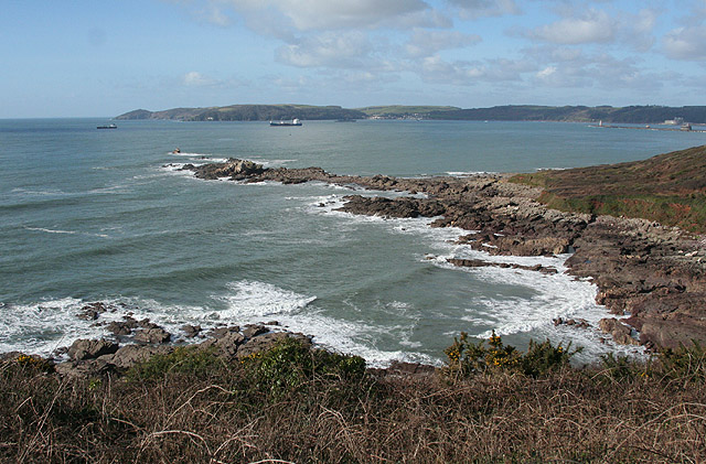
Gabber is a small village located in Devon, a county in southwestern England. Situated on the southern coast, Gabber is part of the South Hams district and is nestled between the towns of Salcombe and Kingsbridge. With its picturesque setting, the village offers breathtaking views of the English Channel and enjoys a mild maritime climate.

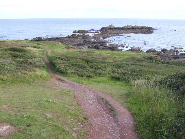
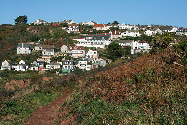
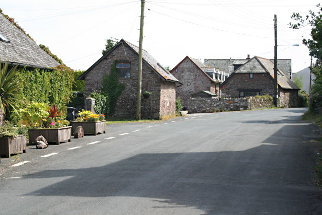
Gabber is known for its tranquil and idyllic atmosphere, making it a popular destination for tourists seeking a peaceful retreat. The village is characterized by charming thatched-roof cottages, narrow lanes, and beautiful gardens. It retains much of its traditional Devonshire charm and has managed to preserve its rural character.

Despite its small size, Gabber boasts a rich history. The area has evidence of human habitation dating back to the Bronze Age, and the village itself has roots dating back to the Domesday Book of 1086. Throughout the centuries, Gabber has been primarily involved in agriculture, with farming being a significant part of the local economy.

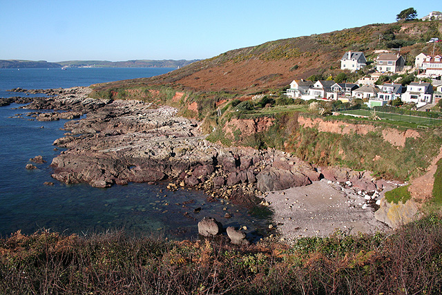
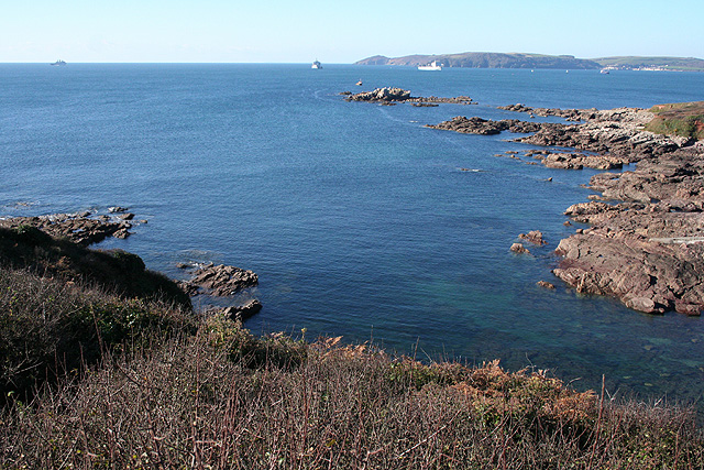
The village offers a range of amenities to cater to both residents and visitors. It has a village hall that serves as a hub for community events and gatherings, a local pub offering traditional English fare, and a small convenience store for daily essentials. Gabber is also within close proximity to various attractions, including stunning beaches, coastal walks, and the nearby Salcombe Estuary, which is popular for boating and water sports.

All in all, Gabber, Devon, offers a serene and picturesque retreat, providing visitors with an opportunity to experience the natural beauty and rich history of the region.

If you have any feedback on the listing, please let us know in the comments section below.
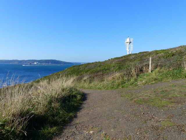
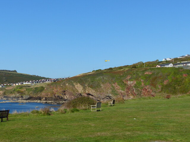
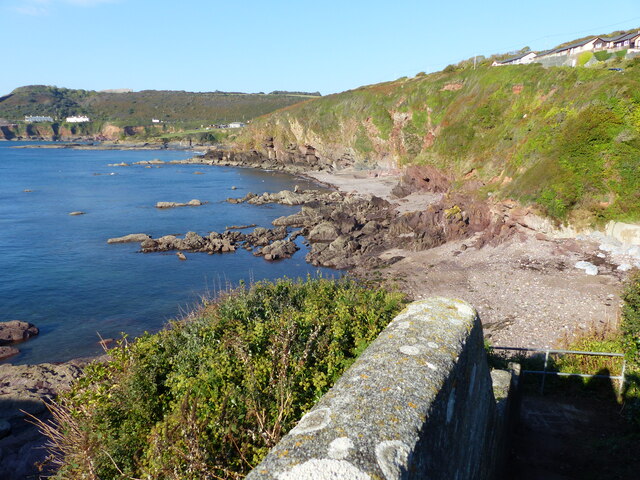
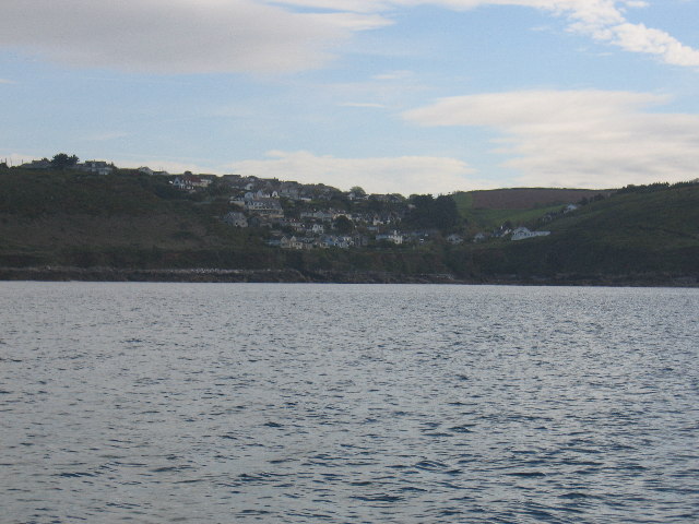
Gabber Images

Images are sourced within 2km of 50.329062/-4.099759 or Grid Reference SX5049. Thanks to Geograph Open Source API. All images are credited.

Beacon near the South West Coast Path between Bovisand and Heybrook Bay The Plymouth Breakwater can just be made out in the background to the left.
Beacon near the South West Coast Path between Bovisand and Heybrook Bay
The Plymouth Breakwater can just be made out in the background to the left.
Grassy area - and occasional car park - Bovisand Bay You can just make out the yellow helicopter in the centre of the photo.  It belongs to the Electricity board - see <a href="https://www.geograph.org.uk/photo/7118177">SX4950 : Zoom shot of Electricity Board helicopter over chalets at Bovisand</a>.
Grassy area - and occasional car park - Bovisand Bay
You can just make out the yellow helicopter in the centre of the photo. It belongs to the Electricity board - see SX4950 : Zoom shot of Electricity Board helicopter over chalets at Bovisand.
Crownhill  Bay, Bovisand - south end, from the access steps
Crownhill Bay, Bovisand - south end, from the access steps
Heybrook Bay The settlement at Heybrook Bay, adjacent to Wembury Point
Heybrook Bay
The settlement at Heybrook Bay, adjacent to Wembury Point
Heybrook Bay This is not a tourist spot.  There is no beach, just rocks and a warning sign in the village advises you not to eat any shellfish you might find.
Heybrook Bay
This is not a tourist spot. There is no beach, just rocks and a warning sign in the village advises you not to eat any shellfish you might find.
Manor Bourne, Andurn Brake Looking down on  Manor Bourne and over Andurn Brake from the arable fields that descend from Down Thomas to the coast. This image showing a Royal Navy frigate shortly after its sailing out from Plymouth Sound.
Manor Bourne, Andurn Brake
Looking down on Manor Bourne and over Andurn Brake from the arable fields that descend from Down Thomas to the coast. This image showing a Royal Navy frigate shortly after its sailing out from Plymouth Sound.
Renney Rocks This is a rocky promontory on the western side of Heybrook Bay seen at mid-tide.  At low tide a wide area of rocks are exposed, at high tide just a few limestone crags.
Renney Rocks
This is a rocky promontory on the western side of Heybrook Bay seen at mid-tide. At low tide a wide area of rocks are exposed, at high tide just a few limestone crags.
Across Heybrook Bay The wave-cut platform in the foreground is a raised beach which stands roughly at the current high tide mark. Behind it the low cliffs are made of glacial "head", an unconsolidated deposit formed in periglacial times.
Across Heybrook Bay
The wave-cut platform in the foreground is a raised beach which stands roughly at the current high tide mark. Behind it the low cliffs are made of glacial "head", an unconsolidated deposit formed in periglacial times.
Renney Road looking towards Plymouth Breakwater This is the site of Fort Renney which was a Gunnery Battery protecting Plymouth Sound.
Renney Road looking towards Plymouth Breakwater
This is the site of Fort Renney which was a Gunnery Battery protecting Plymouth Sound.
Old Fort Renney looking towards Cawsand The building in the foreground is part of the old gunnery battery which overlooks Heybrook Bay.
Old Fort Renney looking towards Cawsand
The building in the foreground is part of the old gunnery battery which overlooks Heybrook Bay.
Andurn Point At a fairly low tide the rocks stretch out like a fist into the approaches to Plymouth Sound. Rame Head is just visible in the west.
Andurn Point
At a fairly low tide the rocks stretch out like a fist into the approaches to Plymouth Sound. Rame Head is just visible in the west.
View south across Westlake Bay Renney Rocks are sticking out beyond the point at the southern end of this small bay.
View south across Westlake Bay
Renney Rocks are sticking out beyond the point at the southern end of this small bay.
Renney Rocks Viewed from the South West Coastal Path LDF. This is at low tide, the rocks becoming an island at mean high tide.
Renney Rocks
Viewed from the South West Coastal Path LDF. This is at low tide, the rocks becoming an island at mean high tide.
Wembury: approaching Heybrook Bay On the South West Coast Path. The large building, centre, with the terrace, dark roof and car park up on the left, is the Eddystone Inn, with two restaurants and a bar providing good views out to sea
Wembury: approaching Heybrook Bay
On the South West Coast Path. The large building, centre, with the terrace, dark roof and car park up on the left, is the Eddystone Inn, with two restaurants and a bar providing good views out to sea
Wembury: coast at Heybrook Bay Looking towards Cawsand Bay with the neighbouring Cornish villages of Cawsand and Kingsand across the water, in the distance
Wembury: coast at Heybrook Bay
Looking towards Cawsand Bay with the neighbouring Cornish villages of Cawsand and Kingsand across the water, in the distance
Wembury: towards Rame Head A coastal view with three Royal Navy vessels visible: the amphibious assault ship HMS Albion in the Channel, left, and two Royal Fleet Auxiliary Bay Class landing vessels closer inshore. Rame Head is in Cornwall and is crowned with a small chapel. In the distance, on the right, are the neighbouring villages of Cawsand and Kingsand
Wembury: towards Rame Head
A coastal view with three Royal Navy vessels visible: the amphibious assault ship HMS Albion in the Channel, left, and two Royal Fleet Auxiliary Bay Class landing vessels closer inshore. Rame Head is in Cornwall and is crowned with a small chapel. In the distance, on the right, are the neighbouring villages of Cawsand and Kingsand
Wembury: towards Wembury Bay On the South West Coast Path looking towards the land mass on the far side of the mouth of the river Yealm including Mouthstone Point, Noss Mayo
Wembury: towards Wembury Bay
On the South West Coast Path looking towards the land mass on the far side of the mouth of the river Yealm including Mouthstone Point, Noss Mayo
Wembury: towards Plymouth Sound With Rame Head, in Cornwall, ahead and Plymouth Breakwater right. Seen from a new upper path on recently-acquired National Trust Land, near Heybrook Bay and in the vicinity of the now demolished HMS Cambridge, a land-based naval installation. It was a training school for gunners, closed in March 2001
Wembury: towards Plymouth Sound
With Rame Head, in Cornwall, ahead and Plymouth Breakwater right. Seen from a new upper path on recently-acquired National Trust Land, near Heybrook Bay and in the vicinity of the now demolished HMS Cambridge, a land-based naval installation. It was a training school for gunners, closed in March 2001
Show me another place!

Gabber is located at Grid Ref: SX5049 (Lat: 50.329062, Lng: -4.099759)

Administrative County: Devon

District: South Hams

Police Authority: Devon and Cornwall

What 3 Words

///pranced.finest.taps. Near Wembury, Devon

Related Wikis

Down Thomas

Down Thomas is a village in Devon, England. The village is situated about 4 miles south of Plymouth. It is on the Wembury peninsula and is surrounded by...

Langdon Court, Devon

Langdon Court is a former manor house, in Wembury, South Devon, England. It consists of a single courtyard mansion from 1693 and a walled formal garden...

HMS Cambridge (shore establishment)

HMS Cambridge was a Royal Navy shore establishment south of Plymouth UK, commissioned between 1956 and 2001. Formerly named HM Gunnery School, Devonport...

Watch House Battery

Watch House Battery is a former 19th-century gun battery, built as one of a number of batteries to defend the Eastern approaches to Plymouth Sound, for...

Lentney Battery

Lentney Battery is a former 20th-century gun battery, built in 1905 as one of three 6-inch gun batteries to defend the Eastern approaches to Plymouth Sound...

Brownhill Battery

Brownhill Battery is a former gun battery at Staddon Heights, Plymouth, Devon. It was one of a number of Plymouth fortifications to be recommended by the...

Wembury

Wembury is a village on the south coast of Devon, England, very close to Plymouth Sound. Wembury is located south of Plymouth. Wembury is also the name...

Frobisher Battery

Frobisher Battery is a former gun battery at Staddon Heights, Plymouth, Devon. The original battery at the site, Twelve Acre Brake Battery, was completed...

Nearby Amenities

Located within 500m of 50.329062,-4.099759
Down Thomas
Place: village
Lat/Long: 50.3304854/-4.1038419
Gabber
Is In: Devon, England, UK
Place: hamlet
Source: OS OpenData StreetView
Lat/Long: 50.3290505/-4.0979
Direction: 175
Generator Method: photovoltaic
Generator Output Electricity: yes
Generator Solar Modules: 16
Generator Source: solar
Generator Type: solar_photovoltaic_panel
Location: roof
Power: generator
Lat/Long: 50.3310302/-4.1028785
Direction: SSE
Generator Method: photovoltaic
Generator Output Electricity: yes
Generator Solar Modules: 2
Generator Source: solar
Generator Type: solar_photovoltaic_panel
Location: roof
Power: generator
Lat/Long: 50.3309835/-4.1042288
Direction: WSW
Generator Method: photovoltaic
Generator Output Electricity: yes
Generator Solar Modules: 6
Generator Source: solar
Generator Type: solar_photovoltaic_panel
Location: roof
Power: generator
Lat/Long: 50.3314068/-4.1045729
Direction: 170
Generator Method: photovoltaic
Generator Output Electricity: yes
Generator Solar Modules: 16
Generator Source: solar
Generator Type: solar_photovoltaic_panel
Location: roof
Power: generator
Lat/Long: 50.3308448/-4.1028995
Direction: 185
Generator Method: photovoltaic
Generator Output Electricity: yes
Generator Solar Modules: 16
Generator Source: solar
Generator Type: solar_photovoltaic_panel
Location: roof
Power: generator
Lat/Long: 50.3291754/-4.1026567
Direction: ENE
Generator Method: photovoltaic
Generator Output Electricity: yes
Generator Solar Modules: 6
Generator Source: solar
Generator Type: solar_photovoltaic_panel
Location: roof
Power: generator
Lat/Long: 50.3314172/-4.1045408
Direction: SSE
Generator Method: photovoltaic
Generator Output Electricity: yes
Generator Solar Modules: 3
Generator Source: solar
Generator Type: solar_photovoltaic_panel
Location: roof
Power: generator
Lat/Long: 50.3309484/-4.1043411
Direction: WSW
Generator Method: photovoltaic
Generator Output Electricity: yes
Generator Solar Modules: 5
Generator Source: solar
Generator Type: solar_photovoltaic_panel
Location: roof
Power: generator
Lat/Long: 50.3309412/-4.1042876
Barrier: stile
Lat/Long: 50.3292098/-4.1008636
Bus Stop
Naptan AtcoCode: 1100PLB11924
Naptan NaptanCode: dvnajgta
Shelter: yes
Survey Date: 2021-12-11
Lat/Long: 50.3314013/-4.1035761
Waste Basket
Survey Date: 2021-12-11
Lat/Long: 50.3314629/-4.1036416
Telephone
Booth: K6
Covered: booth
Fixme: telephone removed, box remains
Man Made: telephone_box
Survey Date: 2022-04-20
Lat/Long: 50.3315002/-4.1038112
Defibrillator
Emergency: defibrillator
Indoor: no
Lat/Long: 50.3310399/-4.1031828
Post Office
Down Thomas Post Office
Addr Country: GB
Addr Postcode: PL9 0AN
Brand: Post Office
Brand Wikidata: Q1783168
Brand Wikipedia: en:Post Office Ltd
Contact Website: https://www.postoffice.co.uk/branch-finder/4024710/down-thomas
Ref Pol Id: 135435
Lat/Long: 50.3311109/-4.1031934
Information: board
Tourism: information
Lat/Long: 50.3310724/-4.1032001
Leisure: playground
Lat/Long: 50.3285986/-4.1024944
Post Box
Brand: Royal Mail
Brand Wikidata: Q638098
Brand Wikipedia: en:Royal Mail
Collection Times: Mo-Fr 16:15; Sa 09:45; Su off
Drive Through: no
Operator: Royal Mail
Operator Wikidata: Q638098
Post Box Design: type_b
Post Box Mounting: stone_wall
Post Box Type: wall
Ref: PL9 472
Royal Cypher: EIIR
Royal Cypher Wikidata: Q33102113
Source: survey;streetlevel imagery;aerial imagery
Lat/Long: 50.3315104/-4.1037928
Fire Hydrant
Emergency: fire_hydrant
Fire Hydrant Diameter Signed: no
Fire Hydrant Position: lane
Fire Hydrant Type: underground
Survey Date: 2022-04-20
Lat/Long: 50.3316947/-4.1036678
Bench
Backrest: yes
Survey Date: 2022-04-20
Lat/Long: 50.331532/-4.1037636
Grit Bin
Survey Date: 2022-04-20
Lat/Long: 50.3314549/-4.104549
Fire Hydrant
Emergency: fire_hydrant
Fire Hydrant Diameter: 4"
Fire Hydrant Position: lane
Fire Hydrant Type: underground
Survey Date: 2024-01-21
Lat/Long: 50.3291157/-4.1030106
Fire Hydrant
Emergency: fire_hydrant
Fire Hydrant Position: lane
Fire Hydrant Type: underground
Survey Date: 2024-01-21
Lat/Long: 50.3288973/-4.0994209
The data included in this document is from www.openstreetmap.org. The data is made available under ODbL.

Have you been to Gabber?

Leave your review of Gabber below (or comments, questions and feedback).