Fourlane Ends

Settlement in Derbyshire

England

Fourlane Ends

parkrun: it's good to be back parkrun returned to England on 24th July, 2021 after a gap of 16 months during the Covid-19 restrictions but the return was delayed until 31st July at Millhouses Park because of another event there the previous week. 

207 runners, joggers and walkers are here setting off on the first of three laps on this 5k route at Millhouses Park.
parkrun: it's good to be back Credit: Graham Hogg

Fourlane Ends is a small village located in the county of Derbyshire, England. Situated in the Amber Valley district, it lies approximately 11 miles northeast of the city of Derby. The village is surrounded by picturesque countryside and is known for its scenic beauty.

Fourlane Ends is a rural community with a population of around 500 people. The village is characterized by its charming cottages and traditional architecture, which give it a quintessential English countryside feel. The village is well-connected to nearby towns and cities through a network of roads, making it easily accessible.

In terms of amenities, Fourlane Ends offers a range of facilities to cater to the needs of its residents. These include a local pub, a village hall, and a primary school. The village hall serves as a community center and hosts various events and activities throughout the year, fostering a strong sense of community spirit.

Nature enthusiasts are drawn to Fourlane Ends due to its proximity to the Peak District National Park, which is renowned for its stunning landscapes and opportunities for outdoor recreation. The village is also surrounded by several walking and cycling trails, allowing residents and visitors to explore the beautiful countryside.

Overall, Fourlane Ends offers a tranquil and idyllic setting for those seeking a peaceful rural lifestyle. Its close-knit community, scenic surroundings, and convenient location make it an attractive place to live or visit in Derbyshire.

If you have any feedback on the listing, please let us know in the comments section below.

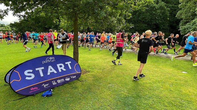
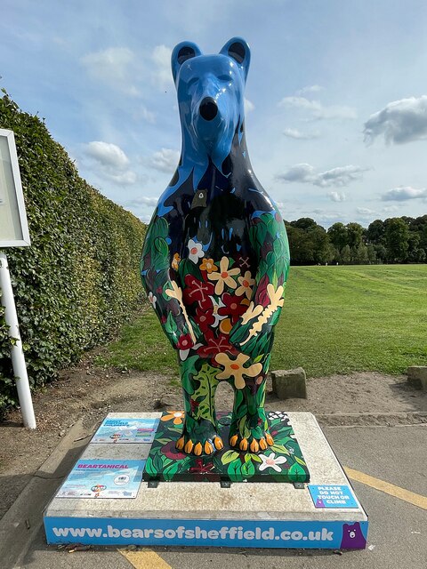
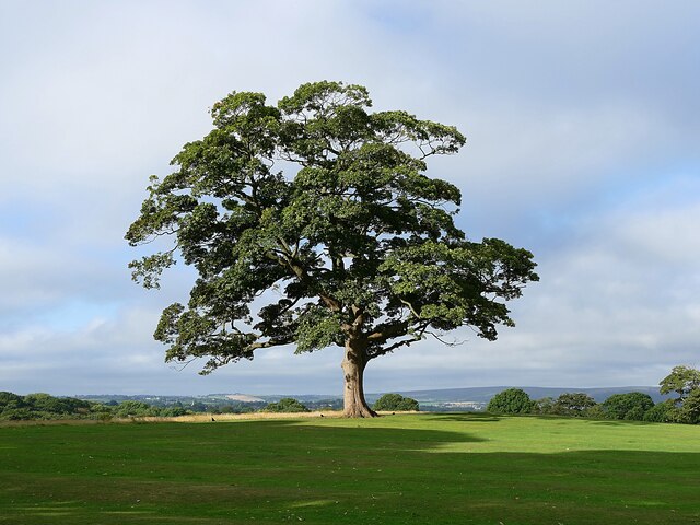
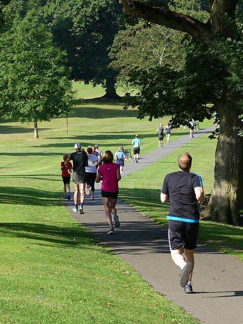
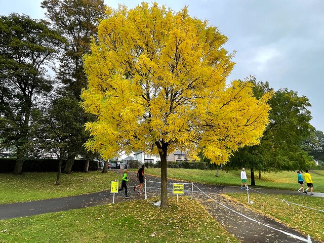
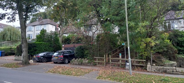
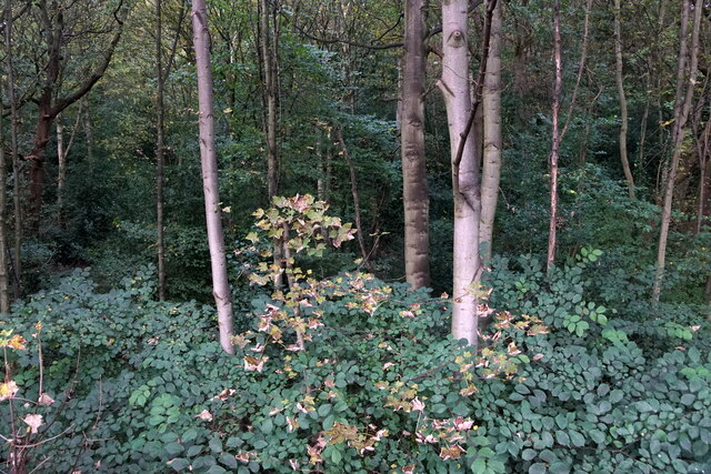
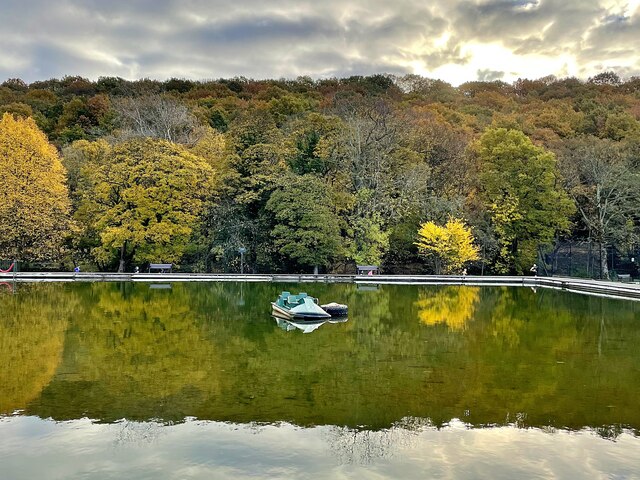
Fourlane Ends Images

Images are sourced within 2km of 53.348511/-1.4763799 or Grid Reference SK3483. Thanks to Geograph Open Source API. All images are credited.

parkrun: it's good to be back parkrun returned to England on 24th July, 2021 after a gap of 16 months during the Covid-19 restrictions but the return was delayed until 31st July at Millhouses Park because of another event there the previous week. 

207 runners, joggers and walkers are here setting off on the first of three laps on this 5k route at Millhouses Park.
parkrun: it's good to be back
parkrun returned to England on 24th July, 2021 after a gap of 16 months during the Covid-19 restrictions but the return was delayed until 31st July at Millhouses Park because of another event there the previous week. 207 runners, joggers and walkers are here setting off on the first of three laps on this 5k route at Millhouses Park.
Bears of Sheffield: #57 Beartanical #57 of 61 big bear sculptures, this one was decorated by Vanessa Scott and is located in Graves Park.

Beartantical was inspired by the artist's many adventures and relaxing days spent exploring the hills and woodland surrounding the city, and the afternoons she has spent gazing at the beautiful star shaped plants at the botanical gardens.
Bears of Sheffield: #57 Beartanical
#57 of 61 big bear sculptures, this one was decorated by Vanessa Scott and is located in Graves Park. Beartantical was inspired by the artist's many adventures and relaxing days spent exploring the hills and woodland surrounding the city, and the afternoons she has spent gazing at the beautiful star shaped plants at the botanical gardens.
Sycamore tree in Graves Park One of my favourite trees and I can't resist a photo when I pass by!
Sycamore tree in Graves Park
One of my favourite trees and I can't resist a photo when I pass by!
Graves parkrunners Participants in the 405th Graves parkrun on a downhill section which comes as something of a relief from the hills that precede it.
Graves parkrunners
Participants in the 405th Graves parkrun on a downhill section which comes as something of a relief from the hills that precede it.
Gleadless Road, looking towards Heeley, Sheffield View of Gleadless Road at the corner with Abney Road and looking west towards Heeley.
Gleadless Road, looking towards Heeley, Sheffield
View of Gleadless Road at the corner with Abney Road and looking west towards Heeley.
Autumn colour at Rosie's Corner On the course of Millhouses parkrun, the corner is named for the volunteer who is often stationed here to guide runners who on their third and final lap must turn sharp right to the finish line.
Autumn colour at Rosie's Corner
On the course of Millhouses parkrun, the corner is named for the volunteer who is often stationed here to guide runners who on their third and final lap must turn sharp right to the finish line.
Footpath off Bocking Lane, Beauchief, Sheffield
Chancet Wood, Beauchief, Sheffield
Archer Road, Sheffield
Hutcliffe Road, Sheffield
Brexit Bonus, Sainsbury's, Archer Road, Sheffield Sainsbury's are doing their best to make it look as though the shelves aren't empty, but crisps and other potato products have been especially badly hit by supply chain problems in 2021. Apparently, a lot of our crisps come from Ireland. Yes, really, we can't even get crisps from Ireland when we were promised that everything would be better after Brexit.
Brexit Bonus, Sainsbury's, Archer Road, Sheffield
Sainsbury's are doing their best to make it look as though the shelves aren't empty, but crisps and other potato products have been especially badly hit by supply chain problems in 2021. Apparently, a lot of our crisps come from Ireland. Yes, really, we can't even get crisps from Ireland when we were promised that everything would be better after Brexit.
Fox & flower mural by Faunagraphic This mural on the Meersbrook Park Pavilion by artist Sarah Yates (aka Faunagraphic) was financed through crowdfunding by the local community with matched funding from the City Council.
Fox & flower mural by Faunagraphic
This mural on the Meersbrook Park Pavilion by artist Sarah Yates (aka Faunagraphic) was financed through crowdfunding by the local community with matched funding from the City Council.
Autumn scene at the boating lake Most of the boats on the boating lake at Millhouses Park have been put into their winter storage
Autumn scene at the boating lake
Most of the boats on the boating lake at Millhouses Park have been put into their winter storage
Autumn scene at the boating lake Most of the boats on the boating lake at Millhouses Park have been put into their winter storage
Autumn scene at the boating lake
Most of the boats on the boating lake at Millhouses Park have been put into their winter storage
Lottie the Shire Horse At Graves Park Animal Farm, Sheffield.
Lottie the Shire Horse
At Graves Park Animal Farm, Sheffield.
Eye of a shire horse at Graves Park Animal Centre This is Lottie the Shire Horse's right eye. She is the biggest animal on the show farm which is popular with Sheffield families.
Eye of a shire horse at Graves Park Animal Centre
This is Lottie the Shire Horse's right eye. She is the biggest animal on the show farm which is popular with Sheffield families.
Christmas llama and sheep at Graves Park Animal Farm Graves Park is a large public park in southern Sheffield. It was given to the city by wealthy local businessman J.G.Graves in 1925.
Christmas llama and sheep at Graves Park Animal Farm
Graves Park is a large public park in southern Sheffield. It was given to the city by wealthy local businessman J.G.Graves in 1925.
Sycamore tree to the north of Graves Park With a distant view of The Peak District. The same tree was snapped by another Geograph member in August 2021: <a title="https://www.geograph.org.uk/photo/6949291" href="https://www.geograph.org.uk/photo/6949291">Link</a>
Sycamore tree to the north of Graves Park
With a distant view of The Peak District. The same tree was snapped by another Geograph member in August 2021: Link
Show me another place!

Fourlane Ends is located at Grid Ref: SK3483 (Lat: 53.348511, Lng: -1.4763799)

Unitary Authority: Sheffield

Police Authority: South Yorkshire

What 3 Words

///tuck.burn.dimes. Near Sheffield, South Yorkshire

Related Wikis

Norton Cemetery, Sheffield

Norton Cemetery is one of the city of Sheffield's many cemeteries. It was opened on 6 June 1869, and covers 6 acres (24,000 m2). Norton is a smaller cemetery...

St Peter, Greenhill

St Peter's Greenhill is a Parish Church in the Church of England Diocese of Sheffield located in the Greenhill area of the city.The church was built between...

St Paul's Church and Centre, Norton Lees, Sheffield

St Paul's Church and Centre is a Parish Church in the Church of England Diocese of Sheffield located at the junction of Norton Lees Lane and Angerford...

Chesterfield Road (Sheffield)

Chesterfield Road is a shopping street in Sheffield, England. It leads south from the suburb of Meersbrook to Woodseats, before becoming Meadowhead at...

Woodseats

Woodseats is a district of Sheffield, South Yorkshire in the Graves Park ward. Historically, Norton Woodseats (grid reference SK347833) was a village that...

Norton Lees

Norton Lees (grid reference SK353839) is a residential suburb in the Graves Park ward of the City of Sheffield, England located to the east of Woodseats...
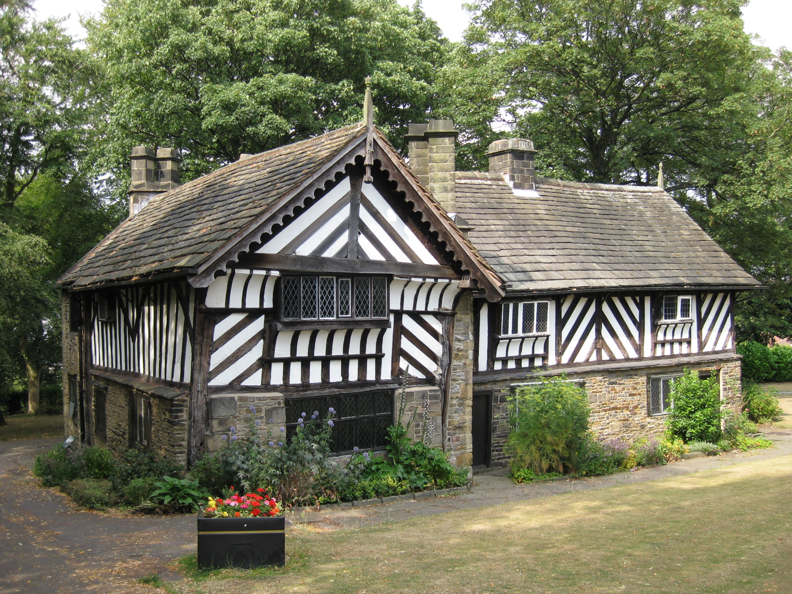
Bishops' House

Bishops' House is a half-timbered house in the Norton Lees district of the City of Sheffield, England. It was built c. 1500 and is located on the southern...

Meersbrook Park

Meersbrook Park is set on a steep hillside in Meersbrook, Sheffield, England, offering panoramic views over central Sheffield to the north. Within the...

Nearby Amenities

Located within 500m of 53.348511,-1.4763799
Norton Lees Road/Cliffefield Road
Bus: yes
Public Transport: stop_position
Lat/Long: 53.3514311/-1.4745526
Turning Circle
Lat/Long: 53.3457519/-1.4706055
Turning Circle
Lat/Long: 53.3489007/-1.4734569
Turning Circle
Source: Bing
Lat/Long: 53.348113/-1.4711801
Turning Circle
Source: Bing
Lat/Long: 53.3475005/-1.4704708
Key News & Stores
Addr City: Sheffield
Addr Country: GB
Addr Housenumber: 29
Addr Postcode: S8 9EH
Addr Street: Derbyshire Lane
Fhrs Id: 972513
Opening Hours: Mo-Sa 06:00-20:00, Su 06:00-12:00
Payment Cash: yes
Payment Credit Cards: yes
Payment Debit Cards: yes
Shop: convenience
Wheelchair: yes
Lat/Long: 53.3525192/-1.4786394
Post Box
Collection Times: Mo-Fr 09:00, Sa 07:00
Post Box Type: pillar
Ref: S8 178
Royal Cypher: EIIR
Royal Cypher Wikidata: Q33102113
Lat/Long: 53.3520452/-1.4785021
Norton Warminster Road
Man Made: pumping_station
Pumping Station: water
Lat/Long: 53.3487226/-1.4691831
Community Centre
Brindley Meeting Rooms
Lat/Long: 53.3479988/-1.4698507
The Wine Seller
Shop: convenience
Lat/Long: 53.3458849/-1.4726189
Pharmacy
Derbyshire Lane Pharmacy
Addr City: Sheffield
Addr Country: GB
Addr Housenumber: 144
Addr Postcode: S8 8SE
Addr Street: Derbyshire Lane
Fhrs Id: 1211623
Healthcare: pharmacy
Lat/Long: 53.3459301/-1.4727204
Post Box
Collection Times: Mo-Fr 09:00, Sa 07:00
Ref: S8 483
Royal Cypher: GR
Royal Cypher Wikidata: Q33102273
Lat/Long: 53.3485021/-1.4760982
Post Box
Collection Times: Mo-Fr 09:00, Sa 07:00
Ref: S8 341
Royal Cypher: EIIR
Royal Cypher Wikidata: Q33102113
Lat/Long: 53.3461301/-1.4793996
Crossing
Crossing: unmarked
Crossing Island: no
Crossing Markings: no
Kerb: flush
Tactile Paving: yes
Lat/Long: 53.3456965/-1.4784753
Turning Circle
Source: Bing
Lat/Long: 53.3456205/-1.4753313
Give Way
Lat/Long: 53.3461065/-1.4790313
Crossing
Button Operated: yes
Crossing: traffic_signals
Crossing Island: no
Crossing Ref: puffin
Kerb: lowered
Tactile Paving: yes
Traffic Signals Sound: yes
Traffic Signals Vibration: yes
Lat/Long: 53.344759/-1.4783526
Bus Stop
Scarsdale Road/Woodseats Road
Bench: no
Bin: no
Bus: yes
Lit: no
Naptan AtcoCode: 370021563
Naptan Bearing: N
Naptan CommonName: Scarsdale Road/Woodseats Road
Naptan Indicator: 21563
Naptan Landmark: 21563
Naptan PlusbusZoneRef: ROTHCEN
Naptan Street: Scarsdale Road
Naptan Verified: no
Public Transport: platform
Shelter: no
Source: naptan_import
Tactile Paving: no
Wheelchair: yes
Lat/Long: 53.3458989/-1.4796509
Bus Stop
Derbyshire Lane/Cemetery
Bench: no
Bin: no
Bus: yes
Lit: no
Naptan AtcoCode: 370022254
Naptan Bearing: NW
Naptan CommonName: Derbyshire Lane/Cemetery
Naptan Indicator: 22254
Naptan Landmark: CEMETERY
Naptan PlusbusZoneRef: ROTHCEN
Naptan Street: Derbyshire Lane
Naptan Verified: no
Public Transport: platform
Shelter: yes
Source: naptan_import
Tactile Paving: no
Lat/Long: 53.3461945/-1.4732783
Bus Stop
Derbyshire Lane/Cemetery
Bench: no
Bin: no
Bus: yes
Lit: no
Naptan AtcoCode: 370022255
Naptan Bearing: SE
Naptan CommonName: Derbyshire Lane/Cemetery
Naptan Indicator: 22255
Naptan Landmark: PRINCE OF WALES PUB
Naptan PlusbusZoneRef: ROTHCEN
Naptan Street: Derbyshire Lane
Naptan Verified: no
Public Transport: platform
Shelter: yes
Source: naptan_import
Tactile Paving: no
Lat/Long: 53.3460117/-1.4725745
Bus Stop
Norton Lees Lane/Angerford Avenue
Bench: no
Bin: no
Bus: yes
Lit: no
Naptan AtcoCode: 370022256
Naptan Bearing: N
Naptan CommonName: Norton Lees Lane/Angerford Avenue
Naptan Indicator: 22256
Naptan Landmark: ST PAULS CHURCH
Naptan PlusbusZoneRef: ROTHCEN
Naptan Street: Norton Lees Lane
Naptan Verified: no
Public Transport: platform
Shelter: no
Source: naptan_import
Tactile Paving: no
Lat/Long: 53.35006/-1.4733207
Bus Stop
Norton Lees Lane/Norton Lees Road
Alt Name: Norton Lees Lane/Norton Lees Road
Bench: no
Bin: no
Bus: yes
Lit: no
Naptan AltCommonName: Norton Lees Lane/Norton Lees Road
Naptan AtcoCode: 370022257
Naptan Bearing: NE
Naptan CommonName: Norton Lees Lane/Norton Lees Road
Naptan Indicator: 22257
Naptan Landmark: Uk Garage
Naptan PlusbusZoneRef: ROTHCEN
Naptan Street: Norton Lees Lane
Naptan Verified: no
Public Transport: platform
Shelter: no
Source: naptan_import
Tactile Paving: no
Lat/Long: 53.3507644/-1.4720201
Bus Stop
Norton Lees Lane/Warminster Road
Bench: no
Bin: no
Bus: yes
Lit: no
Naptan AtcoCode: 370022258
Naptan Bearing: SW
Naptan CommonName: Norton Lees Lane/Warminster Road
Naptan Indicator: 22258
Naptan Landmark: Road Junction
Naptan PlusbusZoneRef: ROTHCEN
Naptan Street: Norton Lees Lane
Naptan Verified: no
Public Transport: platform
Shelter: no
Source: naptan_import
Tactile Paving: no
Lat/Long: 53.3507806/-1.4716293
Bus Stop
Norton Lees Road/Cliffefield Road
Bench: yes
Bin: no
Bus: yes
Lit: no
Naptan AtcoCode: 370022259
Naptan Bearing: NW
Naptan CommonName: Norton Lees Road/Cliffe Field Road
Naptan Indicator: 22259
Naptan Landmark: PARISH HALL
Naptan PlusbusZoneRef: ROTHCEN
Naptan Street: Norton Lees Road
Naptan Verified: no
Public Transport: platform
Shelter: yes
Source: naptan_import
Tactile Paving: no
Lat/Long: 53.3515532/-1.4755859
Bus Stop
Norton Lees Road/Cliffefield Road
Bench: no
Bin: no
Bus: yes
Lit: no
Naptan AtcoCode: 370022260
Naptan Bearing: E
Naptan CommonName: Norton Lees Road/Cliffe Field Road
Naptan Indicator: 22260
Naptan Landmark: Open Area View
Naptan PlusbusZoneRef: ROTHCEN
Naptan Street: Norton Lees Road
Naptan Verified: no
Public Transport: platform
Shelter: no
Source: naptan_import
Tactile Paving: no
Lat/Long: 53.3514078/-1.4744011
Bus Stop
Norton Lees Road/Beverleys Road
Alt Name: Norton Lees Road/Beverleys Road
Bench: no
Bin: no
Bus: yes
Lit: no
Naptan AltCommonName: Norton Lees Road/Beverleys Road
Naptan AtcoCode: 370022261
Naptan Bearing: W
Naptan CommonName: Norton Lees Road/Beverleys Road
Naptan Indicator: 22261
Naptan Landmark: OPPOSITE ALLOTMENTS
Naptan PlusbusZoneRef: ROTHCEN
Naptan Street: Norton Lees Road
Naptan Verified: no
Public Transport: platform
Shelter: no
Source: naptan_import
Tactile Paving: no
Lat/Long: 53.3511114/-1.4732477
Bus Stop
Norton Lees Road/Norton Lees Lane
Alt Name: Norton Lees Road/Norton Lees Lane
Bench: no
Bin: yes
Bus: yes
Lit: no
Naptan AltCommonName: Norton Lees Road/Norton Lees Lane
Naptan AtcoCode: 370022262
Naptan Bearing: SE
Naptan CommonName: Norton Lees Road/Norton Lees Lane
Naptan Indicator: 22262
Naptan Landmark: Allotments
Naptan PlusbusZoneRef: ROTHCEN
Naptan Street: Norton Lees Road
Naptan Verified: no
Public Transport: platform
Shelter: no
Source: naptan_import
Tactile Paving: no
Lat/Long: 53.3512036/-1.4717442
Bus Stop
Warminster Road/Norton Lees Lane
Bench: no
Bin: no
Bus: yes
Lit: no
Naptan AtcoCode: 370022263
Naptan Bearing: N
Naptan CommonName: Warminster Road/Norton Lees Lane
Naptan Indicator: 22263
Naptan Landmark: Road Junction
Naptan PlusbusZoneRef: ROTHCEN
Naptan Street: Warminster Road
Naptan Verified: no
Public Transport: platform
Shelter: no
Source: naptan_import
Tactile Paving: no
Lat/Long: 53.3504634/-1.4710473
Bus Stop
Warminster Road/Warminster Close
Bench: no
Bin: no
Bus: yes
Lit: no
Naptan AtcoCode: 370022264
Naptan Bearing: SE
Naptan CommonName: Warminster Road/Warminster Close
Naptan Indicator: 22264
Naptan Landmark: Outside Electricity Sub Statio
Naptan PlusbusZoneRef: ROTHCEN
Naptan Street: Warminster Road
Naptan Verified: no
Public Transport: platform
Shelter: no
Source: naptan_import
Tactile Paving: no
Lat/Long: 53.3495496/-1.4697066
Bus Stop
Warminster Road/Holmwood Nursing Home
Alt Name: Warminster Road/Holmwood Nursing Home
Bench: yes
Bin: no
Bus: yes
Lit: yes
Naptan AltCommonName: Warminster Road/Holmwood Nursing Home
Naptan AtcoCode: 370022265
Naptan Bearing: NW
Naptan CommonName: Warminster Road/Holmwood Nursing Home
Naptan Indicator: 22265
Naptan Landmark: Holmwood Nursing Home/Recreati
Naptan PlusbusZoneRef: ROTHCEN
Naptan Street: Warminster Road
Naptan Verified: no
Public Transport: platform
Shelter: yes
Source: naptan_import
Tactile Paving: no
Lat/Long: 53.3494602/-1.4698129
Bus Stop
Norton Lees Road/Derbyshire Lane
Alt Name: Norton Lees Road/Derbyshire Lane
Bench: no
Bin: no
Bus: yes
Lit: no
Naptan AltCommonName: Norton Lees Road/Derbyshire Lane
Naptan AtcoCode: 370023821
Naptan Bearing: NW
Naptan CommonName: Norton Lees Road/Derbyshire Lane
Naptan Indicator: 23821
Naptan Landmark: 23821
Naptan PlusbusZoneRef: ROTHCEN
Naptan Street: Norton Lees Road
Naptan Verified: no
Public Transport: platform
Shelter: no
Source: naptan_import
Tactile Paving: no
Lat/Long: 53.3518699/-1.4781209
Bus Stop
Norton Lees Road/Cockayne Place
Bench: no
Bin: no
Bus: yes
Lit: no
Naptan AtcoCode: 370023822
Naptan Bearing: SE
Naptan CommonName: Norton Lees Road/Cockayne Place
Naptan Indicator: 23822
Naptan Landmark: 23822
Naptan PlusbusZoneRef: ROTHCEN
Naptan Street: Norton Lees Road
Naptan Verified: no
Public Transport: platform
Shelter: no
Source: naptan_import
Tactile Paving: no
Lat/Long: 53.3518578/-1.4773661
Bus Stop
Woodseats Road/Firbeck Road
Bench: no
Bin: no
Bus: yes
Lit: no
Naptan AtcoCode: 370026722
Naptan Bearing: SE
Naptan CommonName: Woodseats Road/Firbeck Road
Naptan Indicator: 26722
Naptan Landmark: OUTSIDE NO.237
Naptan PlusbusZoneRef: ROTHCEN
Naptan Street: Woodseats Road
Naptan Verified: no
Public Transport: platform
Shelter: no
Source: naptan_import
Tactile Paving: yes
Lat/Long: 53.3470775/-1.4819499
Bus Stop
Chesterfield Road/Smithy Wood Crescent
Alt Name: Chesterfield Road/Smithy Wood Crescent
Bench: yes
Bin: no
Bus: yes
Lit: yes
Naptan AltCommonName: Chesterfield Road/Smithy Wood Crescent
Naptan AtcoCode: 370021800
Naptan Bearing: N
Naptan CommonName: Chesterfield Road/Smithy Wood Crescent
Naptan Indicator: 21800
Naptan Landmark: Home Base
Naptan PlusbusZoneRef: ROTHCEN
Naptan Street: Chesterfield Road
Naptan Verified: no
Public Transport: platform
Shelter: yes
Source: naptan_import
Tactile Paving: yes
Lat/Long: 53.3502171/-1.481362
Bus Stop
Woodseats Road/Todwick Road
Bench: yes
Bus: yes
Naptan AtcoCode: 370021812
Naptan Bearing: NW
Naptan CommonName: Woodseats Road/Todwick Road
Naptan Indicator: 21812
Naptan Landmark: 21812
Naptan PlusbusZoneRef: ROTHCEN
Naptan Street: Woodseats Road
Naptan Verified: no
Public Transport: platform
Shelter: yes
Source: naptan_import
Tactile Paving: yes
Lat/Long: 53.3482917/-1.4829773
Bus Stop
Woodseats Road/Todwick Road
Bench: no
Bus: yes
Naptan AtcoCode: 370021813
Naptan Bearing: SE
Naptan CommonName: Woodseats Road/Todwick Road
Naptan Indicator: 21813
Naptan Landmark: 21813
Naptan PlusbusZoneRef: ROTHCEN
Naptan Street: Woodseats Road
Naptan Verified: no
Public Transport: platform
Shelter: no
Source: naptan_import
Tactile Paving: yes
Lat/Long: 53.3482096/-1.4827505
Bus Stop
Woodseats Road/Firbeck Road
Bench: no
Bin: no
Bus: yes
Lit: no
Naptan AtcoCode: 370021814
Naptan Bearing: NW
Naptan CommonName: Woodseats Road/Firbeck Road
Naptan Indicator: 21814
Naptan Landmark: 21814
Naptan PlusbusZoneRef: ROTHCEN
Naptan Street: Woodseats Road
Naptan Verified: no
Public Transport: platform
Shelter: no
Source: naptan_import
Tactile Paving: yes
Lat/Long: 53.3472096/-1.4822831
Bus Stop
Woodseats Road/Chesterfield Road
Bench: no
Bin: no
Bus: yes
Lit: no
Naptan AtcoCode: 370021816
Naptan Bearing: SE
Naptan CommonName: Woodseats Road/Chesterfield Road
Naptan Indicator: 21816
Naptan Landmark: Opposite No. 336
Naptan PlusbusZoneRef: ROTHCEN
Naptan Street: Woodseats Road
Naptan Verified: no
Public Transport: platform
Shelter: no
Source: naptan_import
Tactile Paving: yes
Wheelchair: yes
Lat/Long: 53.3456075/-1.4789437
Bus Stop
Scarsdale Road/Chesterfield Road
Bench: no
Bin: no
Bus: yes
Lit: no
Naptan AtcoCode: 370021817
Naptan Bearing: SW
Naptan CommonName: Scarsdale Road/Chesterfield Road
Naptan Indicator: 21817
Naptan Landmark: 21817
Naptan PlusbusZoneRef: ROTHCEN
Naptan Street: Scarsdale Road
Naptan Verified: no
Public Transport: platform
Shelter: yes
Source: naptan_import
Tactile Paving: no
Lat/Long: 53.3464435/-1.4781489
Bus Stop
Derbyshire Lane/Scarsdale Road
Bench: no
Bin: no
Bus: yes
Lit: no
Naptan AtcoCode: 370021818
Naptan Bearing: NW
Naptan CommonName: Derbyshire Lane/Scarsdale Road
Naptan Indicator: 21818
Naptan Landmark: CEMETERY
Naptan PlusbusZoneRef: ROTHCEN
Naptan Street: Derbyshire Lane
Naptan Verified: no
Public Transport: platform
Shelter: no
Source: naptan_import
Tactile Paving: no
Lat/Long: 53.3481653/-1.4765102
Bus Stop
Norton Lees Lane/Derbyshire Lane
Bench: no
Bin: no
Bus: yes
Lit: no
Naptan AtcoCode: 370021819
Naptan Bearing: W
Naptan CommonName: Norton Lees Lane/Derbyshire Lane
Naptan Indicator: 21819
Naptan Landmark: 21819
Naptan PlusbusZoneRef: ROTHCEN
Naptan Street: Norton Lees Lane
Naptan Verified: no
Public Transport: platform
Shelter: no
Source: naptan_import
Tactile Paving: no
Lat/Long: 53.3484787/-1.4761163
Bus Stop
Norton Lees Lane/Derbyshire Lane
Bench: no
Bin: no
Bus: yes
Lit: no
Naptan AtcoCode: 370021820
Naptan Bearing: NE
Naptan CommonName: Norton Lees Lane/Derbyshire Lane
Naptan Indicator: 21820
Naptan Landmark: OPPOSITE NO. 8
Naptan PlusbusZoneRef: ROTHCEN
Naptan Street: Norton Lees Lane
Naptan Verified: no
Public Transport: platform
Shelter: no
Source: naptan_import
Tactile Paving: no
Lat/Long: 53.3486505/-1.4757717
Bus Stop
Derbyshire Lane/Norton Lees Lane
Alt Name: Derbyshire Lane/Norton Lees Lane
Bench: no
Bin: yes
Bus: yes
Lit: no
Naptan AltCommonName: Derbyshire Lane/Norton Lees Lane
Naptan AtcoCode: 370021821
Naptan Bearing: SE
Naptan CommonName: Derbyshire Lane/Norton Lees Lane
Naptan Indicator: 21821
Naptan Landmark: 21821
Naptan PlusbusZoneRef: ROTHCEN
Naptan Street: Derbyshire Lane
Naptan Verified: no
Public Transport: platform
Shelter: yes
Source: naptan_import
Tactile Paving: no
Lat/Long: 53.3481275/-1.4762493
Bus Stop
Chesterfield Road/Nettleham Road
Alt Name: Chesterfield Road/Nettleham Road
Bench: yes
Bin: no
Bus: yes
Lit: yes
Naptan AltCommonName: Chesterfield Road/Nettleham Road
Naptan AtcoCode: 370021823
Naptan Bearing: S
Naptan CommonName: Chesterfield Road/Nettleham Road
Naptan Indicator: 21823
Naptan Landmark: WOODSEATS SCHOOL/TESCO
Naptan PlusbusZoneRef: ROTHCEN
Naptan Street: Chesterfield Road
Naptan Verified: no
Public Transport: platform
Shelter: yes
Source: naptan_import
Tactile Paving: yes
Lat/Long: 53.3444517/-1.4781977
Bus Stop
Chesterfield Road/Woodseats Road
Alt Name: Chesterfield Road/Woodseats Road
Bench: no
Bin: yes
Bus: yes
Naptan AltCommonName: Chesterfield Road/Woodseats Road
Naptan AtcoCode: 370021824
Naptan Bearing: N
Naptan CommonName: Chesterfield Road/Woodseats Road
Naptan Indicator: 21824
Naptan Landmark: WOODSEATS SCHOOL
Naptan PlusbusZoneRef: ROTHCEN
Naptan Street: Chesterfield Road
Naptan Verified: no
Public Transport: platform
Shelter: yes
Source: naptan_import
Tactile Paving: yes
Wheelchair: yes
Lat/Long: 53.3453047/-1.4786459
Bus Stop
Chesterfield Road/Scarsdale Road
Bench: no
Bin: yes
Bus: yes
Lit: no
Naptan AtcoCode: 370021825
Naptan Bearing: SE
Naptan CommonName: Chesterfield Road/Scarsdale Road
Naptan Indicator: 21825
Naptan Landmark: 21825
Naptan PlusbusZoneRef: ROTHCEN
Naptan Street: Chesterfield Road
Naptan Verified: no
Public Transport: platform
Shelter: no
Source: naptan_import
Tactile Paving: yes
Lat/Long: 53.3466065/-1.4789207
Bus Stop
Chesterfield Road/Tadcaster Way
Bench: yes
Bin: no
Bus: yes
Lit: no
Naptan AtcoCode: 370021827
Naptan Bearing: N
Naptan CommonName: Chesterfield Road/Tadcaster Way
Naptan Indicator: 21827
Naptan Landmark: TYRE CENTRE
Naptan PlusbusZoneRef: ROTHCEN
Naptan Street: Chesterfield Road
Naptan Verified: no
Public Transport: platform
Shelter: yes
Source: naptan_import
Tactile Paving: yes
Lat/Long: 53.34821/-1.480093
Bus Stop
Chesterfield Road/Smithy Wood Crescent
Alt Name: Chesterfield Road/Smithy Wood Crescent
Bench: no
Bin: yes
Bus: yes
Lit: no
Naptan AltCommonName: Chesterfield Road/Smithy Wood Crescent
Naptan AtcoCode: 370021828
Naptan Bearing: N
Naptan CommonName: Chesterfield Road/Smithy Wood Crescent
Naptan Indicator: 21828
Naptan Landmark: Sainsburys (Homebase)
Naptan PlusbusZoneRef: ROTHCEN
Naptan Street: Chesterfield Road
Naptan Verified: no
Public Transport: platform
Shelter: yes
Source: naptan_import
Tactile Paving: yes
Lat/Long: 53.3492491/-1.4805404
Bus Stop
Chesterfield Road/Woodbank Crescent
Alt Name: Chesterfield Road/Woodbank Crescent
Bench: no
Bin: no
Bus: yes
Naptan AltCommonName: Chesterfield Road/Woodbank Crescent
Naptan AtcoCode: 370021829
Naptan Bearing: N
Naptan CommonName: Chesterfield Road/Woodbank Crescent
Naptan Indicator: 21829
Naptan Landmark: Bill Boards
Naptan PlusbusZoneRef: ROTHCEN
Naptan Street: Chesterfield Road
Naptan Verified: no
Public Transport: platform
Shelter: no
Source: naptan_import
Tactile Paving: yes
Lat/Long: 53.3514329/-1.4815875
Bicycle Parking
Bicycle Parking: stands
Capacity: 2
Covered: no
Lat/Long: 53.3447814/-1.4782414
Bicycle Parking
Bicycle Parking: stands
Capacity: 2
Covered: no
Lat/Long: 53.3452952/-1.4786893
Addr City: Sheffield
Addr Postcode: S8 8SW
Lat/Long: 53.3449601/-1.4779479
Crossing
Crossing: unmarked
Tactile Paving: no
Lat/Long: 53.3497126/-1.4805664
Crossing
Crossing: unmarked
Tactile Paving: no
Lat/Long: 53.349644/-1.4805263
Traffic Signals
Lat/Long: 53.349428/-1.480754
Traffic Signals
Lat/Long: 53.349842/-1.480828
Crossing
Crossing: unmarked
Tactile Paving: no
Lat/Long: 53.349533/-1.4806437
Turning Circle
Lat/Long: 53.34973/-1.4802651
Atm
Yorkshire Bank
Brand: Yorkshire Bank
Brand Wikidata: Q8055678
Operator: Yorkshire Bank
Operator Wikidata: Q8055678
Lat/Long: 53.3448616/-1.4782129
Crossing
Crossing: unmarked
Crossing Island: yes
Tactile Paving: no
Lat/Long: 53.3462431/-1.4786711
Traffic Signals
Lat/Long: 53.3496491/-1.4805042
Addr Housenumber: 133
Addr Street: Woodseats Road
Lat/Long: 53.3494133/-1.4834462
Addr Housenumber: 157
Addr Street: Woodseats Road
Survey Date: 2013-12-19
Lat/Long: 53.3492634/-1.4833456
Addr Housenumber: 185
Addr Street: Woodseats Road
Survey Date: 2013-12-19
Lat/Long: 53.3484138/-1.4827831
Crossing
Crossing: unmarked
Crossing Island: no
Crossing Markings: no
Kerb: lowered
Tactile Paving: yes
Lat/Long: 53.3455504/-1.4787193
Give Way
Lat/Long: 53.3462427/-1.4785757
Parcel Locker
Amazon Hub Locker
Brand: Amazon Hub
Brand Wikidata: Q16974764
Operator: Amazon
Ref: mie
Lat/Long: 53.3452123/-1.4714518
Woodseats Road/Todwick Road
Bus: yes
Public Transport: stop_position
Lat/Long: 53.3481926/-1.4828368
Woodseats Road/Todwick Road
Bus: yes
Public Transport: stop_position
Lat/Long: 53.3483062/-1.4829124
Woodseats Road/Firbeck Road
Bus: yes
Public Transport: stop_position
Lat/Long: 53.3472285/-1.4821735
Woodseats Road/Firbeck Road
Bus: yes
Public Transport: stop_position
Lat/Long: 53.3470525/-1.4820554
Woodseats Road/Chesterfield Road
Bus: yes
Public Transport: stop_position
Lat/Long: 53.3455706/-1.4789592
Scarsdale Road/Woodseats Road
Bus: yes
Public Transport: stop_position
Lat/Long: 53.3458508/-1.4796112
Chesterfield Road/Woodseats Road
Bus: yes
Public Transport: stop_position
Lat/Long: 53.3453179/-1.4785029
Chesterfield Road/Nettleham Road
Bus: yes
Public Transport: stop_position
Lat/Long: 53.3444454/-1.4782842
Norton Lees Road/Derbyshire Lane
Bus: yes
Public Transport: stop_position
Lat/Long: 53.351937/-1.4781216
Norton Lees Road/Cockayne Place
Bus: yes
Public Transport: stop_position
Lat/Long: 53.3518356/-1.4773786
Norton Lees Road/Cliffefield Road
Bus: yes
Public Transport: stop_position
Lat/Long: 53.3516048/-1.4755785
Norton Lees Road/Beverleys Road
Bus: yes
Public Transport: stop_position
Lat/Long: 53.3511683/-1.4732581
Norton Lees Road/Norton Lees Lane
Bus: yes
Public Transport: stop_position
Lat/Long: 53.3511449/-1.4717685
Norton Lees Lane/Norton Lees Road
Bus: yes
Public Transport: stop_position
Lat/Long: 53.3507213/-1.4719787
Norton Lees Lane/Warminster Road
Bus: yes
Public Transport: stop_position
Lat/Long: 53.3508431/-1.471669
Warminster Road/Norton Lees Lane
Bus: yes
Public Transport: stop_position
Lat/Long: 53.3504961/-1.4709643
Warminster Road/Holmwood Nursing Home
Bus: yes
Public Transport: stop_position
Lat/Long: 53.3495011/-1.4697424
Warminster Road/Warminster Close
Bus: yes
Public Transport: stop_position
Lat/Long: 53.3495163/-1.4697694
Warminster Road/Thorpe House Avenue
Bus: yes
Public Transport: stop_position
Lat/Long: 53.3486125/-1.4688839
Chesterfield Road/Woodbank Crescent
Bus: yes
Public Transport: stop_position
Lat/Long: 53.3514375/-1.4816804
Chesterfield Road/Smithy Wood Crescent
Bus: yes
Public Transport: stop_position
Lat/Long: 53.3502664/-1.4812365
Chesterfield Road/Smithy Wood Crescent
Bus: yes
Public Transport: stop_position
Lat/Long: 53.3492548/-1.4805951
Chesterfield Road/Tadcaster Way
Bus: yes
Public Transport: stop_position
Lat/Long: 53.3482333/-1.4799837
Chesterfield Road/Scarsdale Road
Bus: yes
Public Transport: stop_position
Lat/Long: 53.346593/-1.478997
Scarsdale Road/Chesterfield Road
Bus: yes
Public Transport: stop_position
Lat/Long: 53.3464682/-1.4782261
Crossing
Crossing: unmarked
Tactile Paving: no
Lat/Long: 53.3495171/-1.4807776
Cycleway: asl
Lat/Long: 53.3497892/-1.4807832
Cycleway: asl
Lat/Long: 53.3494826/-1.4807631
Crossing
Crossing: unmarked
Tactile Paving: no
Lat/Long: 53.3473111/-1.4792282
Traffic Signals
Crossing: no
Traffic Signals Direction: backward
Lat/Long: 53.3461954/-1.4785811
Traffic Signals
Crossing: no
Traffic Signals Direction: forward
Lat/Long: 53.3462098/-1.4788024
Traffic Signals
Crossing: no
Traffic Signals Direction: forward
Lat/Long: 53.3460529/-1.4789486
Crossing
Crossing: unmarked
Crossing Island: yes
Tactile Paving: no
Lat/Long: 53.3461642/-1.4786482
Crossing
Crossing: unmarked
Crossing Island: no
Tactile Paving: no
Lat/Long: 53.346189/-1.4787957
Crossing
Crossing: unmarked
Crossing Island: yes
Kerb: lowered
Tactile Paving: yes
Lat/Long: 53.3460089/-1.4787206
Traffic Signals
Crossing: no
Traffic Signals Direction: backward
Lat/Long: 53.3459512/-1.4787045
Crossing
Crossing: unmarked
Crossing Island: no
Crossing Markings: no
Tactile Paving: yes
Lat/Long: 53.3451762/-1.4783451
Crossing
Crossing: unmarked
Crossing Island: no
Crossing Markings: no
Kerb: lowered
Tactile Paving: yes
Lat/Long: 53.3446742/-1.4781795
Traffic Signals
Crossing: no
Traffic Signals Direction: forward
Lat/Long: 53.3447943/-1.4783592
Traffic Signals
Crossing: no
Traffic Signals Direction: backward
Lat/Long: 53.3447191/-1.4783424
Crossing
Crossing: unmarked
Crossing Island: no
Tactile Paving: no
Lat/Long: 53.3476973/-1.4797291
Power: transformer
Lat/Long: 53.3485542/-1.4717122
Power: transformer
Lat/Long: 53.3486344/-1.4714536
Direction: 330
Man Made: surveillance
Surveillance: public
Surveillance Type: ALPR
Surveillance Zone: traffic
Lat/Long: 53.3457577/-1.478552
Direction: 150
Man Made: surveillance
Surveillance: public
Surveillance Type: ALPR
Surveillance Zone: traffic
Lat/Long: 53.3476099/-1.4797153
Power: switch
Lat/Long: 53.348372/-1.4715537
Power: switch
Lat/Long: 53.3483885/-1.4717301
Power: switch
Lat/Long: 53.3484994/-1.4716666
Power: switch
Lat/Long: 53.3485728/-1.4713975
Power: switch
Lat/Long: 53.34845/-1.4712841
Power: switch
Lat/Long: 53.3485457/-1.4712193
Street Lamp
Direction: 130
Lamp Type: led
Ref: 1
Lat/Long: 53.3500782/-1.4813992
Street Lamp
Direction: 110
Lamp Type: led
Ref: 2
Lat/Long: 53.349748/-1.4815879
Man Made: utility_pole
Material: wood
Ref: DP#972
Utility: telecom
Lat/Long: 53.3497308/-1.4816005
Street Lamp
Lamp Type: led
Ref: 3
Lat/Long: 53.3493853/-1.481561
Man Made: utility_pole
Material: wood
Ref: DP1038
Utility: telecom
Lat/Long: 53.3492837/-1.4815202
Street Lamp
Direction: 330
Lamp Type: led
Ref: 4
Lat/Long: 53.3490541/-1.4815566
Man Made: utility_pole
Material: wood
Ref: A1
Utility: telecom
Lat/Long: 53.3490477/-1.4820674
Street Lamp
Direction: 45
Lamp Type: led
Ref: 5
Lat/Long: 53.3490877/-1.4821254
Man Made: utility_pole
Material: metal
Ref: DP2038
Utility: telecom
Lat/Long: 53.349252/-1.4821132
Street Lamp
Direction: 240
Lamp Type: led
Ref: 6
Lat/Long: 53.3493915/-1.4822072
Man Made: utility_pole
Material: wood
Ref: DP####
Utility: telecom
Lat/Long: 53.3495517/-1.4824544
Street Lamp
Direction: 160
Lamp Type: led
Ref: 7
Lat/Long: 53.3495301/-1.4827776
Street Lamp
Direction: 160
Lamp Type: led8
Lat/Long: 53.3494152/-1.4832511
Grit Bin
Access: yes
Colour: yellow
Operator: Sheffield City Council
Operator Type: government
Operator Wikidata: Q7492609
Seasonal: no
Lat/Long: 53.3490205/-1.4819159
Grit Bin
Operator: Sheffield City Council
Operator Type: government
Operator Wikidata: Q7492609
Seasonal: no
Lat/Long: 53.3468588/-1.4829636
Grit Bin
Operator: Sheffield City Council
Operator Type: government
Operator Wikidata: Q7492609
Seasonal: no
Lat/Long: 53.3499184/-1.4734625
Grit Bin
Operator: Sheffield City Council
Operator Type: government
Operator Wikidata: Q7492609
Seasonal: no
Lat/Long: 53.3489109/-1.4692238
Grit Bin
Operator: Sheffield City Council
Operator Type: government
Operator Wikidata: Q7492609
Seasonal: no
Lat/Long: 53.351205/-1.4798914
Grit Bin
Operator: Sheffield City Council
Operator Type: government
Operator Wikidata: Q7492609
Seasonal: no
Lat/Long: 53.3510316/-1.4792927
Grit Bin
Operator: Sheffield City Council
Operator Type: government
Operator Wikidata: Q7492609
Seasonal: no
Lat/Long: 53.3477164/-1.4755626
Grit Bin
Operator: Sheffield City Council
Operator Type: government
Operator Wikidata: Q7492609
Seasonal: no
Lat/Long: 53.3450659/-1.4799361
Grit Bin
Operator: Sheffield City Council
Operator Type: government
Operator Wikidata: Q7492609
Seasonal: no
Lat/Long: 53.3441101/-1.4751262
Grit Bin
Operator: Sheffield City Council
Operator Type: government
Operator Wikidata: Q7492609
Seasonal: no
Lat/Long: 53.3473707/-1.4705347
Grit Bin
Operator: Sheffield City Council
Operator Type: government
Operator Wikidata: Q7492609
Seasonal: no
Lat/Long: 53.3454497/-1.4731571
Grit Bin
Operator: Sheffield City Council
Operator Type: government
Operator Wikidata: Q7492609
Seasonal: no
Lat/Long: 53.3480563/-1.471082
Grit Bin
Operator: Sheffield City Council
Operator Type: government
Operator Wikidata: Q7492609
Seasonal: no
Lat/Long: 53.3448308/-1.4754929
Grit Bin
Operator: Sheffield City Council
Operator Type: government
Operator Wikidata: Q7492609
Seasonal: no
Lat/Long: 53.3513515/-1.4805056
Grit Bin
Operator: Sheffield City Council
Operator Type: government
Operator Wikidata: Q7492609
Seasonal: no
Lat/Long: 53.3510009/-1.4702494
Grit Bin
Operator: Sheffield City Council
Operator Type: government
Operator Wikidata: Q7492609
Seasonal: no
Lat/Long: 53.3457787/-1.4805583
Grit Bin
Operator: Sheffield City Council
Operator Type: government
Operator Wikidata: Q7492609
Seasonal: no
Lat/Long: 53.3484132/-1.4766206
Grit Bin
Operator: Sheffield City Council
Operator Type: government
Operator Wikidata: Q7492609
Seasonal: no
Lat/Long: 53.3463148/-1.4798157
Grit Bin
Operator: Sheffield City Council
Operator Type: government
Operator Wikidata: Q7492609
Seasonal: no
Lat/Long: 53.3458411/-1.472221
Grit Bin
Operator: Sheffield City Council
Operator Type: government
Operator Wikidata: Q7492609
Seasonal: no
Lat/Long: 53.3476357/-1.4694799
Grit Bin
Operator: Sheffield City Council
Operator Type: government
Operator Wikidata: Q7492609
Seasonal: no
Lat/Long: 53.3491691/-1.4747637
Grit Bin
Operator: Sheffield City Council
Operator Type: government
Operator Wikidata: Q7492609
Seasonal: no
Lat/Long: 53.3512558/-1.4750535
Grit Bin
Operator: Sheffield City Council
Operator Type: government
Operator Wikidata: Q7492609
Seasonal: no
Lat/Long: 53.3465175/-1.4768241
Grit Bin
Operator: Sheffield City Council
Operator Type: government
Operator Wikidata: Q7492609
Seasonal: no
Lat/Long: 53.3482162/-1.4829922
Grit Bin
Operator: Sheffield City Council
Operator Type: government
Operator Wikidata: Q7492609
Seasonal: no
Lat/Long: 53.3472397/-1.4775363
Grit Bin
Operator: Sheffield City Council
Operator Type: government
Operator Wikidata: Q7492609
Seasonal: no
Lat/Long: 53.3443587/-1.4744322
Grit Bin
Operator: Sheffield City Council
Operator Type: government
Operator Wikidata: Q7492609
Seasonal: no
Lat/Long: 53.3506617/-1.4769236
Grit Bin
Operator: Sheffield City Council
Operator Type: government
Operator Wikidata: Q7492609
Seasonal: no
Lat/Long: 53.3483927/-1.482239
Grit Bin
Operator: Sheffield City Council
Operator Type: government
Operator Wikidata: Q7492609
Seasonal: no
Lat/Long: 53.3503048/-1.4734277
Grit Bin
Operator: Sheffield City Council
Operator Type: government
Operator Wikidata: Q7492609
Seasonal: no
Lat/Long: 53.3514625/-1.475051
Grit Bin
Operator: Sheffield City Council
Operator Type: government
Operator Wikidata: Q7492609
Seasonal: no
Lat/Long: 53.3492101/-1.4779629
Grit Bin
Operator: Sheffield City Council
Operator Type: government
Operator Wikidata: Q7492609
Seasonal: no
Lat/Long: 53.3477656/-1.4724225
Grit Bin
Operator: Sheffield City Council
Operator Type: government
Operator Wikidata: Q7492609
Seasonal: no
Lat/Long: 53.3505041/-1.4778719
Grit Bin
Operator: Sheffield City Council
Operator Type: government
Operator Wikidata: Q7492609
Seasonal: no
Lat/Long: 53.3527149/-1.4777848
Grit Bin
Operator: Sheffield City Council
Operator Type: government
Operator Wikidata: Q7492609
Seasonal: no
Lat/Long: 53.3467207/-1.4801413
The data included in this document is from www.openstreetmap.org. The data is made available under ODbL.

Have you been to Fourlane Ends?

Leave your review of Fourlane Ends below (or comments, questions and feedback).