Easter Mandally

Settlement in Inverness-shire

Scotland

Easter Mandally

The Well of the Seven Heads
The Well of the Seven Heads Credit: Tim Glover

Easter Mandally is a small village located in the county of Inverness-shire, Scotland. Situated in the picturesque Scottish Highlands, the village is known for its stunning natural beauty and tranquil atmosphere.

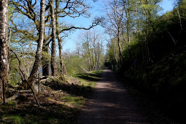
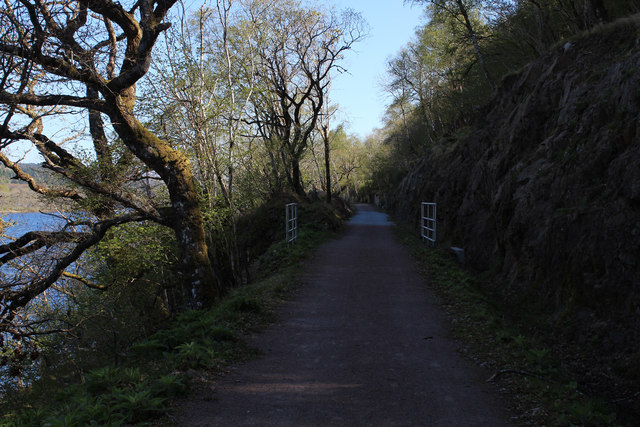
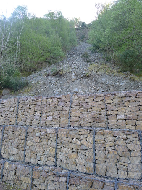
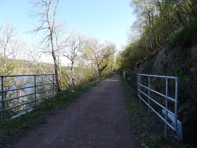
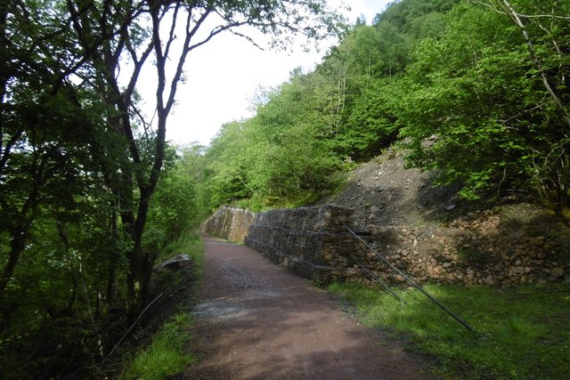
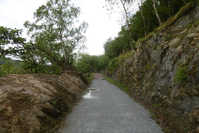
Surrounded by rolling hills and lush green landscapes, Easter Mandally offers visitors a peaceful escape from the hustle and bustle of city life. The village is dotted with charming cottages and traditional stone buildings, adding to its rustic charm.

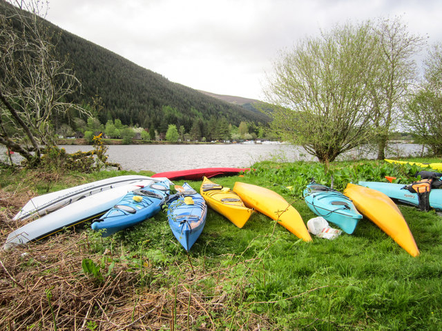
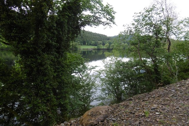
One of the main attractions of Easter Mandally is its close proximity to the iconic Loch Ness, famous for its mythical creature, the Loch Ness Monster. Visitors can enjoy scenic walks along the loch or even embark on a boat trip to try and catch a glimpse of the elusive creature.

Outdoor enthusiasts will also find plenty to do in Easter Mandally, with numerous hiking and cycling trails in the area. The nearby Cairngorms National Park offers breathtaking views and opportunities for outdoor activities such as skiing, snowboarding, and wildlife spotting.

For those interested in history and culture, the village is within reach of several historic sites and castles, including Urquhart Castle and Cawdor Castle. These landmarks provide a glimpse into Scotland's rich heritage and offer visitors a chance to step back in time.

Overall, Easter Mandally is a hidden gem in the Scottish Highlands, offering visitors a chance to connect with nature, explore historic sites, and experience the warm hospitality of the local community.

If you have any feedback on the listing, please let us know in the comments section below.

Easter Mandally Images

Images are sourced within 2km of 57.067045/-4.7974171 or Grid Reference NH3000. Thanks to Geograph Open Source API. All images are credited.
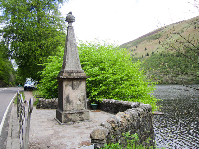
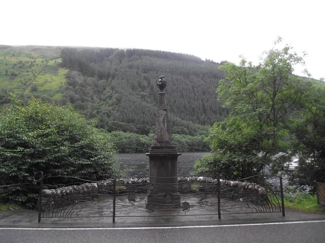
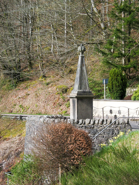
The Well of the Seven Heads
Old railway line, by Loch Oich This was the route of the Invergarry and Fort Augustus Railway. The line closed in 1947, and since then it had been largely disused and overgrown.

It has now been cleared and resurfaced - it opened earlier this year as part of National Cycle Network Route 78 and the Great Glen Way. It is a fairly smooth, compacted gravel path, so easy to cycle along.

This part is in a bit of a cutting, with steep rocks to the right. Also some  mixed woodland on either side.
Old railway line, by Loch Oich
This was the route of the Invergarry and Fort Augustus Railway. The line closed in 1947, and since then it had been largely disused and overgrown. It has now been cleared and resurfaced - it opened earlier this year as part of National Cycle Network Route 78 and the Great Glen Way. It is a fairly smooth, compacted gravel path, so easy to cycle along. This part is in a bit of a cutting, with steep rocks to the right. Also some mixed woodland on either side.
Highland cattle beside Loch Oich View southward on A82 just south of Invergarry.
Highland cattle beside Loch Oich
View southward on A82 just south of Invergarry.
Tobar nan Ceann Well of The Seven Heads Monument (Tobar nan Ceann)
<span class="nowrap"><a title="http://www.outdoorcapital.co.uk/see-and-do/well-of-the-seven-heads-toban-nan-ceann-p185021" rel="nofollow ugc noopener" href="http://www.outdoorcapital.co.uk/see-and-do/well-of-the-seven-heads-toban-nan-ceann-p185021">Link</a><img style="margin-left:2px;" alt="External link" title="External link - shift click to open in new window" src="https://s1.geograph.org.uk/img/external.png" width="10" height="10"/></span>
Tobar nan Ceann
Well of The Seven Heads Monument (Tobar nan Ceann) LinkExternal link
Resting Kayaks Kayaks on the banks of Loch Oich.
Resting Kayaks
Kayaks on the banks of Loch Oich.
Former railway route by Loch Oich The Great Glen Way now follows much of the former railway as far as Aberchalder. Quite a bit of work has been done to stabilise the cutting sides in places.
Former railway route by Loch Oich
The Great Glen Way now follows much of the former railway as far as Aberchalder. Quite a bit of work has been done to stabilise the cutting sides in places.
On the Great Glen Way by Loch Oich Easy walking on the old railway route on the E side of the loch.
On the Great Glen Way by Loch Oich
Easy walking on the old railway route on the E side of the loch.
Railway Trackbed above Loch Oich Section of the course of the former railway between Fort Augustus and Spean Bridge.
It has been recently upgraded and refurbished to accommodate the Great Glen Way National Trail.
Railway Trackbed above Loch Oich
Section of the course of the former railway between Fort Augustus and Spean Bridge. It has been recently upgraded and refurbished to accommodate the Great Glen Way National Trail.
Course of the Old Railway above Loch Oich (1) Now adopted by the Great Glen Way National Trail - a new lease of life for the former railway that ran between Spean Bridge and Fort Augustus
Course of the Old Railway above Loch Oich (1)
Now adopted by the Great Glen Way National Trail - a new lease of life for the former railway that ran between Spean Bridge and Fort Augustus
Course of the Old Railway above Loch Oich (2)
Landslide protection from stone-filled gabions Alongside the old Invergarry to Fort Augustus railway track, and the route of the Great Glen Way
Landslide protection from stone-filled gabions
Alongside the old Invergarry to Fort Augustus railway track, and the route of the Great Glen Way
'Health and Safety' gone mad? I count eleven pairs of railings visible in this picture of part of the restored trackbed of the Invergarry to Fort Augustus railway. The railings align with concrete drainage culverts. But the likelihood of injury from falling off the track at these points is surely no greater than at any other (non-railinged) part of the track.
'Health and Safety' gone mad?
I count eleven pairs of railings visible in this picture of part of the restored trackbed of the Invergarry to Fort Augustus railway. The railings align with concrete drainage culverts. But the likelihood of injury from falling off the track at these points is surely no greater than at any other (non-railinged) part of the track.
Invergarry and Fort Augustus Railway The trackbed along the shores of Loch Oich. Here gabions are being used to protect the trackbed from landslides on the steep slopes above.  The trackbed has recently been cleared and used as the Great Glen Way.
Invergarry and Fort Augustus Railway
The trackbed along the shores of Loch Oich. Here gabions are being used to protect the trackbed from landslides on the steep slopes above. The trackbed has recently been cleared and used as the Great Glen Way.
Invergarry and Fort Augustus Railway The railway, over engineered in an area of limited population was a financial disaster.  More over engineering is apparent in the conversion to a path - every culvert has railings, yet you are just as likely to come to grief on any other part of the track.   The rails to trails conversion is very welcome, taking out a long stretch of hostile A82.
Invergarry and Fort Augustus Railway
The railway, over engineered in an area of limited population was a financial disaster. More over engineering is apparent in the conversion to a path - every culvert has railings, yet you are just as likely to come to grief on any other part of the track. The rails to trails conversion is very welcome, taking out a long stretch of hostile A82.
Loch Oich View from the Great Glen Way on the trackbed of the Invergarry and Fort Augustus Railway.
Loch Oich
View from the Great Glen Way on the trackbed of the Invergarry and Fort Augustus Railway.
Well of the Seven Heads A Category B listed monument [<span class="nowrap"><a title="http://portal.historicenvironment.scot/designation/LB6825" rel="nofollow ugc noopener" href="http://portal.historicenvironment.scot/designation/LB6825">Link</a><img style="margin-left:2px;" alt="External link" title="External link - shift click to open in new window" src="https://s1.geograph.org.uk/img/external.png" width="10" height="10"/></span>], dating from 1812, which commemorates the murder of two sons of the 12th MacDonald of Keppoch in 1663. The murderers (seven in total) were found and executed in 1665 and their heads washed in the spring here before being shown to the clan chief.

The monument sits beside the A82 on the shore of Loch Oich.
Well of the Seven Heads
A Category B listed monument [LinkExternal link], dating from 1812, which commemorates the murder of two sons of the 12th MacDonald of Keppoch in 1663. The murderers (seven in total) were found and executed in 1665 and their heads washed in the spring here before being shown to the clan chief. The monument sits beside the A82 on the shore of Loch Oich.
Monument at Well of the Seven Heads Named on OS maps as  Tobar nan Ceann the monument is above an actual well which lies below the retaining wall. It's not obvious in the image from the distance at which it was recorded that the finial to the obelisk is a cluster of seven heads carved in stone, held by a hand which also holds a knife. The actual heads belonged to the (supposed?) murderers of two MacDonald brothers who were put to death in a revenge attack.
Monument at Well of the Seven Heads
Named on OS maps as Tobar nan Ceann the monument is above an actual well which lies below the retaining wall. It's not obvious in the image from the distance at which it was recorded that the finial to the obelisk is a cluster of seven heads carved in stone, held by a hand which also holds a knife. The actual heads belonged to the (supposed?) murderers of two MacDonald brothers who were put to death in a revenge attack.
Loch Oich The wooded shore of the loch near the A82.
Loch Oich
The wooded shore of the loch near the A82.
Show me another place!

Easter Mandally is located at Grid Ref: NH3000 (Lat: 57.067045, Lng: -4.7974171)

Unitary Authority: Highland

Police Authority: Highlands and Islands

What 3 Words

///etchings.future.topped. Near Gairlochy, Highland

Related Wikis

Invergarry

Invergarry (Scottish Gaelic: Inbhir Garadh) is a village in the Highlands of Scotland. It is in the Great Glen, near where the River Garry flows into Loch...

Loch Oich

Loch Oich (; Scottish Gaelic: Loch Omhaich) is a freshwater loch in the Highlands of Scotland which forms part of the Caledonian Canal, of which it is...
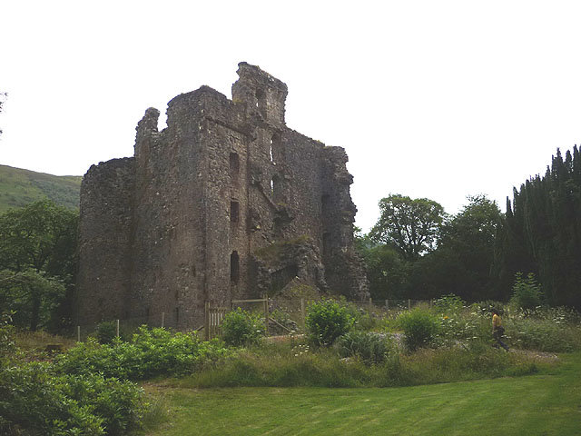
Invergarry Castle

Invergarry Castle in the Scottish Highlands was the seat of the Chiefs of the Clan MacDonell of Glengarry, a powerful branch of the Clan Donald. The castle...

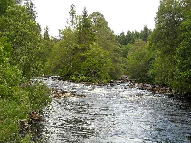
River Garry, Inverness-shire

The River Garry (Scottish Gaelic: Garadh / Abhainn Gharadh) in Inverness-shire is a Scottish river punctuated by two long Lochs, in the region of Lochaber...

Nearby Amenities

Located within 500m of 57.067045,-4.7974171
Recycling
Source: survey
Lat/Long: 57.0683026/-4.8032074
Turning Circle
Lat/Long: 57.0680914/-4.8024081
Bus Stop
School
Direction: E
Long Name: Invergarry, outside School
Naptan AtcoCode: 670020012
Naptan Bearing: E
Naptan CommonName: School
Naptan Indicator: o/s
Naptan Landmark: Garry Crescent
Naptan NaptanCode: 45323797
Naptan Street: A87
Naptan Verified: no
Source: naptan_import
Lat/Long: 57.0690484/-4.8004866
Bus Stop
Invergarry Junction
Naptan AtcoCode: 670085862A
Naptan Bearing: E
Naptan CommonName: Invergarry Junction
Naptan Indicator: at Junction
Naptan Landmark: Bus Bay
Naptan NaptanCode: 45323734
Naptan Street: A82
Naptan Verified: no
Source: naptan_import
Lat/Long: 57.0699801/-4.7925706
Bus Stop
Invergarry Junction
Naptan AtcoCode: 670085862B
Naptan Bearing: W
Naptan CommonName: Invergarry Junction
Naptan Indicator: opp Junction (Southbound)
Naptan Landmark: Bus Bay
Naptan NaptanCode: 45323823
Naptan Street: A82
Naptan Verified: no
Source: naptan_import
Lat/Long: 57.0699153/-4.7922522
Bus Stop
Invergarry Hotel
Direction: E
Long Name: Invergarry, outside Hotel
Naptan AtcoCode: 670085862C
Naptan Bearing: E
Naptan CommonName: Invergarry Hotel
Naptan Indicator: o/s
Naptan Landmark: Invergarry Hotel
Naptan NaptanCode: 45323798
Naptan Street: A87
Naptan Verified: no
Source: naptan_import
Lat/Long: 57.0695727/-4.794718
Bus Stop
Invergarry Hotel
Naptan AtcoCode: 670085862D
Naptan Bearing: W
Naptan CommonName: Invergarry Hotel
Naptan Indicator: opp
Naptan Landmark: Invergarry Hotel
Naptan NaptanCode: 45324727
Naptan Street: A87
Naptan Verified: no
Source: naptan_import
Lat/Long: 57.0694048/-4.7945899
Telephone
Booth: KX100
Covered: booth
Source: survey
Lat/Long: 57.0693814/-4.795889
Post Box
Post Box Type: lamp
Ref: PH35 46
Source: survey
Lat/Long: 57.0682842/-4.8033264
Noexit: yes
Lat/Long: 57.0694117/-4.795848
Leisure: picnic_table
Lat/Long: 57.0682641/-4.803544
Defibrillator
Defibrillator Location: outside Invergarry Post Office
Emergency: defibrillator
Indoor: no
Lat/Long: 57.0682876/-4.8034241
Power: pole
Lat/Long: 57.0668089/-4.804823
Power: pole
Lat/Long: 57.0668871/-4.8037286
Power: pole
Lat/Long: 57.0669994/-4.80245
Power: pole
Lat/Long: 57.0671394/-4.8012433
Power: pole
Lat/Long: 57.0671817/-4.8004228
Power: pole
Lat/Long: 57.0672761/-4.7991772
Power: pole
Lat/Long: 57.0674454/-4.7967892
Power: pole
Lat/Long: 57.0679322/-4.7959254
Power: pole
Lat/Long: 57.067876/-4.7946812
Power: pole
Lat/Long: 57.067832/-4.7934895
Power: pole
Lat/Long: 57.0677734/-4.7923232
Power: pole
Lat/Long: 57.0676961/-4.7908126
Power: pole
Lat/Long: 57.0675708/-4.7901373
Power: pole
Lat/Long: 57.0707547/-4.7928128
Power: pole
Lat/Long: 57.070618/-4.7943069
Power: pole
Lat/Long: 57.0705325/-4.7953504
Power: pole
Lat/Long: 57.0704292/-4.7965587
Power: pole
Lat/Long: 57.0702916/-4.797972
Power: pole
Lat/Long: 57.0701622/-4.7994167
Power: pole
Lat/Long: 57.0699531/-4.8010352
Power: pole
Lat/Long: 57.0697439/-4.8026237
Power: pole
Lat/Long: 57.0695355/-4.8040969
Bench
Lat/Long: 57.0709748/-4.7969693
Building: yes
Note: used to tag houses that need mapping as areas
Lat/Long: 57.0692744/-4.7909076
Building: yes
Note: used to tag houses that need mapping as areas
Lat/Long: 57.0693156/-4.790505
Building: yes
Note: used to tag houses that need mapping as areas
Lat/Long: 57.0698936/-4.7998689
Building: yes
Note: used to tag houses that need mapping as areas
Lat/Long: 57.0694684/-4.7975019
Building: yes
Note: used to tag houses that need mapping as areas
Lat/Long: 57.0689111/-4.803361
Building: yes
Note: used to tag houses that need mapping as areas
Lat/Long: 57.0686737/-4.803939
Building: yes
Note: used to tag houses that need mapping as areas
Lat/Long: 57.0687693/-4.8026918
Building: yes
Note: used to tag houses that need mapping as areas
Lat/Long: 57.0682365/-4.8023306
Building: yes
Note: used to tag houses that need mapping as areas
Lat/Long: 57.0681682/-4.8027138
Building: yes
Note: used to tag houses that need mapping as areas
Lat/Long: 57.0680042/-4.8017651
Building: yes
Note: used to tag houses that need mapping as areas
Lat/Long: 57.0679906/-4.8013787
Building: yes
Note: used to tag houses that need mapping as areas
Lat/Long: 57.0679581/-4.8008635
Building: yes
Note: used to tag houses that need mapping as areas
Lat/Long: 57.0679718/-4.8006059
Building: yes
Note: used to tag houses that need mapping as areas
Lat/Long: 57.0682246/-4.8008792
Building: yes
Note: used to tag houses that need mapping as areas
Lat/Long: 57.0685507/-4.8009012
Building: yes
Note: used to tag houses that need mapping as areas
Lat/Long: 57.0687403/-4.8010866
Building: yes
Note: used to tag houses that need mapping as areas
Lat/Long: 57.0687728/-4.8002981
Building: yes
Note: used to tag houses that need mapping as areas
Lat/Long: 57.068602/-4.8004583
Building: yes
Note: used to tag houses that need mapping as areas
Lat/Long: 57.0682655/-4.8004551
Building: yes
Note: used to tag houses that need mapping as areas
Lat/Long: 57.0680538/-4.8003138
Building: yes
Note: used to tag houses that need mapping as areas
Lat/Long: 57.069321/-4.8005494
The data included in this document is from www.openstreetmap.org. The data is made available under ODbL.

Have you been to Easter Mandally?

Leave your review of Easter Mandally below (or comments, questions and feedback).