East Twerton

Settlement in Somerset

England

East Twerton

Bath: River Avon through Bath This picture was taken from the south side of the bridge and east of the Abbey and Roman Baths. The bridge is situated right in the upper left quadrant of the square.
Bath: River Avon through Bath Credit: Pam Brophy

East Twerton is a small village located in the county of Somerset, England. Situated approximately 2 miles southwest of Bath, East Twerton is a peaceful and picturesque community that offers a pleasant rural atmosphere while still being within close proximity to urban amenities.

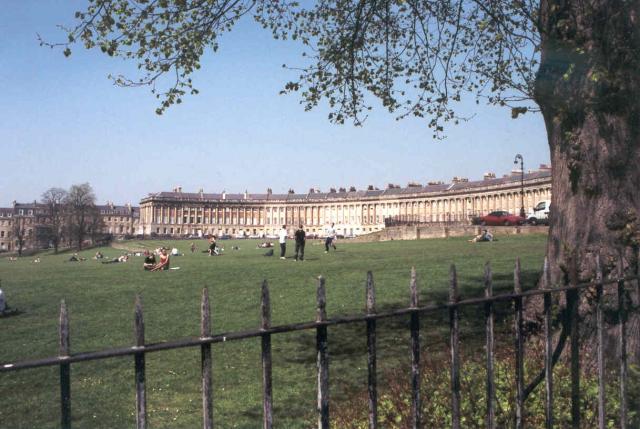
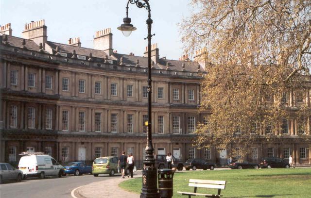
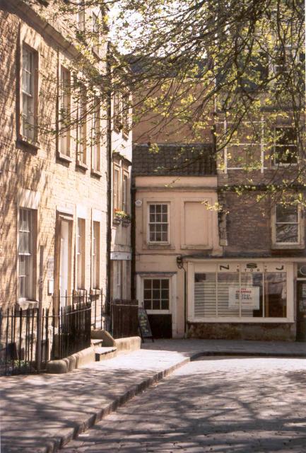
The village is primarily residential, characterized by a mix of traditional cottages and modern houses. The architecture reflects the historical significance of the area, with some buildings dating back to the 19th century. The streets are lined with charming gardens and green spaces, contributing to the overall tranquility of the village.

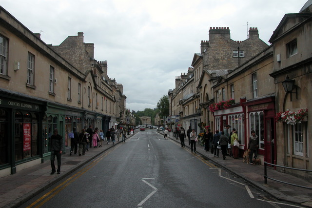
East Twerton benefits from its close proximity to Bath, which provides residents with a range of amenities including shops, schools, and healthcare facilities. The village itself has a few local shops and services, ensuring that residents have easy access to everyday essentials.

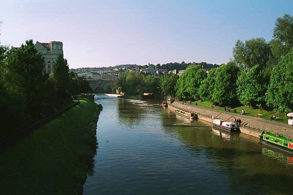
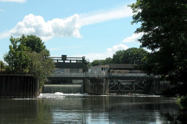
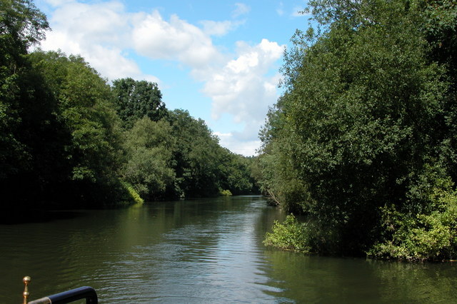
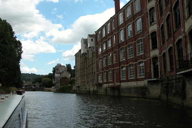
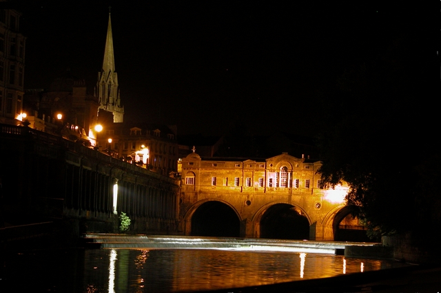
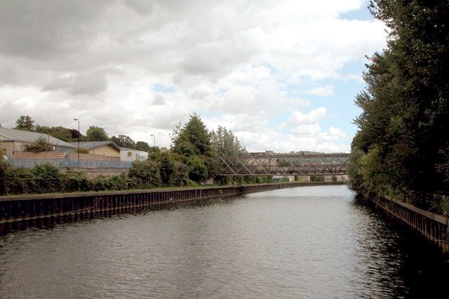
The surrounding countryside offers ample opportunities for outdoor activities and exploration. The nearby countryside is dotted with picturesque walking trails and bike paths, allowing residents to enjoy the natural beauty of the area. Additionally, the village is located near the River Avon, providing opportunities for boating and fishing.

Overall, East Twerton is a quiet and charming village that offers a peaceful lifestyle within a short distance of the bustling city of Bath. With its mix of historical architecture, rural landscapes, and proximity to urban amenities, East Twerton is an attractive place to live for those seeking a balance between tranquility and convenience.

If you have any feedback on the listing, please let us know in the comments section below.
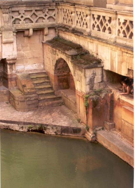
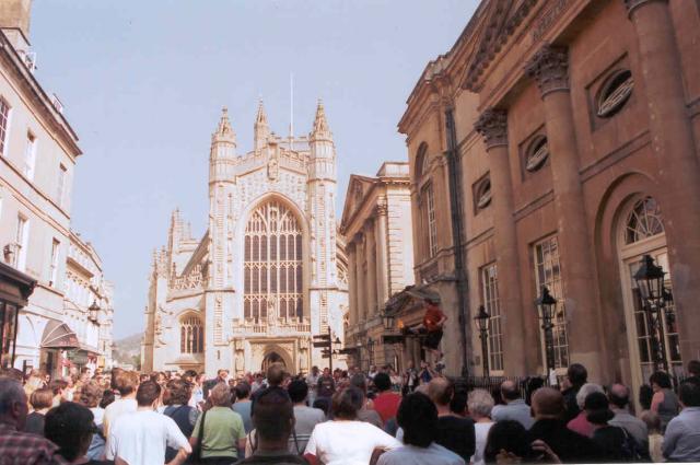
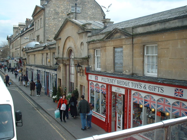
East Twerton Images

Images are sourced within 2km of 51.380934/-2.3814561 or Grid Reference ST7364. Thanks to Geograph Open Source API. All images are credited.

Bath: River Avon through Bath This picture was taken from the south side of the bridge and east of the Abbey and Roman Baths. The bridge is situated right in the upper left quadrant of the square.
Bath: River Avon through Bath
This picture was taken from the south side of the bridge and east of the Abbey and Roman Baths. The bridge is situated right in the upper left quadrant of the square.
Royal Crescent, Bath Georgian Architecture
Royal Crescent, Bath
Georgian Architecture
The Circus, Bath Georgian Architecture
The Circus, Bath
Georgian Architecture
Pulteney Bridge, Bath from the park
Pulteney Bridge, Bath
from the park
Near North Parade Passage, Bath Close to Bath Abbey
Near North Parade Passage, Bath
Close to Bath Abbey
Sacred Springs Roman Baths, Bath Part of the Roman Bath site
Sacred Springs Roman Baths, Bath
Part of the Roman Bath site
Bath Abbey Pump Rooms on the right
Bath Abbey
Pump Rooms on the right
Pulteney Bridge
Pulteney Bridge
Weir at Weston Lock on the River Avon. This is the weir beside Locksbrook, on the Western side of Bath.
Weir at Weston Lock on the River Avon.
This is the weir beside Locksbrook, on the Western side of Bath.
River  Avon  on the Western fringes of Bath This section of the river is just to the west of Bath, and flows down to Bristol. Once it would have carried heavy industrial traffic to Bristol, now it really only carries leisure craft.
Photo taken from the boat, looking upstream.
River Avon on the Western fringes of Bath
This section of the river is just to the west of Bath, and flows down to Bristol. Once it would have carried heavy industrial traffic to Bristol, now it really only carries leisure craft. Photo taken from the boat, looking upstream.
Pipelines crossing the River Avon. On the Western fringes of Bath.
Pipelines crossing the River Avon.
On the Western fringes of Bath.
Warehouses by River Avon in the centre of Bath.
Pulteney Bridge, Bath - at street level This is the only bridge in the UK which has shops all across it. It was modelled on the Ponte Vecchio in Florence.
Pulteney Bridge, Bath - at street level
This is the only bridge in the UK which has shops all across it. It was modelled on the Ponte Vecchio in Florence.
Pulteney Bridge, Bath - from river level This is the only bridge in the UK covered with shops. It was modelled on the Pont Aveccio. I think the church is St Michael with St Paul.
Pulteney Bridge, Bath - from river level
This is the only bridge in the UK covered with shops. It was modelled on the Pont Aveccio. I think the church is St Michael with St Paul.
River Avon at Locksbrook, on the Western edge of bath
Pulteney Weir Bath
Pulteney Weir Bath
Bath Green Park railway station Bath Green Park was the station which served both the Midland Railway line to Birmingham and it was the northern terminus of the Somerset & Dorset Railway to Bournemouth. It closed in 1966 but was subsequently fully restored as part of the development of a Sainsbury's store in the adjacent station yard. Cars now park where trains once stood.
Bath Green Park railway station
Bath Green Park was the station which served both the Midland Railway line to Birmingham and it was the northern terminus of the Somerset & Dorset Railway to Bournemouth. It closed in 1966 but was subsequently fully restored as part of the development of a Sainsbury's store in the adjacent station yard. Cars now park where trains once stood.
Disused railway crosses railway This bridge once carried the Bath to Bournemouth line of the Somerset and Dorset Joint Railway over the Bath to Bristol main line. The latter now has 125mph trains while the other closed in 1966.
Disused railway crosses railway
This bridge once carried the Bath to Bournemouth line of the Somerset and Dorset Joint Railway over the Bath to Bristol main line. The latter now has 125mph trains while the other closed in 1966.
Show me another place!

East Twerton is located at Grid Ref: ST7364 (Lat: 51.380934, Lng: -2.3814561)

Unitary Authority: Bath and North East Somerset

Police Authority: Avon and Somerset

What 3 Words

///larger.gossip.sample. Near Bath, Somerset

Nearby Locations

East Twerton Oldfield Park

Related Wikis

Oldfield Park railway station

Oldfield Park railway station is on the Great Western Main Line in South West England, serving the mainly residential areas of southern Bath, Somerset...

Bath FM

Bath FM was a local independent radio station based at the former Weston railway station in Bath, England. The station was launched in November 1999 and...

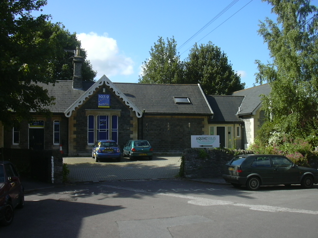
Weston railway station (Bath)

Weston (Bath) was a small railway station in Bath, England, about a mile west of Bath Green Park railway station on the Midland Railway line. It was opened...

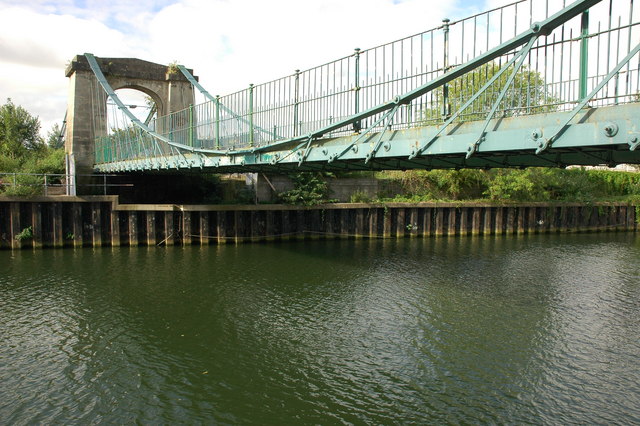
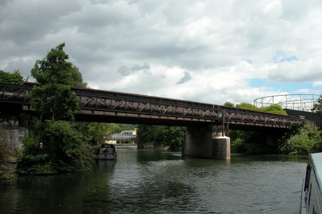
Victoria Bridge, Bath

Victoria Bridge in Bath, England, was built in 1836 across the River Avon. The bridge has been recognised as a Grade II* listed building. Victoria Bridge...

Nearby Amenities

Located within 500m of 51.380934,-2.3814561
Crossing
Button Operated: yes
Crossing: traffic_signals
Crossing Island: no
Crossing Ref: toucan
Tactile Paving: yes
Traffic Signals Sound: yes
Traffic Signals Vibration: yes
Lat/Long: 51.3807915/-2.3874186
Crossing
Crossing: uncontrolled
Crossing Island: no
Crossing Ref: zebra
Kerb: lowered
Tactile Paving: yes
Lat/Long: 51.3793683/-2.3758959
Traffic Signals
Traffic Signals: signal
Lat/Long: 51.3811944/-2.3742677
Kerb: no
Lat/Long: 51.3794804/-2.3810739
Post Box
Check Date Collection Times: 2023-03-24
Collection Times: Mo-Fr 09:00, Sa 07:00
Postal Code: BA2
Ref: BA2 165
Royal Cypher: EIIR
Royal Cypher Wikidata: Q33102113
Lat/Long: 51.3795162/-2.3759057
Barrier: bollard
Bicycle: yes
Bollard: removable
Foot: yes
Lat/Long: 51.3802916/-2.3847034
Turning Circle
Lat/Long: 51.3808893/-2.3844715
Oldfield Park
Naptan AtcoCode: 9100OLDFLDP
Network: National Rail
Network Website: https://www.nationalrail.co.uk/stations/olf/
Network Wikidata: Q26334
Operator: Great Western Railway
Operator Website: https://www.gwr.com/stations-and-destinations/stations/oldfield-park
Operator Wikidata: Q1419438
Public Transport: station
Railway: station
Ref Crs: OLF
Wheelchair: yes
Wikidata: Q2275914
Wikipedia: en:Oldfield Park railway station
Lat/Long: 51.379209/-2.3801536
Crossing: informal
Lat/Long: 51.3785845/-2.3860708
Post Box
Brand: Royal Mail
Brand Wikidata: Q638098
Collection Times: Mo-Fr 09:00
Operator: Royal Mail
Operator Wikidata: Q638098
Post Box Type: pillar
Ref: BA2 353
Lat/Long: 51.380547/-2.3879527
Traffic Signals
Lat/Long: 51.3848797/-2.3813039
Crossing
Button Operated: yes
Crossing: traffic_signals
Crossing Ref: pelican
Tactile Paving: yes
Traffic Signals Sound: no
Traffic Signals Vibration: yes
Lat/Long: 51.3845896/-2.3817448
Barrier: bollard
Bicycle: yes
Bollard: removable
Foot: yes
Lat/Long: 51.379522/-2.3850262
Barrier: cycle_barrier
Cycle Barrier: double
Cycle Barrier Installation: fixed
Lat/Long: 51.3792334/-2.3854843
Crossing
Crossing: unmarked
Crossing Markings: no
Tactile Paving: yes
Lat/Long: 51.3812927/-2.3881127
Barrier: cycle_barrier
Cycle Barrier: diagonal
Cycle Barrier Installation: removable
Lat/Long: 51.3786921/-2.385427
Post Box
Collection Times: Mo-Fr 09:00, Sa 07:00
Operator: Royal Mail
Operator Wikidata: Q638098
Ref: BA2 230
Royal Cypher: EIIR
Royal Cypher Wikidata: Q33102113
Lat/Long: 51.3775931/-2.3823407
Barrier: cycle_barrier
Cycle Barrier: double
Cycle Barrier Installation: fixed
Lat/Long: 51.3813522/-2.3882208
Crossing
Button Operated: yes
Crossing: traffic_signals
Crossing Island: no
Crossing Ref: pelican
Tactile Paving: yes
Traffic Signals Sound: yes
Traffic Signals Vibration: no
Lat/Long: 51.3846947/-2.3818106
Traffic Signals
Lat/Long: 51.384599/-2.3815188
Bus Stop
Windsor Villas
Bench: yes
Bin: yes
Bus: yes
Lit: yes
Naptan AtcoCode: 0180BAC23435
Naptan Bearing: NE
Naptan CommonName: Windsor Villas
Naptan Crossing: Windsor Bridge Road
Naptan NaptanCode: bthmjgm
Naptan PlusbusZoneRef: BATHSPA
Naptan Street: Upper Bristol Road
Naptan Verified: no
Public Transport: platform
Shelter: yes
Source: naptan_import
Tactile Paving: yes
Wheelchair: yes
Lat/Long: 51.3844096/-2.3831534
Bus Stop
Windsor Bridge Road
Bench: yes
Bin: yes
Bus: yes
Departures Board: yes
Lit: yes
Naptan AtcoCode: 0180BAC23463
Naptan Bearing: N
Naptan CommonName: Windsor Bridge Road
Naptan Crossing: Lower Bristol Road
Naptan NaptanCode: bthmjtw
Naptan PlusbusZoneRef: BATHSPA
Naptan Street: Windsor Bridge Road
Naptan Verified: no
Public Transport: platform
Shelter: yes
Source: naptan_import
Tactile Paving: yes
Wheelchair: yes
Lat/Long: 51.3830918/-2.3812211
Bus Stop
Arlington Road
Bench: no
Bin: no
Bus: yes
Departures Board: timetable
Lit: no
Naptan AtcoCode: 0180BAC30250
Naptan Bearing: SW
Naptan CommonName: Livingstone Road
Naptan Crossing: Brougham Hayes
Naptan NaptanCode: bthjdad
Naptan PlusbusZoneRef: BATHSPA
Naptan Street: Livingstone Road
Naptan Verified: no
Public Transport: platform
Shelter: no
Source: naptan_import
Tactile Paving: yes
Wheelchair: yes
Lat/Long: 51.3782678/-2.3769677
Bus Stop
Arlington Road
Bench: no
Bin: no
Bus: yes
Departures Board: timetable
Lit: no
Naptan AtcoCode: 0180BAC30251
Naptan Bearing: NE
Naptan CommonName: Livingstone Road
Naptan Crossing: Arlington Road
Naptan NaptanCode: bthjawm
Naptan PlusbusZoneRef: BATHSPA
Naptan Verified: no
Public Transport: platform
Shelter: no
Source: naptan_import
Tactile Paving: yes
Wheelchair: yes
Lat/Long: 51.3781949/-2.3772544
Bus Stop
Moorland Road
Bench: yes
Bin: no
Bus: yes
Lit: yes
Naptan AtcoCode: 0180BAC30252
Naptan Bearing: NE
Naptan CommonName: Moorland Road
Naptan Crossing: Moorland Road
Naptan NaptanCode: bthjapd
Naptan PlusbusZoneRef: BATHSPA
Naptan Street: Livingstone Road
Naptan Verified: no
Public Transport: platform
Shelter: yes
Source: naptan_import
Tactile Paving: yes
Wheelchair: yes
Lat/Long: 51.3774649/-2.3786822
Bus Stop
The Triangle North
Bench: no
Bin: no
Bus: yes
Lit: no
Naptan AtcoCode: 0180BAC30253
Naptan Bearing: E
Naptan CommonName: The Triangle North
Naptan Crossing: Crandale Road
Naptan NaptanCode: bthjamj
Naptan PlusbusZoneRef: BATHSPA
Naptan Street: Triangle North
Naptan Verified: no
Public Transport: platform
Shelter: no
Source: naptan_import
Tactile Paving: yes
Lat/Long: 51.3787381/-2.3788969
Bus Stop
West Ave
Bench: no
Bin: no
Bus: yes
Lit: no
Naptan AtcoCode: 0180BAC30255
Naptan Bearing: SW
Naptan CommonName: West Ave
Naptan Crossing: Triangle North
Naptan NaptanCode: bthjadm
Naptan PlusbusZoneRef: BATHSPA
Naptan Street: West Avenue
Naptan Verified: no
Public Transport: platform
Shelter: no
Source: naptan_import
Tactile Paving: no
Lat/Long: 51.3787384/-2.3815838
Bus Stop
Lyndhurst Road
Bench: no
Bin: no
Bus: yes
Lit: no
Naptan AtcoCode: 0180BAC30256
Naptan Bearing: S
Naptan CommonName: Millmead Rd
Naptan Crossing: Lyndhurst Road
Naptan NaptanCode: bthdwmp
Naptan PlusbusZoneRef: BATHSPA
Naptan Street: Millmead Road
Naptan Verified: no
Public Transport: platform
Shelter: no
Source: naptan_import
Tactile Paving: no
Lat/Long: 51.3786433/-2.3831779
Bus Stop
Lyndhurst Road
Bench: no
Bin: no
Bus: yes
Lit: no
Naptan AtcoCode: 0180BAC30257
Naptan Bearing: N
Naptan BusStopType: CUS
Naptan CommonName: Millmead Rd
Naptan Crossing: Lyndhurst Road
Naptan NaptanCode: bthdwmg
Naptan PlusbusZoneRef: BATHSPA
Naptan Street: Millmead Road
Naptan Verified: no
Public Transport: platform
Shelter: no
Source: naptan_import
Tactile Paving: no
Lat/Long: 51.3786879/-2.3832789
Bus Stop
Moorland Road
Bench: yes
Bin: no
Bus: yes
Lit: yes
Naptan AtcoCode: 0180BAC30299
Naptan Bearing: SW
Naptan CommonName: Moorland Road
Naptan Crossing: Moorland Road
Naptan NaptanCode: bthjajw
Naptan PlusbusZoneRef: BATHSPA
Naptan Street: Herbert Road
Naptan Verified: no
Public Transport: platform
Shelter: yes
Source: naptan_import
Tactile Paving: no
Wheelchair: yes
Lat/Long: 51.3770383/-2.3790122
Bus Stop
Maybrick Road
Bench: yes
Bin: no
Bus: yes
Lit: yes
Naptan AtcoCode: 0180BAC30300
Naptan Bearing: NW
Naptan CommonName: Maybrick Road
Naptan Crossing: Maybrick Road
Naptan NaptanCode: bthjajm
Naptan PlusbusZoneRef: BATHSPA
Naptan Street: Moorland Road
Naptan Verified: no
Public Transport: platform
Shelter: yes
Source: naptan_import
Tactile Paving: no
Wheelchair: yes
Lat/Long: 51.3775637/-2.3793233
Bus Stop
Lorne Road
Bench: no
Bin: no
Bus: yes
Lit: yes
Naptan AtcoCode: 0180BAC30302
Naptan Bearing: SW
Naptan CommonName: Hayesfield Lower School
Naptan Crossing: Lorne Road
Naptan NaptanCode: bthjdjp
Naptan PlusbusZoneRef: BATHSPA
Naptan Street: Brougham Hayes
Naptan Verified: no
Public Transport: platform
Shelter: yes
Source: naptan_import
Tactile Paving: yes
Wheelchair: yes
Lat/Long: 51.3803695/-2.3749158
Bus Stop
Brougham Hayes
Bench: no
Bin: yes
Bus: yes
Lit: no
Naptan AtcoCode: 0180BAC30306
Naptan Bearing: W
Naptan CommonName: Brougham Hayes
Naptan Crossing: Lorne Road
Naptan NaptanCode: bthjdgt
Naptan PlusbusZoneRef: BATHSPA
Naptan Street: Lower Bristol Road
Naptan Verified: no
Public Transport: platform
Shelter: no
Source: naptan_import
Tactile Paving: no
Lat/Long: 51.381321/-2.3754555
Bus Stop
Bath Press
Bus: yes
Covered: yes
Naptan AtcoCode: 0180BAC30307
Naptan Bearing: W
Naptan CommonName: Bath Press
Naptan Crossing: Dorset Close
Naptan NaptanCode: bthjapj
Naptan PlusbusZoneRef: BATHSPA
Naptan Street: Lower Bristol Road
Naptan Verified: no
Public Transport: platform
Source: naptan_import
Lat/Long: 51.3816274/-2.3780011
Bus Stop
Bellotts Road
Bench: yes
Bin: yes
Bus: yes
Lit: yes
Naptan AtcoCode: 0180BAC30310
Naptan Bearing: W
Naptan CommonName: Bellotts Road
Naptan Crossing: Bellotts Road
Naptan NaptanCode: bthdwpd
Naptan PlusbusZoneRef: BATHSPA
Naptan Street: Lower Bristol Road
Naptan Verified: no
Public Transport: platform
Shelter: yes
Source: naptan_import
Tactile Paving: no
Lat/Long: 51.3819407/-2.3835397
Bus Stop
Bellotts Road
Bench: no
Bin: yes
Bus: yes
Lit: yes
Naptan AtcoCode: 0180BAC30311
Naptan Bearing: W
Naptan CommonName: Bellotts Road
Naptan Crossing: Bellotts Road
Naptan NaptanCode: bthdwmd
Naptan PlusbusZoneRef: BATHSPA
Naptan Street: Lower Bristol Road
Naptan Verified: no
Public Transport: platform
Shelter: no
Source: naptan_import
Tactile Paving: no
Lat/Long: 51.3818137/-2.3835644
Bus Stop
Burnham Road
Bench: no
Bin: yes
Bus: yes
Lit: no
Naptan AtcoCode: 0180BAC30312
Naptan Bearing: SW
Naptan CommonName: Burnham Road
Naptan Crossing: Burnham Road
Naptan NaptanCode: bthdtwt
Naptan PlusbusZoneRef: BATHSPA
Naptan Street: Lower Bristol Road
Naptan Verified: no
Public Transport: platform
Shelter: no
Source: naptan_import
Tactile Paving: yes
Lat/Long: 51.380864/-2.3870091
Bus Stop
Burnham Road
Bench: yes
Bin: yes
Bus: yes
Lit: yes
Naptan AtcoCode: 0180BAC30313
Naptan Bearing: E
Naptan CommonName: Burnham Road
Naptan Crossing: Jews Lane
Naptan NaptanCode: bthdtwg
Naptan PlusbusZoneRef: BATHSPA
Naptan Street: Lower Bristol Road
Naptan Verified: no
Public Transport: platform
Shelter: yes
Source: naptan_import
Tactile Paving: yes
Lat/Long: 51.3809828/-2.387032
Bus Stop
Windsor Villas
Bench: yes
Bin: yes
Bus: yes
Lit: yes
Naptan AtcoCode: 0180BAC30357
Naptan Bearing: SW
Naptan CommonName: Windsor Castle
Naptan Crossing: Windsor Bridge Road
Naptan NaptanCode: bthdwtp
Naptan PlusbusZoneRef: BATHSPA
Naptan Street: Upper Bristol Road
Naptan Verified: no
Public Transport: platform
Shelter: yes
Source: naptan_import
Tactile Paving: no
Wheelchair: yes
Lat/Long: 51.3845276/-2.3820484
Bus Stop
The Weston
Bench: yes
Bin: yes
Bus: yes
Naptan AtcoCode: 0180BAC30358
Naptan Bearing: E
Naptan CommonName: The Weston
Naptan Crossing: Ashley Avenue
Naptan NaptanCode: bthdwga
Naptan PlusbusZoneRef: BATHSPA
Naptan Street: Upper Bristol Road
Naptan Verified: no
Public Transport: platform
Shelter: yes
Source: naptan_import
Wheelchair: yes
Lat/Long: 51.3844299/-2.3855158
Bus Stop
Twerton Bridge
Bus: yes
Naptan AtcoCode: 0180BAZ02452
Naptan Bearing: W
Naptan CommonName: Twerton Bridge
Naptan Crossing: High Street
Naptan NaptanCode: bthmjat
Naptan PlusbusZoneRef: BATHSPA
Naptan Street: Lower Bristol Road
Naptan Verified: no
Public Transport: platform
Source: naptan_import
Lat/Long: 51.3803609/-2.3885807
Barrier: kissing_gate
Lat/Long: 51.3770389/-2.384995
Traffic Signals
Lat/Long: 51.3820344/-2.381257
Barrier: cycle_barrier
Cycle Barrier: double
Cycle Barrier Installation: openable
Lat/Long: 51.3786745/-2.3857117
Barrier: kissing_gate
Lat/Long: 51.3782336/-2.3860826
Crossing
Button Operated: yes
Crossing: traffic_signals
Crossing Island: no
Crossing Ref: pelican
Kerb: lowered
Tactile Paving: yes
Traffic Signals Sound: yes
Traffic Signals Vibration: no
Lat/Long: 51.3815367/-2.3770489
Traffic Signals
Lat/Long: 51.3810407/-2.3743814
Cycleway: asl
Lat/Long: 51.3810715/-2.3743556
Traffic Signals
Lat/Long: 51.3810901/-2.3744415
Crossing
Button Operated: yes
Check Date Crossing: 2021-05-01
Crossing: traffic_signals
Crossing Island: no
Crossing Ref: pelican
Tactile Paving: yes
Traffic Signals Sound: no
Traffic Signals Vibration: yes
Lat/Long: 51.3811004/-2.374337
Crossing
Button Operated: yes
Check Date Crossing: 2021-05-01
Crossing: traffic_signals
Crossing Ref: pelican
Tactile Paving: yes
Traffic Signals Sound: no
Traffic Signals Vibration: yes
Lat/Long: 51.3811263/-2.3744625
Crossing
Button Operated: yes
Check Date Crossing: 2021-04-05
Crossing: traffic_signals
Crossing Island: no
Crossing Ref: pelican
Tactile Paving: yes
Traffic Signals Sound: yes
Traffic Signals Vibration: yes
Lat/Long: 51.381214/-2.3743748
Cycleway: asl
Lat/Long: 51.3812228/-2.3744255
Traffic Signals
Lat/Long: 51.3812283/-2.3744597
Crossing
Button Operated: yes
Crossing Signals: yes
Tactile Paving: yes
Traffic Signals Sound: no
Traffic Signals Vibration: yes
Lat/Long: 51.3820067/-2.3811437
Traffic Signals
Lat/Long: 51.3821292/-2.3810973
Traffic Signals
Lat/Long: 51.3821816/-2.3815702
Crossing
Button Operated: yes
Crossing Signals: yes
Tactile Paving: yes
Traffic Signals Sound: no
Traffic Signals Vibration: yes
Lat/Long: 51.3822177/-2.3810598
Traffic Signals
Lat/Long: 51.3822676/-2.381107
Traffic Signals
Lat/Long: 51.3822605/-2.3811686
Crossing
Crossing: uncontrolled
Crossing Ref: zebra
Source: Bing
Tactile Paving: yes
Lat/Long: 51.3772016/-2.3788115
Crossing
Crossing: uncontrolled
Crossing Island: no
Tactile Paving: yes
Lat/Long: 51.3773221/-2.3787744
Barrier: bollard
Bollard: fixed
Lat/Long: 51.3769385/-2.3844655
Oldfield Park
Place: suburb
Lat/Long: 51.3767005/-2.3799185
Bicycle Parking
Bicycle Parking: stands
Capacity: 6
Covered: no
Lat/Long: 51.3771795/-2.3787251
Barrier: bollard
Bicycle: yes
Bollard: fixed
Foot: yes
Lat/Long: 51.3802578/-2.3846662
Bicycle Parking
Bicycle Parking: stands
Capacity: 8
Check Date Capacity: 2023-07-07
Covered: no
Lat/Long: 51.3847281/-2.3822712
Barrier: bollard
Bicycle: yes
Bollard: removable
Foot: yes
Lat/Long: 51.3802509/-2.3845777
Barrier: bollard
Bollard: removable
Lat/Long: 51.3817979/-2.3825948
Capacity: 15
Disused Amenity: bicycle_rental
Disused Website: http://www.nextbike.co.uk/en/bath/
Operator: Nextbike
Station Name: Unite Student Apartments
Station No: 8208
Lat/Long: 51.381801/-2.384428
Bicycle Parking
Bicycle Parking: stands
Capacity: 30
Covered: no
Lat/Long: 51.3818977/-2.3847535
Bicycle Parking
Bicycle Parking: stands
Capacity: 10
Covered: yes
Lat/Long: 51.3814847/-2.3882415
Entrance: yes
Lat/Long: 51.3813791/-2.3874308
Barrier: lift_gate
Lat/Long: 51.3813146/-2.3880669
Bicycle Parking
Bicycle Parking: wall_loops
Capacity: 6
Covered: no
Lat/Long: 51.3812834/-2.3742862
East Twerton
Place: suburb
Lat/Long: 51.381384/-2.3805158
Bench
Backrest: no
Check Date: 2021-02-10
Lat/Long: 51.3770756/-2.3845186
Bicycle Parking
Bicycle Parking: stands
Capacity: 2
Covered: no
Lat/Long: 51.3775285/-2.3792803
Bicycle Parking
Bicycle Parking: stands
Capacity: 2
Covered: no
Lat/Long: 51.3771381/-2.3787936
Bench
Backrest: yes
Check Date: 2024-03-16
Lat/Long: 51.3836891/-2.3825212
Bench
Backrest: yes
Check Date: 2024-03-16
Lat/Long: 51.3837636/-2.3831315
Leisure: picnic_table
Lat/Long: 51.3820899/-2.3878301
Leisure: picnic_table
Lat/Long: 51.3821033/-2.3877153
Bicycle Parking
Bicycle Parking: stands
Capacity: 10
Covered: yes
Lat/Long: 51.3812172/-2.3880162
Bicycle Parking
Bicycle Parking: stands
Capacity: 6
Covered: no
Lat/Long: 51.3836801/-2.3772264
Bath Junction
Historic Railway: junction
Railway: site
Lat/Long: 51.3824474/-2.3786267
Bench
Backrest: yes
Check Date: 2024-03-16
Lat/Long: 51.3835377/-2.3826987
Wolseley
Brand: Wolseley
Brand Wikidata: Q8030423
Name En: Plumb Center
Shop: trade
Trade: plumbing
Website: https://www.wolseley.co.uk/branch/bath/
Lat/Long: 51.3830208/-2.3876196
Bench
Backrest: yes
Check Date: 2021-04-02
Lat/Long: 51.3794209/-2.3759986
Bicycle Parking
Bicycle Parking: stands
Capacity: 6
Covered: no
Lat/Long: 51.3807826/-2.3744393
Bench
Backrest: no
Lat/Long: 51.3835799/-2.3760125
Bench
Backrest: no
Lat/Long: 51.3835481/-2.3757953
Bench
Backrest: no
Lat/Long: 51.3835142/-2.3755673
Bicycle Parking
Bicycle Parking: stands
Capacity: 4
Covered: no
Lat/Long: 51.3812331/-2.3749285
Leisure: picnic_table
Lat/Long: 51.3820739/-2.3877599
Kindergarten
Oldfield Park Pre-school
Addr Housename: Oldfield Park Infant School
Addr Postcode: BA2 3RF
Addr Street: Dorset Close
Fhrs Id: 1228814
Website: https://www.oldfieldparkpreschool.org.uk/
Lat/Long: 51.3805804/-2.3775423
Kiddlywinks Before and After School Club
Addr Postcode: BA2 3RF
Club: School
Fhrs Id: 204561
Website: http://oldfieldparkinfants.co.uk/clubs-before-after-school/
Lat/Long: 51.3806535/-2.3772615
Atm
Check Date: 2021-02-03
Wheelchair: yes
Lat/Long: 51.3848824/-2.3818737
Pistachio Provenance Ltd
Addr Postcode: BA2 3RT
Fhrs Id: 914713
Website: https://www.pistachioprovenance.com/
Lat/Long: 51.3804985/-2.3821251
Novel Wines
Addr Postcode: BA2 3RT
Disused Fhrs Id: 917885
Website: https://www.novelwines.co.uk/
Lat/Long: 51.3805219/-2.3824176
Post Box
Collection Times: Mo-Fr 17:00, Sa 11:45
Drive Through: no
Operator: Royal Mail
Operator Wikidata: Q638098
Ref: BA2 1018
Royal Cypher: EIIR
Royal Cypher Wikidata: Q33102113
Lat/Long: 51.3775453/-2.3791301
Bench
Backrest: no
Lat/Long: 51.3836138/-2.3762472
Taste of Bath
Addr Housenumber: 24
Addr Postcode: BA1 3BW
Addr Street: St John's Road
Addr Suburb: Lower Weston
Fhrs Id: 1010968
Website: https://taste-of-bath.com/
Lat/Long: 51.3852322/-2.3820589
Bench
Backrest: yes
Lat/Long: 51.3772607/-2.3789994
Crossing
Button Operated: yes
Crossing: traffic_signals
Crossing Island: yes
Crossing Ref: toucan
Tactile Paving: yes
Traffic Signals Sound: yes
Traffic Signals Vibration: yes
Lat/Long: 51.381986/-2.3830451
Cassia
Addr Housename: Sovereign Point
Addr Housenumber: Unit 1
Addr Postcode: BA2 3GJ
Addr Street: Midland Road
Cafe: yes
Fhrs Id: 1320763
Office: coworking
Opening Hours: Mo-Fr 08:00-17:00; Sa,Su 09:00-16:00
Website: https://www.cassiacommunity.co.uk/
Lat/Long: 51.3840636/-2.3765989
Bicycle Parking
Bicycle Parking: stands
Capacity: 10
Covered: no
Lat/Long: 51.3838714/-2.3764814
Covered: no
Leisure: picnic_table
Lat/Long: 51.3826603/-2.383232
Covered: no
Leisure: picnic_table
Lat/Long: 51.3826863/-2.3833071
Historic: memorial
Inscription: Remembering the Bath Blitz 25th - 27th April 1942
Material: stone
Memorial: war_memorial
Wikimedia Commons: File:Bath Blitz memorial, Spring Wharf, Bath.jpg
Lat/Long: 51.3827139/-2.3832293
Bicycle Parking
Bicycle Parking: stands
Capacity: 10
Check Date Capacity: 2024-03-07
Covered: no
Lat/Long: 51.3822578/-2.3821214
Bicycle Parking
Bicycle Parking: stands
Capacity: 4
Covered: no
Lat/Long: 51.3822778/-2.3817729
Bicycle Parking
Bicycle Parking: stands
Capacity: 10
Check Date Capacity: 2024-03-07
Covered: no
Lat/Long: 51.3822293/-2.3823937
Bicycle Parking
Bicycle Parking: stands
Capacity: 4
Covered: no
Lat/Long: 51.382272/-2.3814832
Bicycle Parking
Bicycle Parking: stands
Capacity: 10
Check Date Capacity: 2024-03-07
Covered: no
Lat/Long: 51.3822729/-2.3819779
Bicycle Parking
Bicycle Parking: stands
Capacity: 10
Check Date Capacity: 2024-03-07
Covered: no
Lat/Long: 51.3822494/-2.3822113
Barrier: bollard
Bollard: fixed
Lat/Long: 51.3827804/-2.3817812
Bench
Backrest: yes
Lat/Long: 51.3837872/-2.3764812
Waste Basket
Lat/Long: 51.3838132/-2.3764092
Bench
Backrest: yes
Lat/Long: 51.3837417/-2.3764786
Defibrillator
Defibrillator Location: On outside wall of The Golden Fleece, facing Fielding's Road
Emergency: defibrillator
Indoor: no
Ref: CHT-14-1110
Lat/Long: 51.380763/-2.3879381
Crossing
Crossing Island: no
Crossing Markings: no
Crossing Signals: no
Tactile Paving: yes
Lat/Long: 51.3821656/-2.3826665
Barrier: bollard
Bollard: concrete
Description: Temporary bollard blocking motor vehicle access.
Motor Vehicle: no
Lat/Long: 51.3836195/-2.3764288
Waste Basket
Lat/Long: 51.3839589/-2.3767593
Bus Stop
Sovereign Point
Bench: yes
Bin: no
Bus: yes
Lit: yes
Naptan AtcoCode: 0180BAC49604
Naptan NaptanCode: bthmtmw
Public Transport: platform
Shelter: yes
Tactile Paving: no
Lat/Long: 51.3838678/-2.3770966
Bus Stop
Sovereign Point
Bench: yes
Bin: no
Bus: yes
Lit: yes
Naptan AtcoCode: 0180BAZ02396
Naptan NaptanCode: bthjmtj
Public Transport: platform
Shelter: yes
Tactile Paving: no
Lat/Long: 51.3840873/-2.3771778
PureGym
Addr Housename: Spring Wharf
Addr Housenumber: Units 1a-c
Addr Postcode: BA2 3BW
Addr Street: Roseberry Place
Brand: PureGym
Brand Wikidata: Q18345898
Leisure: fitness_centre
Opening Hours: 24/7
Website: https://www.puregym.com/gyms/bath-spring-wharf/
Lat/Long: 51.3822965/-2.3815826
Scoop Wholefoods
Addr Housename: The Grain Store
Addr Housenumber: Unit 3,
Addr Postcode: BA2 3GS
Addr Street: Roseberry Place
Fhrs Id: 1223142
Opening Hours: Mo-Fr 09:30-18:30; Sa 09:00-18:00; Su 10:00-16:00
Shop: health_food
Website: https://uk.scoopwholefoods.com/
Zero Waste: yes
Lat/Long: 51.382342/-2.3820805
Trek
Addr Housename: The Grain Store
Addr Housenumber: Unit 2
Addr Postcode: BA2 3GS
Addr Street: Roseberry Place
Alt Name: Trek Bicycle Store
Brand: Trek
Brand Wikidata: Q1067617
Opening Hours: Tu-Sa 09:30-18:00
Service Bicycle Pump: no
Shop: bicycle
Website: https://www.trekbikes.com/gb/en_GB/
Lat/Long: 51.3823054/-2.3818257
Waste Basket
Colour: black
Material: plastic
Waste: trash
Lat/Long: 51.377053/-2.3845665
Entrance: yes
Lat/Long: 51.3787746/-2.3832739
Bench
Backrest: no
Colour: brown
Material: wood
Seats: 3
Lat/Long: 51.3780082/-2.384969
Addr City: Bath
Addr Housenumber: 4A
Addr Postcode: BA2 3PQ
Addr Street: Livingstone Road
Door: hinged
Entrance: yes
Lat/Long: 51.3778181/-2.3781062
Addr City: Bath
Addr Housenumber: 1
Addr Street: Lyndhurst Mews
Entrance: yes
Lat/Long: 51.3790932/-2.3831228
Charging Station
Kyla-Jill
Capacity: 2
Operator: Pod Point
Operator Wikidata: Q42888154
Ref: PG-84602
Socket Type2: 2
Socket Type2 Output: 22kW
Lat/Long: 51.3828534/-2.3871788
Charging Station
Zach-Rich
Capacity: 2
Operator: Pod Point
Operator Wikidata: Q42888154
Ref: PG-85260
Socket Type2: 2
Socket Type2 Output: 22kW
Lat/Long: 51.3828368/-2.3874006
Charging Station
Hugh-Shay
Capacity: 2
Operator: Pod Point
Operator Wikidata: Q42888154
Ref: PG-85252
Socket Type2: 2
Socket Type2 Output: 22kW
Lat/Long: 51.3828447/-2.3872974
Addr Housenumber: 14A
Addr Street: Brougham Hayes
Entrance: yes
Lat/Long: 51.3806096/-2.3749784
Entrance: yes
Lat/Long: 51.3773683/-2.3786318
Access: private
Entrance: yes
Lat/Long: 51.3767371/-2.3805725
Crossing
Crossing Island: yes
Crossing Markings: yes
Crossing Signals: no
Tactile Paving: yes
Lat/Long: 51.3846304/-2.3815379
Henny and Joe’s
Fhrs Id: 1343300
Shop: Masala Chai
Website: https://www.hennyandjoes.co.uk/
Lat/Long: 51.3851861/-2.3800214
Addr City: Bath
Addr Housenumber: 123A
Addr Postcode: BA2 3HR
Addr Street: Lower Oldfield Park
Entrance: yes
Lat/Long: 51.378044/-2.3770694
Addr City: Bath
Addr Housenumber: 15A
Addr Postcode: BA2 3NY
Addr Street: Moorland Road
Entrance: yes
Lat/Long: 51.3775856/-2.3794995
Artwork Type: sculpture
Tourism: artwork
Lat/Long: 51.3840306/-2.37626
Crossing
Button Operated: yes
Crossing: traffic_signals
Crossing Ref: pelican
Tactile Paving: no
Traffic Signals Sound: no
Traffic Signals Vibration: yes
Lat/Long: 51.3810537/-2.3742547
Addr City: Bath
Addr Housenumber: Flat 2 Philippa House
Addr Postcode: BA2 3PU
Addr Street: South Avenue
Entrance: yes
Lat/Long: 51.3768608/-2.3804673
Addr City: Bath
Addr Housenumber: Flat 1 Phillipa House
Addr Postcode: BA2 3PU
Addr Street: South Avenue
Entrance: yes
Lat/Long: 51.376898/-2.3806182
Addr City: Bath
Addr Housenumber: Flat 3 Philippa House, Flat 4 Philippa House
Addr Postcode: BA2 3PU
Addr Street: South Avenue
Entrance: yes
Lat/Long: 51.3768809/-2.3805488
Addr Housenumber: 4
Addr Street: Triangle North
Entrance: yes
Lat/Long: 51.3787237/-2.380272
Addr Housenumber: 5
Addr Street: Triangle North
Entrance: yes
Lat/Long: 51.3787308/-2.3804364
Addr Housenumber: 2
Addr Street: Triangle North
Entrance: yes
Lat/Long: 51.3787223/-2.3802383
Addr Housenumber: 8
Addr Street: Triangle North
Entrance: yes
Lat/Long: 51.3787332/-2.3804915
Addr Housenumber: 3
Addr Street: Triangle North
Entrance: yes
Lat/Long: 51.3787248/-2.3802971
Addr Housenumber: 6
Addr Street: Triangle North
Entrance: yes
Lat/Long: 51.3787319/-2.3804626
Access: private
Entrance: yes
Lat/Long: 51.3794786/-2.3774171
Barrier: cycle_barrier
Bicycle: no
Cycle Barrier: single
Cycle Barrier Installation: fixed
Foot: yes
Horse: no
Motor Vehicle: no
Lat/Long: 51.3777729/-2.384853
Access: private
Addr City: Bath
Addr Housenumber: 21B
Addr Postcode: BA2 3RR
Addr Street: Brook Road
Entrance: yes
Lat/Long: 51.3808512/-2.3813331
Access: private
Addr City: Bath
Addr Housenumber: 21A
Addr Postcode: BA2 3RR
Addr Street: Brook Road
Entrance: yes
Lat/Long: 51.380929/-2.3813327
Access: private
Addr City: Bath
Addr Housenumber: 50
Addr Postcode: BA2 3RW
Addr Street: South View Road
Entrance: yes
Lat/Long: 51.3808752/-2.3812394
Access: private
Addr Housenumber: 89
Addr Street: Brook Road
Entrance: yes
Lat/Long: 51.3817534/-2.3815298
Access: private
Addr Housenumber: 91
Addr Street: Brook Road
Entrance: yes
Lat/Long: 51.381833/-2.3815414
Access: private
Addr Housenumber: 88
Addr Street: Brook Road
Entrance: yes
Lat/Long: 51.3817301/-2.3815961
Access: private
Addr Housenumber: 90
Addr Street: Brook Road
Entrance: yes
Lat/Long: 51.3817777/-2.3815147
Addr Housename: The Old Schoolroom
Addr Street: Denmark Road
Entrance: yes
Lat/Long: 51.3805251/-2.3795118
Addr Housenumber: 1A
Addr Street: South Avenue
Entrance: yes
Lat/Long: 51.3775824/-2.3821227
Addr Housenumber: 1
Addr Street: South Avenue
Entrance: yes
Lat/Long: 51.3776465/-2.3820543
Addr City: Bath
Addr Housenumber: 85
Addr Postcode: BA2 3PZ
Addr Street: West Avenue
Entrance: yes
Lat/Long: 51.3774419/-2.3822451
Board Type: history
Description: Bellots Road. Somerset and Dorset line history. Runaway loco 89 1929.
Information: board
Tourism: information
Lat/Long: 51.3786326/-2.385184
Bench
Backrest: no
Material: wood
Seats: 2
Lat/Long: 51.3786779/-2.3852107
Waste Basket
Waste: trash;dog_excrement
Lat/Long: 51.3792978/-2.3850037
Communication Mobile Phone: yes
Man Made: mast
Tower Type: communication
Lat/Long: 51.3819646/-2.3771467
Post Box
Brand: Royal Mail
Brand Wikidata: Q638098
Collection Times: Mo-Fr 09:00; Sa 07:00
Operator: Royal Mail
Operator Wikidata: Q638098
Operator Wikipedia: en:Royal_Mail
Post Box Type: pillar
Ref: BA2 1020D
Royal Cypher: GR
Royal Cypher Wikidata: Q33102273
Lat/Long: 51.3812837/-2.3751853
Bench
Lat/Long: 51.3773886/-2.3852443
Bench
Backrest: yes
Lat/Long: 51.3802956/-2.3782203
Bench
Backrest: yes
Lat/Long: 51.3803283/-2.3782646
Barrier: bollard
Bollard: removable
Lat/Long: 51.3793107/-2.3795194
Waste Basket
Lat/Long: 51.3792916/-2.379517
Waste Basket
Lat/Long: 51.385105/-2.3809528
Waste Basket
Lat/Long: 51.3849594/-2.3812934
Waste Basket
Lat/Long: 51.3844364/-2.3855434
Waste Basket
Lat/Long: 51.384423/-2.3831173
Waste Basket
Lat/Long: 51.3845393/-2.382019
Entrance: main
Lat/Long: 51.3848432/-2.3819461
Defibrillator
Defibrillator Location: On outside wall of Tesco Express, just round the corner on teh right-hand side of the main entrance.
Emergency: defibrillator
Lat/Long: 51.3848623/-2.3819091
Traffic Signals
Lat/Long: 51.384565/-2.3816805
Traffic Signals
Lat/Long: 51.3846626/-2.381905
Crossing
Lat/Long: 51.384808/-2.3819554
Waste Basket
Lat/Long: 51.3808698/-2.3869916
Waste Basket
Lat/Long: 51.3816469/-2.3863304
Waste Basket
Lat/Long: 51.3816888/-2.386541
Waste Basket
Lat/Long: 51.3831297/-2.3812061
Waste Basket
Lat/Long: 51.3819512/-2.3835061
Waste Basket
Lat/Long: 51.3809669/-2.3870667
Waste Basket
Lat/Long: 51.3830619/-2.3812289
Waste Basket
Lat/Long: 51.3817546/-2.382499
Atm
Cash In: no
Indoor: no
Operator: Link
Lat/Long: 51.377904/-2.3795098
Waste Basket
Lat/Long: 51.3786207/-2.3807595
Waste Basket
Lat/Long: 51.3775461/-2.3793003
Waste Basket
Lat/Long: 51.3772005/-2.3787371
Waste Basket
Lat/Long: 51.3773059/-2.3790536
Waste Basket
Lat/Long: 51.3774457/-2.3787009
Bicycle Parking
Bicycle Parking: stands
Capacity: 6
Covered: no
Lat/Long: 51.3772632/-2.378949
Waste Basket
Lat/Long: 51.3779128/-2.3795511
Bench
Backrest: yes
Lat/Long: 51.3778634/-2.3794707
Waste Basket
Lat/Long: 51.3839622/-2.376169
Waste Basket
Lat/Long: 51.3835977/-2.3759704
Waste Basket
Lat/Long: 51.3837141/-2.3766477
Waste Basket
Lat/Long: 51.3813277/-2.3754798
Waste Basket
Lat/Long: 51.3812826/-2.3744552
Waste Basket
Lat/Long: 51.3815094/-2.3771588
Waste Basket
Lat/Long: 51.3803819/-2.3749058
Crossing
Crossing: uncontrolled
Crossing Markings: surface
Tactile Paving: yes
Traffic Calming: table
Lat/Long: 51.3776639/-2.3774635
Barrier: cycle_barrier
Cycle Barrier: double
Cycle Barrier Installation: fixed
Lat/Long: 51.378644/-2.3860707
Bicycle Parking
Bicycle Parking: stands
Capacity: 14
Covered: no
Lat/Long: 51.3773545/-2.377856
Railway: signal
Railway Signal Direction: forward
Railway Signal Main: GB-NR:main
Ref: D0 1927
Lat/Long: 51.3792874/-2.381029
Railway: signal
Railway Signal Direction: forward
Railway Signal Main: GB-NR:main
Ref: D0 1925
Lat/Long: 51.378972/-2.3783089
Railway: signal
Railway Signal Direction: forward
Railway Signal Main: GB-NR:main
Ref: D0 1928
Lat/Long: 51.379816/-2.3860825
Barrier: bollard
Bollard: fixed
Lat/Long: 51.3766567/-2.3831309
Crossing
Button Operated: yes
Crossing Signals: yes
Tactile Paving: yes
Traffic Signals Sound: no
Traffic Signals Vibration: yes
Lat/Long: 51.3822717/-2.3812827
Crossing
Button Operated: yes
Crossing Signals: yes
Tactile Paving: yes
Traffic Signals Sound: no
Traffic Signals Vibration: yes
Lat/Long: 51.3822213/-2.3811759
Crossing
Crossing Markings: yes
Crossing Signals: no
Tactile Paving: yes
Lat/Long: 51.3820425/-2.3812526
Crossing
Button Operated: yes
Crossing Island: no
Crossing Signals: yes
Tactile Paving: yes
Traffic Signals Sound: no
Traffic Signals Vibration: yes
Lat/Long: 51.3821319/-2.3811165
Police
Redbridge House Police Centre
Operator: Avon and Somerset Police
Operator Wikidata: Q4829263
Lat/Long: 51.3819426/-2.3770575
Bluebird Care
Office: yes
Lat/Long: 51.3819292/-2.3769449
WTP Wills Trusts And Probate
Addr City: Bath
Addr Housename: Redbridge House
Addr Postcode: BA2 3EW
Addr Street: Midland Road
Office: yes
Website: http://www.wtponline.co.uk/
Lat/Long: 51.3820012/-2.3769261
Addr City: Bath
Addr Housenumber: 25-32
Addr Street: Stothert Avenue
Addr Substreet: Imperial
Entrance: yes
Lat/Long: 51.382342/-2.3747753
Addr City: Bath
Addr Housenumber: 17-24
Addr Street: Stothert Avenue
Addr Substreet: Imperial
Entrance: yes
Lat/Long: 51.3823204/-2.3746265
Addr City: Bath
Addr Housenumber: 17-24
Addr Street: Stothert Avenue
Addr Substreet: Beatrice House
Entrance: yes
Lat/Long: 51.3825505/-2.3761696
Addr City: Bath
Addr Housenumber: 9-16
Addr Street: Stothert Avenue
Addr Substreet: Beatrice House
Entrance: yes
Lat/Long: 51.3825269/-2.3760201
Addr City: Bath
Addr Housenumber: 1-8
Addr Street: Stothert Avenue
Addr Substreet: Beatrice House
Entrance: yes
Lat/Long: 51.3825024/-2.375865
Steers McGillan Eves
Addr City: Bath
Addr Housenumber: Unit A
Addr Street: Midland Road
Addr Substreet: Corinthian
Office: yes
Website: https://www.steersmcgillaneves.co.uk/
Lat/Long: 51.3835781/-2.3767442
Our Name Is Mud
Addr City: Bath
Addr Housenumber: Unit B
Addr Postcode: BA2 3FT
Addr Street: Midland Road
Office: yes
Phone: +44 1225 471 465
Website: https://ournameismud.co.uk/
Lat/Long: 51.3836166/-2.3771492
Supple Studio
Addr City: Bath
Addr Housenumber: Unit 1B
Addr Postcode: BA2 3FT
Addr Street: Midland Road
Addr Substreet: Corinthian
Office: yes
Lat/Long: 51.38363/-2.3772082
Addr City: Bath
Addr Housenumber: 3
Addr Street: Midland Road
Addr Substreet: Corinthian
Entrance: yes
Lat/Long: 51.3835291/-2.377253
Addr City: Bath
Addr Housenumber: 2
Addr Street: Midland Road
Addr Substreet: Corinthian
Entrance: yes
Lat/Long: 51.3835231/-2.377208
Addr City: Bath
Addr Housenumber: 1
Addr Street: Midland Road
Addr Substreet: Corinthian
Entrance: yes
Lat/Long: 51.3835062/-2.3770868
Addr City: Bath
Addr Housenumber: 28-55
Addr Street: Midland Road
Addr Substreet: Corinthian
Entrance: yes
Lat/Long: 51.3834763/-2.3768579
Addr City: Bath
Addr Housenumber: 4-27
Addr Street: Midland Road
Addr Substreet: Corinthian
Entrance: yes
Lat/Long: 51.3834898/-2.3769614
Truebyte
Addr City: Bath
Addr Housename: Top Floor Studio
Addr Housenumber: 25
Addr Street: Upper Bristol Road
Addr Substreet: Windsor Castle
Office: yes
Website: https://www.truebyte.co.uk/
Lat/Long: 51.3844626/-2.3819261
Samaritans
Addr City: Bath
Addr Housenumber: 25
Addr Street: Upper Bristol Road
Addr Substreet: Windsor Castle
Office: yes
Lat/Long: 51.384455/-2.3819905
Bicycle Parking
Bicycle Parking: stands
Capacity: 20
Covered: yes
Lat/Long: 51.3802906/-2.3876098
The data included in this document is from www.openstreetmap.org. The data is made available under ODbL.

Have you been to East Twerton?

Leave your review of East Twerton below (or comments, questions and feedback).