Dairycoates

Settlement in Yorkshire

England

Dairycoates

Trawlermen's memorial entrance, Hull Entrance to the area dedicated to more than 6,000 Hull trawlermen who lost their lives at sea. It is sited at the St Andrew's Quay shopping park (formerly St Andrew's Dock, once the home of the world's largest distant water fleet of deep sea trawlers).

The enhanced memorial site, including information panels, extra features and seating, was completed in September 2023. It is centred around the memorial sculpture of thirteen 8-foot high trawlermen silhouettes in 'corten' steel. This was originally installed in 2017, but removed while adjacent flood defence work was carried out.
Trawlermen's memorial entrance, Hull Credit: Paul Harrop

Dairycoates is a small suburb located in the city of Kingston upon Hull, in the county of Yorkshire, England. Situated on the western outskirts of the city, it lies close to the River Hull and is part of the Hull West and Hessle parliamentary constituency.

The area is primarily residential, with a mix of housing types including terraced houses, semi-detached properties, and some apartment blocks. Dairycoates also features a number of industrial sites, including warehouses and factories, which contribute to the local economy.

Dairycoates benefits from its proximity to the city center, with good transport links connecting it to the rest of Hull and the wider region. The A63 road runs nearby, offering convenient access for commuters, and the Hull Paragon Interchange, a major transport hub, is within easy reach.

Residents of Dairycoates enjoy a range of amenities and services. The area has several local shops, including convenience stores, as well as pubs and eateries. There are also recreational facilities nearby, such as playing fields and parks, providing opportunities for outdoor activities and leisure pursuits.

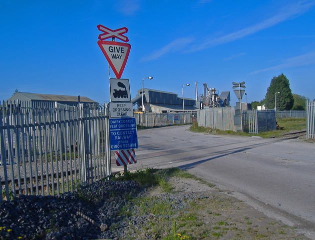
Historically, Dairycoates played a significant role in Hull's industrial past. It was once home to a large dairy and cattle market, which gave the area its name. Today, the neighborhood has evolved into a vibrant and diverse community, offering a mix of residential, commercial, and industrial spaces.

If you have any feedback on the listing, please let us know in the comments section below.
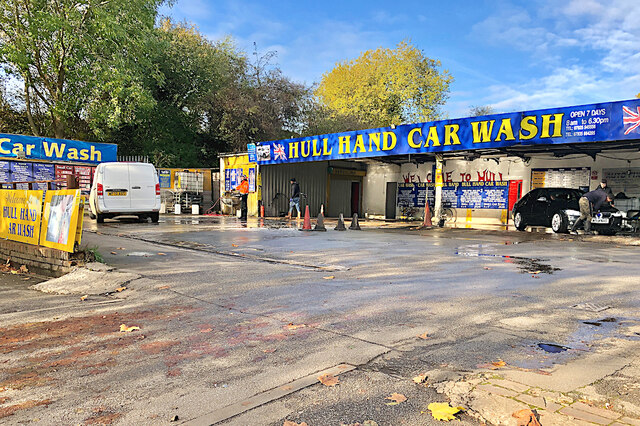
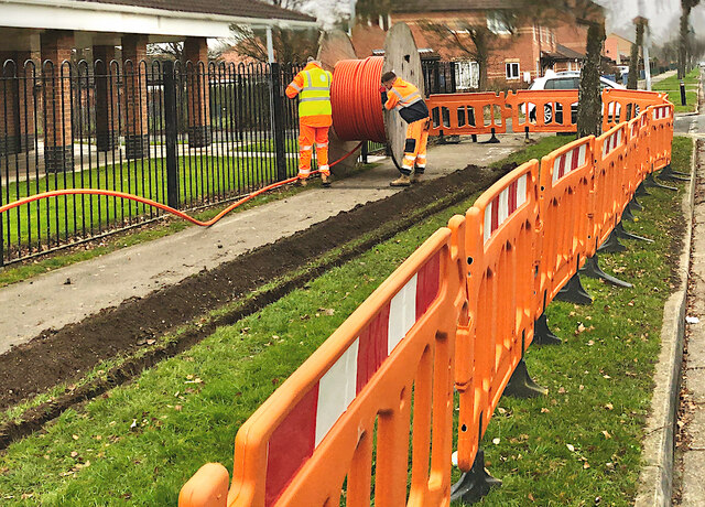
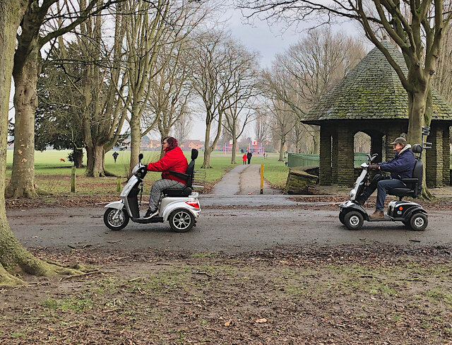
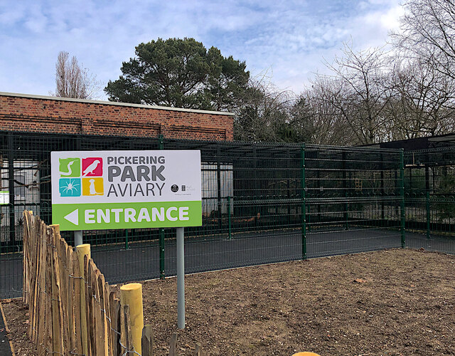
Dairycoates Images

Images are sourced within 2km of 53.732348/-0.37273402 or Grid Reference TA0727. Thanks to Geograph Open Source API. All images are credited.

Trawlermen's memorial entrance, Hull Entrance to the area dedicated to more than 6,000 Hull trawlermen who lost their lives at sea. It is sited at the St Andrew's Quay shopping park (formerly St Andrew's Dock, once the home of the world's largest distant water fleet of deep sea trawlers).

The enhanced memorial site, including information panels, extra features and seating, was completed in September 2023. It is centred around the memorial sculpture of thirteen 8-foot high trawlermen silhouettes in 'corten' steel. This was originally installed in 2017, but removed while adjacent flood defence work was carried out.
Trawlermen's memorial entrance, Hull
Entrance to the area dedicated to more than 6,000 Hull trawlermen who lost their lives at sea. It is sited at the St Andrew's Quay shopping park (formerly St Andrew's Dock, once the home of the world's largest distant water fleet of deep sea trawlers). The enhanced memorial site, including information panels, extra features and seating, was completed in September 2023. It is centred around the memorial sculpture of thirteen 8-foot high trawlermen silhouettes in 'corten' steel. This was originally installed in 2017, but removed while adjacent flood defence work was carried out.
Trawlermen's memorial sculpture, Hull The memorial sculpture of thirteen 8-foot high trawlermen silhouettes in 'corten' steel. This was originally installed in 2017, but removed while adjacent flood defence work was carried out. The area is dedicated to more than 6,000 Hull trawlermen who lost their lives at sea. It is at the St Andrew's Quay shopping park (formerly St Andrew's Dock, once the home of the world's largest distant water fleet of deep sea trawlers).

The enhanced memorial site, including information panels, extra features and seating, was completed in September 2023. This part of the memorial is shaped to resemble the bow of a trawler, symbolically pointed towards the Humber estuary.
Trawlermen's memorial sculpture, Hull
The memorial sculpture of thirteen 8-foot high trawlermen silhouettes in 'corten' steel. This was originally installed in 2017, but removed while adjacent flood defence work was carried out. The area is dedicated to more than 6,000 Hull trawlermen who lost their lives at sea. It is at the St Andrew's Quay shopping park (formerly St Andrew's Dock, once the home of the world's largest distant water fleet of deep sea trawlers). The enhanced memorial site, including information panels, extra features and seating, was completed in September 2023. This part of the memorial is shaped to resemble the bow of a trawler, symbolically pointed towards the Humber estuary.
Trawlermen's memorial 'compass', Hull Part of the area dedicated to over 6,000 Hull trawlermen who lost their lives at sea. It is sited at the St Andrew's Quay shopping park (formerly St Andrew's Dock, once the home of the world's largest distant water fleet of deep sea trawlers).

The enhanced memorial site, including information panels, extra features and seating, was completed in September 2023. It is centred around the memorial sculpture of thirteen 8-foot high trawlermen silhouettes in 'corten' steel. This was originally installed in 2017, but removed while adjacent flood defence work was carried out.
Trawlermen's memorial 'compass', Hull
Part of the area dedicated to over 6,000 Hull trawlermen who lost their lives at sea. It is sited at the St Andrew's Quay shopping park (formerly St Andrew's Dock, once the home of the world's largest distant water fleet of deep sea trawlers). The enhanced memorial site, including information panels, extra features and seating, was completed in September 2023. It is centred around the memorial sculpture of thirteen 8-foot high trawlermen silhouettes in 'corten' steel. This was originally installed in 2017, but removed while adjacent flood defence work was carried out.
Car Wash, Brighton St, Hull Attended car wash operated by imo on the eastern side of Brighton Street.
Car Wash, Brighton St, Hull
Attended car wash operated by imo on the eastern side of Brighton Street.
Rotting jetties, Hull Looking along the Humber shortly before sunrise, over the decaying remains of wooden staithes by the former St Andrew's Dock. Despite being long abandoned, what remains of these structures is proving remarkably resilient against decades of tides and weather.
Rotting jetties, Hull
Looking along the Humber shortly before sunrise, over the decaying remains of wooden staithes by the former St Andrew's Dock. Despite being long abandoned, what remains of these structures is proving remarkably resilient against decades of tides and weather.
Car wash, Boothferry Road, Hull On the north side of the road between the Three Tuns pub and the high level railway line. The site was previously used by a tyre fitter (as seen in <a href="https://www.geograph.org.uk/photo/3722237">TA0628 : Tyriffic garage on Boothferry Road, Hull</a>) and, before that, a tool hire company.
Car wash, Boothferry Road, Hull
On the north side of the road between the Three Tuns pub and the high level railway line. The site was previously used by a tyre fitter (as seen in TA0628 : Tyriffic garage on Boothferry Road, Hull) and, before that, a tool hire company.
Demolition of Arco on Hessle Road, Hull To make way for the A63 road improvements.
Demolition of Arco on Hessle Road, Hull
To make way for the A63 road improvements.
Spring Street, Kingston upon Hull Hull Royal Infirmary tower block and its incinerator chimney, Anlaby Road, and the former C19 college, Park Street, as viewed from Spring Street.
Spring Street, Kingston upon Hull
Hull Royal Infirmary tower block and its incinerator chimney, Anlaby Road, and the former C19 college, Park Street, as viewed from Spring Street.
The Range, Hull Recently-opened store on Kingston Retail Park. It opened on 26 December 2021 in the 14,487 sq ft premises. This had been previously occupied by a branch of Outfit, which ceased trading in January 2021.
The Range, Hull
Recently-opened store on Kingston Retail Park. It opened on 26 December 2021 in the 14,487 sq ft premises. This had been previously occupied by a branch of Outfit, which ceased trading in January 2021.
Monochrome mural, Hull Part of the graphic adorning the wall of the former Shipham Valves factory on Hawthorn Avenue. It is the work of Spray Creative, who are responsible for much of the local profusion of 'professional' street art in recent years. 

This example celebrates some of Hull's traditional industries, the steam locomotive relevant to its location next to the main railway line into/out of the city. It must have been done in the last four years, as it is absent in this 2018 shot showing the same wall: <a href="https://www.geograph.org.uk/photo/5685850">TA0627 : Approaching the level crossing Hawthorn Avenue, Hull</a>.
Monochrome mural, Hull
Part of the graphic adorning the wall of the former Shipham Valves factory on Hawthorn Avenue. It is the work of Spray Creative, who are responsible for much of the local profusion of 'professional' street art in recent years. This example celebrates some of Hull's traditional industries, the steam locomotive relevant to its location next to the main railway line into/out of the city. It must have been done in the last four years, as it is absent in this 2018 shot showing the same wall: TA0627 : Approaching the level crossing Hawthorn Avenue, Hull.
Shop Fronts on St Andrew's Quay (East) Taken in the mid-afternoon low January sun.
Shop Fronts on St Andrew's Quay (East)
Taken in the mid-afternoon low January sun.
Council Avenue works, Hull Work under way to install new pipework/ducting by the footway along Council Avenue, seen by the junction with Priory Grove. The Oaks Medical Centre is on the left.
Council Avenue works, Hull
Work under way to install new pipework/ducting by the footway along Council Avenue, seen by the junction with Priory Grove. The Oaks Medical Centre is on the left.
Pumping cement, Hull A huge mobile boom is being used to convey cement from a mixer lorry into the foundations of new houses on the eastern side of Hawthorn Avenue. The houses are the latest phase in the extensive Keepmoat Homes Amy Johnson development. 

This section will comprise 241 homes to the north of Greek Street, part of the long-term regeneration of housing in the Newington and St Andrews areas, which replaces hundreds of now-demolished substandard terraces.
Pumping cement, Hull
A huge mobile boom is being used to convey cement from a mixer lorry into the foundations of new houses on the eastern side of Hawthorn Avenue. The houses are the latest phase in the extensive Keepmoat Homes Amy Johnson development. This section will comprise 241 homes to the north of Greek Street, part of the long-term regeneration of housing in the Newington and St Andrews areas, which replaces hundreds of now-demolished substandard terraces.
CHCP CIC HQ, HU3 Offices on Beacon Way, one of the buildings on 'The Beacon' business park, off Brighton Street in west Hull. This one is occupied by City Health Care Partnership (CHCP) <span class="nowrap"><a title="https://www.chcpcic.org.uk/" rel="nofollow ugc noopener" href="https://www.chcpcic.org.uk/">Link</a><img style="margin-left:2px;" alt="External link" title="External link - shift click to open in new window" src="https://s1.geograph.org.uk/img/external.png" width="10" height="10"/></span>. CHCP provides a wide range of health and care services in Hull and the East Riding of Yorkshire, as well as in Knowsley and St Helens. It is a Community Interest Company (CIC), which are enterprises set up to make a profit for the benefit of the community.
CHCP CIC HQ, HU3
Offices on Beacon Way, one of the buildings on 'The Beacon' business park, off Brighton Street in west Hull. This one is occupied by City Health Care Partnership (CHCP) LinkExternal link. CHCP provides a wide range of health and care services in Hull and the East Riding of Yorkshire, as well as in Knowsley and St Helens. It is a Community Interest Company (CIC), which are enterprises set up to make a profit for the benefit of the community.
Road in Pickering Park, Hull Stretch of road in the southern half of the park, connecting its two main gated entrances: on Hessle Road and Pickering Road
Road in Pickering Park, Hull
Stretch of road in the southern half of the park, connecting its two main gated entrances: on Hessle Road and Pickering Road
Refurbished aviary, Hull Although not due to re-open until later in 2022, porcupines, tortoises, grey parrots and other birds have already moved into the restored aviary in Pickering Park. This follows a £500,000 investment from Hull City Council after local group The Friends of Pickering Park campaigned for its reinstatement <span class="nowrap"><a title="https://friendsofpickeringpark.com/small-animal-centre" rel="nofollow ugc noopener" href="https://friendsofpickeringpark.com/small-animal-centre">Link</a><img style="margin-left:2px;" alt="External link" title="External link - shift click to open in new window" src="https://s1.geograph.org.uk/img/external.png" width="10" height="10"/></span> . When it opens, it will also feature meerkats.

It has been closed since 2016 when the displays and buildings became badly neglected and rat-infested. The remaining birds were moved to the city's East Park.
Refurbished aviary, Hull
Although not due to re-open until later in 2022, porcupines, tortoises, grey parrots and other birds have already moved into the restored aviary in Pickering Park. This follows a £500,000 investment from Hull City Council after local group The Friends of Pickering Park campaigned for its reinstatement LinkExternal link . When it opens, it will also feature meerkats. It has been closed since 2016 when the displays and buildings became badly neglected and rat-infested. The remaining birds were moved to the city's East Park.
Part of restored aviary, Hull Although not due to re-open until later in 2022, porcupines, tortoises, grey parrots and other birds have already moved into the restored aviary in Pickering Park (one is just about visible to the left of the shot). This follows a £500,000 investment from Hull City Council after local group The Friends of Pickering Park campaigned for its reinstatement <span class="nowrap"><a title="https://friendsofpickeringpark.com/small-animal-centre" rel="nofollow ugc noopener" href="https://friendsofpickeringpark.com/small-animal-centre">Link</a><img style="margin-left:2px;" alt="External link" title="External link - shift click to open in new window" src="https://s1.geograph.org.uk/img/external.png" width="10" height="10"/></span> . When it opens, it will also feature meerkats.

It has been closed since 2016 when the displays and buildings became badly neglected and rat-infested. The remaining birds were moved to the city's East Park.
Part of restored aviary, Hull
Although not due to re-open until later in 2022, porcupines, tortoises, grey parrots and other birds have already moved into the restored aviary in Pickering Park (one is just about visible to the left of the shot). This follows a £500,000 investment from Hull City Council after local group The Friends of Pickering Park campaigned for its reinstatement LinkExternal link . When it opens, it will also feature meerkats. It has been closed since 2016 when the displays and buildings became badly neglected and rat-infested. The remaining birds were moved to the city's East Park.
Another toad revisited Seen from Woodcock Street, in a fenced-off area behind Saint John the Baptist Church on St George's Road, like <a href="https://www.geograph.org.uk/photo/7108718">TA0232 : Toad revisited, Cottingham</a> this was one of the 'Larkin Toads' sited mainly in Hull during the Larkin 25 celebrations. This one was entitled 'Space Hopper' - shown at its original location in <a href="https://www.geograph.org.uk/photo/1965858">TA0928 : Larkin toad, Hull (4)</a>. Though it doesn't appear to have survived the years and the elements as well as its fellow fibreglass amphibian.
Another toad revisited
Seen from Woodcock Street, in a fenced-off area behind Saint John the Baptist Church on St George's Road, like TA0232 : Toad revisited, Cottingham this was one of the 'Larkin Toads' sited mainly in Hull during the Larkin 25 celebrations. This one was entitled 'Space Hopper' - shown at its original location in TA0928 : Larkin toad, Hull (4). Though it doesn't appear to have survived the years and the elements as well as its fellow fibreglass amphibian.
Show me another place!

Dairycoates is located at Grid Ref: TA0727 (Lat: 53.732348, Lng: -0.37273402)

Division: East Riding

Unitary Authority: Kingston upon Hull

Police Authority: Humberside

What 3 Words

///canny.frogs.bared. Near Kingston upon Hull, East Yorkshire

Nearby Locations

Dairycoates

Related Wikis

Dairycoates

Dairycoates is an area of Kingston upon Hull, East Riding of Yorkshire, England, a former hamlet. The area was formerly the site of a major North Eastern...

Lagoon Hull

Lagoon Hull is a proposed £1.5 billion development on the Humber Estuary foreshore between Hessle and Kingston upon Hull, in the East Riding of Yorkshire...

The Boulevard (stadium)

The Boulevard was a multi-purpose stadium in Hull, England. The venue was saved from demolition and reopened on 25 October 2007 as the home of greyhound...

The Boulevard Academy

The Boulevard academy is a coeducational secondary school located in Kingston upon Hull in the East Riding of Yorkshire, England. It opened as a free school...

Nearby Amenities

Located within 500m of 53.732348,-0.37273402
Motorway Junction
Brighton Street Interchange
Lat/Long: 53.7299024/-0.3690883
Crossing
Crossing: traffic_signals
Lat/Long: 53.7344105/-0.3691554
Crossing
Crossing: traffic_signals
Crossing Island: no
Kerb: lowered
Tactile Paving: yes
Lat/Long: 53.7339651/-0.3738566
Mini Roundabout
Direction: clockwise
Lat/Long: 53.7337355/-0.3762898
Traffic Signals
Lat/Long: 53.7341746/-0.3716492
Crossing
Crossing: zebra
Lat/Long: 53.7286037/-0.3698087
Pub
Dee Street Social Club
Created By: Potlatch 0.10f
Lat/Long: 53.7348662/-0.3675733
Turning Circle
Lat/Long: 53.7347143/-0.3729497
Turning Circle
Lat/Long: 53.7358843/-0.372757
Turning Circle
Lat/Long: 53.7359228/-0.3740384
Turning Circle
Lat/Long: 53.7363734/-0.3743827
Bank
Lloyds Bank
Addr Country: GB
Brand: Lloyds Bank
Brand Wikidata: Q1152847
Brand Wikipedia: en:Lloyds Bank
Contact Website: https://branches.lloydsbank.com/hull/348-hessle-road
Lat/Long: 53.7346433/-0.3679377
Crossing
Bicycle: yes
Crossing: island
Lat/Long: 53.729106/-0.370146
Bus Stop
Brighton Street
Kerb: raised
Layby: yes
Naptan AtcoCode: 2290YHA00220
Naptan Bearing: W
Naptan CommonName: Brighton Street
Naptan Crossing: Liverpool Street
Naptan PlusbusZoneRef: HULL
Naptan ShortCommonName: Brighton Street
Naptan Street: Brighton St
Shelter: yes
Source: naptan + survey
Wheelchair: yes
Lat/Long: 53.7333152/-0.3772511
Bus Stop
Hessle Road Liverpool Street
Bench: yes
Bin: no
Layby: yes
Lit: yes
Naptan AtcoCode: 2290YHA00576
Naptan Bearing: W
Naptan CommonName: Hessle Road Liverpool Street
Naptan Crossing: Liverpool St
Naptan PlusbusZoneRef: HULL
Naptan ShortCommonName: Liverpool Street
Naptan Street: Hessle Road
Note: bearing should be E; stop moved E
Shelter: yes
Source: naptan + survey
Tactile Paving: no
Wheelchair: yes
Lat/Long: 53.7339771/-0.3746305
Bus Stop
Hessle Road ASDA
Bench: no
Bin: no
Kerb: raised
Layby: yes
Lit: yes
Naptan AtcoCode: 2290YHA00577
Naptan Bearing: E
Naptan CommonName: Hessle Road ASDA
Naptan Crossing: Havelock Street
Naptan PlusbusZoneRef: HULL
Naptan ShortCommonName: ASDA Hessle Road
Naptan Street: Hessle Road
Shelter: no
Source: naptan + survey
Tactile Paving: no
Wheelchair: yes
Lat/Long: 53.7341441/-0.3727467
Bus Stop
Hessle Road Rugby Street
Kerb: raised
Naptan AtcoCode: 2290YHA00578
Naptan Bearing: E
Naptan CommonName: Hessle Road Rugby Street
Naptan Crossing: Dee Street
Naptan PlusbusZoneRef: HULL
Naptan ShortCommonName: Rugby Street
Naptan Street: Hessle Road
Shelter: yes
Source: naptan + survey
Lat/Long: 53.7345395/-0.3687744
Bus Stop
ASDA Hessle Road
Bench: yes
Bin: no
Check Date Tactile Paving: 2024-04-13
Kerb: raised
Layby: yes
Naptan AtcoCode: 2290YHA00584
Naptan Bearing: W
Naptan CommonName: ASDA Hessle Road
Naptan Crossing: Havelock Street
Naptan PlusbusZoneRef: HULL
Naptan ShortCommonName: ASDA Hessle Rd
Naptan Street: Hessle Road
Shelter: yes
Source: naptan + survey
Tactile Paving: no
Wheelchair: yes
Lat/Long: 53.7339361/-0.3733157
Bus Stop
St Andrews Park
Bench: no
Bin: no
Kerb: raised
Layby: yes
Lit: yes
Naptan AtcoCode: 2290YHA00597
Naptan Bearing: W
Naptan CommonName: St Andrews Park
Naptan Crossing: Flinton Street
Naptan PlusbusZoneRef: HULL
Naptan ShortCommonName: St Andrews Pk
Naptan Street: Hessle Road
Shelter: no
Source: naptan + survey
Tactile Paving: no
Wheelchair: yes
Lat/Long: 53.7343163/-0.3695411
Bus Stop
St Georges Road
Bench: no
Bin: no
Naptan AtcoCode: 2290YHA01263
Naptan Bearing: S
Naptan CommonName: St Georges Road
Naptan Crossing: Hessle Road
Naptan PlusbusZoneRef: HULL
Naptan ShortCommonName: Wynsors Shoes
Naptan Street: St Georges Road
Shelter: no
Source: naptan + survey
Wheelchair: yes
Lat/Long: 53.7346686/-0.37165
Bus Stop
Beecroft Court
Bench: no
Naptan AtcoCode: 2290YHA01264
Naptan Bearing: N
Naptan CommonName: Beecroft Court
Naptan Crossing: Hessle Road
Naptan PlusbusZoneRef: HULL
Naptan ShortCommonName: St Georges Road
Naptan Street: St Georges Road
Shelter: no
Source: naptan + survey
Wheelchair: yes
Lat/Long: 53.7346406/-0.3719193
Bus Stop
Hawthorn Factory Est
Naptan AtcoCode: 2290YHA01536
Naptan Bearing: N
Naptan CommonName: Hawthorn Factory Est
Naptan Crossing: Hessle Road
Naptan PlusbusZoneRef: HULL
Naptan ShortCommonName: Carlton Street
Naptan Street: Hawthorn Avenue
Shelter: no
Source: naptan + survey
Lat/Long: 53.7340139/-0.3783916
Bus Stop
Supermarket
Layby: yes
Naptan AtcoCode: 2290YHA01537
Naptan Bearing: E
Naptan CommonName: Supermarket
Naptan Crossing: Hawthorn Avenue
Naptan PlusbusZoneRef: HULL
Naptan ShortCommonName: Lidl
Naptan Street: Hessle Road
Shelter: no
Source: naptan + survey
Wheelchair: yes
Lat/Long: 53.7336957/-0.3774639
Crossing
Crossing: traffic_signals
Crossing Island: no
Kerb: lowered
Tactile Paving: no
Lat/Long: 53.7346694/-0.3666711
Bus Stop
Is In: Hull
Note: naptan code 22901206
Shelter: no
Source: survey
Lat/Long: 53.7321246/-0.3745694
Bus Stop
Is In: Hull
Note: naptan code 22901204
Shelter: no
Wheelchair: yes
Lat/Long: 53.7324344/-0.3725438
Railway: buffer_stop
Lat/Long: 53.7289046/-0.3751213
Railway: switch
Lat/Long: 53.7286143/-0.3758991
Crossing
Crossing Markings: yes
Crossing Signals: no
Tactile Paving: yes
Lat/Long: 53.7326489/-0.3762484
Crossing
Crossing Markings: yes
Crossing Signals: no
Tactile Paving: yes
Lat/Long: 53.7326879/-0.3760742
Cafe
Costa
Addr City: Hull
Addr Postcode: HU3 4AE
Addr Street: Beacon Way
Brand: Costa
Brand Wikidata: Q608845
Brand Wikipedia: en:Costa Coffee
Cuisine: coffee_shop
Fhrs Id: 193848
Takeaway: yes
Lat/Long: 53.7301011/-0.3745748
Fast Food
KFC
Addr City: Hull
Addr Postcode: HU3 4AE
Addr Street: Beacon Way
Alt Name: Kentucky Fried Chicken
Brand: KFC
Brand Wikidata: Q524757
Brand Wikipedia: en:KFC
Contact Website: https://www.kfc.co.uk/kfc-near-me/hull-beacon
Cuisine: chicken
Drive Through: yes
Fhrs Id: 193025
Takeaway: yes
Lat/Long: 53.7300839/-0.3744364
Crossing
Bicycle: yes
Crossing: island
Lat/Long: 53.7297423/-0.3749332
Crossing
Crossing: uncontrolled
Crossing Ref: zebra
Lat/Long: 53.729962/-0.3745774
Barrier: bollard
Lat/Long: 53.7330944/-0.3669373
Barrier: bollard
Lat/Long: 53.7330967/-0.3669133
Barrier: bollard
Lat/Long: 53.7331008/-0.366891
Barrier: bollard
Lat/Long: 53.7331031/-0.3668671
Barrier: bollard
Lat/Long: 53.7331054/-0.3668393
Barrier: bollard
Lat/Long: 53.733109/-0.3668185
Barrier: block
Lat/Long: 53.7292083/-0.3700066
Bicycle Parking
Bicycle Parking: stands
Capacity: 10
Covered: yes
Lat/Long: 53.7285561/-0.3699825
Crossing
Crossing: traffic_signals
Lat/Long: 53.7334643/-0.378516
Crossing
Crossing: traffic_signals
Lat/Long: 53.7334063/-0.3784935
Pub
The Red Sails
Addr City: Hull
Addr Housenumber: 2
Addr Postcode: HU3 4AE
Addr Street: Beacon Way
Fhrs Id: 576679
Source Addr: FHRS Open Data
Lat/Long: 53.7294744/-0.3744695
Currys
Addr City: Hull
Addr Postcode: HU3 4SA
Addr Street: St Andrews Quay
Brand: currys
Brand Wikidata: Q3246464
Contact Website: https://www.currys.co.uk/store-finder/hull-st-andrews-quay-retail-park--2322.html
Shop: electronics
Source Addr Postcode: code-point_open
Wheelchair: yes
Lat/Long: 53.7280526/-0.3728239
Addr City: Hull
Addr Housenumber: 35
Addr Postcode: HU4 6JE
Addr Street: The Greenway
Lat/Long: 53.7334601/-0.3795835
Crossing
Crossing: uncontrolled
Crossing Ref: zebra
Lat/Long: 53.7279423/-0.3742659
Wheelchair: yes
Lat/Long: 53.7332163/-0.3777981
Crossing
Crossing: marked
Lat/Long: 53.732632/-0.376543
Fast Food
Taco Bell
Addr City: Hull
Addr Housename: The Beacon
Addr Postcode: HU3 4HA
Addr Street: Brighton Street
Brand: Taco Bell
Brand Wikidata: Q752941
Brand Wikipedia: en:Taco Bell
Cuisine: tex-mex
Delivery: yes
Drive Through: no
Opening Hours: Su-Th 10:30-23:00, Sa-Fr 10:30-01:00
Takeaway: yes
Website: https://locations.tacobell.co.uk/hull/the-beacon--brighton-street.html
Lat/Long: 53.7299515/-0.3739565
Fast Food
Burger King
Addr City: Hull
Addr County: Kingston Upon Hull
Addr Housenumber: 1
Addr Postcode: HU3 4AE
Addr Street: Beacon Way
Brand: Burger King
Brand Wikidata: Q177054
Brand Wikipedia: en:Burger King
Contact Website: https://locations.burgerking.co.uk/hull/2-beacon-way
Cuisine: burger
Drive Through: yes
Fhrs Id: 817393
Source Addr: FHRS Open Data
Takeaway: yes
Lat/Long: 53.7299377/-0.3738328
Cafe
Brand: Asda
Brand Wikidata: Q297410
Brand Wikipedia: en:Asda
Contact Phone: +44 1482 596600
Contact Website: https://storelocator.asda.com/yorkshire-&-humber/hull/hessle-road/cafe
Drinking Water Refill: yes
Drinking Water Refill Network: Refill
Fixme: Location not accurate
Internet Access: wlan
Internet Access Fee: no
Opening Hours Covid19: Mo-Su off
Operator: Asda Stores Ltd
Lat/Long: 53.7332348/-0.3729716
Brand: Asda
Brand Wikidata: Q297410
Brand Wikipedia: en:Asda
Contact Phone: +44 1482 596620
Contact Website: https://storelocator.asda.com/yorkshire-&-humber/hull/hessle-road/opticians
Fixme: Location not accurate
Operator: Asda Stores Ltd
Shop: optician
Lat/Long: 53.7332269/-0.3731977
Pharmacy
Brand: Asda
Brand Wikidata: Q297410
Brand Wikipedia: en:Asda
Contact Phone: +44 1482 596610
Contact Website: https://storelocator.asda.com/yorkshire-&-humber/hull/hessle-road/pharmacy
Fixme: Location not accurate
Operator: Asda Stores Ltd
Lat/Long: 53.733219/-0.3734222
Dove House Hospice At Home
Shop: furniture
Lat/Long: 53.7345645/-0.3690265
Age UK
Shop: furniture
Lat/Long: 53.7340044/-0.368348
B&M Bargains
Brand: B&M Bargains
Brand Wikidata: Q4836931
Brand Wikipedia: en:B & M
Contact Website: https://www.bmstores.co.uk/stores/hull-hessle-road-217
Shop: variety_store
Lat/Long: 53.7337125/-0.3684365
Barnardo's
Shop: furniture
Lat/Long: 53.7335665/-0.369209
Poundland
Brand: Poundland
Brand Wikidata: Q1434528
Brand Wikipedia: en:Poundland
Shop: variety_store
Lat/Long: 53.7336255/-0.3689384
Iceland
Brand: Iceland
Brand Wikidata: Q721810
Brand Wikipedia: en:Iceland (supermarket)
Contact Website: https://www.iceland.co.uk/store-finder/store?StoreID=1341&StoreName=HESSLE%20ROAD
Shop: frozen_food
Lat/Long: 53.7336838/-0.3686744
Fast Food
Greggs
Brand: Greggs
Brand Wikidata: Q3403981
Brand Wikipedia: en:Greggs
Contact Website: https://www.greggs.co.uk/shop-finder?shop-code=5139
Cuisine: sandwich;bakery
Takeaway: yes
Lat/Long: 53.734103/-0.3684048
Food Plus
Shop: convenience
Lat/Long: 53.7345892/-0.3662777
Carl Hammond
Shop: furniture
Lat/Long: 53.7343538/-0.3683172
Barrier: lift_gate
Lat/Long: 53.7314997/-0.3778292
Barrier: lift_gate
Lat/Long: 53.7312136/-0.3783528
Generator Method: photovoltaic
Generator Output Electricity: yes
Generator Source: solar
Generator Type: solar_photovoltaic_panel
Power: generator
Lat/Long: 53.7362732/-0.3740131
Generator Method: photovoltaic
Generator Output Electricity: yes
Generator Source: solar
Generator Type: solar_photovoltaic_panel
Power: generator
Lat/Long: 53.7362617/-0.3740793
Generator Method: photovoltaic
Generator Output Electricity: yes
Generator Source: solar
Generator Type: solar_photovoltaic_panel
Power: generator
Lat/Long: 53.7362949/-0.3738947
Generator Method: photovoltaic
Generator Output Electricity: yes
Generator Source: solar
Generator Type: solar_photovoltaic_panel
Power: generator
Lat/Long: 53.7360044/-0.3740557
Generator Method: photovoltaic
Generator Output Electricity: yes
Generator Source: solar
Generator Type: solar_photovoltaic_panel
Power: generator
Lat/Long: 53.7360506/-0.3738291
Generator Method: photovoltaic
Generator Output Electricity: yes
Generator Source: solar
Generator Type: solar_photovoltaic_panel
Power: generator
Lat/Long: 53.7360644/-0.373765
Generator Method: photovoltaic
Generator Output Electricity: yes
Generator Source: solar
Generator Type: solar_photovoltaic_panel
Power: generator
Lat/Long: 53.7364888/-0.3742839
Generator Method: photovoltaic
Generator Output Electricity: yes
Generator Source: solar
Generator Type: solar_photovoltaic_panel
Power: generator
Lat/Long: 53.7364257/-0.3745416
Generator Method: photovoltaic
Generator Output Electricity: yes
Generator Source: solar
Generator Type: solar_photovoltaic_panel
Power: generator
Lat/Long: 53.7362394/-0.3746502
Generator Method: photovoltaic
Generator Output Electricity: yes
Generator Source: solar
Generator Type: solar_photovoltaic_panel
Power: generator
Lat/Long: 53.7367446/-0.3743459
Generator Method: photovoltaic
Generator Output Electricity: yes
Generator Source: solar
Generator Type: solar_photovoltaic_panel
Power: generator
Lat/Long: 53.7361572/-0.3755802
Generator Method: photovoltaic
Generator Output Electricity: yes
Generator Source: solar
Generator Type: solar_photovoltaic_panel
Power: generator
Lat/Long: 53.7361691/-0.3755106
Generator Method: photovoltaic
Generator Output Electricity: yes
Generator Source: solar
Generator Type: solar_photovoltaic_panel
Power: generator
Lat/Long: 53.7362052/-0.3753394
Generator Method: photovoltaic
Generator Output Electricity: yes
Generator Source: solar
Generator Type: solar_photovoltaic_panel
Power: generator
Lat/Long: 53.7362139/-0.3752852
Generator Method: photovoltaic
Generator Output Electricity: yes
Generator Source: solar
Generator Type: solar_photovoltaic_panel
Power: generator
Lat/Long: 53.7362469/-0.3751178
Generator Method: photovoltaic
Generator Output Electricity: yes
Generator Source: solar
Generator Type: solar_photovoltaic_panel
Power: generator
Lat/Long: 53.7362583/-0.3750565
Generator Method: photovoltaic
Generator Output Electricity: yes
Generator Source: solar
Generator Type: solar_photovoltaic_panel
Power: generator
Lat/Long: 53.7359261/-0.375446
Generator Method: photovoltaic
Generator Output Electricity: yes
Generator Source: solar
Generator Type: solar_photovoltaic_panel
Power: generator
Lat/Long: 53.735938/-0.3753764
Generator Method: photovoltaic
Generator Output Electricity: yes
Generator Source: solar
Generator Type: solar_photovoltaic_panel
Power: generator
Lat/Long: 53.7359613/-0.3752152
Generator Method: photovoltaic
Generator Output Electricity: yes
Generator Source: solar
Generator Type: solar_photovoltaic_panel
Power: generator
Lat/Long: 53.7359731/-0.3751455
Generator Method: photovoltaic
Generator Output Electricity: yes
Generator Source: solar
Generator Type: solar_photovoltaic_panel
Power: generator
Lat/Long: 53.7360091/-0.375002
Generator Method: photovoltaic
Generator Output Electricity: yes
Generator Source: solar
Generator Type: solar_photovoltaic_panel
Power: generator
Lat/Long: 53.7360209/-0.3749323
Generator Method: photovoltaic
Generator Output Electricity: yes
Generator Source: solar
Generator Type: solar_photovoltaic_panel
Power: generator
Lat/Long: 53.7358392/-0.3748844
Generator Method: photovoltaic
Generator Output Electricity: yes
Generator Source: solar
Generator Type: solar_photovoltaic_panel
Power: generator
Lat/Long: 53.7358115/-0.3748627
Generator Method: photovoltaic
Generator Output Electricity: yes
Generator Source: solar
Generator Type: solar_photovoltaic_panel
Power: generator
Lat/Long: 53.735893/-0.3758824
Generator Method: photovoltaic
Generator Output Electricity: yes
Generator Source: solar
Generator Type: solar_photovoltaic_panel
Power: generator
Lat/Long: 53.7358422/-0.3758608
Generator Method: photovoltaic
Generator Output Electricity: yes
Generator Source: solar
Generator Type: solar_photovoltaic_panel
Power: generator
Lat/Long: 53.7357935/-0.3758302
Generator Method: photovoltaic
Generator Output Electricity: yes
Generator Source: solar
Generator Type: solar_photovoltaic_panel
Power: generator
Lat/Long: 53.7356355/-0.3757351
Generator Method: photovoltaic
Generator Output Electricity: yes
Generator Source: solar
Generator Type: solar_photovoltaic_panel
Power: generator
Lat/Long: 53.7356842/-0.3757657
Generator Method: photovoltaic
Generator Output Electricity: yes
Generator Source: solar
Generator Type: solar_photovoltaic_panel
Power: generator
Lat/Long: 53.735735/-0.3757873
Generator Method: photovoltaic
Generator Output Electricity: yes
Generator Source: solar
Generator Type: solar_photovoltaic_panel
Power: generator
Lat/Long: 53.7355935/-0.3757163
Generator Method: photovoltaic
Generator Output Electricity: yes
Generator Source: solar
Generator Type: solar_photovoltaic_panel
Power: generator
Lat/Long: 53.7360026/-0.3758706
Generator Method: photovoltaic
Generator Output Electricity: yes
Generator Source: solar
Generator Type: solar_photovoltaic_panel
Power: generator
Lat/Long: 53.7359518/-0.3758491
Generator Method: photovoltaic
Generator Output Electricity: yes
Generator Source: solar
Generator Type: solar_photovoltaic_panel
Power: generator
Lat/Long: 53.7361576/-0.3759485
Generator Method: photovoltaic
Generator Output Electricity: yes
Generator Source: solar
Generator Type: solar_photovoltaic_panel
Power: generator
Lat/Long: 53.7361068/-0.375927
Generator Method: photovoltaic
Generator Output Electricity: yes
Generator Source: solar
Generator Type: solar_photovoltaic_panel
Power: generator
Lat/Long: 53.7360582/-0.3758964
Crossing
Crossing: uncontrolled
Crossing Ref: zebra
Lat/Long: 53.729962/-0.3741657
Crossing
Crossing: uncontrolled
Crossing Ref: zebra
Lat/Long: 53.729823/-0.3740695
Crossing
Crossing: uncontrolled
Crossing Ref: zebra
Lat/Long: 53.7298037/-0.3738183
Telephone
Booth: K8
Check Date: 2024-04-13
Colour: white
Covered: booth
Phone: +44 1482 569984
Lat/Long: 53.7344178/-0.3716478
Crossing
Crossing: marked
Lat/Long: 53.7332087/-0.375312
Crossing
Crossing: marked
Lat/Long: 53.7333184/-0.3741027
Crossing
Crossing: marked
Lat/Long: 53.7329004/-0.3753763
Telephone
Booth: K6
Colour: white
Covered: booth
Phone: +44 1482 328469
Lat/Long: 53.7337895/-0.3764061
Crossing
Crossing: marked
Lat/Long: 53.7326192/-0.3768124
Addr City: Hull
Addr Postcode: HU3 4SA
Addr Street: St Andrews Quay
Disused Shop: computer
Source Addr Postcode: code-point_open
Lat/Long: 53.7285967/-0.3707061
Dreams
Addr City: Hull
Addr Postcode: HU3 4SA
Addr Street: St Andrews Quay
Brand: Dreams
Brand Wikidata: Q5306688
Contact Website: https://dreams.co.uk/store/hull
Shop: bed
Source Addr Postcode: code-point_open
Lat/Long: 53.7282349/-0.3720882
Barker and Stonehouse
Addr City: Hull
Addr Postcode: HU3 4SA
Addr Street: St Andrews Quay
Shop: furniture
Source Addr Postcode: code-point_open
Lat/Long: 53.7287025/-0.3703398
Pets at Home
Addr City: Hull
Addr Postcode: HU3 4SA
Addr Street: St Andrews Quay
Brand: Pets at Home
Brand Wikidata: Q7179258
Shop: pet
Source Addr Postcode: code-point_open
Website: https://community.petsathome.com/store/hull-junction/
Lat/Long: 53.7285306/-0.3709857
Bensons for Beds
Addr City: Hull
Addr Postcode: HU3 4SA
Addr Street: St Andrews Quay
Brand: Bensons for Beds
Brand Wikidata: Q4890299
Shop: bed
Source Addr Postcode: code-point_open
Lat/Long: 53.7284503/-0.3713248
Euro Car Parts
Addr Street: Scarborough Street
Brand: Euro Car Parts
Brand Wikidata: Q23782692
Shop: car_parts
Lat/Long: 53.7316023/-0.3729433
Dairycoates Junction
Historic Railway: junction
Railway: site
Lat/Long: 53.7286306/-0.3744083
Restaurant
Coconut Cafe
Addr City: Kingston Upon Hull
Addr Housenumber: 379
Addr Street: Hessle Road
Contact Facebook: https://www.facebook.com/coconutcafehull/
Cuisine: thai
Opening Hours: Mo-Su 08:00-15:00
Phone: +44 01482 219799
Wikimedia Commons: Category:Coconut Cafe, Hull
Lat/Long: 53.7342806/-0.3695285
Barrier: block
Lat/Long: 53.7285607/-0.3687214
Bicycle Parking
Bicycle Parking: stands
Capacity: 8
Covered: no
Lat/Long: 53.7344772/-0.3692943
Waste Basket
Lat/Long: 53.7344283/-0.3679653
Waste Basket
Lat/Long: 53.7342896/-0.3700456
Waste Basket
Lat/Long: 53.7345769/-0.3669595
Waste Basket
Lat/Long: 53.7343983/-0.368662
Waste Basket
Lat/Long: 53.7346138/-0.3666166
The data included in this document is from www.openstreetmap.org. The data is made available under ODbL.

Have you been to Dairycoates?

Leave your review of Dairycoates below (or comments, questions and feedback).