Craigend

Settlement in Perthshire

Scotland

Craigend

Footpaths and signpost on north side of Mailer Hill The signpost indicates three separate routes developed in the area as 'core paths'. Buildings in the city of Perth are in the distance.
Footpaths and signpost on north side of Mailer Hill Credit: Trevor Littlewood

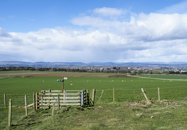
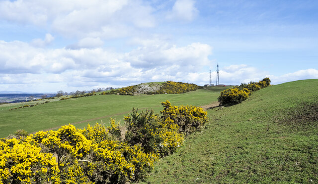
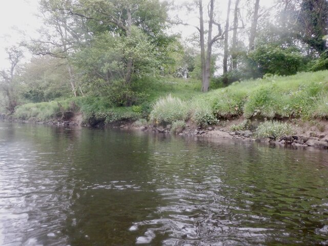
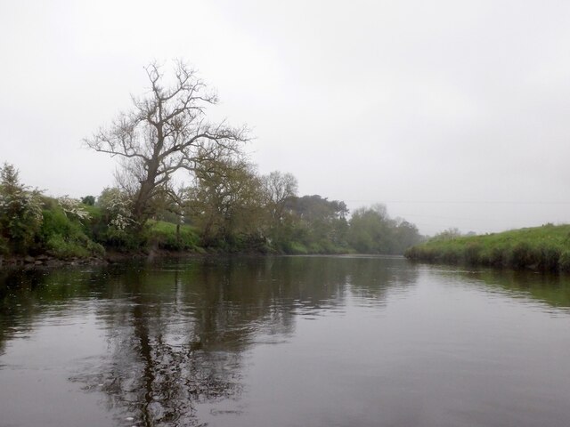
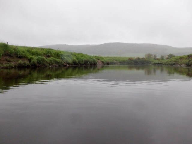
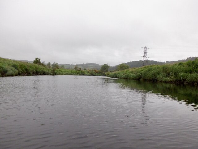
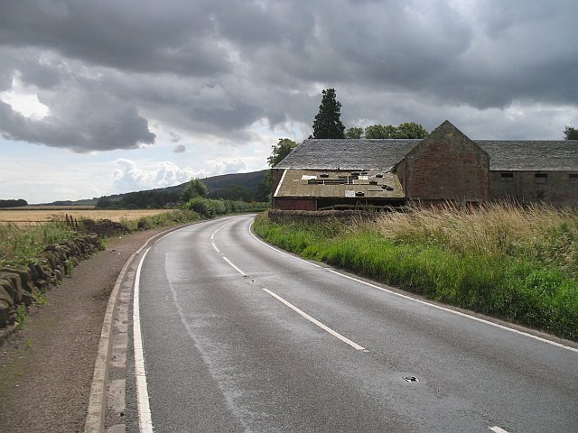
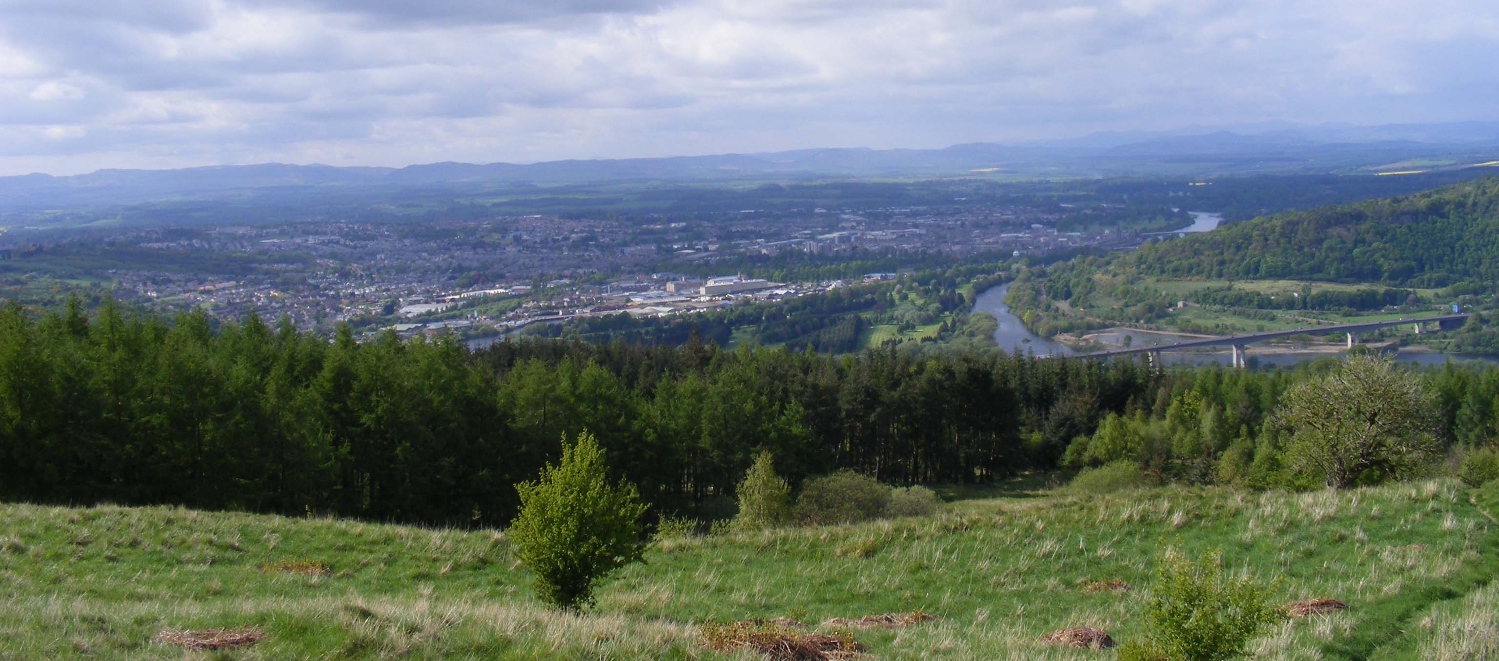
Craigend is a small village located in the county of Perthshire, Scotland. Situated on the southern bank of the River Earn, it lies approximately 5 miles west of the town of Crieff. The village is nestled within the picturesque countryside of Perthshire, surrounded by rolling hills and lush green fields.

With a population of around 200 residents, Craigend is a close-knit community known for its tranquil and rural atmosphere. The village is primarily residential, consisting of traditional stone houses and cottages. Many of these buildings have a charming rustic character, reflecting the area's rich history.

One notable landmark in Craigend is the Craigend Castle, which dates back to the 16th century. The castle stands on a hill overlooking the village, offering breathtaking views of the surrounding countryside. Although privately owned, its elegant architecture and historical significance make it a notable attraction for visitors to the area.

Craigend is also known for its proximity to outdoor recreational activities. The nearby River Earn provides opportunities for fishing, canoeing, and riverside walks. The surrounding hills and forests offer picturesque hiking trails, attracting nature enthusiasts and outdoor adventurers.

While Craigend is a peaceful and secluded village, it benefits from its close proximity to Crieff, where residents can access a wider range of amenities such as shops, schools, and healthcare facilities. Overall, Craigend offers a charming and idyllic retreat for those seeking a quieter way of life in the stunning Perthshire countryside.

If you have any feedback on the listing, please let us know in the comments section below.

Craigend Images

Images are sourced within 2km of 56.366417/-3.4323349 or Grid Reference NO1120. Thanks to Geograph Open Source API. All images are credited.

Footpaths and signpost on north side of Mailer Hill The signpost indicates three separate routes developed in the area as 'core paths'. Buildings in the city of Perth are in the distance.
Footpaths and signpost on north side of Mailer Hill
The signpost indicates three separate routes developed in the area as 'core paths'. Buildings in the city of Perth are in the distance.
Gorse bushes west of Mailer Hill The bushes lie along the ridge of Mailer Hill, west of its summit which is at a trig point at the centre of the image.
Gorse bushes west of Mailer Hill
The bushes lie along the ridge of Mailer Hill, west of its summit which is at a trig point at the centre of the image.
River Earn, Freeland Farm The river is mature here with lots of meanders. There is still a good flow.
River Earn, Freeland Farm
The river is mature here with lots of meanders. There is still a good flow.
River Earn, Freeland Farm Upstream view.
River Earn, Freeland Farm
Upstream view.
River Earn Passing the Kirkton Pouch, once almost an island due to meandering. There is a large oxbow lake nearby
River Earn
Passing the Kirkton Pouch, once almost an island due to meandering. There is a large oxbow lake nearby
Simmental cattle, Hilton On the river left bank of the Earn.
Simmental cattle, Hilton
On the river left bank of the Earn.
Hilton Viaduct A rather battered and old looking railway bridge (the line was closed to passengers in 1955, reopening in the 1970s to provide a route between the Forth Bridge and Perth via Ladybank)
Hilton Viaduct
A rather battered and old looking railway bridge (the line was closed to passengers in 1955, reopening in the 1970s to provide a route between the Forth Bridge and Perth via Ladybank)
River Earn, Hilton Another big meander.
River Earn, Hilton
Another big meander.
River Earn, Eastfield There is a narrow strip of land between the river and the Perth to Ladybank railway.
River Earn, Eastfield
There is a narrow strip of land between the river and the Perth to Ladybank railway.
River Earn, Eastfield Outside of a meander with the bank being eroded.
River Earn, Eastfield
Outside of a meander with the bank being eroded.
River Earn, Eastfield
River Earn, Eastfield Near Bridge of Earn and noticeably tidal.
River Earn, Eastfield
Near Bridge of Earn and noticeably tidal.
River Earn, Hilton Tidal section of the Earn, upstream of Bridge of Earn.
River Earn, Hilton
Tidal section of the Earn, upstream of Bridge of Earn.
River Earn, Hilton Tidal section of the Earn, upstream of Bridge of Earn.
River Earn, Hilton
Tidal section of the Earn, upstream of Bridge of Earn.
Horsemill near Bridge of Earn
River Earn beneath Moncrieffe Hill Upstream of Bridge of Earn.
River Earn beneath Moncrieffe Hill
Upstream of Bridge of Earn.
A912 north of Bridge of Earn The A912 heading for Perth from Bridge of Earn near Horsemill.
A912 north of Bridge of Earn
The A912 heading for Perth from Bridge of Earn near Horsemill.
Woodhead of Mailer Looking southeast from Woodhead of Mailer across grazing land, with fallen tree in the foreground and Earn valley in the distance.
Woodhead of Mailer
Looking southeast from Woodhead of Mailer across grazing land, with fallen tree in the foreground and Earn valley in the distance.
Show me another place!

Craigend is located at Grid Ref: NO1120 (Lat: 56.366417, Lng: -3.4323349)

Unitary Authority: Perth and Kinross

Police Authority: Tayside

What 3 Words

///emperor.suspended.compounds. Near Bridge of Earn, Perth & Kinross

Nearby Locations

Craigend Burden Hill

Related Wikis

Craigclowan Preparatory School

Craigclowan School & Nursery is a private day preparatory school for boys and girls aged 3 to 13 in Perth, Scotland. == History == Craigclowan School and...

HM Prison Friarton

HM Prison Friarton (later Friarton Detention Centre, Friarton Borstal and Friarton Hall Young Offenders Institution) was a place of detention for young...

A912 road

The A912 is a major road in both Perth and Kinross and Fife, Scotland. It runs from the A9 in Perth, in the north, to the A92 at Muirhead, in the south...

Moncreiffe Island

Moncreiffe Island, also known as Friarton Island, is an island in Perth, Scotland. It divides the River Tay into two channels as it flows through Perth...

Moncreiffe Hill

Moncreiffe Hill (also known as Moredun Hill) is a long, wooded ridge that lies south of Perth, Scotland. It can be easily seen on the right during the...
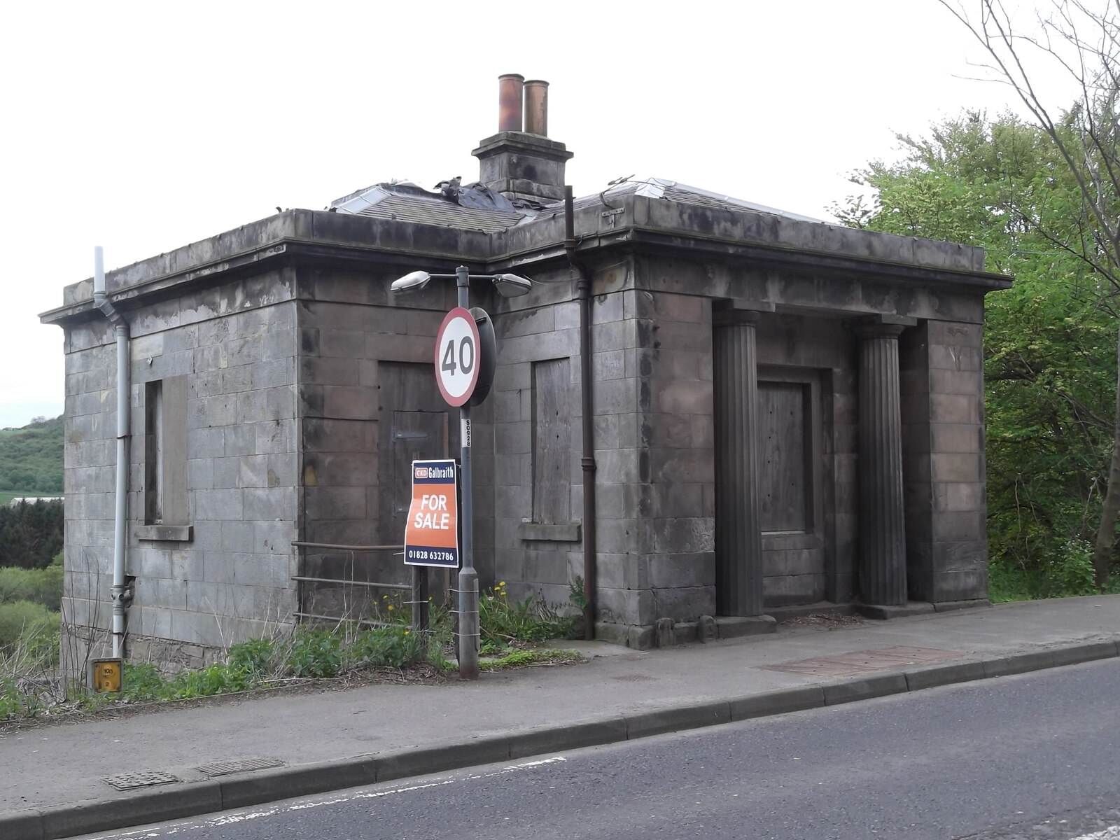
Barnhill Tollhouse

Barnhill Tollhouse (also known as the Old Toll House), located just to the southeast of Perth, Scotland, was built in the early 19th century. Now a Category...
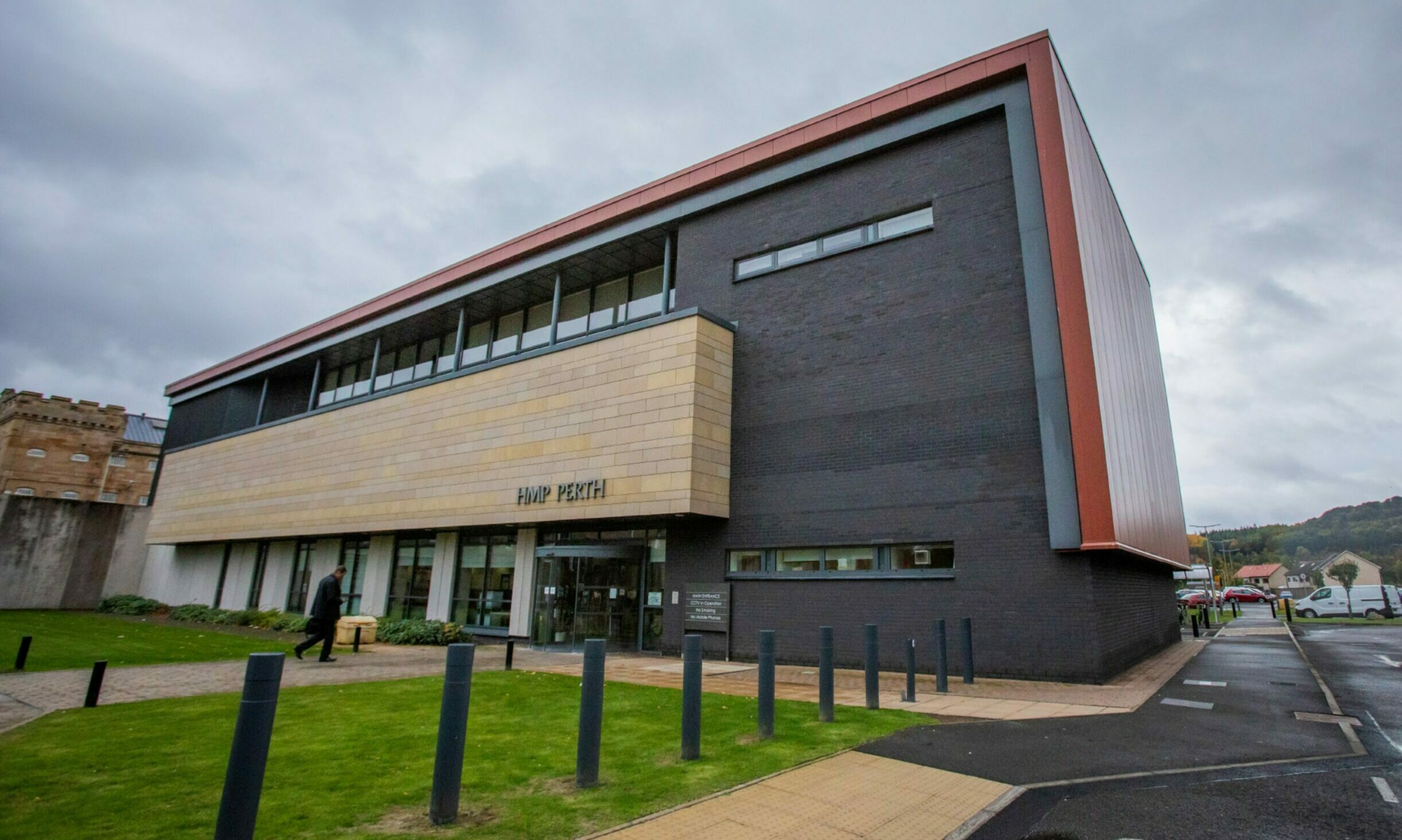
HM Prison Perth

HM Prison Perth is a prison in Perth, Scotland that houses short term adult male prisoners (those prisoners serving under 4 years). It was originally constructed...

Moncreiffe House

Moncreiffe House is a country house near Bridge of Earn in Perthshire in Scotland. It is a category B listed building. == History == The original house...

Nearby Amenities

Located within 500m of 56.366417,-3.4323349
Motorway Junction
Craigend Interchange
Ref: 10
Lat/Long: 56.3693671/-3.4343207
Railway: switch
Lat/Long: 56.3645035/-3.4314238
Crossing
Crossing: unmarked
Crossing Island: no
Crossing Markings: no
Kerb: flush
Tactile Paving: no
Lat/Long: 56.3669756/-3.425976
Crossing
Crossing: unmarked
Crossing Island: no
Crossing Markings: no
Kerb: flush
Tactile Paving: no
Lat/Long: 56.3670905/-3.426041
Material: wood
Power: pole
Lat/Long: 56.370773/-3.4304625
Material: wood
Power: pole
Lat/Long: 56.3691442/-3.4312416
Material: wood
Power: pole
Lat/Long: 56.3671386/-3.4318049
Material: wood
Power: pole
Lat/Long: 56.3702202/-3.4307195
Material: wood
Power: pole
Lat/Long: 56.3696548/-3.4309959
Material: wood
Power: pole
Lat/Long: 56.3681964/-3.4315771
Material: wood
Power: pole
Lat/Long: 56.3677519/-3.431679
Material: wood
Power: pole
Lat/Long: 56.3648335/-3.4322936
Material: wood
Power: pole
Lat/Long: 56.369031/-3.4313028
Railway: switch
Lat/Long: 56.3640073/-3.4322766
Hilton
1860name: Saw Mill
Pont: no
Stobie1783: no
Designation: Historic Mill
Historic: archaeological_site
Source: OS Six inch First Series
Lat/Long: 56.3637269/-3.4305379
Craigend
Place: hamlet
Lat/Long: 56.3664452/-3.4312561
Railway: switch
Lat/Long: 56.3635301/-3.4330304
Railway: switch
Lat/Long: 56.3645128/-3.431367
Railway: railway_crossing
Lat/Long: 56.3643173/-3.4316656
Material: wood
Power: pole
Lat/Long: 56.3702319/-3.4343766
Power: pole
Lat/Long: 56.3694287/-3.4320071
Material: wood
Power: pole
Lat/Long: 56.3656484/-3.4321208
Man Made: mast
Tower Type: communication
Lat/Long: 56.3633939/-3.433149
Hilton Junction
Railway: junction
Lat/Long: 56.3645073/-3.4313963
Power: pole
Lat/Long: 56.3628091/-3.4306043
Power: pole
Lat/Long: 56.3620737/-3.4304166
Generator Method: photovoltaic
Generator Output Electricity: yes
Generator Source: solar
Generator Type: solar_photovoltaic_panel
Power: generator
Lat/Long: 56.3667996/-3.4319957
Generator Method: photovoltaic
Generator Output Electricity: yes
Generator Source: solar
Generator Type: solar_photovoltaic_panel
Power: generator
Lat/Long: 56.3662713/-3.4362042
Generator Method: photovoltaic
Generator Output Electricity: yes
Generator Source: solar
Generator Type: solar_photovoltaic_panel
Power: generator
Lat/Long: 56.3661689/-3.4359643
Frequency: 50
Material: wood
Power: pole
Transformer: distribution
Voltage Primary: 11000
Voltage Secondary: 400
Lat/Long: 56.363263/-3.4322552
Power: pole
Lat/Long: 56.363396/-3.4316383
Power: pole
Lat/Long: 56.3648817/-3.4387588
Power: pole
Lat/Long: 56.3648611/-3.4378556
Power: pole
Lat/Long: 56.3648733/-3.4371421
Power: pole
Lat/Long: 56.3651705/-3.4362307
Power: pole
Lat/Long: 56.3654387/-3.4357756
Power: pole
Lat/Long: 56.365667/-3.4354043
Power: pole
Lat/Long: 56.3646077/-3.436964
Power: pole
Lat/Long: 56.3647611/-3.4358059
Power: pole
Lat/Long: 56.3648746/-3.4348992
Power: pole
Lat/Long: 56.365304/-3.4349795
Material: wood
Power: pole
Lat/Long: 56.3648256/-3.4317809
Material: wood
Power: pole
Lat/Long: 56.3652911/-3.4311361
Material: wood
Power: pole
Lat/Long: 56.3658417/-3.4302492
Material: wood
Power: pole
Lat/Long: 56.3663329/-3.4294658
Material: wood
Power: pole
Lat/Long: 56.3643614/-3.4336328
Material: wood
Power: pole
Lat/Long: 56.3640365/-3.4342799
Material: wood
Power: pole
Lat/Long: 56.3630345/-3.4363401
Material: wood
Power: pole
Lat/Long: 56.3665108/-3.431938
Give Way
Direction: backward
Lat/Long: 56.3657244/-3.4280842
Railway: signal
Railway Signal Direction: forward
Railway Signal Main: GB-NR:main
Railway Signal Main Form: semaphore
Ref: HJ12
Lat/Long: 56.3640259/-3.4319694
Railway: signal
Railway Signal Direction: backward
Railway Signal Main: GB-NR:main
Railway Signal Main Form: semaphore
Railway Signal Position: overhead
Ref: HJ6/3
Lat/Long: 56.3648202/-3.4309677
The data included in this document is from www.openstreetmap.org. The data is made available under ODbL.

Have you been to Craigend?

Leave your review of Craigend below (or comments, questions and feedback).