Counthorpe

Settlement in Lincolnshire South Kesteven

England

Counthorpe

Out for a ride Cyclists on a glorous day
Out for a ride Credit: Bob Harvey

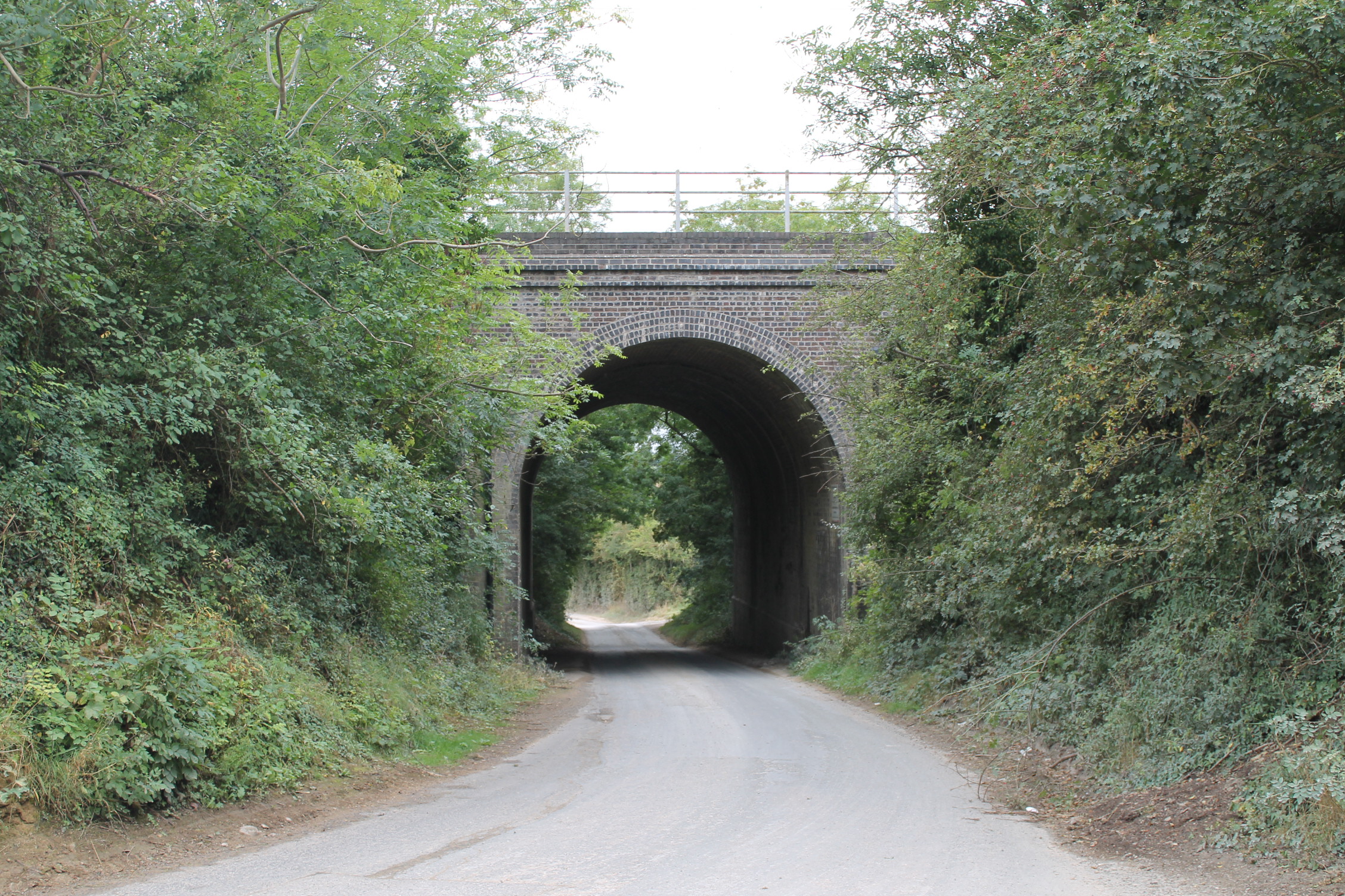
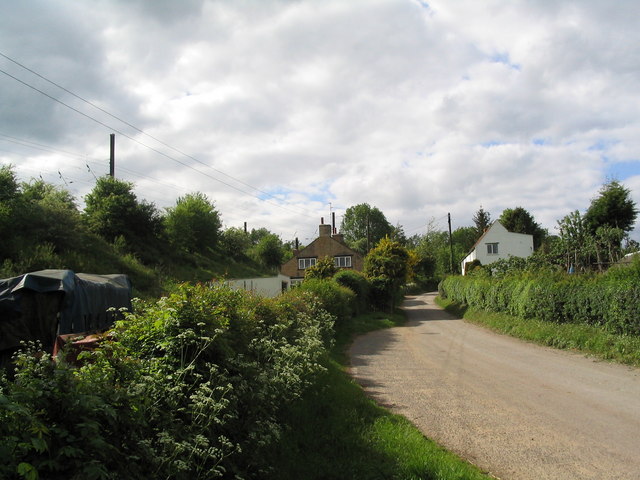
Counthorpe is a small village located in the county of Lincolnshire, in the East Midlands region of England. Situated approximately 7 miles southeast of Grantham and 9 miles northwest of Stamford, Counthorpe is nestled in a rural landscape characterized by rolling hills and scenic countryside.

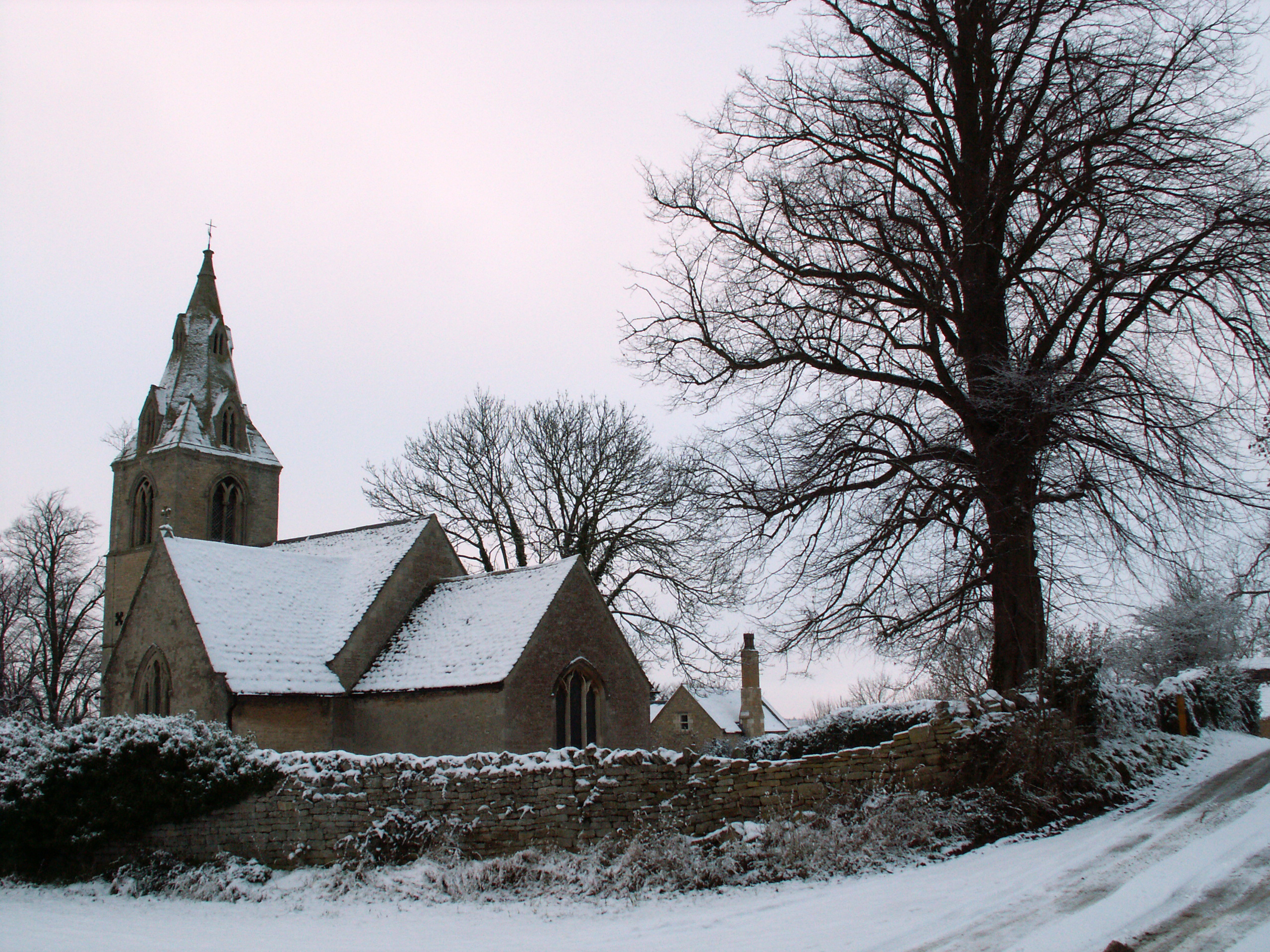
The village itself is relatively small, with a population of around 100 residents. Its picturesque charm is enhanced by the presence of a few traditional stone cottages and a historic church, St. Peter's, dating back to the 13th century. The church showcases beautiful architectural features and serves as a focal point for the community.

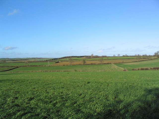
Counthorpe is primarily an agricultural village, with farming being the main occupation for many of its inhabitants. The surrounding fertile land supports a mixture of arable farming and livestock rearing. The village benefits from its proximity to larger towns, which provide access to services, employment opportunities, and amenities.

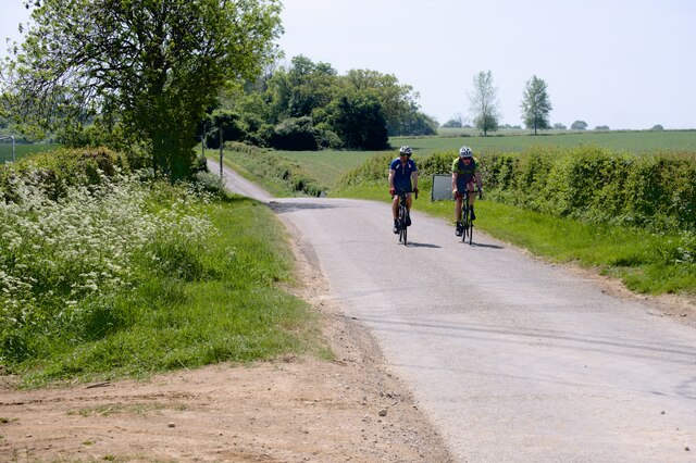
Nature enthusiasts will appreciate the tranquil setting of Counthorpe, as it is surrounded by stunning countryside and offers excellent opportunities for outdoor activities such as walking, cycling, and birdwatching. The area is also home to a diverse range of wildlife, including various bird species, small mammals, and insects.

While Counthorpe may be small in size, its rich history, natural beauty, and close-knit community make it a charming destination for those seeking a peaceful countryside experience in the heart of Lincolnshire.

If you have any feedback on the listing, please let us know in the comments section below.

Counthorpe Images

Images are sourced within 2km of 52.771308/-0.51086121 or Grid Reference TF0020. Thanks to Geograph Open Source API. All images are credited.

Out for a ride Cyclists on a glorous day
Out for a ride
Cyclists on a glorous day
Counthorpe The name 'Mallard Cottage' for the white building has nothing to do with birds. The East Coast Main Line runs along the embankment immediately opposite
Counthorpe
The name 'Mallard Cottage' for the white building has nothing to do with birds. The East Coast Main Line runs along the embankment immediately opposite
Counthorpe House
Counthorpe House
Valley of the West Glen River A footpath runs from The Drift (behind camera), alongside the hedge bounding Gorse Hill plantation (left), across the river, and up the far bank to Swinstead.
Valley of the West Glen River
A footpath runs from The Drift (behind camera), alongside the hedge bounding Gorse Hill plantation (left), across the river, and up the far bank to Swinstead.
'The Drift', north of Creeton View north of this attractive lane, which runs parallel to the West Glen River (to right)
'The Drift', north of Creeton
View north of this attractive lane, which runs parallel to the West Glen River (to right)
Footbridge over the West Glen River View north, with Croakhill Plantation on the right. The footpath runs from The Drift (left) to Creeton Farm on the Creeton-Swinstead road (right)
Footbridge over the West Glen River
View north, with Croakhill Plantation on the right. The footpath runs from The Drift (left) to Creeton Farm on the Creeton-Swinstead road (right)
Creeton Farm
Creeton Farm
View north-west of TF0120 Showing most of square TF0120, with Croakhill Plantation in the distance. Taken from the footpath running east from Creeton toward Grimsthorpe Park, which cuts across the south-east corner of the square.
View north-west of TF0120
Showing most of square TF0120, with Croakhill Plantation in the distance. Taken from the footpath running east from Creeton toward Grimsthorpe Park, which cuts across the south-east corner of the square.
Swinstead Road, north of Creeton 'Spring Buildings Plantation' to the left of the road at the top of the hill.
Swinstead Road, north of Creeton
'Spring Buildings Plantation' to the left of the road at the top of the hill.
Mistletoe in lime trees; Steel's Riding, Grimsthorpe Park The track running west-east through the southern part of Grimsthorpe Park is lined with lime trees, heavily infested with mistletoe. The trees look rather sick - but I've only seen them in their leaf-free, winter months.
Mistletoe in lime trees; Steel's Riding, Grimsthorpe Park
The track running west-east through the southern part of Grimsthorpe Park is lined with lime trees, heavily infested with mistletoe. The trees look rather sick - but I've only seen them in their leaf-free, winter months.
Western end of 'Steel's Riding', Grimsthorpe Park With one of the many mistletoe-infested lime trees.
Western end of 'Steel's Riding', Grimsthorpe Park
With one of the many mistletoe-infested lime trees.
Manure pile
Manure pile
Counthorpe Lane The lane from Counthorpe (behind camera) takes a sharp left towards Castle Bytham. Straight ahead is to Swayfield and the Creeton Quarry (right fork).
Counthorpe Lane
The lane from Counthorpe (behind camera) takes a sharp left towards Castle Bytham. Straight ahead is to Swayfield and the Creeton Quarry (right fork).
Creeton Road Plantation View is looking towards Swinstead - in the distance
Creeton Road Plantation
View is looking towards Swinstead - in the distance
Queen Victoria 60 year reign commemorative plaque This stone plaque, by the roadside, is let into a stone wall by Millington's Farm.
It commemorates Queen Victoria's Diamond Jubilee - 60 years reign 1837-1897.
Queen Victoria 60 year reign commemorative plaque
This stone plaque, by the roadside, is let into a stone wall by Millington's Farm. It commemorates Queen Victoria's Diamond Jubilee - 60 years reign 1837-1897.
Ford on the West Glen River near Millington's Farm This ford is found on the West Glen River just off the footpath leading from the Counthorpe Road and "The Drift" track down to Croakhill Plantation. There is a footbridge further down stream.
Ford on the West Glen River near Millington's Farm
This ford is found on the West Glen River just off the footpath leading from the Counthorpe Road and "The Drift" track down to Croakhill Plantation. There is a footbridge further down stream.
Farm Ford on the West Glen River at Creeton This farm ford is the closest to Creeton of the three fords on this stretch of the West Glen River.
Farm Ford on the West Glen River at Creeton
This farm ford is the closest to Creeton of the three fords on this stretch of the West Glen River.
Farm Ford on the West Glen River near Croakhill Plantation This farm ford is found just off The Drift upstream of the two other fords at Creeton.
Farm Ford on the West Glen River near Croakhill Plantation
This farm ford is found just off The Drift upstream of the two other fords at Creeton.
Show me another place!

Counthorpe is located at Grid Ref: TF0020 (Lat: 52.771308, Lng: -0.51086121)

Division: Parts of Kesteven

Administrative County: Lincolnshire

District: South Kesteven

Police Authority: Lincolnshire

What 3 Words

///also.functions.clarifies. Near Corby Glen, Lincolnshire

Related Wikis

Counthorpe and Creeton

Counthorpe and Creeton is a civil parish in the South Kesteven district of Lincolnshire, England. According to the 2001 census it had a population of...

Creeton

Creeton is a village in the civil parish of Counthorpe and Creeton in the South Kesteven district of Lincolnshire, England. It is situated 3 miles (5 km...

Counthorpe

Counthorpe is a hamlet in the civil parish of Counthorpe and Creeton in the South Kesteven district of Lincolnshire, England. It adjoins the hamlet of...
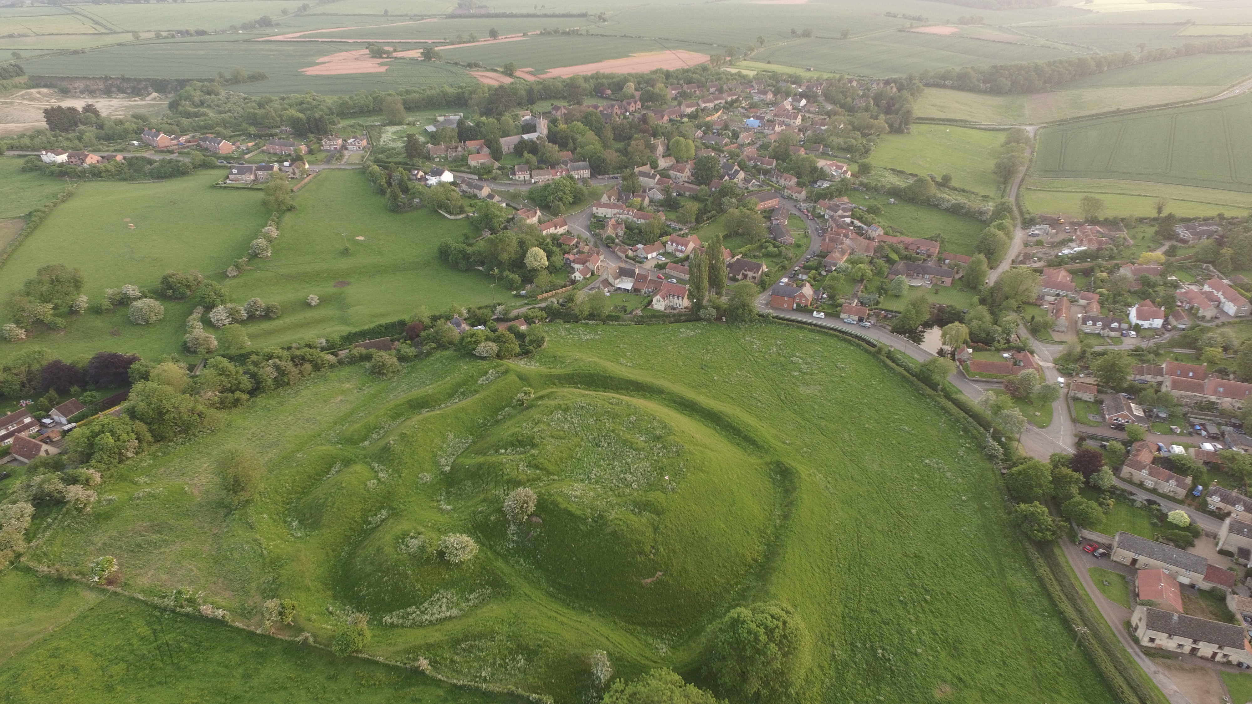
Bytham Castle

Bytham Castle was a castle in the village of Castle Bytham in Lincolnshire (grid reference SK992186.) The castle is thought to be of early Norman origin...

Nearby Amenities

Located within 500m of 52.771308,-0.51086121
Counthorpe
Place: hamlet
Lat/Long: 52.7709138/-0.5124716
Passing Place
Lat/Long: 52.768187/-0.5062594
Description: Mobile Phone Mast
Man Made: tower
Tower Type: communication
Lat/Long: 52.7721901/-0.5100903
Ele: 52.0000000
Lat/Long: 52.7741381/-0.5105795
Ele: 51.0000000
Lat/Long: 52.7721909/-0.5098207
Ele: 53.0000000
Lat/Long: 52.7726385/-0.5101213
Passing Place
Lat/Long: 52.770512/-0.5084129
Passing Place
Lat/Long: 52.7687968/-0.5067953
Elmtree Farm
Place: farm
Source: Bing
Lat/Long: 52.7725701/-0.5132658
Place: farm
Lat/Long: 52.7697663/-0.5121602
The data included in this document is from www.openstreetmap.org. The data is made available under ODbL.

Have you been to Counthorpe?

Leave your review of Counthorpe below (or comments, questions and feedback).