Clopton Green

Settlement in Suffolk East Suffolk

England

Clopton Green

Otley, St Mary
Otley, St Mary Credit: Dave Kelly

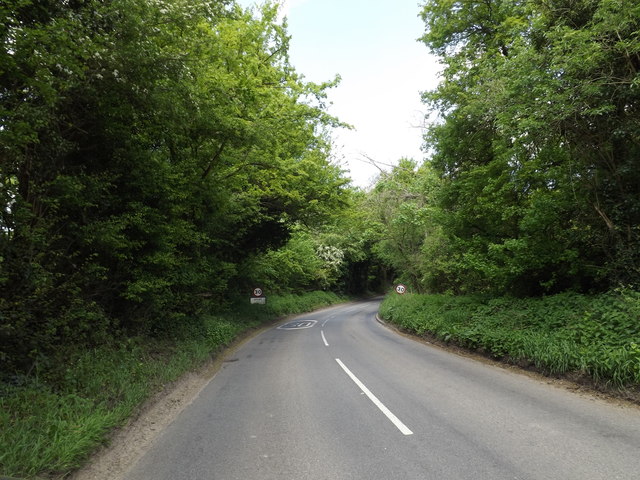
Clopton Green is a small village located in the county of Suffolk, England. Situated approximately 8 miles east of the town of Ipswich, it falls within the district of East Suffolk. The village is nestled in a picturesque rural setting, surrounded by beautiful countryside and farmland.

Clopton Green is characterized by its quaint and charming atmosphere, with a small community of residents who enjoy a peaceful and tight-knit lifestyle. The village is predominantly residential, with a scattering of traditional cottages and houses lining its streets. The architectural style of the buildings reflects the village's historical roots, with many dating back several centuries.

Although small in size, Clopton Green offers a range of amenities and services to its residents. These include a village hall, which serves as a social hub for community events and gatherings. There is also a local pub, providing a cozy setting for villagers to meet and socialize.

The village is surrounded by natural beauty, making it an ideal location for outdoor enthusiasts. There are plenty of walking and cycling routes in the area, allowing residents and visitors to explore the stunning countryside and enjoy the tranquility of the surroundings.

In terms of transport links, Clopton Green is well-connected. The A12 road runs nearby, providing easy access to Ipswich and other major towns and cities in the region. Public transportation is available, with regular bus services connecting the village to nearby towns and villages.

Overall, Clopton Green offers a serene and idyllic setting for those seeking a peaceful rural lifestyle, while still providing easy access to amenities and transport links.

If you have any feedback on the listing, please let us know in the comments section below.

Clopton Green Images

Images are sourced within 2km of 52.145143/1.2371198 or Grid Reference TM2154. Thanks to Geograph Open Source API. All images are credited.

Otley, St Mary
Otley, St Mary
View towards Otley Church
Derelict tin tabernacle next to the B1078, Clopton A Clopton village website (<span class="nowrap"><a title="http://clopton.onesuffolk.net/clopton-village/history-and-heritage/" rel="nofollow ugc noopener" href="http://clopton.onesuffolk.net/clopton-village/history-and-heritage/">Link</a><img style="margin-left:2px;" alt="External link" title="External link - shift click to open in new window" src="https://s1.geograph.org.uk/img/external.png" width="10" height="10"/></span> ) implies that these are the former Mission Rooms, which were replaced by a new village hall in the early 1990s.
Derelict tin tabernacle next to the B1078, Clopton
A Clopton village website (LinkExternal link ) implies that these are the former Mission Rooms, which were replaced by a new village hall in the early 1990s.
Derelict tin tabernacle next to the B1078, Clopton As can just be made out, the roof of the chapel has collapsed at the north-west end (liturgical east end) and the window at that end can be seen from the "inside" side.
A Clopton village website (<span class="nowrap"><a title="http://clopton.onesuffolk.net/clopton-village/history-and-heritage/" rel="nofollow ugc noopener" href="http://clopton.onesuffolk.net/clopton-village/history-and-heritage/">Link</a><img style="margin-left:2px;" alt="External link" title="External link - shift click to open in new window" src="https://s1.geograph.org.uk/img/external.png" width="10" height="10"/></span> ) implies that these are the former Mission Rooms, which were replaced by a new village hall in the early 1990s.
Derelict tin tabernacle next to the B1078, Clopton
As can just be made out, the roof of the chapel has collapsed at the north-west end (liturgical east end) and the window at that end can be seen from the "inside" side. A Clopton village website (LinkExternal link ) implies that these are the former Mission Rooms, which were replaced by a new village hall in the early 1990s.
View out of the valley from the B1078
Former school, Clopton, Suffolk According to a Clopton village website (<span class="nowrap"><a title="http://clopton.onesuffolk.net/clopton-village/history-and-heritage/" rel="nofollow ugc noopener" href="http://clopton.onesuffolk.net/clopton-village/history-and-heritage/">Link</a><img style="margin-left:2px;" alt="External link" title="External link - shift click to open in new window" src="https://s1.geograph.org.uk/img/external.png" width="10" height="10"/></span> ), Clopton school closed in the late 1930s.
Former school, Clopton, Suffolk
According to a Clopton village website (LinkExternal link ), Clopton school closed in the late 1930s.
Fish  Ponds  in  the  grounds  of  Otley  Hall Building on the left over the reeds is the cafe and entrance to the gardens of the hall
Fish Ponds in the grounds of Otley Hall
Building on the left over the reeds is the cafe and entrance to the gardens of the hall
Otley  Hall  c15  and  early  c16  House Pevsner states it is one of the most interesting houses in Suffolk
Otley Hall c15 and early c16 House
Pevsner states it is one of the most interesting houses in Suffolk
Otley  Primary  School  and  Under  5s  Centre.  Chapel  Road
Otley Primary School and Under 5s Centre. Chapel Road
Otley  Post  Office  and  Store.  Chapel  Road
Otley Post Office and Store. Chapel Road
Road  junction  in  Otley  village The village name sign is to the left of the Stop sign
Road junction in Otley village
The village name sign is to the left of the Stop sign
Entering Otley on the B1079 <span class="nowrap"><a title="https://en.wikipedia.org/wiki/Otley,_Suffolk" rel="nofollow ugc noopener" href="https://en.wikipedia.org/wiki/Otley,_Suffolk">Link</a><img style="margin-left:2px;" alt="External link" title="External link - shift click to open in new window" src="https://s1.geograph.org.uk/img/external.png" width="10" height="10"/></span>
Entering Otley on the B1079
Otley Village Name sign on the B1079 <span class="nowrap"><a title="https://en.wikipedia.org/wiki/Otley,_Suffolk" rel="nofollow ugc noopener" href="https://en.wikipedia.org/wiki/Otley,_Suffolk">Link</a><img style="margin-left:2px;" alt="External link" title="External link - shift click to open in new window" src="https://s1.geograph.org.uk/img/external.png" width="10" height="10"/></span>
Otley Village Name sign on the B1079
B1079 at Otley <span class="nowrap"><a title="https://en.wikipedia.org/wiki/Otley,_Suffolk" rel="nofollow ugc noopener" href="https://en.wikipedia.org/wiki/Otley,_Suffolk">Link</a><img style="margin-left:2px;" alt="External link" title="External link - shift click to open in new window" src="https://s1.geograph.org.uk/img/external.png" width="10" height="10"/></span>
B1079 at Otley
2 Newlands Postbox & Bus Shelter Off Chapel Road
Postbox No.IP6 1126
2 Newlands Postbox & Bus Shelter
Off Chapel Road Postbox No.IP6 1126
2 Newlands Postbox & Otley Village Notice Board Off Chapel Road
Postbox No.IP6 1126
2 Newlands Postbox & Otley Village Notice Board
Off Chapel Road Postbox No.IP6 1126
2 Newlands Postbox Off Chapel Road
Postbox No.IP6 1126
2 Newlands Postbox
Off Chapel Road Postbox No.IP6 1126
2 Newlands Postbox Off Chapel Road
Postbox No.IP6 1126
(Close up)
2 Newlands Postbox
Off Chapel Road Postbox No.IP6 1126 (Close up)
Show me another place!

Clopton Green is located at Grid Ref: TM2154 (Lat: 52.145143, Lng: 1.2371198)

Administrative County: Suffolk

District: East Suffolk

Police Authority: Suffolk

What 3 Words

///cleanest.clubbing.sprinter. Near Grundisburgh, Suffolk

Nearby Locations

Clopton Green

Related Wikis

Otley, Suffolk

Otley is a village and civil parish in the East Suffolk district, in the English county of Suffolk. It is around 7 miles (11 km) north-east of Ipswich...

Suffolk Rural College

Suffolk Rural College is an English further education college in the village of Otley, Suffolk. The college was founded in 1970 as Otley College of Agriculture...
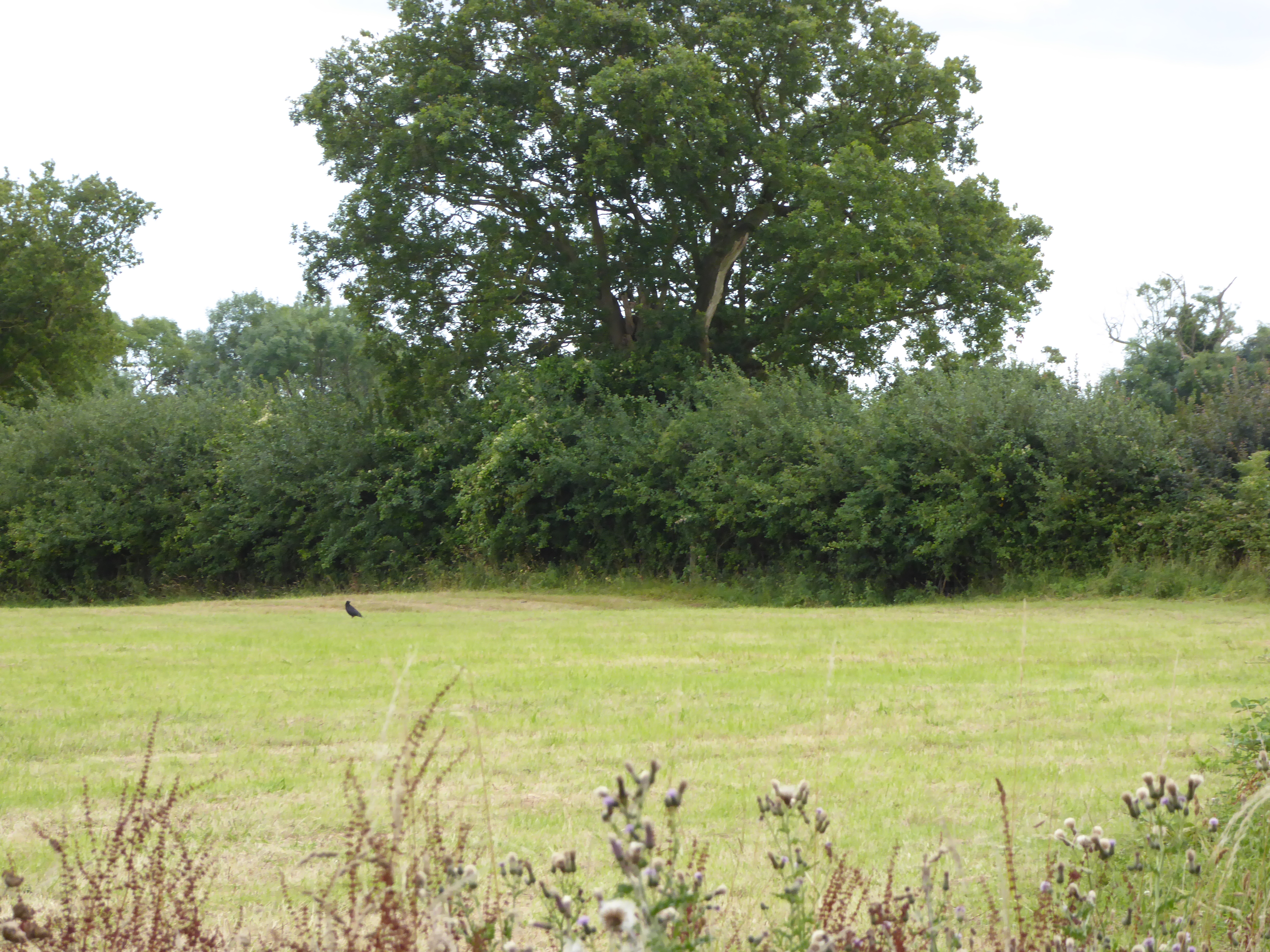
Moat Farm Meadows

Moat Farm Meadows is a 3.3-hectare (8.2-acre) biological Site of Special Scientific Interest north-east of Otley in Suffolk.These calcareous meadows are...
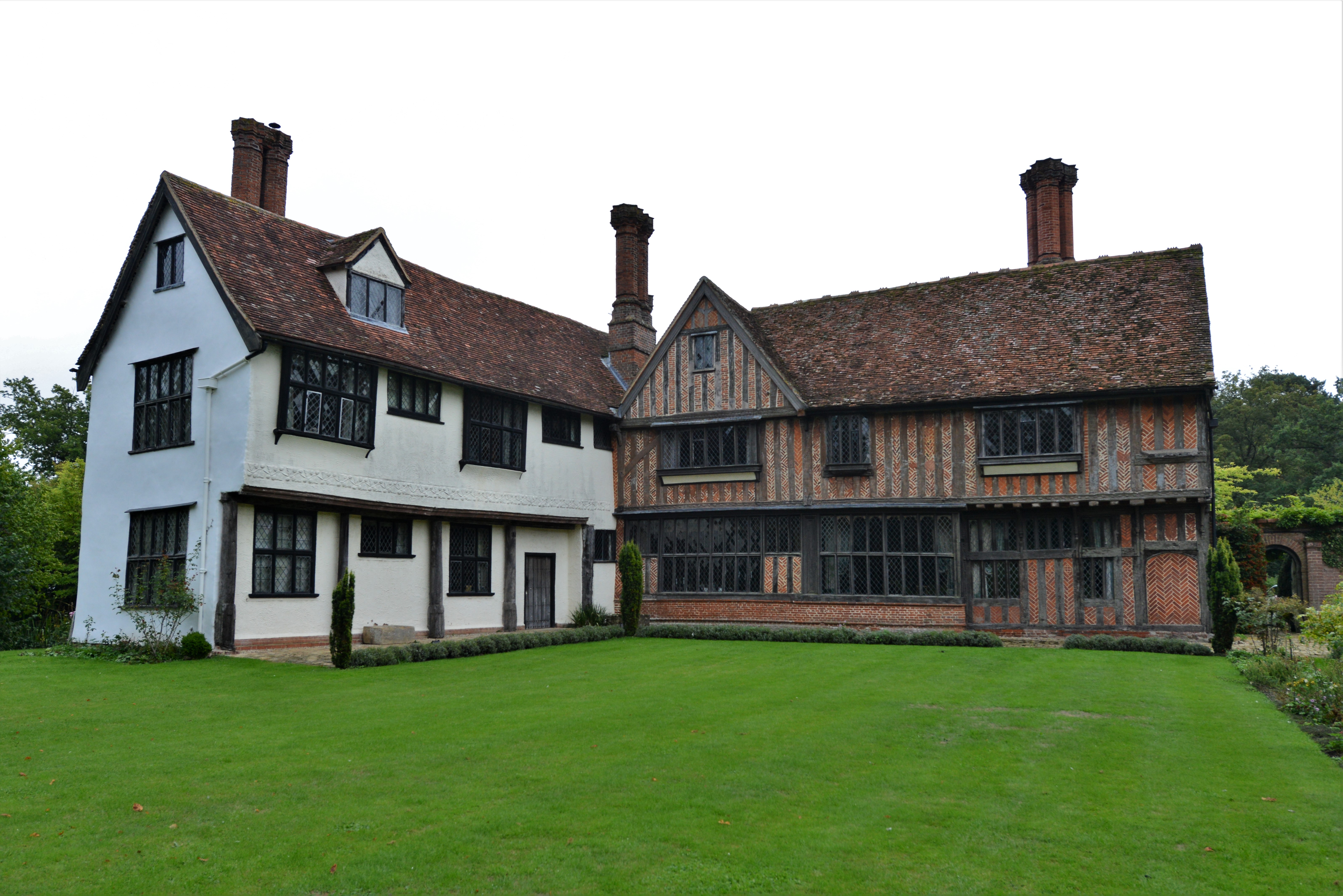
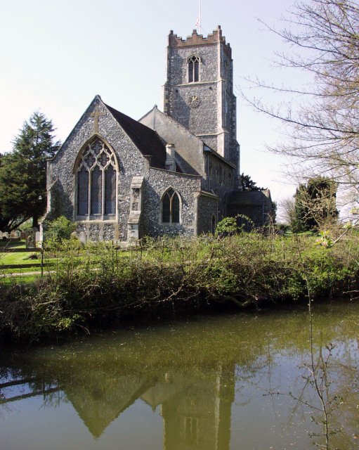
Otley Hall

Otley Hall is a 16th-century English manor house in the civil parish of Otley, in the East Suffolk district, Suffolk, England. It is a Grade I listed building...

Nearby Amenities

Located within 500m of 52.145143,1.2371198
Clopton Green
Place: hamlet
Source: OS 1:25k + nptg
Lat/Long: 52.1455467/1.2373675
The data included in this document is from www.openstreetmap.org. The data is made available under ODbL.

Have you been to Clopton Green?

Leave your review of Clopton Green below (or comments, questions and feedback).