Clopton

Settlement in Suffolk East Suffolk

England

Clopton

Country road near Gibraltar Oak tree beside a country road passing through farmland near Gibraltar.
Country road near Gibraltar Credit: Philip Halling

Clopton is a small village located in the county of Suffolk, England. Situated approximately 8 miles north of the market town of Woodbridge, it is nestled in a rural area surrounded by picturesque countryside. The village is part of the Mid Suffolk district and falls within the civil parish of Clopton and Kettleburgh.

Clopton is characterized by its quaint and traditional charm, with a scattering of charming cottages and farmhouses throughout the area. The village is home to a close-knit community of around 200 residents, who enjoy a peaceful and idyllic lifestyle away from the hustle and bustle of larger towns and cities.

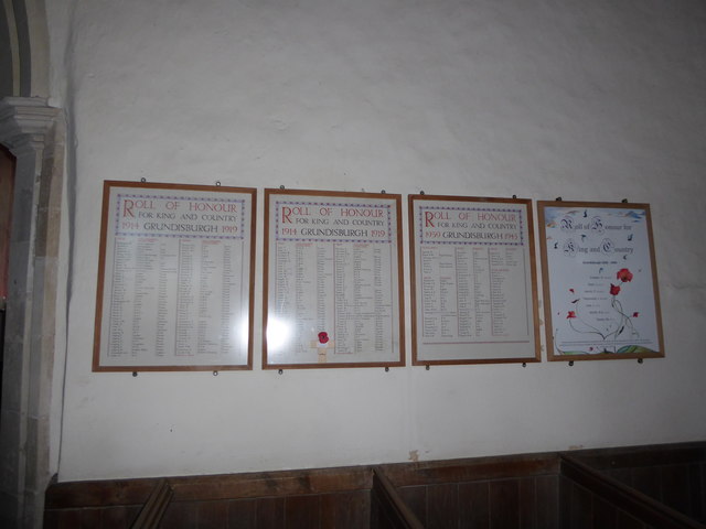
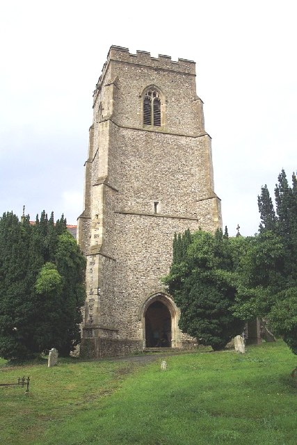
The village is known for its historic St. Mary's Church, a Grade II listed building dating back to the 14th century. The church features a striking tower and beautiful stained glass windows, attracting visitors with an interest in architectural heritage.

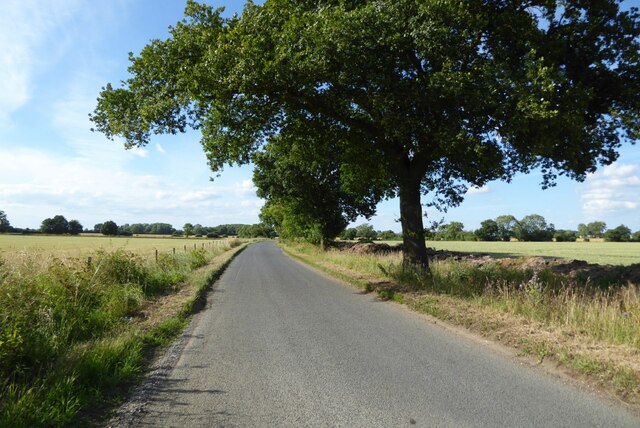
Surrounded by rolling fields and farmland, Clopton offers ample opportunities for outdoor activities such as scenic walks and cycling. The village is also in close proximity to the River Deben, a popular spot for boating and fishing enthusiasts.

While Clopton itself does not have any major amenities, residents benefit from easy access to nearby towns for shopping, healthcare, and educational facilities. The village is well-connected by road, with the A12 highway just a short drive away, providing convenient links to larger towns and cities in the region.

In summary, Clopton is a charming and peaceful village in Suffolk, offering a tranquil rural lifestyle amidst beautiful countryside, historic architecture, and a close-knit community.

If you have any feedback on the listing, please let us know in the comments section below.

Clopton Images

Images are sourced within 2km of 52.128932/1.2405034 or Grid Reference TM2152. Thanks to Geograph Open Source API. All images are credited.

Country road near Gibraltar Oak tree beside a country road passing through farmland near Gibraltar.
Country road near Gibraltar
Oak tree beside a country road passing through farmland near Gibraltar.
Derelict tin tabernacle next to the B1078, Clopton A Clopton village website (<span class="nowrap"><a title="http://clopton.onesuffolk.net/clopton-village/history-and-heritage/" rel="nofollow ugc noopener" href="http://clopton.onesuffolk.net/clopton-village/history-and-heritage/">Link</a><img style="margin-left:2px;" alt="External link" title="External link - shift click to open in new window" src="https://s1.geograph.org.uk/img/external.png" width="10" height="10"/></span> ) implies that these are the former Mission Rooms, which were replaced by a new village hall in the early 1990s.
Derelict tin tabernacle next to the B1078, Clopton
A Clopton village website (LinkExternal link ) implies that these are the former Mission Rooms, which were replaced by a new village hall in the early 1990s.
Derelict tin tabernacle next to the B1078, Clopton As can just be made out, the roof of the chapel has collapsed at the north-west end (liturgical east end) and the window at that end can be seen from the "inside" side.
A Clopton village website (<span class="nowrap"><a title="http://clopton.onesuffolk.net/clopton-village/history-and-heritage/" rel="nofollow ugc noopener" href="http://clopton.onesuffolk.net/clopton-village/history-and-heritage/">Link</a><img style="margin-left:2px;" alt="External link" title="External link - shift click to open in new window" src="https://s1.geograph.org.uk/img/external.png" width="10" height="10"/></span> ) implies that these are the former Mission Rooms, which were replaced by a new village hall in the early 1990s.
Derelict tin tabernacle next to the B1078, Clopton
As can just be made out, the roof of the chapel has collapsed at the north-west end (liturgical east end) and the window at that end can be seen from the "inside" side. A Clopton village website (LinkExternal link ) implies that these are the former Mission Rooms, which were replaced by a new village hall in the early 1990s.
View out of the valley from the B1078
Former school, Clopton, Suffolk According to a Clopton village website (<span class="nowrap"><a title="http://clopton.onesuffolk.net/clopton-village/history-and-heritage/" rel="nofollow ugc noopener" href="http://clopton.onesuffolk.net/clopton-village/history-and-heritage/">Link</a><img style="margin-left:2px;" alt="External link" title="External link - shift click to open in new window" src="https://s1.geograph.org.uk/img/external.png" width="10" height="10"/></span> ), Clopton school closed in the late 1930s.
Former school, Clopton, Suffolk
According to a Clopton village website (LinkExternal link ), Clopton school closed in the late 1930s.
Flooding in Grundisburgh The Ford at Grundisburgh at the height of the flooding caused by Storm Babet on 20th October 2023. The depth gauge in the ford shows a depth of 3.5 feet. The road past the Old Forge Stores to The Green was impassable for several hours.
Flooding in Grundisburgh
The Ford at Grundisburgh at the height of the flooding caused by Storm Babet on 20th October 2023. The depth gauge in the ford shows a depth of 3.5 feet. The road past the Old Forge Stores to The Green was impassable for several hours.
Flooding at The Green in Grundisburgh The Green at Grundisburgh was flooded as a result of Storm Babet. The roads through the village were impassable for several hours.
Flooding at The Green in Grundisburgh
The Green at Grundisburgh was flooded as a result of Storm Babet. The roads through the village were impassable for several hours.
Flooding in Grundisburgh Looking towards the village centre. The road was impassable for several hours.
Flooding in Grundisburgh
Looking towards the village centre. The road was impassable for several hours.
493rd Bomb Group Memorial Debach Airfield, Station 152, was the home of the 493rd Bomb Group USAAF during the Second World War. The memorial lists the 237 names of the men from Squadrons 860, 861, 862 and 863 who didn't make it back home when the hostilities ended.
(The names are readable on the largest size image)
493rd Bomb Group Memorial
Debach Airfield, Station 152, was the home of the 493rd Bomb Group USAAF during the Second World War. The memorial lists the 237 names of the men from Squadrons 860, 861, 862 and 863 who didn't make it back home when the hostilities ended. (The names are readable on the largest size image)
St Mary, Grundisburgh: late December 2016
St Mary, Grundisburgh: tower
Inside St Mary, Grundisburgh (I)
Inside St Mary, Grundisburgh (II)
Inside St Mary, Grundisburgh (III)
Inside St Mary, Grundisburgh (IV)
Inside St Mary, Grundisburgh (V)
Inside St Mary, Grundisburgh (VI)
Inside St Mary, Grundisburgh (VII)
Show me another place!

Clopton is located at Grid Ref: TM2152 (Lat: 52.128932, Lng: 1.2405034)

Administrative County: Suffolk

District: East Suffolk

Police Authority: Suffolk

What 3 Words

///salmon.exile.surpasses. Near Grundisburgh, Suffolk

Nearby Locations

Clopton

Related Wikis

Clopton, Suffolk

Clopton is a village and civil parish in Suffolk. It is located between Ipswich and Debenham two kilometres north of Grundisburgh on the River Lark. The...

Burgh, Suffolk

Burgh () is a village and civil parish in the East Suffolk district of Suffolk, England, about 3.5 miles (6 km) north-west of Woodbridge.St Botolph's church...

Grundisburgh

Grundisburgh () is a village of 1,584 residents situated in the English county of Suffolk. It is in the East Suffolk district, six 6 miles (10 km) north...

Burgh Windmill

Burgh Mill is a Grade II listed tower mill at Burgh, Suffolk, England which has been converted to residential accommodation. == History == Burgh Mill was...

Nearby Amenities

Located within 500m of 52.128932,1.2405034
Bus Stop
Red House
Naptan AtcoCode: 390060540
Naptan Bearing: NW
Naptan CommonName: Red House
Naptan Indicator: opp
Naptan Landmark: Red House
Naptan NaptanCode: sufgpwpg
Naptan Street: Grundisburgh Road
Naptan Verified: no
Public Transport: platform
Source: naptan_import
Lat/Long: 52.1286467/1.2406711
Bus Stop
Red House
Naptan AtcoCode: 390060541
Naptan Bearing: SE
Naptan BusStopType: CUS
Naptan CommonName: Red House
Naptan Indicator: adj
Naptan Landmark: Red House
Naptan NaptanCode: sufgpwpj
Naptan Street: Grundisburgh Road
Naptan Verified: no
Source: naptan_import
Lat/Long: 52.1290318/1.2405742
Clopton
Place: village
Wikidata: Q2049258
Wikipedia: en:Clopton, Suffolk
Lat/Long: 52.1262166/1.2428743
Service: driveway
Lat/Long: 52.1302741/1.2420505
The data included in this document is from www.openstreetmap.org. The data is made available under ODbL.

Have you been to Clopton?

Leave your review of Clopton below (or comments, questions and feedback).