Clifton upon Teme

Settlement in Worcestershire Malvern Hills

England

Clifton upon Teme

Abandoned church at Lower Sapey From the SW
Abandoned church at Lower Sapey Credit: mym

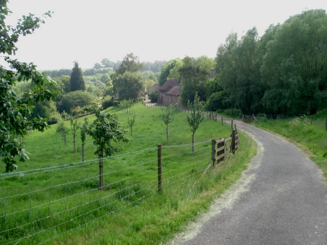
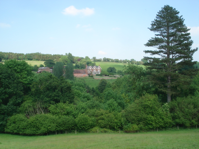
Clifton upon Teme is a small village located in the county of Worcestershire, England. Situated on the banks of the River Teme, the village is surrounded by picturesque countryside and rolling hills. It is part of the Malvern Hills District and falls within the administrative area of the Wychavon District Council.

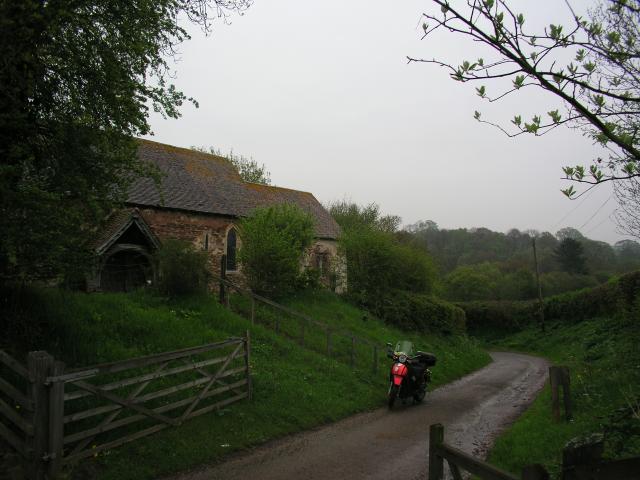
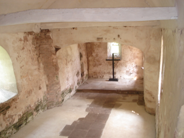
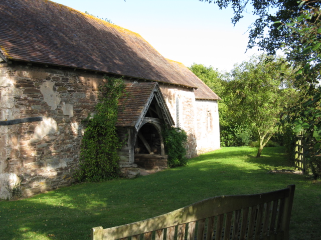
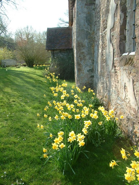
With a population of around 500 residents, Clifton upon Teme maintains a close-knit community atmosphere. The village is known for its charming historic buildings, including St. Kenelm's Church, which dates back to the 12th century. The church is a prominent landmark and serves as a focal point for both religious and community events.

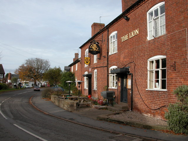
Clifton upon Teme offers a range of amenities for its residents, including a primary school, village hall, and a local pub. The village also has a post office and a convenience store, ensuring that essential services are readily available to its residents.

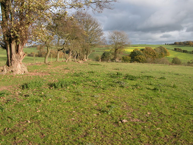
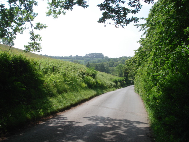
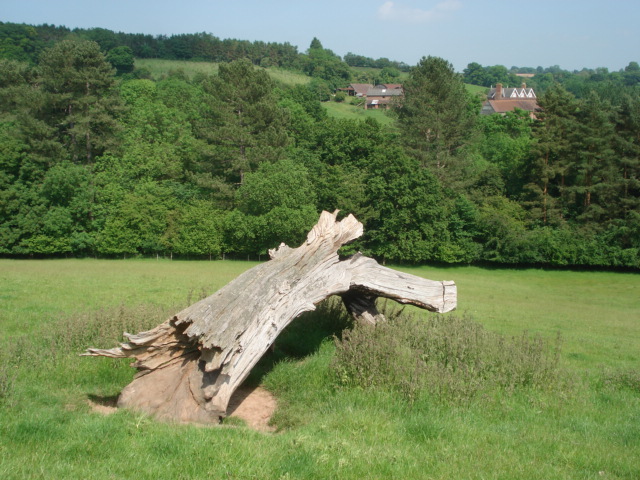
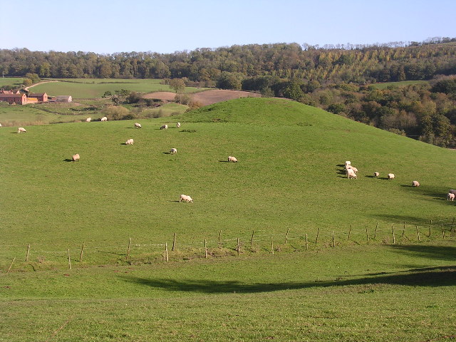
The surrounding countryside provides ample opportunities for outdoor activities, such as hiking, cycling, and fishing. The River Teme is particularly popular for fishing enthusiasts, attracting visitors from near and far. The village is also within close proximity to the Malvern Hills Area of Outstanding Natural Beauty, offering stunning landscapes and panoramic views.

Clifton upon Teme is well-connected to other towns and cities in Worcestershire, with regular bus services and easy access to major road networks. The nearby towns of Worcester and Malvern provide additional amenities and cultural attractions, making Clifton upon Teme an ideal location for those seeking a peaceful village lifestyle with convenient access to urban centers.

If you have any feedback on the listing, please let us know in the comments section below.

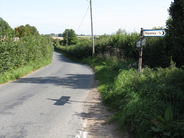
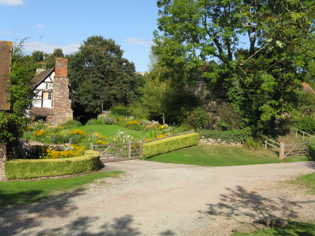
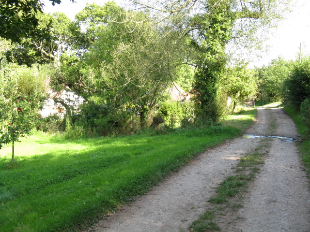
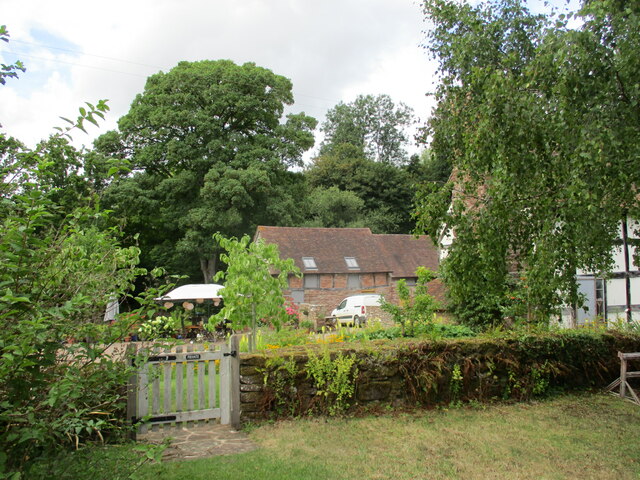
Clifton upon Teme Images

Images are sourced within 2km of 52.250885/-2.4245173 or Grid Reference SO7161. Thanks to Geograph Open Source API. All images are credited.

Abandoned church at Lower Sapey From the SW
Abandoned church at Lower Sapey
From the SW
Bridleway and farmland to the east of Burton Court
Farm buildings at Burton Court
The Harpley Road
The Harpley Road
Entrance lane to Hatt House Farm
Bleached tree on Hatt House Farm With Hope Farm on the other side of the valley.
Bleached tree on Hatt House Farm
With Hope Farm on the other side of the valley.
Hope Farm
Hope Farm
Interior of Old St Bartholomew's Church Altar end.
Interior of Old St Bartholomew's Church
Altar end.
Interior of Old St Bartholomew's Church Balcony end.
Interior of Old St Bartholomew's Church
Balcony end.
Porch of Old St Bartholomew's Church
Old St Bartholomew's Church at Lower Sapey The original Saxon church for Lower Sapey parish has an entry in the Domesday Book of 1086. In 1878 a new St Bartholomew's parish church was built, which is when this one became known as Old St Bartholomew's. Instructions were issued to demolish it, but these were never carried out and nobody from the Diocese noticed in this remote parish. The church was in disrepair until restored over 1989 to 1994, driven by the owners of the cottage next door. Now administered by the Churches Conservation Trust.
<span class="nowrap"><a title="http://www.british-history.ac.uk/report.aspx?compid=42903" rel="nofollow ugc noopener" href="http://www.british-history.ac.uk/report.aspx?compid=42903">Link</a><img style="margin-left:2px;" alt="External link" title="External link - shift click to open in new window" src="https://s1.geograph.org.uk/img/external.png" width="10" height="10"/></span>
Old St Bartholomew's Church at Lower Sapey
The original Saxon church for Lower Sapey parish has an entry in the Domesday Book of 1086. In 1878 a new St Bartholomew's parish church was built, which is when this one became known as Old St Bartholomew's. Instructions were issued to demolish it, but these were never carried out and nobody from the Diocese noticed in this remote parish. The church was in disrepair until restored over 1989 to 1994, driven by the owners of the cottage next door. Now administered by the Churches Conservation Trust. LinkExternal link
Cottage next to the church at Lower Sapey
Lane To Clifton At Harpley Junction
The Old Church, Lower Sapey
Cottage Garden, Lower Sapey
Bridleway At Lower Sapey
Springtime - St Bartholomew's, Lower Sapey Hereford and Worcester have more than their share of conserved churches. St Bartholomew's is one of the best.
Springtime - St Bartholomew's, Lower Sapey
Hereford and Worcester have more than their share of conserved churches. St Bartholomew's is one of the best.
Gate leading to Church House Farm
Show me another place!

Clifton upon Teme is located at Grid Ref: SO7161 (Lat: 52.250885, Lng: -2.4245173)

Administrative County: Worcestershire

District: Malvern Hills

Police Authority: West Merica

What 3 Words

///thundered.mats.risk. Near Collington, Herefordshire

Related Wikis

Clifton upon Teme

Clifton upon Teme is a village and civil parish in the Malvern Hills District in the county of Worcestershire, England. == Amenities == Named after the...

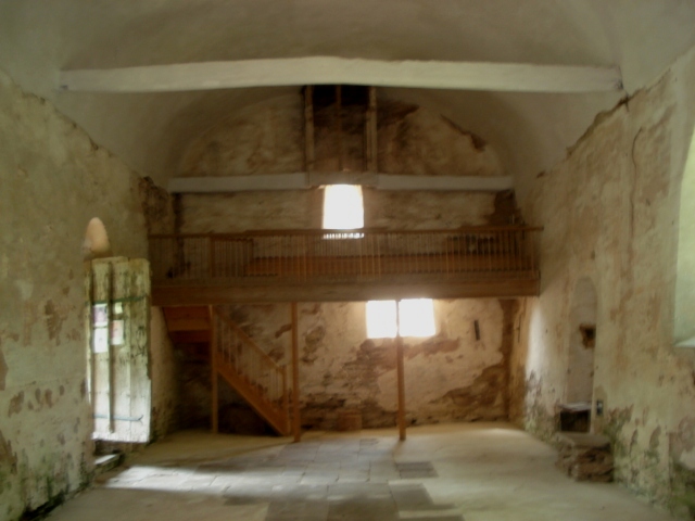
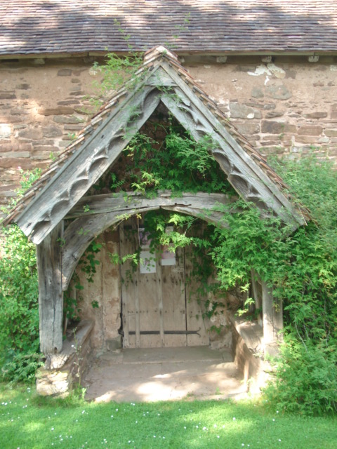
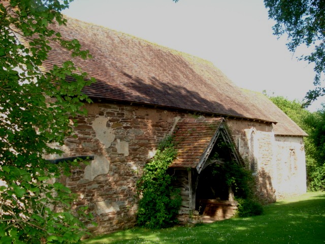
Old St Bartholomew's Church, Lower Sapey

Old St Bartholomew's Church is a redundant Anglican church near the village of Lower Sapey, Worcestershire, England. It is recorded in the National Heritage...

Shelsley Walsh

Shelsley Walsh is a small village and civil parish in Worcestershire, England, on the western side of the River Teme. For administrative purposes it is...

Lower Sapey

Lower Sapey is a village and civil parish in the Malvern Hills District in the county of Worcestershire, England. Sapey Pritchard was in the upper division...
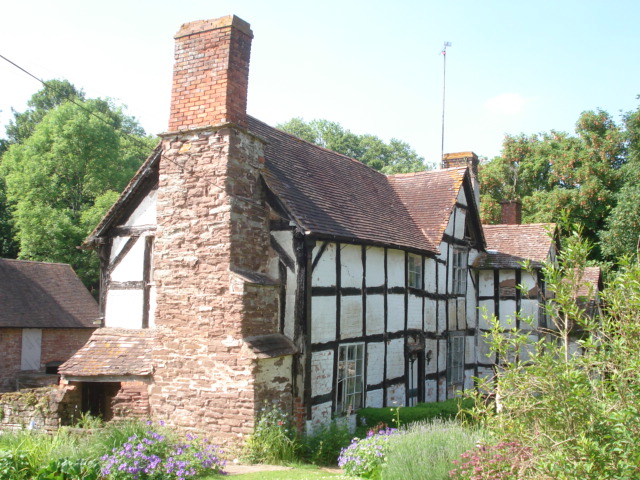
Ham Castle

Ham Castle (also known as Home or Homme Castle) is located in Worcestershire at the bottom of a wooded escarpment (and close to the River Teme), within...

Shelsley Beauchamp

Shelsley Beauchamp or Great Shelsley is a village and civil parish 9 miles (14 km) north west of Worcester, in the Malvern Hills district, in the county...

Sapey Common

Sapey Common is a small village in Herefordshire, England, near the border with Worcestershire, 10 km (6.2 mi) north east of Bromyard . Although the area...

Shelsleys

The Shelsleys are a group of small villages in the Malvern Hills District in the county of Worcestershire, England. Situated on either wide of the Teme...

Nearby Amenities

Located within 500m of 52.250885,-2.4245173
Bus Stop
Clifton-upon-Teme- Lion Inn
Bus: yes
Naptan AtcoCode: 2000G107500
Naptan Bearing: NW
Naptan BusStopType: CUS
Naptan CommonName: Clifton-upon-Teme- Lion Inn
Naptan Indicator: Adj
Naptan Landmark: Public House
Naptan NaptanCode: wocgmdmd
Naptan Street: Village Road
Naptan Verified: no
Public Transport: platform
Source: naptan_import
Lat/Long: 52.2516939/-2.4209197
Bus Stop
The Village
Bus: yes
Naptan AtcoCode: 2000G107501
Naptan Bearing: NE
Naptan BusStopType: CUS
Naptan CommonName: The Village
Naptan Crossing: The Village
Naptan Indicator: Adj
Naptan Landmark: Manor Road Junction
Naptan NaptanCode: wocgmdmg
Naptan Street: Manor Road
Naptan Verified: no
Public Transport: platform
Source: naptan_import
Lat/Long: 52.253593/-2.4228568
Bus Stop
Clifton-upon-Teme- Old Smithy
Bus: yes
Naptan AtcoCode: 2000G107502
Naptan Bearing: NW
Naptan BusStopType: CUS
Naptan CommonName: Clifton-upon-Teme- Old Smithy
Naptan Indicator: Adj
Naptan Landmark: Public House
Naptan NaptanCode: wocdgjdm
Naptan Street: Village Road
Naptan Verified: no
Public Transport: platform
Source: naptan_import
Lat/Long: 52.2518009/-2.4211844
Bus Stop
Manor Road
Bus: yes
Naptan AtcoCode: 2000G581602
Naptan Bearing: N
Naptan BusStopType: CUS
Naptan CommonName: Manor Road
Naptan Crossing: Manor Road
Naptan Indicator: Adj
Naptan Landmark: opposite Police House
Naptan NaptanCode: wocdadaj
Naptan Street: The Village
Naptan Verified: no
Public Transport: platform
Source: naptan_import
Lat/Long: 52.2533969/-2.4223861
Clifton on Teme- School
Naptan AtcoCode: 2000G653005
Naptan Bearing: N
Naptan BusStopType: CUS
Naptan CommonName: Clifton on Teme- School
Naptan Indicator: Adj
Naptan Landmark: Public House
Naptan NaptanCode: wocdmtpa
Naptan Street: Village Road
Naptan Verified: no
Source: naptan_import
Lat/Long: 52.251121/-2.4202258
Bus Stop
Clifton on Teme- The Green
Bus: yes
Naptan AtcoCode: 2000G653010
Naptan Bearing: W
Naptan BusStopType: CUS
Naptan CommonName: Clifton on Teme- The Green
Naptan Indicator: Adj
Naptan Landmark: Saxon Close
Naptan NaptanCode: wocdmtpt
Naptan Street: Village Road
Naptan Verified: no
Public Transport: platform
Source: naptan_import
Lat/Long: 52.2511093/-2.4228365
Post Box
Collection Times: Mo-Fr 16:00; Sa 10:00
Post Box Type: pillar
Ref: WR6 287
Royal Cypher: GVIR
Royal Cypher Wikidata: Q33102169
Lat/Long: 52.2521879/-2.4214072
Post Box
Collection Times: Mo-Fr 15:15; Sa 10:04
Post Box Type: lamp
Ref: WR6 23
Royal Cypher: EIIR
Royal Cypher Wikidata: Q33102113
Lat/Long: 52.2529031/-2.4238612
Shop: car_repair
Lat/Long: 52.2531798/-2.422648
Veterinary
Teme Veterinary Practice
Lat/Long: 52.2523879/-2.4217002
Clifton upon Teme
Alt Name: Clifton-upon-Teme
Place: village
Wikidata: Q105115806
Lat/Long: 52.252042/-2.4219341
Post Office
Clifton-on-Teme Post Office
Addr City: Worcester
Addr Housenumber: 27
Addr Place: Clifton-on-Teme
Addr Postcode: WR6 6EN
Addr Street: The Village
Fixme: verify by survey
Opening Hours: Tu 09:00-12:00; We 13:00-16:00; Fr 09:00-13:00
Ref Pol Id: 97552
Source: pol_branch_list_2018-02
Lat/Long: 52.25286/-2.42193
Historic: milestone
Lat/Long: 52.2535012/-2.4222212
Power: pole
Lat/Long: 52.2464434/-2.4245024
Power: pole
Lat/Long: 52.246817/-2.4227563
Power: transformer
Transformer: distribution
Voltage Primary: 11000
Lat/Long: 52.2505283/-2.4196771
Hope Lane
Power: transformer
Transformer: distribution
Voltage Primary: 11000
Lat/Long: 52.2515669/-2.4231774
Power: pole
Lat/Long: 52.2474994/-2.4227563
Power: pole
Lat/Long: 52.2484682/-2.4227522
Clifton Sewage Works
Power: pole
Transformer: distribution
Voltage Primary: 11000
Lat/Long: 52.2488763/-2.4269257
Clifton Smallholding
Power: pole
Transformer: distribution
Voltage Primary: 11000
Lat/Long: 52.2487162/-2.4302363
Power: pole
Lat/Long: 52.2491169/-2.4287128
Power: pole
Lat/Long: 52.2493653/-2.4277861
Power: pole
Lat/Long: 52.2496112/-2.4268553
Power: pole
Lat/Long: 52.2505053/-2.4268164
Location Transition: yes
Power: pole
Lat/Long: 52.2504802/-2.4257858
Power: pole
Lat/Long: 52.2506991/-2.4268325
Power: pole
Lat/Long: 52.251268/-2.4269009
Power: pole
Lat/Long: 52.2518329/-2.4269787
Power: pole
Lat/Long: 52.252378/-2.4270404
Power: transformer
Transformer: distribution
Voltage Primary: 11000
Lat/Long: 52.2536034/-2.4236206
Location Transition: yes
Power: pole
Lat/Long: 52.2533521/-2.424839
Power: pole
Lat/Long: 52.2531206/-2.4261392
Power: pole
Lat/Long: 52.2529088/-2.4274347
Power: pole
Lat/Long: 52.2533854/-2.4278048
Power: pole
Lat/Long: 52.254355/-2.4277445
Power: pole
Lat/Long: 52.2548615/-2.4276841
Telephone
Booth: K6
Covered: booth
Listed Status: Grade II
Operator: BT
Phone: +44 1886 812311
Lat/Long: 52.251766/-2.4210402
Advertising: board
Lat/Long: 52.2517863/-2.4210089
Advertising: board
Lat/Long: 52.2511423/-2.4226182
The data included in this document is from www.openstreetmap.org. The data is made available under ODbL.

Have you been to Clifton upon Teme?

Leave your review of Clifton upon Teme below (or comments, questions and feedback).