Clifton Dykes

Settlement in Westmorland Eden

England

Clifton Dykes

Brougham Castle This ancient castle which was home to Lady Anne Clifford. Open to the public under the care of English Heritage.
Brougham Castle Credit: Carl Bendelow

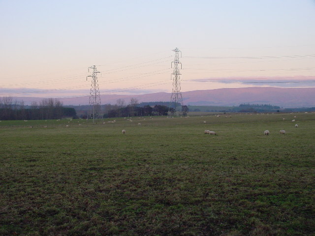
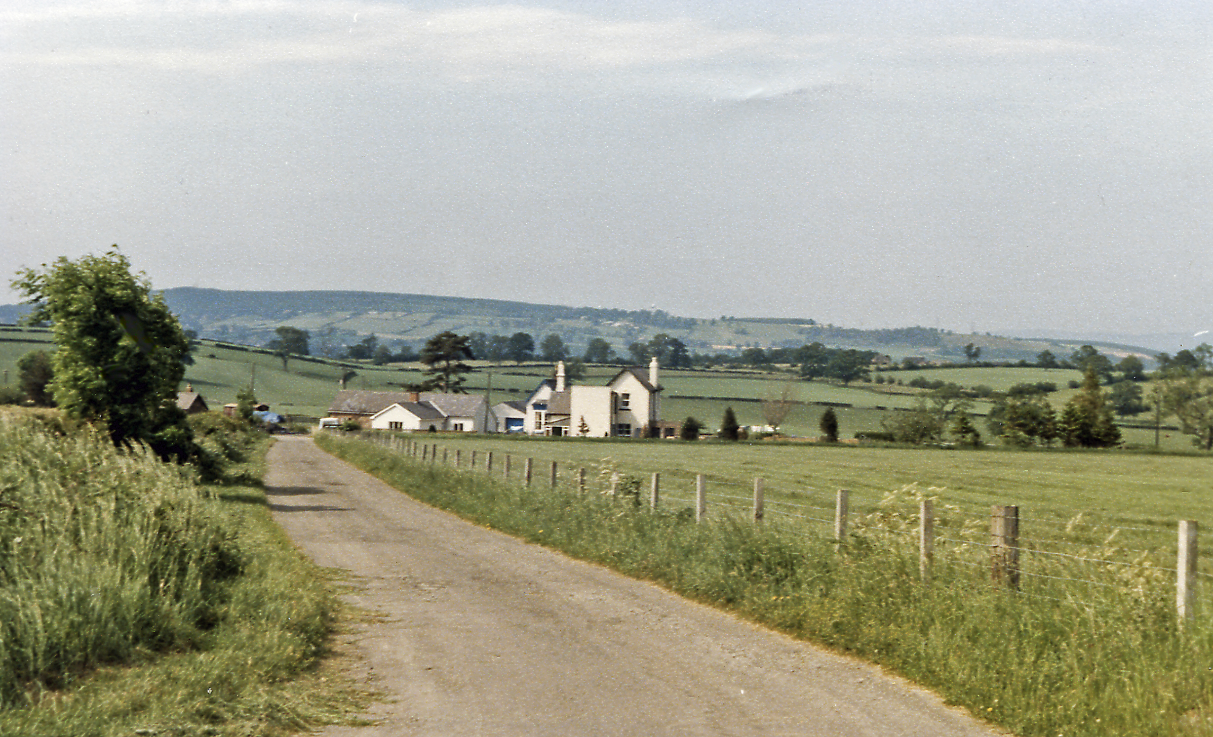
Clifton Dykes is a small rural village located in the county of Westmorland, England. It is situated in the picturesque Lake District National Park, surrounded by rolling hills, lush green valleys, and stunning natural beauty. The village is approximately 5 miles northeast of the town of Penrith and sits on the banks of the River Petteril.

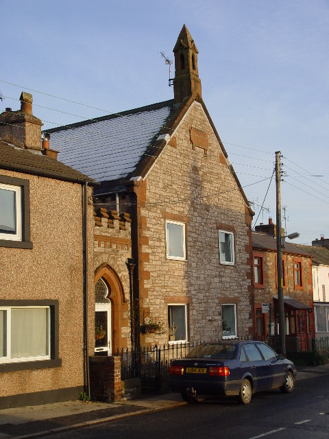
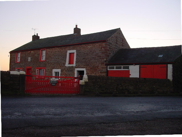
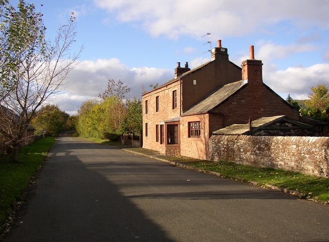
The village is known for its tranquil and idyllic setting, making it a popular destination for those seeking a peaceful retreat. Clifton Dykes is characterized by its charming stone-built houses, many of which date back to the 18th and 19th centuries, adding to its overall charm and historical appeal.

Despite its small size, Clifton Dykes offers a range of amenities to its residents and visitors. The village is home to a local pub, serving traditional British dishes and ales, as well as a village hall that hosts various community events and gatherings throughout the year. Additionally, there is a primary school catering to the educational needs of the local children.

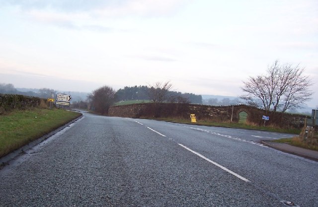
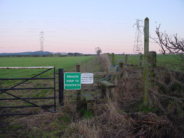
The surrounding countryside provides ample opportunities for outdoor activities, such as hiking, cycling, and fishing. The nearby Lake District National Park offers breathtaking landscapes, including the famous Lake Ullswater, which is only a short drive away.

Overall, Clifton Dykes is a charming and peaceful village, offering a perfect blend of natural beauty, historical architecture, and a tight-knit community spirit.

If you have any feedback on the listing, please let us know in the comments section below.

Clifton Dykes Images

Images are sourced within 2km of 54.638093/-2.7090146 or Grid Reference NY5427. Thanks to Geograph Open Source API. All images are credited.

Brougham Castle This ancient castle which was home to Lady Anne Clifford. Open to the public under the care of English Heritage.
Brougham Castle
This ancient castle which was home to Lady Anne Clifford. Open to the public under the care of English Heritage.
Brougham Castle near Penrith Photo shows the double gatehouse - started in the 13th century based on a roman fort.
Brougham Castle near Penrith
Photo shows the double gatehouse - started in the 13th century based on a roman fort.
Clifton Hall Pele, near Penrith, Cumbria Built in late 16th century
<span class="nowrap"><a title="www.visitcumbria.com/pen/clifthal.htm" rel="nofollow ugc noopener" href="http://www.visitcumbria.com/pen/clifthal.htm">Link</a><img style="margin-left:2px;" alt="External link" title="External link - shift click to open in new window" src="https://s1.geograph.org.uk/img/external.png" width="10" height="10"/></span>
Clifton Hall Pele, near Penrith, Cumbria
Built in late 16th century LinkExternal link
Old Church, Clifton, Penrith I think this could be a private house? There are no signs outside and I saw a man take his dog into the building.
Old Church, Clifton, Penrith
I think this could be a private house? There are no signs outside and I saw a man take his dog into the building.
Old Chapel, Clifton Now a private house, The plaque reads "Wesleyan Chapel 1885"
Old Chapel, Clifton
Now a private house, The plaque reads "Wesleyan Chapel 1885"
A6 to Cliburn Junction.
The Hag This odd-shaped plantation shows clearly on map and ground. Deciduous trees on left, coniferous on right with the odd one ....
The Hag
This odd-shaped plantation shows clearly on map and ground. Deciduous trees on left, coniferous on right with the odd one ....
Standing Stones Located in Lowther Estates, and about 200m from the M6, the backdrop of the Pennines is breathtaking. Great Dun Fell with its "Golfball" on the summit lies between the two stones.
Standing Stones
Located in Lowther Estates, and about 200m from the M6, the backdrop of the Pennines is breathtaking. Great Dun Fell with its "Golfball" on the summit lies between the two stones.
Bridge Over Disappeared Railway The OS map clearly shows a dismantled line here, but the old cutting has been filled up the road level. Compare with <a href="https://www.geograph.org.uk/gridref/NY5425">NY5425</a> where an unmarked line is clearly visible on the ground.
Bridge Over Disappeared Railway
The OS map clearly shows a dismantled line here, but the old cutting has been filled up the road level. Compare with NY5425 where an unmarked line is clearly visible on the ground.
Disused Railway Bridge See also <a href="https://www.geograph.org.uk/gridref/NY5426">NY5426</a>. The bridleway beneath leads to Melkinthorpe.
Disused Railway Bridge
See also NY5426. The bridleway beneath leads to Melkinthorpe.
Wetheriggs Pottery Now a tourist attraction, as well as being a working pottery.
Wetheriggs Pottery
Now a tourist attraction, as well as being a working pottery.
Evening Grazing Taken from Fremington, looking east towards the Pennines. The two power lines provide a contrast to the rural scene.
Evening Grazing
Taken from Fremington, looking east towards the Pennines. The two power lines provide a contrast to the rural scene.
Fremington House A large, imposing sandstone house.
Fremington House
A large, imposing sandstone house.
High Dykes Farm
High Dykes Farm
Footpath to High Ground Rather pointless, as there's a shorter path round the corner.
Footpath to High Ground
Rather pointless, as there's a shorter path round the corner.
River Eamont from Brougham Castle Bridge, Brougham / Carleton, Penrith Looking upstream, Westmorland on the left, Cumberland on the right.
River Eamont from Brougham Castle Bridge, Brougham / Carleton, Penrith
Looking upstream, Westmorland on the left, Cumberland on the right.
The old A66, Carleton, Penrith Hard to imagine endless heavy lorries thundering up and down this road before the new road was constructed.
The old A66, Carleton, Penrith
Hard to imagine endless heavy lorries thundering up and down this road before the new road was constructed.
Brougham Castle Bridge, Carleton, Penrith / Brougham This Grade II listed bridge is dated 1813, and was built as part of the turnpike road from Penrith to Appleby (which later became the A66).  It was repaired in 1899.  The small arch on the left was for a mill race.
Brougham Castle Bridge, Carleton, Penrith / Brougham
This Grade II listed bridge is dated 1813, and was built as part of the turnpike road from Penrith to Appleby (which later became the A66). It was repaired in 1899. The small arch on the left was for a mill race.
Show me another place!

Clifton Dykes is located at Grid Ref: NY5427 (Lat: 54.638093, Lng: -2.7090146)

Administrative County: Cumbria

District: Eden

Police Authority: Cumbria

What 3 Words

///patting.belts.scripted. Near Penrith, Cumbria

Nearby Locations

Clifton Dykes

Related Wikis

Clifton Moor railway station

Clifton Moor railway station was situated in England on the Eden Valley Railway between Penrith and Kirkby Stephen East. It served the village of Clifton...
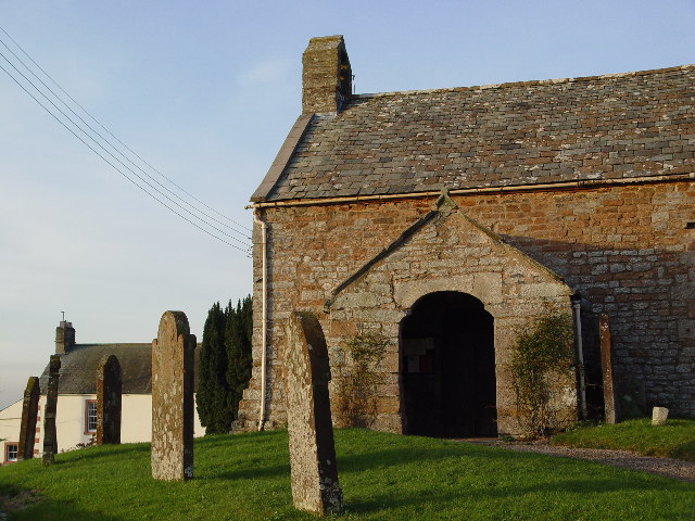
Clifton, Cumbria

Clifton is a small linear village and civil parish in Cumbria, England. Historically part of Westmorland, it lies 3 miles (4.8 km) south east of Penrith...
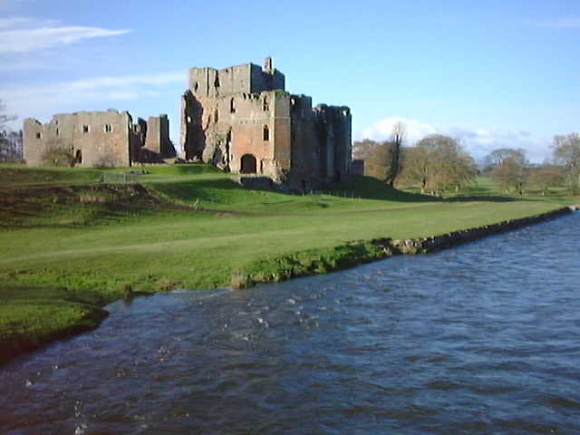
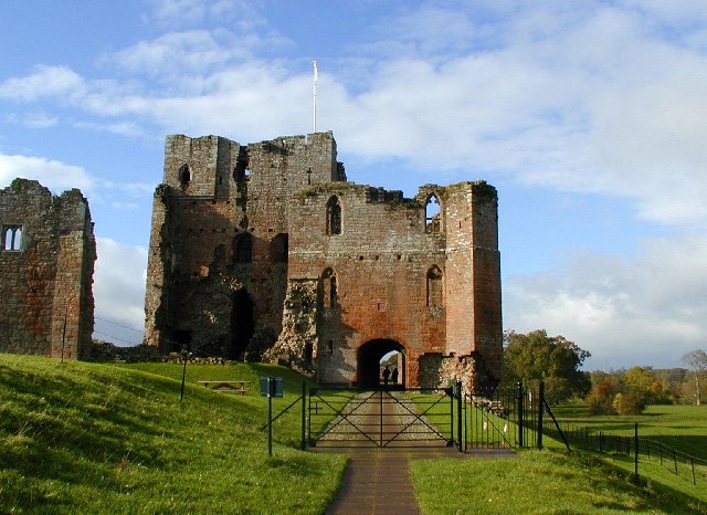
Brougham, Cumbria

Brougham is a small village (or more properly a collection of hamlets) and civil parish on the outskirts of Penrith in the Eden District of Cumbria, England...

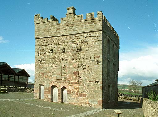
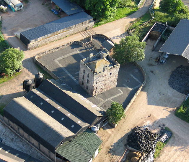
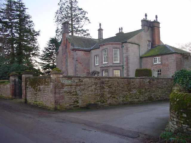
Clifton Hall, Cumbria

Clifton Hall was a fortified manor house in the village of Clifton, Cumbria. Dating from around 1400, it was constructed by either Elianor Engaine or her...

Nearby Amenities

Located within 500m of 54.638093,-2.7090146
Clifton Dykes
Place: hamlet
Lat/Long: 54.6355654/-2.7039653
Naptan AtcoCode: 090074162245
Naptan Bearing: W
Naptan BusStopType: CUS
Naptan CommonName: Cottages
Naptan Indicator: o/s
Naptan Landmark: Clifton Dykes Cottages
Naptan NaptanCode: cumdagdj
Naptan Street: No name
Naptan Verified: no
Source: naptan_import
Lat/Long: 54.6379216/-2.7086819
Power: tower
Lat/Long: 54.639743/-2.7051623
Power: tower
Lat/Long: 54.6347532/-2.7042089
Power: tower
Lat/Long: 54.6370993/-2.7046532
Design: three-level
Power: tower
Lat/Long: 54.6369679/-2.7017311
Design: three-level
Power: tower
Lat/Long: 54.6395058/-2.7020298
High Dykes
Place: locality
Lat/Long: 54.6380383/-2.710822
Crossfells Campsite
Addr City: Clifton Dykes
Addr Postcode: CA10 2DG
Phone: +44 7551 339697
Tourism: camp_site
Website: https://www.crossfells-campsite.co.uk/
Lat/Long: 54.638031/-2.7099259
Power: pole
Lat/Long: 54.6378359/-2.7093715
Power: pole
Lat/Long: 54.6376499/-2.7087669
Power: pole
Lat/Long: 54.6373896/-2.7081909
Power: pole
Lat/Long: 54.6370851/-2.7075364
Power: pole
Lat/Long: 54.636789/-2.7069128
Power: pole
Lat/Long: 54.6380315/-2.7082695
Power: pole
Lat/Long: 54.6377477/-2.7067819
Power: pole
Lat/Long: 54.6374254/-2.7050824
Power: pole
Lat/Long: 54.6373055/-2.7044873
The data included in this document is from www.openstreetmap.org. The data is made available under ODbL.

Have you been to Clifton Dykes?

Leave your review of Clifton Dykes below (or comments, questions and feedback).