Clayton Hill

Settlement in Yorkshire

England

Clayton Hill

Crossing the line in Wakefield
Crossing the line in Wakefield Credit: Roy Hughes

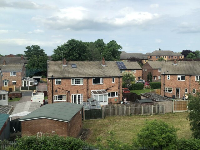
Clayton Hill is a picturesque village located in the county of Yorkshire, England. Nestled amidst rolling green hills and surrounded by breathtaking natural beauty, this idyllic village offers a serene and peaceful escape from the hustle and bustle of city life.

With a population of approximately 1,000 residents, Clayton Hill exudes a close-knit community atmosphere. The village is characterized by its quaint cottages, charming gardens, and well-preserved historic buildings. Walking through the narrow streets, visitors can admire the local architecture, which dates back centuries and showcases the region's rich heritage.

The heart of Clayton Hill is its village square, a bustling hub that is home to a range of amenities. Here, visitors can find a small but well-stocked grocery store, a post office, a cozy pub serving traditional Yorkshire ale, and a handful of local shops. The village also boasts a primary school, a church, and a community center, which hosts various events and activities throughout the year.

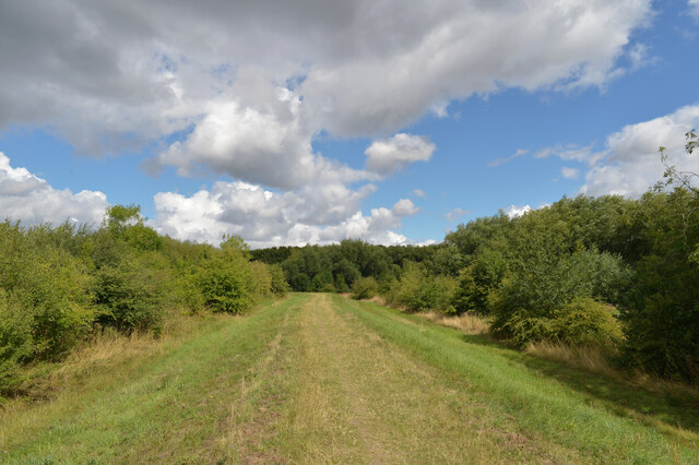
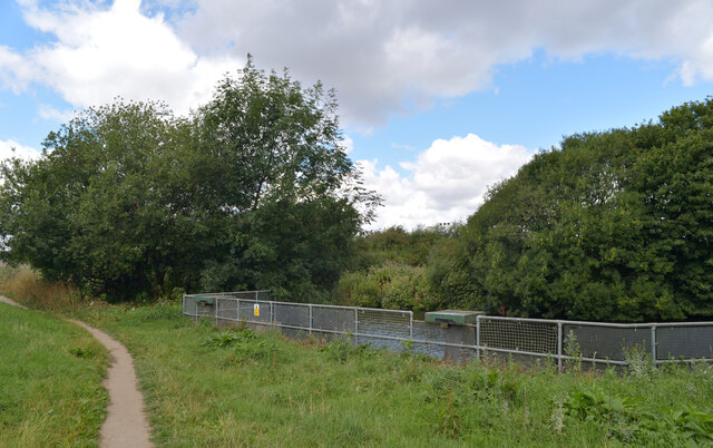
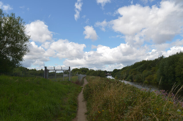
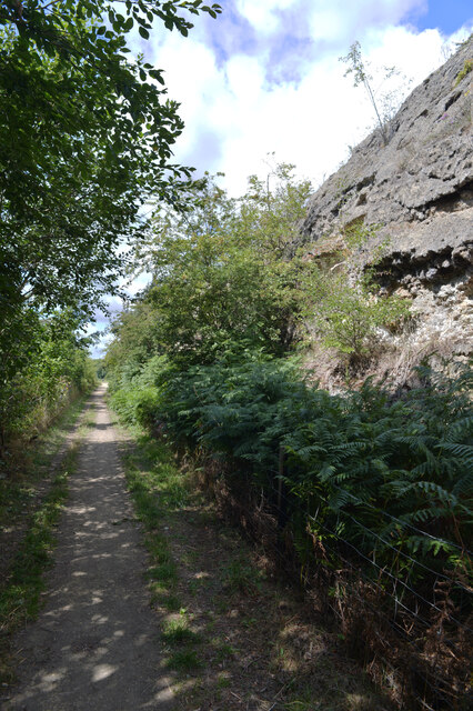
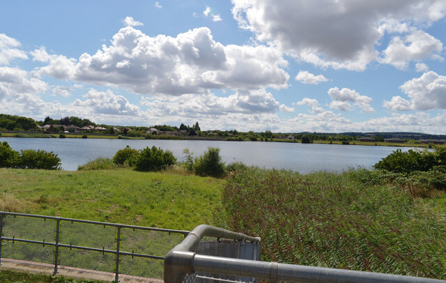
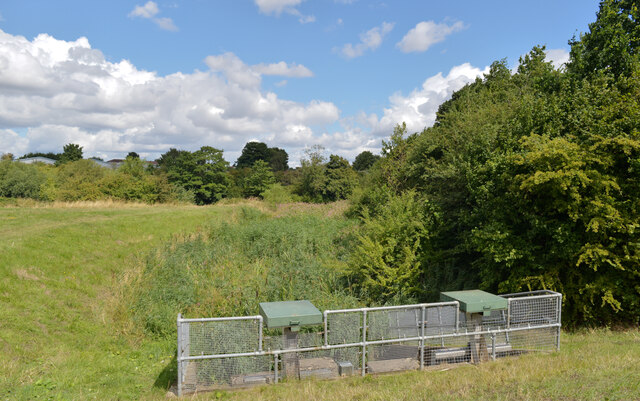
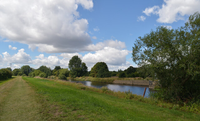
Surrounding the village, the landscape is a haven for outdoor enthusiasts. Rolling hills and meandering footpaths invite long walks, hikes, and cycling adventures. Nearby, the picturesque countryside offers opportunities for wildlife spotting and birdwatching. Visitors to Clayton Hill are also drawn to the nearby nature reserve, which boasts a diverse range of flora and fauna.

Overall, Clayton Hill is a charming village that offers a peaceful retreat in the heart of Yorkshire's stunning countryside. With its warm and welcoming community, rich history, and natural beauty, it is a destination that appeals to both locals and tourists seeking a tranquil and authentic Yorkshire experience.

If you have any feedback on the listing, please let us know in the comments section below.
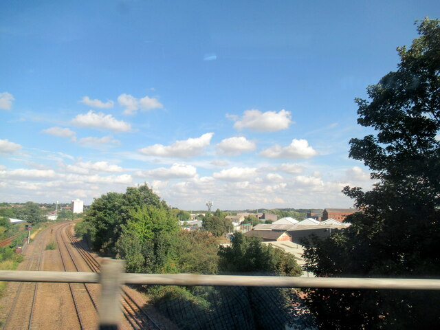
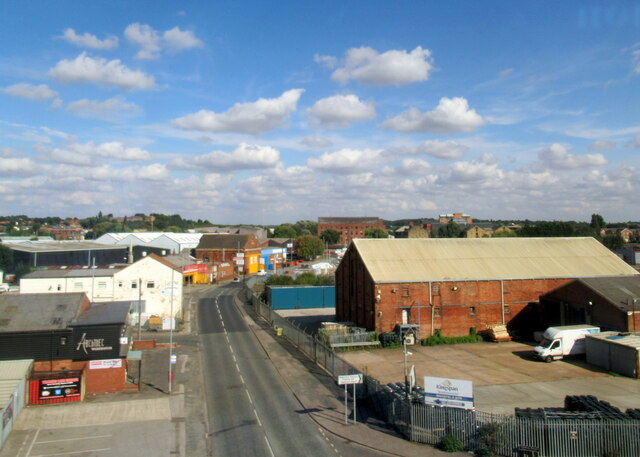
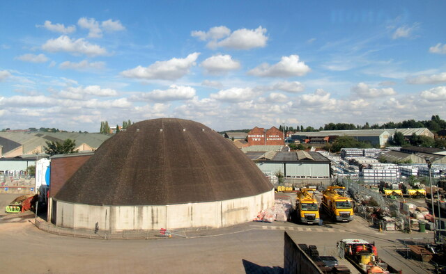
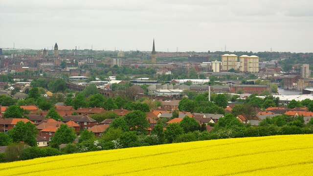
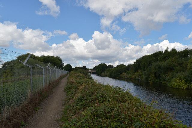
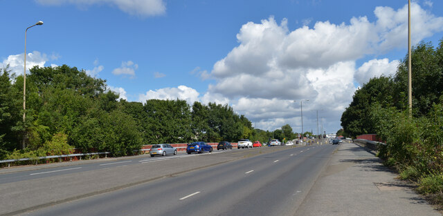
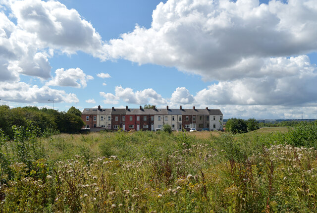
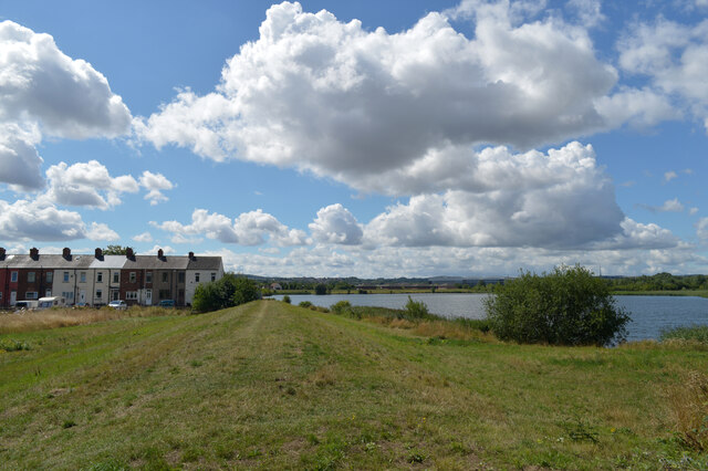
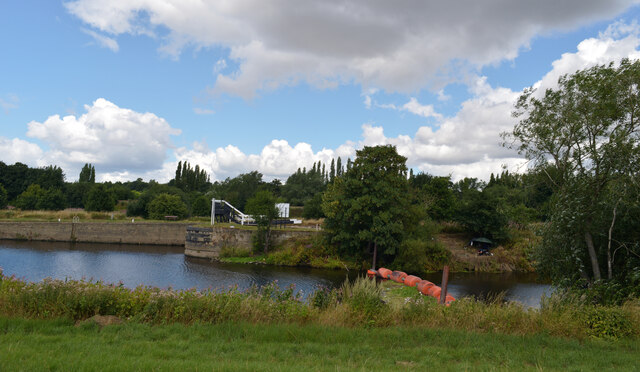
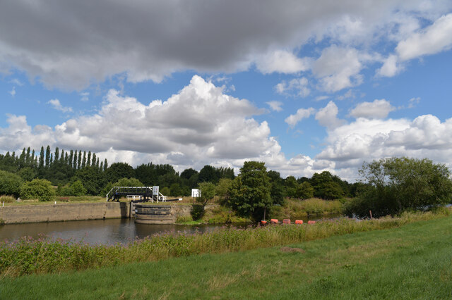
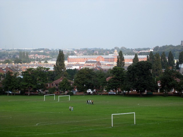
Clayton Hill Images

Images are sourced within 2km of 53.67778/-1.510941 or Grid Reference SE3220. Thanks to Geograph Open Source API. All images are credited.

Crossing the line in Wakefield
Thornes Lane Wakefield
Council Depot Wakefield
Wakefield Panorama View from Sandal Castle with the railway viaduct prominent
Wakefield Panorama
View from Sandal Castle with the railway viaduct prominent
Suburban housing, Sandal, Wakefield
Path on an embankment, Pugneys Country Park, Wakefield Pugneys Country Park was developed from a former open cast mine close to Wakefield. Its 250 acres contain two lakes, the larger of which is used for water sports. It is a local nature reserve and the lakes act as a flood defence by serving as an overflow for the River Calder. There is a miniature railway and a cafe close to the larger lake.
Path on an embankment, Pugneys Country Park, Wakefield
Pugneys Country Park was developed from a former open cast mine close to Wakefield. Its 250 acres contain two lakes, the larger of which is used for water sports. It is a local nature reserve and the lakes act as a flood defence by serving as an overflow for the River Calder. There is a miniature railway and a cafe close to the larger lake.
Path by The River Calder, Pugneys Country Park, Wakefield Pugneys Country Park was developed from a former open cast mine close to Wakefield. Its 250 acres contain two lakes, the larger of which is used for water sports. It is a local nature reserve and the lakes act as a flood defence by serving as an overflow for the River Calder. There is a miniature railway and a cafe close to the larger lake.
Path by The River Calder, Pugneys Country Park, Wakefield
Pugneys Country Park was developed from a former open cast mine close to Wakefield. Its 250 acres contain two lakes, the larger of which is used for water sports. It is a local nature reserve and the lakes act as a flood defence by serving as an overflow for the River Calder. There is a miniature railway and a cafe close to the larger lake.
Denby Dale Road (A636) crossing The Calder, Wakefield
Calder Park Wetlands Nature Reserve, Wakefield
Path, Calder Park Wetlands Nature Reserve, Wakefield
Calder Park Wetlands Nature Reserve, Wakefield
The River Calder at Calder Park Wetlands Nature Reserve, Wakefield The River Calder is a river in West Yorkshire.
The Calder rises on the eastern slopes of the Pennines flows through alternating countryside, former woollen-mill villages, and large and small towns before joining the River Aire near Castleford, 45 miles later.
The river's valley is generally known as the Calder Valley. The name Calderdale usually refers to the large urban and rural borough (centred on Halifax) through which the upper river flows. The lower reaches flow through the boroughs of Kirklees (based on Huddersfield) and Wakefield. However, the river does not flow through the centres of Halifax and Huddersfield, which are on the Calder's main tributaries, the River Hebble and River Colne respectively. The only large town centres through which the Calder flows are Brighouse, Mirfield, Dewsbury and Wakefield.
The River Calder at Calder Park Wetlands Nature Reserve, Wakefield
The River Calder is a river in West Yorkshire. The Calder rises on the eastern slopes of the Pennines flows through alternating countryside, former woollen-mill villages, and large and small towns before joining the River Aire near Castleford, 45 miles later. The river's valley is generally known as the Calder Valley. The name Calderdale usually refers to the large urban and rural borough (centred on Halifax) through which the upper river flows. The lower reaches flow through the boroughs of Kirklees (based on Huddersfield) and Wakefield. However, the river does not flow through the centres of Halifax and Huddersfield, which are on the Calder's main tributaries, the River Hebble and River Colne respectively. The only large town centres through which the Calder flows are Brighouse, Mirfield, Dewsbury and Wakefield.
A junction of the Calder and Hebble Navigation and River Calder, Wakefield The lock is seen from Calder Park Wetlands Nature Reserve.
A junction of the Calder and Hebble Navigation and River Calder, Wakefield
The lock is seen from Calder Park Wetlands Nature Reserve.
A junction of the Calder and Hebble Navigation and River Calder, Wakefield The lock is seen from Calder Park Wetlands Nature Reserve.
A junction of the Calder and Hebble Navigation and River Calder, Wakefield
The lock is seen from Calder Park Wetlands Nature Reserve.
Show me another place!

Clayton Hill is located at Grid Ref: SE3220 (Lat: 53.67778, Lng: -1.510941)

Division: West Riding

Unitary Authority: Wakefield

Police Authority: West Yorkshire

What 3 Words

///debit.ridge.proven. Near Wakefield, West Yorkshire

Related Wikis

Albion Mills Retail Park

Albion Mills Retail Park is a retail park in central Wakefield, West Yorkshire, England. The park, which contains a branch of PC World, was built in 2000...

HM Prison Wakefield

His Majesty's Prison Wakefield is a Category A men's prison in Wakefield, West Yorkshire, England, operated by His Majesty's Prison Service. The prison...

Thornes Park

Thornes Park is a large public park situated close to the centre of Wakefield, West Yorkshire, England. Along with Clarence Park and Holmfield Park it...

Wakefield Westgate railway station

Wakefield Westgate railway station is a mainline railway station in Wakefield, West Yorkshire, England. It is 10 miles (16 km) south of Leeds to the west...

Wakefield Castle

Wakefield Castle, Lowe Hill or Lawe Hill was a castle built in the 12th century on a hill on the north side of the River Calder near Wakefield, England...

The Art House

The Art House is an art gallery and studio complex in the city centre of Wakefield, in West Yorkshire, in England. The Art House was founded in 1994 as...

Theatre Royal, Wakefield

The Theatre Royal Wakefield is a theatre in Wakefield, England, which dates back to 1894. The theatre was originally known as the Theatre Royal and Opera...

Diocese of Wakefield

The Diocese of Wakefield is a former Church of England diocese based in Wakefield in West Yorkshire, covering Wakefield, Barnsley, Kirklees and Calderdale...

Related Videos

WAKEFIELD - A walking tour of Wakey in 4k - January 2024

Come with me as I walk round Wakefield City Centre, filming in 4k. Filmed in January 2024, I walk around the civic buildings and ...

WAKEFIELD | A walk through the City Centre of Wakefield, West Yorkshire!

WAKEFIELD | A walk through Wakefield City Centre in West Yorkshire, England We visited the city of Wakefield Yorkshire to have ...

Top 10 Places to Visit in Wakefield, West Yorkshire | England - English

WakefieldPlaces #PlacesInWakefield #WakefieldVisitPlaces #Wakefield Wakefield is a cathedral city and the administrative ...

Nearby Amenities

Located within 500m of 53.67778,-1.510941
Crossing
Crossing: marked
Crossing Ref: toucan
Lat/Long: 53.6809276/-1.5059597
Traffic Signals
Traffic Signals: signal
Traffic Signals Direction: forward
Lat/Long: 53.6805545/-1.5072736
Crossing
Crossing: marked
Lat/Long: 53.680387/-1.5076057
Traffic Signals
Crossing: traffic_signals
Crossing Ref: pelican
Tactile Paving: yes
Traffic Signals Direction: forward
Lat/Long: 53.679626/-1.5063899
Pub
The Waterloo
Addr City: Wakefield
Addr Housenumber: 101
Addr Postcode: WF2 9RL
Addr Street: Westgate End
Fhrs Id: 1257069
Lat/Long: 53.6792826/-1.5123421
Pub
The White Hart
Addr City: Wakefield
Addr Housenumber: 77
Addr Postcode: WF2 9RL
Addr Street: Westgate End
Fhrs Id: 1282541
Lat/Long: 53.679423/-1.5118351
Barrier: cycle_barrier
Foot: yes
Source: survey
Lat/Long: 53.6766417/-1.5074584
Post Box
Operator: Royal Mail
Post Box Type: lamp
Ref: WF2 486
Lat/Long: 53.6816373/-1.5127876
Public Transport: station
Railway: station
Usage: tourism
Lat/Long: 53.6763613/-1.5121653
Post Box
Operator: Royal Mail
Post Box Type: pillar
Ref: WF2 210
Lat/Long: 53.676019/-1.517661
Crossing
Lat/Long: 53.6788637/-1.5169202
Traffic Signals
Traffic Signals: signal
Traffic Signals Direction: both
Lat/Long: 53.6788613/-1.5169387
Barrier: bollard
Lat/Long: 53.6733486/-1.5108157
Crossing
Button Operated: yes
Crossing: traffic_signals
Crossing Island: no
Crossing Markings: dots
Crossing Ref: pelican
Kerb: lowered
Tactile Paving: yes
Lat/Long: 53.6791266/-1.5039103
Crossing
Button Operated: yes
Crossing: traffic_signals
Crossing Island: no
Crossing Markings: dots
Crossing Ref: pelican
Kerb: lowered
Tactile Paving: yes
Lat/Long: 53.6790997/-1.5040703
Traffic Signals
Crossing: traffic_signals
Crossing Ref: puffin
Traffic Signals Direction: forward
Lat/Long: 53.6804477/-1.5074564
Crossing
Crossing: marked
Crossing Ref: pelican
Tactile Paving: yes
Lat/Long: 53.679395/-1.5128411
Telephone
Booth: KXPlus
Covered: booth
Lat/Long: 53.6792583/-1.5131014
Post Box
Operator: Royal Mail
Operator Wikidata: Q638098
Post Box Type: lamp
Ref: WF2 104
Lat/Long: 53.6788489/-1.5178462
Post Box
Collection Times: Mo-Fr 09:00, Sa 07:00
Operator: Royal Mail
Operator Wikidata: Q638098
Post Box Type: pillar
Ref: WF2 77
Royal Cypher: GR
Royal Cypher Wikidata: Q33102273
Lat/Long: 53.6797787/-1.5106048
Post Box
Operator: Royal Mail
Post Box Type: lamp
Ref: WF2 187
Lat/Long: 53.6766808/-1.5114473
Bus Stop
Charlesworth Way Cathedral Retail Park
Bus: yes
Local Ref: 45018409
Naptan AtcoCode: 450018409
Naptan Bearing: S
Naptan CommonName: Charlesworth Way Cathedral Retail Park
Naptan Crossing: Cathedral Retail Park
Naptan Indicator: Stop 45018409
Naptan PlusbusZoneRef: LEEDS
Naptan ShortCommonName: Cathedral Retail Pk
Naptan Street: Charlesworth Way
Naptan Verified: yes
Public Transport: platform
Shelter: yes
Source: naptan_import
Timetable: yes
Lat/Long: 53.6782448/-1.5039251
Bus Stop
C4 Wakefield Charlesworth Way
Bus: yes
Local Ref: 45018410
Naptan AtcoCode: 450018410
Naptan Bearing: N
Naptan CommonName: C4 Wakefield Charlesworth Way
Naptan Indicator: Stop 45018410
Naptan PlusbusZoneRef: LEEDS
Naptan ShortCommonName: Cathedral Retail Pk
Naptan Street: Charlesworth Way
Naptan Verified: yes
Public Transport: platform
Source: naptan_import
Timetable: yes
Lat/Long: 53.6786324/-1.504339
Bus Stop
Dewsbury Road Manor Road
Bus: yes
Local Ref: 45020492
Naptan AtcoCode: 450020492
Naptan Bearing: W
Naptan CommonName: Dewsbury Road Manor Road
Naptan Indicator: Stop 45020492
Naptan Landmark: Garage
Naptan Notes: New TF shelter & 3P case fitted 170605 awaiting photo's and survey info.
Naptan PlusbusZoneRef: LEEDS
Naptan ShortCommonName: Manor Road
Naptan Street: Dewsbury Road
Naptan Verified: yes
Public Transport: platform
Source: naptan_import
Lat/Long: 53.6786177/-1.5182517
Bus Stop
Dewsbury Road Hanover Street
Bus: yes
Local Ref: 45020493
Naptan AtcoCode: 450020493
Naptan Bearing: E
Naptan CommonName: Dewsbury Road Hanover Street
Naptan Indicator: Stop 45020493
Naptan PlusbusZoneRef: LEEDS
Naptan ShortCommonName: Hanover Street
Naptan Street: Dewsbury Road
Naptan Verified: yes
Public Transport: platform
Source: naptan_import
Lat/Long: 53.6790489/-1.5160077
Bus Stop
Westgate End Makin Street
Bus: yes
Local Ref: 45022233
Naptan AtcoCode: 450022233
Naptan Bearing: E
Naptan CommonName: Westgate End Makin Street
Naptan Crossing: Makin Street
Naptan Indicator: Stop 45022233
Naptan PlusbusZoneRef: LEEDS
Naptan ShortCommonName: Makin Street
Naptan Street: Westgate End
Naptan Verified: yes
Public Transport: platform
Shelter: yes
Source: naptan_import
Lat/Long: 53.6796961/-1.5116541
Bus Stop
Westgate End Makin Street
Bus: yes
Local Ref: 45022234
Naptan AtcoCode: 450022234
Naptan Bearing: SW
Naptan CommonName: Westgate End Makin Street
Naptan Crossing: Makin Street
Naptan Indicator: Stop 45022234
Naptan PlusbusZoneRef: LEEDS
Naptan ShortCommonName: Makin Street
Naptan Street: Westgate End
Naptan Verified: yes
Public Transport: platform
Shelter: yes
Source: naptan_import
Timetable: yes
Lat/Long: 53.6795252/-1.5116258
Bus Stop
Westgate Ings Road
Bus: yes
Local Ref: 45022235
Naptan AtcoCode: 450022235
Naptan Bearing: NE
Naptan CommonName: Westgate Ings Road
Naptan Crossing: Ings Road
Naptan Indicator: Stop 45022235
Naptan Landmark: Chamber of Commerce
Naptan PlusbusZoneRef: LEEDS
Naptan ShortCommonName: Ings Road
Naptan Street: Westgate
Naptan Verified: yes
Public Transport: platform
Source: naptan_import
Timetable: yes
Lat/Long: 53.6807125/-1.5074486
Bus Stop
Westgate Ings Road
Bus: yes
Local Ref: 45022236
Naptan AtcoCode: 450022236
Naptan Bearing: SW
Naptan CommonName: Westgate Ings Road
Naptan Crossing: Ings Road
Naptan Indicator: Stop 45022236
Naptan PlusbusZoneRef: LEEDS
Naptan ShortCommonName: Ings Road
Naptan Street: Westgate
Naptan Verified: yes
Public Transport: platform
Source: naptan_import
Timetable: yes
Lat/Long: 53.6806818/-1.5065405
Bus Stop
Lawefield Lane Park Grove Road
Bus: yes
Local Ref: 45022237
Naptan AtcoCode: 450022237
Naptan Bearing: NE
Naptan CommonName: Lawefield Lane Park Grove Road
Naptan Crossing: Park Grove Road
Naptan Indicator: Stop 45022237
Naptan PlusbusZoneRef: LEEDS
Naptan ShortCommonName: Park Grove Road
Naptan Street: Horbury Road
Naptan Verified: yes
Public Transport: platform
Source: naptan_import
Lat/Long: 53.6778686/-1.5153844
Bus Stop
Horbury Road Cambridge Street
Bus: yes
Local Ref: 45022238
Naptan AtcoCode: 450022238
Naptan Bearing: SW
Naptan CommonName: Horbury Road Cambridge Street
Naptan Crossing: Cambridge Street
Naptan Indicator: Stop 45022238
Naptan Landmark: The Parklands Hotel
Naptan PlusbusZoneRef: LEEDS
Naptan ShortCommonName: Cambridge Street
Naptan Street: Horbury Road
Naptan Verified: no
Public Transport: platform
Source: naptan_import
Lat/Long: 53.6775013/-1.5156914
Bus Stop
Horbury Road Cross Lane
Bus: yes
Local Ref: 45022239
Naptan AtcoCode: 450022239
Naptan Bearing: NE
Naptan CommonName: Horbury Road Cross Lane
Naptan Crossing: Cross Lane
Naptan Indicator: Stop 45022239
Naptan Landmark: The Union PH
Naptan PlusbusZoneRef: LEEDS
Naptan ShortCommonName: Cross Lane
Naptan Street: Horbury Road
Naptan Verified: yes
Public Transport: platform
Shelter: yes
Source: naptan_import
Lat/Long: 53.6764422/-1.5174769
Bus Stop
Horbury Road Cross Lane
Bus: yes
Local Ref: 45022240
Naptan AtcoCode: 450022240
Naptan Bearing: S
Naptan CommonName: Horbury Road Cross Lane
Naptan Crossing: Cross Lane
Naptan Indicator: Stop 45022240
Naptan Landmark: The Union PH
Naptan PlusbusZoneRef: LEEDS
Naptan ShortCommonName: Cross Lane
Naptan Street: Horbury Road
Naptan Verified: yes
Public Transport: platform
Shelter: yes
Source: naptan_import
Lat/Long: 53.6761449/-1.5172986
Bus Stop
Plumpton Road Plumpton Place
Bus: yes
Local Ref: 45023855
Naptan AtcoCode: 450023855
Naptan Bearing: NW
Naptan CommonName: Plumpton Road Plumpton Place
Naptan Crossing: Plumpton Place
Naptan Indicator: Stop 45023855
Naptan PlusbusZoneRef: LEEDS
Naptan ShortCommonName: Plumpton Place
Naptan Street: Plumpton Road
Naptan Verified: yes
Public Transport: platform
Source: naptan_import
Lat/Long: 53.6812511/-1.5116327
Bus Stop
Victoria Avenue Henry Street
Bus: yes
Local Ref: 45023856
Naptan AtcoCode: 450023856
Naptan Bearing: S
Naptan CommonName: Victoria Avenue Henry Street
Naptan Crossing: Henry Street
Naptan Indicator: Stop 45023856
Naptan PlusbusZoneRef: LEEDS
Naptan ShortCommonName: Henry Street
Naptan Street: Victoria Avenue
Naptan Verified: no
Public Transport: platform
Source: naptan_import
Lat/Long: 53.6821977/-1.5123368
Bus Stop
Park Grove Road Clarence Walk
Bus: yes
Local Ref: 45024406
Naptan AtcoCode: 450024406
Naptan Bearing: SE
Naptan CommonName: Park Grove Road Clarence Walk
Naptan Crossing: Clarence Walk
Naptan Indicator: Stop 45024406
Naptan Landmark: Working Mens Club
Naptan PlusbusZoneRef: LEEDS
Naptan ShortCommonName: Clarence Walk
Naptan Street: Park Grove Road
Naptan Verified: yes
Public Transport: platform
Source: naptan_import
Lat/Long: 53.6773669/-1.5142038
Bus Stop
Lawefield Lane Park Grove Road
Bus: yes
Local Ref: 45024407
Naptan AtcoCode: 450024407
Naptan Bearing: SE
Naptan CommonName: Lawefield Lane Park Grove Road
Naptan Crossing: Park Grove Rd
Naptan Indicator: Stop 45024407
Naptan Landmark: Thornes Park
Naptan PlusbusZoneRef: LEEDS
Naptan ShortCommonName: Park Grove Road
Naptan Street: Lawefiled Lane
Naptan Verified: yes
Public Transport: platform
Source: naptan_import
Lat/Long: 53.6761432/-1.5103155
Bus Stop
Lawefield Lane Thornes Park
Bus: yes
Local Ref: 45024408
Naptan AtcoCode: 450024408
Naptan Bearing: W
Naptan CommonName: Lawefield Lane Thornes Park
Naptan Indicator: Stop 45024408
Naptan Landmark: Clarence Park
Naptan PlusbusZoneRef: LEEDS
Naptan ShortCommonName: Clarence Park
Naptan Street: Lawefield Lane
Naptan Verified: no
Public Transport: platform
Source: naptan_import
Lat/Long: 53.6755466/-1.5080538
Bus Stop
Lawefield Lane Ryburn Place
Local Ref: 45024409
Naptan AtcoCode: 450024409
Naptan Bearing: E
Naptan CommonName: Lawefield Lane Ryburn Place
Naptan Indicator: Stop 45024409
Naptan Landmark: Public Park
Naptan PlusbusZoneRef: LEEDS
Naptan ShortCommonName: St. James Court
Naptan Street: Lawefield Lane
Naptan Verified: yes
Shelter: no
Source: naptan_import
Timetable: yes
Lat/Long: 53.6754815/-1.5046624
Bus Stop
Lawefield Lane Park Grove Road
Bus: yes
Local Ref: 45025604
Naptan AtcoCode: 450025604
Naptan Bearing: NW
Naptan CommonName: Lawefield Lane Park Grove Road
Naptan Indicator: Stop 45025604
Naptan Landmark: Thornes Park
Naptan PlusbusZoneRef: LEEDS
Naptan ShortCommonName: Park Grove Road
Naptan Street: Lawefield Lane
Naptan Verified: yes
Public Transport: platform
Shelter: no
Source: naptan_import
Timetable: yes
Lat/Long: 53.6760356/-1.5103773
Bus Stop
Lawefield Lane School
Local Ref: 45025605
Naptan AtcoCode: 450025605
Naptan Bearing: E
Naptan CommonName: Lawefield Lane School
Naptan Indicator: Stop 45025605
Naptan PlusbusZoneRef: LEEDS
Naptan ShortCommonName: The Park School
Naptan Street: Lawefield Lane
Naptan Verified: no
Shelter: no
Source: naptan_import
Timetable: yes
Lat/Long: 53.6756272/-1.507962
Bus Stop
Park Grove Road Horbury Road
Bus: yes
Local Ref: 45024762
Naptan AtcoCode: 450024762
Naptan Bearing: W
Naptan CommonName: Park Grove Road Horbury Road
Naptan Crossing: Horbury Road
Naptan Indicator: Stop 45024762
Naptan Landmark: St Michaels House
Naptan PlusbusZoneRef: LEEDS
Naptan ShortCommonName: Horbury Road
Naptan Street: Park Grove Road
Naptan Verified: yes
Public Transport: platform
Shelter: no
Source: naptan_import
Lat/Long: 53.6770895/-1.5136244
Bus Stop
Quebec Street Westgate
Bus: yes
Local Ref: 45028116
Naptan AtcoCode: 450028116
Naptan Bearing: SE
Naptan CommonName: Quebec Street Westgate
Naptan Crossing: Westgate
Naptan Indicator: Stop 45028116
Naptan Landmark: Unknown
Naptan PlusbusZoneRef: LEEDS
Naptan ShortCommonName: Quebec Street
Naptan Street: Quebec Street
Naptan Verified: yes
Note: Stop removed
Public Transport: platform
Source: naptan_import
Lat/Long: 53.6802578/-1.5050903
Bus Stop
C5 Ings Road
Bus: yes
Local Ref: 45028227
Naptan AtcoCode: 450028227
Naptan Bearing: W
Naptan CommonName: C5 Ings Road
Naptan Indicator: Stop 45028227
Naptan Landmark: Unknown
Naptan Notes: Stop for the 'Wakefield Free City Bus'
Naptan PlusbusZoneRef: LEEDS
Naptan ShortCommonName: Ings Road
Naptan Street: Ings Road
Naptan Verified: yes
Public Transport: platform
Source: naptan_import
Timetable: yes
Lat/Long: 53.6794022/-1.5057379
Bus Stop
C3A Charlesworth Way Cineworld
Bus: yes
Naptan AtcoCode: 450029006
Naptan Bearing: NW
Naptan CommonName: Charlesworth Way Cineworld
Naptan Crossing: Colinsway
Naptan Landmark: Unknown
Naptan ShortCommonName: C3A Charlewth Way
Naptan Street: Charlesworth Way
Naptan Verified: yes
Public Transport: platform
Source: naptan_import
Lat/Long: 53.6771126/-1.5042609
Plumpton Road Plumpton Place
Local Ref: 45051349
Naptan AtcoCode: 450051349
Naptan Bearing: E
Naptan BusStopType: CUS
Naptan CommonName: Plumpton Road Plumpton Place
Naptan Indicator: Stop 45051349
Naptan PlusbusZoneRef: LEEDS
Naptan ShortCommonName: Henry Street
Naptan Street: Plumpton Road
Naptan Verified: yes
Source: naptan_import
Lat/Long: 53.6812865/-1.5115112
Victoria Avenue Henry Street
Local Ref: 45051350
Naptan AtcoCode: 450051350
Naptan Bearing: N
Naptan BusStopType: CUS
Naptan CommonName: Victoria Avenue Henry Street
Naptan Indicator: Stop 45051350
Naptan PlusbusZoneRef: LEEDS
Naptan ShortCommonName: Moorhouse Avenue
Naptan Street: Victoria Avenue
Naptan Verified: no
Source: naptan_import
Lat/Long: 53.6821624/-1.5125038
Lawefield Lane Clarence Park
Local Ref: 45051445
Naptan AtcoCode: 450051445
Naptan Bearing: W
Naptan BusStopType: CUS
Naptan CommonName: Lawefield Lane Clarence Park
Naptan Indicator: Stop 45051445
Naptan PlusbusZoneRef: LEEDS
Naptan ShortCommonName: St. James Court
Naptan Street: Lawefield Lane
Naptan Verified: yes
Source: naptan_import
Lat/Long: 53.6754365/-1.5046429
Cabinet: cable_tv
Operator: Virgin
Utility: cabinet
Lat/Long: 53.6798355/-1.5066095
Cabinet: cable_tv
Operator: Virgin
Utility: cabinet
Lat/Long: 53.6798248/-1.5065977
Cabinet: cable_tv
Operator: Virgin
Utility: cabinet
Lat/Long: 53.6803846/-1.5072882
Cabinet: pstn
Operator: BT
Ref: 19
Utility: cabinet
Lat/Long: 53.6791419/-1.513274
Crossing
Crossing: unmarked
Crossing Island: yes
Tactile Paving: yes
Lat/Long: 53.6776765/-1.504542
Crossing
Crossing: marked
Traffic Calming: table
Lat/Long: 53.6792203/-1.5070158
Crossing
Crossing: unmarked
Crossing Island: yes
Tactile Paving: yes
Lat/Long: 53.6775999/-1.5045337
Barrier: lift_gate
Lat/Long: 53.6734082/-1.5112694
Entrance: yes
Lat/Long: 53.6760605/-1.5146402
Traffic Signals
Traffic Signals: signal
Traffic Signals Direction: forward
Lat/Long: 53.6808418/-1.506472
Traffic Signals
Traffic Signals: signal
Traffic Signals Direction: forward
Lat/Long: 53.6791192/-1.5037147
Crossing
Button Operated: yes
Crossing: traffic_signals
Crossing Island: no
Crossing Markings: dots
Crossing Ref: pelican
Kerb: lowered
Tactile Paving: yes
Lat/Long: 53.6792127/-1.5041535
Crossing
Button Operated: yes
Crossing: traffic_signals
Crossing Island: no
Crossing Markings: dots
Crossing Ref: pelican
Kerb: lowered
Tactile Paving: yes
Lat/Long: 53.6793081/-1.504037
Crossing
Button Operated: yes
Crossing: traffic_signals
Crossing Island: no
Crossing Markings: dots
Crossing Ref: pelican
Kerb: lowered
Tactile Paving: yes
Lat/Long: 53.6793885/-1.5038995
Crossing
Crossing: marked
Crossing Ref: puffin
Kerb: flush
Tactile Paving: yes
Lat/Long: 53.6804827/-1.5075929
Crossing
Crossing: marked
Crossing Ref: puffin
Kerb: flush
Tactile Paving: yes
Lat/Long: 53.6805653/-1.5077278
Telephone
Booth: K6
Covered: booth
Listed Status: Grade II
Lat/Long: 53.6807249/-1.5074962
Crossing
Crossing: marked
Crossing Ref: toucan
Lat/Long: 53.6809918/-1.5060066
Crossing
Crossing: marked
Crossing Ref: toucan
Lat/Long: 53.6808617/-1.5058098
Crossing
Crossing: marked
Lat/Long: 53.678/-1.5172541
Crossing
Crossing: marked
Lat/Long: 53.6780305/-1.5173931
Crossing
Crossing: marked
Lat/Long: 53.6782243/-1.5174713
Crossing
Crossing: marked
Lat/Long: 53.6783536/-1.5174301
Crossing
Crossing: marked
Lat/Long: 53.6784247/-1.5175271
Fast Food
Wakefield Pizza & Kebab
Addr City: Wakefield
Addr Housenumber: 2a
Addr Postcode: WF2 9BS
Addr Street: Dewsbury Road
Cuisine: pizza;kebab
Delivery: yes
Fhrs Id: 1428016
Takeaway: yes
Website: https://take-a-way.co.uk
Lat/Long: 53.6794888/-1.5129284
Bench
Backrest: yes
Lat/Long: 53.6804172/-1.5087112
Crossing
Crossing: marked
Crossing Ref: pelican
Tactile Paving: yes
Lat/Long: 53.6793162/-1.5127324
Crossing
Crossing: marked
Crossing Ref: pelican
Kerb: flush
Tactile Paving: yes
Lat/Long: 53.6798326/-1.510589
Traffic Signals
Traffic Signals: signal
Traffic Signals Direction: backward
Lat/Long: 53.6800458/-1.5107393
Waste Basket
Lat/Long: 53.680427/-1.5086068
PA Schofield Ltd
Addr City: Wakefield
Addr Housenumber: 6-8
Addr Street: Lawefield Lane
Craft: painter
Source: survey
Lat/Long: 53.6796386/-1.5104168
Fast Food
St Michaels Fish & Chips
Addr City: Wakefield
Addr Housenumber: 5
Addr Postcode: WF2 8TN
Addr Street: Horbury Road
Cuisine: fish_and_chips
Fhrs Id: 283874
Level: 0
Outdoor Seating: yes
Source: survey
Takeaway: yes
Lat/Long: 53.678841/-1.5132845
The Suntan Centre
Addr City: Wakefield
Addr Housenumber: 5A
Addr Postcode: WF2 8TN
Addr Street: Horbury Road
Level: 1
Shop: beauty
Source: survey
Lat/Long: 53.678796/-1.513219
Barrier: lift_gate
Source: survey
Lat/Long: 53.6809289/-1.5090593
Crossing
Crossing: zebra
Lat/Long: 53.6765105/-1.50847
Crossing
Crossing: zebra
Lat/Long: 53.676762/-1.5090823
Crossing
Crossing: zebra
Lat/Long: 53.6771342/-1.5090681
Crossing
Crossing: zebra
Lat/Long: 53.6768062/-1.5078212
Barrier: bollard
Source: survey
Lat/Long: 53.6756563/-1.5076945
Barrier: cycle_barrier
Bicycle: yes
Source: survey
Lat/Long: 53.6766328/-1.5073832
TaxAssist
Addr City: Wakefield
Addr Housenumber: 35
Addr Postcode: WF2 9RG
Addr Street: Westgate End
Brand: TaxAssist Accountants
Brand Wikidata: Q122459380
Office: accountant
Website: https://www.taxassist.co.uk/accountants/westgate-wakefield/
Lat/Long: 53.680033/-1.509307
Fast Food
Freddys Chicken & Pizza
Addr City: Wakefield
Addr Housenumber: 61
Addr Postcode: WF2 9RL
Addr Street: Westgate End
Cuisine: chicken;pizza
Fhrs Id: 284022
Takeaway: yes
Lat/Long: 53.6796489/-1.5109075
Fast Food
Sabura
Addr City: Wakefield
Addr Housenumber: 160
Addr Postcode: WF2 9SR
Addr Street: Westgate
Fhrs Id: 1268728
Old Name: Italia Express
Takeaway: yes
Lat/Long: 53.6808549/-1.5069875
Restaurant
Bear Kitchen
Addr City: Wakefield
Addr Housenumber: 89-91
Addr Postcode: WF2 9RL
Addr Street: Westgate End
Cuisine: burger;chicken
Fhrs Id: 1003584
Toilets: yes
Lat/Long: 53.6793816/-1.5120132
M & S Newsagents
Addr City: Wakefield
Addr Housenumber: 71
Addr Postcode: WF2 9RL
Addr Street: Westgate End
Fhrs Id: 314021
Shop: newsagent
Lat/Long: 53.6794497/-1.5116787
Fast Food
Pizza Piazzo
Addr City: Wakefield
Addr Housenumber: 79-83
Addr Postcode: WF2 9RL
Addr Street: Westgate End
Cuisine: pizza
Fhrs Id: 283741
Takeaway: yes
Lat/Long: 53.6794077/-1.5118936
Fast Food
Segundo's
Addr City: Wakefield
Addr Housenumber: 27
Addr Postcode: WF2 9RG
Addr Street: Westgate End
Cuisine: pizza;pasta;burger
Fhrs Id: 1042922
Takeaway: yes
Lat/Long: 53.6800949/-1.5090158
Fast Food
Westgate Rolls
Addr City: Wakefield
Addr Housenumber: 57
Addr Postcode: WF2 9RL
Addr Street: Westgate End
Cuisine: sandwich
Fhrs Id: 284586
Takeaway: yes
Lat/Long: 53.6797047/-1.5106889
Fast Food
Raja's
Addr City: Wakefield
Addr Housenumber: 65
Addr Postcode: WF2 9RL
Addr Street: Westgate End
Cuisine: burger
Old Name: UK Chicken Ranch
Takeaway: yes
Lat/Long: 53.6795356/-1.511329
Fast Food
Ali's Cuisine
Addr City: Wakefield
Addr Housenumber: 61a
Addr Postcode: WF2 9RL
Addr Street: Westgate End
Cuisine: indian
Fhrs Id: 1411408
Takeaway: yes
Website: http://aliscuisine-wakefield.co.uk/
Lat/Long: 53.6796161/-1.5109741
Fast Food
Madouries
Addr City: Wakefield
Addr Housenumber: 61b
Addr Postcode: WF2 9RL
Addr Street: Westgate End
Cuisine: jamaican
Takeaway: yes
Lat/Long: 53.6796338/-1.5109856
Traffic Signals
Traffic Signals: signal
Traffic Signals Direction: forward
Lat/Long: 53.6794036/-1.5039634
Traffic Signals
Traffic Signals: signal
Traffic Signals Direction: forward
Lat/Long: 53.679346/-1.5041014
Traffic Signals
Traffic Signals: signal
Traffic Signals Direction: forward
Lat/Long: 53.6790791/-1.5041886
Traffic Signals
Traffic Signals: signal
Traffic Signals Direction: forward
Lat/Long: 53.6790606/-1.5040747
Traffic Signals
Traffic Signals: signal
Traffic Signals Direction: forward
Lat/Long: 53.6791771/-1.5037423
Give Way
Traffic Signals: signal
Traffic Signals Direction: forward
Lat/Long: 53.6793129/-1.5046044
Traffic Signals
Traffic Signals: pedestrian
Traffic Signals Direction: forward
Lat/Long: 53.6783261/-1.5042013
Traffic Signals
Traffic Signals: signal
Traffic Signals Direction: forward
Lat/Long: 53.6784337/-1.5039899
Traffic Signals
Traffic Signals: pedestrian_crossing
Traffic Signals Direction: forward
Lat/Long: 53.680373/-1.5075678
Traffic Signals
Traffic Signals: signal
Traffic Signals Direction: forward
Lat/Long: 53.6805608/-1.5077484
Traffic Signals
Crossing Ref: pelican
Traffic Signals: pedestrian_crossing
Traffic Signals Direction: forward
Lat/Long: 53.680964/-1.5061173
Traffic Signals
Traffic Signals: signal
Traffic Signals Direction: forward
Lat/Long: 53.6809484/-1.5059167
Traffic Signals
Traffic Signals: signal
Traffic Signals Direction: forward
Lat/Long: 53.6808819/-1.5058063
Traffic Signals
Ele: 1
Traffic Signals: signal
Lat/Long: 53.6798419/-1.5108521
Traffic Signals
Traffic Signals: signal
Traffic Signals Direction: forward
Lat/Long: 53.6798418/-1.5105506
Traffic Signals
Traffic Signals: signal
Traffic Signals Direction: forward
Lat/Long: 53.6798864/-1.5104662
Traffic Signals
Traffic Signals: signal
Traffic Signals Direction: forward
Lat/Long: 53.6793909/-1.5128925
Traffic Signals
Traffic Signals: signal
Traffic Signals Direction: forward
Lat/Long: 53.6793272/-1.5126941
Crossing
Lat/Long: 53.6806578/-1.5055909
The Cabin
Addr City: Wakefield
Addr Housename: The Waterloo
Addr Housenumber: 101
Addr Postcode: WF2 9RL
Addr Street: Westgate End
Craft: caterer
Fhrs Id: 1266767
Lat/Long: 53.6792854/-1.5123206
Fast Food
Westy's
Addr City: Wakefield
Addr Housenumber: 49
Addr Postcode: WF2 9RL
Addr Street: Westgate End
Fhrs Id: 1283609
Lat/Long: 53.6797461/-1.5105397
Barrier: height_restrictor
Maxheight: 2.5
Lat/Long: 53.6784302/-1.5046676
Crossing
Lat/Long: 53.6778144/-1.5066274
Recycling
Recycling Type: centre
Lat/Long: 53.6757721/-1.5133562
Information: map
Map Size: park
Tourism: information
Lat/Long: 53.6758056/-1.5134802
Crossing
Crossing: marked
Crossing Ref: toucan
Lat/Long: 53.6808172/-1.5059831
Traffic Signals
Crossing Ref: pelican
Traffic Signals: pedestrian_crossing
Traffic Signals Direction: both
Lat/Long: 53.6766909/-1.5170566
Recycling
Recycling Clothes: yes
Recycling Type: container
Lat/Long: 53.6784172/-1.5145484
Carpet Bagger
Shop: carpet
Lat/Long: 53.6795133/-1.5114831
Angel
Shop: hairdresser
Lat/Long: 53.6794429/-1.511752
Bar
Bar Street
Lat/Long: 53.6793977/-1.5119498
West End Florist
Shop: florist
Lat/Long: 53.6793716/-1.5120726
Internet Cafe
Westgate Internet Cafe
Addr City: Wakefield
Addr Housenumber: 95
Addr Postcode: WF2 9RL
Addr Street: Westgate End
Lat/Long: 53.6793506/-1.5121587
Arees
Shop: hairdresser
Lat/Long: 53.6793437/-1.5121991
Fast Food
Cha Cha Chai
Addr City: Wakefield
Addr Housenumber: 63
Addr Postcode: WF2 9RL
Addr Street: Westgate End
Fhrs Id: 1410858
Old Name: Tile Inn Ceramics
Shop: tiles
Lat/Long: 53.6796168/-1.5110416
WestgateFone
Shop: mobile_phone
Lat/Long: 53.6796766/-1.5108019
Hearts Alive
Shop: tattoo
Lat/Long: 53.6796965/-1.5107568
Milan
Shop: hairdresser
Lat/Long: 53.6797997/-1.5103602
Bepoke Hair Creations
Shop: hairdresser
Lat/Long: 53.680015/-1.5093757
Wakefield Lock & Key Center
Shop: locksmith
Lat/Long: 53.6800523/-1.5091977
Nasir's
Shop: hairdresser
Lat/Long: 53.6800735/-1.5090962
Barrier: bollard
Lat/Long: 53.6804752/-1.506811
Barrier: bollard
Lat/Long: 53.6805654/-1.5068726
Crossing
Crossing: unmarked
Lat/Long: 53.6781465/-1.5050667
Crossing
Crossing: unmarked
Lat/Long: 53.6780506/-1.505166
Noexit: yes
Lat/Long: 53.6764743/-1.507429
Crossing
Crossing: marked
Traffic Calming: table
Lat/Long: 53.6796743/-1.5074882
Crossing
Crossing: marked
Traffic Calming: table
Lat/Long: 53.6798178/-1.5070764
Crossing
Crossing: marked
Traffic Calming: table
Lat/Long: 53.6797454/-1.5072841
Crossing
Crossing: marked
Traffic Calming: table
Lat/Long: 53.6790826/-1.5059845
Crossing
Crossing: marked
Traffic Calming: table
Lat/Long: 53.6791859/-1.5050225
Crossing
Crossing: marked
Traffic Calming: table
Lat/Long: 53.6790503/-1.5051012
Crossing
Crossing: marked
Traffic Calming: table
Lat/Long: 53.6789152/-1.5051796
Barrier: bollard
Lat/Long: 53.6792617/-1.5049785
Crossing
Crossing: marked
Traffic Calming: table
Lat/Long: 53.6783432/-1.5048907
Crossing
Button Operated: yes
Crossing: traffic_signals
Crossing Island: no
Crossing Markings: dots
Crossing Ref: pelican
Kerb: lowered
Tactile Paving: yes
Lat/Long: 53.6791129/-1.5042269
Crossing
Button Operated: yes
Crossing: traffic_signals
Crossing Island: no
Crossing Markings: dots
Crossing Ref: pelican
Kerb: lowered
Tactile Paving: yes
Lat/Long: 53.6791029/-1.5037643
Advertising: totem
Lat/Long: 53.6789978/-1.5037203
Crossing
Button Operated: yes
Crossing: traffic_signals
Crossing Island: no
Crossing Markings: dots
Crossing Ref: pelican
Kerb: lowered
Tactile Paving: yes
Lat/Long: 53.6791823/-1.503815
Crossing
Button Operated: yes
Crossing: traffic_signals
Crossing Island: no
Crossing Markings: dots
Crossing Ref: pelican
Kerb: lowered
Tactile Paving: yes
Lat/Long: 53.6792913/-1.5038697
Crossing
Bicycle: designated
Button Operated: yes
Crossing: traffic_signals
Crossing Island: no
Crossing Markings: dots
Foot: designated
Tactile Paving: yes
Lat/Long: 53.6783968/-1.5039942
Crossing
Bicycle: designated
Button Operated: yes
Crossing: traffic_signals
Crossing Island: no
Crossing Markings: dots
Foot: designated
Tactile Paving: yes
Lat/Long: 53.6783591/-1.5041937
Crossing
Crossing: unmarked
Crossing Island: yes
Tactile Paving: yes
Lat/Long: 53.6776761/-1.5038143
Crossing
Crossing: unmarked
Crossing Island: yes
Tactile Paving: yes
Lat/Long: 53.6774154/-1.5040687
Crossing
Crossing: unmarked
Crossing Island: yes
Tactile Paving: yes
Lat/Long: 53.6773986/-1.5042617
Crossing
Lat/Long: 53.6795276/-1.5067843
Crossing
Crossing: marked
Lat/Long: 53.6796511/-1.5064475
Give Way
Direction: forward
Lat/Long: 53.6792687/-1.5130081
Give Way
Direction: forward
Lat/Long: 53.6786821/-1.5142361
Generator Method: photovoltaic
Generator Output Electricity: yes
Generator Source: solar
Generator Type: solar_photovoltaic_panel
Power: generator
Lat/Long: 53.6799542/-1.5162947
Generator Method: photovoltaic
Generator Output Electricity: yes
Generator Source: solar
Generator Type: solar_photovoltaic_panel
Power: generator
Lat/Long: 53.6795572/-1.5138445
Generator Method: photovoltaic
Generator Output Electricity: yes
Generator Source: solar
Generator Type: solar_photovoltaic_panel
Power: generator
Lat/Long: 53.6795616/-1.5139102
Generator Method: photovoltaic
Generator Output Electricity: yes
Generator Source: solar
Generator Type: solar_photovoltaic_panel
Power: generator
Lat/Long: 53.6796001/-1.5142502
Parking
Parking: surface
Lat/Long: 53.6789929/-1.5140062
Entrance: main
Lat/Long: 53.6799334/-1.5098305
Entrance: main
Lat/Long: 53.6799488/-1.5097974
Generator Method: photovoltaic
Generator Output Electricity: yes
Generator Source: solar
Generator Type: solar_photovoltaic_panel
Power: generator
Lat/Long: 53.6767709/-1.5069602
Generator Method: photovoltaic
Generator Output Electricity: yes
Generator Source: solar
Generator Type: solar_photovoltaic_panel
Power: generator
Lat/Long: 53.6764904/-1.5062685
Generator Method: photovoltaic
Generator Output Electricity: yes
Generator Source: solar
Generator Type: solar_photovoltaic_panel
Power: generator
Lat/Long: 53.6763045/-1.505893
Generator Method: photovoltaic
Generator Output Electricity: yes
Generator Source: solar
Generator Type: solar_photovoltaic_panel
Power: generator
Lat/Long: 53.6764077/-1.5053834
Generator Method: photovoltaic
Generator Output Electricity: yes
Generator Source: solar
Generator Type: solar_photovoltaic_panel
Power: generator
Lat/Long: 53.6760264/-1.5057454
Generator Method: photovoltaic
Generator Output Electricity: yes
Generator Source: solar
Generator Type: solar_photovoltaic_panel
Power: generator
Lat/Long: 53.6762282/-1.5065903
Generator Method: photovoltaic
Generator Output Electricity: yes
Generator Source: solar
Generator Type: solar_photovoltaic_panel
Power: generator
Lat/Long: 53.6762997/-1.5072797
The data included in this document is from www.openstreetmap.org. The data is made available under ODbL.

Have you been to Clayton Hill?

Leave your review of Clayton Hill below (or comments, questions and feedback).