Malinbridge

Settlement in Yorkshire

England

Malinbridge

Loxley Trig Point
Loxley Trig Point Credit: Dave Pickersgill

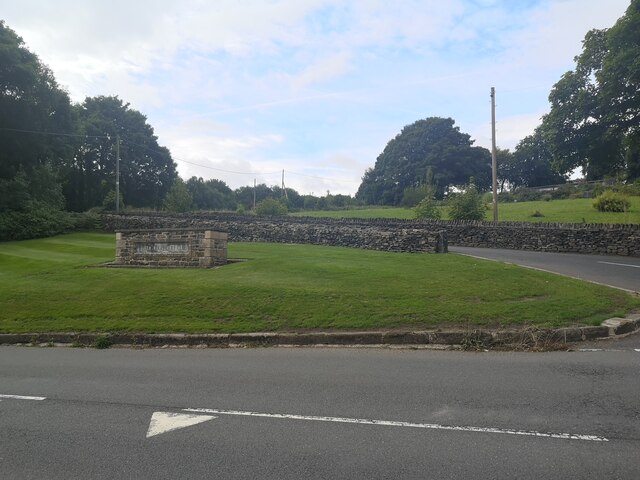
Malinbridge is a small yet vibrant village located in the county of Yorkshire, England. Situated on the outskirts of the bustling city of Sheffield, it offers a peaceful and idyllic setting for its residents. With a population of around 5,000 people, Malinbridge exudes a strong sense of community and charm.

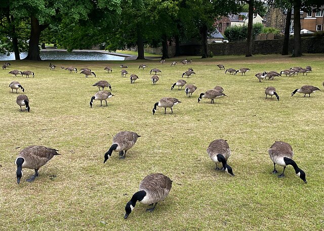
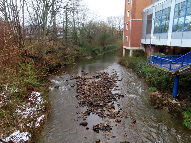
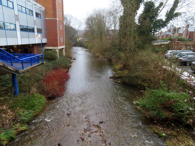
The village is blessed with picturesque landscapes, surrounded by rolling hills and lush green fields, providing ample opportunities for outdoor activities and exploration. The nearby River Don adds to the natural beauty of the area, attracting nature enthusiasts and anglers alike.

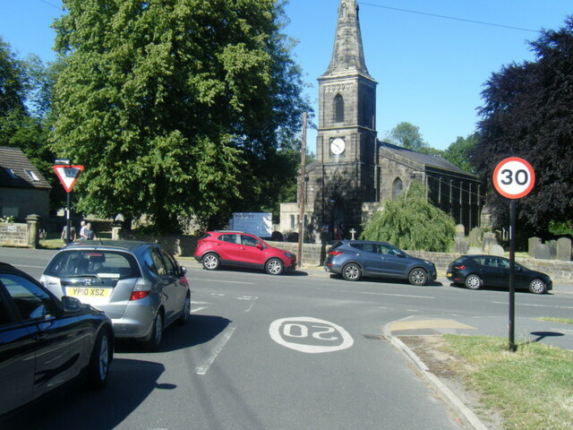
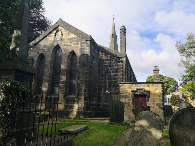
In terms of amenities and services, Malinbridge caters well to its residents. The village has a range of local shops, including grocery stores, boutiques, and quaint cafes. There are also several churches, a primary school, and a library, ensuring that the needs of the community are met.

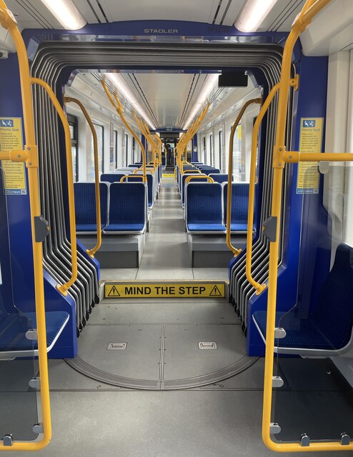
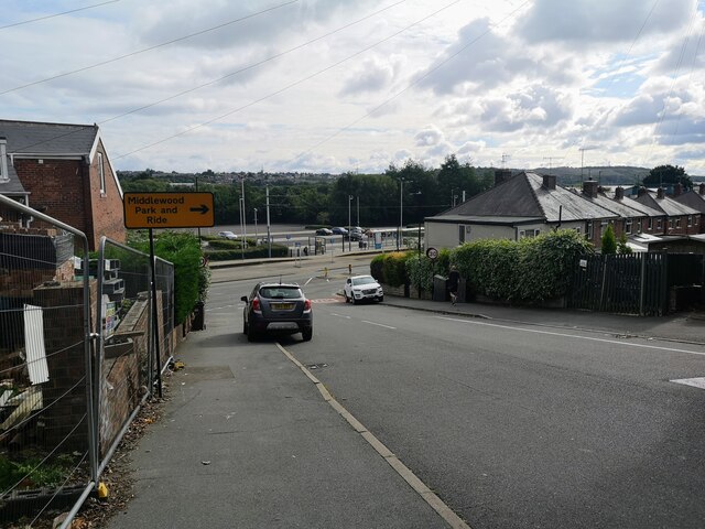
Transportation in Malinbridge is convenient, with regular bus services connecting the village to Sheffield and other nearby towns. Additionally, the village is well-connected to major road networks, making it easily accessible for commuters.

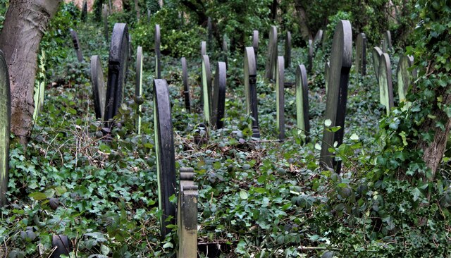
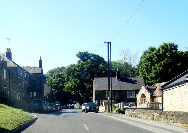
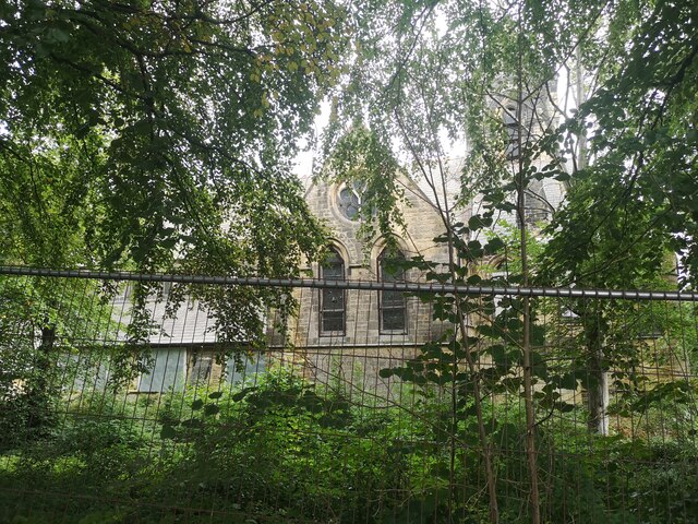
Malinbridge boasts a rich history, with some buildings dating back to the 17th century. The village has preserved its heritage, evident in the charming architecture and well-preserved landmarks that dot its streets.

Overall, Malinbridge offers a peaceful and close-knit community, combined with its natural beauty and convenient amenities, making it an ideal place to live for those seeking a balance between rural tranquility and urban accessibility.

If you have any feedback on the listing, please let us know in the comments section below.

Malinbridge Images

Images are sourced within 2km of 53.399351/-1.515231 or Grid Reference SK3289. Thanks to Geograph Open Source API. All images are credited.

Loxley Trig Point
Loxley Trig Point
Benchmark on a house This cut benchmark is on one of the houses seen across the road from the tram terminus in <a href="https://www.geograph.org.uk/photo/1589480">SK3291 : Middlewood Road and Sheffield Supertram terminus</a>. It is just round the angle, on the 6th and 7th course of bricks. <span class="nowrap"><a title="https://www.bench-marks.org.uk/bm158620" rel="nofollow ugc noopener" href="https://www.bench-marks.org.uk/bm158620">Link</a><img style="margin-left:2px;" alt="External link" title="External link - shift click to open in new window" src="https://s1.geograph.org.uk/img/external.png" width="10" height="10"/></span>
Benchmark on a house
This cut benchmark is on one of the houses seen across the road from the tram terminus in SK3291 : Middlewood Road and Sheffield Supertram terminus. It is just round the angle, on the 6th and 7th course of bricks. LinkExternal link
A suburban street A view SW up Langsett Avenue close to no. 96, on which there is a benchmark <a href="https://www.geograph.org.uk/photo/7007939">SK3291 : Benchmark by a drainpipe</a>.
A suburban street
A view SW up Langsett Avenue close to no. 96, on which there is a benchmark SK3291 : Benchmark by a drainpipe.
Benchmark by a drainpipe There is a cut benchmark to the right of the drainpipe. Langsett Avenue is an unremarkable, if rather steep,  suburban street <a href="https://www.geograph.org.uk/photo/7007937">SK3290 : A suburban street</a>. <span class="nowrap"><a title="https://www.bench-marks.org.uk/bm158618" rel="nofollow ugc noopener" href="https://www.bench-marks.org.uk/bm158618">Link</a><img style="margin-left:2px;" alt="External link" title="External link - shift click to open in new window" src="https://s1.geograph.org.uk/img/external.png" width="10" height="10"/></span>
Benchmark by a drainpipe
There is a cut benchmark to the right of the drainpipe. Langsett Avenue is an unremarkable, if rather steep, suburban street SK3290 : A suburban street. LinkExternal link
Wardsend Cemetery, Sheffield
Wadsley Church from Rydalhurst Avenue
Worrall Road in Wadsley Grove
Who let the geese out? The geese are usually to be found on or beside the lake in Hillsborough Park but on this occasion they have found something better to eat on the grass bank.
Who let the geese out?
The geese are usually to be found on or beside the lake in Hillsborough Park but on this occasion they have found something better to eat on the grass bank.
Super tram at Middlewood  A tram-train Supertram about to leave the Middlewood stop.
Super tram at Middlewood
A tram-train Supertram about to leave the Middlewood stop.
Wadsley Parish Church
Middlewood Tram Stop Taken from Langsett Avenue
Middlewood Tram Stop
Taken from Langsett Avenue
Middlewood Church Abandoned and overgrown church in middle of new housing development
Middlewood Church
Abandoned and overgrown church in middle of new housing development
Entrance to Hillsborough Golf Club
Hillsborough Stadium Mural This mural on the wall of the Kop at the home of Sheffield Wednesday is by local artist Luke Horton. A second mural by Luke appeared in April 2023 <a href="https://www.geograph.org.uk/photo/7464667">SK3390 : Hillsborough Stadium Mural</a>
Hillsborough Stadium Mural
This mural on the wall of the Kop at the home of Sheffield Wednesday is by local artist Luke Horton. A second mural by Luke appeared in April 2023 SK3390 : Hillsborough Stadium Mural
The River Don by Hillsborough Stadium
Wadsley Common; 'Tree of the Month,' February 2023
The North Stand at Hillsborough Stadium Hillsborough Stadium is the home of Sheffield Wednesday.
The North Stand at Hillsborough Stadium
Hillsborough Stadium is the home of Sheffield Wednesday.
Show me another place!

Malinbridge is located at Grid Ref: SK3289 (Lat: 53.399351, Lng: -1.515231)

Division: West Riding

Unitary Authority: Sheffield

Police Authority: South Yorkshire

What 3 Words

///turns.crew.wider. Near Sheffield, South Yorkshire

Related Wikis

Myers Grove School

Myers Grove School was a secondary school (11–18) in the north-west of Sheffield, South Yorkshire, England. The school was bidding to become a businesses...

Forge Valley School

Forge Valley School is a secondary school and sixth form located in Sheffield, South Yorkshire England. It replaced Myers Grove School and Wisewood School...

Malin Bridge

Malin Bridge is a suburb of the city of Sheffield, England. It is located at grid reference SK325893 and stands 2+1⁄2 miles north-west of the city centre...

Walkley (ward)

Walkley is an electoral ward in Sheffield, South Yorkshire, England. Walkley ward—which includes the districts of Netherthorpe, Upperthorpe, Walkley and...

Nearby Amenities

Located within 500m of 53.399351,-1.515231
Crossing
Crossing: traffic_signals
Lat/Long: 53.3995193/-1.5126808
Crossing
Crossing: unmarked
Crossing Island: no
Tactile Paving: yes
Lat/Long: 53.4004221/-1.5087898
Give Way
Direction: forward
Lat/Long: 53.4003484/-1.5088156
Railway: buffer_stop
Lat/Long: 53.400659/-1.5090732
Recycling
Recycling Type: container
Lat/Long: 53.4009221/-1.5108057
Barrier: entrance
Foot: yes
Motorcar: yes
Motorcycle: yes
Lat/Long: 53.3999935/-1.5090469
Barrier: entrance
Foot: yes
Motorcar: yes
Motorcycle: yes
Lat/Long: 53.400078/-1.509077
Noexit: yes
Lat/Long: 53.4020453/-1.5133662
Turning Circle
Source: Bing
Lat/Long: 53.4020306/-1.5142555
Guide Hut
Lat/Long: 53.4014822/-1.5140411
Malin Bridge
Is In: South Yorkshire, England, UK
Place: suburb
Wikidata: Q13528124
Lat/Long: 53.4002304/-1.5109556
Turning Circle
Source: Bing
Lat/Long: 53.3976894/-1.5162791
Turning Circle
Source: Bing
Lat/Long: 53.3973018/-1.5169554
Turning Circle
Source: Bing
Lat/Long: 53.3955408/-1.5185509
Turning Circle
Source: Bing
Lat/Long: 53.3972831/-1.5114896
Bus Stop
Stannington Road/Holme Lane
Bus: yes
Naptan AtcoCode: 370020739
Naptan Bearing: SW
Naptan CommonName: Stannington Road/Holme Lane
Naptan Indicator: 20739
Naptan Landmark: B.p. Garage
Naptan PlusbusZoneRef: ROTHCEN
Naptan Street: Stannington Road
Naptan Verified: no
Public Transport: platform
Shelter: yes
Source: naptan_import
Lat/Long: 53.3999539/-1.5114038
Bus Stop
Loxley New Road/Dykes Lane
Alt Name: Loxley New Road/Dykes Lane
Bus: yes
Naptan AltCommonName: Loxley New Road/Dykes Lane
Naptan AtcoCode: 370020740
Naptan Bearing: W
Naptan CommonName: Loxley New Road/Dykes Lane
Naptan Indicator: 20740
Naptan Landmark: 20740
Naptan PlusbusZoneRef: ROTHCEN
Naptan Street: Loxley New Road
Naptan Verified: no
Public Transport: platform
Source: naptan_import
Lat/Long: 53.4006632/-1.5124483
Bus Stop
Loxley New Road/Dykes Lane
Alt Name: Loxley New Road/Dykes Lane
Bus: yes
Naptan AltCommonName: Loxley New Road/Dykes Lane
Naptan AtcoCode: 370020741
Naptan Bearing: E
Naptan CommonName: Loxley New Road/Dykes Lane
Naptan Indicator: 20741
Naptan Landmark: Opposite 81
Naptan PlusbusZoneRef: ROTHCEN
Naptan Street: Loxley New Road
Naptan Verified: no
Public Transport: platform
Source: naptan_import
Lat/Long: 53.4006575/-1.510807
Bus Stop
Holme Lane/Loxley New Road
Alt Name: Holme Lane/Loxley New Road
Bus: yes
Naptan AltCommonName: Holme Lane/Loxley New Road
Naptan AtcoCode: 370020743
Naptan Bearing: N
Naptan CommonName: Holme Lane/Loxley New Road
Naptan Indicator: 20743
Naptan Landmark: Grass Island
Naptan PlusbusZoneRef: ROTHCEN
Naptan Street: Holme Lane
Naptan Verified: no
Public Transport: platform
Source: naptan_import
Lat/Long: 53.4003299/-1.5085014
Bus Stop
Stannington Road/Holme Lane
Bus: yes
Naptan AtcoCode: 370020745
Naptan Bearing: NE
Naptan CommonName: Stannington Road/Holme Lane
Naptan Indicator: 20745
Naptan Landmark: B.p. Garage
Naptan PlusbusZoneRef: ROTHCEN
Naptan Street: Stannington Road
Naptan Verified: no
Public Transport: platform
Source: naptan_import
Lat/Long: 53.3997857/-1.5123581
Bus Stop
Stannington Road/Wood Lane
Bus: yes
Naptan AtcoCode: 370020746
Naptan Bearing: N
Naptan CommonName: Stannington Road/Wood Lane
Naptan Indicator: 20746
Naptan Landmark: Opposite The Anvil Pub
Naptan PlusbusZoneRef: ROTHCEN
Naptan Street: Stannington Road
Naptan Verified: no
Public Transport: platform
Source: naptan_import
Lat/Long: 53.3975791/-1.5144551
Bus Stop
Stannington Road/Wood Bank
Alt Name: Stannington Road/Wood Bank
Bus: yes
Naptan AltCommonName: Stannington Road/Wood Bank
Naptan AtcoCode: 370020747
Naptan Bearing: N
Naptan CommonName: Stannington Road/Wood Bank
Naptan Indicator: 20747
Naptan Landmark: The Anvil
Naptan PlusbusZoneRef: ROTHCEN
Naptan Street: Stannington Road
Naptan Verified: no
Public Transport: platform
Source: naptan_import
Lat/Long: 53.3975325/-1.5146824
Bus Stop
Rivelin Valley Road/Racker Way
Bus: yes
Naptan AtcoCode: 370020748
Naptan Bearing: S
Naptan CommonName: Rivelin Valley Road/Racker Way
Naptan Indicator: 20748
Naptan Landmark: FIRE STATION
Naptan PlusbusZoneRef: ROTHCEN
Naptan Street: Rivelin Valley Road
Naptan Verified: no
Public Transport: platform
Source: naptan_import
Lat/Long: 53.3977384/-1.5116095
Bus Stop
Rivelin Valley Road/Watersmeet Road
Bus: yes
Naptan AtcoCode: 370020749
Naptan Bearing: N
Naptan CommonName: Rivelin Valley Road/Watersmeet Road
Naptan Indicator: 20749
Naptan Landmark: Weir and Bridge
Naptan PlusbusZoneRef: ROTHCEN
Naptan Street: Rivelin Valley Road
Naptan Verified: no
Public Transport: platform
Source: naptan_import
Lat/Long: 53.3994003/-1.5113648
Bus Stop
Rivelin Valley Road/Watersmeet Road
Bus: yes
Naptan AtcoCode: 370020750
Naptan Bearing: S
Naptan CommonName: Rivelin Valley Road/Watersmeet Road
Naptan Indicator: 20750
Naptan Landmark: Opposite Road Junction
Naptan PlusbusZoneRef: ROTHCEN
Naptan Street: Rivelin Valley Road
Naptan Verified: no
Public Transport: platform
Source: naptan_import
Lat/Long: 53.3995878/-1.5110468
Bus Stop
Wisewood Avenue/Hallowmoor Road
Bus: yes
Naptan AtcoCode: 370020757
Naptan Bearing: W
Naptan CommonName: Wisewood Avenue/Hallowmoor Road
Naptan Indicator: 20757
Naptan Landmark: 20757
Naptan PlusbusZoneRef: ROTHCEN
Naptan Street: Wisewood Avenue
Naptan Verified: no
Public Transport: platform
Source: naptan_import
Lat/Long: 53.4032584/-1.5184503
Bus Stop
Wisewood Road/Wisewood Avenue
Alt Name: Wisewood Road/Wisewood Avenue
Bus: yes
Naptan AltCommonName: Wisewood Road/Wisewood Avenue
Naptan AtcoCode: 370020759
Naptan Bearing: E
Naptan CommonName: Wisewood Road/Wisewood Avenue
Naptan Indicator: 20759
Naptan Landmark: Road Junction
Naptan PlusbusZoneRef: ROTHCEN
Naptan Street: Wisewood Road
Naptan Verified: no
Public Transport: platform
Source: naptan_import
Lat/Long: 53.402283/-1.5195292
Bus Stop
Hallowmoor Road/Wisewood Road
Bus: yes
Naptan AtcoCode: 370020760
Naptan Bearing: N
Naptan CommonName: Hallowmoor Road/Wisewood Road
Naptan Indicator: 20760
Naptan Landmark: Road Junction
Naptan PlusbusZoneRef: ROTHCEN
Naptan Street: Hallowmoor Road
Naptan Verified: no
Public Transport: platform
Source: naptan_import
Lat/Long: 53.4023191/-1.5173479
Bus Stop
Loxley Road/Wisewood Lane
Bus: yes
Naptan AtcoCode: 370020762
Naptan Bearing: SE
Naptan CommonName: Loxley Road/Wisewood Lane
Naptan Indicator: 20762
Naptan Landmark: STREETLIGHT NO
Naptan PlusbusZoneRef: ROTHCEN
Naptan Street: Loxley Road
Naptan Verified: no
Public Transport: platform
Source: naptan_import
Lat/Long: 53.4014556/-1.516746
Bus Stop
Holme Way/Loxley New Road
Alt Name: Holme Way/Loxley New Road
Bus: yes
Naptan AltCommonName: Holme Way/Loxley New Road
Naptan AtcoCode: 370023751
Naptan Bearing: N
Naptan CommonName: Holme Way/Loxley New Road
Naptan Indicator: 23751
Naptan Landmark: 23751
Naptan PlusbusZoneRef: ROTHCEN
Naptan Street: Loxley New Road
Naptan Verified: no
Public Transport: platform
Shelter: yes
Source: naptan_import
Tactile Paving: yes
Wheelchair: yes
Lat/Long: 53.4005914/-1.5088044
Bus Stop
Stannington Road/Low Road
Bus: yes
Naptan AtcoCode: 370023840
Naptan Bearing: N
Naptan CommonName: Stannington Road/Low Road
Naptan Indicator: 23840
Naptan Landmark: 23840
Naptan PlusbusZoneRef: ROTHCEN
Naptan Street: Stannington Road
Naptan Verified: no
Public Transport: platform
Source: naptan_import
Lat/Long: 53.3967213/-1.5154305
Bus Stop
Loxley Road/Wisewood Lane
Bus: yes
Naptan AtcoCode: 370026932
Naptan Bearing: NW
Naptan BusStopType: CUS
Naptan CommonName: Loxley Road/Wisewood Lane
Naptan Indicator: 26932
Naptan Landmark: OPPOSITE VICARAGE
Naptan PlusbusZoneRef: ROTHCEN
Naptan Street: Loxley Road
Naptan Verified: no
Public Transport: platform
Source: naptan_import
Lat/Long: 53.4013688/-1.5168538
Bus Stop
Stannington Road/Butler Road
Bus: yes
Naptan AtcoCode: 370021892
Naptan Bearing: NE
Naptan CommonName: Stannington Road/Butler Road
Naptan Indicator: 21892
Naptan Landmark: Opposite Middle Lane
Naptan PlusbusZoneRef: ROTHCEN
Naptan Street: Stannington Road
Naptan Verified: no
Public Transport: platform
Source: naptan_import
Lat/Long: 53.3957602/-1.5169681
Bus Stop
Stannington Road/Barlow Road
Alt Name: Stannington Road/Barlow Road
Bus: yes
Naptan AltCommonName: Stannington Road/Barlow Road
Naptan AtcoCode: 370021902
Naptan Bearing: SW
Naptan CommonName: Stannington Road/Barlow Road
Naptan Indicator: 21902
Naptan Landmark: 21902
Naptan PlusbusZoneRef: ROTHCEN
Naptan Street: Stannington Road
Naptan Verified: no
Public Transport: platform
Source: naptan_import
Lat/Long: 53.3951259/-1.517574
Bus Stop
Rivelin Valley Rd/Walkley Bank Plantation
Alt Name: Rivelin Valley Rd/Walkley Bank Plantation
Bus: yes
Naptan AltCommonName: Rivelin Valley Rd/Walkley Bank Plantation
Naptan AtcoCode: 370021903
Naptan Bearing: N
Naptan CommonName: Rivelin Valley Rd/Walkley Bank Plantation
Naptan Indicator: 21903
Naptan Landmark: OPPOSITE WALKLEY BANK PLANTATI
Naptan PlusbusZoneRef: ROTHCEN
Naptan Street: Rivelin Valley Road
Naptan Verified: no
Public Transport: platform
Source: naptan_import
Lat/Long: 53.3960703/-1.5125459
Bus Stop
Loxley Park/Loxley Road
Bus: yes
Naptan AtcoCode: 370027272
Naptan Bearing: N
Naptan BusStopType: CUS
Naptan CommonName: Loxley Park/Loxley Road
Naptan Indicator: 27272
Naptan Landmark: 27272
Naptan PlusbusZoneRef: ROTHCEN
Naptan Street: Loxley Park Access Road
Naptan Verified: no
Public Transport: platform
Source: naptan_import
Lat/Long: 53.401024/-1.5198034
Loxley New Road/Dykes Lane
Bus: yes
Public Transport: stop_position
Lat/Long: 53.4006265/-1.5108022
Stannington Road/Holme Lane
Bus: yes
Public Transport: stop_position
Lat/Long: 53.3997947/-1.5122236
Crossing
Crossing: unmarked
Crossing Island: no
Tactile Paving: yes
Lat/Long: 53.4021327/-1.5170683
Crossing
Bicycle: yes
Crossing: traffic_signals
Crossing Island: yes
Crossing Ref: toucan
Lat/Long: 53.4007061/-1.512143
Malin Bridge
Network: Supertram
Operator: Stagecoach
Public Transport: stop_position
Railway: tram_stop
Ref: 37090179
Tram: yes
Lat/Long: 53.4007/-1.5082244
Waterway: weir
Lat/Long: 53.3980944/-1.5124732
Turning Circle
Source: Bing
Lat/Long: 53.3978811/-1.5153977
Turning Circle
Source: Bing
Lat/Long: 53.4024594/-1.510462
Turning Circle
Source: Bing
Lat/Long: 53.4013994/-1.513689
Noexit: yes
Lat/Long: 53.4021054/-1.5133627
Crossing
Crossing: unmarked
Crossing Island: no
Tactile Paving: yes
Lat/Long: 53.402103/-1.5165388
Turning Circle
Source: Bing
Lat/Long: 53.4018357/-1.5173957
Crossing
Crossing: unmarked
Crossing Island: no
Tactile Paving: yes
Lat/Long: 53.4025548/-1.5199578
Wisewood Avenue/Hallowmoor Road
Bus: yes
Public Transport: stop_position
Lat/Long: 53.4033197/-1.5185605
Turning Circle
Source: Bing
Lat/Long: 53.4010809/-1.5186354
Crossing
Crossing: marked
Crossing Island: no
Tactile Paving: no
Lat/Long: 53.4008437/-1.520083
Parking
Walkley Bank Tilt Car Park
Access: yes
Capacity: 15
Fee: no
Operator: Sheffield City Council
Parking: surface
Source: Local_Knowledge
Lat/Long: 53.3953717/-1.5136318
Traffic Calming: table
Lat/Long: 53.3971135/-1.5197375
Traffic Calming: table
Lat/Long: 53.3976148/-1.5187142
Crossing
Crossing: unmarked
Crossing Island: yes
Tactile Paving: yes
Lat/Long: 53.3980209/-1.5142266
Traffic Calming: table
Lat/Long: 53.3981743/-1.5172263
Traffic Calming: table
Lat/Long: 53.3982129/-1.5152726
Crossing
Crossing Ref: zebra
Traffic Calming: table
Lat/Long: 53.395385/-1.5173092
Traffic Calming: cushion
Lat/Long: 53.3962654/-1.5162751
Traffic Calming: cushion
Lat/Long: 53.396961/-1.5152943
Crossing
Crossing Ref: zebra
Traffic Calming: table
Lat/Long: 53.3978245/-1.5142324
Barrier: entrance
Bicycle: yes
Foot: yes
Motorcar: yes
Motorcycle: yes
Lat/Long: 53.4002477/-1.5118322
Barrier: entrance
Bicycle: yes
Foot: yes
Lat/Long: 53.4003124/-1.5084811
Crossing
Bicycle: yes
Crossing: traffic_signals
Crossing Ref: toucan
Lat/Long: 53.3996329/-1.5111705
Bus Stop
Bench: no
Bus: yes
Public Transport: platform
Shelter: no
Lat/Long: 53.4006865/-1.5099661
Crossing
Bicycle: yes
Crossing: unmarked
Lat/Long: 53.4000153/-1.5117067
Crossing
Bicycle: yes
Crossing: unmarked
Lat/Long: 53.4000281/-1.5118483
Mousehole Forge
Craft: metal_construction
Lat/Long: 53.3976766/-1.512857
Crossing
Crossing: unmarked
Crossing Island: no
Tactile Paving: yes
Lat/Long: 53.4004552/-1.5085584
Ford: stepping_stones
Lat/Long: 53.3952361/-1.5151525
Man Made: tower
Lat/Long: 53.3978216/-1.512117
Post Box
Collection Times: Mo-Fr 09:00; Sa 07:00
Post Box Type: wall
Ref: S6 210D
Royal Cypher: VR
Royal Cypher Wikidata: Q33102356
Lat/Long: 53.3964482/-1.5158883
Post Box
Collection Times: Mo-Fr 09:00; Sa 07:00
Post Box Type: pillar
Ref: S6 456D
Royal Cypher: GR
Royal Cypher Wikidata: Q33102273
Lat/Long: 53.4003858/-1.5117879
Post Box
Post Box Type: pillar
Ref: S6 1068
Lat/Long: 53.3961546/-1.5106024
EMC
Shop: car
Lat/Long: 53.4001714/-1.5114061
Fast Food
Chinese 2 Night
Addr City: Sheffield
Addr Country: GB
Addr Housenumber: 3
Addr Postcode: S6 4WB
Addr Street: Wisewood Road
Cuisine: chinese
Fhrs Id: 591055
Lat/Long: 53.402854/-1.5127716
Dykes Lane News
Addr City: Sheffield
Addr Country: GB
Addr Housenumber: 138
Addr Postcode: S6 4RJ
Addr Street: Dykes Lane
Fhrs Id: 436045
Shop: newsagent
Lat/Long: 53.4034728/-1.5124149
Cafe
One More Slice
Addr City: Sheffield
Addr Country: GB
Addr Housenumber: 130
Addr Postcode: S6 4RJ
Addr Street: Dykes Lane
Fhrs Id: 437900
Website: http://www.onemoreslice.co.uk
Lat/Long: 53.4032953/-1.5124095
Malin Bridge Mini Market
Addr City: Sheffield
Addr Country: GB
Addr Housenumber: 4-6
Addr Postcode: S6 4TD
Addr Street: Loxley Road
Fhrs Id: 855888
Shop: convenience
Lat/Long: 53.4004003/-1.5114646
Craft Den
Shop: craft
Lat/Long: 53.4005492/-1.5118031
Party Zone UK
Shop: party
Lat/Long: 53.4000818/-1.5110803
Browns Lock Stock & Barrel
Shop: weapons
Lat/Long: 53.4000898/-1.5109529
Malin Bridge Motors
Shop: car
Lat/Long: 53.4001802/-1.5107638
Hutchinson's Motors
Shop: car_repair
Lat/Long: 53.4002473/-1.5102233
Driving School
A DAVE CRAWSHAW S.O.M
Lat/Long: 53.4001674/-1.5100061
Communication Mobile Phone: yes
Man Made: mast
Tower Type: communication
Lat/Long: 53.3981609/-1.5088628
The Sheffield Cutlery Shop
Man Made: works
Lat/Long: 53.4000686/-1.5080799
School Office
Office: yes
Lat/Long: 53.4028007/-1.5121886
Waste Basket
Colour: black
Operator: Sheffield City Council
Operator Type: government
Operator Wikidata: Q7492609
Waste: trash
Lat/Long: 53.4034928/-1.5125818
Power: substation
Lat/Long: 53.4005143/-1.509648
Philip Hodgson
Craft: joiner
Lat/Long: 53.4005427/-1.5111769
Loxley Kitchens & Bathrooms
Shop: kitchen
Lat/Long: 53.4005459/-1.511416
Waterway: weir
Lat/Long: 53.395547/-1.5148794
Power: substation
Substation: minor_distribution
Lat/Long: 53.4024549/-1.5182114
Power: substation
Substation: minor_distribution
Lat/Long: 53.3986681/-1.5116638
Crossing
Bicycle: yes
Crossing: unmarked
Lat/Long: 53.4003591/-1.5117668
Crossing
Lat/Long: 53.4002439/-1.5118124
Crossing
Crossing: unmarked
Crossing Island: no
Tactile Paving: yes
Lat/Long: 53.4028706/-1.5176529
Crossing
Crossing: unmarked
Crossing Island: yes
Tactile Paving: yes
Lat/Long: 53.4020957/-1.5168336
Generator Method: photovoltaic
Generator Output Electricity: yes
Generator Source: solar
Generator Type: solar_photovoltaic_panel
Power: generator
Lat/Long: 53.4018604/-1.5184549
Loxley Park/Loxley Road
Bus: yes
Public Transport: stop_position
Lat/Long: 53.4010387/-1.5198722
Loxley Road/Wisewood Lane
Bus: yes
Public Transport: stop_position
Lat/Long: 53.4014283/-1.5168462
Loxley Road/Wisewood Lane
Bus: yes
Public Transport: stop_position
Lat/Long: 53.401413/-1.516762
Loxley New Road/Dykes Lane
Bus: yes
Public Transport: stop_position
Lat/Long: 53.4006976/-1.5124581
Holme Way/Loxley New Road
Bus: yes
Public Transport: stop_position
Lat/Long: 53.400552/-1.5088249
Holme Lane/Loxley New Road
Bus: yes
Public Transport: stop_position
Lat/Long: 53.4003736/-1.5085253
Stannington Road/Loxley Road
Bus: yes
Public Transport: stop_position
Lat/Long: 53.3997641/-1.5122977
Generator Method: photovoltaic
Generator Output Electricity: yes
Generator Source: solar
Generator Type: solar_photovoltaic_panel
Power: generator
Lat/Long: 53.3974312/-1.5168692
Generator Method: photovoltaic
Generator Output Electricity: yes
Generator Source: solar
Generator Type: solar_photovoltaic_panel
Power: generator
Lat/Long: 53.3980026/-1.5164872
Stannington Road/Wood Lane
Bus: yes
Public Transport: stop_position
Lat/Long: 53.3976012/-1.514509
Stannington Road/Wood Lane
Bus: yes
Public Transport: stop_position
Lat/Long: 53.3975104/-1.5146209
Generator Method: photovoltaic
Generator Output Electricity: yes
Generator Source: solar
Generator Type: solar_photovoltaic_panel
Power: generator
Lat/Long: 53.3956964/-1.5172972
Stannington Road/Low Road
Bus: yes
Public Transport: stop_position
Lat/Long: 53.3967849/-1.5155666
Stannington Road/Butler Road
Bus: yes
Public Transport: stop_position
Lat/Long: 53.3957663/-1.5168947
Stannington Road/Barlow Road
Bus: yes
Public Transport: stop_position
Lat/Long: 53.3951677/-1.5176128
Myers Grove Lane
Power: substation
Ref: 363
Substation: minor_distribution
Lat/Long: 53.3984101/-1.5155588
Generator Method: photovoltaic
Generator Output Electricity: yes
Generator Source: solar
Generator Type: solar_photovoltaic_panel
Power: generator
Lat/Long: 53.402646/-1.5120983
Generator Method: photovoltaic
Generator Output Electricity: yes
Generator Source: solar
Generator Type: solar_photovoltaic_panel
Power: generator
Lat/Long: 53.401303/-1.5088615
Generator Method: photovoltaic
Generator Output Electricity: yes
Generator Source: solar
Generator Type: solar_photovoltaic_panel
Power: generator
Lat/Long: 53.4018455/-1.5126482
Generator Method: photovoltaic
Generator Output Electricity: yes
Generator Source: solar
Generator Type: solar_photovoltaic_panel
Power: generator
Lat/Long: 53.401816/-1.5124175
Generator Method: photovoltaic
Generator Output Electricity: yes
Generator Source: solar
Generator Type: solar_photovoltaic_panel
Power: generator
Lat/Long: 53.4018037/-1.5123222
Generator Method: photovoltaic
Generator Output Electricity: yes
Generator Source: solar
Generator Type: solar_photovoltaic_panel
Power: generator
Lat/Long: 53.4026685/-1.5119992
Generator Method: photovoltaic
Generator Output Electricity: yes
Generator Source: solar
Generator Type: solar_photovoltaic_panel
Power: generator
Lat/Long: 53.4021687/-1.5142368
Bench
Backrest: yes
Lat/Long: 53.3986326/-1.5130786
Bench
Backrest: yes
Lat/Long: 53.3988518/-1.5131347
Charging Station
Lat/Long: 53.3997489/-1.5125745
Bicycle Parking
Access: customers
Lat/Long: 53.3998464/-1.5143635
Bicycle Parking
Access: customers
Lat/Long: 53.3999264/-1.5130948
Crossing
Lat/Long: 53.399706/-1.5131752
Footway
Button Operated: no
Crossing: traffic_signals
Crossing Island: no
Footway: crossing
Kerb: no
Tactile Paving: no
Traffic Signals Sound: yes
Traffic Signals Vibration: no
Lat/Long: 53.4007084/-1.5121223
Footway
Button Operated: no
Crossing: traffic_signals
Crossing Island: no
Footway: crossing
Kerb: no
Tactile Paving: no
Traffic Signals Sound: yes
Traffic Signals Vibration: no
Lat/Long: 53.3996616/-1.5111439
Crossing
Crossing: unmarked
Crossing Island: no
Tactile Paving: yes
Lat/Long: 53.4004054/-1.5084173
Crossing
Crossing: unmarked
Crossing Island: no
Tactile Paving: yes
Lat/Long: 53.4005396/-1.5084385
Bench
Backrest: no
Lat/Long: 53.3949902/-1.5144734
Bench
Backrest: no
Lat/Long: 53.3949199/-1.5145791
Grit Bin
Operator: Sheffield City Council
Operator Type: government
Operator Wikidata: Q7492609
Seasonal: no
Lat/Long: 53.4021903/-1.5166932
Grit Bin
Operator: Sheffield City Council
Operator Type: government
Operator Wikidata: Q7492609
Seasonal: no
Lat/Long: 53.3971693/-1.5153662
Grit Bin
Operator: Sheffield City Council
Operator Type: government
Operator Wikidata: Q7492609
Seasonal: no
Lat/Long: 53.395728/-1.5168262
Grit Bin
Operator: Sheffield City Council
Operator Type: government
Operator Wikidata: Q7492609
Seasonal: no
Lat/Long: 53.402258/-1.5134436
Grit Bin
Operator: Sheffield City Council
Operator Type: government
Operator Wikidata: Q7492609
Seasonal: no
Lat/Long: 53.401781/-1.5089067
Grit Bin
Operator: Sheffield City Council
Operator Type: government
Operator Wikidata: Q7492609
Seasonal: no
Lat/Long: 53.3981174/-1.5142275
Grit Bin
Operator: Sheffield City Council
Operator Type: government
Operator Wikidata: Q7492609
Seasonal: no
Lat/Long: 53.4015372/-1.5196786
Grit Bin
Operator: Sheffield City Council
Operator Type: government
Operator Wikidata: Q7492609
Seasonal: no
Lat/Long: 53.398641/-1.5147781
Grit Bin
Operator: Sheffield City Council
Operator Type: government
Operator Wikidata: Q7492609
Seasonal: no
Lat/Long: 53.401315/-1.5114238
Grit Bin
Operator: Sheffield City Council
Operator Type: government
Operator Wikidata: Q7492609
Seasonal: no
Lat/Long: 53.3977003/-1.5089384
Grit Bin
Operator: Sheffield City Council
Operator Type: government
Operator Wikidata: Q7492609
Seasonal: no
Lat/Long: 53.4013137/-1.5199819
Grit Bin
Operator: Sheffield City Council
Operator Type: government
Operator Wikidata: Q7492609
Seasonal: no
Lat/Long: 53.3966181/-1.5102592
Grit Bin
Operator: Sheffield City Council
Operator Type: government
Operator Wikidata: Q7492609
Seasonal: no
Lat/Long: 53.4019378/-1.5120635
Traffic Signals
Crossing: no
Traffic Signals Direction: backward
Lat/Long: 53.3997009/-1.5111322
Traffic Signals
Crossing: no
Traffic Signals Direction: forward
Lat/Long: 53.3996201/-1.5111772
Traffic Signals
Crossing: no
Traffic Signals Direction: forward
Lat/Long: 53.3995654/-1.5126273
Traffic Signals
Crossing: no
Traffic Signals Direction: backward
Lat/Long: 53.3994976/-1.512701
Bench
Backrest: no
Lat/Long: 53.3956948/-1.5142615
Bench
Backrest: no
Lat/Long: 53.3965655/-1.5136094
Power: catenary_mast
Lat/Long: 53.4006544/-1.5085836
Power: catenary_mast
Lat/Long: 53.4006306/-1.5090745
Power: catenary_mast
Lat/Long: 53.4006442/-1.5082034
Defibrillator
Access: yes
Defibrillator Location: On the outside wall next to the entrance.
Emergency: defibrillator
Indoor: no
Lat/Long: 53.4008008/-1.5116158
Defibrillator
Access: yes
Defibrillator Location: On the outside wall of industrial building.
Emergency: defibrillator
Indoor: no
Lat/Long: 53.3984831/-1.5156431
Building: entrance
Lat/Long: 53.4007653/-1.5116087
Bench
Backrest: no
Lat/Long: 53.3971226/-1.5122674
The data included in this document is from www.openstreetmap.org. The data is made available under ODbL.

Have you been to Malinbridge?

Leave your review of Malinbridge below (or comments, questions and feedback).