Carlton Ashes

Settlement in Lincolnshire South Kesteven

England

Carlton Ashes

Direction Sign – Signpost on Grantham Road, Hough on the Hill Located on the west side of the junction of Grantham Road and High Road in Hough on the Hill parish. 3 arms and pawn finial.

Milestone Society National ID: LI_SK9246
Direction Sign – Signpost on Grantham Road, Hough on the Hill Credit: D Phillips

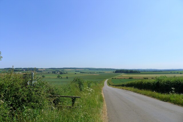
Carlton Ashes is a small village located in the county of Lincolnshire, England. Situated in the East Midlands region, it lies approximately 6 miles north of the town of Louth. The village is surrounded by picturesque countryside, characterized by rolling hills and fertile farmland. The population of Carlton Ashes is relatively small, with just over 200 residents.

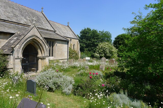
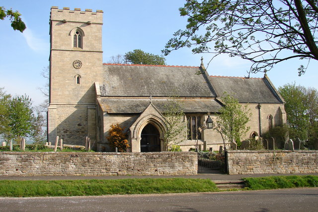
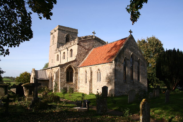
The village is known for its peaceful and idyllic atmosphere, offering a tranquil retreat for both residents and visitors alike. The architecture of Carlton Ashes reflects its rich history, with several charming cottages and traditional farmhouses dotting the landscape. The village church, St. Mary's, is a notable landmark, built in the 13th century and showcasing stunning medieval craftsmanship.

Despite its small size, Carlton Ashes has a strong sense of community, with various social and recreational activities taking place throughout the year. The village boasts a community center that serves as a gathering place for events and celebrations. Additionally, there are several footpaths and walking trails in the surrounding area, providing opportunities for outdoor enthusiasts to explore the beautiful countryside.

Agriculture plays a significant role in the local economy, with many residents engaged in farming and related industries. The village is also conveniently located near the larger town of Louth, which offers a wider range of amenities, including shops, schools, and healthcare services.

In summary, Carlton Ashes is a charming village in Lincolnshire, known for its peaceful atmosphere, historical architecture, and strong sense of community. Its beautiful countryside surroundings and proximity to larger towns make it an appealing destination for those seeking a rural retreat.

If you have any feedback on the listing, please let us know in the comments section below.

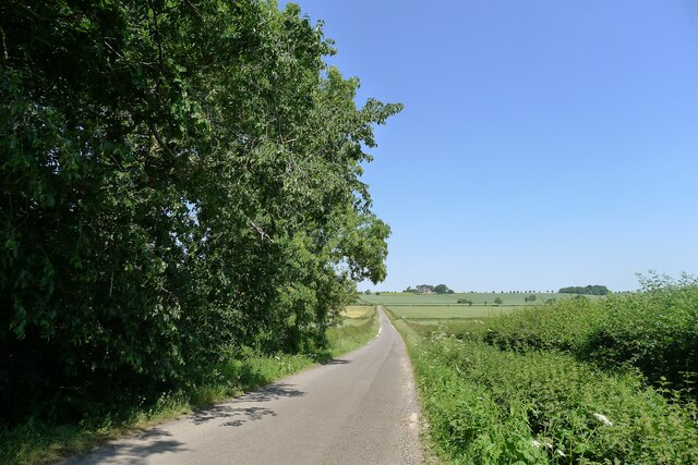
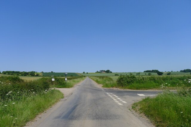
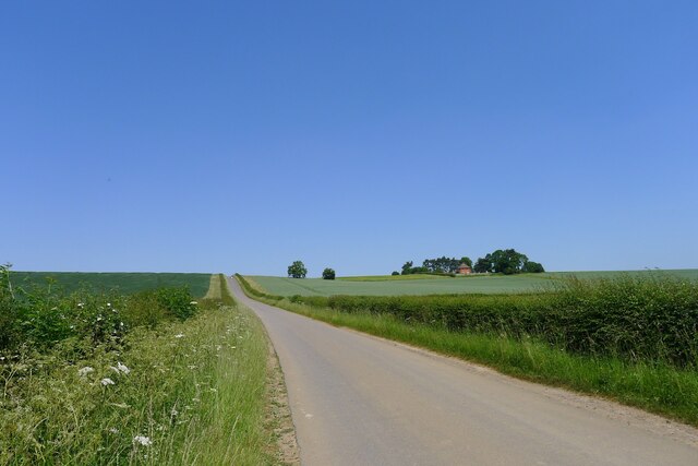
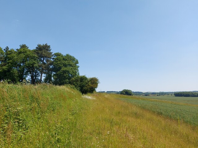
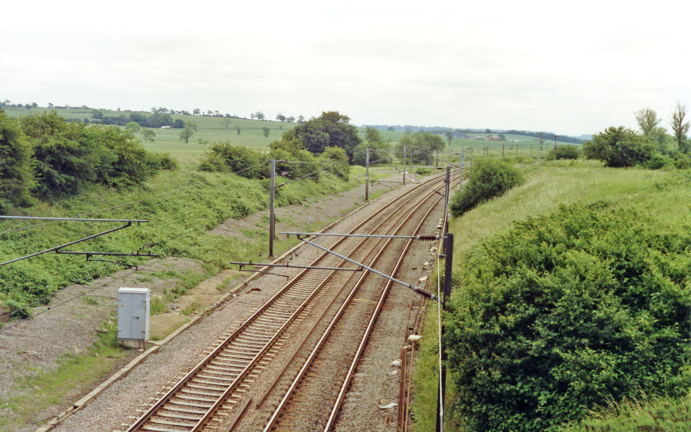
Carlton Ashes Images

Images are sourced within 2km of 52.991468/-0.61882426 or Grid Reference SK9244. Thanks to Geograph Open Source API. All images are credited.

Direction Sign – Signpost on Grantham Road, Hough on the Hill Located on the west side of the junction of Grantham Road and High Road in Hough on the Hill parish. 3 arms and pawn finial.

Milestone Society National ID: LI_SK9246
Direction Sign – Signpost on Grantham Road, Hough on the Hill
Located on the west side of the junction of Grantham Road and High Road in Hough on the Hill parish. 3 arms and pawn finial. Milestone Society National ID: LI_SK9246
Hough Lane Level Crossing Crossing the 'Poacher Line' running from Grantham to Skegness via Sleaford and Boston. The crossing is signed Hough Lane, OS map calls this Hough Road
Hough Lane Level Crossing
Crossing the 'Poacher Line' running from Grantham to Skegness via Sleaford and Boston. The crossing is signed Hough Lane, OS map calls this Hough Road
Hough Road from the north side of Grove Plantations
Frinkley Lane crossing Hough Road The Viking Way comes down Hough Road from the north (ahead), and turns left along Frinkley Lane
Frinkley Lane crossing Hough Road
The Viking Way comes down Hough Road from the north (ahead), and turns left along Frinkley Lane
Hough Road rising up to the Red House ridge Rising from Jurassic mudstones in the valley of Honington Beck to a ridge of harder sandstones and ironstones <span class="nowrap"><a title="https://geologyviewer.bgs.ac.uk/" rel="nofollow ugc noopener" href="https://geologyviewer.bgs.ac.uk/">Link</a><img style="margin-left:2px;" alt="External link" title="External link - shift click to open in new window" src="https://s1.geograph.org.uk/img/external.png" width="10" height="10"/></span>
Hough Road rising up to the Red House ridge
Rising from Jurassic mudstones in the valley of Honington Beck to a ridge of harder sandstones and ironstones LinkExternal link
Footpath running along the ridge below The Red House The footpath runs to Carlton Scroop. It is probably little used as Howdale Lane immediately to the north offers an easier traffic-free route
Footpath running along the ridge below The Red House
The footpath runs to Carlton Scroop. It is probably little used as Howdale Lane immediately to the north offers an easier traffic-free route
Howdale Lane east of Belle Vue Farm Taking the Viking Way east to Carlton Scroop
Howdale Lane east of Belle Vue Farm
Taking the Viking Way east to Carlton Scroop
Howdale Lane Taking the Viking Way west to Hough Road
Howdale Lane
Taking the Viking Way west to Hough Road
Grantham Road (A607) entering Carlton Scroop 'Carlton' means the settlement of freemen or peasants ('karl' + 'ton'). Scroop derives from the Scrope family who held the manor
Grantham Road (A607) entering Carlton Scroop
'Carlton' means the settlement of freemen or peasants ('karl' + 'ton'). Scroop derives from the Scrope family who held the manor
Church of St Nicholas, Carlton Scroop Listed Grade I. With a flower rich 'God's Acre' <a href="https://www.geograph.org.uk/photo/7524836">SK9444 : God's Acre, Church of St Nicholas, Carlton Scroop</a>
Church of St Nicholas, Carlton Scroop
Listed Grade I. With a flower rich 'God's Acre' SK9444 : God's Acre, Church of St Nicholas, Carlton Scroop
God's Acre, Church of St Nicholas, Carlton Scroop "This churchyard has been managed for its botanical diversity since 1996.  The different habitats within the churchyard attract many different species of wildlife between 2015 and 2018 over 200 species of plants, invertebrates, mammals and birds have been recorded here." <span class="nowrap"><a title="https://www.caringforgodsacre.org.uk/churchyard/carlton-scroop-st-nicholas/" rel="nofollow ugc noopener" href="https://www.caringforgodsacre.org.uk/churchyard/carlton-scroop-st-nicholas/">Link</a><img style="margin-left:2px;" alt="External link" title="External link - shift click to open in new window" src="https://s1.geograph.org.uk/img/external.png" width="10" height="10"/></span>
God's Acre, Church of St Nicholas, Carlton Scroop
"This churchyard has been managed for its botanical diversity since 1996. The different habitats within the churchyard attract many different species of wildlife between 2015 and 2018 over 200 species of plants, invertebrates, mammals and birds have been recorded here." LinkExternal link
Hough Road, looking south from Carlton Ashes The road carries the Viking Way. The footpath to the left goes to Carlton Scroop
Hough Road, looking south from Carlton Ashes
The road carries the Viking Way. The footpath to the left goes to Carlton Scroop
All Saints' church, Hough on the Hill, Lincs. Only 4 church towers in the country have a Saxon external staircase turret and All Saints' has arguably the best. A church rich in history and fine architecture, a churchyard of fine trees in a very pretty village.
All Saints' church, Hough on the Hill, Lincs.
Only 4 church towers in the country have a Saxon external staircase turret and All Saints' has arguably the best. A church rich in history and fine architecture, a churchyard of fine trees in a very pretty village.
St.Nicholas' church, Carlton Scroop, Lincs. The lower part of the tower and tower arch are Norman, but the upper part is dated 1632, and inscription inside reveals that the steeple fell into the church on 14th November 1630 !
St.Nicholas' church, Carlton Scroop, Lincs.
The lower part of the tower and tower arch are Norman, but the upper part is dated 1632, and inscription inside reveals that the steeple fell into the church on 14th November 1630 !
The Old Repeater Station, Honington
Frinkley Lane level crossing
Carlton Ashes The Red House near Carlton Scroop from the Viking Way at Carlton Ashes
Carlton Ashes
The Red House near Carlton Scroop from the Viking Way at Carlton Ashes
Yellow, Blue, Green & Red Yellow oil seed rape, hazy blue sky, green hedges & trees and the Red House on the hill - looking north from Frinkley Lane
Yellow, Blue, Green & Red
Yellow oil seed rape, hazy blue sky, green hedges & trees and the Red House on the hill - looking north from Frinkley Lane
Show me another place!

Carlton Ashes is located at Grid Ref: SK9244 (Lat: 52.991468, Lng: -0.61882426)

Division: Parts of Kesteven

Administrative County: Lincolnshire

District: South Kesteven

Police Authority: Lincolnshire

What 3 Words

///notion.rehearsed.reacting. Near Caythorpe, Lincolnshire

Nearby Locations

Carlton Ashes

Related Wikis

Gelston, Lincolnshire

Gelston is a village in the South Kesteven district of Lincolnshire, England. It is 2 miles (3 km) west from the A607 road, 5 miles (8 km) north from Grantham...

Honington railway station

Honington railway station was a station in the village of Honington, Lincolnshire. It was located on junction with the line Grantham and Lincoln railway...

Hough-on-the-Hill

Hough-on-the-Hill is a village and civil parish in the South Kesteven district of Lincolnshire, England. The population of the civil parish including Brandon...

Carlton Scroop

Carlton Scroop is a small village and civil parish in the South Kesteven district of Lincolnshire, England. The population of the civil parish (including...

Honington, Lincolnshire

Honington is an English village and civil parish in the South Kesteven district of Lincolnshire. It lies just north of the junction between the A153 and...

St Nicholas Church, Normanton

St Nicholas Church is a redundant Anglican church in Normanton-on-Cliffe, Lincolnshire, England. It is recorded in the National Heritage List for England...

Normanton-on-Cliffe

Normanton-on-Cliffe, sometimes known as Normanton, is a village and civil parish in the South Kesteven district of Lincolnshire, England. It lies on the...

Hougham railway station

Hougham railway station is a former railway station in Hougham, Lincolnshire. The station was about a mile east of the village of Hougham itself and was...

Nearby Amenities

Located within 500m of 52.991468,-0.61882426
Carlton Ashes Farm
Place: farm
Source: Bing
Lat/Long: 52.9917456/-0.6221447
Carlton Ashes
Place: hamlet
Source: Bing
Lat/Long: 52.9913017/-0.6190045
Howdale Farm
Place: farm
Source: Bing
Lat/Long: 52.9949498/-0.6145331
The Red House
Place: isolated_dwelling
Source: Bing
Lat/Long: 52.9913302/-0.61529
The data included in this document is from www.openstreetmap.org. The data is made available under ODbL.

Have you been to Carlton Ashes?

Leave your review of Carlton Ashes below (or comments, questions and feedback).