Burngate

Settlement in Dorset

England

Burngate

Lulworth Cove at dawn
Lulworth Cove at dawn Credit: Alan Hughes

Burngate is a small village located in Dorset, England. Situated on the Isle of Purbeck, it lies within the picturesque surroundings of the Purbeck Hills and boasts stunning views of the English Channel. With a population of around 500 residents, Burngate is a quaint and peaceful village that attracts visitors seeking tranquility and natural beauty.

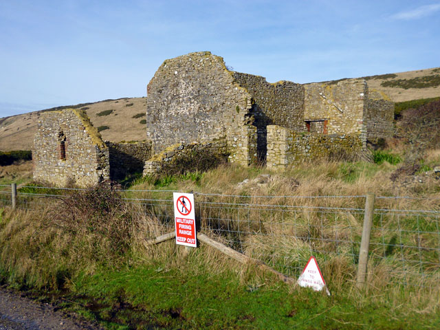
The village is known for its rich history, which dates back centuries. Its name is believed to have originated from the burn, a small stream that runs through the village. Burngate was historically a farming community, and remnants of its agricultural past can still be seen in the surrounding fields and farms.

One of the main attractions in Burngate is the Burngate Stone Carving Centre. This unique establishment offers workshops and courses on stone carving, attracting artists and enthusiasts from all over the country. The center also houses a gallery where visitors can view and purchase beautiful stone carvings created by local artists.

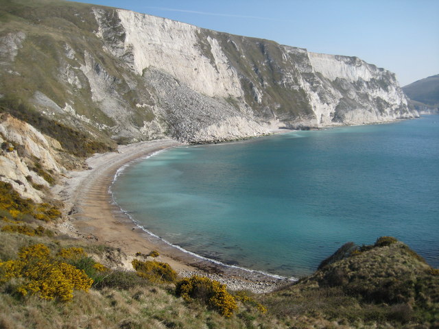
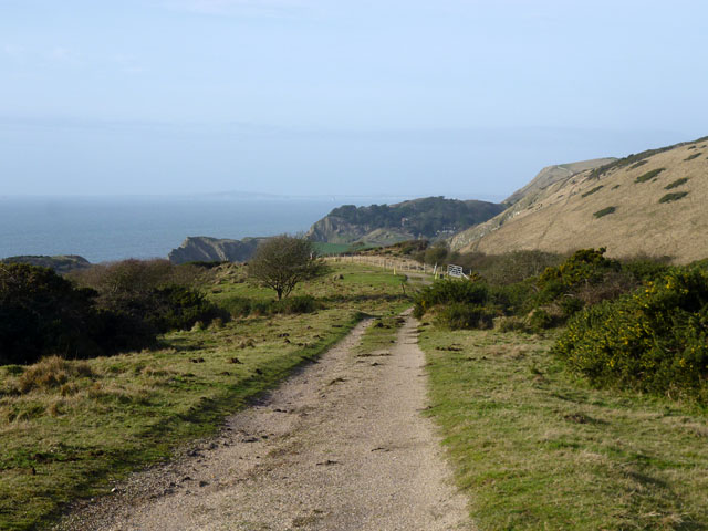
Nature lovers are drawn to Burngate for its access to the stunning countryside. The village is surrounded by walking trails that lead to the nearby Purbeck Hills and the South West Coast Path, offering breathtaking views of the Dorset coastline. The area is home to a diverse range of wildlife, including rare birds and butterflies, making it a popular destination for birdwatchers and nature enthusiasts.

Although small in size, Burngate offers a peaceful and picturesque retreat for visitors seeking relaxation and a connection with nature. With its historic charm, stunning landscapes, and artistic offerings, this Dorset village is a true gem for those who venture to explore it.

If you have any feedback on the listing, please let us know in the comments section below.
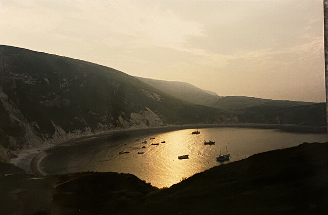
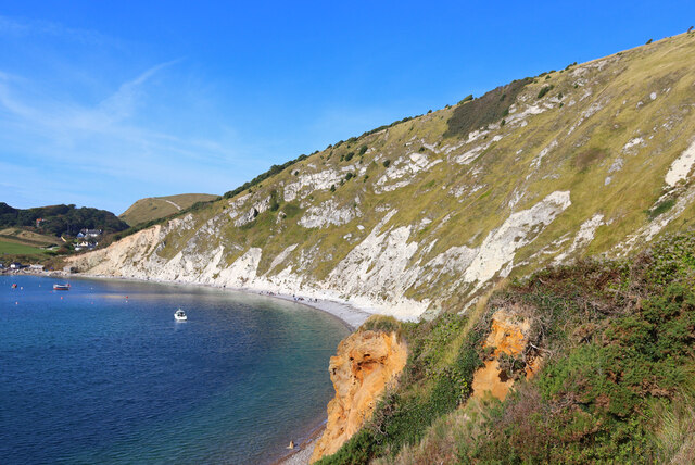
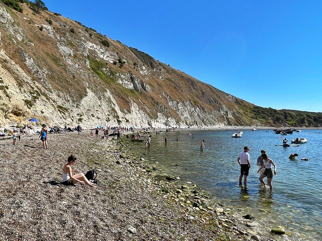
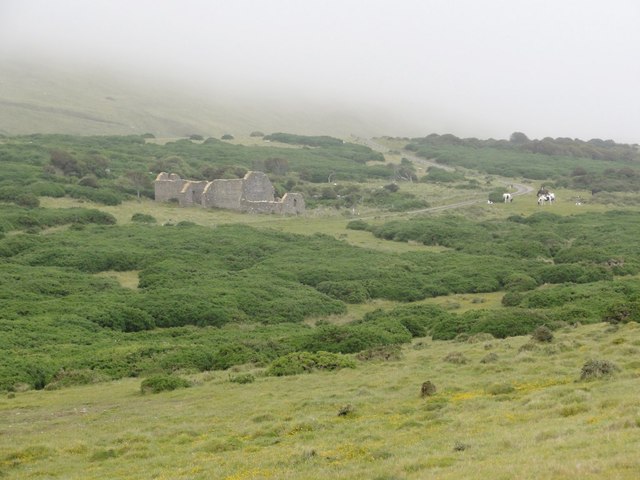
Burngate Images

Images are sourced within 2km of 50.634893/-2.2345599 or Grid Reference SY8381. Thanks to Geograph Open Source API. All images are credited.

Lulworth Cove at dawn
Lulworth Cove Cliffs at Lulworth.
Lulworth Cove
Cliffs at Lulworth.
Lulworth Cove
Lulworth Cove
Little Bindon Looking toward the derelict farmhouse on the military range below Bindon Hill which is shrouded in cloud.
Little Bindon
Looking toward the derelict farmhouse on the military range below Bindon Hill which is shrouded in cloud.
Lulworth Cove View of the eastern side of the cove with the photographer standing a few metres south of the 8000 northing grid line which approximates to the left hand side of the image.
Lulworth Cove
View of the eastern side of the cove with the photographer standing a few metres south of the 8000 northing grid line which approximates to the left hand side of the image.
Lulworth Cove Photo date c1930. Must be one of the most photographed places in UK! Many very similar photos on this site.
Lulworth Cove
Photo date c1930. Must be one of the most photographed places in UK! Many very similar photos on this site.
Mupe Bay The high chalk cliffs of Bindon Hill tower above Mupe Bay. Thousands of tonnes of rock lie at the foot of the cliff as a result of huge rockfall.
Mupe Bay
The high chalk cliffs of Bindon Hill tower above Mupe Bay. Thousands of tonnes of rock lie at the foot of the cliff as a result of huge rockfall.
Ruin, Lulworth Ranges Maps of the last 120 years have shown this without a name or function, although earlier it does not seem to have been a ruin. It is by a footpath (a track) through the ranges, open most weekends.
Ruin, Lulworth Ranges
Maps of the last 120 years have shown this without a name or function, although earlier it does not seem to have been a ruin. It is by a footpath (a track) through the ranges, open most weekends.
Lulworth Ranges - track This is used by one of the footpaths which are open when the ranges are not being used, usually most weekends. Where paths follow tracks such as this, the walking is easy, but some paths go off track and feature some diabolical gradients, usually supplied with never-ending steps.
Lulworth Ranges - track
This is used by one of the footpaths which are open when the ranges are not being used, usually most weekends. Where paths follow tracks such as this, the walking is easy, but some paths go off track and feature some diabolical gradients, usually supplied with never-ending steps.
Pebbly beach at Lulworth Cove The cove has formed due to bands of rock of alternating resistance running parallel to the shore (a concordant coastline). A narrow band of Portland limestone rocks forms the shoreline. Behind this is a narrow band of slightly less resistant Purbeck limestone. Behind this are 300-350 metres of much less resistant clays and greensands (Wealden clays, Gault and Upper Greensand).
Forming the back of the cove is a  band of chalk, which is considerably more resistant than the clays and sands, but less resistant than the limestones. The entrance to the cove is a narrow gap in the limestone bands. This was formed by a combination wave action , glacial melt waters and the processes of weathering. The wide part of the cove is where the weak clays and greensands have been eroded. The back of the cove is the chalk, which the sea has been unable to erode as fast as it does not dissolve in the sea acids.
The unique shape of the cove is a result of wave diffraction. The narrow entrance to the cove ensures that as waves enter they bend into an arced shape.
Pebbly beach at Lulworth Cove
The cove has formed due to bands of rock of alternating resistance running parallel to the shore (a concordant coastline). A narrow band of Portland limestone rocks forms the shoreline. Behind this is a narrow band of slightly less resistant Purbeck limestone. Behind this are 300-350 metres of much less resistant clays and greensands (Wealden clays, Gault and Upper Greensand). Forming the back of the cove is a band of chalk, which is considerably more resistant than the clays and sands, but less resistant than the limestones. The entrance to the cove is a narrow gap in the limestone bands. This was formed by a combination wave action , glacial melt waters and the processes of weathering. The wide part of the cove is where the weak clays and greensands have been eroded. The back of the cove is the chalk, which the sea has been unable to erode as fast as it does not dissolve in the sea acids. The unique shape of the cove is a result of wave diffraction. The narrow entrance to the cove ensures that as waves enter they bend into an arced shape.
Paddle Steamer in Lulworth Cove Taking on passengers from the beach,
Paddle Steamer in Lulworth Cove
Taking on passengers from the beach,
Lulworth Cove View E from the slipway in Lulworth Cove
Lulworth Cove
View E from the slipway in Lulworth Cove
Cosy cove A few hardy sun-worshippers garner the evening rays in Lulworth Cove.
Cosy cove
A few hardy sun-worshippers garner the evening rays in Lulworth Cove.
Trespassers Will Be Shot The path climbs steeply up from the beach along the edge of the military land.
Trespassers Will Be Shot
The path climbs steeply up from the beach along the edge of the military land.
Lulworth Cove The cove has formed due to bands of rock of alternating resistance running parallel to the shore (a concordant coastline). A narrow band of Portland limestone rocks forms the shoreline. Behind this is a narrow band of slightly less resistant Purbeck limestone. Behind this are 300-350 metres of much less resistant clays and greensands (Wealden clays, Gault and Upper Greensand).
Forming the back of the cove is a  band of chalk, which is considerably more resistant than the clays and sands, but less resistant than the limestones. The entrance to the cove is a narrow gap in the limestone bands. This was formed by a combination wave action , glacial melt waters and the processes of weathering. The wide part of the cove is where the weak clays and greensands have been eroded. The back of the cove is the chalk, which the sea has been unable to erode as fast as it does not dissolve in the sea acids.
The unique shape of the cove is a result of wave diffraction. The narrow entrance to the cove ensures that as waves enter they bend into an arced shape.
Lulworth Cove
The cove has formed due to bands of rock of alternating resistance running parallel to the shore (a concordant coastline). A narrow band of Portland limestone rocks forms the shoreline. Behind this is a narrow band of slightly less resistant Purbeck limestone. Behind this are 300-350 metres of much less resistant clays and greensands (Wealden clays, Gault and Upper Greensand). Forming the back of the cove is a band of chalk, which is considerably more resistant than the clays and sands, but less resistant than the limestones. The entrance to the cove is a narrow gap in the limestone bands. This was formed by a combination wave action , glacial melt waters and the processes of weathering. The wide part of the cove is where the weak clays and greensands have been eroded. The back of the cove is the chalk, which the sea has been unable to erode as fast as it does not dissolve in the sea acids. The unique shape of the cove is a result of wave diffraction. The narrow entrance to the cove ensures that as waves enter they bend into an arced shape.
Steps off the beach on the east side of Lulworth Cove Leading towards the coast path near Little Bindon.
Steps off the beach on the east side of Lulworth Cove
Leading towards the coast path near Little Bindon.
View towards Little Bindon, below Bindon Hill, Lulworth Ranges The cottage / former medieval chapel at Little Bindon is hidden by the trees and other thick vegetation and can barely be seen even up close.
View towards Little Bindon, below Bindon Hill, Lulworth Ranges
The cottage / former medieval chapel at Little Bindon is hidden by the trees and other thick vegetation and can barely be seen even up close.
Mupe Bay near Lulworth Cove
Show me another place!

Burngate is located at Grid Ref: SY8381 (Lat: 50.634893, Lng: -2.2345599)

Unitary Authority: Dorset

Police Authority: Dorset

What 3 Words

///earmarked.familiar.meanders. Near Wool, Dorset

Nearby Locations

Burngate Lulworth Camp

Related Wikis

Lulworth Camp

Lulworth Camp is a British Army base that is home to the Armoured Fighting Vehicle Gunnery School and runs the Lulworth Ranges on the southern coast of...

West Lulworth

West Lulworth is a village and civil parish in the English county of Dorset, situated on the English Channel beside Lulworth Cove. In the 2011 census the...

Bindon Hill

Bindon Hill is an extensive Iron Age earthwork enclosing a coastal hill area on the Jurassic Coast near Lulworth Cove in Dorset, England, about 19 kilometres...

Bestival

Bestival was a four-day music festival held in the south of England. The name Bestival is a portmanteau of the words best and festival. It had been held...

Nearby Amenities

Located within 500m of 50.634893,-2.2345599
CHALDONDOWNG2
Disused: yes
Man Made: petroleum_well
Ref GB Decc: L97/14-4
Source: DECC
Lat/Long: 50.6320556/-2.2371111
Camera Type: dome
Height: 10
Man Made: surveillance
Surveillance: public
Surveillance Type: camera
Lat/Long: 50.632492/-2.2339943
Crossing
Crossing: uncontrolled
Crossing Island: yes
Crossing Markings: zebra
Lat/Long: 50.6325168/-2.2344146
Fixme: Sign for underground cable
Lat/Long: 50.6336931/-2.2339229
Location Transition: yes
Material: wood
Power: pole
Ref: 53502157;184
Source: bing
Source Ref: survey
Lat/Long: 50.6340067/-2.2402111
Material: wood
Power: pole
Ref: 183
Source: bing
Source Ref: interpolation
Switch: mechanical
Lat/Long: 50.6350085/-2.2400148
Material: wood
Power: pole
Ref: 182
Source: bing
Source Ref: interpolation
Lat/Long: 50.6360095/-2.2398173
Material: wood
Power: pole
Ref: 53502154;181
Source: bing
Source Ref: survey
Lat/Long: 50.6372726/-2.2395715
Power: switch
Lat/Long: 50.6340068/-2.2316898
Cabinet: pstn
Colour: green
Connection Point: primary
Man Made: street_cabinet
Operator: Openreach
Operator Wikidata: Q7096543
Ref: 4
Source: survey
Telephone Exchange: West Lulworth
Utility: telecom
Lat/Long: 50.6338279/-2.2337891
Power: switch
Lat/Long: 50.6337086/-2.2347331
Marker: post
Note: High voltage cable below
Lat/Long: 50.6339276/-2.240178
Marker: post
Note: High voltage cable below
Lat/Long: 50.6339844/-2.2401818
Burngate Farm
Landuse: farm
Note Retag: CS #48756035
Source: OS OpenData StreetView
Lat/Long: 50.6343188/-2.2337916
Burngate
Place: hamlet
Lat/Long: 50.6345536/-2.2350791
Power: transformer
Source: bing
Transformer: distribution
Lat/Long: 50.6340167/-2.2316613
Colour: green
Fttc: yes
Man Made: street_cabinet
Manufacturer: Huawei
Operator: Openreach
Operator Wikidata: Q7096543
Utility: telecom
Lat/Long: 50.633712/-2.2339777
Give Way
Direction: forward
Lat/Long: 50.6338272/-2.2344602
Give Way
Direction: backward
Lat/Long: 50.632384/-2.2339227
Give Way
Direction: backward
Lat/Long: 50.6325944/-2.234728
The data included in this document is from www.openstreetmap.org. The data is made available under ODbL.

Have you been to Burngate?

Leave your review of Burngate below (or comments, questions and feedback).