Bullhouse

Settlement in Yorkshire

England

Bullhouse

Bullhouse Railway Bridge OS BM on old Railway Bridge west of Bullhouse 
SE 2059 0256
Bullhouse Railway Bridge Credit: mralrule

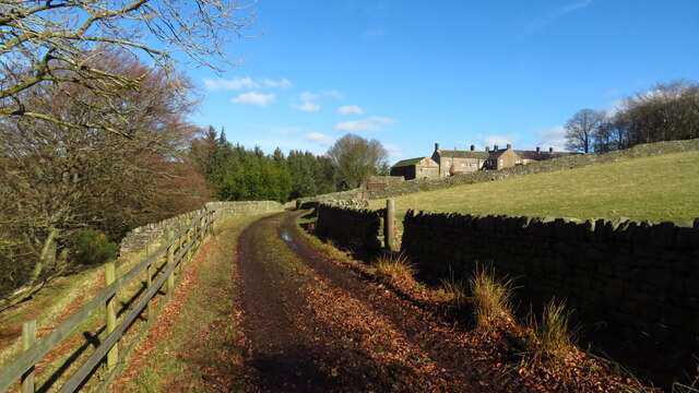
Bullhouse is a small village located in the metropolitan borough of Barnsley, South Yorkshire, England. Situated within the picturesque Pennine Hills, Bullhouse offers a tranquil and idyllic setting for its residents and visitors alike.

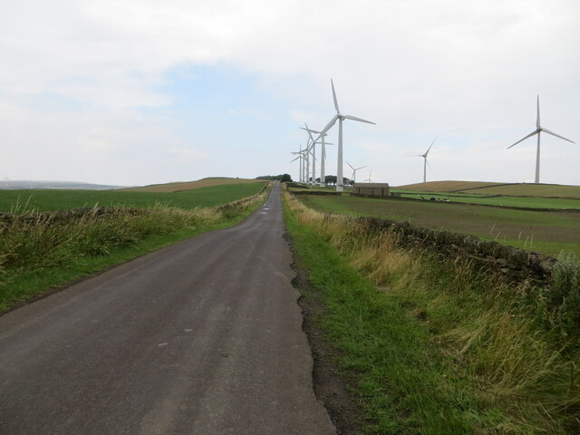
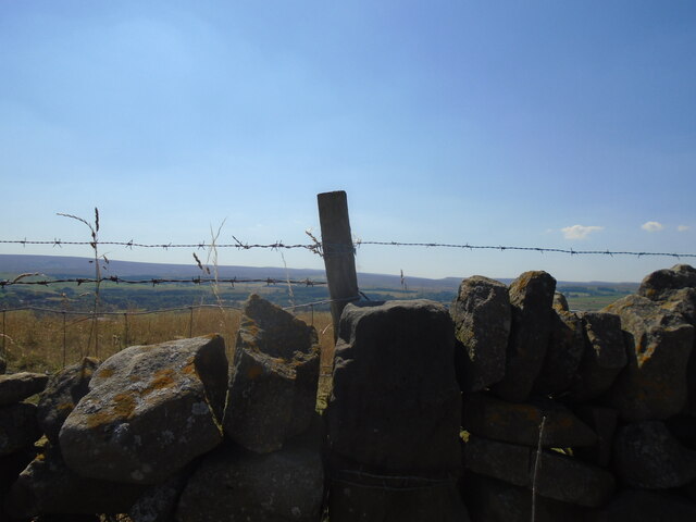
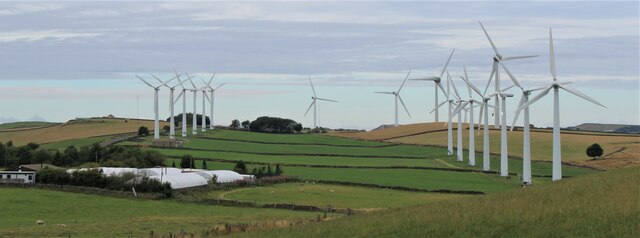
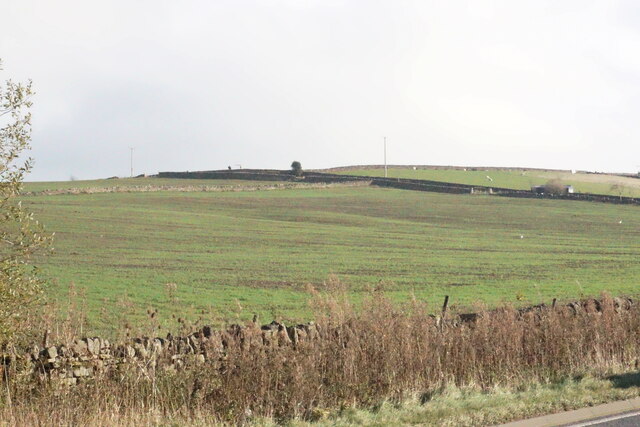
The village is known for its stunning natural beauty, with rolling hills, lush green meadows, and charming countryside views. It is surrounded by several other quaint villages, including Millhouse Green and Thurlstone, creating a sense of unity and a close-knit community.

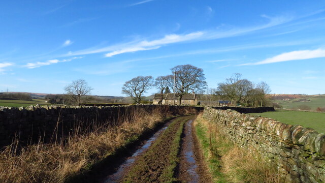
Historically, Bullhouse was predominantly an agricultural community, with farming playing a significant role in the local economy. However, in recent years, the village has evolved into a more residential area, attracting individuals seeking a peaceful retreat from the hustle and bustle of city life.

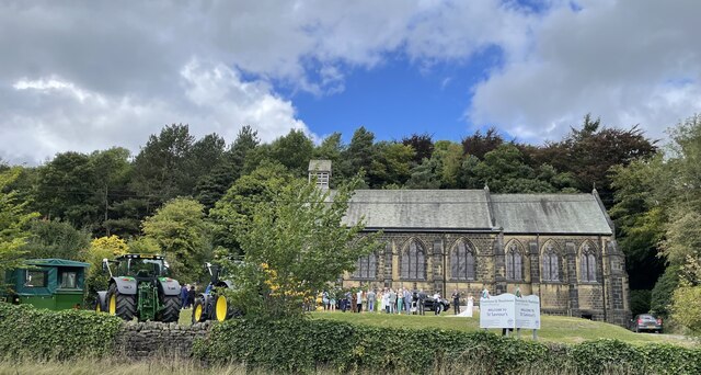
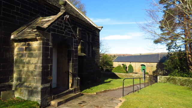
Bullhouse is home to a number of well-preserved historic buildings, including traditional stone cottages and farmhouses, which add to the village's charm and character. Additionally, the area features a beautiful church, St. John the Baptist, dating back to the 12th century, serving as a reminder of the village's rich heritage.

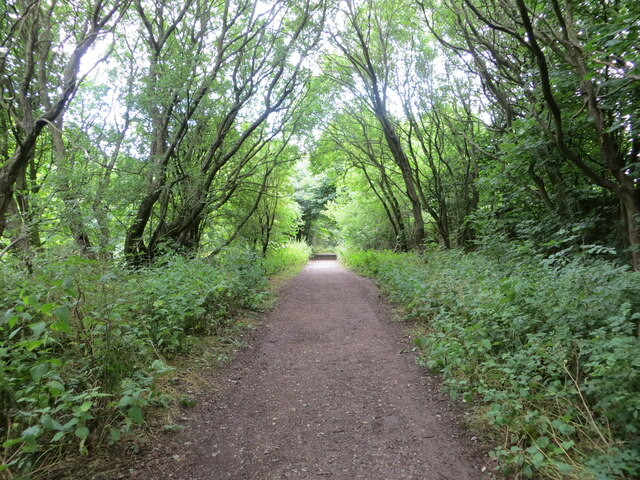
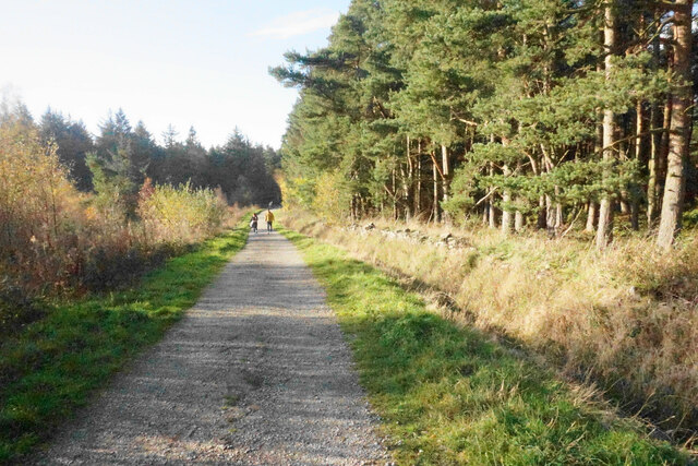
For outdoor enthusiasts, Bullhouse offers ample opportunities for walking, hiking, and exploring the surrounding countryside. The Trans Pennine Trail, a long-distance path that stretches across the country, passes through the village, providing access to stunning scenery and breathtaking views.

Although Bullhouse is a small village, it benefits from its proximity to larger towns, such as Barnsley and Sheffield, which offer a wider range of amenities, including shopping centers, schools, and healthcare facilities.

If you have any feedback on the listing, please let us know in the comments section below.
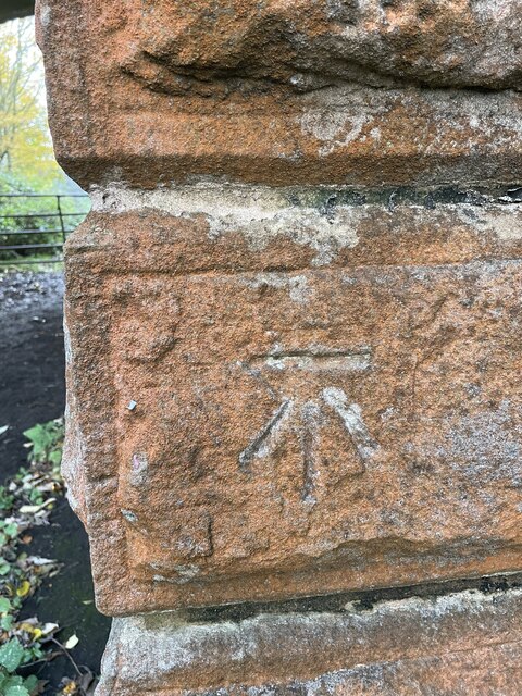
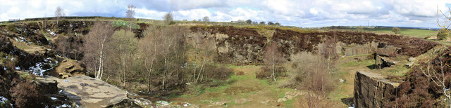
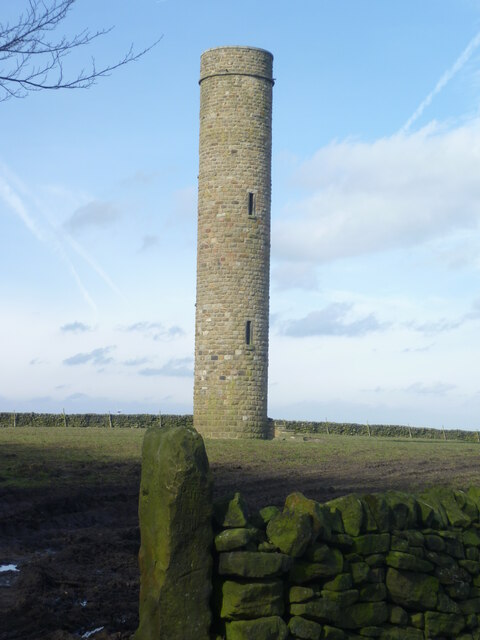
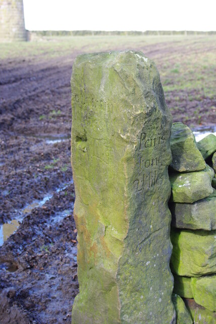
Bullhouse Images

Images are sourced within 2km of 53.520448/-1.6815872 or Grid Reference SE2102. Thanks to Geograph Open Source API. All images are credited.

Bullhouse Railway Bridge OS BM on old Railway Bridge west of Bullhouse 
SE 2059 0256
Bullhouse Railway Bridge
OS BM on old Railway Bridge west of Bullhouse SE 2059 0256
Disused quarry Disused quarry, off High Bank Lane, Thurlstone, South Yorkshire.
Disused quarry
Disused quarry, off High Bank Lane, Thurlstone, South Yorkshire.
Hartcliff Tower A true folly tower with no apparent reason for its construction in 1856
Hartcliff Tower
A true folly tower with no apparent reason for its construction in 1856
Old Milestone near Hartcliff Tower A gatepost with mileage to Penistone & Rotherham so probably was a guide stoup at one time (listed Grade II)
Old Milestone near Hartcliff Tower
A gatepost with mileage to Penistone & Rotherham so probably was a guide stoup at one time (listed Grade II)
Whitley Road and Wind Turbines on Spicer Hill Looking north-westward.
Whitley Road and Wind Turbines on Spicer Hill
Looking north-westward.
Woodland footpath giving access to Royd Moor Reservoir Looking north-westward.
Woodland footpath giving access to Royd Moor Reservoir
Looking north-westward.
Old milestone The milestone on High Bank Lane which is probably about 250 years old.   It is the stone with the fence post at its left corner.   The large stone to the left can be moved to see the legend on that face, (P)enistone/(?) mile.   It still has barbed wire wrapped round it, 3 strands now.   In the distance is the eastern edge of the Pennines.   Grade II listed 1315076.
Old milestone
The milestone on High Bank Lane which is probably about 250 years old. It is the stone with the fence post at its left corner. The large stone to the left can be moved to see the legend on that face, (P)enistone/(?) mile. It still has barbed wire wrapped round it, 3 strands now. In the distance is the eastern edge of the Pennines. Grade II listed 1315076.
Royd Moor wind farm
Royd Moor wind farm
St. Saviour's Church, Thurlstone
Ordnance Survey Cut Mark This mark can be found on a gatepost beside Spicer House Land, Royd Moor.
The recorded detail s give a height of 322.7649 metres above sea level.
For more detail see : <span class="nowrap"><a title="https://www.bench-marks.org.uk/bm91191" rel="nofollow ugc noopener" href="https://www.bench-marks.org.uk/bm91191">Link</a><img style="margin-left:2px;" alt="External link" title="External link - shift click to open in new window" src="https://s1.geograph.org.uk/img/external.png" width="10" height="10"/></span>
Ordnance Survey Cut Mark
This mark can be found on a gatepost beside Spicer House Land, Royd Moor. The recorded detail s give a height of 322.7649 metres above sea level. For more detail see : LinkExternal link
Ordnance Survey Cut Mark This mark can be found on a gatepost beside Whitley Road, Spicer Hill.
The recorded details give a height of 329.5163 metres above sea level.
For more detail see : <span class="nowrap"><a title="https://www.bench-marks.org.uk/bm91229" rel="nofollow ugc noopener" href="https://www.bench-marks.org.uk/bm91229">Link</a><img style="margin-left:2px;" alt="External link" title="External link - shift click to open in new window" src="https://s1.geograph.org.uk/img/external.png" width="10" height="10"/></span>
Ordnance Survey Cut Mark
This mark can be found on a gatepost beside Whitley Road, Spicer Hill. The recorded details give a height of 329.5163 metres above sea level. For more detail see : LinkExternal link
Ordnance Survey Cut Mark This mark can be found on a gatepost beside Royd Moor Road, Royd Moor.
The recorded details give a height of 261.5855 metres above sea level.
For more detail see : <span class="nowrap"><a title="https://www.bench-marks.org.uk/bm91414" rel="nofollow ugc noopener" href="https://www.bench-marks.org.uk/bm91414">Link</a><img style="margin-left:2px;" alt="External link" title="External link - shift click to open in new window" src="https://s1.geograph.org.uk/img/external.png" width="10" height="10"/></span>
Ordnance Survey Cut Mark
This mark can be found on a gatepost beside Royd Moor Road, Royd Moor. The recorded details give a height of 261.5855 metres above sea level. For more detail see : LinkExternal link
Brook House Lane Access from the A616 to forestry walks near Langsett Reservoir and the Barnsley Boundary Walk.
Brook House Lane
Access from the A616 to forestry walks near Langsett Reservoir and the Barnsley Boundary Walk.
Farmland near Fullshaw Grazing land on the lower foothills of the Pennines but still with some of their character.
Farmland near Fullshaw
Grazing land on the lower foothills of the Pennines but still with some of their character.
Track leading NW towards Ecklands near Millhouse Green
Bullhouse Green Chapel near Millhouse Green
Track west of Bullhouse Hall near Millhouse Green
Millhouse Green Some rather exotic birds at a farm at Millhouse Green looking towards the windmills on the hill.
Millhouse Green
Some rather exotic birds at a farm at Millhouse Green looking towards the windmills on the hill.
Show me another place!

Bullhouse is located at Grid Ref: SE2102 (Lat: 53.520448, Lng: -1.6815872)

Division: West Riding

Unitary Authority: Barnsley

Police Authority: South Yorkshire

What 3 Words

///lawn.radically.isolating. Near Penistone, South Yorkshire

Related Wikis

Millhouse Green

Millhouse Green is a village on the north banks of the River Don on the A628 road west of Penistone in the English county of South Yorkshire. Administratively...

Catshaw

Catshaw is a hamlet in the western parts of Penistone, in the Barnsley district, in the county of South Yorkshire, England. It lies about 0.9 miles (1...

Hartcliff Folly

The Hartcliff Folly (or Tower) is a stone structure 1.2 miles (2 km) south-west of Penistone in South Yorkshire, England. The folly was built in 1856 by...

Hazlehead Bridge railway station

Hazlehead Bridge railway station was a railway station on the Sheffield, Ashton-under-Lyne and Manchester Railway's Woodhead Line. It served villages scattered...

Nearby Amenities

Located within 500m of 53.520448,-1.6815872
Bus Stop
Manchester Road/Bullhouse Lane
Check Date Shelter: 2022-01-03
Naptan AtcoCode: 370055142
Naptan Bearing: NE
Naptan CommonName: Manchester Road/Bullhouse Lane
Naptan Indicator: 55142
Naptan Landmark: 55142
Naptan PlusbusZoneRef: ROTHCEN
Naptan Street: Manchester Road
Naptan Verified: no
Shelter: yes
Source: naptan_import
Lat/Long: 53.5210142/-1.6775089
Bus Stop
Manchester Road/Bullhouse Lane
Naptan AtcoCode: 370051063
Naptan Bearing: SW
Naptan CommonName: Manchester Road/Bullhouse Lane
Naptan Indicator: 51063
Naptan Landmark: ELECTRIC WINDMILL
Naptan PlusbusZoneRef: ROTHCEN
Naptan Street: Manchester Road
Naptan Verified: no
Source: naptan_import
Lat/Long: 53.5213116/-1.6770098
Bus Stop
Manchester Road/Liley Lane
Alt Name: Manchester Road/Liley Lane
Bench: no
Bin: no
Bus: yes
Naptan AltCommonName: Manchester Road/Liley Lane
Naptan AtcoCode: 370051064
Naptan Bearing: N
Naptan CommonName: Manchester Road/Liley Lane
Naptan Indicator: 51064
Naptan Landmark: WORKS
Naptan PlusbusZoneRef: ROTHCEN
Naptan Street: Manchester Road
Naptan Verified: no
Public Transport: platform
Shelter: no
Source: naptan_import
Lat/Long: 53.5180646/-1.6795833
Manchester Road/Liley Lane
Alt Name: Manchester Road/Liley Lane
Naptan AltCommonName: Manchester Road/Liley Lane
Naptan AtcoCode: 370055561
Naptan Bearing: NE
Naptan BusStopType: CUS
Naptan CommonName: Manchester Road/Liley Lane
Naptan Indicator: 55561
Naptan Landmark: WORKS
Naptan PlusbusZoneRef: ROTHCEN
Naptan Street: Manchester Road
Naptan Verified: no
Source: naptan_import
Lat/Long: 53.5181281/-1.6798091
Barrier: stile
Step Count: 3
Stile: stepover
Lat/Long: 53.5177146/-1.683407
Barrier: stile
Stile: stepover
Lat/Long: 53.5193162/-1.675308
Barrier: stile
Stile: stepover
Lat/Long: 53.5194269/-1.6761885
Barrier: stile
Lat/Long: 53.5194902/-1.676424
Generator Method: wind_turbine
Generator Source: wind
Power: generator
Lat/Long: 53.5232931/-1.6843882
Generator Method: wind_turbine
Generator Source: wind
Power: generator
Lat/Long: 53.5246951/-1.6831089
Barrier: stile
Step Count: 1
Stile: stepover
Lat/Long: 53.5228042/-1.6838167
Barrier: kissing_gate
Lat/Long: 53.5199227/-1.6782349
Give Way
Lat/Long: 53.5178961/-1.6797732
Power: pole
Lat/Long: 53.5177812/-1.6810918
Power: pole
Lat/Long: 53.5183591/-1.6809286
Power: pole
Lat/Long: 53.5189916/-1.6807612
Power: pole
Lat/Long: 53.5195785/-1.6806022
Power: pole
Lat/Long: 53.5169771/-1.6789955
Power: pole
Lat/Long: 53.5168035/-1.6779377
Power: pole
Lat/Long: 53.5171518/-1.6800644
Power: pole
Lat/Long: 53.5173143/-1.6810664
Power: pole
Lat/Long: 53.5171267/-1.6768662
Generator Method: wind_turbine
Generator Source: wind
Power: generator
Lat/Long: 53.5236595/-1.6850752
Barrier: stile
Step Count: 2
Stile: stepover
Lat/Long: 53.5221594/-1.6811759
Marker: aerial
Lat/Long: 53.5216354/-1.6780864
Barrier: stile
Step Count: 3
Stile: stepover
Lat/Long: 53.5204676/-1.6803364
Bench
Backrest: yes
Lat/Long: 53.5227783/-1.6836312
Barrier: stile
Step Count: 4
Stile: ladder
Lat/Long: 53.5214573/-1.6808362
Bench
Lat/Long: 53.52022/-1.6826299
Entrance: yes
Lat/Long: 53.5200981/-1.6826255
Bench
Lat/Long: 53.5200641/-1.6825473
Waterway: weir
Lat/Long: 53.5202997/-1.686112
Marker: aerial
Lat/Long: 53.5211519/-1.6774139
Barrier: stile
Step Count: 2
Stile: stepover
Lat/Long: 53.5175739/-1.6833391
Marker: aerial
Lat/Long: 53.5202243/-1.6769936
Bench
Backrest: yes
Lat/Long: 53.5204087/-1.6770995
Leisure: picnic_table
Lat/Long: 53.5204353/-1.67683
Leisure: picnic_table
Lat/Long: 53.520429/-1.6769741
Bullhouse
Place: hamlet
Lat/Long: 53.5208316/-1.6809833
The data included in this document is from www.openstreetmap.org. The data is made available under ODbL.

Have you been to Bullhouse?

Leave your review of Bullhouse below (or comments, questions and feedback).