Bullingstone

Settlement in Kent Tunbridge Wells

England

Bullingstone

Rusthall Rd
Rusthall Rd Credit: N Chadwick

Bullingstone is a small village located in the county of Kent, England. Situated in the southeastern part of the country, it is nestled amidst the picturesque countryside and is renowned for its idyllic charm and rural beauty.

The village of Bullingstone is characterised by its traditional architecture, with many of its buildings dating back several centuries. The village is home to a tight-knit community, with a population of around 500 residents. The residents take great pride in their village and actively participate in various community events and initiatives.

Surrounded by rolling hills and lush green fields, Bullingstone offers a tranquil and peaceful environment. The village is known for its stunning natural landscapes, which attract visitors from far and wide. It is also a popular destination for outdoor enthusiasts, with ample opportunities for hiking, cycling, and exploring the nearby countryside.

Bullingstone boasts a rich history, with evidence of human habitation dating back to the Roman era. The village is home to several historical landmarks, including a medieval church and a manor house, which serve as reminders of its past.

While Bullingstone is primarily a rural village, it is conveniently located near larger towns and cities. The bustling market town of Tunbridge Wells is only a short drive away, providing residents with access to a range of amenities and services.

Overall, Bullingstone is a charming village that offers a peaceful countryside lifestyle, rich history, and stunning natural beauty.

If you have any feedback on the listing, please let us know in the comments section below.
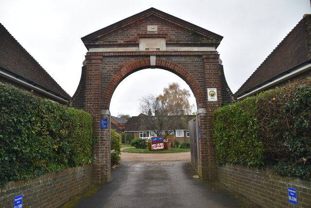
Bullingstone Images

Images are sourced within 2km of 51.144027/0.21401602 or Grid Reference TQ5440. Thanks to Geograph Open Source API. All images are credited.

Rusthall Rd
Rusthall Rd
Victorian Postbox In the British Isles the first pillar post boxes were erected in Jersey in 1852. Roadside wall boxes first appeared in 1857 as a cheaper alternative to pillar boxes, especially in rural districts. In 1853 the first pillar box in Britain was installed at Botchergate, Carlisle. In 1856 Richard Redgrave of the Department of Science and Art designed an ornate pillar box for use in London and other large cities. In 1859 the design was improved, and this became the first National Standard pillar box. Green was adopted as the standard colour for the early Victorian post boxes. Between 1866 and 1879 the hexagonal Penfold post box became the standard design for pillar boxes and it was during this period that red was first adopted as the standard colour. The first boxes to be painted red were in London in July 1874, although it would be nearly 10 years before all the boxes had been repainted.
Victorian Postbox
In the British Isles the first pillar post boxes were erected in Jersey in 1852. Roadside wall boxes first appeared in 1857 as a cheaper alternative to pillar boxes, especially in rural districts. In 1853 the first pillar box in Britain was installed at Botchergate, Carlisle. In 1856 Richard Redgrave of the Department of Science and Art designed an ornate pillar box for use in London and other large cities. In 1859 the design was improved, and this became the first National Standard pillar box. Green was adopted as the standard colour for the early Victorian post boxes. Between 1866 and 1879 the hexagonal Penfold post box became the standard design for pillar boxes and it was during this period that red was first adopted as the standard colour. The first boxes to be painted red were in London in July 1874, although it would be nearly 10 years before all the boxes had been repainted.
Sunnyside Community Hall
Drinking Fountain Listed buildings and structures are officially designated as being of special architectural, historical or cultural significance. There are over half a million listed structures in the United Kingdom, covered by around 375,000 listings.
Listed status is more commonly associated with buildings or groups of buildings, however it can cover many other structures, including bridges, headstones, steps, ponds, monuments, walls, phone boxes, wrecks, parks, and heritage sites, and in more recent times a road crossing (Abbey Road) and graffiti art (Banksy 'Spy-booth') have been included.

In England and Wales there are three main listing designations;
Grade I (2.5%) - exceptional interest, sometimes considered to be internationally important.
Grade II* (5.5%) - particularly important buildings of more than special interest. 
Grade II (92%) - nationally important and of special interest. 

There are also locally listed structures (at the discretion of local authorities) using A, B and C designations.

In Scotland three classifications are also used but the criteria are different. There are around 47,500 Listed buildings.
Category A (8%)- generally equivalent to Grade I and II* in England and Wales
Category B (51%)- this appears generally to cover the ground of Grade II, recognising national importance.
Category C (41%)- buildings of local importance, probably with some overlap with English Grade II.

In Northern Ireland the criteria are similar to Scotland, but the classifications are:
Grade A (2.3%)
Grade B+ (4.7%)
Grade B (93%)

Read more at Wikipedia <span class="nowrap"><a title="http://en.wikipedia.org/wiki/Listed_building" rel="nofollow ugc noopener" href="http://en.wikipedia.org/wiki/Listed_building">Link</a><img style="margin-left:2px;" alt="External link" title="External link - shift click to open in new window" src="https://s1.geograph.org.uk/img/external.png" width="10" height="10"/></span>
Drinking Fountain
Listed buildings and structures are officially designated as being of special architectural, historical or cultural significance. There are over half a million listed structures in the United Kingdom, covered by around 375,000 listings. Listed status is more commonly associated with buildings or groups of buildings, however it can cover many other structures, including bridges, headstones, steps, ponds, monuments, walls, phone boxes, wrecks, parks, and heritage sites, and in more recent times a road crossing (Abbey Road) and graffiti art (Banksy 'Spy-booth') have been included. In England and Wales there are three main listing designations; Grade I (2.5%) - exceptional interest, sometimes considered to be internationally important. Grade II* (5.5%) - particularly important buildings of more than special interest. Grade II (92%) - nationally important and of special interest. There are also locally listed structures (at the discretion of local authorities) using A, B and C designations. In Scotland three classifications are also used but the criteria are different. There are around 47,500 Listed buildings. Category A (8%)- generally equivalent to Grade I and II* in England and Wales Category B (51%)- this appears generally to cover the ground of Grade II, recognising national importance. Category C (41%)- buildings of local importance, probably with some overlap with English Grade II. In Northern Ireland the criteria are similar to Scotland, but the classifications are: Grade A (2.3%) Grade B+ (4.7%) Grade B (93%) Read more at Wikipedia LinkExternal link
Water trough
Water trough
Mission Church
Mission Church
Mission Church
Mission Church
One Stop One Stop is a retail convenience business with over 700 shops in the UK.
<span class="nowrap"><a title="http://www.onestop.co.uk/" rel="nofollow ugc noopener" href="http://www.onestop.co.uk/">Link</a><img style="margin-left:2px;" alt="External link" title="External link - shift click to open in new window" src="https://s1.geograph.org.uk/img/external.png" width="10" height="10"/></span>
One Stop
One Stop is a retail convenience business with over 700 shops in the UK. LinkExternal link
Congregational Church
One Stop One Stop is a retail convenience business with over 700 shops in the UK.
<span class="nowrap"><a title="http://www.onestop.co.uk/" rel="nofollow ugc noopener" href="http://www.onestop.co.uk/">Link</a><img style="margin-left:2px;" alt="External link" title="External link - shift click to open in new window" src="https://s1.geograph.org.uk/img/external.png" width="10" height="10"/></span>
One Stop
One Stop is a retail convenience business with over 700 shops in the UK. LinkExternal link
The Oak
The Oak
Rusthall Library
Rusthall Library
Molyneux Almshouses Almshouses are charitable housing provided to enable people (typically elderly people who can no longer work to earn enough to pay rent) to live in a particular community. They are often targeted at the poor of a locality, at those from certain forms of previous employment, or their widows, and are generally maintained by a charity or the trustees of a bequest.
 Alms are, money or services donated to support the poor and indigent. Almshouses were established from the 10th century in Britain, to provide a place of residence for poor, old and distressed folk. The first recorded almshouse was founded in York by King Athelstan; the oldest still in existence is the Hospital of St. Cross in Winchester, dating to about 1132. In the Middle Ages, the majority of European hospitals functioned as almshouses.
An incomplete list of British Almshouses can be found at <span class="nowrap"><a title="http://en.wikipedia.org/wiki/List_of_British_almshouses" rel="nofollow ugc noopener" href="http://en.wikipedia.org/wiki/List_of_British_almshouses">Link</a><img style="margin-left:2px;" alt="External link" title="External link - shift click to open in new window" src="https://s1.geograph.org.uk/img/external.png" width="10" height="10"/></span>
Molyneux Almshouses
Almshouses are charitable housing provided to enable people (typically elderly people who can no longer work to earn enough to pay rent) to live in a particular community. They are often targeted at the poor of a locality, at those from certain forms of previous employment, or their widows, and are generally maintained by a charity or the trustees of a bequest. Alms are, money or services donated to support the poor and indigent. Almshouses were established from the 10th century in Britain, to provide a place of residence for poor, old and distressed folk. The first recorded almshouse was founded in York by King Athelstan; the oldest still in existence is the Hospital of St. Cross in Winchester, dating to about 1132. In the Middle Ages, the majority of European hospitals functioned as almshouses. An incomplete list of British Almshouses can be found at LinkExternal link
Rusthall village sign
Nellington Lane
Nellington Lane
Nellington Lane
Nellington Lane
Nellington Wood
Nellington Wood
Show me another place!

Bullingstone is located at Grid Ref: TQ5440 (Lat: 51.144027, Lng: 0.21401602)

Administrative County: Kent

District: Tunbridge Wells

Police Authority: Kent

What 3 Words

///upstarts.nursery.rooms. Near Speldhurst, Kent

Related Wikis

Rusthall F.C.

Rusthall FC is an English football club located in Rusthall, near Royal Tunbridge Wells, in Kent. The club plays in the Southern Counties East League Premier...

Speldhurst

Speldhurst is a village and civil parish in the borough of Tunbridge Wells in Kent, England. The parish is to the west of Tunbridge Wells: the village...

Langton Green

Langton Green is a village in the borough of Tunbridge Wells, England, lying around two miles west of the town centre along the A264. It is located within...

Poundsbridge Manor

Poundsbridge Manor, nicknamed "The Picture House", is an oak timber-framed house built in 1593 by John and Brian Durtnall for their father William, Rector...

Nearby Amenities

Located within 500m of 51.144027,0.21401602
Barrier: stile
Lat/Long: 51.1414122/0.2085706
Barrier: stile
Lat/Long: 51.1414914/0.2085798
Barrier: stile
Lat/Long: 51.1434591/0.2085219
Post Box
Operator: Royal Mail
Post Box Type: lamp
Ref: TN3 180
Royal Cypher: EIIR
Royal Cypher Wikidata: Q33102113
Lat/Long: 51.1415383/0.2116065
Turning Loop
Lat/Long: 51.1450317/0.2135174
Leisure: picnic_table
Material: wood
Lat/Long: 51.1453003/0.2190526
Leisure: picnic_table
Material: wood
Lat/Long: 51.1452404/0.2186759
Information: route_marker
Tourism: information
Lat/Long: 51.1455645/0.2180784
The data included in this document is from www.openstreetmap.org. The data is made available under ODbL.

Have you been to Bullingstone?

Leave your review of Bullingstone below (or comments, questions and feedback).