Brookend

Settlement in Essex Uttlesford

England

Brookend

Footbridge, A120 The A120 is a trunk road that runs east-west across East Anglia from Harwich to Puckeridge, 63 miles in length. It follows the route of the Roman Road, Stane Street. <span class="nowrap"><a title="http://www.sabre-roads.org.uk/wiki/index.php?title=A120" rel="nofollow ugc noopener" href="http://www.sabre-roads.org.uk/wiki/index.php?title=A120">Link</a><img style="margin-left:2px;" alt="External link" title="External link - shift click to open in new window" src="https://s1.geograph.org.uk/img/external.png" width="10" height="10"/></span>
Footbridge, A120 Credit: N Chadwick

Brookend is a small village located in the county of Essex, in the southeastern part of England. Situated about 10 miles northeast of Chelmsford, the village is nestled within the picturesque countryside of the region. With a population of around 500 residents, it offers a peaceful and tight-knit community atmosphere.

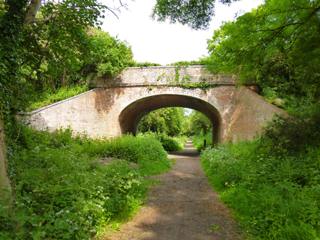
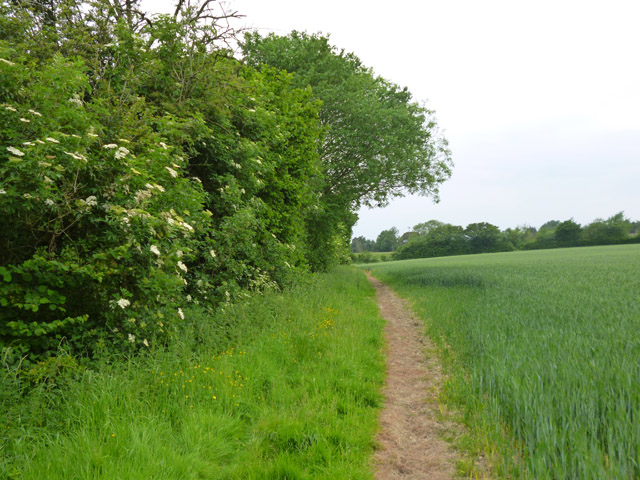
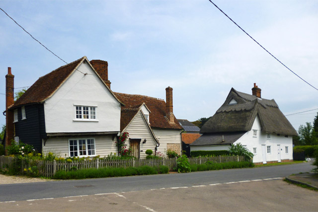
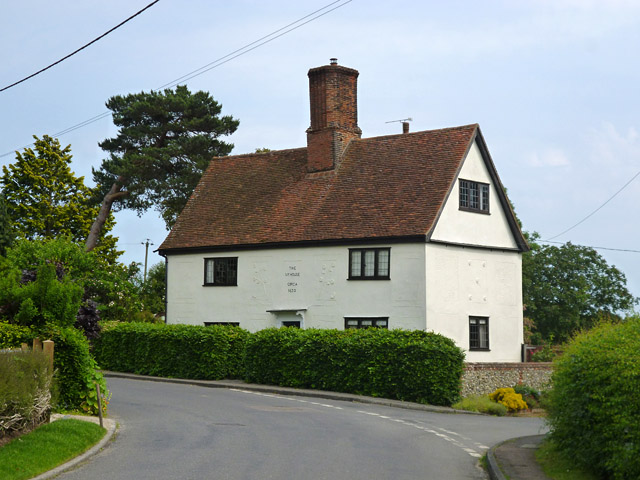
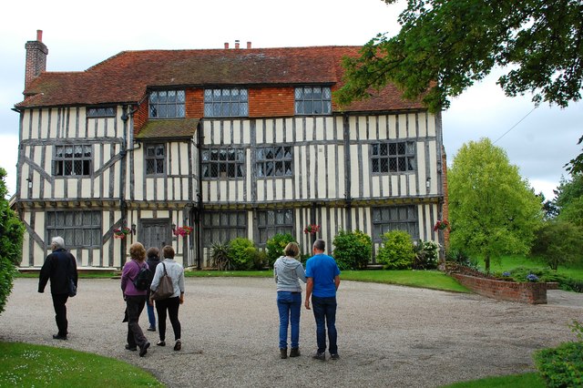
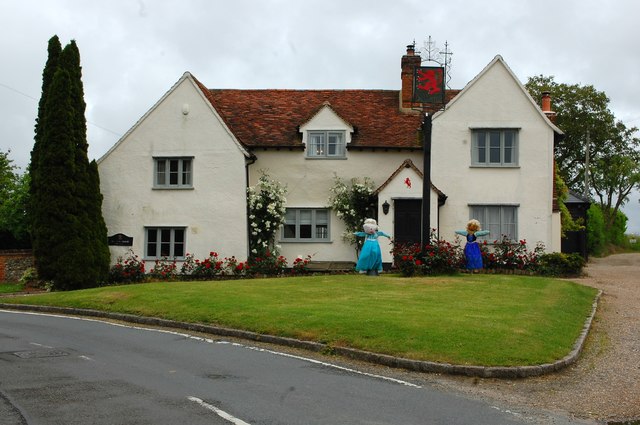
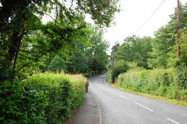
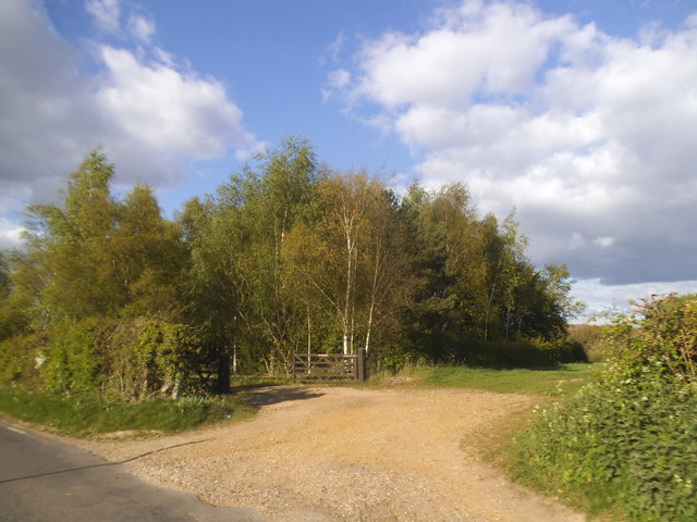
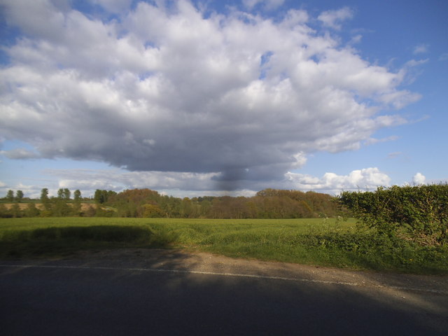
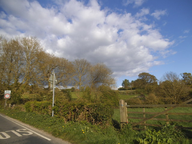
The village is characterized by its charming rural setting, with rolling hills, meandering streams, and lush green fields surrounding it. The landscape is dotted with traditional English cottages, giving Brookend a quintessential English countryside feel.

Despite its small size, Brookend offers a range of amenities for its residents. The village has a primary school, ensuring local children have access to education within the community. There is also a village hall, which serves as a gathering place for various community events and activities.

For those seeking outdoor activities and recreation, Brookend has several options to offer. The surrounding countryside provides ample opportunities for walking, hiking, and cycling. The village is also home to a local cricket club, which serves as a hub for sports enthusiasts.

Although Brookend itself lacks commercial establishments, the nearby towns of Chelmsford and Brentwood provide convenient access to a wider range of amenities, including shops, supermarkets, restaurants, and other essential services.

Overall, Brookend is a tranquil and idyllic village, offering residents a close-knit community, stunning natural surroundings, and easy access to nearby towns for additional amenities.

If you have any feedback on the listing, please let us know in the comments section below.
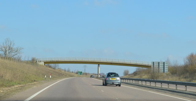
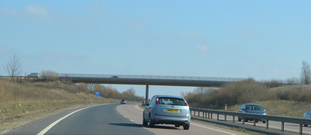
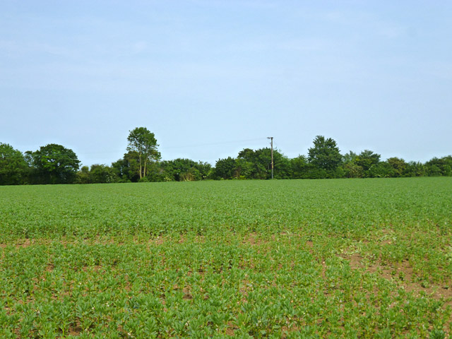
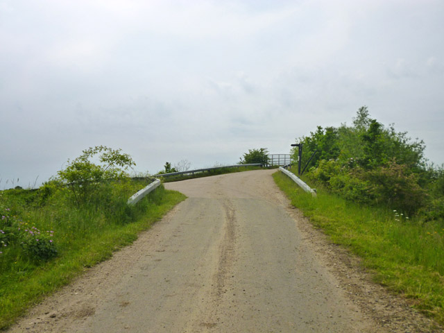
Brookend Images

Images are sourced within 2km of 51.880468/0.40815201 or Grid Reference TL6522. Thanks to Geograph Open Source API. All images are credited.

Footbridge, A120 The A120 is a trunk road that runs east-west across East Anglia from Harwich to Puckeridge, 63 miles in length. It follows the route of the Roman Road, Stane Street. <span class="nowrap"><a title="http://www.sabre-roads.org.uk/wiki/index.php?title=A120" rel="nofollow ugc noopener" href="http://www.sabre-roads.org.uk/wiki/index.php?title=A120">Link</a><img style="margin-left:2px;" alt="External link" title="External link - shift click to open in new window" src="https://s1.geograph.org.uk/img/external.png" width="10" height="10"/></span>
Footbridge, A120
The A120 is a trunk road that runs east-west across East Anglia from Harwich to Puckeridge, 63 miles in length. It follows the route of the Roman Road, Stane Street. LinkExternal link
Station Road Bridge, A120 The A120 is a trunk road that runs east-west across East Anglia from Harwich to Puckeridge, 63 miles in length. It follows the route of the Roman Road, Stane Street. <span class="nowrap"><a title="http://www.sabre-roads.org.uk/wiki/index.php?title=A120" rel="nofollow ugc noopener" href="http://www.sabre-roads.org.uk/wiki/index.php?title=A120">Link</a><img style="margin-left:2px;" alt="External link" title="External link - shift click to open in new window" src="https://s1.geograph.org.uk/img/external.png" width="10" height="10"/></span>
Station Road Bridge, A120
The A120 is a trunk road that runs east-west across East Anglia from Harwich to Puckeridge, 63 miles in length. It follows the route of the Roman Road, Stane Street. LinkExternal link
A120, eastbound The A120 is a trunk road that runs east-west across East Anglia from Harwich to Puckeridge, 63 miles in length. It follows the route of the Roman Road, Stane Street. <span class="nowrap"><a title="http://www.sabre-roads.org.uk/wiki/index.php?title=A120" rel="nofollow ugc noopener" href="http://www.sabre-roads.org.uk/wiki/index.php?title=A120">Link</a><img style="margin-left:2px;" alt="External link" title="External link - shift click to open in new window" src="https://s1.geograph.org.uk/img/external.png" width="10" height="10"/></span>
A120, eastbound
The A120 is a trunk road that runs east-west across East Anglia from Harwich to Puckeridge, 63 miles in length. It follows the route of the Roman Road, Stane Street. LinkExternal link
Stebbing Road Bridge, A120 The A120 is a trunk road that runs east-west across East Anglia from Harwich to Puckeridge, 63 miles in length. It follows the route of the Roman Road, Stane Street. <span class="nowrap"><a title="http://www.sabre-roads.org.uk/wiki/index.php?title=A120" rel="nofollow ugc noopener" href="http://www.sabre-roads.org.uk/wiki/index.php?title=A120">Link</a><img style="margin-left:2px;" alt="External link" title="External link - shift click to open in new window" src="https://s1.geograph.org.uk/img/external.png" width="10" height="10"/></span>
Stebbing Road Bridge, A120
The A120 is a trunk road that runs east-west across East Anglia from Harwich to Puckeridge, 63 miles in length. It follows the route of the Roman Road, Stane Street. LinkExternal link
A field of beans Between the new and old A120, the latter, the ancient Stane Street, now B1256.
A field of beans
Between the new and old A120, the latter, the ancient Stane Street, now B1256.
Grange Lane near the A120 The lane ramps up to a farm and footpath bridge over the A120, but itself turns left and after a short distance degenerates to a public byway through to Great Dunmow.
Grange Lane near the A120
The lane ramps up to a farm and footpath bridge over the A120, but itself turns left and after a short distance degenerates to a public byway through to Great Dunmow.
Old railway bridge, Little Dunmow Brook Lane crosses the former Bishop's Stortford - Braintree railway, now a cycle path.
Old railway bridge, Little Dunmow
Brook Lane crosses the former Bishop's Stortford - Braintree railway, now a cycle path.
Footpath to Little Dunmow The path skirts round The Moors to the left. In these parts such a name implies a pretty damp area. The mapped route of the public path actually passes through this, but there is no trace of anybody trying to follow the route. There is a fair bit of optimistic routing of public paths through marshes around here, fortunately most have reasonable ways round, as this.
Footpath to Little Dunmow
The path skirts round The Moors to the left. In these parts such a name implies a pretty damp area. The mapped route of the public path actually passes through this, but there is no trace of anybody trying to follow the route. There is a fair bit of optimistic routing of public paths through marshes around here, fortunately most have reasonable ways round, as this.
Rose Farm and Rose Farm Cottage, Little Dunmow Rose Farm, on the left, was built around 1400. The thatched house is of 16th century or earlier build. Both are grade II listed.
Rose Farm and Rose Farm Cottage, Little Dunmow
Rose Farm, on the left, was built around 1400. The thatched house is of 16th century or earlier build. Both are grade II listed.
The Ivy House, Little Dunmow Dated 'circa 1630' on the front, it is grade II listed.
The Ivy House, Little Dunmow
Dated 'circa 1630' on the front, it is grade II listed.
Prior's Hall, Stebbing A fine half-timbered house dating from the 16th century or earlier. The Knights Hospitaller had a hall here and this became one of the three manor houses of Stebbing. Here seen on an open gardens day.
Prior's Hall, Stebbing
A fine half-timbered house dating from the 16th century or earlier. The Knights Hospitaller had a hall here and this became one of the three manor houses of Stebbing. Here seen on an open gardens day.
The Red Lion One of the former pubs in Stebbing - of which there were several with just one; the White Hart, still operating. This building stands at the end of Watch House Road.
The Red Lion
One of the former pubs in Stebbing - of which there were several with just one; the White Hart, still operating. This building stands at the end of Watch House Road.
High Street, Stebbing North of the main village approaching Bran End.
High Street, Stebbing
North of the main village approaching Bran End.
Stebbing Road meets B1256 The B1256 was formerly the A120, it largely follows a Roman route towards Colchester. A foggy morning with no long distance views available, so instead, some teasels.
Stebbing Road meets B1256
The B1256 was formerly the A120, it largely follows a Roman route towards Colchester. A foggy morning with no long distance views available, so instead, some teasels.
The B1256 Braintree Road, Throws
Copse on Brookend
Copse on Brookend
Field by Brookend
Field by Brookend
Field by Stebbing Brook
Show me another place!

Brookend is located at Grid Ref: TL6522 (Lat: 51.880468, Lng: 0.40815201)

Administrative County: Essex

District: Uttlesford

Police Authority: Essex

What 3 Words

///perused.monk.relieves. Near Little Dunmow, Essex

Nearby Locations

Stane Street Brookend

Related Wikis

Little Dunmow

Little Dunmow is a village situated in the Uttlesford district, in rural Essex, England, in the vale of the River Chelmer about 3 miles (4.8 km) east-southeast...

Bran End

Bran End is a village in Essex, England. == External links == Media related to Bran End at Wikimedia Commons

Stebbing

Stebbing is a small village in the Uttlesford district of northern Essex, England. The village is situated north of the ancient Roman road Stane Street...

Little Dunmow Priory

Little Dunmow Priory in Little Dunmow was an Augustinian priory in Essex, England. The priory was founded as a church by Juga de Baynard in 1104, dedicated...

Nearby Amenities

Located within 500m of 51.880468,0.40815201
Brookend
Place: locality
Lat/Long: 51.8800635/0.4097205
Turning Circle
Lat/Long: 51.8849482/0.4077434
The data included in this document is from www.openstreetmap.org. The data is made available under ODbL.

Have you been to Brookend?

Leave your review of Brookend below (or comments, questions and feedback).