Broadheath Common

Settlement in Worcestershire Malvern Hills

England

Broadheath Common

Entrance to Little Lightwood Farm from Lightwood Road
Entrance to Little Lightwood Farm from Lightwood Road Credit: peter robinson

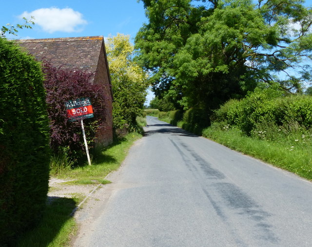
Broadheath Common is a picturesque and historic area located in Worcestershire, England. This common spans over 20 acres and is situated near the town of Pershore. It is a cherished local spot that attracts nature enthusiasts, history buffs, and those seeking a tranquil escape.

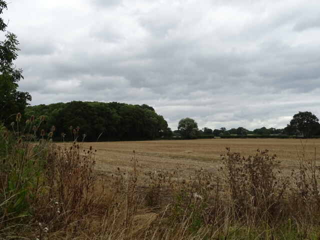
The common is characterized by its diverse landscape, consisting of open grassland, woodland areas, and a small stream that meanders through the site. This variety of habitats supports a range of flora and fauna, making it a haven for wildlife. Visitors can spot various species of birds, butterflies, and small mammals, as well as a variety of wildflowers during the spring and summer months.

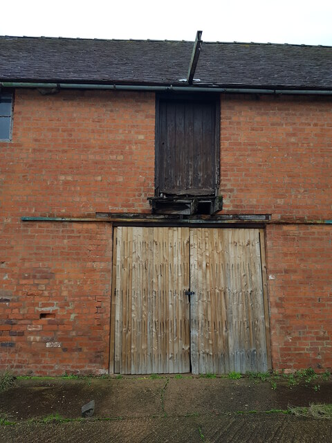
In addition to its natural beauty, Broadheath Common also holds historical significance. The area has evidence of human activity dating back to the Bronze Age, with archaeological finds including pottery and tools. It is believed that the common was once used as grazing land for livestock, and remnants of old enclosures can still be seen today.

The common is open to the public year-round and offers several amenities to enhance visitors' experiences. There are well-maintained footpaths that crisscross the site, allowing for pleasant walks and nature exploration. Picnic areas and benches are scattered throughout, providing perfect spots to relax and take in the surroundings.

Overall, Broadheath Common is a cherished natural and historical gem in Worcestershire, offering a tranquil and educational experience for all who visit.

If you have any feedback on the listing, please let us know in the comments section below.

Broadheath Common Images

Images are sourced within 2km of 52.200534/-2.2855194 or Grid Reference SO8055. Thanks to Geograph Open Source API. All images are credited.

Entrance to Little Lightwood Farm from Lightwood Road
Post box and steps to rural telephone exchange Cotheridge
Sign along the A44 at Cotheridge
Postbox along the A44 at Cotheridge
Lightwood Lane near Cotheridge
Heading south along Lightwood Lane The Malvern Hills are 9.5 kilometres away.
Heading south along Lightwood Lane
The Malvern Hills are 9.5 kilometres away.
Middle Lightwood Farm along Lightwood Lane
Fields south of Ankerdine Road The Malvern Hills are 10 kilometres away.
Fields south of Ankerdine Road
The Malvern Hills are 10 kilometres away.
Ankerdine Road near Maple's Cross Farm
Farmland near the Lingens Farm The high ground to the left is Woodbury Hill, 276m (905 ft), and the Abberley Hills to the right.
Farmland near the Lingens Farm
The high ground to the left is Woodbury Hill, 276m (905 ft), and the Abberley Hills to the right.
Stubble field and woodland near Cotheridge
A44 towards Worcester
Telephone exchange near Cotheridge
Field off the A44 near Cotheridge
A44 towards Worcester
Elizabeth II postbox on the A44, Cotheridge Postbox No. WR6 390.

See <a href="https://www.geograph.org.uk/photo/6945420">SO7954 : A44, Cotheridge</a> for context.
Elizabeth II postbox on the A44, Cotheridge
Postbox No. WR6 390. See SO7954 : A44, Cotheridge for context.
A44, Cotheridge Towards Worcester.
Showing position of Postbox No. WR6 390.

See <a href="https://www.geograph.org.uk/photo/6945417">SO7954 : Elizabeth II postbox on the A44, Cotheridge</a> for postbox.
A44, Cotheridge
Towards Worcester. Showing position of Postbox No. WR6 390. See SO7954 : Elizabeth II postbox on the A44, Cotheridge for postbox.
Barn doors, Lower Howsen
Show me another place!

Broadheath Common is located at Grid Ref: SO8055 (Lat: 52.200534, Lng: -2.2855194)

Administrative County: Worcestershire

District: Malvern Hills

Police Authority: West Merica

What 3 Words

///tilting.teaching.splashes. Near Lower Broadheath, Worcestershire

Related Wikis

Upper Broadheath

Upper Broadheath is an area in the village of Lower Broadheath. It is not a separate village. Worcestershire, England. It is in the Malvern Hills District...

Elgar Birthplace Museum

The Firs in Lower Broadheath, Worcestershire, England was the birthplace of Edward Elgar. The cottage now houses a museum administered by the National...

Lower Broadheath

Lower Broadheath is a village and civil parish in the Malvern Hills district of Worcestershire, England. According to the 2011 census it had a population...

A44 road

The A44 is a major road in the United Kingdom that runs from Oxford in southern England to Aberystwyth in west Wales. == History == The original (1923...

Cotheridge

Cotheridge is a village and civil parish in the district of Malvern Hills in the county of Worcestershire, England. It is 4 miles (6 km) west of the...

St Leonard's Church, Cotheridge

St. Leonard's Church is a small, 12th-century church located in the scattered village of Cotheridge in Worcestershire. It stands not far from the manor...

Dines Green

Dines Green is a suburb of Worcester in England, and lies in the St. John ward in the west of the city . Initially developed as council housing, the estate...

Cotheridge Court

Cotheridge Court is a Grade II* listed ancient manor house situated in the south-western part of Cotheridge, in the county of Worcestershire, England,...

Nearby Amenities

Located within 500m of 52.200534,-2.2855194
Broadheath Common- Crossroads
Naptan AtcoCode: 2000G051800
Naptan Bearing: NE
Naptan BusStopType: CUS
Naptan CommonName: Broadheath Common- Crossroads
Naptan Indicator: Opp
Naptan Landmark: Broadheath Common
Naptan NaptanCode: wocgjtjw
Naptan Street: Bell Lane
Naptan Verified: no
Source: naptan_import
Lat/Long: 52.2029317/-2.2882073
Broadheath Crossroads
Naptan AtcoCode: 2000G502056
Naptan Bearing: NW
Naptan BusStopType: CUS
Naptan CommonName: Broadheath Crossroads
Naptan Indicator: Adj
Naptan NaptanCode: wocdjtwm
Naptan Street: Crown East Lane
Naptan Verified: no
Source: naptan_import
Lat/Long: 52.2013047/-2.2880797
Broadheath Common Crossroads
Naptan AtcoCode: 2000G502067
Naptan Bearing: SW
Naptan BusStopType: CUS
Naptan CommonName: Broadheath Common Crossroads
Naptan Indicator: Adj
Naptan Landmark: Broadheath Common
Naptan NaptanCode: wocgdmjw
Naptan Street: Bell Lane
Naptan Verified: no
Source: naptan_import
Lat/Long: 52.2032037/-2.2872579
Bus Stop
The Plough
Bus: yes
Naptan AtcoCode: 2000G652004
Naptan Bearing: NW
Naptan CommonName: The Plough
Naptan Indicator: opp
Naptan Landmark: The Plough Inn
Naptan NaptanCode: wocdptjw
Naptan Street: Crown East Lane
Naptan Verified: no
Public Transport: platform
Source: naptan_import
Lat/Long: 52.1991843/-2.2837789
Post Box
Ref: WR2 152
Lat/Long: 52.2031486/-2.2877744
The Plough
Disused Pub: yes
Lat/Long: 52.1992333/-2.2836452
Upper Broadheath
Place: hamlet
Wikidata: Q7898515
Lat/Long: 52.200695/-2.2850403
Bicycle Parking
Lat/Long: 52.1991041/-2.2828699
Power: pole
Lat/Long: 52.2019324/-2.2786009
Power: pole
Lat/Long: 52.2011203/-2.2784776
Power: pole
Lat/Long: 52.2014285/-2.2794284
Broadheath Common No. 2
Power: pole
Transformer: distribution
Voltage Primary: 11000
Lat/Long: 52.2044968/-2.2837923
Power: pole
Lat/Long: 52.2041105/-2.2833659
Power: pole
Lat/Long: 52.2037069/-2.2829407
Power: pole
Lat/Long: 52.2033535/-2.2823694
Broadheath Common
Power: pole
Transformer: distribution
Voltage Primary: 11000
Lat/Long: 52.2031299/-2.281884
Power: pole
Lat/Long: 52.2027461/-2.2822554
Power: pole
Lat/Long: 52.2022053/-2.2818169
Power: pole
Lat/Long: 52.2017738/-2.2804423
Power: pole
Lat/Long: 52.2011877/-2.2817203
Broadheath Common South
Power: pole
Transformer: distribution
Voltage Primary: 11000
Lat/Long: 52.2015642/-2.2839412
Power: pole
Lat/Long: 52.2010965/-2.2834705
Broadheath Crossroads
Power: pole
Transformer: distribution
Voltage Primary: 11000
Lat/Long: 52.2024666/-2.2901827
Power: pole
Lat/Long: 52.2025275/-2.2906508
Power: pole
Lat/Long: 52.2025891/-2.2911805
Power: pole
Lat/Long: 52.2027481/-2.2916278
Power: pole
Lat/Long: 52.2005412/-2.2831433
Location Transition: yes
Power: pole
Lat/Long: 52.2001816/-2.2839157
Upper Broadheath
Location Transition: yes
Power: pole
Transformer: distribution
Voltage Primary: 11000
Lat/Long: 52.2000394/-2.28465
Location Transition: yes
Power: pole
Lat/Long: 52.1993296/-2.2853179
Power: pole
Lat/Long: 52.199409/-2.2868655
Upper Lightwood
Power: pole
Transformer: distribution
Voltage Primary: 11000
Lat/Long: 52.1995027/-2.2886431
Power: pole
Lat/Long: 52.2002614/-2.2914058
Power: pole
Lat/Long: 52.1999046/-2.2901264
Power: pole
Lat/Long: 52.2006037/-2.2926222
Elgar Centre
Location Transition: yes
Power: pole
Transformer: distribution
Voltage Primary: 11000
Lat/Long: 52.1988439/-2.2821012
Power: pole
Lat/Long: 52.200083/-2.2785573
The data included in this document is from www.openstreetmap.org. The data is made available under ODbL.

Have you been to Broadheath Common?

Leave your review of Broadheath Common below (or comments, questions and feedback).