Bristol

Settlement in Gloucestershire

England

Bristol

Industrial buildings north of Feeder Canal The north side of the canal near its western end.
Industrial buildings north of Feeder Canal Credit: Pierre Terre

Bristol is a vibrant city located in the county of Gloucestershire, England. Situated on the banks of the River Avon, it is the largest city in the South West region of the country and has a population of around 460,000 people. The city has a rich history that dates back to the Roman era, and its prominence as a trading port during the Middle Ages is evident in its stunning architecture and historic landmarks.

Bristol is renowned for its maritime heritage, with the iconic Clifton Suspension Bridge being a popular attraction for tourists and locals alike. The city also boasts a diverse cultural scene, with numerous art galleries, museums, and theaters showcasing a wide range of artistic expressions.

In recent years, Bristol has become known for its thriving creative and tech industries. The city is home to a number of world-class universities and research institutions, attracting a young and innovative population. This has led to a buzzing music and nightlife scene, with a plethora of live music venues, clubs, and bars catering to a variety of tastes.

Nature enthusiasts will also find plenty to enjoy in Bristol, as the city is surrounded by beautiful countryside and is just a short drive away from the picturesque Cotswolds. Additionally, Bristol hosts a number of festivals and events throughout the year, such as the Bristol International Balloon Fiesta and the Bristol Harbour Festival, adding to its vibrant atmosphere and attracting visitors from far and wide.

Overall, Bristol is a dynamic and culturally rich city that seamlessly combines its historic past with modern innovation, making it a truly unique and exciting place to live or visit.

If you have any feedback on the listing, please let us know in the comments section below.
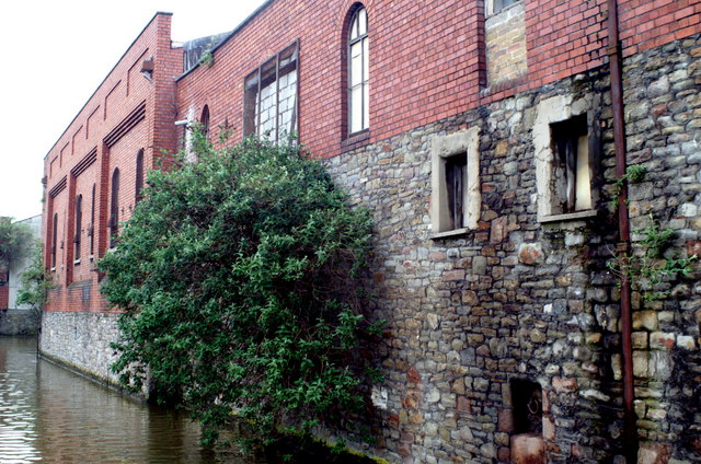
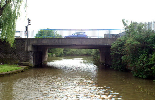
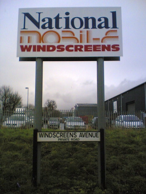
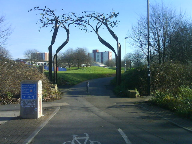
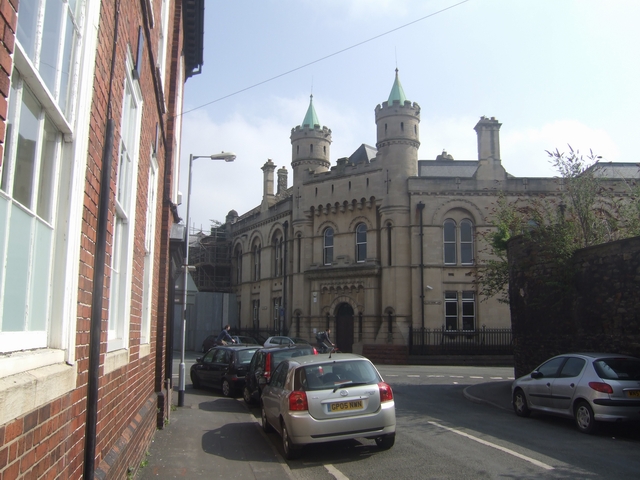
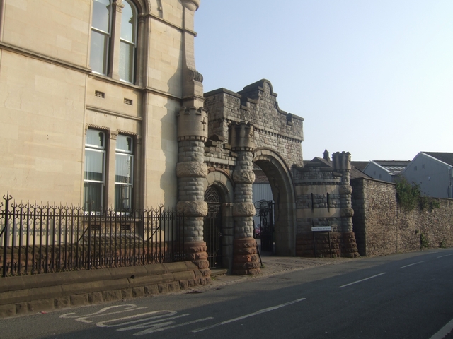
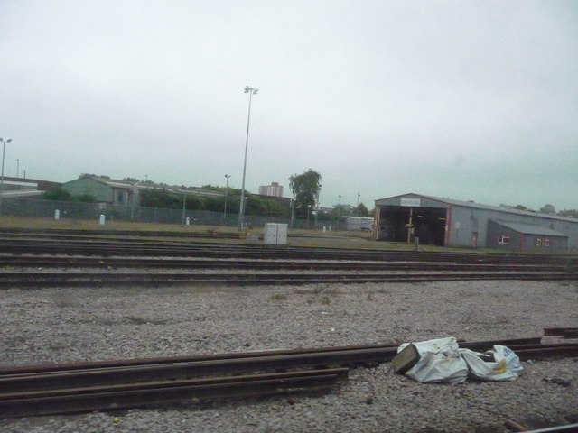
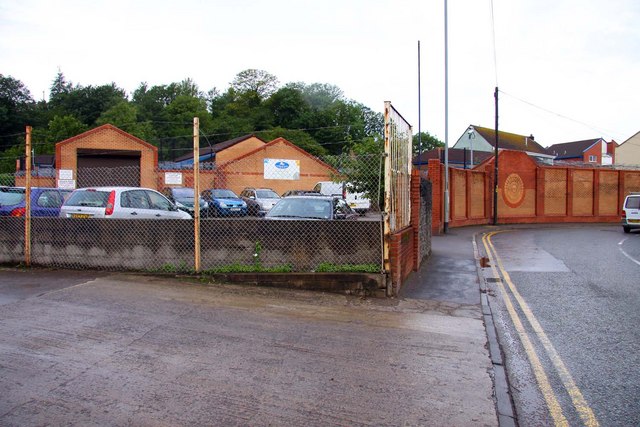
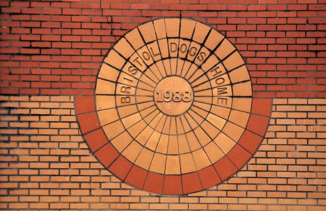
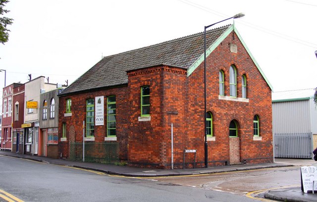
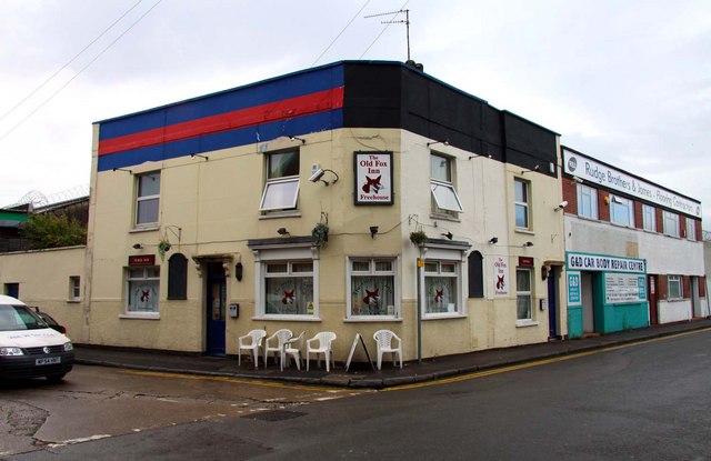
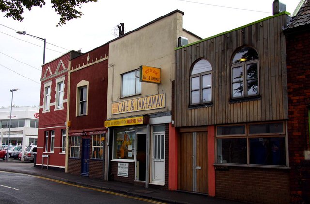
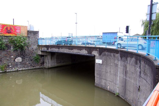
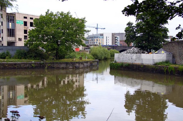
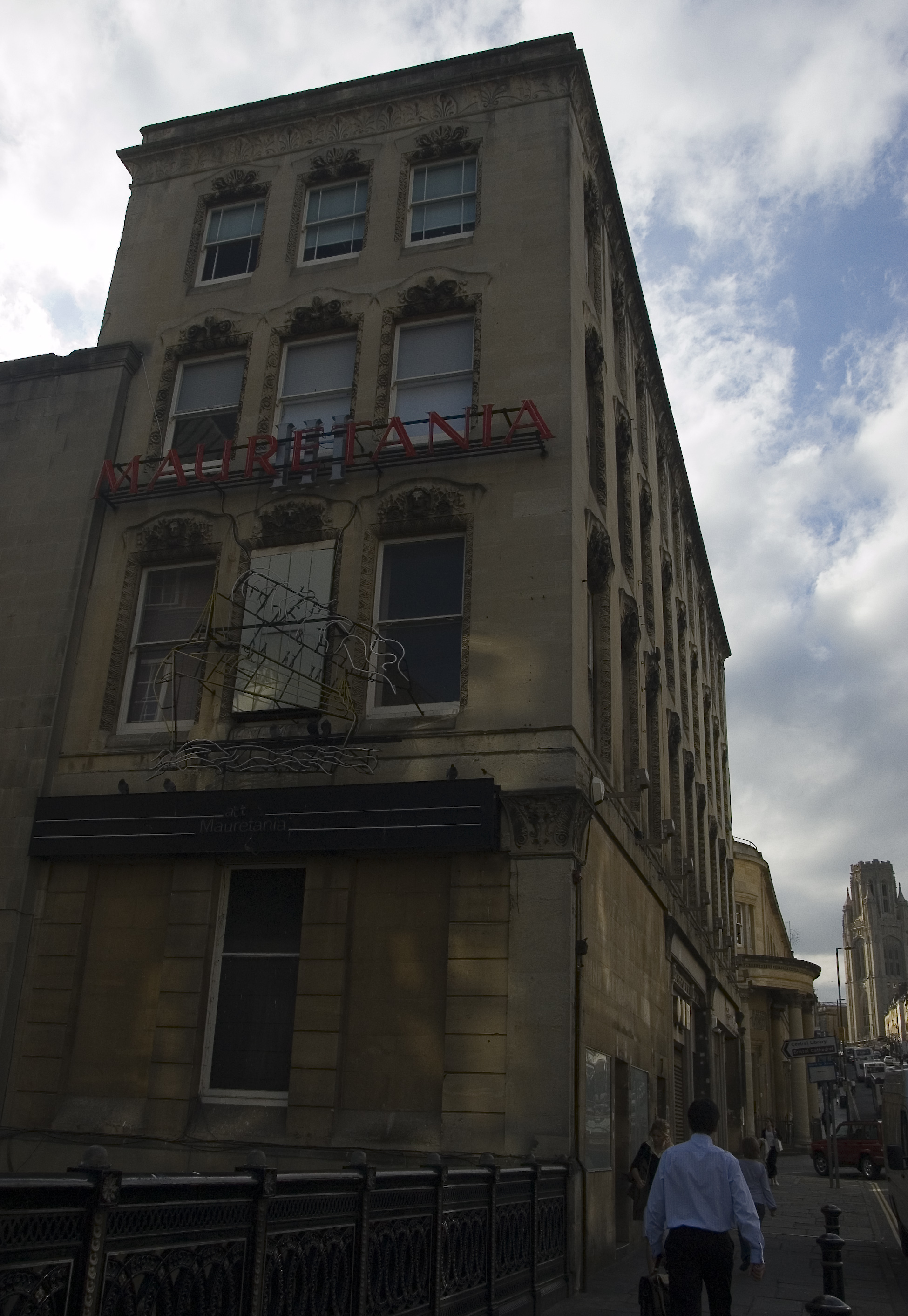
Bristol Images

Images are sourced within 2km of 51.453134/-2.6009817 or Grid Reference ST5872. Thanks to Geograph Open Source API. All images are credited.

Industrial buildings north of Feeder Canal The north side of the canal near its western end.
Industrial buildings north of Feeder Canal
The north side of the canal near its western end.
Feeder Canal, Avon Street Bridge Looking west. Beyond the bridge the canal joins Bristol Floating Harbour.
Feeder Canal, Avon Street Bridge
Looking west. Beyond the bridge the canal joins Bristol Floating Harbour.
Commercial signage And matching road name
Commercial signage
And matching road name
The Bristol and Bath Railway Path through a park in Newtown Looking north east in the direction of Easton, this photo was taken near the start of the Bristol and Bath railway path close to the centre of Bristol. Bath is a 15 mile journey according to the sign.
The Bristol and Bath Railway Path through a park in Newtown
Looking north east in the direction of Easton, this photo was taken near the start of the Bristol and Bath railway path close to the centre of Bristol. Bath is a 15 mile journey according to the sign.
St Vincent's Works Offices built for John Lysaght's works in Silverthorne Lane. Late 19th century Grade 2* Listed Building in the 'Ruritanian Romanesque' style. The works specialised in galvanising and corrugating steel for the Australian export market and the fabrication of oil drums. Fabrications were provided for the SS Great Britain and Clifton Suspension Bridge. 

The current owner's Garrard Hassan restored the building in 2000 from a derelict condition.
St Vincent's Works
Offices built for John Lysaght's works in Silverthorne Lane. Late 19th century Grade 2* Listed Building in the 'Ruritanian Romanesque' style. The works specialised in galvanising and corrugating steel for the Australian export market and the fabrication of oil drums. Fabrications were provided for the SS Great Britain and Clifton Suspension Bridge. The current owner's Garrard Hassan restored the building in 2000 from a derelict condition.
Works entrance - St Vincent's Works Less grand than the offices. <a href="https://www.geograph.org.uk/photo/1232165">ST6072 : St Vincent's Works</a>
Works entrance - St Vincent's Works
Less grand than the offices. ST6072 : St Vincent's Works
Bristol : Railway & Train Shed
Bristol Dogs Home in Albert Road
Brick sign at Bristol Dogs Home in Albert Road
Railway bridge over Albert Road in Bristol
Mobile refreshment bar in Albert Road
Jubilee Room on Chapel Street
The Old Fox Inn on Albert Road
Best Of Both Cafe on Albert Road
The Feeder Canal in Bristol
Albert Road Bridge over the Feeder Canal in Bristol
The Old Stop Lock off Totterdown Basin
Show me another place!

Bristol is located at Grid Ref: ST5872 (Lat: 51.453134, Lng: -2.6009817)

Unitary Authority: Bristol

Police Authority: Avon and Somerset

What 3 Words

///glad.foods.smiles. Near Bristol

Related Wikis

Nearby Amenities

Located within 500m of 51.453134,-2.6009817
Traffic Signals
Lat/Long: 51.4534741/-2.5969121
Crossing
Crossing: uncontrolled
Crossing Ref: zebra
Tactile Paving: yes
Lat/Long: 51.449154/-2.6032522
Traffic Signals
Button Operated: yes
Crossing: traffic_signals
Crossing Ref: puffin
Tactile Paving: yes
Traffic Signals Sound: no
Traffic Signals Vibration: yes
Lat/Long: 51.4508954/-2.6000686
Parking
Millennium Square
Parking: underground
Wheelchair: yes
Lat/Long: 51.4493269/-2.600207
Parking Entrance
Millennium Square
Entrance: yes
Lat/Long: 51.4493198/-2.6001487
Mary Carpenter; Lady Byron
Historic: memorial
Memorial: blue_plaque
Lat/Long: 51.4555569/-2.5995231
Stripclub
Platinum Club
Addr City: Bristol
Addr Postcode: BS1 5DQ
Phone: +44 7961 012208
Website: http://www.platinumclubbristol.com/
Lat/Long: 51.4530565/-2.5984894
Barrier: bollard
Lat/Long: 51.454249/-2.5965316
Crossing
Button Operated: yes
Crossing: traffic_signals
Crossing Island: no
Crossing Ref: toucan
Fixme: Is this here?
Tactile Paving: yes
Traffic Signals Vibration: yes
Lat/Long: 51.4520175/-2.5967463
Traffic Signals
Button Operated: yes
Crossing: traffic_signals
Crossing Ref: puffin
Tactile Paving: yes
Traffic Signals Vibration: yes
Lat/Long: 51.4537157/-2.597076
Tourism: viewpoint
Lat/Long: 51.4540315/-2.6068173
Traffic Signals
Crossing: traffic_signals
Crossing Ref: pelican
Lat/Long: 51.4532434/-2.6011469
Postal Code: BS1
Lat/Long: 51.4502422/-2.6053361
Crossing
Button Operated: yes
Check Date Crossing: 2021-08-21
Crossing: traffic_signals
Crossing Ref: toucan
Tactile Paving: yes
Traffic Signals Vibration: yes
Lat/Long: 51.451481/-2.5962348
Traffic Signals
Button Operated: yes
Crossing: traffic_signals
Crossing Ref: pelican
Lat/Long: 51.453439/-2.5971153
Traffic Signals
Button Operated: yes
Crossing: traffic_signals
Crossing Ref: toucan
Tactile Paving: yes
Traffic Signals Vibration: yes
Lat/Long: 51.4545496/-2.5971971
Traffic Signals
Button Operated: yes
Crossing: traffic_signals
Crossing Ref: toucan
Tactile Paving: yes
Traffic Signals: bus_priority
Traffic Signals Vibration: yes
Lat/Long: 51.4545482/-2.5969682
Ferry Terminal
City Centre
Wheelchair: yes
Lat/Long: 51.4520327/-2.597747
Post Box
Brand: Royal Mail
Brand Wikidata: Q638098
Check Date: 2024-03-27
Collection Times: Mo-Fr 09:00, Sa 07:00
Colour: red
Operator: Royal Mail
Operator Wikidata: Q638098
Post Box Apertures: 1
Post Box Type: pillar
Ref: BS1 425D
Royal Cypher: EVIIR
Royal Cypher Wikidata: Q33102324
Lat/Long: 51.4554218/-2.6018257
Traffic Signals
Button Operated: yes
Crossing: traffic_signals
Lat/Long: 51.4522931/-2.5984073
Traffic Signals
Button Operated: yes
Crossing: traffic_signals
Crossing Island: no
Crossing Ref: puffin
Tactile Paving: yes
Traffic Signals Sound: no
Traffic Signals Vibration: yes
Lat/Long: 51.4561296/-2.6060954
Bus Stop
The Centre (C8)
Bench: yes
Bin: yes
Bus: yes
Departures Board: timetable
Lit: yes
Local Ref: C8
Mapillary: 734298393904338
Naptan AtcoCode: 0100BRP90332
Naptan Bearing: N
Naptan CommonName: The Centre
Naptan Indicator: C8
Naptan NaptanCode: bstdwmj
Naptan PlusbusZoneRef: BRSTLTM
Naptan Street: St Augustines Parade
Naptan Verified: no
Public Transport: platform
Shelter: yes
Survey Date: 2019-05-12
Tactile Paving: yes
Lat/Long: 51.453378/-2.5979563
Bus Stop
Queen's Road (U6)
Alt Name: Park Street (U6)
Bench: no
Bin: no
Bus: yes
Departures Board: timetable
Lit: yes
Local Ref: U6
Naptan AtcoCode: 0100BRP90231
Naptan Bearing: W
Naptan CommonName: Park St Top (U6)
Naptan Crossing: Berkeley Square
Naptan NaptanCode: bstdpgp
Naptan PlusbusZoneRef: BRSTLTM
Naptan Street: Queen's Road
Note: Bus stop signed as "Park Street (U6)", but timetable says "Queen's Road (U6)".
Public Transport: platform
Shelter: no
Source: naptan_import
Tactile Paving: no
Wheelchair: yes
Lat/Long: 51.4559006/-2.6052243
Bus Stop
Gasferry Road
Bus: yes
Naptan AtcoCode: 0100053233
Naptan Bearing: W
Naptan CommonName: Gasferry Road
Naptan Crossing: Gasferry Road
Naptan NaptanCode: bstdmwp
Naptan PlusbusZoneRef: BRSTLTM
Naptan Street: Anchor Road
Naptan Verified: no
Public Transport: platform
Shelter: yes
Source: naptan_import
Lat/Long: 51.4504288/-2.6059932
Bus Stop
Anchor Road (A1)
Bench: yes
Bin: yes
Bus: yes
Departures Board: realtime
Lit: yes
Local Ref: A1
Mapillary: 192263369389075
Naptan AtcoCode: 01000053227
Naptan Bearing: W
Naptan CommonName: Anchor Road (A1)
Naptan Crossing: Canons Way
Naptan NaptanCode: bstdtpw
Naptan PlusbusZoneRef: BRSTLTM
Naptan Street: Anchor Road
Public Transport: platform
Shelter: yes
Source: naptan_import
Survey Date: 2019-05-12
Tactile Paving: yes
Lat/Long: 51.4507465/-2.6007054
Bus Stop
Anchor Road (A2)
Bench: yes
Bin: yes
Bus: yes
Departures Board: timetable
Lit: yes
Local Ref: A2
Mapillary: 378969406735934
Naptan AtcoCode: 01000053228
Naptan Bearing: E
Naptan CommonName: Anchor Road (A2)
Naptan Crossing: Canons Way
Naptan NaptanCode: bstdtpd
Naptan PlusbusZoneRef: BRSTLTM
Naptan Street: Anchor Road
Passenger Information Display: yes
Public Transport: platform
Shelter: yes
Source: naptan_import
Survey Date: 2019-05-12
Tactile Paving: no
Lat/Long: 51.4509474/-2.600496
Telephone
Booth: ST6
Operator: BT
Lat/Long: 51.452389/-2.5980014
Bus Stop
Gasferry Road
Bus: yes
Naptan AtcoCode: 0100053234
Naptan Bearing: E
Naptan CommonName: Gasferry Road
Naptan Crossing: Gasferry Road
Naptan NaptanCode: bstdpat
Naptan PlusbusZoneRef: BRSTLTM
Naptan Street: Anchor Road
Naptan Verified: no
Public Transport: platform
Shelter: no
Source: naptan_import
Lat/Long: 51.4505749/-2.605861
Bus Stop
Park Row (U4)
Bench: no
Bin: no
Local Ref: U4
Mapillary: 2895171420737860
Naptan AtcoCode: 0100053247
Naptan Bearing: E
Naptan CommonName: Park Row (U4)
Naptan Crossing: Woodland Road
Naptan NaptanCode: bstdtpg
Naptan PlusbusZoneRef: BRSTLTM
Naptan Street: Park Row
Public Transport: platform
Shelter: no
Source: naptan_import
Survey Date: 2019-05-12
Tactile Paving: no
Lat/Long: 51.4555154/-2.6005078
Bus Stop
The Centre (C3)
Bench: yes
Bin: yes
Bus: yes
Departures Board: realtime
Lit: yes
Local Ref: C3
Naptan AtcoCode: 0100BRA10811
Naptan Bearing: N
Naptan CommonName: Broad Quay co
Naptan Crossing: Marsh Street
Naptan NaptanCode: bstdwtw
Naptan PlusbusZoneRef: BRSTLTM
Naptan Street: Broad Quay
Public Transport: platform
Shelter: yes
Source: naptan_import
Tactile Paving: no
Wheelchair: yes
Lat/Long: 51.4526677/-2.5970696
The Centre (C13)
Bus: yes
Departures Board: timetable
Disused Highway: bus_stop
Disused Public Transport: platform
Local Ref: C13
Naptan AtcoCode: 0100BRA16904
Naptan Bearing: S
Naptan CommonName: The Centre 13
Naptan Landmark: Colston Hall
Naptan NaptanCode: bstpadw
Naptan PlusbusZoneRef: BRSTLTM
Naptan Street: Colston Street
Note: signed as "Please be advised services now depart from stop ~40m to your right and no longer serve this stop"
Shelter: no
Source: naptan_import
Lat/Long: 51.4547416/-2.5976544
Bus Stop
Queen's Road (U1)
Alt Name: Park St. Top (U1)
Bench: no
Bin: no
Bus: yes
Departures Board: timetable
Lit: yes
Local Ref: U1
Naptan AtcoCode: 0100BRP90232
Naptan Bearing: W
Naptan CommonName: Park St Top (U1)
Naptan Crossing: Berkeley Square
Naptan NaptanCode: bstpdmg
Naptan PlusbusZoneRef: BRSTLTM
Naptan Street: Queen's Road
Naptan Verified: no
Note: Bus stop signed as "Park St. Top (U1)", but timetables says "Queen's Road (U1)".
Public Transport: platform
Shelter: no
Source: naptan_import
Tactile Paving: no
Wheelchair: yes
Lat/Long: 51.4559391/-2.6054948
Bus Stop
Park Row (U5)
Bench: no
Bin: no
Local Ref: U5
Mapillary: 964243754343963
Naptan AtcoCode: 0100BRP90268
Naptan Bearing: W
Naptan CommonName: Park Row (U5)
Naptan Crossing: Woodland Road
Naptan NaptanCode: bstdtwp
Naptan PlusbusZoneRef: BRSTLTM
Naptan Street: Park Row
Public Transport: platform
Shelter: no
Source: naptan_import
Survey Date: 2019-05-12
Lat/Long: 51.4554134/-2.6004177
Bus Stop
College Green (P2)
Bench: yes
Bin: yes
Bus: yes
Departures Board: timetable
Lit: yes
Local Ref: P2
Naptan AtcoCode: 0100BRP90326
Naptan Bearing: N
Naptan CommonName: College Green (P2)
Naptan Crossing: Unity Street
Naptan Landmark: Council House
Naptan NaptanCode: bstdtga
Naptan PlusbusZoneRef: BRSTLTM
Naptan Street: Park Street
Public Transport: platform
Shelter: yes
Source: naptan_import
Tactile Paving: no
Wheelchair: yes
Lat/Long: 51.4534784/-2.6013186
Bus Stop
College Green (P1)
Bench: yes
Bin: yes
Bus: yes
Departures Board: realtime
Lit: yes
Mapillary: 468612174255008
Naptan AtcoCode: 0100BRP90327
Naptan Bearing: N
Naptan CommonName: College Green (P1)
Naptan Crossing: Unity Street
Naptan Landmark: Council House
Naptan NaptanCode: bstdtja
Naptan PlusbusZoneRef: BRSTLTM
Naptan Street: College Green
Public Transport: platform
Shelter: yes
Source: naptan_import
Survey Date: 2019-05-19
Tactile Paving: no
Wheelchair: yes
Lat/Long: 51.4529506/-2.6008791
The Centre (C14)
Bench: no
Bus: yes
Departures Board: timetable
Local Ref: C14
Naptan AtcoCode: 0100BRP90336
Naptan Bearing: SW
Naptan CommonName: The Centre 14
Naptan Crossing: St Augustine's Parade
Naptan Landmark: Colston Hall
Naptan NaptanCode: bstdwmg
Naptan PlusbusZoneRef: BRSTLTM
Naptan Street: Colston Street
Note: signed as "Bus Top Suspended"
Shelter: no
Source: naptan_import
Suspended Highway: bus_stop
Suspended Public Transport: platform
Wheelchair: yes
Lat/Long: 51.4543964/-2.5978396
Bus Stop
The Centre (C10)
Bench: yes
Bin: no
Bus: yes
Departures Board: timetable
Lit: yes
Local Ref: C10
Mapillary: 755571848483753
Naptan AtcoCode: 0100BRP90337
Naptan Bearing: N
Naptan CommonName: The Centre C10
Naptan Crossing: Rupert Street
Naptan NaptanCode: bstgada
Naptan PlusbusZoneRef: BRSTLTM
Naptan Street: Colston Avenue
Public Transport: platform
Shelter: yes
Source: naptan_import
Survey Date: 2019-05-19
Tactile Paving: yes
Lat/Long: 51.4548854/-2.5969639
Bus Stop
The Centre (C11)
Bench: yes
Bin: yes
Bus: yes
Departures Board: timetable
Lit: yes
Local Ref: C11
Mapillary: 224652222358703
Naptan AtcoCode: 0100BRP90338
Naptan Bearing: N
Naptan CommonName: The Centre (C11)
Naptan Crossing: Rupert Street
Naptan NaptanCode: bstgagm
Naptan PlusbusZoneRef: BRSTLTM
Naptan Street: Colston Avenue
Public Transport: platform
Shelter: yes
Source: naptan_import
Survey Date: 2019-05-19
Tactile Paving: yes
Wheelchair: yes
Lat/Long: 51.4551227/-2.5967642
Bus Stop
The Centre (C12)
Bench: yes
Bin: yes
Bus: yes
Lit: yes
Local Ref: C12
Mapillary: 936169560478184
Naptan AtcoCode: 0100BRP90340
Naptan Bearing: N
Naptan CommonName: The Centre (C12)
Naptan Crossing: Colston Avenue
Naptan NaptanCode: bstgajt
Naptan PlusbusZoneRef: BRSTLTM
Naptan Street: Rupert Street
Public Transport: platform
Shelter: yes
Source: naptan_import
Survey Date: 2019-05-19
Tactile Paving: no
Lat/Long: 51.4557853/-2.5962861
Bus Stop
Baldwin Street (C13)
Bus: yes
Local Ref: C13
Naptan AtcoCode: 0100BRP90377
Naptan Bearing: E
Naptan CommonName: Baldwin Street (C13)
Naptan Crossing: St Stephen's Street
Naptan NaptanCode: bstgata
Naptan PlusbusZoneRef: BRSTLTM
Naptan Street: Baldwin Street
Public Transport: platform
Source: naptan_import
Wheelchair: yes
Lat/Long: 51.4534287/-2.5954996
Bus Stop
Queen Square (Q2)
Bench: yes
Bin: yes
Bus: yes
Check Date Shelter: 2024-03-01
Departures Board: realtime
Lit: yes
Naptan AtcoCode: 0100BRX32922
Naptan Bearing: N
Naptan CommonName: Queen Square (Q2)
Naptan Crossing: Middle Avenue
Naptan Landmark: Jury's Hotel
Naptan NaptanCode: bstgaga
Naptan PlusbusZoneRef: BRSTLTM
Naptan Street: Prince Street
Network: Bristol
Operator: metrobus
Public Transport: platform
Shelter: yes
Source: naptan_import
Tactile Paving: yes
Wheelchair: yes
Lat/Long: 51.4511995/-2.596466
Bus Stop
The Centre (C9)
Bench: yes
Bin: yes
Lit: yes
Local Ref: C9
Mapillary: 1916774771803842
Naptan AtcoCode: 0100BRZ00692
Naptan Bearing: S
Naptan CommonName: The Centre (C9)
Naptan Crossing: Colston Avenue
Naptan NaptanCode: bstgamw
Naptan PlusbusZoneRef: BRSTLTM
Naptan Street: Rupert Street
Passenger Information Display: yes
Public Transport: platform
Shelter: yes
Source: naptan_import
Survey Date: 2019-05-12
Tactile Paving: no
Wheelchair: yes
Lat/Long: 51.4553313/-2.5963296
Cafe
Addr Housename: We The Curious
Addr Street: Anchor Road
Note: Not sure if this cafe inside "We The Curious" has a separate name
Wheelchair: yes
Lat/Long: 51.4503187/-2.6000677
Post Box
Collection Times: Mo-Fr 16:30; Sa 11:00
Post Box Apertures: 2
Post Box Design: type_c
Post Box Type: pillar
Ref: BS1 410;BS1 409
Royal Cypher: EVIIR
Royal Cypher Wikidata: Q33102324
Lat/Long: 51.4534723/-2.5965682
Parking Entrance
Lat/Long: 51.4550563/-2.5995208
Parking Entrance
Lat/Long: 51.4552855/-2.6000669
Vacant
Addr Housenumber: 41
Addr Street: Corn Street
Lat/Long: 51.4543371/-2.5946349
Neptune
Artwork Type: statue
Landmark: statue
Mapillary: 1899531396879905
Survey Date: 2019-05-12
Tourism: artwork
Wheelchair: yes
Wikidata: Q17552681
Lat/Long: 51.4532657/-2.5974418
Barrier: bollard
Bollard: fixed
Lat/Long: 51.4537456/-2.6050194
Bicycle Parking
Bicycle Parking: stands
Capacity: 18
Check Date: 2022-09-24
Covered: no
Lat/Long: 51.4561107/-2.6059892
Bicycle Parking
Bicycle Parking: stands
Capacity: 10
Check Date Capacity: 2021-11-22
Covered: no
Lat/Long: 51.4562794/-2.6029448
Traffic Signals
Button Operated: yes
Crossing: traffic_signals
Crossing Ref: pelican
Tactile Paving: yes
Traffic Signals Sound: yes
Traffic Signals Vibration: yes
Lat/Long: 51.4555182/-2.5999822
Bicycle Parking
Bicycle Parking: stands
Capacity: 22
Check Date Capacity: 2021-11-22
Covered: no
Operator: University of Bristol
Lat/Long: 51.4561873/-2.6030927
Bicycle Parking
Bicycle Parking: stands
Capacity: 14
Check Date Capacity: 2022-10-03
Covered: no
Lat/Long: 51.4556722/-2.6042082
Well Hung Lover
Artist Name: Banksy
Artwork Type: graffiti
Start Date: 2006
Tourism: artwork
Website: http://www.bristol-street-art.co.uk/category/banksy-street-art/photo/man-hanging-from-window
Wikidata: Q48812496
Lat/Long: 51.4533872/-2.6010226
Clock
Check Date: 2023-07-03
Display: sundial
Lat/Long: 51.452844/-2.6003622
Digby Associates
Addr City: Bristol
Addr Housenumber: 57
Addr Postcode: BS1 4LF
Addr Street: Queen Square
Office: accountant
Website: https://www.digby-associates.co.uk/
Lat/Long: 51.4507917/-2.5959835
Street Lamp
Lat/Long: 51.4560966/-2.5967299
Traffic Signals
Button Operated: yes
Crossing: traffic_signals
Crossing Ref: toucan
Lat/Long: 51.4525442/-2.5979543
Noexit: yes
Lat/Long: 51.4528897/-2.5993394
The Coat of Arms
Artist Name: Nick Walker
Artwork Type: graffiti
Tourism: artwork
Website: http://www.bristol-street-art.co.uk/gallery/photo/coat-of-arms-graffiti
Wheelchair: no
Lat/Long: 51.4548689/-2.6037474
Bicycle Parking
Bicycle Parking: stands
Capacity: 3
Covered: no
Lat/Long: 51.4525849/-2.5997854
Traffic Signals
Button Operated: yes
Crossing: traffic_signals
Crossing Ref: pelican
Lat/Long: 51.4525316/-2.5998613
Queen Victoria
Historic: memorial
Landmark: statue
Memorial: statue
Monument: statue
Wheelchair: yes
Wikidata: Q7270543
Lat/Long: 51.4521901/-2.5994036
Bicycle Parking
Bicycle Parking: stands
Capacity: 6
Covered: no
Lat/Long: 51.452521/-2.599947
Cafe
Addr City: Bristol
Addr Postcode: BS8 1RL
Addr Street: Queens Road
Addr Suburb: Clifton
Fhrs Id: 311570
Wheelchair: yes
Lat/Long: 51.4566122/-2.6049184
Rajah Rammohun Roy
Historic: monument
Landmark: statue
Lat/Long: 51.4517893/-2.6018246
Top Six
Addr City: Bristol
Addr Country: GB
Addr Housenumber: 77
Addr Postcode: BS1 5PF
Addr Street: Park Street
Email: info@topsixgroup.co.uk
Fax: +44 1179 304507
Phone: +44 1179 264952
Shop: hairdresser
Website: https://www.topsixgroup.co.uk/
Wheelchair: no
Lat/Long: 51.4552561/-2.6039254
Bicycle Parking
Bicycle Parking: stands
Capacity: 10
Covered: no
Lat/Long: 51.453525/-2.5978779
Post Box
Collection Times: Mo-Fr 17:45; Sa 12:15
Note: moved as part of bus improvements
Post Box Apertures: 2
Post Box Design: type_c
Post Box Type: pillar
Ref: BS1 411;BS1 406
Royal Cypher: EVIIR
Royal Cypher Wikidata: Q33102324
Survey Date: 2014-02-27
Lat/Long: 51.4530978/-2.5980068
Telephone
Booth: ST6
Covered: booth
Operator: BT
Lat/Long: 51.4535827/-2.5978645
Traffic Signals
Button Operated: yes
Crossing: traffic_signals
Crossing Ref: pelican
Tactile Paving: yes
Traffic Signals Vibration: yes
Lat/Long: 51.4517192/-2.5984184
Entrance: yes
Lat/Long: 51.451991/-2.5979633
Post Box
BS1 2405D;BS1 2406D
Collection Times: Mo-Fr 16:00; Sa 11:45
Post Box Apertures: 2
Post Box Design: type_c
Post Box Type: pillar
Ref: BS1 2405;BS1 2406
Royal Cypher: EIIR
Royal Cypher Wikidata: Q33102113
Lat/Long: 51.452881/-2.6005306
Man Made: surveillance
Lat/Long: 51.4499715/-2.5974588
Bicycle Parking
Bicycle Parking: stands
Capacity: 6
Covered: yes
Lat/Long: 51.4517169/-2.598179
Entrance: main
Lat/Long: 51.4517496/-2.5980005
Traffic Signals
Crossing: traffic_signals
Crossing Ref: pelican
Lat/Long: 51.4516927/-2.5986114
Bicycle Parking
Bicycle Parking: stands
Capacity: 16
Covered: no
Fixme: Is this here?
Lat/Long: 51.4523981/-2.5968995
Bicycle Parking
Bicycle Parking: stands
Capacity: 4
Check Date Capacity: 2023-03-30
Covered: no
Lat/Long: 51.4523931/-2.5990779
Bicycle Parking
Capacity: 14
Lat/Long: 51.4517178/-2.5979845
Telephone
Booth: KX100
Covered: booth
Operator: BT
Lat/Long: 51.4532771/-2.6013148
Post Box
Collection Times: Mo-Fr 16:30; Sa 11:45
Post Box Design: type_k
Post Box Type: pillar
Ref: BS1 2404
Royal Cypher: EIIR
Royal Cypher Wikidata: Q33102113
Lat/Long: 51.4541127/-2.6021653
Post Box
Collection Times: Mo-Fr 16:30; Sa 12:30
Post Box Design: type_k
Post Box Type: pillar
Ref: BS1 2403
Royal Cypher: EIIR
Royal Cypher Wikidata: Q33102113
Lat/Long: 51.4541207/-2.6021782
Bristol
Ele: 11
Loc Name: Brizzle
Name Ar: برستل
Name Az-Arab: بریستول
Name Azb: بریستول
Name Be: Брысталь
Name Be-tarask: Брыстал
Name Bg: Бристъл
Name Br: Bryste
Name Cy: Bryste
Name El: Μπρίστολ
Name En: Bristol
Name Eo: Bristolo
Name Ga: Briostó
Name Ja: ブリストル
Name Ko: 브리스틀
Name Ks: برسٹل
Name Lt: Bristolis
Name Mk: Бристол
Name Mzn: بریستول
Name Pa: ਬਰਿਸਟਲ
Name Pnb: برسٹل
Name Ro: Bristol
Name Ru: Бристоль
Name Sr: Бристол
Name Uk: Бристоль
Name Ur: برسٹل
Place: city
Population: 463400
Ref LOCODE: GBBRS
Source Name Br: proper translation
Website: https://www.bristol.gov.uk
Wikidata: Q23154
Wikipedia: en:Bristol
Lat/Long: 51.4538022/-2.5972985
Telephone
Booth: KX100
Covered: booth
Operator: BT
Operator Wikidata: Q593786
Lat/Long: 51.4541301/-2.6001701
Waste Basket
Check Date: 2024-01-18
Lat/Long: 51.4541502/-2.6001308
Crossing
Crossing: uncontrolled
Crossing Island: no
Crossing Ref: zebra
Tactile Paving: yes
Lat/Long: 51.4524652/-2.6024818
Crossing
Crossing: unmarked
Kerb: flush
Tactile Paving: yes
Lat/Long: 51.4499706/-2.5959114
Crossing
Crossing: unmarked
Kerb: flush
Tactile Paving: yes
Lat/Long: 51.4512414/-2.5956517
Crossing
Crossing: uncontrolled
Crossing Ref: zebra
Tactile Paving: yes
Lat/Long: 51.449717/-2.6036113
Crossing
Button Operated: yes
Crossing: traffic_signals
Crossing Island: no
Crossing Ref: toucan
Lat/Long: 51.4525525/-2.5971154
Bicycle Parking
Bicycle Parking: stands
Capacity: 12
Covered: no
Lat/Long: 51.4501684/-2.5984329
Bicycle Parking
Bicycle Parking: stands
Capacity: 10
Covered: no
Lat/Long: 51.4494295/-2.5969956
Bicycle Parking
Bicycle Parking: stands
Capacity: 10
Covered: no
Lat/Long: 51.4493927/-2.5970037
Bicycle Parking
Bicycle Parking: stands
Capacity: 12
Covered: no
Lat/Long: 51.4502411/-2.5983659
Barrier: entrance
Lat/Long: 51.4524244/-2.6044123
Barrier: entrance
Lat/Long: 51.4517297/-2.6055059
Barrier: bollard
Bollard: removable
Lat/Long: 51.4528157/-2.605691
Barrier: entrance
Lat/Long: 51.4541316/-2.6054719
Entrance: yes
Lat/Long: 51.4548846/-2.6072071
Barrier: entrance
Lat/Long: 51.4537463/-2.6050173
Bicycle Parking
Bicycle Parking: stands
Capacity: 12
Mapillary: 198838215414877
Survey Date: 2019-05-12
Lat/Long: 51.4564799/-2.597941
Cycleway: asl
Lat/Long: 51.4557875/-2.604182
Traffic Signals
Button Operated: yes
Crossing: traffic_signals
Crossing Ref: puffin
Tactile Paving: yes
Traffic Signals Sound: no
Traffic Signals Vibration: yes
Lat/Long: 51.4560157/-2.6060121
Crossing
Crossing: uncontrolled
Crossing Ref: zebra
Mapillary: 219767382925896
Survey Date: 2019-05-12
Tactile Paving: yes
Lat/Long: 51.4534707/-2.5945873
Burke
Artwork Type: statue
Landmark: statue
Mapillary: 460414568386118
Survey Date: 2019-05-19
Tourism: artwork
Wheelchair: yes
Wikidata: Q26571134
Lat/Long: 51.4536752/-2.5973793
Noexit: yes
Lat/Long: 51.4527175/-2.5994736
Ferry Terminal
Bristol Packet Boat Trips
Ferry: yes
Public Transport: station
Wheelchair: yes
Lat/Long: 51.4509299/-2.5978384
Crossing
Button Operated: yes
Crossing: traffic_signals
Crossing Island: no
Tactile Paving: yes
Traffic Signals Sound: no
Traffic Signals Vibration: yes
Lat/Long: 51.4523266/-2.5985516
Man Made: surveillance
Surveillance: outdoor
Lat/Long: 51.4555743/-2.5994345
Bicycle Parking
Bicycle Parking: stands
Capacity: 12
Check Date Capacity: 2022-09-26
Covered: no
Lat/Long: 51.4552883/-2.6034168
Barrier: bollard
Bicycle: yes
Foot: yes
Horse: no
Motor Vehicle: no
Lat/Long: 51.4558732/-2.6038347
Crossing
Crossing: uncontrolled
Crossing Ref: zebra
Lat/Long: 51.4560634/-2.5975655
Steps
Lat/Long: 51.4557869/-2.5987626
Crossing
Crossing: unmarked
Crossing Island: yes
Tactile Paving: yes
Lat/Long: 51.4553492/-2.6018306
Man Made: surveillance
Surveillance: outdoor
Lat/Long: 51.4569149/-2.5976827
Vacant
Addr City: Bristol
Addr Country: GB
Addr Housenumber: 31
Addr Street: Corn Street
Lat/Long: 51.4541806/-2.595099
Bench
Backrest: yes
Check Date: 2022-10-19
Colour: black
Material: wood
Seats: 4
Lat/Long: 51.4572287/-2.6017886
Barrier: kerb
Kerb: lowered
Tactile Paving: yes
Lat/Long: 51.4571383/-2.6011876
Hollow
Artist Name: John Huggins
Artwork Type: sculpture
Landmark: statue
Material: wood
Tourism: artwork
Website: http://www.hollow.org.uk
Lat/Long: 51.4574737/-2.6009124
Bench
Backrest: yes
Check Date: 2022-10-19
Colour: black
Material: wood
Seats: 4
Lat/Long: 51.4575297/-2.6008876
Bench
Backrest: yes
Check Date: 2022-11-10
Colour: brown
Material: wood
Lat/Long: 51.4570204/-2.6021124
Bench
Backrest: yes
Check Date: 2022-10-19
Colour: brown
Material: wood
Lat/Long: 51.4571415/-2.6013727
Bench
Backrest: yes
Check Date: 2022-11-10
Colour: brown
Material: wood
Lat/Long: 51.4570087/-2.6019378
Bench
Backrest: yes
Check Date: 2022-12-01
Colour: brown
Material: wood
Lat/Long: 51.4572208/-2.6023426
Barrier: bollard
Bollard: fixed
Lat/Long: 51.4499102/-2.5961131
Entrance: main
Lat/Long: 51.4543774/-2.6017864
Bicycle Parking
Bicycle Parking: stands
Capacity: 16
Covered: no
Lat/Long: 51.4499665/-2.5964923
Sir George White
Historic: memorial
Memorial: blue_plaque
Lat/Long: 51.4537414/-2.5943534
Barrier: lift_gate
Lat/Long: 51.4522581/-2.5958679
Parking Entrance
Access: customers
Maxheight: 1.95
Parking: underground
Lat/Long: 51.4519865/-2.5990446
Museum Gift Shop
Shop: gift
Wheelchair: yes
Lat/Long: 51.4565126/-2.6052047
Telephone
Booth: ST6
Operator: BT
Payment Coins: yes
Lat/Long: 51.4545383/-2.5972884
Post Box
Brand: Royal Mail
Brand Wikidata: Q638098
Check Date: 2024-03-27
Collection Plate: CP1D
Collection Times: Mo-Fr 09:00; Sa 07:00
Colour: red
Operator: Royal Mail
Operator Wikidata: Q638098
Post Box Apertures: 1
Post Box Type: pillar
Ref: BS1 378D
Royal Cypher: GR
Royal Cypher Wikidata: Q33102273
Lat/Long: 51.4500614/-2.5967996
Traffic Signals
Lat/Long: 51.4496586/-2.596814
Traffic Signals
Bicycle: yes
Crossing: controlled
Crossing Ref: toucan
Lat/Long: 51.4499596/-2.5967243
Barrier: bollard
Bicycle: yes
Bollard: removable
Foot: yes
Lat/Long: 51.4505364/-2.5987265
Bicycle Parking
Bicycle Parking: stands
Capacity: 12
Covered: no
Lat/Long: 51.4570091/-2.6035229
Bicycle Parking
Bicycle Parking: stands
Capacity: 20
Covered: no
Operator: University of Bristol
Lat/Long: 51.4571577/-2.6029353
Bicycle Parking
Bicycle Parking: stands
Capacity: 4
Covered: no
Lat/Long: 51.4569179/-2.6014626
Bicycle Parking
Bicycle Parking: stands
Capacity: 12
Covered: no
Lat/Long: 51.4550714/-2.606437
Bicycle Parking
Bicycle Parking: stands
Capacity: 4
Check Date: 2022-12-05
Covered: no
Lat/Long: 51.4547939/-2.6057312
Bicycle Parking
Bicycle Parking: stands
Capacity: 6
Covered: no
Lat/Long: 51.4552483/-2.6050291
Bicycle Parking
Bicycle Parking: stands
Capacity: 6
Covered: no
Lat/Long: 51.4554993/-2.6062599
Bicycle Parking
Bicycle Parking: stands
Capacity: 12
Check Date Capacity: 2022-09-26
Covered: no
Lat/Long: 51.4549844/-2.603719
Clock
Check Date: 2023-07-03
Lat/Long: 51.4527752/-2.6002375
Clock
Lat/Long: 51.4538373/-2.5978992
Bicycle Parking
Bicycle Parking: stands
Capacity: 12
Check Date: 2023-06-24
Covered: no
Lat/Long: 51.4493043/-2.603257
Bicycle Parking
Bicycle Parking: stands
Capacity: 12
Check Date: 2023-06-24
Covered: no
Lat/Long: 51.4492475/-2.602962
Bicycle Parking
Bicycle Parking: stands
Capacity: 10
Covered: no
Fixme: Is this here?
Lat/Long: 51.4525505/-2.5969288
Bicycle Parking
Bicycle Parking: stands
Capacity: 6
Covered: no
Lat/Long: 51.4523767/-2.5980358
Bicycle Parking
Bicycle Parking: stands
Capacity: 10
Covered: no
Lat/Long: 51.4542776/-2.5982023
Bicycle Parking
Bicycle Parking: stands
Capacity: 6
Covered: no
Lat/Long: 51.4526467/-2.5981891
Bicycle Parking
Bicycle Parking: stands
Capacity: 18
Check Date: 2023-06-24
Covered: no
Lat/Long: 51.4505738/-2.6019051
Bicycle Parking
Bicycle Parking: stands
Capacity: 12
Covered: no
Lat/Long: 51.4525511/-2.5977933
Bicycle Parking
Bicycle Parking: stands
Capacity: 6
Covered: no
Lat/Long: 51.4514546/-2.6041625
Bicycle Parking
Bicycle Parking: stands
Capacity: 12
Check Date Capacity: 2022-12-17
Covered: no
Lat/Long: 51.4541308/-2.5972343
Bicycle Parking
Capacity: 18
Covered: no
Lat/Long: 51.454535/-2.5980235
Bicycle Parking
Bicycle Parking: stands
Capacity: 12
Covered: no
Mapillary: 597973827852762
Survey Date: 2019-05-12
Lat/Long: 51.4496903/-2.601104
Bicycle Parking
Capacity: 16
Covered: no
Lat/Long: 51.4503021/-2.6022614
Bicycle Parking
Bicycle Parking: stands
Capacity: 6
Check Date: 2022-09-24
Covered: no
Lat/Long: 51.4517356/-2.6024913
Bicycle Parking
Bicycle Parking: stands
Capacity: 22
Covered: no
Lat/Long: 51.4497145/-2.6028719
Bicycle Parking
Bicycle Parking: stands
Capacity: 4
Check Date: 2022-10-08
Covered: no
Lat/Long: 51.4529339/-2.60192
Bicycle Parking
Bicycle Parking: stands
Capacity: 8
Covered: no
Lat/Long: 51.4552958/-2.5958918
Bicycle Parking
Bicycle Parking: stands
Capacity: 12
Covered: no
Lat/Long: 51.4538406/-2.5973998
Bicycle Parking
Bicycle Parking: stands
Capacity: 4
Covered: no
Lat/Long: 51.4536066/-2.5968599
Post Box
Collection Times: Mo-Fr 09:00; Sa 07:00
Post Box Design: type_b
Post Box Type: pillar
Ref: BS1 375D
Royal Cypher: EVIIR
Royal Cypher Wikidata: Q33102324
Lat/Long: 51.4511117/-2.6056681
Bicycle Parking
Bicycle Parking: stands
Capacity: 44
Covered: no
Mapillary: 226051042654491
Survey Date: 2019-05-12
Lat/Long: 51.4495935/-2.6010908
Bicycle Parking
Bicycle Parking: stands
Capacity: 10
Check Date: 2023-06-24
Covered: no
Lat/Long: 51.4510241/-2.6023371
Bicycle Parking
Capacity: 8
Covered: no
Lat/Long: 51.4545868/-2.5976425
Bicycle Parking
Bicycle Parking: stands
Capacity: 10
Covered: no
Lat/Long: 51.4523299/-2.5980995
Bicycle Parking
Bicycle Parking: stands
Capacity: 6
Covered: no
Lat/Long: 51.4551386/-2.5960111
Bicycle Parking
Bicycle Parking: stands
Capacity: 18
Covered: no
Lat/Long: 51.4528884/-2.6025553
Bicycle Parking
Capacity: 4
Covered: no
Lat/Long: 51.4545092/-2.5972944
Bicycle Parking
Bicycle Parking: stands
Capacity: 18
Check Date: 2023-06-24
Covered: no
Lat/Long: 51.4516319/-2.6022741
Bicycle Parking
Bicycle Parking: stands
Capacity: 10
Check Date: 2023-06-24
Covered: no
Lat/Long: 51.4517823/-2.6021936
Bicycle Parking
Bicycle Parking: stands
Capacity: 6
Covered: no
Fixme: Is this here?
Lat/Long: 51.4523677/-2.5971061
Bicycle Parking
Bicycle Parking: stands
Capacity: 22
Covered: no
Lat/Long: 51.4496435/-2.6026506
Bicycle Parking
Bicycle Parking: stands
Capacity: 10
Covered: no
Lat/Long: 51.453681/-2.5964078
Bicycle Parking
Bicycle Parking: stands
Capacity: 6
Covered: no
Mapillary: 1912182418963241
Survey Date: 2019-05-12
Lat/Long: 51.4534649/-2.5960343
Bicycle Parking
Bicycle Parking: stands
Capacity: 16
Covered: no
Mapillary: 1917948205052301
Survey Date: 2019-05-12
Lat/Long: 51.4544883/-2.5942367
Bicycle Parking
Bicycle Parking: stands
Capacity: 6
Covered: no
Mapillary: 522434715785220
Survey Date: 2019-05-12
Lat/Long: 51.4534721/-2.5961047
Bicycle Parking
Bicycle Parking: stands
Capacity: 2
Check Date Capacity: 2023-03-30
Covered: no
Lat/Long: 51.4528608/-2.6004921
Bicycle Parking
Bicycle Parking: stands
Capacity: 4
Check Date Capacity: 2023-03-30
Covered: no
Lat/Long: 51.4529022/-2.6005731
Bicycle Parking
Bicycle Parking: stands
Capacity: 6
Covered: no
Lat/Long: 51.4529837/-2.6010029
Barrier: bollard
Bicycle: yes
Bollard: removable
Foot: yes
Lat/Long: 51.4503401/-2.6063405
Bicycle Parking
Capacity: 6
Covered: no
Lat/Long: 51.4562749/-2.5976665
Bicycle Parking
Capacity: 4
Covered: no
Lat/Long: 51.4560996/-2.5976976
Post Box
Collection Times: Mo-Fr 18:00; Sa 11:45
Post Box Type: pillar
Ref: BS1 404
Royal Cypher: EIIR
Royal Cypher Wikidata: Q33102113
Lat/Long: 51.451775/-2.6021348
Entrance: main
Level: 2
Lat/Long: 51.4565372/-2.6005593
Bicycle Parking
Bicycle Parking: stands
Capacity: 20
Covered: no
Lat/Long: 51.4562738/-2.6022381
Bicycle Parking
Bicycle Parking: stands
Capacity: 24
Check Date: 2022-09-24
Covered: yes
Lat/Long: 51.4567628/-2.6005101
Bicycle Parking
Bicycle Parking: stands
Capacity: 26
Check Date Capacity: 2021-11-25
Covered: no
Operator: University of Bristol
Lat/Long: 51.4572505/-2.6006969
Arnolfini Bookshop
Check Date: 2023-03-29
Location: indoor
Opening Hours: Tu-Su 11:00-18:00
Shop: books
Website: https://www.arnolfini.org.uk/pages/bookshop/
Wheelchair: yes
Lat/Long: 51.4494189/-2.5973893
His Masters Voice
Alt Name: Nipper
Historic: memorial
Memorial: blue_plaque
Lat/Long: 51.4554264/-2.6018807
Waste Basket
Check Date: 2021-11-22
Lat/Long: 51.4554158/-2.5964578
Bench
Backrest: no
Lat/Long: 51.4523899/-2.5975757
Bench
Backrest: no
Lat/Long: 51.4523926/-2.5976366
Bench
Backrest: yes
Lat/Long: 51.452592/-2.5977528
Bench
Backrest: no
Lat/Long: 51.4525671/-2.5974175
Bench
Backrest: no
Lat/Long: 51.4526685/-2.5974595
Bench
Backrest: yes
Lat/Long: 51.4527065/-2.5977229
Bench
Backrest: no
Lat/Long: 51.4527237/-2.5973665
Bench
Backrest: no
Lat/Long: 51.4527872/-2.5975049
Bench
Backrest: no
Lat/Long: 51.4527906/-2.597568
Bench
Backrest: yes
Lat/Long: 51.452823/-2.5977074
Bench
Backrest: no
Lat/Long: 51.4528389/-2.5973499
Bench
Backrest: no
Lat/Long: 51.4529003/-2.5974197
Bench
Backrest: yes
Lat/Long: 51.4529403/-2.5976731
Bench
Backrest: no
Lat/Long: 51.4529582/-2.5973333
Bench
Backrest: yes
Check Date: 2021-04-23
Lat/Long: 51.4530568/-2.5976565
Bench
Backrest: no
Lat/Long: 51.453072/-2.5973245
Bench
Backrest: no
Lat/Long: 51.4531306/-2.5973776
Bench
Backrest: yes
Check Date: 2021-04-23
Lat/Long: 51.4531699/-2.59763
Bench
Backrest: yes
Lat/Long: 51.4531872/-2.5973178
Bench
Backrest: no
Check Date: 2022-12-17
Lat/Long: 51.453221/-2.5974307
Bench
Backrest: no
Lat/Long: 51.4532251/-2.5974883
Crossing
Button Operated: yes
Crossing: traffic_signals
Crossing Ref: toucan
Tactile Paving: yes
Traffic Signals Vibration: yes
Lat/Long: 51.4515398/-2.5963552
Traffic Signals
Button Operated: yes
Crossing: traffic_signals
Crossing Ref: puffin
Tactile Paving: yes
Traffic Signals Vibration: yes
Lat/Long: 51.4519761/-2.5963692
Grit Bin
Lat/Long: 51.4561414/-2.5974864
Telephone
Booth: KX100
Covered: booth
Mapillary: 3417536581683271
Survey Date: 2019-05-12
Lat/Long: 51.4566098/-2.5977551
st. bartholomews
Building: yes
Wikidata: Q7592613
Lat/Long: 51.4564455/-2.5963532
Henry Cruger
Board Type: history
Check Date: 2022-07-10
Information: board
Plaque: metal
Tourism: information
Lat/Long: 51.454255/-2.602689
Bench
Backrest: yes
Lat/Long: 51.4526186/-2.6078057
Post Box
Check Date Collection Times: 2022-09-22
Collection Times: Mo-Fr 09:00; Sa 07:00
Drive Through: no
Post Box Apertures: 2
Post Box Type: pillar
Ref: BS1 2401;BS1 2402
Royal Cypher: EIIR
Royal Cypher Wikidata: Q33102113
Lat/Long: 51.4534201/-2.604634
Waste Basket
Check Date: 2022-07-10
Lat/Long: 51.4535119/-2.6044914
Barrier: bollard
Lat/Long: 51.4541331/-2.6055776
Atm
Cash In: no
Check Date: 2023-02-23
Operator: Lloyds TSB
Wheelchair: yes
Lat/Long: 51.4502651/-2.5997821
Traffic Signals
Button Operated: yes
Crossing: traffic_signals
Crossing Ref: puffin
Tactile Paving: yes
Traffic Signals Sound: no
Traffic Signals Vibration: yes
Lat/Long: 51.4506331/-2.6012345
BBC Big Screen
Tourism: attraction
Wheelchair: yes
Lat/Long: 51.450183/-2.6005253
Street Lamp
Lat/Long: 51.4491331/-2.6009274
Street Lamp
Lat/Long: 51.4491343/-2.6007525
Street Lamp
Lat/Long: 51.4491639/-2.6004674
Street Lamp
Lat/Long: 51.4491671/-2.6011363
Street Lamp
Lat/Long: 51.4491817/-2.6002326
Street Lamp
Lat/Long: 51.4492012/-2.5999941
Street Lamp
Lat/Long: 51.4492202/-2.6007716
Street Lamp
Lat/Long: 51.449228/-2.5996516
Street Lamp
Lat/Long: 51.449248/-2.6006014
Street Lamp
Lat/Long: 51.4492557/-2.6004836
Street Lamp
Lat/Long: 51.4492646/-2.6003657
Street Lamp
Lat/Long: 51.4492741/-2.6002488
Street Lamp
Lat/Long: 51.449283/-2.60013
Street Lamp
Lat/Long: 51.449309/-2.6007887
Street Lamp
Lat/Long: 51.449312/-2.6006128
Street Lamp
Lat/Long: 51.4493166/-2.5996695
Street Lamp
Lat/Long: 51.4493203/-2.6004959
Street Lamp
Lat/Long: 51.4493292/-2.600379
Street Lamp
Lat/Long: 51.4493345/-2.6011289
Street Lamp
Lat/Long: 51.4493381/-2.6002583
Street Lamp
Lat/Long: 51.4493469/-2.6001433
Man Made: surveillance
Surveillance: public
Lat/Long: 51.449379/-2.6009535
Street Lamp
Lat/Long: 51.4493798/-2.5996814
Street Lamp
Lat/Long: 51.4493911/-2.6008775
Street Lamp
Lat/Long: 51.4494081/-2.6006806
Street Lamp
Lat/Long: 51.4494565/-2.6000406
Street Lamp
Lat/Long: 51.4494832/-2.6010662
Street Lamp
Lat/Long: 51.4495668/-2.5998862
Street Lamp
Lat/Long: 51.4495984/-2.6010809
Street Lamp
Lat/Long: 51.4496135/-2.6009555
Street Lamp
Lat/Long: 51.4496914/-2.5999121
Street Lamp
Lat/Long: 51.4497203/-2.6006738
Street Lamp
Lat/Long: 51.4497229/-2.6011041
Street Lamp
Lat/Long: 51.4497233/-2.6009798
Street Lamp
Lat/Long: 51.449774/-2.6005821
Street Lamp
Lat/Long: 51.4498029/-2.5999349
Street Lamp
Lat/Long: 51.449833/-2.6011277
Street Lamp
Lat/Long: 51.4499076/-2.600355
Street Lamp
Lat/Long: 51.4499615/-2.6002615
Street Lamp
Lat/Long: 51.4500018/-2.6012023
Street Lamp
Lat/Long: 51.450055/-2.6010275
Street Lamp
Lat/Long: 51.4500793/-2.6012157
Street Lamp
Lat/Long: 51.4502452/-2.6012527
Street Lamp
Lat/Long: 51.450246/-2.6010739
Street Lamp
Lat/Long: 51.4504007/-2.6011078
Street Lamp
Lat/Long: 51.450547/-2.6013356
Street Lamp
Lat/Long: 51.4505663/-2.6011444
Street Lamp
Lat/Long: 51.4561898/-2.5975
Waste Basket
Check Date: 2021-11-22
Lat/Long: 51.4561993/-2.5975007
Waste Basket
Lat/Long: 51.4562511/-2.5976812
Information: guidepost
Tourism: information
Type: Legible City
Lat/Long: 51.4562541/-2.5976691
Entrance: main
Lat/Long: 51.4563654/-2.5978867
Entrance: yes
Lat/Long: 51.4565236/-2.5977859
Traffic Signals
Button Operated: yes
Crossing: traffic_signals
Crossing Ref: puffin
Tactile Paving: yes
Traffic Signals Sound: yes
Traffic Signals Vibration: yes
Lat/Long: 51.4533845/-2.5947414
Traffic Signals
Button Operated: no
Crossing: traffic_signals
Dropped Kerb: yes
Tactile Paving: yes
Lat/Long: 51.4522395/-2.5986044
Bench
Backrest: yes
Lat/Long: 51.4533125/-2.6069675
Bench
Backrest: yes
Lat/Long: 51.4533158/-2.6070452
Bench
Backrest: yes
Check Date: 2022-07-10
Lat/Long: 51.45334/-2.6068473
Bench
Backrest: yes
Lat/Long: 51.4533337/-2.6071436
Bench
Backrest: yes
Lat/Long: 51.4533631/-2.6072411
Bench
Backrest: yes
Check Date: 2022-07-10
Lat/Long: 51.4533751/-2.6067091
Bench
Backrest: yes
Lat/Long: 51.4533935/-2.6069002
Bench
Backrest: yes
Check Date: 2022-07-10
Lat/Long: 51.4534353/-2.6067051
Bench
Backrest: yes
Lat/Long: 51.4534136/-2.6073347
Bench
Backrest: yes
Lat/Long: 51.4534469/-2.6065334
Bench
Backrest: yes
Lat/Long: 51.4535746/-2.606368
Bench
Backrest: yes
Check Date: 2022-07-10
Lat/Long: 51.4536259/-2.6062486
Crossing
Crossing: uncontrolled
Crossing Island: no
Crossing Ref: zebra
Tactile Paving: yes
Lat/Long: 51.4526824/-2.6028497
The Fourteenth Army 1942-1945
Historic: monument
Lat/Long: 51.4547041/-2.5965834
Bus Stop
Bus: yes
Public Transport: platform
Lat/Long: 51.4565628/-2.5976461
Richard Langton Gregory
Historic: memorial
Memorial: plaque
Openplaques Id: 42765
Lat/Long: 51.4569387/-2.5977072
Traffic Signals
Button Operated: yes
Crossing: traffic_signals
Crossing Island: yes
Crossing Ref: pelican
Tactile Paving: yes
Traffic Signals Sound: no
Traffic Signals Vibration: yes
Lat/Long: 51.4557597/-2.6044842
Cycleway: asl
Lat/Long: 51.455914/-2.6046319
Entrance: main
Lat/Long: 51.4520574/-2.5993683
Access: private
Barrier: bollard
Bollard: rising
Lat/Long: 51.4531051/-2.601083
Traffic Signals
Button Operated: yes
Crossing: traffic_signals
Crossing Island: no
Crossing Ref: puffin
Tactile Paving: yes
Traffic Signals Sound: no
Traffic Signals Vibration: yes
Lat/Long: 51.4562089/-2.6059444
Head Of The Quay Pipe Conduit
Board Type: history
Check Date: 2023-08-13
Information: board
Tourism: information
Lat/Long: 51.4548031/-2.5960147
Clock
Check Date: 2023-11-22
Lat/Long: 51.4551396/-2.5967675
Pero's Bridge
Historic: memorial
Material: metal
Memorial: plaque
Lat/Long: 51.4499984/-2.5976209
a2dominion
Office: estate_agent
Opening Hours: Mo-Fr 09:00-12:00,14:00-17:00
Lat/Long: 51.4533722/-2.6021427
Grit Bin
Lat/Long: 51.4534478/-2.6020656
Clock
Check Date: 2022-11-21
Indoor: no
Lat/Long: 51.455948/-2.6061096
Colonel Henry Washington
Board Type: history
Check Date: 2023-03-30
Information: board
Plaque: metal
Tourism: information
Lat/Long: 51.4561429/-2.6055446
Fountain
King George V
Lat/Long: 51.4519714/-2.5971725
Telephone
Booth: KX100
Covered: booth
Lat/Long: 51.4550482/-2.5958795
Power: substation
Lat/Long: 51.4553082/-2.5966716
Power: substation
Lat/Long: 51.4557324/-2.5973488
Arts Centre
Weapon of Choice Gallery
Addr City: Bristol
Addr Housenumber: 8B
Addr Postcode: BS1 5HR
Addr Street: Park Street
Lat/Long: 51.4534808/-2.6011845
Clock
Check Date: 2023-10-16
Indoor: no
Lat/Long: 51.4518149/-2.6007186
Traffic Signals
Button Operated: yes
Crossing: traffic_signals
Crossing Island: yes
Crossing Ref: puffin
Tactile Paving: yes
Traffic Signals Sound: no
Traffic Signals Vibration: yes
Lat/Long: 51.455798/-2.6042565
Traffic Signals
Button Operated: yes
Crossing: traffic_signals
Crossing Island: yes
Crossing Ref: puffin
Tactile Paving: yes
Traffic Signals Sound: no
Traffic Signals Vibration: yes
Lat/Long: 51.4558552/-2.6042321
Barrier: bollard
Bollard: fixed
Lat/Long: 51.4500041/-2.5958316
Bus Stop
The Centre (C4)
Bench: yes
Bin: yes
Bus: yes
Check Date Shelter: 2022-12-17
Departures Board: realtime
Lit: yes
Local Ref: C4
Naptan AtcoCode: 010000002
Naptan NaptanCode: bstpata
Public Transport: platform
Shelter: yes
Tactile Paving: yes
Wheelchair: yes
Lat/Long: 51.4531018/-2.5972573
Bus Stop
The Centre (C6)
Bench: yes
Bin: yes
Bus: yes
Departures Board: realtime
Lit: yes
Local Ref: C6
Naptan AtcoCode: 0100BRA10807
Naptan Bearing: N
Naptan CommonName: The Centre
Naptan Indicator: C6
Naptan NaptanCode: bstgadg
Naptan PlusbusZoneRef: BRSTLTM
Naptan Street: Broad Quay
Naptan Verified: no
Public Transport: platform
Shelter: yes
Tactile Paving: no
Wheelchair: yes
Lat/Long: 51.4523723/-2.5971597
Crossing
Crossing: uncontrolled
Crossing Island: yes
Crossing Markings: yes
Tactile Paving: yes
Lat/Long: 51.4509005/-2.6000106
Traffic Signals
Lat/Long: 51.4508037/-2.6011013
Crossing
Crossing: uncontrolled
Crossing Ref: zebra
Lat/Long: 51.4561156/-2.6000462
Bristol Heritage Walk 1
Tourism: viewpoint
Wheelchair: yes
Lat/Long: 51.4532557/-2.5974603
Bristol Heritage Walk 22
Tourism: viewpoint
Lat/Long: 51.4555651/-2.5994912
Sri Chinmoy Peace Blossom City
Check Date: 2022-07-05
Historic: memorial
Memorial: plaque
Lat/Long: 51.4535015/-2.6065083
Thomas Richard Guppy
Historic: memorial
Memorial: plaque
Plaque: green
Lat/Long: 51.4549689/-2.6065536
Barrier: bollard
Bollard: fixed
Lat/Long: 51.4554273/-2.6014423
Merchant Venturer
Artwork Type: statue
Tourism: artwork
Lat/Long: 51.4525293/-2.6018006
Parking Entrance
Lat/Long: 51.4494737/-2.6024136
Traffic Signals
Button Operated: yes
Crossing: traffic_signals
Crossing Ref: pelican
Tactile Paving: yes
Traffic Signals Sound: no
Traffic Signals Vibration: yes
Lat/Long: 51.4522046/-2.5985468
Traffic Signals
Traffic Signals Direction: backward
Lat/Long: 51.4522297/-2.5987906
Traffic Signals
Button Operated: yes
Crossing: traffic_signals
Crossing Ref: pelican
Tactile Paving: yes
Traffic Signals Sound: no
Traffic Signals Vibration: yes
Lat/Long: 51.4522273/-2.5984108
Traffic Signals
Traffic Signals Direction: forward
Lat/Long: 51.4523499/-2.5982805
Cycleway: asl
Lat/Long: 51.4505361/-2.6039152
Crossing
Button Operated: yes
Crossing: traffic_signals
Crossing Ref: puffin
Mapillary: 492744218595492
Survey Date: 2019-05-12
Tactile Paving: yes
Traffic Signals Sound: no
Traffic Signals Vibration: yes
Lat/Long: 51.4505652/-2.6034508
Bicycle Parking
Bicycle Parking: stands
Capacity: 2
Covered: no
Lat/Long: 51.4510641/-2.5992514
Bristol High Cross
Historic: monument
Wikidata: Q26497676
Lat/Long: 51.4552116/-2.6052605
Consumer Intelligence
Office: yes
Website: http://www.consumerintel.com/
Lat/Long: 51.4523534/-2.6036876
Bicycle Parking
Bicycle Parking: stands
Capacity: 20
Covered: no
Lat/Long: 51.455782/-2.5953611
Traffic Signals
Button Operated: yes
Crossing: traffic_signals
Crossing Ref: puffin
Tactile Paving: yes
Traffic Signals Sound: no
Traffic Signals Vibration: yes
Lat/Long: 51.4507447/-2.6014953
Barrier: bollard
Bollard: fixed
Lat/Long: 51.4508378/-2.6016377
Postal Code: BS1
Lat/Long: 51.450238/-2.6053775
Cycleway: asl
Lat/Long: 51.4505279/-2.6032483
Post Box
Collection Times: Mo-Fr 09:00; Sa 07:00
Post Box Type: lamp
Ref: BS1 307D
Royal Cypher: EIIR
Royal Cypher Wikidata: Q33102113
Lat/Long: 51.4495341/-2.6033524
Entrance: yes
Lat/Long: 51.4496684/-2.6024924
Man Made: surveillance
Surveillance Type: camera
Lat/Long: 51.4517551/-2.5945467
Man Made: surveillance
Surveillance Type: camera
Lat/Long: 51.4517807/-2.5950433
Library
Queen's Building Library
Website: https://www.bris.ac.uk/library/study/libraries/queenslibrary/
Lat/Long: 51.4563453/-2.6019837
Library
Chemistry Library
Level: 2
Opening Hours: Mo-Fr 09:00-19:00
Website: https://www.bris.ac.uk/library/study/libraries/chemlibrary/
Lat/Long: 51.4565374/-2.6002283
Library
Wills Memorial Library
Addr Housename: Wills Memorial Building
Operator: University of Bristol
Website: https://www.bris.ac.uk/library/study/libraries/willslibrary/
Lat/Long: 51.4562824/-2.6037249
Optimax
Shop: optician
Wheelchair: limited
Lat/Long: 51.4538428/-2.5962917
Vending Machine
Vending: parking_tickets
Lat/Long: 51.4530226/-2.6019335
Entrance: main
Lat/Long: 51.4561601/-2.5994868
Brandon Cottage
Board Type: history
Check Date: 2022-10-23
Information: board
Plaque: metal
Tourism: information
Lat/Long: 51.4524305/-2.6042887
Girl On A Swing
Artwork Type: mural
Tourism: artwork
Lat/Long: 51.4556575/-2.6038335
The Royal Western Hotel
Board Type: history
Information: board
Plaque: metal
Tourism: information
Lat/Long: 51.4526892/-2.6029974
William Friese-Greene
Board Type: history
Information: board
Plaque: metal
Tourism: information
Lat/Long: 51.4524354/-2.6024145
Cabot Tower
Board Type: history
Information: board
Plaque: metal
Tourism: information
Lat/Long: 51.4540512/-2.6068412
Bench
Backrest: yes
Lat/Long: 51.4527548/-2.6070815
Grit Bin
Lat/Long: 51.4534414/-2.6046223
Grit Bin
Lat/Long: 51.4512859/-2.6050351
Grit Bin
Lat/Long: 51.4514964/-2.6041992
Telephone
Booth: KX100
Covered: booth
Lat/Long: 51.4516609/-2.6029905
Bench
Backrest: no
Check Date: 2021-11-25
Lat/Long: 51.4560686/-2.6043699
Bench
Backrest: no
Check Date: 2021-11-25
Lat/Long: 51.4560177/-2.6044021
Bench
Backrest: no
Check Date: 2021-11-25
Lat/Long: 51.4560402/-2.6041982
Bench
Backrest: no
Check Date: 2021-11-25
Lat/Long: 51.4559767/-2.6042358
Bench
Backrest: yes
Check Date: 2021-11-22
Lat/Long: 51.4560335/-2.6028166
Waste Basket
Check Date: 2022-03-30
Lat/Long: 51.4557883/-2.6036849
Bench
Backrest: yes
Check Date: 2022-03-30
Lat/Long: 51.4557803/-2.6036385
Waste Basket
Check Date: 2022-09-24
Lat/Long: 51.4560099/-2.603664
Bicycle Parking
Bicycle Parking: stands
Capacity: 38
Check Date: 2022-09-24
Covered: no
Operator: University of Bristol
Lat/Long: 51.4559974/-2.603776
William Budd
Board Type: history
Information: board
Openplaques Id: 1313
Plaque: metal
Tourism: information
Lat/Long: 51.4555852/-2.6043438
Man Made: chimney
Lat/Long: 51.4551052/-2.6072898
Beetle
Artwork Type: sculpture
Tourism: artwork
Lat/Long: 51.4504797/-2.599097
Cary Grant
Alt Name: Archibald Leach
Artwork Type: statue
Subject Wikipedia: en:Cary Grant
Tourism: artwork
Wheelchair: yes
Lat/Long: 51.4498351/-2.6009137
Thomas Chatterton
Artwork Type: statue
Subject Wikipedia: en:Thomas Chatterton
Tourism: artwork
Wheelchair: yes
Lat/Long: 51.4496435/-2.6008625
William Penn
Artwork Type: statue
Subject Wikipedia: en:William Penn
Tourism: artwork
Wheelchair: yes
Lat/Long: 51.449759/-2.600819
William Tyndale
Artwork Type: statue
Subject Wikipedia: en:William Tyndale
Tourism: artwork
Wheelchair: yes
Lat/Long: 51.4497142/-2.6008444
Crossing
Crossing: uncontrolled
Crossing Ref: zebra
Tactile Paving: yes
Lat/Long: 51.4492367/-2.603175
Crossing
Crossing: uncontrolled
Crossing Ref: zebra
Tactile Paving: yes
Lat/Long: 51.4497283/-2.6034993
Traffic Signals
Button Operated: yes
Crossing: traffic_signals
Crossing Ref: pelican
Tactile Paving: yes
Traffic Signals Sound: yes
Traffic Signals Vibration: yes
Lat/Long: 51.4533236/-2.5960989
Traffic Signals
Button Operated: yes
Crossing: traffic_signals
Crossing Ref: pelican
Tactile Paving: yes
Traffic Signals Sound: yes
Traffic Signals Vibration: yes
Lat/Long: 51.4533803/-2.5959174
Traffic Signals
Button Operated: yes
Crossing: traffic_signals
Crossing Ref: pelican
Tactile Paving: yes
Traffic Signals Sound: yes
Traffic Signals Vibration: yes
Lat/Long: 51.453409/-2.5962649
Bar
Cast
Addr City: Bristol
Addr Housenumber: 11
Addr Postcode: BS1 4UT
Addr Street: Saint Augustines Parade
Addr Suburb: City Centre
Source Addr: FHRS Open Data
Lat/Long: 51.4531018/-2.5981952
Frank Matcham
Historic: memorial
Memorial: plaque
Plaque: green
Wheelchair: yes
Lat/Long: 51.4531275/-2.5981503
Atm
Booth: K6
Colour: red
Note: in converted phone box (akso has payphone on outside)
Wheelchair: yes
Lat/Long: 51.453727/-2.5979271
Man Made: surveillance
Surveillance Type: camera
Lat/Long: 51.4527105/-2.5981847
John Foster
Board Type: history
Historic: memorial
Memorial: plaque
Openplaques Id: 55201
Plaque: metal
Lat/Long: 51.4551203/-2.5949887
Edward Colston
Artwork Type: statue
Disused: yes
Layer: -1
Material: bronze
Note: now in secure storage, Bristol council. — read the story about it, appreciate that you saved the last seen location.
Removed Tourism: artwork
Subject Wikidata: Q4228958
Subject Wikipedia: en:Edward Colston
Wheelchair: no
Wikidata: Q26497793
Wikipedia: en:Statue of Edward Colston
Lat/Long: 51.4500729/-2.598398
Colston Avenue Toilets
Disused Amenity: toilets
Lat/Long: 51.4548128/-2.5971591
Bicycle Parking
Bicycle Parking: wall_loops
Mapillary: 216426533329692
Survey Date: 2019-05-12
Lat/Long: 51.4550163/-2.5946535
Bicycle Parking
Bicycle Parking: stands
Capacity: 8
Covered: no
Lat/Long: 51.4526704/-2.6000899
Waste Basket
Lat/Long: 51.452709/-2.6001849
Naval: mine
Lat/Long: 51.4524576/-2.5973839
Traffic Signals
Button Operated: yes
Crossing: traffic_signals
Crossing Ref: pelican
Tactile Paving: yes
Traffic Signals Vibration: yes
Lat/Long: 51.4569759/-2.5976467
James Cowles Prichard
Historic: memorial
Memorial: blue_plaque
Lat/Long: 51.45553/-2.599577
Traffic Signals
Button Operated: yes
Crossing: traffic_signals
Crossing Island: yes
Crossing Ref: pelican
Tactile Paving: yes
Traffic Signals Sound: no
Traffic Signals Vibration: yes
Lat/Long: 51.4557578/-2.6043559
Traffic Signals
Lat/Long: 51.4558908/-2.6045672
Cantocks Steps Monkey
Artwork Type: sculpture
Tourism: artwork
Lat/Long: 51.4569487/-2.6005917
Cantocks Steps Monkey
Artwork Type: sculpture
Tourism: artwork
Lat/Long: 51.4571793/-2.6009301
Sandstone Nodule
Artwork Type: stone
Tourism: artwork
Lat/Long: 51.4563089/-2.6028849
Sandstone Nodule
Artwork Type: stone
Tourism: artwork
Lat/Long: 51.4563188/-2.6026696
Colonel Henry Lunsford
Board Type: history
Information: board
Plaque: metal
Tourism: information
Lat/Long: 51.456188/-2.5971908
Marsh Hall Sculptures
Artwork Type: sculpture
Tourism: artwork
Lat/Long: 51.4560985/-2.5968294
Taxi
Note: taxi hailing point
Lat/Long: 51.4527622/-2.6005576
Street Lamp
Lat/Long: 51.45616/-2.5972594
Bicycle Parking
Bicycle Parking: stands
Capacity: 12
Check Date: 2022-09-18
Covered: no
Operator: University of Bristol
Lat/Long: 51.4562574/-2.6027227
Grit Bin
Lat/Long: 51.4562496/-2.6029084
Street Lamp
Lat/Long: 51.4557726/-2.6015011
Barrier: bollard
Bicycle: yes
Foot: yes
Lat/Long: 51.4568243/-2.5980831
Barrier: bollard
Bicycle: yes
Foot: yes
Lat/Long: 51.4568654/-2.5980829
Power: substation
Lat/Long: 51.4560021/-2.600162
Barrier: bollard
Bicycle: yes
Bollard: fixed
Foot: yes
Lat/Long: 51.4501791/-2.5974756
Barrier: lift_gate
Bicycle: yes
Foot: yes
Lat/Long: 51.4509024/-2.5973361
Fountain
The Apotheosis Of Sabrina Goddess Of The Severn
Artist Name: Gerald Laing
Artwork Type: sculpture
Description: A metaphor for the triumph of life over death and a subject for contemplation.
Tourism: artwork
Wikidata: Q120793852
Lat/Long: 51.4514931/-2.5968468
Barrier: bollard
Bicycle: yes
Bollard: fixed
Foot: yes
Lat/Long: 51.4516836/-2.5972563
Grit Bin
Lat/Long: 51.4559083/-2.5987173
Barrier: sally_port
Bicycle: yes
Foot: yes
Lat/Long: 51.4521098/-2.5990988
Taxi
Lat/Long: 51.4509707/-2.5986212
Barrier: bollard
Bicycle: yes
Bollard: fixed
Foot: yes
Lat/Long: 51.450999/-2.5984992
Taxi
Lat/Long: 51.4520441/-2.5982694
Hall of the Merchant Venturers
Board Type: history
Check Date: 2022-12-05
Information: board
Plaque: metal
Tourism: information
Lat/Long: 51.4518795/-2.5961779
Bench
Backrest: yes
Lat/Long: 51.4522345/-2.6000171
Bench
Backrest: yes
Lat/Long: 51.4522886/-2.6002569
Bench
Backrest: yes
Lat/Long: 51.4522791/-2.599963
Bench
Backrest: yes
Lat/Long: 51.4523622/-2.599967
Bench
Backrest: yes
Lat/Long: 51.4523527/-2.6002555
Bench
Backrest: yes
Lat/Long: 51.4524024/-2.6001969
Grit Bin
Lat/Long: 51.452666/-2.6030186
Addr Housenumber: 8
Addr Old Street: Marsh Street
Addr Street: Marsh Street
Lat/Long: 51.452936/-2.5963834
Bristol Basin
Board Type: history
Check Date: 2021-04-23
Information: board
Plaque: metal
Tourism: information
Lat/Long: 51.4530472/-2.5976882
John Cabot
Board Type: history
Check Date: 2022-09-25
Information: board
Plaque: metal
Tourism: information
Lat/Long: 51.4528149/-2.5977376
Port of Bristol
Board Type: history
Check Date: 2022-09-25
Information: board
Plaque: metal
Tourism: information
Lat/Long: 51.4527014/-2.5977569
Samuel Plimsoll
Board Type: history
Check Date: 2022-09-25
Information: board
Plaque: metal
Tourism: information
Lat/Long: 51.4529364/-2.5977065
This Trail
Board Type: history
Check Date: 2022-09-25
Information: board
Plaque: metal
Tourism: information
Lat/Long: 51.4525881/-2.5977832
Bicycle Parking
Bicycle Parking: stands
Capacity: 20
Covered: no
Supervised: no
Lat/Long: 51.4518458/-2.5946697
Barrier: bollard
Motor Vehicle: private
Lat/Long: 51.4528021/-2.5952943
Waste Disposal
Operator: University of Bristol
Lat/Long: 51.4572714/-2.6025905
Addr Housenumber: 35
Lat/Long: 51.455097/-2.6049534
Addr Housenumber: 40
Lat/Long: 51.4547477/-2.6054718
JLL
Office: estate_agent
Lat/Long: 51.454608/-2.6054393
John Loudon McAdam
Board Type: history
Information: board
Plaque: metal
Tourism: information
Lat/Long: 51.455526/-2.6057918
Street Lamp
Lat/Long: 51.4555462/-2.6060774
Bench
Backrest: yes
Lat/Long: 51.4552565/-2.6054091
Bench
Backrest: yes
Check Date: 2022-09-26
Lat/Long: 51.4538627/-2.6059182
Waste Basket
Lat/Long: 51.4534658/-2.6064811
Bench
Backrest: yes
Check Date: 2022-07-09
Lat/Long: 51.4538098/-2.6076329
Bench
Backrest: yes
Lat/Long: 51.4550701/-2.6062735
Bench
Backrest: yes
Lat/Long: 51.4546271/-2.6077684
Bench
Backrest: yes
Lat/Long: 51.4542675/-2.60622
Bench
Backrest: yes
Lat/Long: 51.4540733/-2.6059619
Bench
Backrest: yes
Lat/Long: 51.4549894/-2.6060991
Waste Basket
Lat/Long: 51.4546865/-2.605742
Board Type: notice
Information: board
Tourism: information
Lat/Long: 51.4538803/-2.6056847
Bench
Backrest: yes
Check Date: 2022-07-10
Lat/Long: 51.4534729/-2.6074052
Bench
Backrest: yes
Lat/Long: 51.4544467/-2.6066103
Bench
Backrest: yes
Lat/Long: 51.4541788/-2.6060777
Waste Basket
Lat/Long: 51.4558128/-2.6063453
Information: map
Lat/Long: 51.4561341/-2.6060207
Bench
Backrest: yes
Check Date: 2023-03-30
Date: June 2022
Inscription: This replacement war memorial bench was provided by generous funding from the Post Office Remembrance Fellowship
Lat/Long: 51.4561162/-2.6050938
Waste Basket
Check Date: 2022-09-26
Lat/Long: 51.4538928/-2.6056377
Bench
Backrest: yes
Check Date: 2022-07-10
Lat/Long: 51.4536761/-2.6061457
Waste Basket
Lat/Long: 51.4533466/-2.6067836
Bench
Backrest: yes
Check Date: 2022-07-10
Lat/Long: 51.453406/-2.6066219
Bench
Backrest: yes
Check Date: 2022-07-09
Lat/Long: 51.4540579/-2.6075644
Bench
Backrest: yes
Check Date: 2022-07-09
Lat/Long: 51.4536393/-2.6075739
Waste Basket
Lat/Long: 51.4545025/-2.6067125
Bench
Backrest: yes
Check Date: 2022-07-09
Lat/Long: 51.4538566/-2.6077429
Bench
Backrest: yes
Lat/Long: 51.4542302/-2.6079561
Bench
Backrest: yes
Check Date: 2022-07-09
Lat/Long: 51.4539627/-2.6078475
Bench
Backrest: yes
Check Date: 2022-07-09
Lat/Long: 51.4540655/-2.6079347
Bench
Backrest: yes
Check Date: 2023-03-30
Date: June 2022
Inscription: This replacement war memorial bench was provided by generous funding from the Post Office Remembrance Fellowship
Lat/Long: 51.4561784/-2.6054081
Waste Basket
Lat/Long: 51.4547056/-2.6073912
Waste Basket
Check Date: 2024-03-06
Lat/Long: 51.456085/-2.606383
Waste Basket
Lat/Long: 51.4560357/-2.6047693
Waste Basket
Check Date: 2021-07-25
Lat/Long: 51.4560021/-2.6045355
Bench
Backrest: yes
Check Date: 2022-07-10
Lat/Long: 51.453462/-2.6066126
Waste Basket
Lat/Long: 51.4533851/-2.6072952
Bench
Backrest: no
Check Date: 2022-09-25
Lat/Long: 51.4534538/-2.6081318
Bench
Backrest: yes
Check Date: 2022-11-23
Lat/Long: 51.456544/-2.6034198
Bicycle Parking
Bicycle Parking: stands
Capacity: 6
Covered: no
Lat/Long: 51.4568547/-2.6021704
Waste Basket
Check Date: 2021-11-22
Lat/Long: 51.4553579/-2.6010531
Bicycle Parking
Bicycle Parking: stands
Capacity: 12
Check Date: 2022-09-26
Covered: no
Lat/Long: 51.4555886/-2.6029138
Bicycle Parking
Bicycle Parking: stands
Capacity: 16
Check Date: 2022-09-24
Covered: no
Lat/Long: 51.4561229/-2.6036766
Bicycle Parking
Bicycle Parking: stands
Capacity: 8
Check Date: 2022-11-23
Covered: no
Lat/Long: 51.4556619/-2.603208
Waste Basket
Check Date: 2022-09-26
Lat/Long: 51.4553087/-2.6022656
Bicycle Parking
Bicycle Parking: stands
Capacity: 18
Covered: no
Lat/Long: 51.4562572/-2.6020014
Bicycle Parking
Bicycle Parking: stands
Capacity: 16
Covered: no
Lat/Long: 51.4562353/-2.601774
Addr City: Bristol
Addr Housenumber: 1
Addr Street: Lower College Street
Lat/Long: 51.4510048/-2.6044506
Addr City: Bristol
Addr Housenumber: 15
Addr Street: Lower College Street
Lat/Long: 51.4510695/-2.6040749
Entrance: main
Lat/Long: 51.4500851/-2.601316
Barrier: bollard
Bicycle: yes
Bollard: removable
Foot: yes
Lat/Long: 51.4514769/-2.6017983
Grit Bin
Lat/Long: 51.4517948/-2.602267
Barrier: lift_gate
Bicycle: yes
Foot: yes
Lat/Long: 51.4523118/-2.6024549
Bicycle Parking
Bicycle Parking: stands
Capacity: 14
Covered: no
Mapillary: 927079894771060
Survey Date: 2019-05-19
Lat/Long: 51.4532652/-2.6020398
Bicycle Parking
Bicycle Parking: stands
Capacity: 6
Covered: no
Mapillary: 927079894771060
Survey Date: 2019-05-19
Lat/Long: 51.4533025/-2.6021396
Waste Basket
Check Date: 2021-11-22
Lat/Long: 51.4554836/-2.6000469
Atm
Check Date: 2023-02-23
Operator: Tesco Bank
Wheelchair: yes
Lat/Long: 51.4499269/-2.602769
Atm
Check Date: 2023-04-10
Indoor: no
Operator: Sainsbury's Bank
Wheelchair: yes
Lat/Long: 51.4527022/-2.5969264
Bench
Backrest: yes
Check Date: 2022-11-10
Colour: brown
Material: wood
Lat/Long: 51.4570175/-2.6018563
Bench
Backrest: yes
Colour: black
Material: wood
Seats: 4
Lat/Long: 51.4573807/-2.6016912
Bench
Backrest: yes
Lat/Long: 51.4574633/-2.6026615
Bench
Backrest: yes
Check Date: 2022-10-19
Colour: black
Material: wood
Seats: 4
Lat/Long: 51.4574753/-2.6015204
Barrier: block
Bicycle: yes
Foot: yes
Lat/Long: 51.4575324/-2.6008087
Bench
Backrest: yes
Check Date: 2022-10-19
Colour: black
Material: wood
Seats: 4
Lat/Long: 51.4575465/-2.6008078
Bench
Backrest: yes
Check Date: 2022-10-19
Colour: black
Material: wood
Seats: 4
Lat/Long: 51.4575562/-2.6011184
Bench
Backrest: yes
Check Date: 2021-12-09
Colour: black
Material: wood
Seats: 4
Lat/Long: 51.4575635/-2.6013954
Collected Consciousness
Artist Name: Pete Moorhouse
Material: Cor-ten steel
Tourism: artwork
Website: www.petemoorhouse.co.uk/collected-conciousness
Year: 2013
Lat/Long: 51.453763/-2.6081228
Waste Basket
Check Date: 2021-10-11
Lat/Long: 51.4539752/-2.5971105
Waste Basket
Check Date: 2023-03-30
Lat/Long: 51.4539976/-2.5972206
James Fuller Eberle
Board Type: history
Information: board
Tourism: information
Lat/Long: 51.4542109/-2.5962105
Barrier: swing_gate
Bicycle: yes
Foot: yes
Lat/Long: 51.4552494/-2.599117
Entrance: yes
Lat/Long: 51.4543769/-2.6016016
Artwork Type: mural
Tourism: artwork
Lat/Long: 51.4555916/-2.6035236
Bicycle Parking
Bicycle Parking: stands
Capacity: 6
Covered: no
Lat/Long: 51.4541263/-2.6003413
Bicycle Parking
Bicycle Parking: stands
Capacity: 6
Covered: no
Lat/Long: 51.4541388/-2.6002723
Entrance: service
Lat/Long: 51.4546142/-2.6009059
Check Date: 2024-01-19
Information: map
Tourism: information
Lat/Long: 51.4546449/-2.5991443
Barrier: swing_gate
Bicycle: yes
Foot: yes
Lat/Long: 51.4548255/-2.5987604
Man Made: ventilation_shaft
Lat/Long: 51.4554882/-2.6016465
Barrier: block
Bicycle: yes
Foot: yes
Lat/Long: 51.4496785/-2.6002172
Barrier: block
Bicycle: yes
Foot: yes
Lat/Long: 51.4496914/-2.6002343
Barrier: block
Bicycle: yes
Foot: yes
Lat/Long: 51.4497043/-2.6002562
Barrier: block
Bicycle: yes
Foot: yes
Lat/Long: 51.4497171/-2.6002751
Barrier: block
Bicycle: yes
Foot: yes
Lat/Long: 51.4497296/-2.600293
Barrier: block
Bicycle: yes
Foot: yes
Lat/Long: 51.4497429/-2.6003145
Bench
Backrest: yes
Check Date: 2021-04-23
Lat/Long: 51.4515187/-2.5958161
Bench
Backrest: yes
Check Date: 2021-04-23
Lat/Long: 51.4515258/-2.5960229
Atm
Operator: cashZone
Lat/Long: 51.4497286/-2.5966453
The Treasure Map
Addr Place: M.V. Almshouses
Board Type: history
Brand: Treasure Island Trail
Check Date: 2024-01-18
Information: board
Tourism: information
Lat/Long: 51.4517079/-2.5959217
Uncertain World
Artwork Type: mural
Tourism: artwork
Lat/Long: 51.4554537/-2.6014213
Bicycle Parking
Bicycle Parking: stands
Capacity: 8
Covered: no
Lat/Long: 51.4513383/-2.595621
School
Cathedral Primary School
Wikidata: Q67149657
Lat/Long: 51.4513826/-2.6022035
Bicycle Parking
Bicycle Parking: stands
Capacity: 4
Check Date Capacity: 2022-10-01
Covered: no
Lat/Long: 51.4527977/-2.6024149
Bar
The Grain House
Operator: YHA
Wheelchair: yes
Lat/Long: 51.4497689/-2.5973878
Sustrans Shop
Fixme: Sells cycling ancillary cycle items only. Is there a better tag?
Shop: bicycle
Lat/Long: 51.4517837/-2.5997516
Description: The freehold of this Green belongs t the Dean and Chapter of Bristol Cathedral
Historic: memorial
Memorial: plaque
Source: survey
Wheelchair: yes
Lat/Long: 51.4523122/-2.6002468
Bench
Backrest: yes
Source: survey
Lat/Long: 51.4522586/-2.600245
Bicycle Parking
Bicycle Parking: stands
Capacity: 24
Covered: no
Source: survey
Lat/Long: 51.4521383/-2.599892
Bristol Folkhouse Darkroom
Building: yes
Lat/Long: 51.4543425/-2.6019077
Clifton Triangle
Check Date: 2022-09-24
Information: map
Tourism: information
Type: Legible City
Lat/Long: 51.4561417/-2.6059703
Motorcycle Parking
Capacity: 2
Covered: no
Parking: surface
Lat/Long: 51.4552269/-2.603509
Information: guidepost
Tourism: information
Type: Legible City
Lat/Long: 51.455759/-2.6045261
Information: guidepost
Tourism: information
Type: Legible City
Lat/Long: 51.4563331/-2.6059674
Atm
Operator: RBS
Wheelchair: yes
Lat/Long: 51.4525744/-2.5997468
Waste Basket
Check Date: 2022-11-07
Lat/Long: 51.4562299/-2.6058504
College Green
Check Date: 2023-03-30
Information: map
Tourism: information
Type: Legible City
Lat/Long: 51.453003/-2.6010002
Traffic Signals
Lat/Long: 51.4524691/-2.5982482
Bench
Backrest: yes
Lat/Long: 51.4537756/-2.6019714
College Street
Addr Suburb: West End
Check Date: 2022-10-01
Information: map
Tourism: information
Type: Legible City
Lat/Long: 51.4525087/-2.6026031
Waste Basket
Check Date: 2022-10-08
Lat/Long: 51.4527399/-2.6028146
Barrier: lift_gate
Bicycle: yes
Foot: yes
Lat/Long: 51.4529565/-2.6025391
Bicycle Parking
Bicycle Parking: stands
Capacity: 6
Covered: no
Lat/Long: 51.4512388/-2.5962764
Prince Street Car Park
Addr Suburb: Old City
Check Date: 2023-12-09
Information: map
Tourism: information
Type: Legible City
Lat/Long: 51.4504534/-2.5967125
Waste Basket
Check Date: 2022-11-18
Lat/Long: 51.4542871/-2.60262
Information: guidepost
Tourism: information
Type: Legible City
Lat/Long: 51.4542992/-2.602634
Artwork Type: mural
Tourism: artwork
Lat/Long: 51.4544153/-2.6024878
Artwork Type: mural
Tourism: artwork
Lat/Long: 51.4545914/-2.6034332
Check Date: 2021-11-16
Information: map
Operator: University of Bristol
Tourism: information
Lat/Long: 51.4562363/-2.602779
EU, Bulldog & Child
Artwork Type: mural
Tourism: artwork
Lat/Long: 51.454989/-2.6072791
Information: guidepost
Tourism: information
Lat/Long: 51.4512137/-2.5957665
Information: guidepost
Tourism: information
Lat/Long: 51.4535258/-2.6000125
Anchor Square
Check Date: 2023-02-23
Information: map
Tourism: information
Type: Legible City
Wheelchair: yes
Lat/Long: 51.4501867/-2.59839
Artwork Type: National Cycle Network
Tourism: artwork
Wheelchair: yes
Lat/Long: 51.4502925/-2.5998337
Anchor Road
Check Date: 2022-10-01
Information: map
Tourism: information
Type: Legible City
Lat/Long: 51.4507585/-2.5998759
Artwork Type: sculpture
Tourism: artwork
Lat/Long: 51.4515188/-2.6000015
Information: guidepost
Tourism: information
Lat/Long: 51.4516956/-2.5998145
Cafe
Bowl of Plenty
Addr City: Bristol
Addr Housename: Colston Hall
Addr Postcode: BS1 5AR
Addr Street: Colston Street
Addr Suburb: City Centre
Wheelchair: yes
Lat/Long: 51.4543676/-2.5983429
Cray
Level: 0
Office: it
Lat/Long: 51.4516511/-2.5968493
Just Eat
Level: 2
Office: company
Lat/Long: 51.4517859/-2.5968455
Toilets
Check Date: 2023-12-20
Fee: no
Lat/Long: 51.4517803/-2.5981985
Grit Bin
Lat/Long: 51.4548964/-2.5984892
Information: guidepost
Tourism: information
Type: Legible City
Lat/Long: 51.4500168/-2.5975616
Information: guidepost
Tourism: information
Lat/Long: 51.4558249/-2.6035479
Toilets
Check Date: 2023-03-30
Fee: no
Wheelchair: yes
Lat/Long: 51.4565608/-2.60494
Bicycle Parking
Capacity: 6
Lat/Long: 51.4558777/-2.5974595
Waste Basket
Lat/Long: 51.4565086/-2.5978633
Restaurant
Hanover Street Bistro
Addr City: Bristol
Addr Housename: Bristol Hippodrome
Addr Postcode: BS1 4UZ
Addr Street: Colston Avenue
Addr Suburb: City Centre
Lat/Long: 51.4530972/-2.5983075
Entrance: main
Lat/Long: 51.4528534/-2.6054011
Entrance: emergency
Lat/Long: 51.4529533/-2.6051794
kinneir dufort
Addr Housenumber: 5
Addr Street: Host Street
Office: company
Lat/Long: 51.4557584/-2.596911
Information: guidepost
Tourism: information
Lat/Long: 51.4550708/-2.6035837
Disused Amenity: drinking_water
Lat/Long: 51.4540465/-2.5958997
Telephone
Booth: KX100
Covered: booth
Lat/Long: 51.448906/-2.5993181
Telephone
Booth: KX100
Covered: booth
Lat/Long: 51.4489169/-2.5993181
Telephone
Booth: KX100
Covered: booth
Lat/Long: 51.4489306/-2.5993174
Telephone
Booth: KX100
Covered: booth
Lat/Long: 51.4489419/-2.5993181
Toilets
Millenium Square
Female: yes
Male: yes
Wheelchair: yes
Lat/Long: 51.4494595/-2.6005107
Bill and Bob
Artwork Type: sculpture
Tourism: artwork
Wheelchair: yes
Lat/Long: 51.4494579/-2.5999193
Marketplace
The Harbourside Market
Addr City: Bristol
Addr Postcode: BS1 4DA
Opening Hours: Sa-Su 11:00-16:00
Shop: supermarket
Wheelchair: yes
Lat/Long: 51.4522168/-2.5976414
Information: guidepost
Tourism: information
Type: Legible City
Lat/Long: 51.4518695/-2.6017013
Grit Bin
Lat/Long: 51.4519322/-2.6017093
Cathedral Walk
Check Date: 2023-02-23
Information: map
Tourism: information
Lat/Long: 51.4498953/-2.6026235
Information: guidepost
Tourism: information
Type: Legible City
Lat/Long: 51.4506021/-2.6013234
Information: guidepost
Tourism: information
Lat/Long: 51.4505111/-2.6023403
Cafe
The Library Cafe
Opening Hours: Mo-Fr 09:30-16:00; Sa 10:00-16:00
Lat/Long: 51.4514781/-2.6028426
Waste Basket
Check Date: 2023-08-16
Lat/Long: 51.4513646/-2.6041679
Traffic Signals
Button Operated: yes
Crossing: traffic_signals
Crossing Ref: puffin
Tactile Paving: yes
Traffic Signals Sound: no
Traffic Signals Vibration: yes
Lat/Long: 51.4505232/-2.6033008
Traffic Signals
Lat/Long: 51.4506729/-2.6035816
Traffic Signals
Lat/Long: 51.4503212/-2.6037038
Traffic Signals
Lat/Long: 51.4505399/-2.6038493
Yoga Space
Addr City: Bristol
Addr Housenumber: 10
Addr Postcode: BS1 5LJ
Addr Street: Park Row
Leisure: sports_centre
Lat/Long: 51.4553586/-2.6003816
Information: guidepost
Tourism: information
Type: Legible City
Lat/Long: 51.4536225/-2.5968149
Restaurant
Pepenero
Cuisine: pizza
Diet Vegan: yes
Diet Vegetarian: yes
Is In: The Beer Emporium
Lat/Long: 51.4516525/-2.5945044
Except: psv;bicycle;motorcycle
Lat/Long: 51.4535463/-2.5977593
Cafe
Centre Gate Coffee Shop
Addr City: Bristol
Addr Housename: Centre Gate
Addr Postcode: BS1 4TR
Addr Street: Colston Avenue
Addr Suburb: City Centre
Source Addr: FHRS Open Data
Lat/Long: 51.4558594/-2.5964224
Check Date: 2022-11-23
Information: map
Operator: University of Bristol
Tourism: information
Lat/Long: 51.4559691/-2.6035903
Bus Stop
Queen Square (Q1)
Bench: yes
Bin: yes
Bus: yes
Check Date Shelter: 2023-12-09
Departures Board: realtime
Lit: yes
Network: Bristol
Operator: metrobus
Public Transport: platform
Shelter: yes
Tactile Paving: yes
Wheelchair: yes
Lat/Long: 51.4505895/-2.5964787
Waste Basket
Check Date: 2022-09-24
Lat/Long: 51.4527958/-2.6057038
Bark At Ee
Artwork Type: sculpture
Tourism: artwork
Lat/Long: 51.4561889/-2.6045442
Bicycle Parking
Bicycle Parking: stands
Capacity: 6
Covered: no
Lat/Long: 51.4539987/-2.6033824
Bicycle Parking
Bicycle Parking: stands
Capacity: 6
Covered: no
Lat/Long: 51.4539558/-2.6035015
Bicycle Parking
Bicycle Parking: stands
Capacity: 12
Covered: no
Lat/Long: 51.4536957/-2.6038357
Grit Bin
Lat/Long: 51.454829/-2.6039786
Traffic Signals
Button Operated: yes
Crossing: traffic_signals
Crossing Ref: toucan
Tactile Paving: yes
Traffic Signals Sound: no
Traffic Signals Vibration: yes
Lat/Long: 51.4536191/-2.5977405
Traffic Signals
Button Operated: yes
Crossing: traffic_signals
Crossing Ref: toucan
Tactile Paving: yes
Traffic Signals Sound: no
Traffic Signals Vibration: yes
Lat/Long: 51.453515/-2.5974019
Advanced Composites Centre for Innovation and Science (ACCIS)
Office: yes
Source: survey
Lat/Long: 51.4568872/-2.6007805
Theatre
The Lantern
Addr City: Bristol
Addr Housename: Colston Hall
Addr Postcode: BS1 5AR
Addr Street: Colston Street
Addr Suburb: City Centre
Level: 1
Lat/Long: 51.4544822/-2.5985147
Waste Basket
Check Date: 2023-12-07
Lat/Long: 51.4530434/-2.5975791
Waste Basket
Check Date: 2023-06-17
Lat/Long: 51.4525382/-2.5979967
Atm
Cash In: no
Check Date: 2022-03-30
Indoor: no
Operator: Cashzone
Lat/Long: 51.4545033/-2.6026054
Taxi Fares
Board Type: notice
Information: board
Tourism: information
Lat/Long: 51.4545769/-2.59633
Man Made: surveillance
Surveillance Type: camera
Lat/Long: 51.4540629/-2.5961772
St Johns Conduit
Pipeline: marker
Substance: water
Lat/Long: 51.4544639/-2.6027968
St Johns Conduit
Pipeline: marker
Substance: water
Lat/Long: 51.4552399/-2.6038249
St Johns Conduit
Pipeline: marker
Substance: water
Lat/Long: 51.4553894/-2.6040205
Information: guidepost
Tourism: information
Lat/Long: 51.4517124/-2.5959907
Bicycle Parking
Bicycle Parking: stands
Capacity: 4
Covered: no
Lat/Long: 51.4518691/-2.5961255
Dentist
Your Dentist
Lat/Long: 51.4528344/-2.5958955
Waste Basket
Lat/Long: 51.4527313/-2.6012653
Waste Basket
Lat/Long: 51.452969/-2.6009072
Bus Stop
The Centre (C5)
Bench: yes
Bin: yes
Bus: yes
Departures Board: realtime
Lit: yes
Local Ref: C5
Naptan AtcoCode: 0100BRA10809
Naptan NaptanCode: bstgagp
Public Transport: platform
Shelter: yes
Tactile Paving: no
Wheelchair: yes
Lat/Long: 51.4522131/-2.5968295
Barrier: bollard
Bollard: removable
Lat/Long: 51.4501351/-2.6056507
Barrier: bollard
Bollard: fixed
Lat/Long: 51.4497056/-2.6036702
Bicycle Parking
Lat/Long: 51.4563781/-2.5980393
Waste Basket
Lat/Long: 51.456407/-2.5979883
Restaurant
The Ox
Addr City: Bristol
Addr Housename: The Commercial Rooms
Addr Housenumber: 43-45
Addr Postcode: BS1 1HT
Addr Street: Corn Street
Addr Suburb: City Centre
Fhrs Id: 620246
Note: Basement
Source Addr: FHRS Open Data
Wheelchair: no
Lat/Long: 51.4544608/-2.5944729
Bar
Red Light
Addr Housenumber: 1
Addr Street: Unity Street
Lat/Long: 51.453315/-2.6008153
Bus Stop
The Centre (C1)
Bench: yes
Bin: yes
Bus: yes
Departures Board: realtime
Lit: yes
Local Ref: C1
Naptan AtcoCode: 0100BRP90373
Naptan NaptanCode: bstgajm
Operator: metrobus
Public Transport: platform
Shelter: yes
Tactile Paving: yes
Wheelchair: yes
Lat/Long: 51.4538473/-2.596972
Bus Stop
The Centre (C2)
Bench: yes
Bin: yes
Bus: yes
Check Date Shelter: 2022-12-17
Departures Board: realtime
Lit: yes
Local Ref: C2
Naptan AtcoCode: 0100BRP90372
Naptan Bearing: N
Naptan CommonName: The Centre
Naptan Indicator: C2
Naptan NaptanCode: bstgama
Naptan PlusbusZoneRef: BRSTLTM
Naptan Street: Colston Avenue
Naptan Verified: no
Operator: metrobus
Public Transport: platform
Shelter: yes
Tactile Paving: no
Wheelchair: yes
Lat/Long: 51.4541714/-2.5970281
Addr City: Bristol
Addr Housenumber: 30
Addr Postcode: BS1 1YH
Addr Street: Clare Street
Addr Suburb: City Centre
Disused Shop: yes
Lat/Long: 51.4540061/-2.5951318
Drinking Water
Wheelchair: yes
Lat/Long: 51.4511097/-2.5954359
We The Curious
Addr Housename: We The Curious
Addr Street: Anchor Road
Shop: gift
Lat/Long: 51.4505888/-2.6001254
Canon's Marsh
Alt Name: Harbourside
Place: neighbourhood
Lat/Long: 51.4490696/-2.6022012
Marketplace
Name Signed: no
Lat/Long: 51.4526996/-2.5975667
Traffic Signals
Button Operated: yes
Crossing: traffic_signals
Crossing Ref: toucan
Tactile Paving: yes
Traffic Signals Vibration: yes
Lat/Long: 51.4544537/-2.5970575
Drinking Water
Wheelchair: yes
Lat/Long: 51.4500237/-2.599959
Crossing
Crossing: uncontrolled
Crossing Island: no
Lat/Long: 51.4533343/-2.5947433
Waste Basket
Lat/Long: 51.4533183/-2.5958202
Crossing
Crossing: uncontrolled
Crossing Island: no
Lat/Long: 51.4533327/-2.5959204
Traffic Signals
Button Operated: yes
Crossing: traffic_signals
Crossing Ref: pelican
Lat/Long: 51.4533393/-2.5960957
Crossing
Crossing: uncontrolled
Crossing Island: no
Lat/Long: 51.4533673/-2.5962712
Waste Basket
Check Date: 2024-03-12
Lat/Long: 51.455147/-2.5960473
Barrier: bollard
Lat/Long: 51.4553536/-2.5958333
Waste Basket
Lat/Long: 51.455399/-2.5958672
Traffic Signals
Button Operated: yes
Crossing: traffic_signals
Crossing Ref: toucan
Lat/Long: 51.4544363/-2.5969108
Traffic Signals
Button Operated: yes
Crossing: traffic_signals
Crossing Ref: toucan
Lat/Long: 51.4544694/-2.5968835
Barrier: bollard
Lat/Long: 51.4545235/-2.59652
Bicycle Parking
Bicycle Parking: stands
Capacity: 10
Covered: no
Lat/Long: 51.4542496/-2.5971524
Bicycle Parking
Bicycle Parking: stands
Capacity: 4
Covered: no
Lat/Long: 51.4540124/-2.5978194
Waste Basket
Lat/Long: 51.4536476/-2.5977927
Bicycle Parking
Bicycle Parking: stands
Capacity: 14
Covered: no
Lat/Long: 51.4519978/-2.5966066
Give Way
Lat/Long: 51.451975/-2.5969015
Traffic Signals
Button Operated: yes
Crossing: traffic_signals
Crossing Ref: pelican
Tactile Paving: yes
Traffic Signals Sound: no
Traffic Signals Vibration: yes
Lat/Long: 51.4534081/-2.5971163
Crossing
Crossing: unmarked
Crossing Island: no
Tactile Paving: no
Lat/Long: 51.4532866/-2.5949654
Taxi
Shelter: yes
Wheelchair: yes
Lat/Long: 51.4543972/-2.5965232
Telephone
Booth: KX100
Covered: booth
Lat/Long: 51.4537495/-2.5974204
Bus Stop
The Centre (C7)
Bench: yes
Bin: yes
Bus: yes
Departures Board: realtime
Lit: yes
Local Ref: C7
Mapillary: 234530625102070
Naptan AtcoCode: 0100BRP90371
Naptan Bearing: S
Naptan CommonName: The Centre
Naptan Indicator: C7
Naptan NaptanCode: bstgapd
Naptan PlusbusZoneRef: BRSTLTM
Naptan Street: St Augustines Parade
Naptan Verified: no
Passenger Information Display: yes
Public Transport: platform
Shelter: yes
Survey Date: 2019-05-19
Tactile Paving: no
Wheelchair: yes
Lat/Long: 51.4537537/-2.5975049
The Beaufort Lodge of Freemasons
Historic: memorial
Memorial: plaque
Openplaques Id: 54991
Lat/Long: 51.4495416/-2.5969859
Street Lamp
Lat/Long: 51.4515708/-2.5996922
Street Lamp
Lat/Long: 51.4517053/-2.5997297
Barrier: bollard
Bollard: fixed
Lat/Long: 51.4537211/-2.5963759
Nightclub
omg
Wheelchair: no
Lat/Long: 51.4532673/-2.6015885
Ronald Russel & Peggy Ann Wood
Historic: memorial
Memorial: plaque
Openplaques Id: 929
Lat/Long: 51.4546615/-2.5978649
Tourism: artwork
Wheelchair: yes
Lat/Long: 51.4501742/-2.6000328
Jacobs Wells Community Hub
Board Type: notice
Check Date: 2023-06-24
Information: board
Tourism: information
Lat/Long: 51.4490451/-2.6033226
Check Date: 2023-02-23
Leisure: pitch
Sport: table_tennis
Lat/Long: 51.4500196/-2.6024991
Waste Basket
Lat/Long: 51.4500087/-2.6011983
Information: guidepost
Tourism: information
Lat/Long: 51.4499845/-2.6011956
Waste Basket
Lat/Long: 51.4495194/-2.6001797
Waste Basket
Lat/Long: 51.4494889/-2.6006276
Millennium Square
Addr Suburb: Harbourside
Information: map
Tourism: information
Type: Legible City
Lat/Long: 51.4495324/-2.6004231
Fountain
Lat/Long: 51.4496402/-2.6000275
Artwork Type: sculpture
Tourism: artwork
Lat/Long: 51.4493205/-2.6001006
The Foundation
Addr Housenumber: 1
Addr Street: Saint George's Road
Building: yes
Is In: Triodos Bank
Note: Events are often posted simply as at "The Foundation"
Website: https://www.triodos.co.uk/the-foundation
Lat/Long: 51.4515352/-2.6040978
Grit Bin
Lat/Long: 51.4516874/-2.6055716
Barrier: bollard
Bollard: removable
Lat/Long: 51.4524132/-2.604384
Grit Bin
Lat/Long: 51.4524036/-2.6044035
Give Way
Lat/Long: 51.4532228/-2.6021614
Information: guidepost
Tourism: information
Type: Legible City
Lat/Long: 51.4542142/-2.599774
Parking
Augustine's Court Car Park
Fixme: approximate
Lat/Long: 51.4535694/-2.5991772
Bicycle Parking
Bicycle Parking: stands
Capacity: 4
Check Date Capacity: 2023-07-03
Covered: no
Lat/Long: 51.45281/-2.6003888
Bench
Backrest: yes
Lat/Long: 51.4556257/-2.6041515
Bench
Backrest: yes
Check Date: 2022-10-03
Mapillary: 1113576559126422
Lat/Long: 51.4556366/-2.6041662
Waste Basket
Lat/Long: 51.4515269/-2.5998243
Toilets
Fee: no
Female: yes
Indoor: yes
Wheelchair: no
Lat/Long: 51.4523171/-2.6020995
Toilets
Fee: no
Indoor: yes
Male: yes
Wheelchair: no
Lat/Long: 51.4528001/-2.6018286
Information: guidepost
Tourism: information
Lat/Long: 51.4561571/-2.6019285
Information: guidepost
Tourism: information
Lat/Long: 51.4568699/-2.6003695
Bicycle Parking
Bicycle Parking: stands
Capacity: 8
Mapillary: 928546691242022
Survey Date: 2019-05-12
Lat/Long: 51.4575038/-2.6005726
Bicycle Parking
Bicycle Parking: stands
Capacity: 8
Mapillary: 175578291143418
Survey Date: 2019-05-12
Lat/Long: 51.4574908/-2.6005894
Toilets
Fee: no
Location: indoor
Wheelchair: yes
Lat/Long: 51.4493817/-2.5972022
Crossing: informal
Lat/Long: 51.4508525/-2.5965865
Entrance: main
Level: 1
Lat/Long: 51.4546933/-2.6017968
Entrance: main
Level: 1
Lat/Long: 51.4548351/-2.6020295
Bicycle Parking
Bicycle Parking: stands
Capacity: 8
Lat/Long: 51.4548794/-2.6021397
Barrier: bollard
Bollard: removable
Lat/Long: 51.449271/-2.6031423
Barrier: bollard
Lat/Long: 51.4500905/-2.6023815
Barrier: bollard
Bollard: removable
Lat/Long: 51.4501656/-2.6023184
Bicycle Parking
Bicycle Parking: stands
Capacity: 20
Covered: no
Lat/Long: 51.452595/-2.6017704
Bicycle Parking
Bicycle Parking: stands
Capacity: 20
Covered: no
Lat/Long: 51.4524511/-2.6018449
Bicycle Parking
Bicycle Parking: stands
Capacity: 6
Covered: no
Lat/Long: 51.4530507/-2.5950499
Check Date: 2023-07-03
Information: map
Tourism: information
Lat/Long: 51.4507668/-2.6005465
Barrier: bollard
Bollard: fixed
Lat/Long: 51.4504451/-2.5966715
Give Way
Lat/Long: 51.4503828/-2.5966885
Give Way
Lat/Long: 51.4504614/-2.5966671
Parking Entrance
Maxheight: 1.91
Parking: multi-storey
Lat/Long: 51.4504332/-2.596797
Barrier: bollard
Bollard: fixed
Lat/Long: 51.4508988/-2.5965796
Barrier: bollard
Bollard: fixed
Lat/Long: 51.4508279/-2.5965972
Give Way
Lat/Long: 51.4509085/-2.5965776
Give Way
Lat/Long: 51.450817/-2.5966005
Give Way
Lat/Long: 51.4519182/-2.5968259
Give Way
Lat/Long: 51.4515114/-2.5964575
Give Way
Lat/Long: 51.4515791/-2.5964682
Maxheight: 2
Lat/Long: 51.4491529/-2.6016676
Information: guidepost
Tourism: information
Type: Legible City
Lat/Long: 51.4499126/-2.5966157
Historic: memorial
Memorial: war_memorial
Plaque: metal
Lat/Long: 51.4548902/-2.597006
Bus Stop
Cantocks Close
Bench: no
Bin: no
Mapillary: 629162454708211
Naptan AtcoCode: 0100BRA56580
Naptan Bearing: SE
Naptan CommonName: Cantocks Close
Naptan Indicator: SE-bound
Naptan NaptanCode: bstpgjg
Naptan PlusbusZoneRef: BRSTLTM
Naptan Street: Woodland Road
Naptan Verified: no
Public Transport: platform
Shelter: no
Survey Date: 2019-05-12
Tactile Paving: no
Wheelchair: yes
Lat/Long: 51.4559323/-2.6024911
Bar
Felson's
Wheelchair: no
Lat/Long: 51.4543291/-2.5941212
Bicycle Parking
Capacity: 12
Lat/Long: 51.4571302/-2.5977027
Captain R.B. Nicholetts R.N.
Historic: memorial
Memorial: horse_trough
Wheelchair: yes
Lat/Long: 51.4550306/-2.5965768
Traffic Signals
Lat/Long: 51.4518175/-2.5964127
Thunderbolt Square
Alt Name: Old City
Board Type: history
Information: board
Tourism: information
Type: Legible City
Lat/Long: 51.4513217/-2.5956005
Atm
Operator: Euronet
Lat/Long: 51.4551084/-2.6020698
Old City
Name Ur: پرانا شہر
Place: neighbourhood
Lat/Long: 51.4543529/-2.5945553
Waste Basket
Lat/Long: 51.4503602/-2.5989707
The Energy Tree
Artwork Type: sculpture
Tourism: artwork
Wheelchair: yes
Lat/Long: 51.4499323/-2.6009012
You Don't Need Planning Permission to Build Castles in the Sky
Artist Name: Banksy
Artwork Type: graffiti
Tourism: artwork
Lat/Long: 51.4514365/-2.6029745
Bristol Industrial & Fine Art Exhibition
Disused Amenity: drinking_water
Historic: memorial
Memorial: sculpture
Wheelchair: yes
Lat/Long: 51.454678/-2.5966908
Power: substation
Lat/Long: 51.4505695/-2.5961731
Power: substation
Lat/Long: 51.4502829/-2.6046543
Entrance: main
Lat/Long: 51.4515557/-2.6037354
Entrance: main
Lat/Long: 51.4515143/-2.6041522
Pipeline: marker
Substance: gas
Lat/Long: 51.4525879/-2.6027137
Entrance: main
Lat/Long: 51.4516336/-2.6020025
Entrance: service
Lat/Long: 51.4515027/-2.6029862
Street Lamp
Lat/Long: 51.4517607/-2.6016086
Street Lamp
Lat/Long: 51.4517622/-2.6014906
The College Green Enhancement Scheme
Historic: memorial
Memorial: plaque
Lat/Long: 51.4518798/-2.6012727
Conference Centre
The Vestibule
Addr Housename: The Vestibule
Addr Street: Deanery Road
Location: indoor
Lat/Long: 51.4519506/-2.6019794
Conference Centre
The Vestibule
Addr Housename: The Vestibule
Addr Street: College Green
Location: indoor
Lat/Long: 51.4530347/-2.6013612
Waste Basket
Lat/Long: 51.4531416/-2.6011432
Restaurant
Miller & Carter Steakhouse
Addr City: Bristol
Addr Housename: Marriott Royal Hotel
Addr Postcode: BS1 5TA
Addr Street: College Green
Addr Suburb: City Centre
Brand: Miller & Carter
Brand Wikidata: Q87067401
Contact Website: https://www.millerandcarter.co.uk/restaurants/south-west/millerandcarterbristolcitycentre
Cuisine: steak_house
Fhrs Id: 1092236
Source Addr: FHRS Open Data
Toilets: yes
Toilets Wheelchair: yes
Wheelchair: yes
Lat/Long: 51.4516769/-2.5994991
City Centre
Place: suburb
Wikidata: Q4969110
Wikipedia: en:Bristol city centre
Lat/Long: 51.4539545/-2.5972859
Bicycle Repair Station
Service Bicycle Pump: yes
Lat/Long: 51.4501726/-2.5998263
Bicycle Parking
Bicycle Parking: stands
Capacity: 16
Covered: no
Lat/Long: 51.4503743/-2.5997549
Information: guidepost
Operator: University of Bristol
Tourism: information
Lat/Long: 51.4570471/-2.6034124
Traffic Calming: table
Lat/Long: 51.4507994/-2.6023972
Information: guidepost
Tourism: information
Type: Legible City
Lat/Long: 51.45044/-2.6034634
Crossing
Button Operated: yes
Crossing: traffic_signals
Crossing Ref: puffin
Mapillary: 4122110554512265
Survey Date: 2019-05-12
Tactile Paving: yes
Traffic Signals Sound: no
Traffic Signals Vibration: yes
Lat/Long: 51.4503609/-2.6037071
Crossing
Button Operated: yes
Crossing: traffic_signals
Crossing Ref: puffin
Mapillary: 236283248290945
Survey Date: 2019-05-12
Tactile Paving: yes
Traffic Signals Vibration: yes
Lat/Long: 51.4503665/-2.6035928
Crossing
Crossing: unmarked
Crossing Island: yes
Crossing Markings: no
Tactile Paving: yes
Lat/Long: 51.450366/-2.6051955
Crossing
Crossing: unmarked
Crossing Island: yes
Crossing Markings: no
Tactile Paving: yes
Lat/Long: 51.4503648/-2.6052795
Waste Basket
Lat/Long: 51.4504287/-2.6059645
Entrance: main
Lat/Long: 51.4555106/-2.595935
Clock
Lat/Long: 51.4546356/-2.5976067
Barrier: bollard
Motor Vehicle: private
Lat/Long: 51.4527874/-2.5954625
Centre Promenade
Check Date: 2023-03-30
Information: map
Tourism: information
Lat/Long: 51.4522304/-2.5977832
Waste Basket
Lat/Long: 51.4522542/-2.5977664
Bench
Backrest: yes
Lat/Long: 51.4522674/-2.5977637
Bench
Backrest: no
Lat/Long: 51.4530181/-2.5974576
Bench
Backrest: no
Lat/Long: 51.4530218/-2.5975159
Grit Bin
Lat/Long: 51.4542992/-2.5964691
eye
Artwork Type: mosaic
Tourism: artwork
Lat/Long: 51.4561053/-2.5964904
Entrance: yes
Lat/Long: 51.4568651/-2.5970549
Entrance: yes
Lat/Long: 51.4568525/-2.597003
Wallace & Gromit
Artwork Type: mural
Tourism: artwork
Wheelchair: yes
Lat/Long: 51.452402/-2.5968313
Barrier: bollard
Lat/Long: 51.4530676/-2.5951096
Fire Hydrant
Emergency: fire_hydrant
Fire Hydrant Diameter: 75
Fire Hydrant Position: lane
Fire Hydrant Type: underground
Lat/Long: 51.4512285/-2.5948716
Vending Machine
Operator: RingGo
Operator Wikidata: Q7334684
Payment Coins: yes
Payment Notes: no
Ref: 2739
Vending: parking_tickets
Lat/Long: 51.4514408/-2.5949397
Brand: National Grid
Brand Wikidata: Q1465461
Location: indoor
Operator: National Grid Electricity Distribution Plc
Operator Old: Western Power Distribution
Operator Wikidata: Q7988183
Owner: National Grid Electricity Distribution (South West) Plc
Owner Wikidata: Q114397866
Power: substation
Substation: minor_distribution
Lat/Long: 51.451417/-2.5949983
Fire Hydrant
Emergency: fire_hydrant
Fire Hydrant Diameter: 75
Fire Hydrant Position: sidewalk
Fire Hydrant Type: underground
Lat/Long: 51.4518219/-2.5966472
Dry Riser Inlet
Emergency: dry_riser_inlet
Lat/Long: 51.4518194/-2.5968027
Dry Riser Inlet
Emergency: dry_riser_inlet
Lat/Long: 51.45082/-2.5968759
Fire Hydrant
Emergency: fire_hydrant
Fire Hydrant Diameter: 75
Fire Hydrant Position: lane
Fire Hydrant Type: underground
Lat/Long: 51.4514266/-2.5947489
Brand: National Grid
Brand Wikidata: Q1465461
Location: indoor
Operator: National Grid Electricity Distribution Plc
Operator Old: Western Power Distribution
Operator Wikidata: Q7988183
Owner: National Grid Electricity Distribution (South West) Plc
Owner Wikidata: Q114397866
Power: substation
Substation: minor_distribution
Lat/Long: 51.4526681/-2.5941977
Fire Hydrant
Emergency: fire_hydrant
Fire Hydrant Diameter: 75
Fire Hydrant Position: lane
Fire Hydrant Type: underground
Lat/Long: 51.4523409/-2.5962623
Dry Riser Inlet
Emergency: dry_riser_inlet
Lat/Long: 51.4532937/-2.5946469
Atm
Wheelchair: yes
Lat/Long: 51.4532872/-2.594363
Dry Riser Inlet
Emergency: dry_riser_inlet
Lat/Long: 51.4533102/-2.5944364
Dry Riser Inlet
Emergency: dry_riser_inlet
Lat/Long: 51.452835/-2.595189
Waste Basket
Lat/Long: 51.4496088/-2.5969557
Dry Riser Inlet
Emergency: dry_riser_inlet
Lat/Long: 51.449936/-2.5971539
Sir Roy Fedden
Historic: memorial
Memorial: blue_plaque
Plaque: Engineers Walk
Lat/Long: 51.4510247/-2.5992132
Abraham Darby
Historic: memorial
Memorial: blue_plaque
Plaque: Engineers Walk
Lat/Long: 51.4510172/-2.599237
Thomas Guppy
Historic: memorial
Memorial: blue_plaque
Plaque: Engineers Walk
Lat/Long: 51.4509728/-2.599378
Isambard Brunel
Historic: memorial
Memorial: blue_plaque
Plaque: Engineers Walk
Lat/Long: 51.4509873/-2.599332
Ralph Benjamin
Historic: memorial
Memorial: blue_plaque
Plaque: Engineers Walk
Lat/Long: 51.4510019/-2.5992854
Charles Richardson
Historic: memorial
Memorial: blue_plaque
Plaque: Engineers Walk
Lat/Long: 51.4510321/-2.5991896
Dry Riser Inlet
Emergency: dry_riser_inlet
Lat/Long: 51.4510405/-2.5991631
Sir Archibald Russell
Historic: memorial
Memorial: blue_plaque
Plaque: Engineers Walk
Lat/Long: 51.4511867/-2.5989665
William Patterson
Historic: memorial
Memorial: blue_plaque
Plaque: Engineers Walk
Lat/Long: 51.4512173/-2.5988399
Samuel Plimsoll
Historic: memorial
Memorial: blue_plaque
Plaque: Engineers Walk
Lat/Long: 51.4512124/-2.5987723
Samuel Plimsoll
Historic: memorial
Memorial: blue_plaque
Plaque: Engineers Walk
Lat/Long: 51.4511952/-2.5987128
Silvanus Thompson
Historic: memorial
Memorial: blue_plaque
Plaque: Engineers Walk
Lat/Long: 51.4510168/-2.5986494
Sir Humphry Davy
Historic: memorial
Memorial: blue_plaque
Plaque: Engineers Walk
Lat/Long: 51.4509872/-2.5986885
Sir George White
Historic: memorial
Memorial: blue_plaque
Plaque: Engineers Walk
Lat/Long: 51.450963/-2.5987507
Dry Riser Inlet
Emergency: dry_riser_inlet
Lat/Long: 51.4508838/-2.5987826
Entrance: exit
Lat/Long: 51.4507785/-2.5996042
Sir Stanley Hooker
Historic: memorial
Memorial: blue_plaque
Plaque: Engineers Walk
Lat/Long: 51.4510898/-2.5986183
Donald Cameron
Historic: memorial
Memorial: blue_plaque
Plaque: Engineers Walk
Lat/Long: 51.4511537/-2.5990125
John McAdam
Historic: memorial
Memorial: blue_plaque
Plaque: Engineers Walk
Lat/Long: 51.4512079/-2.5989107
Grit Bin
Lat/Long: 51.4560326/-2.5983323
Fire Hydrant
Emergency: fire_hydrant
Fire Hydrant Diameter: 3"
Fire Hydrant Position: lane
Fire Hydrant Type: underground
Lat/Long: 51.4552283/-2.5953034
Bench
Backrest: yes
Lat/Long: 51.4560498/-2.6033592
Cycle the City
Service Bicycle Rental: yes
Tourism: guided_tour
Website: https://www.cyclethecity.org/
Lat/Long: 51.4522815/-2.5978819
Bicycle Repair Station
Service Bicycle Pump: yes
Lat/Long: 51.4503538/-2.5998185
Restaurant
Hoba
Cuisine: kebab
Diet Vegan: yes
Diet Vegetarian: yes
Is In: Kongs
Lat/Long: 51.4516096/-2.5943149
Bar
1766 bar & kitchen
Addr City: Bristol
Addr Housename: Theatre Royal
Addr Postcode: BS1 4DZ
Addr Street: King Street
Addr Suburb: City Centre
Source Addr: FHRS Open Data
Lat/Long: 51.4520324/-2.5943082
Parking
Access: private
Operator: Just Park
Parking: surface
Lat/Long: 51.4530809/-2.5941306
Waste Basket
Lat/Long: 51.4544156/-2.5965004
Waste Basket
Lat/Long: 51.4542618/-2.5967444
Atm
Check Date: 2023-11-10
Operator: cashZone
Lat/Long: 51.4521073/-2.5967324
Taxi
Capacity: 5
Shelter: yes
Lat/Long: 51.4539006/-2.5977632
Crossing
Crossing: traffic_signals
Crossing Ref: pelican
Mapillary: 122205693236085
Survey Date: 2019-05-12
Tactile Paving: yes
Lat/Long: 51.4568255/-2.5976072
Traffic Signals
Crossing: traffic_signals
Crossing Ref: pelican
Lat/Long: 51.4568482/-2.5976831
Taxi
Capacity: 3
Lat/Long: 51.4533726/-2.5943868
Drinking Water
Check Date: 2022-10-01
Fountain: bottle_refill
Lat/Long: 51.4521558/-2.6000248
Traffic Signals
Crossing: traffic_signals
Crossing Ref: pelican
Lat/Long: 51.4570329/-2.5973949
Taxi
Capacity: 2
Lat/Long: 51.4534186/-2.5955388
Information: guidepost
Operator: University of Bristol
Tourism: information
Lat/Long: 51.4572819/-2.6025662
Information: guidepost
Operator: University of Bristol
Tourism: information
Lat/Long: 51.4572577/-2.6007919
Cinema
Limina
Fixme: approximate
Lat/Long: 51.4513069/-2.5982655
Bicycle Parking
Bicycle Parking: stands
Capacity: 20
Covered: no
Lat/Long: 51.4518156/-2.6022785
Waste Basket
Lat/Long: 51.4506044/-2.5964746
Parking Entrance
Lat/Long: 51.4520775/-2.6028769
Charging Station
Lat/Long: 51.4519569/-2.602817
Charging Station
Capacity: 2
Operator: Genie Point
Lat/Long: 51.4519644/-2.6027486
Charging Station
Access: private
Capacity: 2
Operator: Go Electric
Lat/Long: 51.4518088/-2.6022778
Entrance: main
Lat/Long: 51.4541526/-2.6006994
Man Made: surveillance
Lat/Long: 51.4539829/-2.6012131
Entrance: yes
Lat/Long: 51.4539697/-2.6011956
Bank
Handelsbanken
Addr City: Bristol
Addr Housenumber: 66
Addr Postcode: BS1 4BE
Addr Street: Queen Square
Addr Suburb: City Centre
Brand: Handelsbanken
Brand Wikidata: Q1421630
Lat/Long: 51.4514471/-2.5953016
Entrance: yes
Lat/Long: 51.4543226/-2.6036641
Entrance: yes
Lat/Long: 51.4543477/-2.6037279
Millenium Square
Addr Suburb: Harbourside
Information: map
Tourism: information
Type: Legible City
Lat/Long: 51.4499586/-2.5998732
Bristol Escape Rooms
Tourism: theme_park
Lat/Long: 51.4537204/-2.5982196
Door: revolving
Entrance: main
Lat/Long: 51.4569544/-2.6041221
Man Made: pedestal
Note: Notable pedestal, former Colston/Reid statue location. Its contents may change over time. The pedestal exists, so if updating please keep the node itself and only change its tags.
Lat/Long: 51.4545808/-2.5968075
Hargreaves Lansdown
Addr City: Bristol
Addr Housenumber: 2
Addr Postcode: BS1 5UE
Addr Street: College Square
Office: company
Website: https://www.hl.co.uk/
Lat/Long: 51.4504638/-2.6016698
cxpartners
Addr City: Bristol
Addr Housenumber: 2
Addr Postcode: BS1 5UE
Addr Street: College Square
Consulting: design
Office: consulting
Website: https://www.cxpartners.co.uk/
Lat/Long: 51.4503339/-2.6016647
Barrier: bollard
Lat/Long: 51.4500213/-2.6037712
Barrier: bollard
Bollard: fixed
Motor Vehicle: no
Lat/Long: 51.4499762/-2.5969295
Studio Henley Architects
Addr City: Bristol
Addr Housenumber: 43-45
Addr Postcode: BS1 5NL
Addr Street: Park Street
Office: architect
Phone: +44 117 927 9721
Lat/Long: 51.4541693/-2.602565
Entrance: main
Lat/Long: 51.4506494/-2.5990769
Defibrillator
Access: customers
Emergency: defibrillator
Indoor: yes
Level: 2
Lat/Long: 51.4509573/-2.5991879
Foster's Almshouses
Historic: memorial
Memorial: plaque
Openplaques Id: 55158
Lat/Long: 51.4560066/-2.5974531
Barrier: kerb
Kerb: lowered
Tactile Paving: yes
Lat/Long: 51.4542007/-2.5998438
Crossing
Crossing: unmarked
Crossing Island: no
Tactile Paving: yes
Lat/Long: 51.4541966/-2.5998828
Barrier: kerb
Kerb: lowered
Tactile Paving: yes
Lat/Long: 51.4541909/-2.5999373
Vending Machine
Operator: RingGo
Payment Coins: yes
Payment Notes: no
Ref: 2774
Vending: parking_tickets
Lat/Long: 51.4532887/-2.5994297
Dry Riser Inlet
Emergency: dry_riser_inlet
Lat/Long: 51.4534175/-2.5992251
Dry Riser Inlet
Emergency: dry_riser_inlet
Lat/Long: 51.4535662/-2.5994812
Fire Hydrant
Emergency: fire_hydrant
Fire Hydrant Diameter: 100
Fire Hydrant Position: lane
Fire Hydrant Type: underground
Water Source: main
Lat/Long: 51.4534993/-2.5989776
Crossing
Crossing: unmarked
Crossing Island: no
Tactile Paving: no
Lat/Long: 51.4539281/-2.5994947
Barrier: kerb
Kerb: raised
Tactile Paving: no
Lat/Long: 51.4538939/-2.5994484
Barrier: kerb
Kerb: raised
Tactile Paving: no
Lat/Long: 51.4539632/-2.5995423
Vending Machine
Operator: RingGo
Payment Coins: yes
Payment Notes: no
Ref: 2792
Vending: parking_tickets
Lat/Long: 51.4541751/-2.5990442
Waste Basket
Lat/Long: 51.4529728/-2.5987095
Parking Entrance
Parking: underground
Lat/Long: 51.4537562/-2.5989572
ITPEnergised
Addr City: Bristol
Addr Housename: ITPEnergised
Addr Housenumber: 33
Addr Postcode: BS1 4UA
Addr Street: Colston Avenue
Name En: ITPEnergised
Office: company
Phone: +44 117 214 0510
Website: https://www.itpenergised.com
Lat/Long: 51.455253/-2.5969598
Bicycle Parking
Bicycle Parking: stands
Capacity: 20
Covered: no
Layer: 1
Lat/Long: 51.4566021/-2.6004605
Telephone
Booth: ST6
Operator: BT
Lat/Long: 51.4534747/-2.5941156
Bicycle Parking
Bicycle Parking: stands
Capacity: 12
Covered: no
Indoor: no
Lat/Long: 51.4536813/-2.5975706
Lloyds Banking Group
Addr City: Bristol
Addr Housename: Canons House
Addr Postcode: BS1 5LL
Addr Street: Canons Way
Addr Suburb: Canon's Marsh
Heritage Operator: he
Listed Status: Grade II
Office: bank
Ref GB Nhle: 1479963
Lat/Long: 51.4486397/-2.6009405
Wildflower meadows and woodland
Board Type: nature
Check Date: 2022-07-05
Information: board
Tourism: information
Lat/Long: 51.4528887/-2.6067048
Night Owls
Tourism: artwork
Lat/Long: 51.4572545/-2.6012261
Bench
Direction: 280
Lat/Long: 51.4540138/-2.6066909
Bench
Backrest: yes
Direction: 10
Lat/Long: 51.4539513/-2.6068384
Bench
Direction: 110
Lat/Long: 51.4540445/-2.60691
Bench
Direction: 190
Lat/Long: 51.4540897/-2.6068002
Palm Temple
Artist Name: Luke Jerram
Artwork Type: installation
Tourism: artwork
Lat/Long: 51.4566696/-2.6004644
Motorcycle Parking
Covered: no
Lat/Long: 51.4535138/-2.6046472
Bench
Lat/Long: 51.4535301/-2.6077885
Bench
Backrest: yes
Lat/Long: 51.4536532/-2.6078879
Grit Bin
Lat/Long: 51.4534476/-2.6046663
Bench
Backrest: yes
Lat/Long: 51.4537693/-2.6080428
Motorcycle Parking
Capacity: 6
Covered: no
Lat/Long: 51.4540849/-2.6054038
In memory of Anne Frank
Historic: memorial
Memorial: plaque
Lat/Long: 51.4535453/-2.604764
Bench
Backrest: yes
Lat/Long: 51.4530152/-2.6065896
Bench
Backrest: yes
Lat/Long: 51.4529357/-2.6067536
Waste Disposal
Location: overground
Lat/Long: 51.4529232/-2.6066734
Bench
Backrest: yes
Lat/Long: 51.4529032/-2.6067438
Waste Basket
Lat/Long: 51.4567556/-2.6005349
Waste Basket
Lat/Long: 51.4566821/-2.600671
Bench
Backrest: yes
Lat/Long: 51.4567282/-2.600439
Bureau De Change;gold
Bristol Bullion
Addr City: Bristol
Addr Housenumber: 33
Addr Postcode: BS1 4UA
Addr Street: Colston Avenue
Currency GBP: yes
Currency XAU: yes
Currency XBT: yes
Payment Cash: yes
Payment Lightning: no
Payment Lightning Contactless: no
Payment Onchain: yes
Shop: gold_buyer
Survey Date: 2022-10-04
Lat/Long: 51.4550505/-2.5971274
Entrance: yes
Lat/Long: 51.4562982/-2.6003057
Cafe
Source Café Chemistry
Indoor: yes
Level: 2
Lat/Long: 51.4563471/-2.6005323
Level: 0;6
Lat/Long: 51.4563202/-2.6003388
Entrance: main
Level: 3
Lat/Long: 51.4567357/-2.5998809
Vending Machine
Vending: parking_tickets
Lat/Long: 51.454113/-2.6032273
Vending Machine
Vending: parking_tickets
Lat/Long: 51.4535451/-2.6043955
Bicycle Parking
Lat/Long: 51.456224/-2.5999728
Information: guidepost
Tourism: information
Lat/Long: 51.4562554/-2.5999178
Parking
Lat/Long: 51.456306/-2.6000616
Parking
Parking: street_side
Lat/Long: 51.4559709/-2.601411
Bench
Lat/Long: 51.4560019/-2.6036714
Entrance: yes
Lat/Long: 51.4571211/-2.6037544
Entrance: main
Lat/Long: 51.4568736/-2.6044961
Entrance: yes
Lat/Long: 51.4569317/-2.6043839
Entrance: yes
Lat/Long: 51.4569658/-2.6045407
Entrance: yes
Lat/Long: 51.4569786/-2.6045684
Entrance: exit
Lat/Long: 51.4561158/-2.60526
Entrance: main
Lat/Long: 51.4560361/-2.6046561
Crossing
Crossing: unmarked
Crossing Island: no
Tactile Paving: yes
Lat/Long: 51.4561832/-2.6027388
Crossing
Crossing: unmarked
Crossing Island: yes
Tactile Paving: yes
Lat/Long: 51.4554213/-2.6016529
Entrance: main
Lat/Long: 51.4566447/-2.6036986
Entrance: main
Lat/Long: 51.4556445/-2.6029705
Barrier: kerb
Kerb: lowered
Lat/Long: 51.4553013/-2.601841
Barrier: kerb
Kerb: lowered
Lat/Long: 51.4553935/-2.6018209
Barrier: kerb
Kerb: lowered
Lat/Long: 51.4553411/-2.6018323
Barrier: kerb
Kerb: lowered
Lat/Long: 51.4553572/-2.6018288
Barrier: kerb
Kerb: lowered
Lat/Long: 51.4554361/-2.6015473
Barrier: kerb
Kerb: lowered
Lat/Long: 51.4554051/-2.6017605
Waste Basket
Check Date: 2022-03-30
Lat/Long: 51.455838/-2.6040214
Barrier: bollard
Bollard: removable
Lat/Long: 51.4558393/-2.6039016
Entrance: main
Lat/Long: 51.4560146/-2.6031021
Barrier: bollard
Lat/Long: 51.4558295/-2.6038457
Barrier: bollard
Lat/Long: 51.4557607/-2.6035508
Barrier: kerb
Kerb: lowered
Tactile Paving: yes
Lat/Long: 51.4561371/-2.6061405
Barrier: kerb
Kerb: lowered
Tactile Paving: yes
Lat/Long: 51.4561222/-2.6060506
Barrier: kerb
Kerb: lowered
Tactile Paving: yes
Lat/Long: 51.455775/-2.6042663
Barrier: kerb
Kerb: lowered
Tactile Paving: yes
Lat/Long: 51.455821/-2.6042467
Barrier: kerb
Kerb: lowered
Tactile Paving: yes
Lat/Long: 51.4558389/-2.604239
Barrier: kerb
Kerb: lowered
Tactile Paving: yes
Lat/Long: 51.4558709/-2.6042254
Barrier: kerb
Kerb: lowered
Tactile Paving: yes
Lat/Long: 51.4557584/-2.6043964
Barrier: kerb
Kerb: lowered
Tactile Paving: yes
Lat/Long: 51.455759/-2.6044312
Barrier: kerb
Kerb: lowered
Tactile Paving: yes
Lat/Long: 51.4557606/-2.6045413
Barrier: kerb
Kerb: lowered
Tactile Paving: yes
Lat/Long: 51.4557572/-2.604316
Barrier: kerb
Kerb: lowered
Tactile Paving: yes
Lat/Long: 51.4562402/-2.6059107
Barrier: kerb
Kerb: lowered
Tactile Paving: yes
Lat/Long: 51.4559789/-2.6060184
Barrier: kerb
Kerb: lowered
Tactile Paving: yes
Lat/Long: 51.456051/-2.6060061
Barrier: kerb
Kerb: lowered
Tactile Paving: yes
Lat/Long: 51.4561773/-2.6059784
Parking Entrance
Parking: underground
Lat/Long: 51.4557042/-2.6026048
University Gate East Entrance
Entrance: main
Lat/Long: 51.4554641/-2.6022888
Traffic Calming: bump
Lat/Long: 51.4572602/-2.6026843
Barrier: kerb
Kerb: lowered
Tactile Paving: yes
Lat/Long: 51.4570908/-2.6011233
Historic: memorial
Memorial: plaque
Lat/Long: 51.4569064/-2.6023334
Entrance: yes
Lat/Long: 51.4568485/-2.6023848
Entrance: yes
Lat/Long: 51.4567984/-2.6014503
Entrance: main
Lat/Long: 51.4568216/-2.6019171
Traffic Calming: bump
Lat/Long: 51.4570045/-2.6023657
Barrier: kerb
Kerb: lowered
Tactile Paving: yes
Lat/Long: 51.4562053/-2.6029991
Barrier: kerb
Kerb: lowered
Tactile Paving: yes
Lat/Long: 51.456238/-2.6029193
Crossing
Crossing: unmarked
Crossing Island: no
Tactile Paving: yes
Lat/Long: 51.4562206/-2.6029617
Entrance: yes
Lat/Long: 51.4570287/-2.6026848
Traffic Calming: bump
Lat/Long: 51.4568888/-2.6020204
Crossing
Crossing: uncontrolled
Crossing Island: no
Crossing Ref: zebra
Tactile Paving: yes
Lat/Long: 51.4571136/-2.6011558
Leisure: picnic_table
Lat/Long: 51.4573114/-2.6029199
Leisure: picnic_table
Lat/Long: 51.4573212/-2.602941
Leisure: picnic_table
Lat/Long: 51.4573696/-2.6033586
Barrier: bollard
Lat/Long: 51.457222/-2.6027345
Bench
Lat/Long: 51.4570086/-2.6033469
Entrance: yes
Lat/Long: 51.4572404/-2.6031267
Entrance: yes
Lat/Long: 51.4573774/-2.6032655
Access: private
Entrance: yes
Lat/Long: 51.45647/-2.6018979
Barrier: kerb
Kerb: lowered
Tactile Paving: yes
Lat/Long: 51.4562046/-2.6027679
Barrier: kerb
Kerb: lowered
Tactile Paving: yes
Lat/Long: 51.4561615/-2.6027095
Defibrillator
Defibrillator Location: Attached to exterior of car park ventelation column opposite the Planetarium dome at the corner of Millennium Square.
Emergency: defibrillator
Indoor: no
Lat/Long: 51.4499279/-2.601029
Addr City: Bristol
Addr Housenumber: 13
Addr Street: Lower College Street
Lat/Long: 51.4510603/-2.6041286
Addr City: Bristol
Addr Housenumber: 11
Addr Street: Lower College Street
Lat/Long: 51.4510511/-2.6041823
Addr City: Bristol
Addr Housenumber: 9
Addr Street: Lower College Street
Lat/Long: 51.4510418/-2.6042359
Addr City: Bristol
Addr Housenumber: 7
Addr Street: Lower College Street
Lat/Long: 51.4510326/-2.6042896
Addr City: Bristol
Addr Housenumber: 5
Addr Street: Lower College Street
Lat/Long: 51.4510233/-2.6043433
Addr City: Bristol
Addr Housenumber: 3
Addr Street: Lower College Street
Lat/Long: 51.4510141/-2.6043969
Post Office
St Georges Road Post Office
Addr City: Bristol
Addr Housename: Clements Convenience
Addr Housenumber: 87
Addr Postcode: BS1 5UR
Addr Street: Saint Georges Road
Addr Suburb: City Centre
Brand: Post Office
Brand Wikidata: Q1783168
Ref Pol Id: 149104
Website: https://www.postoffice.co.uk/branch-finder/4735110/st-georges-road
Lat/Long: 51.4512056/-2.6054341
Entrance: yes
Lat/Long: 51.4572649/-2.6006409
Entrance: main
Lat/Long: 51.4575758/-2.6003721
Entrance: yes
Lat/Long: 51.4575292/-2.6003721
Entrance: yes
Lat/Long: 51.4572228/-2.5999305
Restaurant
Quay Street Diner
Cuisine: diner
Lat/Long: 51.4556586/-2.5955065
Brandon Hill
Ele: 76
Natural: peak
Wikidata: Q120450992
Lat/Long: 51.454097/-2.6071824
Cafe
Roco
Building: kiosk
Lat/Long: 51.453063/-2.6012251
City Salons
Shop: hairdresser
Lat/Long: 51.4510468/-2.605235
Entrance: main
Lat/Long: 51.4561748/-2.6053513
Bench
Lat/Long: 51.4537655/-2.6067074
Bench
Lat/Long: 51.4539616/-2.6065643
Bar
The Architect
Addr City: Bristol
Addr Housename: The Architecture Centre
Addr Housenumber: 16
Addr Postcode: BS1 4QA
Addr Street: Narrow Quay
Fhrs Id: 1406637
Opening Hours: Tu-Sa 10:00-23:00; Su,Mo 10:00-21:00
Lat/Long: 51.4497028/-2.5973928
Bicycle Parking
Bicycle Parking: stands
Capacity: 10
Covered: no
Lat/Long: 51.4529863/-2.5976551
Well Hung Lover
Addr Street: Frogmore street
Description: street art by Banksy
Tourism: artwork
Lat/Long: 51.4534842/-2.6012207
Entrance: main
Lat/Long: 51.4542316/-2.5956917
Entrance: main
Lat/Long: 51.4541958/-2.5961437
Millennium Milepost
Information: guidepost
Ncn Milepost: mills
Note: Was installed sometime between 2006 and 2017, really need to get a good image of this one.
Sustrans Ref: Unknown
Tourism: information
Lat/Long: 51.4517566/-2.5997417
Crossing
Crossing: uncontrolled
Crossing Markings: yes
Lat/Long: 51.4507388/-2.6015255
Generator Method: photovoltaic
Generator Output Electricity: yes
Generator Source: solar
Generator Type: solar_photovoltaic_panel
Location: roof
Power: generator
Lat/Long: 51.4513725/-2.6026969
Direction: 175
Generator Method: photovoltaic
Generator Output Electricity: yes
Generator Solar Modules: 71
Generator Source: solar
Generator Type: solar_photovoltaic_panel
Location: roof
Power: generator
Lat/Long: 51.4509136/-2.6031636
Direction: 170
Generator Method: photovoltaic
Generator Output Electricity: yes
Generator Solar Modules: 10
Generator Source: solar
Generator Type: solar_photovoltaic_panel
Location: roof
Power: generator
Lat/Long: 51.4510031/-2.6027452
Torchbox
Company: it
Office: company
Website: https://torchbox.com
Lat/Long: 51.4548594/-2.5977789
Historic: memorial
Inscription: Presented to the citizens of Bristol by the staff of the Bristol Post Office in memory of their colleagues who gave their lives in the Second World War of 1939-45
Memorial: plaque
Lat/Long: 51.4561687/-2.6054505
Historic: memorial
Inscription: Presented to the citizens of Bristol by the staff of the Bristol Post Office in memory of their colleagues who gave their lives in the Second World War of 1939-45
Memorial: plaque
Lat/Long: 51.4560995/-2.6050735
We the curious
Tourism: artwork
Lat/Long: 51.4506258/-2.5998969
Bench
Backrest: yes
Direction: 90
Material: wood
Lat/Long: 51.4521821/-2.6016951
Bench
Backrest: yes
Direction: 98
Material: wood
Lat/Long: 51.4523459/-2.6016757
Bench
Backrest: yes
Direction: 130
Material: wood
Lat/Long: 51.4527571/-2.6013518
Bench
Backrest: yes
Direction: 120
Material: wood
Lat/Long: 51.4526192/-2.6015107
Generator Method: photovoltaic
Generator Output Electricity: yes
Generator Source: solar
Generator Type: solar_photovoltaic_panel
Location: roof
Power: generator
Lat/Long: 51.4556775/-2.5965852
Direction: 195
Generator Method: photovoltaic
Generator Output Electricity: yes
Generator Solar Modules: 21
Generator Source: solar
Generator Type: solar_photovoltaic_panel
Location: roof
Power: generator
Lat/Long: 51.4500363/-2.6055834
Direction: 175
Generator Method: photovoltaic
Generator Output Electricity: yes
Generator Solar Modules: 36
Generator Source: solar
Generator Type: solar_photovoltaic_panel
Location: roof
Power: generator
Lat/Long: 51.4500419/-2.6053525
Direction: 175
Generator Method: photovoltaic
Generator Output Electricity: yes
Generator Solar Modules: 21
Generator Source: solar
Generator Type: solar_photovoltaic_panel
Location: roof
Power: generator
Lat/Long: 51.4497228/-2.6054223
Direction: 175
Generator Method: photovoltaic
Generator Output Electricity: yes
Generator Solar Modules: 24
Generator Source: solar
Generator Type: solar_photovoltaic_panel
Location: roof
Power: generator
Lat/Long: 51.4497324/-2.6051503
Direction: 175
Generator Method: photovoltaic
Generator Output Electricity: yes
Generator Solar Modules: 32
Generator Source: solar
Generator Type: solar_photovoltaic_panel
Location: roof
Power: generator
Lat/Long: 51.4497527/-2.6048359
Direction: 175
Generator Method: photovoltaic
Generator Output Electricity: yes
Generator Solar Modules: 23
Generator Source: solar
Generator Type: solar_photovoltaic_panel
Location: roof
Power: generator
Lat/Long: 51.4498164/-2.6042439
Direction: 175
Generator Method: photovoltaic
Generator Output Electricity: yes
Generator Solar Modules: 48
Generator Source: solar
Generator Type: solar_photovoltaic_panel
Location: roof
Power: generator
Lat/Long: 51.4498279/-2.6039406
Direction: 175
Generator Method: photovoltaic
Generator Output Electricity: yes
Generator Solar Modules: 10
Generator Source: solar
Generator Type: solar_photovoltaic_panel
Location: roof
Power: generator
Lat/Long: 51.4503184/-2.6038874
Direction: 175
Generator Method: photovoltaic
Generator Output Electricity: yes
Generator Solar Modules: 13
Generator Source: solar
Generator Type: solar_photovoltaic_panel
Location: roof
Power: generator
Lat/Long: 51.4502061/-2.6039681
Direction: 175
Generator Method: photovoltaic
Generator Output Electricity: yes
Generator Solar Modules: 44
Generator Source: solar
Generator Type: solar_photovoltaic_panel
Location: roof
Power: generator
Lat/Long: 51.4501334/-2.6038711
Direction: 175
Generator Method: photovoltaic
Generator Output Electricity: yes
Generator Solar Modules: 14
Generator Source: solar
Generator Type: solar_photovoltaic_panel
Location: roof
Power: generator
Lat/Long: 51.4501784/-2.6043658
Direction: 175
Generator Method: photovoltaic
Generator Output Electricity: yes
Generator Solar Modules: 10
Generator Source: solar
Generator Type: solar_photovoltaic_panel
Location: roof
Power: generator
Lat/Long: 51.4502677/-2.6044813
Direction: 175
Generator Method: photovoltaic
Generator Output Electricity: yes
Generator Solar Modules: 66
Generator Source: solar
Generator Type: solar_photovoltaic_panel
Location: roof
Power: generator
Lat/Long: 51.4502931/-2.6041865
Direction: 230
Generator Method: photovoltaic
Generator Output Electricity: yes
Generator Solar Modules: 33
Generator Source: solar
Generator Type: solar_photovoltaic_panel
Location: roof
Power: generator
Lat/Long: 51.4567945/-2.6028886
Bench
Lat/Long: 51.4527493/-2.600799
Bench
Lat/Long: 51.4526842/-2.6006447
Drinking Water
Access: yes
Bottle: yes
Covered: no
Fee: no
Indoor: no
Lit: yes
Operator: Bristol Water
Wheelchair: yes
Lat/Long: 51.4562843/-2.5977029
Addr Street: 57 Prince St, Bristol BS1 4QH, Royaume-Uni
Tourism: hostel
Lat/Long: 51.449699/-2.5965929
Restaurant
Saucy Dough
Cuisine: hungarian
Opening Hours: Tu-Sa 10:00-18:00
Website: https://www.saucy-dough.com/
Lat/Long: 51.4525812/-2.6034284
Entrance: main
Lat/Long: 51.4560544/-2.5964372
Entrance: main
Lat/Long: 51.4560716/-2.5965891
Street Lamp
Lat/Long: 51.4560797/-2.5965805
Restaurant
Square Club
Alt Name: Square
Level: -1
Lat/Long: 51.4553396/-2.6065951
The data included in this document is from www.openstreetmap.org. The data is made available under ODbL.

Have you been to Bristol?

Leave your review of Bristol below (or comments, questions and feedback).