Brest Bochrwyd

Settlement in Radnorshire

Wales

Brest Bochrwyd

Bridge End Inn, Llyswen Built in 1842 near a bridge over the river Wye. It offers excellent home-cooked fare with a varied menu and a log fire in season.
Bridge End Inn, Llyswen Credit: Eirian Evans

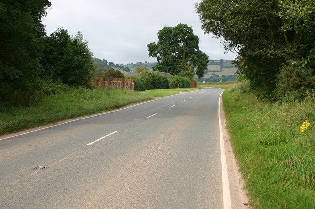
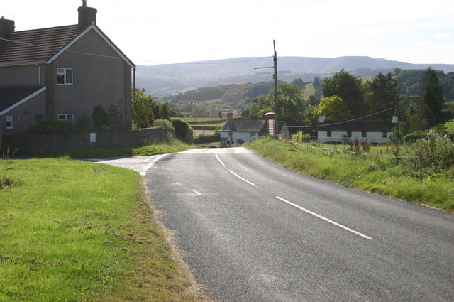
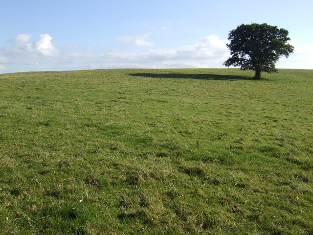
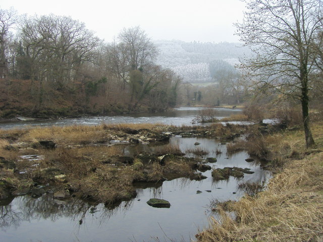
Brest Bochrwyd is a small village located in the county of Radnorshire, Wales. Situated in the heart of the picturesque countryside, this rural settlement offers a tranquil and peaceful environment for its residents. The village is nestled within the Radnor Forest, a vast area of woodland and heathland that provides stunning views and opportunities for outdoor activities.

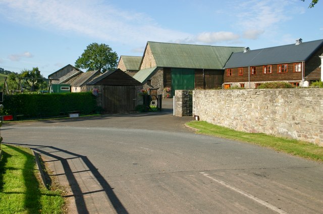
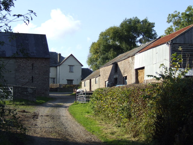
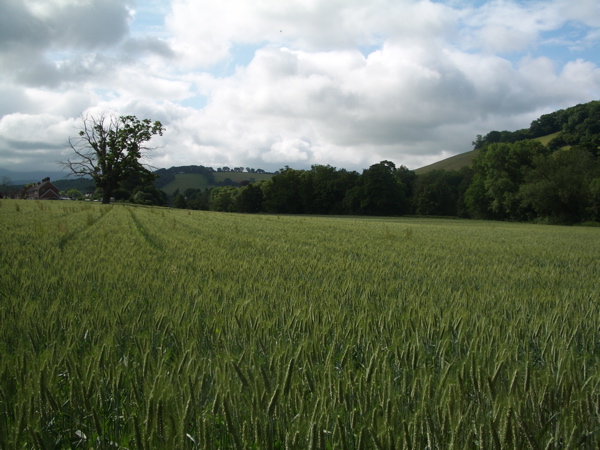
Historically, Brest Bochrwyd was known for its agriculture, with farming being the main occupation for the local community. The fertile land surrounding the village supports the growth of crops and the rearing of livestock, contributing to the area's rural charm. Today, while agriculture remains a significant part of the local economy, many residents also commute to nearby towns and cities for employment.

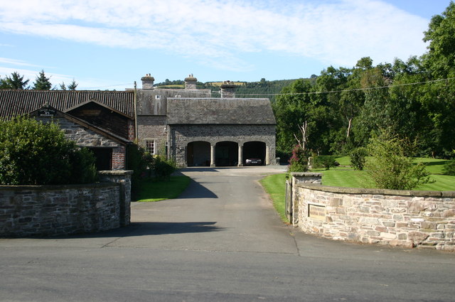
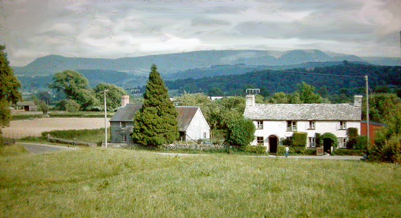
The village itself features a small number of traditional cottages and houses, reflecting its long-standing history. The community is close-knit, with a friendly and welcoming atmosphere. There is a local pub that serves as a gathering place for residents and visitors alike, providing a hub for socializing and community events.

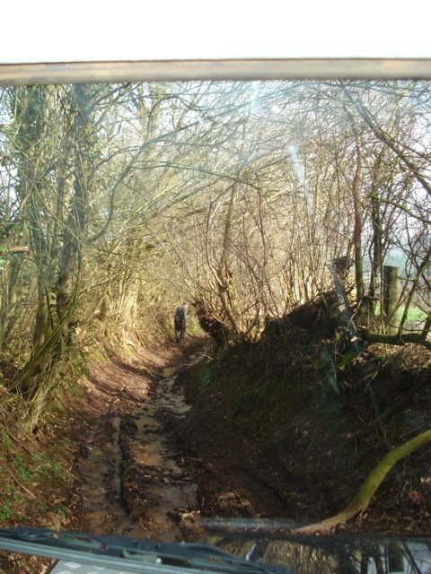
Nature enthusiasts and outdoor lovers will find plenty to enjoy in Brest Bochrwyd and its surrounding area. The Radnor Forest offers walking trails, cycling routes, and opportunities for birdwatching and wildlife spotting. The village is also within reach of the Brecon Beacons National Park and the Elan Valley, both renowned for their stunning natural landscapes and outdoor recreational activities.

Overall, Brest Bochrwyd exudes a sense of tranquility and natural beauty, making it an ideal place for those seeking a peaceful and idyllic countryside retreat.

If you have any feedback on the listing, please let us know in the comments section below.

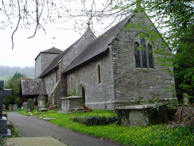
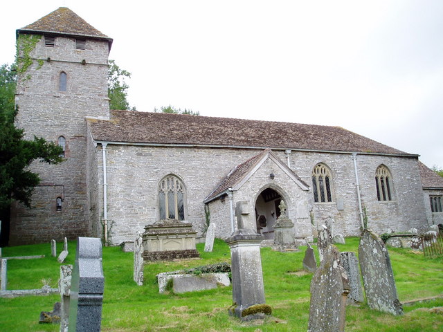
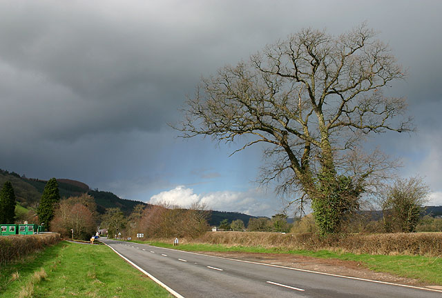
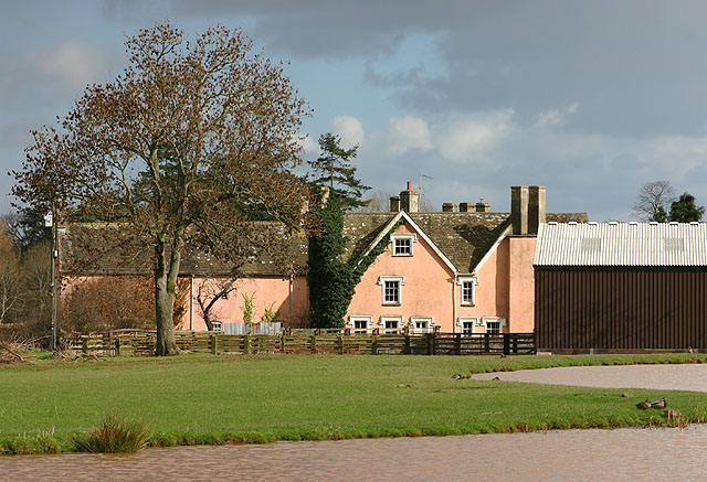
Brest Bochrwyd Images

Images are sourced within 2km of 52.039198/-3.2448791 or Grid Reference SO1438. Thanks to Geograph Open Source API. All images are credited.

Bridge End Inn, Llyswen Built in 1842 near a bridge over the river Wye. It offers excellent home-cooked fare with a varied menu and a log fire in season.
Bridge End Inn, Llyswen
Built in 1842 near a bridge over the river Wye. It offers excellent home-cooked fare with a varied menu and a log fire in season.
St Gwendoline's Church, Llyswen Rebuilt on Norman foundations in 1862, the only remains of the old church is a Norman font. <span class="nowrap"><a title="http://www.wiz.to/llyswen/stgwendoline.htm" rel="nofollow ugc noopener" href="http://www.wiz.to/llyswen/stgwendoline.htm">Link</a><img style="margin-left:2px;" alt="External link" title="External link - shift click to open in new window" src="https://s1.geograph.org.uk/img/external.png" width="10" height="10"/></span>
St Gwendoline's Church, Llyswen
Rebuilt on Norman foundations in 1862, the only remains of the old church is a Norman font. LinkExternal link
Roundabout Near Llyswen The road was closed because of a suspected case of Foot And Mouth disease at a farm adjacent to the A479 road.
Roundabout Near Llyswen
The road was closed because of a suspected case of Foot And Mouth disease at a farm adjacent to the A479 road.
St Gwendoline's Church St Gwendoline's Church, Llyswen, the church adopted St Gwendoline as their Patron Saint between the 9th century and the Norman invasion (she is a local Welsh Saint buried at Talgarth). 

The single bell in the tower is dated 1666, the church was rebuilt in 1862, the only remaining Norman part is the font.
St Gwendoline's Church
St Gwendoline's Church, Llyswen, the church adopted St Gwendoline as their Patron Saint between the 9th century and the Norman invasion (she is a local Welsh Saint buried at Talgarth). The single bell in the tower is dated 1666, the church was rebuilt in 1862, the only remaining Norman part is the font.
Pipes near Llyswen Pipes being laid near the A470 at Llyswen.
Pipes near Llyswen
Pipes being laid near the A470 at Llyswen.
The A470 near Llyswen An approaching storm near Llyswen.
The A470 near Llyswen
An approaching storm near Llyswen.
The Dderw and Pond The ancient farmhouse, the Dderw and pond, as seen from the A470.
The Dderw and Pond
The ancient farmhouse, the Dderw and pond, as seen from the A470.
The A4079 at Boxbush The A4079 at Boxbush heading towards Llyswen
The A4079 at Boxbush
The A4079 at Boxbush heading towards Llyswen
Boughrood Castle farm Boughrood Castle farm, just north of the castle
Boughrood Castle farm
Boughrood Castle farm, just north of the castle
Boughrood Brest The B4350 at Boughrood Brest heading towards Glasbury
Boughrood Brest
The B4350 at Boughrood Brest heading towards Glasbury
Pistyll farm The B4350 passing Pistyll farm
Pistyll farm
The B4350 passing Pistyll farm
Oak in a field A glorious October afternoon, near Boughrood, Radnorshire.
Oak in a field
A glorious October afternoon, near Boughrood, Radnorshire.
Upper Skynlais Pronounced Upper Skun Lice, a farm west of Glasbury in Radnorshire.
Upper Skynlais
Pronounced Upper Skun Lice, a farm west of Glasbury in Radnorshire.
The River Wye in full spate Viewed from the road bridge at Llyswen
The River Wye in full spate
Viewed from the road bridge at Llyswen
River Wye River Wye by Boughrood Bridge
River Wye
River Wye by Boughrood Bridge
River Wye From the Wye Valley Walk by The Old Rectory the River Wye looking up to the meanders to Boughrood Bridge
River Wye
From the Wye Valley Walk by The Old Rectory the River Wye looking up to the meanders to Boughrood Bridge
A bit narrow toward the end! This is about 100yds from the end of the lane. The worst bramble part already over, but this part just tricky with trees protruding into the path of the upper vehicle. Earlier on a centre rut makes it... er... interesting.
A bit narrow toward the end!
This is about 100yds from the end of the lane. The worst bramble part already over, but this part just tricky with trees protruding into the path of the upper vehicle. Earlier on a centre rut makes it... er... interesting.
Boughrood: a field of oats by the Wye
Show me another place!

Brest Bochrwyd is located at Grid Ref: SO1438 (Lat: 52.039198, Lng: -3.2448791)

Unitary Authority: Powys

Police Authority: Dyfed Powys

Also known as: Boughrood Brest

What 3 Words

///lease.clues.magically. Near Talgarth, Powys

Related Wikis

Boughrood Brest

Boughrood Brest (Welsh Brest Bochrwyd) is a settlement in Glasbury-on-Wye, Powys, Wales, which is 39 miles (62 km) from Cardiff and 138 miles (222 km)...
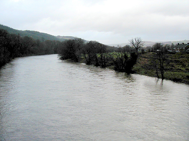
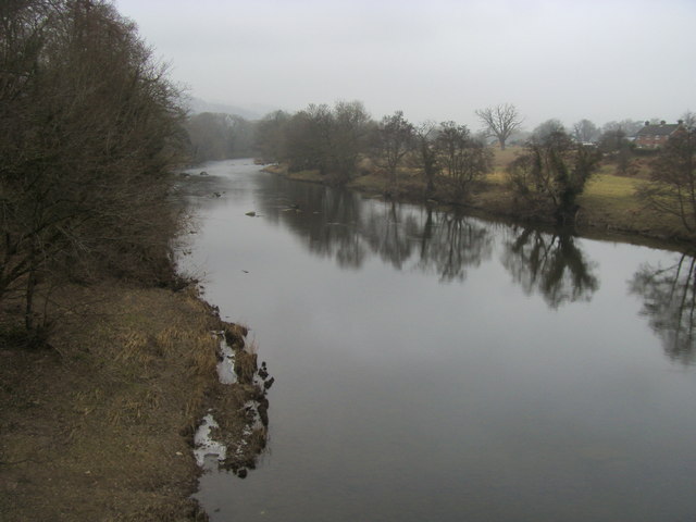
Llyswen

Llyswen is a small village in Powys, Wales on the west bank of the River Wye. It was formerly within the county of Brecknockshire and now forms part of...

Boughrood & Llyswen railway station

Boughrood and Llyswen railway station, in Boughrood Powys, Wales, was opened on 21 September 1864 by the Mid-Wales Railway as Boughrood Station, although...

Boughrood

Boughrood (Welsh: Bochrwyd) is a village in the community of Glasbury in Powys, Wales. Historically in Radnorshire, the village is situated near the River...

Nearby Amenities

Located within 500m of 52.039198,-3.2448791
Post Box
Post Box Type: lamp
Royal Cypher: GVIR
Royal Cypher Wikidata: Q33102169
Lat/Long: 52.039083/-3.2447206
Power: pole
Source: bing
Lat/Long: 52.0392154/-3.2508222
Power: pole
Source: bing
Lat/Long: 52.0388624/-3.2485925
Power: pole
Source: bing
Lat/Long: 52.0381091/-3.2441613
Power: pole
Source: bing
Lat/Long: 52.0384504/-3.2460723
Power: pole
Source: bing
Lat/Long: 52.0375212/-3.2406906
Power: pole
Source: bing
Lat/Long: 52.0375041/-3.2405895
Direction: 165
Generator Method: photovoltaic
Generator Output Electricity: yes
Generator Solar Modules: 20
Generator Source: solar
Generator Type: solar_photovoltaic_panel
Location: roof
Power: generator
Lat/Long: 52.0392142/-3.2446669
Direction: 145
Generator Method: photovoltaic
Generator Output Electricity: yes
Generator Solar Modules: 16
Generator Source: solar
Generator Type: solar_photovoltaic_panel
Location: roof
Power: generator
Lat/Long: 52.0401505/-3.2453308
Walnut Tree Barn
Tourism: chalet
Lat/Long: 52.0384801/-3.2399852
Yew Tree Barn
Tourism: chalet
Lat/Long: 52.0382507/-3.2403312
The data included in this document is from www.openstreetmap.org. The data is made available under ODbL.

Have you been to Brest Bochrwyd?

Leave your review of Brest Bochrwyd below (or comments, questions and feedback).