Bremirehoull

Settlement in Shetland

Scotland

Bremirehoull

Mail Burial Ground Adjacent to the sea as is usual on Scottish islands.
Mail Burial Ground Credit: Oliver Dixon

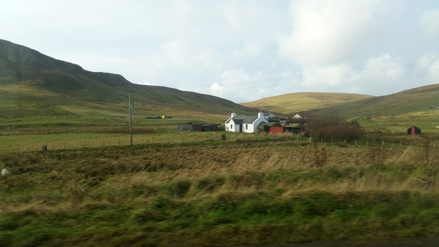
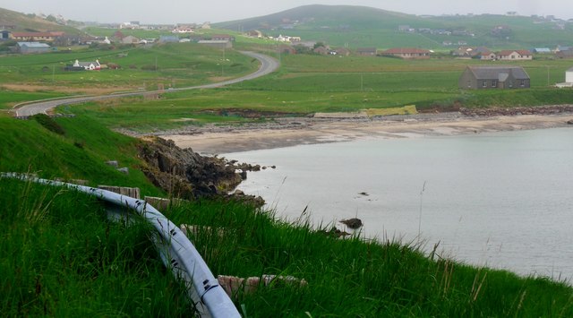
Bremirehoull is a small settlement located in the Shetland Islands, which are part of Scotland, United Kingdom. Situated on the west coast of the mainland Shetland, Bremirehoull is known for its picturesque surroundings and rich history.

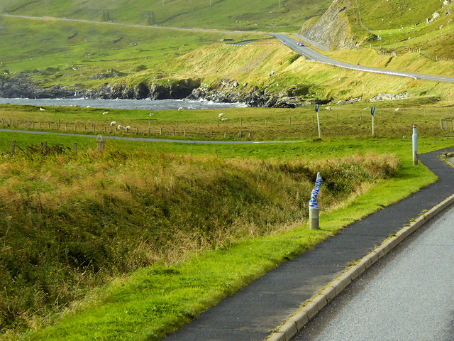
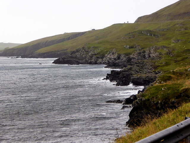
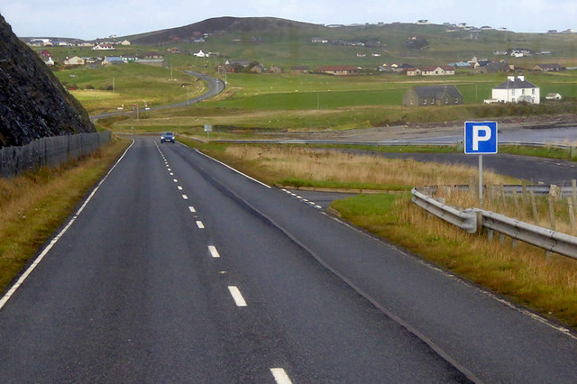
The settlement is nestled amongst rolling hills and offers stunning views of the North Sea. It is primarily a rural area with a scattering of houses and farms, surrounded by lush green fields and rugged coastline. Bremirehoull is also home to a small harbor, providing access to the sea for local fishermen.

Historically, Bremirehoull played a significant role in the fishing and agricultural industries of Shetland. Fishing boats would sail from the harbor in search of herring and other fish, which were then processed and exported. Today, while the fishing industry has declined, the area still retains its rural charm and traditional way of life.

The community in Bremirehoull is close-knit, with residents often engaging in activities such as crofting, farming, and crafts. The settlement is also known for its welcoming atmosphere, with locals known for their friendliness and hospitality.

Visitors to Bremirehoull can enjoy the tranquility of the surroundings, take leisurely walks along the coastal paths, or explore the nearby archaeological sites. The settlement is also within reach of other attractions in Shetland, such as the ancient ruins of Jarlshof and the bustling town of Lerwick.

In summary, Bremirehoull is a small and picturesque settlement in the Shetland Islands, offering visitors a glimpse into the rich history and rural way of life of this unique part of Scotland.

If you have any feedback on the listing, please let us know in the comments section below.
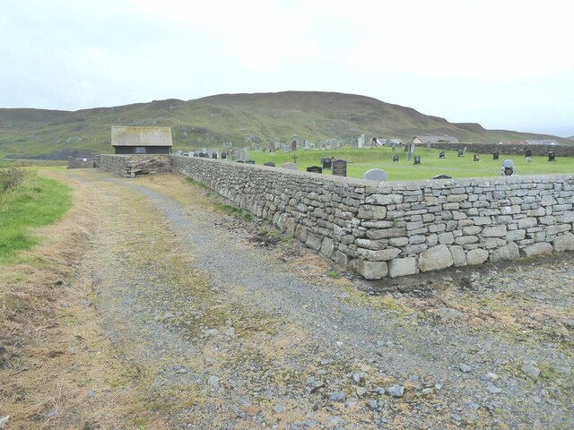
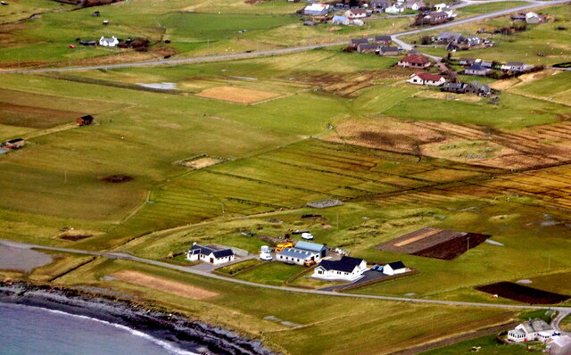
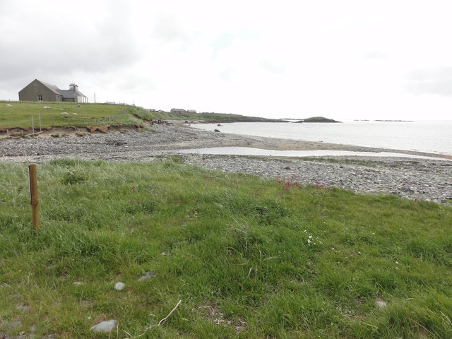
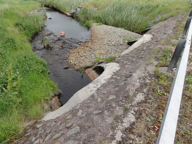
Bremirehoull Images

Images are sourced within 2km of 60.043577/-1.2386914 or Grid Reference HU4229. Thanks to Geograph Open Source API. All images are credited.

Mail Burial Ground Adjacent to the sea as is usual on Scottish islands.
Mail Burial Ground
Adjacent to the sea as is usual on Scottish islands.
Aith, Cunningsburgh, from the air
South Voxter, Cunningsburgh, from the air
Mail, Cunningsburgh, from the air
Shoreline with joining stream Small sandy pebble beach with joining stream to the sea
Shoreline with joining stream
Small sandy pebble beach with joining stream to the sea
Road bridge Road bridge buttress as it passes over the stream. It should have been the location of an Ordnance Survey OSBM Bolt, which seems to have been destroyed in the rebuilding of the road.
Road bridge
Road bridge buttress as it passes over the stream. It should have been the location of an Ordnance Survey OSBM Bolt, which seems to have been destroyed in the rebuilding of the road.
House under renovation, Cunningsburgh
Vadsgarth, Cunningsburgh
Small beach at the Sands of Mail The road is the A970 approaching Cunningsburgh.
Small beach at the Sands of Mail
The road is the A970 approaching Cunningsburgh.
A970 at Cunningsburgh Cunningsburgh, formerly also known as Coningsburgh (from the Old Norse: Konungsborgr meaning "King's castle"), is a hamlet on the coast of Mainland Shetland, nine miles south-west of Lerwick, about halfway between there and Sumburgh Head.
A970 at Cunningsburgh
Cunningsburgh, formerly also known as Coningsburgh (from the Old Norse: Konungsborgr meaning "King's castle"), is a hamlet on the coast of Mainland Shetland, nine miles south-west of Lerwick, about halfway between there and Sumburgh Head.
Bus Stop at Cunningsburgh Bus stop outside Cunningsburgh Primary School.
Bus Stop at Cunningsburgh
Bus stop outside Cunningsburgh Primary School.
Bus Stop on the A970 at Cunningsburgh Cunningsburgh, formerly also known as Coningsburgh (from the Old Norse: Konungsborgr meaning "King's castle"), is a hamlet on the coast of Mainland Shetland, nine miles south-west of Lerwick, about halfway between there and Sumburgh Head.
Bus Stop on the A970 at Cunningsburgh
Cunningsburgh, formerly also known as Coningsburgh (from the Old Norse: Konungsborgr meaning "King's castle"), is a hamlet on the coast of Mainland Shetland, nine miles south-west of Lerwick, about halfway between there and Sumburgh Head.
Bus Stop at Cunningsburgh Cunningsburgh, formerly also known as Coningsburgh (from the Old Norse: Konungsborgr meaning "King's castle"), is a hamlet on the coast of Mainland Shetland, nine miles south-west of Lerwick, about halfway between there and Sumburgh Head.
Bus Stop at Cunningsburgh
Cunningsburgh, formerly also known as Coningsburgh (from the Old Norse: Konungsborgr meaning "King's castle"), is a hamlet on the coast of Mainland Shetland, nine miles south-west of Lerwick, about halfway between there and Sumburgh Head.
Coastal Sheep Farm near Mail
Cunningsburgh, A970 Cunningsburgh, formerly also known as Coningsburgh (from the Old Norse: Konungsborgr meaning "King's castle"), is a hamlet on the coast of Mainland Shetland, nine miles south-west of Lerwick, about halfway between there and Sumburgh Head.
Cunningsburgh, A970
Cunningsburgh, formerly also known as Coningsburgh (from the Old Norse: Konungsborgr meaning "King's castle"), is a hamlet on the coast of Mainland Shetland, nine miles south-west of Lerwick, about halfway between there and Sumburgh Head.
Rocky Shoreline near Mail
Southbound A970, Layby near Mail The A970 runs for 71 miles across most of the length of the "Mainland" in the Shetland Islands. It is a good-quality single-carriageway road for most of its route. Travelling from south to north, the road begins at Grutness near Sumburgh Airport and winds around the many hills and inlets passing close to a number of small villages without going through any large ones before Lerwick. After looping around Lerwick, a short spur runs to Scalloway whilst the main route continues northwards towards Brae where it crosses the narrow isthmus of Mavis Grind. At Sandy Lochs the road splits and a four-mile spur goes through Urafirth to Hillswick. The main route continuing to the right towards its northern terminus at Isbister. This last part of the route tends to be narrower with passing places.

<span class="nowrap"><a title="https://www.sabre-roads.org.uk/wiki/index.php?title=A970" rel="nofollow ugc noopener" href="https://www.sabre-roads.org.uk/wiki/index.php?title=A970">Link</a><img style="margin-left:2px;" alt="External link" title="External link - shift click to open in new window" src="https://s1.geograph.org.uk/img/external.png" width="10" height="10"/></span>  SABRE
Southbound A970, Layby near Mail
The A970 runs for 71 miles across most of the length of the "Mainland" in the Shetland Islands. It is a good-quality single-carriageway road for most of its route. Travelling from south to north, the road begins at Grutness near Sumburgh Airport and winds around the many hills and inlets passing close to a number of small villages without going through any large ones before Lerwick. After looping around Lerwick, a short spur runs to Scalloway whilst the main route continues northwards towards Brae where it crosses the narrow isthmus of Mavis Grind. At Sandy Lochs the road splits and a four-mile spur goes through Urafirth to Hillswick. The main route continuing to the right towards its northern terminus at Isbister. This last part of the route tends to be narrower with passing places. LinkExternal link SABRE
Layby and Viewpoint on the A970 near Mail The A970 runs for 71 miles across most of the length of the "Mainland" in the Shetland Islands. It is a good-quality single-carriageway road for most of its route. Travelling from south to north, the road begins at Grutness near Sumburgh Airport and winds around the many hills and inlets passing close to a number of small villages without going through any large ones before Lerwick. After looping around Lerwick, a short spur runs to Scalloway whilst the main route continues northwards towards Brae where it crosses the narrow isthmus of Mavis Grind. At Sandy Lochs the road splits and a four-mile spur goes through Urafirth to Hillswick. The main route continuing to the right towards its northern terminus at Isbister. This last part of the route tends to be narrower with passing places.

<span class="nowrap"><a title="https://www.sabre-roads.org.uk/wiki/index.php?title=A970" rel="nofollow ugc noopener" href="https://www.sabre-roads.org.uk/wiki/index.php?title=A970">Link</a><img style="margin-left:2px;" alt="External link" title="External link - shift click to open in new window" src="https://s1.geograph.org.uk/img/external.png" width="10" height="10"/></span>  SABRE
Layby and Viewpoint on the A970 near Mail
The A970 runs for 71 miles across most of the length of the "Mainland" in the Shetland Islands. It is a good-quality single-carriageway road for most of its route. Travelling from south to north, the road begins at Grutness near Sumburgh Airport and winds around the many hills and inlets passing close to a number of small villages without going through any large ones before Lerwick. After looping around Lerwick, a short spur runs to Scalloway whilst the main route continues northwards towards Brae where it crosses the narrow isthmus of Mavis Grind. At Sandy Lochs the road splits and a four-mile spur goes through Urafirth to Hillswick. The main route continuing to the right towards its northern terminus at Isbister. This last part of the route tends to be narrower with passing places. LinkExternal link SABRE
Show me another place!

Bremirehoull is located at Grid Ref: HU4229 (Lat: 60.043577, Lng: -1.2386914)

Unitary Authority: Shetland Islands

Police Authority: Highlands and Islands

What 3 Words

///plodding.eating.crispier. Near Sandwick, Shetland Islands

Nearby Locations

Bremirehoull

Related Wikis

Bremirehoull

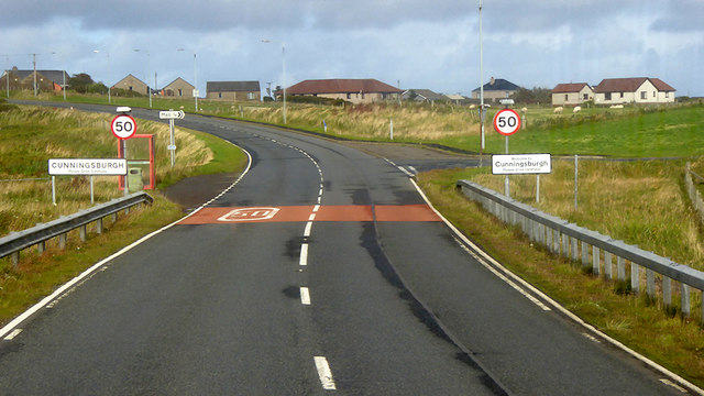
Bremirehoull is a settlement on the island of Mainland, in Shetland, Scotland. Bremirehoull is situated on the A970 in the Cunningsburgh area. == References... ==

Mail, Shetland

Mail is a hamlet on the island of Mainland, in the Shetland Islands, Scotland. == Geography == Mail is located on the south-eastern side of the island...

Cunningsburgh

Cunningsburgh, formerly also known as Coningsburgh (Old Norse: Konungsborgr meaning "King's castle"), is a new hamlet and ancient parish in the south of...

Catpund

Catpund is a quarry site in Shetland, Scotland, where steatite vessels were cut from the rock from prehistory onwards. The quarrying marks are still visible...

Nearby Amenities

Located within 500m of 60.043577,-1.2386914
Power: pole
Lat/Long: 60.0395189/-1.2353826
Power: pole
Lat/Long: 60.0404163/-1.2347522
Power: pole
Lat/Long: 60.0411785/-1.2342051
Power: pole
Lat/Long: 60.041891/-1.2337169
Power: pole
Lat/Long: 60.0424562/-1.2333092
Power: pole
Lat/Long: 60.0430724/-1.2328908
Power: pole
Lat/Long: 60.0438612/-1.232585
Power: pole
Lat/Long: 60.0446059/-1.2323061
Power: pole
Lat/Long: 60.0453184/-1.2319922
Power: pole
Lat/Long: 60.0460242/-1.2317267
Power: pole
Lat/Long: 60.0445383/-1.2409231
Power: pole
Lat/Long: 60.0444287/-1.240244
Power: pole
Lat/Long: 60.0443088/-1.2395579
Power: pole
Lat/Long: 60.0441738/-1.2387817
Power: pole
Lat/Long: 60.0438128/-1.2379155
Power: pole
Lat/Long: 60.0432972/-1.2367305
Power: pole
Lat/Long: 60.0429927/-1.2360051
Power: pole
Lat/Long: 60.0426882/-1.2352821
Power: pole
Lat/Long: 60.0421645/-1.2340879
Power: pole
Lat/Long: 60.0417988/-1.233217
Power: pole
Lat/Long: 60.0414008/-1.2323254
Power: pole
Lat/Long: 60.0415196/-1.2348109
Power: pole
Lat/Long: 60.0418865/-1.2349541
Power: pole
Lat/Long: 60.0422833/-1.2351297
Power: pole
Lat/Long: 60.0431161/-1.2354762
The data included in this document is from www.openstreetmap.org. The data is made available under ODbL.

Have you been to Bremirehoull?

Leave your review of Bremirehoull below (or comments, questions and feedback).