Brasside

Settlement in Durham

England

Brasside

Butterbur in flower beside River Wear Butterbur - Petasites hybridus, flowers in early spring in damp locations. It's unusual in that it flowers before its leaves appear. The rhubarb-like leaves as they develop grow to a spectacular size.
Butterbur in flower beside River Wear Credit: Trevor Littlewood

Brasside is a small village located in County Durham, in the northeast region of England. Situated just three miles southwest of Durham city center, Brasside offers a peaceful and rural atmosphere while still being within close proximity to urban amenities.

The village is primarily residential, with a mix of detached houses, cottages, and farmhouses. The architecture in Brasside reflects its history, with some buildings dating back to the 18th century, adding a charming and traditional character to the area. The surrounding countryside is picturesque, with rolling hills, meadows, and scenic views.

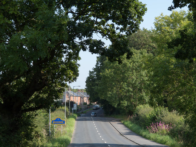
Despite its small size, Brasside benefits from excellent transport links. The A167 road runs through the village, providing easy access to neighboring cities and towns, including Durham and Sunderland. The village also has a railway station, allowing for convenient travel to other parts of the country.

Brasside is known for its close-knit community and friendly atmosphere. It has a local primary school, offering education for young children, and a village hall that hosts various community events and activities. For everyday conveniences, residents have access to nearby shops, supermarkets, and services in Durham city.

Surrounded by natural beauty, Brasside offers opportunities for outdoor activities, such as walking, cycling, and exploring the nearby countryside. The village provides a tranquil retreat from the hustle and bustle of city life, while still being well-connected and conveniently located for those seeking a balance between rural and urban living.

If you have any feedback on the listing, please let us know in the comments section below.
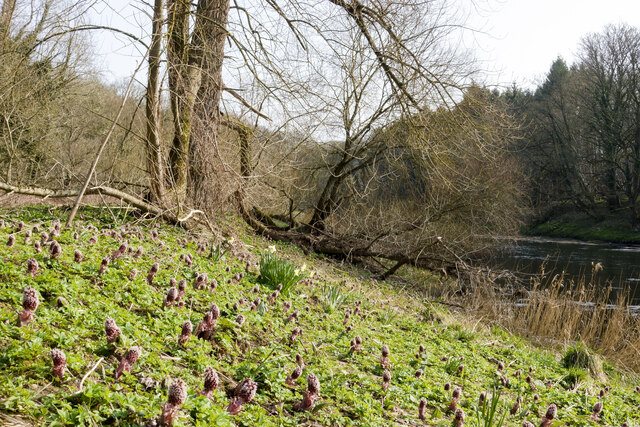
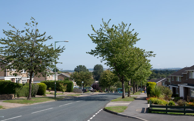
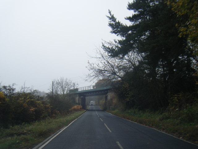
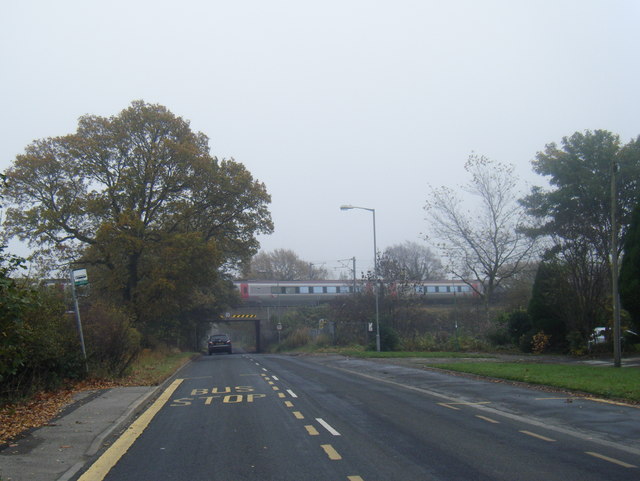
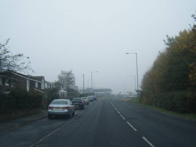
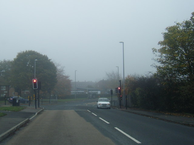
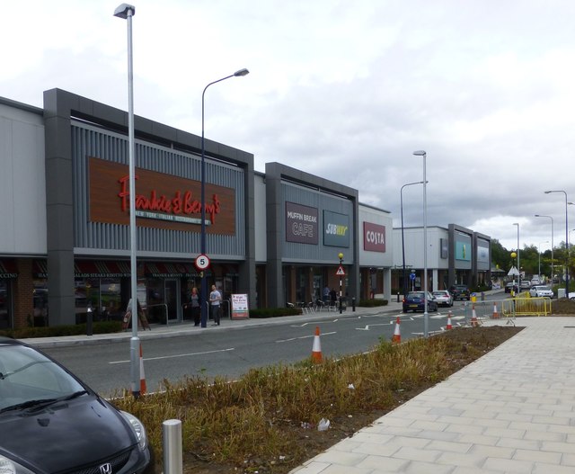
Brasside Images

Images are sourced within 2km of 54.806442/-1.5573586 or Grid Reference NZ2845. Thanks to Geograph Open Source API. All images are credited.

Butterbur in flower beside River Wear Butterbur - Petasites hybridus, flowers in early spring in damp locations. It's unusual in that it flowers before its leaves appear. The rhubarb-like leaves as they develop grow to a spectacular size.
Butterbur in flower beside River Wear
Butterbur - Petasites hybridus, flowers in early spring in damp locations. It's unusual in that it flowers before its leaves appear. The rhubarb-like leaves as they develop grow to a spectacular size.
Wooden fence alongside wooded gorge The fence bounds a surprisingly deep stream groove which bars easy access from a path - a right of way -  leaving Kepier Wood, to another right of way, downstream along the River Wear.
Wooden fence alongside wooded gorge
The fence bounds a surprisingly deep stream groove which bars easy access from a path - a right of way - leaving Kepier Wood, to another right of way, downstream along the River Wear.
Raintonpark Wood rapid The River Wear from Durham to Finchale Priory is an easy river trip, and very popular on Boxing day each year, when there is a river race, followed by lots of paddlers just doing the trip for recreation. There are few rapids of any note, but the one that sticks in most people's minds is this one, less than a mile from the end.
Raintonpark Wood rapid
The River Wear from Durham to Finchale Priory is an easy river trip, and very popular on Boxing day each year, when there is a river race, followed by lots of paddlers just doing the trip for recreation. There are few rapids of any note, but the one that sticks in most people's minds is this one, less than a mile from the end.
Road from Maureen Terrace
Canterbury Road heading east Canterbury Road is one of the main roads to pass through the large residential area of Newton Hall which is on the north side of Durham City.
Canterbury Road heading east
Canterbury Road is one of the main roads to pass through the large residential area of Newton Hall which is on the north side of Durham City.
Grassed area at Newton Hall Newton Hall is a district, basically a housing estate, to the north of Durham City. The grassed area is at the eastern edge of the estate; it has the route of the East Coast Main Line at its far side, running out of sight, in a cutting.
Grassed area at Newton Hall
Newton Hall is a district, basically a housing estate, to the north of Durham City. The grassed area is at the eastern edge of the estate; it has the route of the East Coast Main Line at its far side, running out of sight, in a cutting.
Minor road entering Brasside Brasside is a small village on the outskirts of Durham city; it has the doubtful privilege of being the location of both a remand centre and a prison.
The blue and yellow road sign naming the village is in a style common in County Durham.
Minor road entering Brasside
Brasside is a small village on the outskirts of Durham city; it has the doubtful privilege of being the location of both a remand centre and a prison. The blue and yellow road sign naming the village is in a style common in County Durham.
Chester Low Road nears ECML bridge
Finchale Avenue and ECML train passing over
Pit Lane, Newton Hall
Pit Lane/Bek Road junction
Road heading towards Brasside The minor road is heading towards Brasside, part of Durham city. This area could be a sensitive one for photographers as just along the road is Frankland Prison and remand centre..
Road heading towards Brasside
The minor road is heading towards Brasside, part of Durham city. This area could be a sensitive one for photographers as just along the road is Frankland Prison and remand centre..
Farm track rising at field edge The farm track rises close to The Bungalow at the end of a public road which seems to be an extension of Finchale Road.
Farm track rising at field edge
The farm track rises close to The Bungalow at the end of a public road which seems to be an extension of Finchale Road.
Footbridge in Kepier wood
Footpath by River Wear in Kepier wood
Retail outlets at The Arnison Centre At Pity Me on the northern fringe of Durham.
Retail outlets at The Arnison Centre
At Pity Me on the northern fringe of Durham.
Finchale Priory and camp site entrance
Pillar of Finchale Priory abbey church This is the SW-corner pillar of the abbey church's cross.
Pillar of Finchale Priory abbey church
This is the SW-corner pillar of the abbey church's cross.
Show me another place!

Brasside is located at Grid Ref: NZ2845 (Lat: 54.806442, Lng: -1.5573586)

Unitary Authority: County Durham

Police Authority: Durham

What 3 Words

///inner.shoppers.scorched. Near Durham, Co. Durham

Nearby Locations

Brasside

Related Wikis

HM Prison Low Newton

HM Prison Low Newton is a closed prison for female adults and young offenders in Brasside, County Durham, England. The prison, which is operated by His...

HM Prison Frankland

HM Prison Frankland is a Category A men's prison located in the village of Brasside in County Durham, England. Frankland is operated by His Majesty's Prison...

Brasside

Brasside is a suburban village near Durham, located in the civil parish of Framwellgate Moor in County Durham, England. It is situated to the north of...

Frankland railway station

Frankland railway station served the village of Brasside, County Durham, England, from 1861 to 1877 on the Leamside Line. == History == The station opened...

Brasside Pond

Brasside Pond is a Site of Special Scientific Interest just north of the city of Durham, England. The site occupies an area of former clay pits sandwiched...
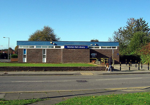
Newton Hall, Durham

Newton Hall is a large housing estate in County Durham, in England. It is situated to the north of Durham, near Framwellgate Moor, Pity Me and Brasside...
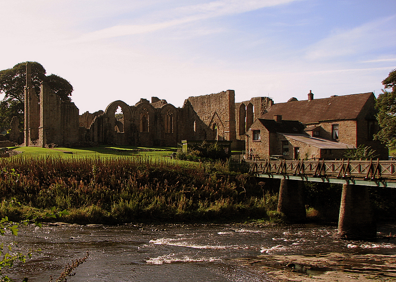
Finchale Priory

Finchale Priory () sometimes referred to as Finchale Abbey was a 13th-century Benedictine priory. The remains are sited by the River Wear, four miles from...

Pity Me

Pity Me is a suburban village of Durham, England, located north of Framwellgate Moor and west of Newton Hall. == Etymology == There are various theories...

Nearby Amenities

Located within 500m of 54.806442,-1.5573586
Turning Circle
Lat/Long: 54.8053271/-1.5637463
Bus Stop
Finchale Road
Naptan AtcoCode: 13005262C
Naptan Bearing: E
Naptan CommonName: Finchale Road
Naptan Indicator: east bound
Naptan Landmark: Landmark not known
Naptan NaptanCode: durdjgtw
Naptan Notes: Opposite 266 Finchale Road- Newton Hall- Framwellgate Moor
Naptan PlusbusZoneRef: DRHM
Naptan Street: Finchale Road
Naptan Verified: no
Source: naptan_import
Lat/Long: 54.805996/-1.5646633
Bus Stop
Finchale Road
Naptan AtcoCode: 13005262G
Naptan Bearing: W
Naptan CommonName: Finchale Road
Naptan Indicator: west bound
Naptan Landmark: Landmark not known
Naptan NaptanCode: durdjgwa
Naptan Notes: Opposite 258 Finchale Road- Newton Hall- Framwellgate Moor
Naptan PlusbusZoneRef: DRHM
Naptan Street: Finchale Road
Naptan Verified: no
Source: naptan_import
Lat/Long: 54.8058534/-1.5649915
Bus Stop
Finchale Avenue
Naptan AtcoCode: 13005263C
Naptan Bearing: E
Naptan CommonName: Finchale Avenue
Naptan Indicator: east bound
Naptan Landmark: Outside Nos 22 and 23
Naptan NaptanCode: durdjgwd
Naptan PlusbusZoneRef: DRHM
Naptan Street: Finchale Avenue
Naptan Verified: no
Shelter: no
Source: naptan_import
Lat/Long: 54.8064893/-1.5575325
Bus Stop
Finchale Avenue
Naptan AtcoCode: 13005263G
Naptan Bearing: W
Naptan CommonName: Finchale Avenue
Naptan Indicator: west bound
Naptan Landmark: opposite No 10
Naptan NaptanCode: durdjgwg
Naptan PlusbusZoneRef: DRHM
Naptan Street: Finchale Avenue
Naptan Verified: no
Shelter: yes
Source: naptan_import
Lat/Long: 54.8063768/-1.5581248
Bus Stop
Frankland Prison
Bus: yes
Naptan AtcoCode: 13005264G
Naptan Bearing: W
Naptan CommonName: Frankland Prison
Naptan Indicator: west bound
Naptan Landmark: Turning Circle
Naptan NaptanCode: durdjgwj
Naptan PlusbusZoneRef: DRHM
Naptan Street: Finchale Avenue
Naptan Verified: no
Public Transport: platform
Shelter: yes
Source: naptan_import
Lat/Long: 54.8064221/-1.5515084
Crossing
Crossing: uncontrolled
Crossing Ref: zebra
Lat/Long: 54.8066447/-1.5498435
Barrier: lift_gate
Lat/Long: 54.8065605/-1.5499026
Crossing
Crossing: uncontrolled
Crossing Ref: zebra
Lat/Long: 54.8065852/-1.5496445
Noexit: yes
Lat/Long: 54.8057999/-1.5542062
Brasside
Place: suburb
Wikidata: Q4957944
Wikipedia: en:Brasside
Lat/Long: 54.8062042/-1.5562623
Railway: signal
Railway Signal Direction: backward
Railway Signal Main: GB-NR:main
Railway Signal Main Form: light
Railway Signal Main Height: normal
Railway Signal Operator: Network Rail
Railway Signal Position: left
Lat/Long: 54.8064653/-1.5638486
Bench
Bench commemorating Martha Sead
Lat/Long: 54.8080478/-1.5578422
Parking
Access: no
Parking: surface
Lat/Long: 54.805809/-1.5635924
Post Box
Operator: Royal Mail
Post Box Type: pillar
Ref: DH1 303
Lat/Long: 54.8065097/-1.5568674
Railway: signal
Railway Signal Direction: forward
Railway Signal Main: GB-NR:main
Railway Signal Main Design: individual
Railway Signal Main Form: light
Railway Signal Main Height: normal
Railway Signal Main States: red;green;yellow;flashing_yellow;double_yellow;flashing_double_yellow
Railway Signal Operator: Network Rail
Railway Signal Position: left
Ref: T 291
Lat/Long: 54.8040157/-1.561636
Generator Method: photovoltaic
Generator Orientation: 230
Generator Output Electricity: yes
Generator Solar Modules: 16
Generator Source: solar
Generator Type: solar_photovoltaic_panel
Location: roof
Power: generator
Lat/Long: 54.8034716/-1.5619375
Generator Method: photovoltaic
Generator Orientation: 240
Generator Output Electricity: yes
Generator Source: solar
Generator Type: solar_photovoltaic_panel
Location: roof
Power: generator
Lat/Long: 54.8047292/-1.5639733
Barrier: lift_gate
Lat/Long: 54.8062751/-1.5534443
Waste Basket
Waste: dog_excrement
Lat/Long: 54.8064923/-1.5574729
Generator Method: photovoltaic
Generator Orientation: 150
Generator Output Electricity: yes
Generator Source: solar
Generator Type: solar_photovoltaic_panel
Location: roof
Power: generator
Lat/Long: 54.8054475/-1.5639542
The data included in this document is from www.openstreetmap.org. The data is made available under ODbL.

Have you been to Brasside?

Leave your review of Brasside below (or comments, questions and feedback).