Bont Newydd

Settlement in Merionethshire

Wales

Bont Newydd

Foel Fawr summit Descending via Foel Fawr after a wildcamp on Graig Wen
Foel Fawr summit Credit: John Horner

Bont Newydd is a small village located in the county of Merionethshire, Wales. It is situated in the northwestern part of the country, near the coast of Cardigan Bay. The village is nestled in a picturesque rural landscape, surrounded by rolling hills and lush green fields.

Bont Newydd is known for its quaint and charming atmosphere, with traditional stone cottages and a sense of tranquility. The village is home to a close-knit community, where people usually know each other and have a strong sense of belonging.

The village is not very large, with a population of around 500 residents. It offers basic amenities to its residents, including a small grocery store, a post office, and a local pub. For more extensive services and facilities, residents often travel to nearby towns such as Harlech or Porthmadog.

The surrounding area of Bont Newydd is rich in natural beauty, making it an ideal destination for outdoor enthusiasts. The nearby Snowdonia National Park offers stunning views, hiking trails, and opportunities for various outdoor activities such as mountain biking and fishing. The coastline of Cardigan Bay is also easily accessible, providing residents and visitors with opportunities for beach walks and water sports.

Overall, Bont Newydd is a peaceful and idyllic village, offering a charming rural lifestyle and easy access to the natural wonders of the surrounding area.

If you have any feedback on the listing, please let us know in the comments section below.
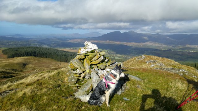
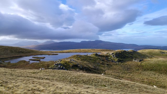
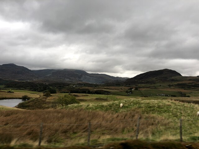
Bont Newydd Images

Images are sourced within 2km of 52.950125/-3.9152613 or Grid Reference SH7140. Thanks to Geograph Open Source API. All images are credited.

Foel Fawr summit Descending via Foel Fawr after a wildcamp on Graig Wen
Foel Fawr summit
Descending via Foel Fawr after a wildcamp on Graig Wen
Llyn Craig-y-tan One of many small pools and quarry reservoirs on the slopes of Foel Fawr and Graig Wen
Llyn Craig-y-tan
One of many small pools and quarry reservoirs on the slopes of Foel Fawr and Graig Wen
Road near the Ffestiniog transmitter Looking along the road beside the radio and TV transmitter.
Road near the Ffestiniog transmitter
Looking along the road beside the radio and TV transmitter.
Road near the TV transmitter Looking along the road in the shadow of the Ffestiniog TV & radio transmitter.
Road near the TV transmitter
Looking along the road in the shadow of the Ffestiniog TV & radio transmitter.
Ffestiniog transmitter Looking towards the radio and TV transmitter providing UHF digital terrestrial television and VHF FM radio.
Ffestiniog transmitter
Looking towards the radio and TV transmitter providing UHF digital terrestrial television and VHF FM radio.
Fields above Sychnant Looking over farmland from the road.
Fields above Sychnant
Looking over farmland from the road.
Stream above Sychnant Looking at a stream dropping down the hillside.
Stream above Sychnant
Looking at a stream dropping down the hillside.
Fallen sign A footpath sign lying on the ground as the footpath leaves the road.
Fallen sign
A footpath sign lying on the ground as the footpath leaves the road.
Road descending Looking across the moorland above the A470.
Road descending
Looking across the moorland above the A470.
Footpath over the moor The footpath leads to the A470.
Footpath over the moor
The footpath leads to the A470.
Cattle grid on a minor road Looking down the road leading to the A470.
Cattle grid on a minor road
Looking down the road leading to the A470.
Road descending to the A470 Looking along a minor road as it descends to the main road.
Road descending to the A470
Looking along a minor road as it descends to the main road.
Road leading towards the Roman Amphitheatre Looking along the road leading up to the Ffestiniog transmitter.
Road leading towards the Roman Amphitheatre
Looking along the road leading up to the Ffestiniog transmitter.
Llan Ffestiniog The village of Llan Ffestiniog in front of the two peaks (L to R) Manod Bach (511m) and Manod Mawr (661m), with in the distance the Gloddfa Ganol, Llechwedd and Maenofferen slate quarries of Blaenau Ffestiniog on the slopes of  the two peaks (L to R) Allt Fawr ( 698m) and  Moel Penamnen (623m). Ref:P3250065ag.
Llan Ffestiniog
The village of Llan Ffestiniog in front of the two peaks (L to R) Manod Bach (511m) and Manod Mawr (661m), with in the distance the Gloddfa Ganol, Llechwedd and Maenofferen slate quarries of Blaenau Ffestiniog on the slopes of the two peaks (L to R) Allt Fawr ( 698m) and Moel Penamnen (623m). Ref:P3250065ag.
View from the B4391 Looking north over Cwm Teigl towards Blaenau Ffestiniog. In the distance atcentre are the waste tips of the Gloddfa Ganol slate mine
View from the B4391
Looking north over Cwm Teigl towards Blaenau Ffestiniog. In the distance atcentre are the waste tips of the Gloddfa Ganol slate mine
Unfenced road With Manod Mawr in the background.
Unfenced road
With Manod Mawr in the background.
Unfenced road near the TV mast
Cattle grid on forestry exit
Show me another place!

Bont Newydd is located at Grid Ref: SH7140 (Lat: 52.950125, Lng: -3.9152613)

Unitary Authority: Gwynedd

Police Authority: North Wales

What 3 Words

///rezoning.prime.skate. Near Ffestiniog, Gwynedd

Nearby Locations

Ceunant Coch Bont Newydd

Related Wikis

Festiniog railway station

Festiniog railway station served the village of Llan Ffestiniog, Gwynedd, Wales. This station was one of many 19th century institutions in Wales to be...

Llan Ffestiniog

Llan Ffestiniog, also known as Ffestiniog or simply Llan, is a village in Gwynedd (formerly in the county of Merionethshire), Wales, lying south of Blaenau...

Ffestiniog transmitting station

The Ffestiniog transmitting station is a broadcasting and telecommunications facility located on the slopes of Mynydd Maentwrog about 3 kilometres (1.9...

Ceunant Cynfal National Nature Reserve

Ceunant Cynfal National Nature Reserve is a river gorge which forms part of a wet wooded ravine of the Afon Cynfal near Ffestiniog in Gwynedd, Wales. The...

Nearby Amenities

Located within 500m of 52.950125,-3.9152613
Bont Newydd
Is In: Gwynedd
Place: village
Source: npe
Lat/Long: 52.9502123/-3.9147442
Telephone
Booth: KX100
Covered: booth
Lat/Long: 52.9499712/-3.915091
Power: tower
Lat/Long: 52.9478162/-3.9166375
Power: tower
Lat/Long: 52.9493091/-3.9126063
Power: tower
Lat/Long: 52.9485689/-3.9145536
Power: tower
Lat/Long: 52.9500729/-3.9104946
Power: tower
Lat/Long: 52.9470691/-3.9187057
Power: tower
Lat/Long: 52.9507854/-3.9085794
Power: pole
Lat/Long: 52.9509485/-3.9148551
Power: pole
Lat/Long: 52.9510503/-3.9139781
Power: pole
Lat/Long: 52.9511909/-3.9130688
Power: pole
Lat/Long: 52.9514349/-3.9115453
Power: pole
Lat/Long: 52.9515318/-3.9109472
Power: pole
Lat/Long: 52.9508127/-3.9161694
Power: pole
Lat/Long: 52.9508117/-3.9178746
Power: pole
Lat/Long: 52.9508295/-3.9190629
Power: pole
Lat/Long: 52.9508472/-3.9201813
Power: pole
Lat/Long: 52.9507535/-3.9213508
Power: pole
Lat/Long: 52.9506792/-3.9225068
Barrier: stile
Foot: yes
Lat/Long: 52.9499659/-3.9092348
Stone of Gronw
Natural: stone
Wikidata: Q16933932
Wikipedia: en:Llech Ronw
Lat/Long: 52.9471869/-3.9129349
Parking
Parking: layby
Lat/Long: 52.9498994/-3.9150846
The data included in this document is from www.openstreetmap.org. The data is made available under ODbL.

Have you been to Bont Newydd?

Leave your review of Bont Newydd below (or comments, questions and feedback).