Bogroy
Settlement in Inverness-shire
Scotland
Bogroy

Bogroy is a small village located in the Inverness-shire region of Scotland. Situated in the Scottish Highlands, it lies approximately 12 miles southwest of the city of Inverness. The village is nestled amidst picturesque landscapes and is surrounded by lush green fields and rolling hills, offering stunning views of the Scottish countryside.
Bogroy is characterized by its tranquil and rural atmosphere, making it an ideal destination for those seeking a peaceful getaway. The village is known for its charming stone cottages and traditional Scottish architecture, which adds to its overall quaint and idyllic charm.
Although Bogroy is a small village, it boasts a sense of community and is home to a close-knit population. The residents take pride in preserving their Scottish heritage and traditions, which are often showcased during local events and festivals.
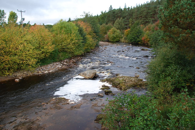
The village is surrounded by several outdoor attractions and activities. The nearby Loch Ness provides opportunities for fishing and boating, while the surrounding hills are perfect for hiking and exploring the scenic trails. Additionally, the area is known for its diverse wildlife, including red deer, golden eagles, and red squirrels, making it a haven for nature enthusiasts.
While Bogroy offers a serene and peaceful atmosphere, it is also conveniently located near Inverness, allowing residents and visitors to easily access the amenities and services of a larger city. The village is well-connected by road and public transportation, making it accessible for both locals and tourists alike.
If you have any feedback on the listing, please let us know in the comments section below.
Bogroy Images
Images are sourced within 2km of 57.285737/-3.8243476 or Grid Reference NH9023. Thanks to Geograph Open Source API. All images are credited.


Bogroy is located at Grid Ref: NH9023 (Lat: 57.285737, Lng: -3.8243476)
Unitary Authority: Highland
Police Authority: Highlands and Islands
What 3 Words
///gently.asks.collapsed. Near Aviemore, Highland
Nearby Locations
Related Wikis

Bogroy
Bogroy is a small crofting village, located 0.5 miles northwest of Carrbridge, in Strathspey, in the county of Inverness-shire, Scottish Highlands and...
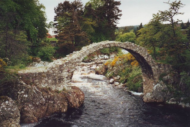
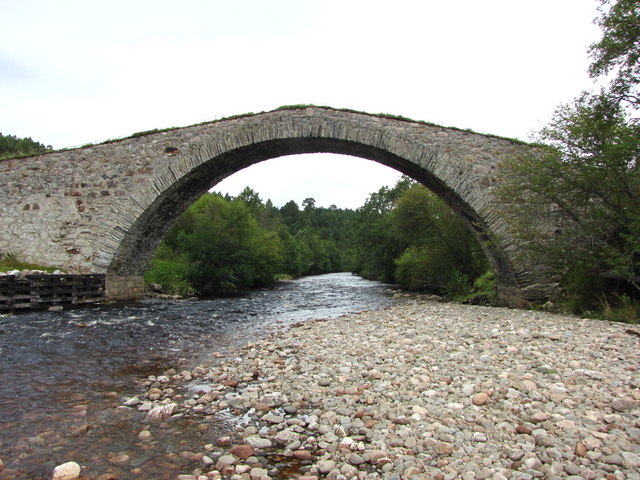
Carrbridge Packhorse Bridge
Carrbridge Packhorse Bridge, also known as Coffin Bridge, is a bridge in the village of Carrbridge in the Highlands of Scotland. The bridge was built in...
Packhorse bridge
A packhorse bridge is a bridge intended to carry packhorses (horses loaded with sidebags or panniers) across a river or stream. Typically a packhorse bridge...
Carrbridge
Carrbridge (Scots: Carrbrig, Scottish Gaelic: Drochaid Chàrr) is a village in Badenoch and Strathspey in the Scottish Highlands. It lies off the A9 on...

Carrbridge railway station
Carrbridge railway station serves the village of Carrbridge, Highland, Scotland. The railway station is managed by ScotRail and is on the Highland Main...
Landmark Forest Adventure Park
Landmark Forest Adventure Park is a nature-based theme and adventure park in the village of Carrbridge, Highlands, Scotland. == Attractions == == References... ==
Sluggan Bridge
Sluggan Bridge is a bridge across the River Dulnain. == History == The present bridge replaces a two-arched bridge of 32 feet (9.8 m) span built by George...
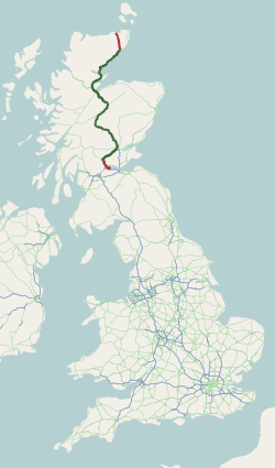
A9 road (Scotland)
The A9 is a major road in Scotland running from the Falkirk council area in central Scotland to Scrabster Harbour, Thurso in the far north, via Stirling...
Nearby Amenities
Located within 500m of 57.285737,-3.8243476Have you been to Bogroy?
Leave your review of Bogroy below (or comments, questions and feedback).