Bogindollo

Settlement in Angus

Scotland

Bogindollo

North side of Carse Hill
North side of Carse Hill Credit: Mike Pennington

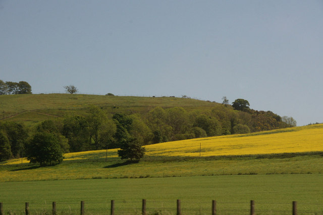
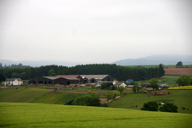
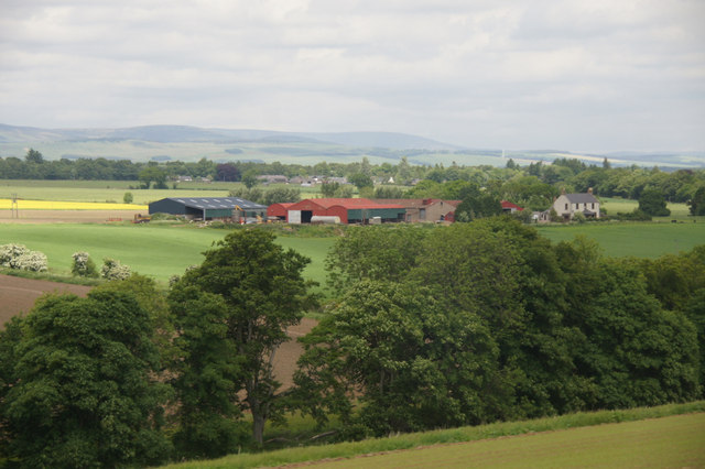
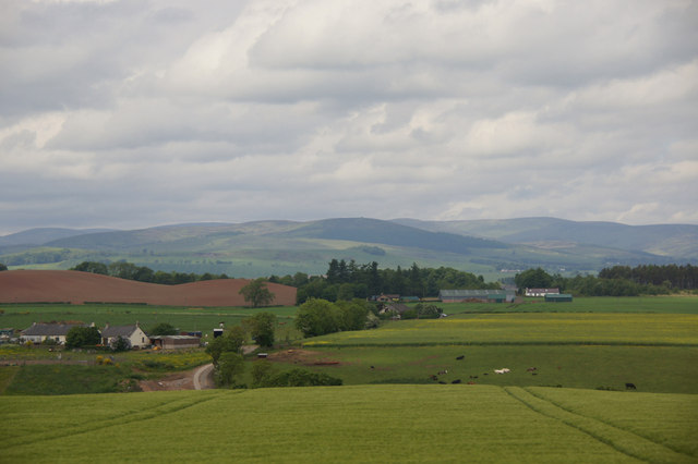
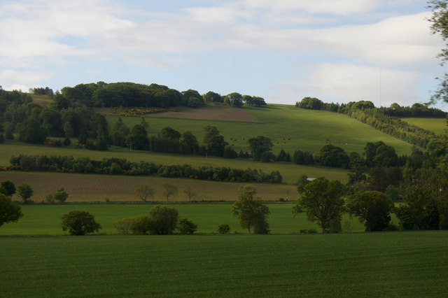
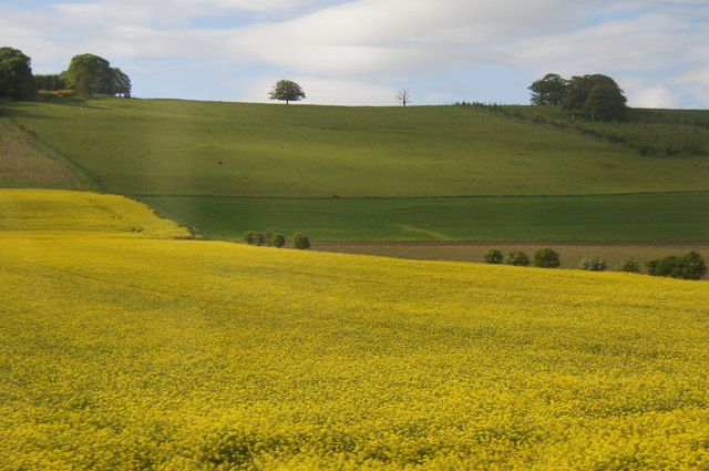
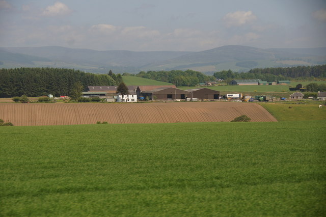
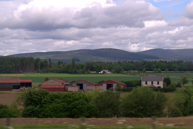
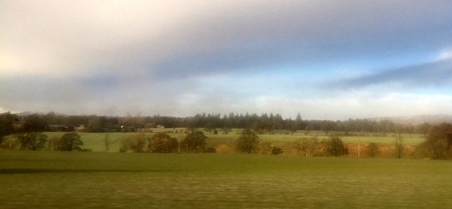
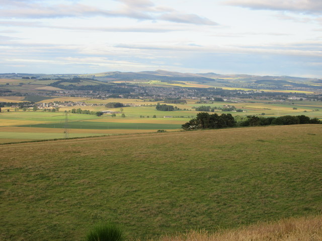
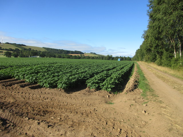
Bogindollo is a small village located in the county of Angus, Scotland. Situated approximately 7 miles north of the town of Forfar, Bogindollo is nestled in a picturesque rural setting, surrounded by rolling hills and farmland.

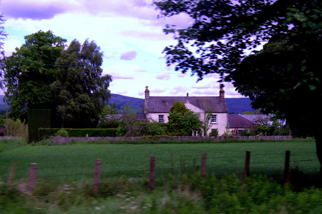
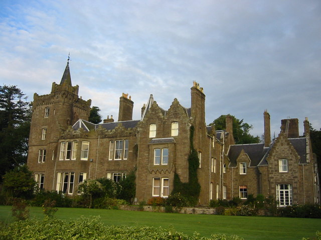
The village itself is relatively small, with a population of around 300 residents. It is characterized by a charming collection of traditional stone cottages, giving it a quaint and timeless feel. The community in Bogindollo is close-knit, with a strong sense of camaraderie and neighborly support.

Although small in size, Bogindollo offers a range of amenities and services for its residents. These include a local convenience store, a post office, and a primary school, ensuring that the basic needs of the community are met. For further amenities, residents often venture into nearby towns such as Forfar.

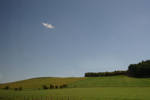
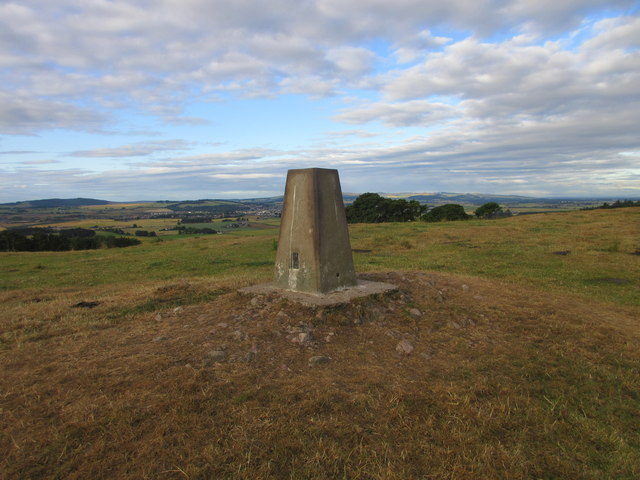
Nature lovers and outdoor enthusiasts are drawn to Bogindollo for its stunning natural surroundings. The village is situated near the Angus Glens, a popular destination for hiking, wildlife spotting, and outdoor activities. The glens offer a diverse landscape, including rugged mountains, picturesque lochs, and dense forests, providing ample opportunities for exploration and adventure.

Overall, Bogindollo is a charming and peaceful village, offering a tranquil lifestyle amidst beautiful natural surroundings. Its tight-knit community and scenic location make it an attractive place to live for those seeking a slower pace of life and a strong sense of community.

If you have any feedback on the listing, please let us know in the comments section below.

Bogindollo Images

Images are sourced within 2km of 56.687689/-2.8611096 or Grid Reference NO4755. Thanks to Geograph Open Source API. All images are credited.

North side of Carse Hill
Trees along burn at Parkford, north of Forfar
Approaching the Oathlaw turnoff Photographer is above the southbound travel lanes of A90.
Approaching the Oathlaw turnoff
Photographer is above the southbound travel lanes of A90.
Bridge At Justinhaugh View Of The Bridge At Justinhaugh
Bridge At Justinhaugh
View Of The Bridge At Justinhaugh
Birkenbush farm, north of Forfar
Bogindollo farm, Oathlaw
Birkenbush, near Forfar With Battledykes in the background.
Birkenbush, near Forfar
With Battledykes in the background.
Fields at Oathlaw
Fields at Oathlaw
Fields at Bogindollo near Forfar
Birkenbush, north of Forfar
House at West Mains of Finavon
Bogindollo Farm, near Oathlaw
Field at Clatterha'
Field at Clatterha'
Looking down the Hill of Finavon A view south-westwards down the Hill of Finavon, with the town of Forfar and the Sidlaw Hills beyond.
Looking down the Hill of Finavon
A view south-westwards down the Hill of Finavon, with the town of Forfar and the Sidlaw Hills beyond.
Carse Bank Trig Pillar The triangulation pillar above Carse Bank on the west side of Finavon Hill, looking south-westwards.
Carse Bank Trig Pillar
The triangulation pillar above Carse Bank on the west side of Finavon Hill, looking south-westwards.
A90 near Parkford The A90 dual-carriageway on the southbound side approaching the Bogindollo turn off.
A90 near Parkford
The A90 dual-carriageway on the southbound side approaching the Bogindollo turn off.
Golden field of barley Field next to the A90 at the northern foot of the Hill of Finavon.
Golden field of barley
Field next to the A90 at the northern foot of the Hill of Finavon.
Potato field by the A90 Field of potatoes on the southbound side of the A90 near Finavon.
Potato field by the A90
Field of potatoes on the southbound side of the A90 near Finavon.
Show me another place!

Bogindollo is located at Grid Ref: NO4755 (Lat: 56.687689, Lng: -2.8611096)

Unitary Authority: Angus

Police Authority: Tayside

What 3 Words

///taped.plugged.mingles. Near Forfar, Angus

Related Wikis

Oathlaw

Oathlaw is a village in Angus, Scotland, 4 miles north of Forfar. == References ==

Battledykes

Battledykes is a Roman camp slightly to the north of Forfar, Scotland. According to Hector Boece, Pictish chiefs met at a castle by Forfar Loch to plan...

Justinhaugh railway station

Justinhaugh railway station served the hamlet of Justinhaugh, Angus, Scotland, from 1895 to 1952 on the Forfar and Brechin Railway. == History == The station...

Milton of Finavon

Milton of Finavon is a hamlet in Angus, Scotland that lies adjacent to the A90 road on its southern side by the River South Esk. It is approximately 5...

Finavon Castle

Finavon Castle lies on the River South Esk, about a quarter of a mile south of Milton of Finavon village and five miles to the north-east of Forfar in...

Tannadice, Angus

Tannadice is a village in Angus, Scotland that lies on the River South Esk and is 4 miles north of Forfar. The estate of Tannadice was formerly owned by...

Finavon

Finavon is a small settlement in Angus, Scotland. Its Ordnance Survey grid reference is NO4957. == References ==

Tannadice railway station

Tannadice railway station served the village of Tannadice, Angus, Scotland, from 1895 to 1952 on the Forfar and Brechin Railway. == History == The station...

Nearby Amenities

Located within 500m of 56.687689,-2.8611096
Bus Stop
Hillview
Bus: yes
Naptan AtcoCode: 6490IM017
Naptan Bearing: S
Naptan BusStopType: CUS
Naptan CommonName: Hillview
Naptan Indicator: opp
Naptan NaptanCode: 26423697
Naptan Street: Unclassified Road
Naptan Verified: no
Public Transport: platform
Source: naptan_import
Lat/Long: 56.6875257/-2.8610688
Bus Stop
Hillview
Bus: yes
Local Ref: AT
Naptan AtcoCode: 6490IM1715
Naptan Bearing: N
Naptan BusStopType: CUS
Naptan CommonName: Hillview
Naptan Indicator: at
Naptan NaptanCode: 26427249
Naptan Street: Unclassified Road
Naptan Verified: no
Public Transport: platform
Source: naptan_import
Lat/Long: 56.6875245/-2.8611957
Bus Stop
A90 Road End
Bench: no
Bin: no
Bus: yes
Lit: no
Local Ref: AT
Naptan AtcoCode: 6490IM1716
Naptan Bearing: NE
Naptan BusStopType: CUS
Naptan CommonName: A90 Road End
Naptan Indicator: at
Naptan NaptanCode: 26427252
Naptan Street: A90
Naptan Verified: no
Public Transport: platform
Shelter: no
Source: naptan_import
Tactile Paving: no
Lat/Long: 56.6837151/-2.8593489
Bogindollo
Is In: Angus, Scotland,UK
Name Gd: Bog an Dalach
Place: village
Lat/Long: 56.6874339/-2.8618959
Bogindollo
Traffic Sign: city_limit
Traffic Sign Direction: backward
Lat/Long: 56.6863229/-2.8617747
Bogindollo
Traffic Sign: city_limit
Traffic Sign Direction: forward
Lat/Long: 56.6884731/-2.8609854
Passing Place
Lat/Long: 56.6864479/-2.8617578
Power: pole
Lat/Long: 56.6845409/-2.8664704
Power: pole
Lat/Long: 56.6849409/-2.8668404
Power: pole
Lat/Long: 56.685434/-2.8672905
Power: pole
Lat/Long: 56.6867322/-2.8685584
Power: pole
Lat/Long: 56.6876486/-2.8621295
Power: pole
Lat/Long: 56.6879967/-2.8632018
Power: pole
Lat/Long: 56.6882815/-2.8640902
Power: pole
Lat/Long: 56.6886749/-2.865318
Power: pole
Lat/Long: 56.6888574/-2.8658624
Power: pole
Lat/Long: 56.6886154/-2.8668215
Power: pole
Lat/Long: 56.6883928/-2.8677665
Power: pole
Lat/Long: 56.6881663/-2.8687469
Material: wood
Power: pole
Lat/Long: 56.6833185/-2.8620994
Power: pole
Lat/Long: 56.6833501/-2.8612099
Power: pole
Lat/Long: 56.6834218/-2.8603625
Traffic Calming: island
Lat/Long: 56.6833182/-2.8604441
The data included in this document is from www.openstreetmap.org. The data is made available under ODbL.

Have you been to Bogindollo?

Leave your review of Bogindollo below (or comments, questions and feedback).