Boghead

Settlement in Lanarkshire

Scotland

Boghead

The road to Boghead This road used to go straight on to Kirkmuirhill, with a side turning to the left to Boghead;  however, the 'straight-on' part was closed, leaving the road with a difficult and poorly cambered left bend.
The road to Boghead Credit: Gordon Brown

Boghead is a small village located in the county of Lanarkshire, Scotland. Situated approximately 4 miles southeast of the town of Lesmahagow, it is part of the South Lanarkshire council area. Despite being a small village, Boghead has a rich history and a close-knit community.

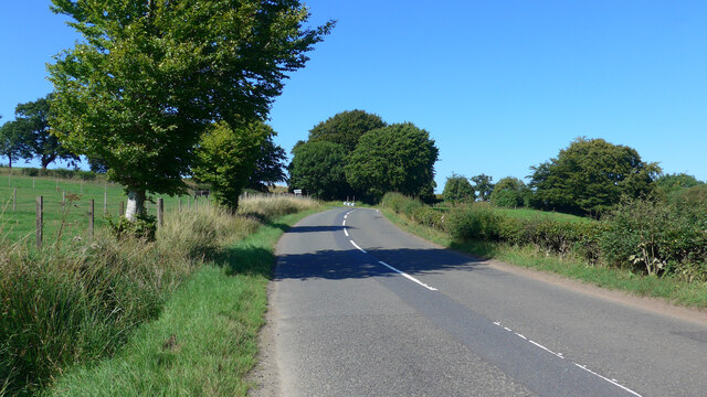
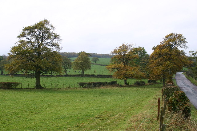
The village is surrounded by picturesque countryside, characterized by rolling hills and lush green fields. It offers a peaceful and rural setting for its residents, with a tranquil atmosphere that attracts those seeking a quieter lifestyle away from the hustle and bustle of larger towns.

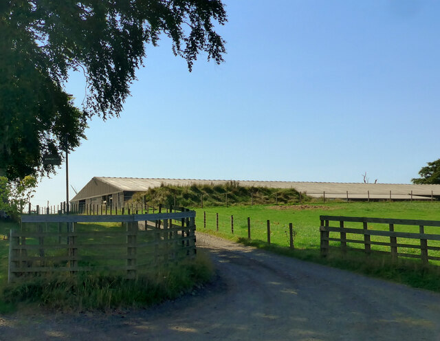
Boghead is known for its agricultural heritage, with farming being a prevalent occupation in the area. The fertile soil and favorable climate make it suitable for a variety of crops and livestock farming. The village is also home to some small-scale businesses and local shops, providing essential goods and services to the community.

In terms of amenities, Boghead has a primary school, providing education for local children, and a village hall that serves as a social hub for community events and gatherings. Additionally, there are several scenic walking trails and outdoor recreational areas nearby, allowing residents and visitors to enjoy the natural beauty of the surrounding landscape.

Although Boghead may not have extensive facilities or attractions, its charm lies in its simplicity and close community spirit. The village offers a peaceful and idyllic retreat for those seeking a tranquil countryside lifestyle in the heart of Lanarkshire.

If you have any feedback on the listing, please let us know in the comments section below.
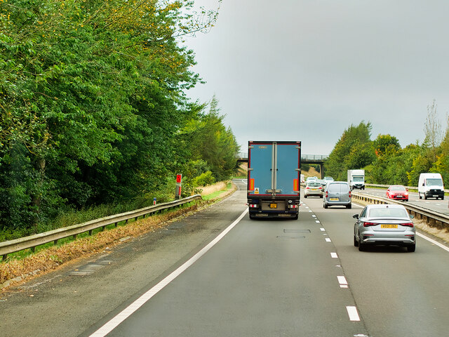
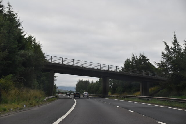
Boghead Images

Images are sourced within 2km of 55.656692/-3.9430562 or Grid Reference NS7742. Thanks to Geograph Open Source API. All images are credited.

The road to Boghead This road used to go straight on to Kirkmuirhill, with a side turning to the left to Boghead;  however, the 'straight-on' part was closed, leaving the road with a difficult and poorly cambered left bend.
The road to Boghead
This road used to go straight on to Kirkmuirhill, with a side turning to the left to Boghead; however, the 'straight-on' part was closed, leaving the road with a difficult and poorly cambered left bend.
Kypehall roadend
Kypehall roadend
M74 Motorway near to Kirkmuirhill, The A74(M) and M74 form a major motorway which runs for over 80 miles in Scotland. Following an extension opened on 28 June 2011, it connects the M8 motorway west of Glasgow to the English border at Gretna,where it becomes the M6. In conjunction with the M6, it forms one of the two major cross-border routes between Scotland and England. As the motorway is one continuous route and has a continuous junction numbering system, the entire route is often erroneously referred to as M74 although, the section south of Abington (more than half its length) is officially the A74(M).

More information :
<span class="nowrap"><a title="http://www.sabre-roads.org.uk/wiki/index.php?title=M74/A74(M)" rel="nofollow ugc noopener" href="http://www.sabre-roads.org.uk/wiki/index.php?title=M74/A74(M)">Link</a><img style="margin-left:2px;" alt="External link" title="External link - shift click to open in new window" src="https://s1.geograph.org.uk/img/external.png" width="10" height="10"/></span>  SABRE Wiki
<span class="nowrap"><a title="http://en.wikipedia.org/wiki/A74(M)_and_M74_motorways" rel="nofollow ugc noopener" href="http://en.wikipedia.org/wiki/A74(M)_and_M74_motorways">Link</a><img style="margin-left:2px;" alt="External link" title="External link - shift click to open in new window" src="https://s1.geograph.org.uk/img/external.png" width="10" height="10"/></span>  Wikipedia
<span class="nowrap"><a title="http://www.cbrd.co.uk/motorway/m74" rel="nofollow ugc noopener" href="http://www.cbrd.co.uk/motorway/m74">Link</a><img style="margin-left:2px;" alt="External link" title="External link - shift click to open in new window" src="https://s1.geograph.org.uk/img/external.png" width="10" height="10"/></span>  cbrd
M74 Motorway near to Kirkmuirhill,
The A74(M) and M74 form a major motorway which runs for over 80 miles in Scotland. Following an extension opened on 28 June 2011, it connects the M8 motorway west of Glasgow to the English border at Gretna,where it becomes the M6. In conjunction with the M6, it forms one of the two major cross-border routes between Scotland and England. As the motorway is one continuous route and has a continuous junction numbering system, the entire route is often erroneously referred to as M74 although, the section south of Abington (more than half its length) is officially the A74(M). More information : LinkExternal link SABRE Wiki LinkExternal link Wikipedia LinkExternal link cbrd
Vere Rd Bridge, M74 The A74(M) & M74  run over 80 miles from the M6 at the Scottish border near Gretna to the M8 at Glasgow. This is one of the two most important routeways into Scotland from the south. The last stretch of the M74 opened in 2011 (see <a title="https://www.geograph.org.uk/snippet/590" href="https://www.geograph.org.uk/snippet/590">Link</a> ).
Wikipedia: <span class="nowrap"><a title="http://en.wikipedia.org/wiki/A74(M)_and_M74_motorways" rel="nofollow ugc noopener" href="http://en.wikipedia.org/wiki/A74(M)_and_M74_motorways">Link</a><img style="margin-left:2px;" alt="External link" title="External link - shift click to open in new window" src="https://s1.geograph.org.uk/img/external.png" width="10" height="10"/></span>
Vere Rd Bridge, M74
The A74(M) & M74 run over 80 miles from the M6 at the Scottish border near Gretna to the M8 at Glasgow. This is one of the two most important routeways into Scotland from the south. The last stretch of the M74 opened in 2011 (see Link ). Wikipedia: LinkExternal link
Boghead village
Boghead village
Autumn scene
Autumn scene
B7086 looking towards M74 bridge at Kirkmuirhill
Farm Buildings at High Blackwood Yards
Townhead farm
Townhead farm
Junction at Boghead
Junction at Boghead
The White Corse Burn near Dykehead
High Blackwood Yards roadend
Just to the right of Rogerhill Farm
From Rogerhill to Bent From the old railway line next to Rogerhill Farm, looking out towards a house by Bent School.
From Rogerhill to Bent
From the old railway line next to Rogerhill Farm, looking out towards a house by Bent School.
Dunduff Quarry near Boghead You can see the windmills on the other side of the Clyde in the distance.
Dunduff Quarry near Boghead
You can see the windmills on the other side of the Clyde in the distance.
Line of trees Small forest with Tinto Hill in background.
Line of trees
Small forest with Tinto Hill in background.
Blackwood Estate Road
Remains of Smithy, Boghead The only remaining 2 walls of the old smithy, on the Strathaven road, Boghead
Remains of Smithy, Boghead
The only remaining 2 walls of the old smithy, on the Strathaven road, Boghead
Show me another place!

Boghead is located at Grid Ref: NS7742 (Lat: 55.656692, Lng: -3.9430562)

Unitary Authority: South Lanarkshire

Police Authority: Lanarkshire

What 3 Words

///strikers.perused.shipped. Near Blackwood, South Lanarkshire

Nearby Locations

Boghead

Related Wikis

Boghead

Boghead is a small village in South Lanarkshire, west central Scotland. It is about 23 miles (37 km) southeast of Glasgow and sits nearby to the River...
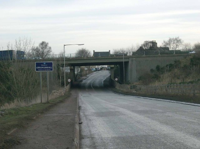
Kirkmuirhill

Kirkmuirhill is a village in South Lanarkshire, Scotland. It borders Blackwood, near Lanark and is sited near Junction 9 of the M74 motorway. Its postal...

Blackwood, South Lanarkshire

Blackwood is a village which borders Kirkmuirhill, near Lanark in the central belt of Scotland. It has a few small shops, a Roman Catholic church and a...

Draffan

Draffan is a farm located 4 miles (6 km) southeast of Larkhall and a mile (1.5 km) west of the M74 motorway, in South Lanarkshire, Scotland. == References... ==

Auchenheath railway station

Auchenheath railway station was just outside Auchenheath, a hamlet in the county of South Lanarkshire, Scotland. It was served by local trains on the Coalburn...

Cartland, South Lanarkshire

Cartland is a village in South Lanarkshire, Scotland. == See also == List of places in South Lanarkshire

Auchenheath

Auchenheath is a small village in South Lanarkshire, Scotland. It is on the River Nethan and is located near Blackwood, Kirkmuirhill, and Lanark. Auchenheath...

Lesmahagow High School

Lesmahagow High School is a non-denominational secondary school in Lesmahagow, South Lanarkshire, Scotland. The new school building opened in 2007. The...

Nearby Amenities

Located within 500m of 55.656692,-3.9430562
Boghead
Is In: South Lanarkshire
Place: village
Source: survey
Wikidata: Q4937618
Lat/Long: 55.6565887/-3.9429514
Telephone
Defibrillator
Booth: K6
Covered: booth
Defibrillator Location: inside red phone box on Lesmahagow Road, Boghead
Emergency: defibrillator
Man Made: telephone_box
Lat/Long: 55.6550589/-3.9412089
Bus Stop
Lesmahagow Road
Naptan AtcoCode: 61501456
Naptan Bearing: W
Naptan CommonName: Lesmahagow Road
Naptan Indicator: Near Leshmahagow Road
Naptan Landmark: Leshmahagow Road
Naptan NaptanCode: 75234894
Naptan Street: Strathaven Road
Naptan Verified: no
Source: naptan_import
Lat/Long: 55.6566947/-3.9421842
Post Box
Post Box Type: lamp
Royal Cypher: scottish_crown
Source: survey
Lat/Long: 55.6555484/-3.9416478
Turning Circle
Lat/Long: 55.6545852/-3.941592
Power: pole
Lat/Long: 55.6527344/-3.9466325
Power: pole
Lat/Long: 55.653113/-3.9456031
Power: pole
Lat/Long: 55.6534704/-3.9446342
Power: pole
Lat/Long: 55.653689/-3.9436445
Power: pole
Lat/Long: 55.6540393/-3.9420942
Power: pole
Lat/Long: 55.6541875/-3.9415045
Power: pole
Lat/Long: 55.6548205/-3.9469461
Power: pole
Lat/Long: 55.6540552/-3.9468273
Power: pole
Lat/Long: 55.6531947/-3.9466939
Power: pole
Lat/Long: 55.6551309/-3.9380675
Power: pole
Lat/Long: 55.6555458/-3.9372611
Power: pole
Lat/Long: 55.6559526/-3.9364318
Power: pole
Lat/Long: 55.6563593/-3.9356046
The data included in this document is from www.openstreetmap.org. The data is made available under ODbL.

Have you been to Boghead?

Leave your review of Boghead below (or comments, questions and feedback).