Blairmore
Settlement in Nairnshire
Scotland
Blairmore

Blairmore is a small village located in the county of Nairnshire, in the Highland region of Scotland. Situated on the eastern coast of Scotland, Blairmore is an idyllic coastal community that offers stunning views of the Moray Firth.
The village is home to a relatively small population, with approximately 500 residents. It is known for its peaceful and close-knit community, where neighbors often come together to participate in various social events and activities. The village has a strong sense of community spirit, with local organizations and clubs playing an essential role in bringing residents together.
Blairmore is surrounded by breathtaking natural beauty. The village is nestled between the picturesque countryside and the stunning coastline, providing residents and visitors with ample opportunities to explore and enjoy outdoor activities. The nearby beaches offer sandy shores and are popular for walks, picnics, and water sports.
Despite its small size, Blairmore has a few amenities to offer its residents. These include a local convenience store, a primary school, and a community hall that serves as a hub for various events and gatherings. For further amenities, residents can easily access the nearby town of Nairn, which is just a short drive away.
Overall, Blairmore is a charming and tranquil village that appeals to those seeking a peaceful coastal lifestyle. Its stunning natural surroundings, strong community spirit, and close proximity to larger towns make it an attractive place to call home.
If you have any feedback on the listing, please let us know in the comments section below.
Blairmore Images
Images are sourced within 2km of 57.537471/-3.8947484 or Grid Reference NH8651. Thanks to Geograph Open Source API. All images are credited.


Blairmore is located at Grid Ref: NH8651 (Lat: 57.537471, Lng: -3.8947484)
Unitary Authority: Highland
Police Authority: Highlands and Islands
What 3 Words
///bedspread.router.quality. Near Nairn, Highland
Nearby Locations
Related Wikis

Piperhill
Piperhill is a village, located four miles south of Nairn in Nairnshire, Scottish Highlands and is in the Scottish council area of Highland.
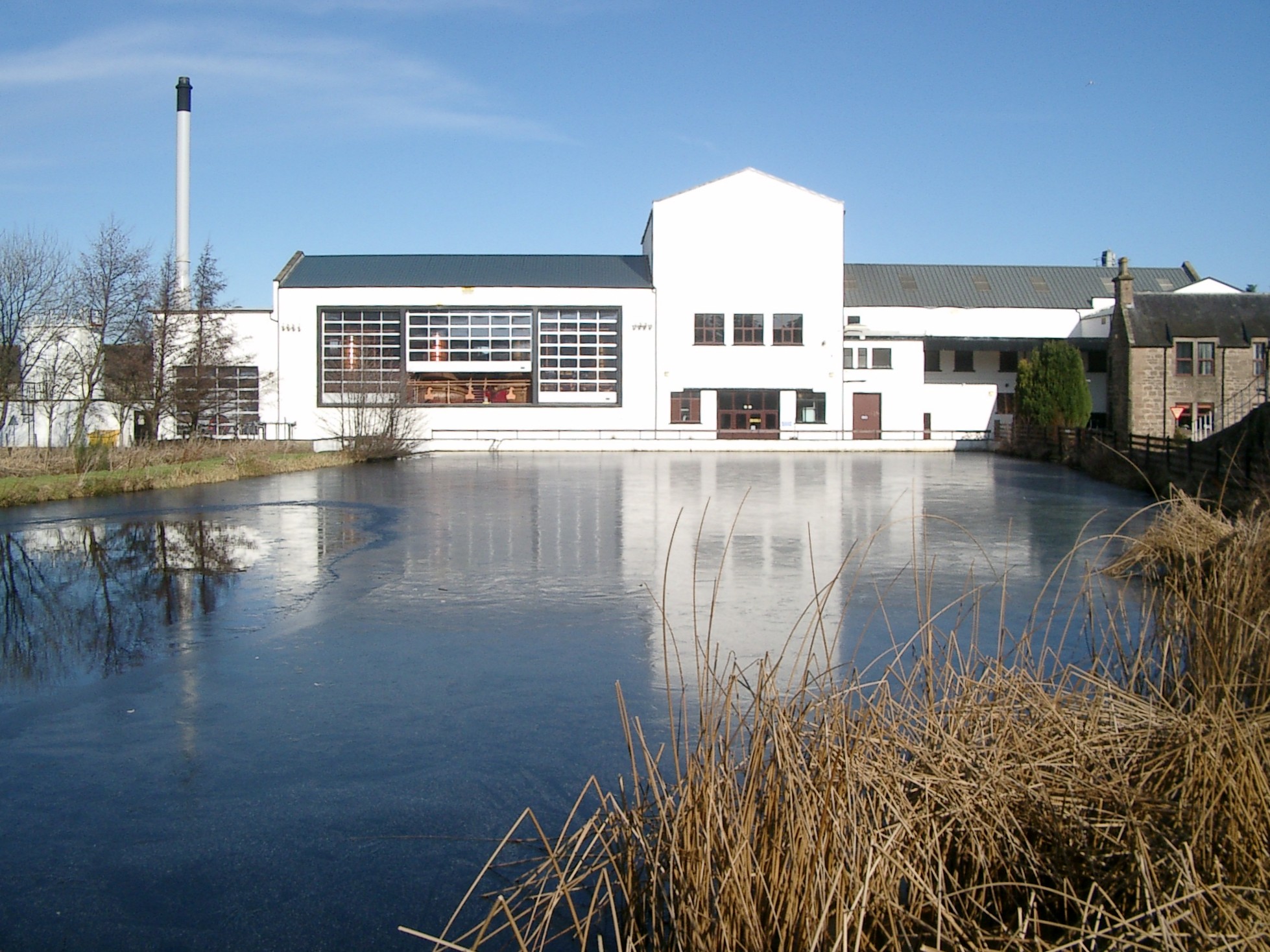
Royal Brackla distillery
Royal Brackla distillery is a Highland Scotch whisky distillery on the Cawdor Estate, near Nairn in Scotland. The distillery is operated by John Dewar...
RAF Brackla
Royal Air Force Brackla or more simply RAF Brackla is a former Royal Air Force satellite station located in Scotland. == History == The following units...
Culcharry
Culcharry is a small residential settlement, close to the village of Cawdor and the hamlet of Brackla, lying 4 miles southwest of Nairn, in Nairnshire...
Geddes House
The Geddes House is a Georgian Neoclassical style building near Nairn, Scotland. It was built in 1780 for George Mackintosh and is currently self-catering...
Geddes, Highland
Geddes (Scottish Gaelic: Geadais) is a small village located 5 km to the south of Nairn, in the Highland council area of Scotland. == Geddes House == Geddes...

Cawdor Castle
Cawdor Castle is a castle in the parish of Cawdor in Nairnshire, Scotland. It is built around a 15th-century tower house, with substantial additions in...

Rait Castle
Rait Castle is a ruined hall-house castle dating from the thirteenth century, situated just south of Nairn near Inverness, Scotland. It is a scheduled...
Nearby Amenities
Located within 500m of 57.537471,-3.8947484Have you been to Blairmore?
Leave your review of Blairmore below (or comments, questions and feedback).