Blackhills

Settlement in Aberdeenshire

Scotland

Blackhills

Aberdeenshire staggered junction A minor road meets the B9033 in the flat Aberdeenshire landscape, with Newark Farm in the right background.   The B9033 is about 12 km long and loops around from Lumms Crossroads on the A90 to a roundabout at Fraserburgh: <span class="nowrap"><a title="https://www.sabre-roads.org.uk/wiki/index.php?title=B9033" rel="nofollow ugc noopener" href="https://www.sabre-roads.org.uk/wiki/index.php?title=B9033">Link</a><img style="margin-left:2px;" alt="External link" title="External link - shift click to open in new window" src="https://s1.geograph.org.uk/img/external.png" width="10" height="10"/></span> .
Aberdeenshire staggered junction Credit: Bill Harrison

Blackhills is a small village located in the Aberdeenshire region of Scotland. Situated approximately 30 miles northwest of Aberdeen, it is nestled in a picturesque landscape, surrounded by rolling hills and lush green fields. The village is known for its tranquil and idyllic setting, making it a popular destination for those seeking a peaceful retreat.

Despite its small size, Blackhills offers a range of amenities to its residents and visitors. There is a local convenience store where one can find basic necessities, and a quaint village pub where locals often gather to socialize and enjoy a pint. The village also has a primary school, providing education to the younger members of the community.

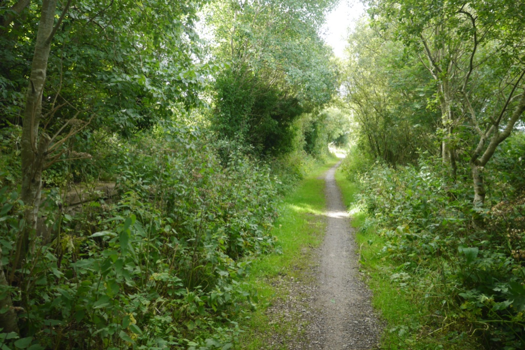
Blackhills is surrounded by natural beauty, with various walking trails and hiking routes in the nearby hills. The area is known for its wildlife, and it is not uncommon to spot deer and a variety of bird species in the surrounding countryside. Additionally, the village is within close proximity to the renowned Cairngorms National Park, offering opportunities for outdoor enthusiasts to engage in activities such as mountain biking, skiing, and hiking.

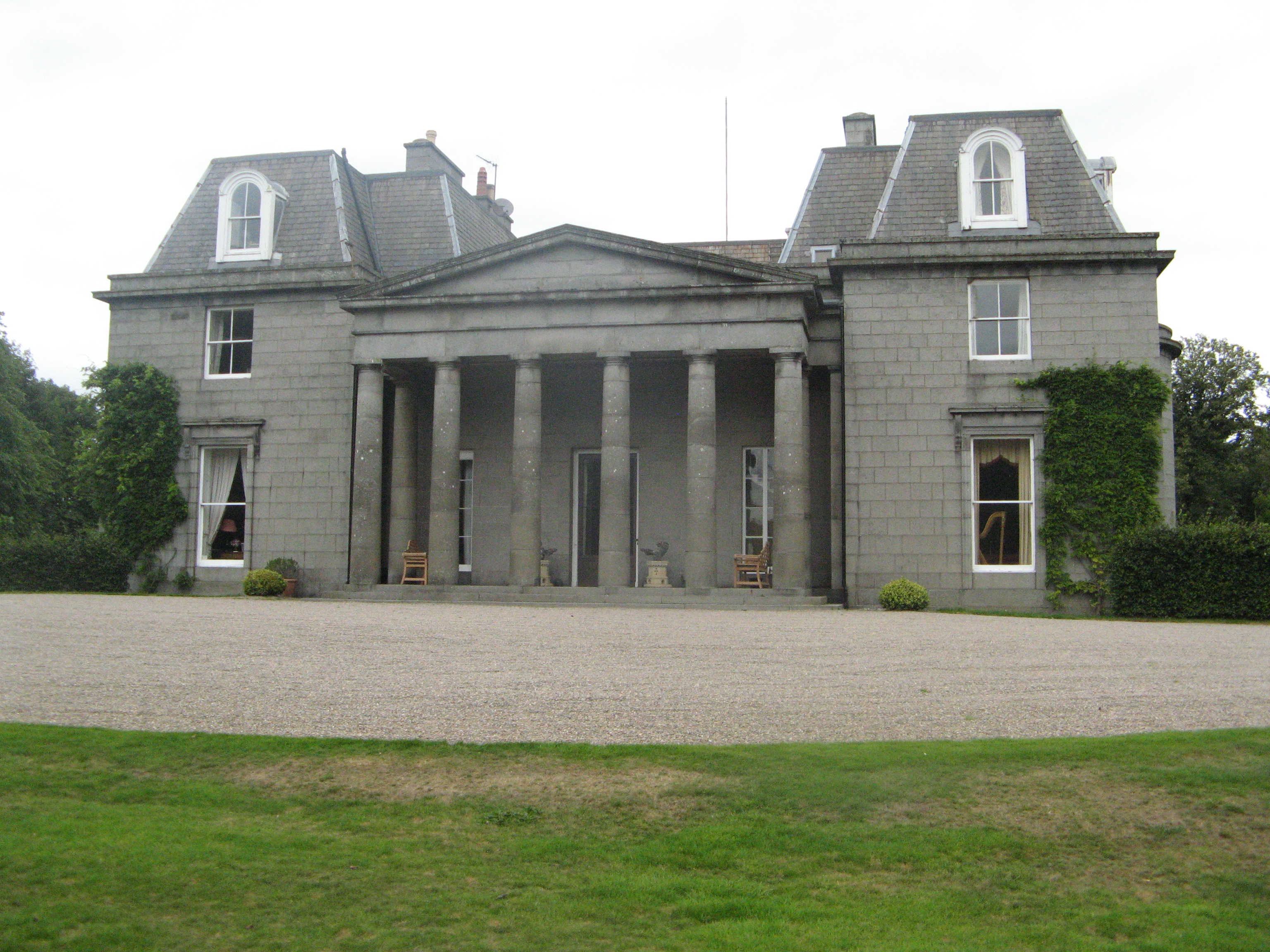
The village has a rich history, with several historic landmarks and sites worth exploring. One notable attraction is the Blackhills House, a grand mansion that dates back to the 18th century. The house is known for its stunning architecture and beautiful gardens, which are occasionally open to the public for tours.

Overall, Blackhills provides a serene and picturesque setting, making it an appealing destination for those looking to escape the hustle and bustle of city life and immerse themselves in Scotland's natural beauty.

If you have any feedback on the listing, please let us know in the comments section below.
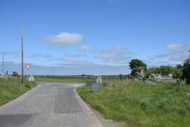
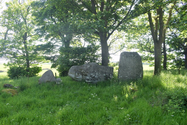
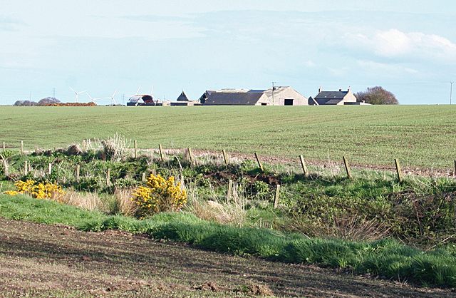
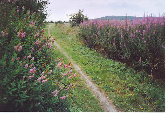
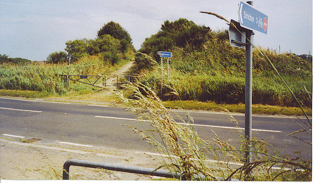
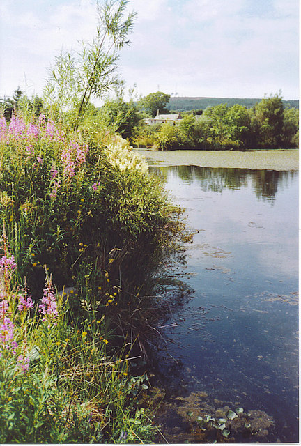
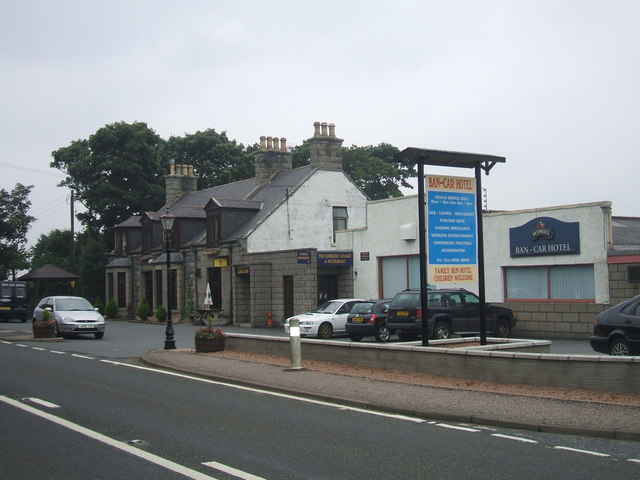
Blackhills Images

Images are sourced within 2km of 57.602601/-1.9717918 or Grid Reference NK0156. Thanks to Geograph Open Source API. All images are credited.

Aberdeenshire staggered junction A minor road meets the B9033 in the flat Aberdeenshire landscape, with Newark Farm in the right background.   The B9033 is about 12 km long and loops around from Lumms Crossroads on the A90 to a roundabout at Fraserburgh: <span class="nowrap"><a title="https://www.sabre-roads.org.uk/wiki/index.php?title=B9033" rel="nofollow ugc noopener" href="https://www.sabre-roads.org.uk/wiki/index.php?title=B9033">Link</a><img style="margin-left:2px;" alt="External link" title="External link - shift click to open in new window" src="https://s1.geograph.org.uk/img/external.png" width="10" height="10"/></span> .
Aberdeenshire staggered junction
A minor road meets the B9033 in the flat Aberdeenshire landscape, with Newark Farm in the right background. The B9033 is about 12 km long and loops around from Lumms Crossroads on the A90 to a roundabout at Fraserburgh: LinkExternal link .
Berrybrae stone circle: recumbent stone and flankers This site photographs better in the winter when the trees admit more light.  For more, see Canmore listing 21099: <span class="nowrap"><a title="https://canmore.org.uk/site/21099/berrybrae" rel="nofollow ugc noopener" href="https://canmore.org.uk/site/21099/berrybrae">Link</a><img style="margin-left:2px;" alt="External link" title="External link - shift click to open in new window" src="https://s1.geograph.org.uk/img/external.png" width="10" height="10"/></span> .
Berrybrae stone circle: recumbent stone and flankers
This site photographs better in the winter when the trees admit more light. For more, see Canmore listing 21099: LinkExternal link .
Ridinghill Farm A field of brassicas of some description with the house and steading at Ridinghill beyond.
Ridinghill Farm
A field of brassicas of some description with the house and steading at Ridinghill beyond.
Park of Logie A traditional 18th century farmhouse, with Mormond Hill in the distance.
Park of Logie
A traditional 18th century farmhouse, with Mormond Hill in the distance.
Berrybrae Recumbent Stone Circle (1) This circle is inside a small circular wood, making it quite difficult to photograph. The recumbent and three other stones are still in their original positions, and one stone has been re-erected. See <span class="nowrap"><a title="http://canmore.rcahms.gov.uk/en/site/21099/details/berrybrae/" rel="nofollow ugc noopener" href="http://canmore.rcahms.gov.uk/en/site/21099/details/berrybrae/">Link</a><img style="margin-left:2px;" alt="External link" title="External link - shift click to open in new window" src="https://s1.geograph.org.uk/img/external.png" width="10" height="10"/></span> for more information. <a href="https://www.geograph.org.uk/photo/4468847">NK0257 : Berrybrae Recumbent Stone Circle (2)</a>
Berrybrae Recumbent Stone Circle (1)
This circle is inside a small circular wood, making it quite difficult to photograph. The recumbent and three other stones are still in their original positions, and one stone has been re-erected. See LinkExternal link for more information. NK0257 : Berrybrae Recumbent Stone Circle (2)
Berrybrae Recumbent Stone Circle (2) The nearest stone is of red granite. To the right is the west flanker, with the recumbent beyond. See <span class="nowrap"><a title="http://canmore.rcahms.gov.uk/en/site/21099/details/berrybrae/" rel="nofollow ugc noopener" href="http://canmore.rcahms.gov.uk/en/site/21099/details/berrybrae/">Link</a><img style="margin-left:2px;" alt="External link" title="External link - shift click to open in new window" src="https://s1.geograph.org.uk/img/external.png" width="10" height="10"/></span> for more information. <a href="https://www.geograph.org.uk/photo/4468853">NK0257 : Berrybrae Recumbent Stone Circle (3)</a>
Berrybrae Recumbent Stone Circle (2)
The nearest stone is of red granite. To the right is the west flanker, with the recumbent beyond. See LinkExternal link for more information. NK0257 : Berrybrae Recumbent Stone Circle (3)
Berrybrae Recumbent Stone Circle (3) The recumbent and flankers silhouetted against the afternoon sun. The west flanker (on the right) is as it originally was, but the east flanker has broken off, leaving only a short stump standing. See <span class="nowrap"><a title="http://canmore.rcahms.gov.uk/en/site/21099/details/berrybrae/" rel="nofollow ugc noopener" href="http://canmore.rcahms.gov.uk/en/site/21099/details/berrybrae/">Link</a><img style="margin-left:2px;" alt="External link" title="External link - shift click to open in new window" src="https://s1.geograph.org.uk/img/external.png" width="10" height="10"/></span> for more information. <a href="https://www.geograph.org.uk/photo/4468858">NK0257 : Berrybrae Recumbent Stone Circle (4)</a>
Berrybrae Recumbent Stone Circle (3)
The recumbent and flankers silhouetted against the afternoon sun. The west flanker (on the right) is as it originally was, but the east flanker has broken off, leaving only a short stump standing. See LinkExternal link for more information. NK0257 : Berrybrae Recumbent Stone Circle (4)
Berrybrae Recumbent Stone Circle (4) All the surviving stones are in the west arc of the circle. The large dark one on the left is the recumbent, with the broken east flanker in front of it. The next one is still in its original position, but the one furthest to the right has been re-erected after falling over. See <span class="nowrap"><a title="http://canmore.rcahms.gov.uk/en/site/21099/details/berrybrae/" rel="nofollow ugc noopener" href="http://canmore.rcahms.gov.uk/en/site/21099/details/berrybrae/">Link</a><img style="margin-left:2px;" alt="External link" title="External link - shift click to open in new window" src="https://s1.geograph.org.uk/img/external.png" width="10" height="10"/></span> for more information. <a href="https://www.geograph.org.uk/photo/4468867">NK0257 : Berrybrae Recumbent Stone Circle (5)</a>
Berrybrae Recumbent Stone Circle (4)
All the surviving stones are in the west arc of the circle. The large dark one on the left is the recumbent, with the broken east flanker in front of it. The next one is still in its original position, but the one furthest to the right has been re-erected after falling over. See LinkExternal link for more information. NK0257 : Berrybrae Recumbent Stone Circle (5)
Berrybrae Recumbent Stone Circle (5) The recumbent here has an unusual feature in the boss in the centre of its upper surface. Behind it, in the shade, is the tallest stone of the circle, the west flanker, and the broken east flanker is on the right. The stone at the far side of the circle had fallen but was re-erected in 1976. See <span class="nowrap"><a title="http://canmore.rcahms.gov.uk/en/site/21099/details/berrybrae/" rel="nofollow ugc noopener" href="http://canmore.rcahms.gov.uk/en/site/21099/details/berrybrae/">Link</a><img style="margin-left:2px;" alt="External link" title="External link - shift click to open in new window" src="https://s1.geograph.org.uk/img/external.png" width="10" height="10"/></span> for more information. <a href="https://www.geograph.org.uk/photo/4468878">NK0257 : Berrybrae Recumbent Stone Circle (6)</a>
Berrybrae Recumbent Stone Circle (5)
The recumbent here has an unusual feature in the boss in the centre of its upper surface. Behind it, in the shade, is the tallest stone of the circle, the west flanker, and the broken east flanker is on the right. The stone at the far side of the circle had fallen but was re-erected in 1976. See LinkExternal link for more information. NK0257 : Berrybrae Recumbent Stone Circle (6)
Berrybrae Recumbent Stone Circle (6) The tall stone is the massive west flanker, and to its right is the recumbent, with its unusually-shaped upper surface. See <span class="nowrap"><a title="http://canmore.rcahms.gov.uk/en/site/21099/details/berrybrae/" rel="nofollow ugc noopener" href="http://canmore.rcahms.gov.uk/en/site/21099/details/berrybrae/">Link</a><img style="margin-left:2px;" alt="External link" title="External link - shift click to open in new window" src="https://s1.geograph.org.uk/img/external.png" width="10" height="10"/></span> for more information. See <span class="nowrap"><a title="http://canmore.rcahms.gov.uk/en/site/21099/details/berrybrae/" rel="nofollow ugc noopener" href="http://canmore.rcahms.gov.uk/en/site/21099/details/berrybrae/">Link</a><img style="margin-left:2px;" alt="External link" title="External link - shift click to open in new window" src="https://s1.geograph.org.uk/img/external.png" width="10" height="10"/></span> for more information. <a href="https://www.geograph.org.uk/photo/4468888">NK0257 : Berrybrae Recumbent Stone Circle (7)</a>
Berrybrae Recumbent Stone Circle (6)
The tall stone is the massive west flanker, and to its right is the recumbent, with its unusually-shaped upper surface. See LinkExternal link for more information. See LinkExternal link for more information. NK0257 : Berrybrae Recumbent Stone Circle (7)
Berrybrae Recumbent Stone Circle (7) From the very edge of the wooded circle, the whole extent of the circle can be seen. See <span class="nowrap"><a title="http://canmore.rcahms.gov.uk/en/site/21099/details/berrybrae/" rel="nofollow ugc noopener" href="http://canmore.rcahms.gov.uk/en/site/21099/details/berrybrae/">Link</a><img style="margin-left:2px;" alt="External link" title="External link - shift click to open in new window" src="https://s1.geograph.org.uk/img/external.png" width="10" height="10"/></span> for more information. <a href="https://www.geograph.org.uk/photo/4468895">NK0257 : Berrybrae Recumbent Stone Circle (8)</a>
Berrybrae Recumbent Stone Circle (7)
From the very edge of the wooded circle, the whole extent of the circle can be seen. See LinkExternal link for more information. NK0257 : Berrybrae Recumbent Stone Circle (8)
Berrybrae Recumbent Stone Circle (8) The stone circle is inside this small circular wood in the field. Fortunately the crop was not so well grown that it precluded visiting the circle. Later in the year, it will be impossible because the crop will be too tall. See <span class="nowrap"><a title="http://canmore.rcahms.gov.uk/en/site/21099/details/berrybrae/" rel="nofollow ugc noopener" href="http://canmore.rcahms.gov.uk/en/site/21099/details/berrybrae/">Link</a><img style="margin-left:2px;" alt="External link" title="External link - shift click to open in new window" src="https://s1.geograph.org.uk/img/external.png" width="10" height="10"/></span> for more information. <a href="https://www.geograph.org.uk/photo/4468842">NK0257 : Berrybrae Recumbent Stone Circle (1)</a>
Berrybrae Recumbent Stone Circle (8)
The stone circle is inside this small circular wood in the field. Fortunately the crop was not so well grown that it precluded visiting the circle. Later in the year, it will be impossible because the crop will be too tall. See LinkExternal link for more information. NK0257 : Berrybrae Recumbent Stone Circle (1)
Berrybrae Looking over a ditch from the very muddy field edge just beside the road.
Berrybrae
Looking over a ditch from the very muddy field edge just beside the road.
Lonmay, Old Formartine & Buchan Railway Lonmay once had a station on the Maud - Fraserburgh railway which was opened in 1965. Lonmay also has potatoes named after it eg Lonmay Pinks, which reflects well on this farming area in Buchan.
Lonmay, Old Formartine & Buchan Railway
Lonmay once had a station on the Maud - Fraserburgh railway which was opened in 1965. Lonmay also has potatoes named after it eg Lonmay Pinks, which reflects well on this farming area in Buchan.
A92 Crossing with the F&B Way A railway bridge once crossed this road, but today the Formartine 7 Buchan Way descends to ground level. The road is busy with refrigerated fish lorries thundering south from Fraserburgh ("The Broch") to the large UK cities and to France.
A92 Crossing with the F&B Way
A railway bridge once crossed this road, but today the Formartine 7 Buchan Way descends to ground level. The road is busy with refrigerated fish lorries thundering south from Fraserburgh ("The Broch") to the large UK cities and to France.
Pond on the F&B Way This attractive pond is by Kilbirnie Farm, on the Formartine & Buchan Way, west of Lonmay. Water lilies cover the far end of the water while fireweed coats the bank by the old railway line.
Pond on the F&B Way
This attractive pond is by Kilbirnie Farm, on the Formartine & Buchan Way, west of Lonmay. Water lilies cover the far end of the water while fireweed coats the bank by the old railway line.
Ban Car Hotel, Lonmay Small country hotel on Peterhead to Fraserburgh road. Large function area which is popular for local weddings.
Ban Car Hotel, Lonmay
Small country hotel on Peterhead to Fraserburgh road. Large function area which is popular for local weddings.
Berrybrae Stone Circle In a copse 50m into the field.
Berrybrae Stone Circle
In a copse 50m into the field.
Show me another place!

Blackhills is located at Grid Ref: NK0156 (Lat: 57.602601, Lng: -1.9717918)

Unitary Authority: Aberdeenshire

Police Authority: North East

What 3 Words

///dice.warping.telephone. Near Mintlaw, Aberdeenshire

Nearby Locations

Blackhills

Related Wikis

Lonmay

Lonmay (Scottish Gaelic: Lòn Magh) is a village and parish in the Buchan area of Aberdeenshire, Scotland. It lies along the A90 road, between Peterhead...

Lonmay railway station

Lonmay railway station was a railway station in Lonmay, Aberdeenshire. == History == The station was opened on 24 April 1865 by the Formartine and Buchan...

Cortes, Aberdeenshire

Cortes is a rural settlement in the Banff and Buchan area of Aberdeenshire, Scotland, situated in the parish of Rathen, 7.8 kilometres (4.8 mi) south of...

Crimonmogate

Crimonmogate is an estate near Crimond, Aberdeenshire. The estate formed part of Lonmay parish, dates back to the 14th century, and was included in the...

New Leeds

New Leeds is a planned village in the Buchan area of Aberdeenshire, Scotland, situated 5.1 kilometres (3.2 mi) east of Strichen at the foot of Mormond...
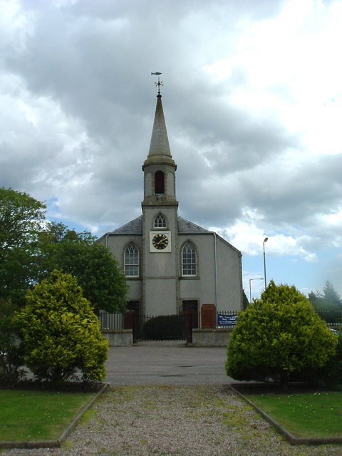
Crimond Church

Crimond Church is a Christian, Church of Scotland Presbyterian church, located on the east side of the A90 road in the centre of the village of Crimond...

Mormond Halt railway station

Mormond Halt railway station was a railway station near New Leeds, Aberdeenshire. == History == The station was opened as Mormond on 24 April 1865. It...

Crimond

Crimond is a village in Aberdeenshire, in the northeast of Scotland, located 9 miles (14 km) northwest of the port of Peterhead and just over 2 miles...

Nearby Amenities

Located within 500m of 57.602601,-1.9717918
Power: tower
Lat/Long: 57.6011422/-1.9664377
Power: tower
Lat/Long: 57.5995336/-1.9705669
Power: pole
Lat/Long: 57.6015435/-1.9721
Power: pole
Lat/Long: 57.6017944/-1.9720036
Power: pole
Lat/Long: 57.6021565/-1.971856
Power: pole
Lat/Long: 57.6022972/-1.9706967
Power: pole
Lat/Long: 57.6003457/-1.9645814
Power: pole
Lat/Long: 57.6006589/-1.9656459
Power: pole
Lat/Long: 57.6009467/-1.9666357
Power: pole
Lat/Long: 57.6012345/-1.9676727
Power: pole
Lat/Long: 57.6015709/-1.9686231
Power: pole
Lat/Long: 57.6019125/-1.9696482
Power: pole
Lat/Long: 57.6023015/-1.9707206
Power: pole
Lat/Long: 57.602583/-1.9715431
Power: pole
Lat/Long: 57.6029446/-1.9725703
Power: pole
Lat/Long: 57.6033009/-1.9736112
Power: pole
Lat/Long: 57.6036625/-1.9746521
Power: pole
Lat/Long: 57.6040463/-1.9757461
Power: pole
Lat/Long: 57.6044037/-1.9767615
Power: pole
Lat/Long: 57.6047642/-1.9777591
Power: pole
Lat/Long: 57.6026199/-1.9698529
Power: pole
Lat/Long: 57.6026125/-1.9703822
Power: pole
Lat/Long: 57.6025988/-1.9709627
Power: pole
Lat/Long: 57.6025187/-1.9717084
Power: pole
Lat/Long: 57.6034454/-1.9761377
Power: pole
Lat/Long: 57.6029615/-1.9764545
Power: pole
Lat/Long: 57.6025239/-1.9766414
Power: pole
Lat/Long: 57.6024101/-1.977336
The data included in this document is from www.openstreetmap.org. The data is made available under ODbL.

Have you been to Blackhills?

Leave your review of Blackhills below (or comments, questions and feedback).