Blackhills

Settlement in Aberdeenshire

Scotland

Blackhills

Bale stash, Red Moss A stack of round silage bales beside a road running south to Strichen.
Bale stash, Red Moss Credit: Richard Webb

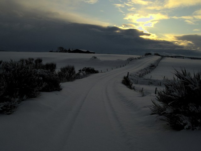
Blackhills is a small village located in Aberdeenshire, Scotland. Situated in the northeast region of the country, it lies approximately 7 miles west of the town of Peterhead. The village is nestled amidst rolling green hills and is surrounded by picturesque countryside, making it an idyllic setting for those seeking a tranquil retreat.

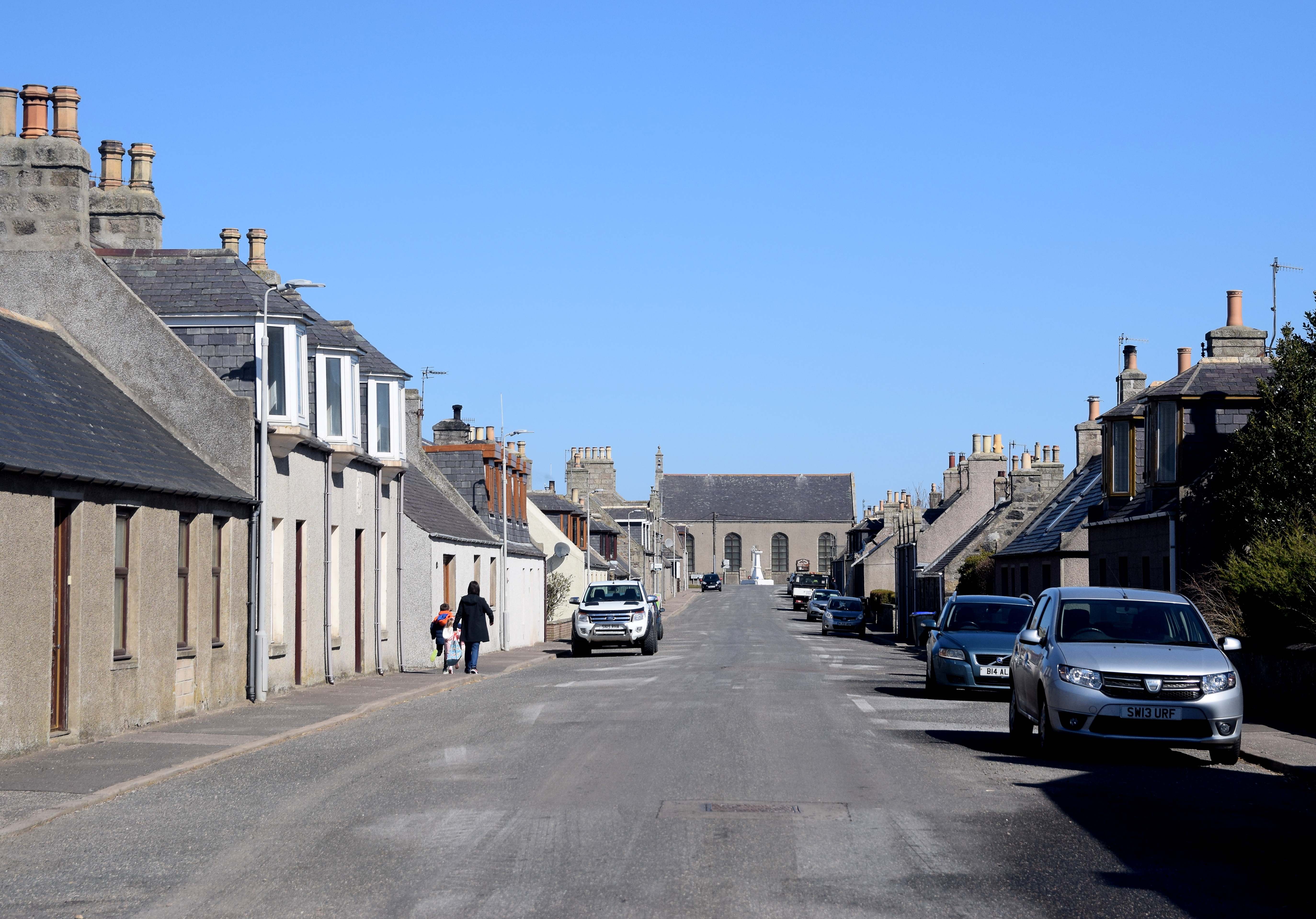
With a population of around 300 residents, Blackhills is a close-knit community that offers a peaceful and friendly atmosphere. The village is primarily residential, with a mix of traditional stone houses and more modern properties. Many of the houses enjoy stunning views of the surrounding landscape.

Although Blackhills is a relatively small village, it benefits from its proximity to larger towns like Peterhead, which provide essential amenities and services. Residents have access to schools, healthcare facilities, shops, and leisure activities within a short drive.

Nature enthusiasts will appreciate the abundance of outdoor activities available in the area. The nearby Cairngorms National Park offers opportunities for hiking, cycling, and wildlife spotting. The coastline is also easily accessible, with beautiful sandy beaches to explore.

Overall, Blackhills offers a peaceful and picturesque living environment, ideal for those seeking a rural lifestyle while still having access to nearby amenities. Its stunning natural surroundings and friendly community make it a desirable place to call home.

If you have any feedback on the listing, please let us know in the comments section below.

Blackhills Images

Images are sourced within 2km of 57.635265/-2.1249384 or Grid Reference NJ9260. Thanks to Geograph Open Source API. All images are credited.

Bale stash, Red Moss A stack of round silage bales beside a road running south to Strichen.
Bale stash, Red Moss
A stack of round silage bales beside a road running south to Strichen.
Telecoms mast, Quarry Croft Mobile mast?
Telecoms mast, Quarry Croft
Mobile mast?
View west along access road at WW2 RAF Station,Hillhead of Tyrie
Road junction near Corsehill
Minor road near School Croft
Auchentumb road east towards Strichen
View towards Mormond Hill from Blackhills,Tyrie
View 'up' Blackhills road Jan 6th 2010 Snowy scene with the 'Yeti's' footprints/trail.
View 'up' Blackhills road Jan 6th 2010
Snowy scene with the 'Yeti's' footprints/trail.
Snowy Blackhills towards Mormond Hill Following the course of the Mirydubs burn towards Mormond Hill from the southerly end of Blackhills.
Snowy Blackhills towards Mormond Hill
Following the course of the Mirydubs burn towards Mormond Hill from the southerly end of Blackhills.
South out Blackhills road towards Auchentumb road Wintry view out the Blackhills road towards Auchentumb, the Strichen-Boyndlie road.
South out Blackhills road towards Auchentumb road
Wintry view out the Blackhills road towards Auchentumb, the Strichen-Boyndlie road.
Minor road near North Skelmanae
Lane to Coulterfanny.
Tyrie School.
Tyrie School.
Cottage at Mountsolie.
The Burn of Marno. Marno Farm can be seen on the brow of the hill to the right.
The Burn of Marno.
Marno Farm can be seen on the brow of the hill to the right.
Footpath by Coldhome leading to a setting sun.
Derelict military bunkers and camp by Smiddyseat. This is the remains of the WW2 Hillhead Chain Home Radar Station; the masts have been demolished.
Derelict military bunkers and camp by Smiddyseat.
This is the remains of the WW2 Hillhead Chain Home Radar Station; the masts have been demolished.
Abandoned military accommodation and bunkers
Show me another place!

Blackhills is located at Grid Ref: NJ9260 (Lat: 57.635265, Lng: -2.1249384)

Unitary Authority: Aberdeenshire

Police Authority: North East

What 3 Words

///permanent.telephone.rank. Near New Pitsligo, Aberdeenshire

Related Wikis

Tyrie, Aberdeenshire

Tyrie is a hamlet and parish in the Banff and Buchan district of Aberdeenshire, north-east Scotland. Tyrie is located on the A98 road, around 5.5 miles...

Aberdour House (Aberdeenshire)

Aberdour House is Category A listed country house in New Aberdour, Aberdeenshire, Scotland. Dating to around 1740, it was built by John Forbes, of Knappernay...

House of Memsie

House of Memsie (also known as Mesmie House) is a Category A listed country house and estate in Memsie, Aberdeenshire, Scotland. It dates to around 1760...

Memsie

Memsie, Aberdeenshire, is a small community near Fraserburgh, Scotland. On Memsie Moor there is a very large stone cairn, Memsie Cairn, which has been...

New Aberdour

New Aberdour is a small planned village in the Aberdour parish of Aberdeenshire, Scotland, situated south of Aberdour Bay on the Moray Firth. It lies 7...
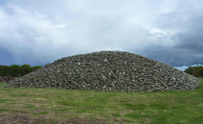
Memsie Cairn

Memsie Cairn is an ancient cairn in Memsie, near Fraserburgh, Aberdeenshire, Scotland. Historic Scotland believe the burial cairn to be from the Bronze...

Mormond Hill

Mormond Hill (from Gaelic Mórmhonadh, "big hill") is a broad eminence in Aberdeenshire, Scotland, not far from Fraserburgh. Its twin summits reach heights...
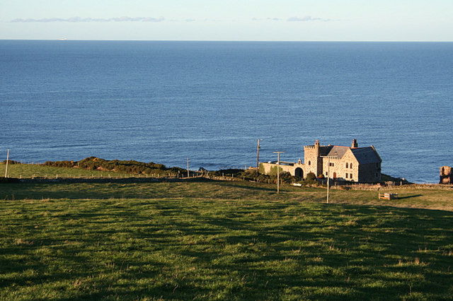
Dundarg Castle

Dundarg Castle is a ruined castle about 2 kilometres (1.2 mi) north-northeast of New Aberdour, Aberdeenshire, Scotland, built within the ramparts of an...

Nearby Amenities

Located within 500m of 57.635265,-2.1249384
Wellhead
Place: isolated_dwelling
Lat/Long: 57.6351184/-2.119762
Power: pole
Lat/Long: 57.6379301/-2.131573
Power: pole
Lat/Long: 57.6365618/-2.118347
Power: pole
Lat/Long: 57.6366465/-2.1172982
Power: pole
Lat/Long: 57.6363622/-2.1205303
Power: pole
Lat/Long: 57.6364642/-2.1194521
Power: pole
Lat/Long: 57.6378238/-2.1180573
Power: pole
Lat/Long: 57.6376702/-2.1198544
Power: pole
Lat/Long: 57.638121/-2.1201789
Power: pole
Lat/Long: 57.6386177/-2.120254
Power: pole
Lat/Long: 57.6358045/-2.1207534
Power: pole
Lat/Long: 57.6351937/-2.1210163
Power: pole
Lat/Long: 57.6344622/-2.1213104
Power: pole
Lat/Long: 57.6339038/-2.1215524
Power: pole
Lat/Long: 57.6333275/-2.1217777
Power: pole
Lat/Long: 57.6328786/-2.1219613
Power: pole
Lat/Long: 57.6327635/-2.1218612
Power: pole
Lat/Long: 57.6323302/-2.1220385
Power: pole
Lat/Long: 57.6319214/-2.1221992
Power: pole
Lat/Long: 57.6315685/-2.1223514
Power: pole
Lat/Long: 57.6311787/-2.1225058
Power: pole
Lat/Long: 57.6355466/-2.1202486
Power: pole
Lat/Long: 57.6352763/-2.1197312
Power: pole
Lat/Long: 57.6374578/-2.1306065
Power: pole
Lat/Long: 57.6373903/-2.1299421
Power: pole
Lat/Long: 57.637254/-2.1287508
Power: pole
Lat/Long: 57.6371105/-2.1275972
Power: pole
Lat/Long: 57.6369604/-2.1263903
Power: pole
Lat/Long: 57.6368325/-2.1252252
Power: pole
Lat/Long: 57.6366829/-2.1240673
Power: pole
Lat/Long: 57.6365438/-2.1229398
Power: pole
Lat/Long: 57.6364187/-2.1218967
Power: pole
Lat/Long: 57.6317025/-2.1201964
Power: pole
Lat/Long: 57.6318131/-2.121202
The data included in this document is from www.openstreetmap.org. The data is made available under ODbL.

Have you been to Blackhills?

Leave your review of Blackhills below (or comments, questions and feedback).