Blackheath

Settlement in Surrey Waverley

England

Blackheath

Chinthurst Hill - Waymarkers Two waymarkers point towards short circular walks (Bluebell Trail and Tower Trail) on Chinthurst Hill, north of Wonersh.
Chinthurst Hill - Waymarkers Credit: Colin Smith

Blackheath is a small village located in the district of Tandridge, Surrey, England. Situated about 20 miles south of London, it is nestled within the picturesque North Downs. With a population of around 500 residents, Blackheath exudes a charming and tranquil atmosphere, making it an ideal place for those seeking a peaceful countryside lifestyle.

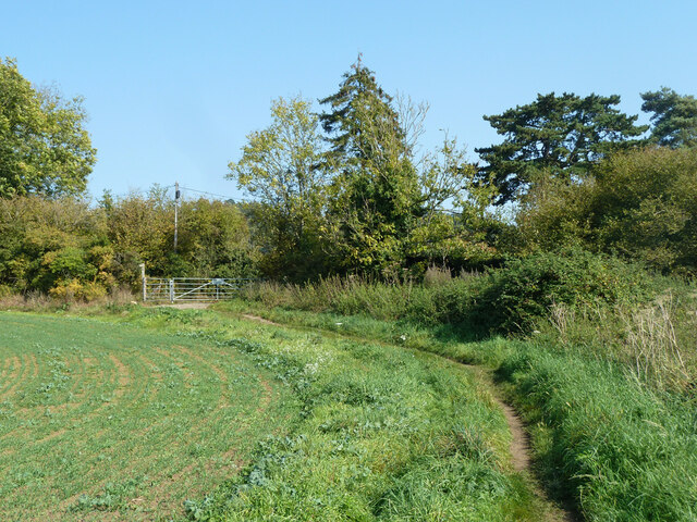
The village is known for its stunning natural beauty, characterized by rolling hills, verdant meadows, and ancient woodlands. It offers breathtaking views of the surrounding countryside, providing ample opportunities for outdoor activities such as hiking, cycling, and horse riding. The nearby Blackheath Common, a large open space, is a popular spot for picnics, dog walking, and nature enthusiasts.

Blackheath boasts a rich history, dating back to medieval times. The village is home to several historical landmarks, including St. Martin's Church, a Grade II listed building with origins dating back to the 12th century. The church features beautiful stained glass windows and a peaceful churchyard that adds to the village's serene ambiance.

Despite its rural setting, Blackheath enjoys good transport links. The village is easily accessible by road, with the A22 passing nearby, connecting it to surrounding towns and cities. Additionally, Blackheath has a railway station providing regular services to London and other towns in the region.

While Blackheath may be a small village, it offers a close-knit community spirit and a range of amenities. These include a local pub, village hall, and a village shop, providing the essentials for its residents. For a wider range of services, the neighboring towns of Oxted and Caterham are just a short drive away.

In summary, Blackheath is a delightful village in the Surrey countryside, offering a peaceful and idyllic setting for its residents. With its natural beauty, rich history, and convenient location, it is a hidden gem for those seeking a rural escape while still having access to urban amenities

If you have any feedback on the listing, please let us know in the comments section below.

Blackheath Images

Images are sourced within 2km of 51.205991/-0.52388757 or Grid Reference TQ0346. Thanks to Geograph Open Source API. All images are credited.

Chinthurst Hill - Waymarkers Two waymarkers point towards short circular walks (Bluebell Trail and Tower Trail) on Chinthurst Hill, north of Wonersh.
Chinthurst Hill - Waymarkers
Two waymarkers point towards short circular walks (Bluebell Trail and Tower Trail) on Chinthurst Hill, north of Wonersh.
Wonersh - From Chinthurst Hill Modern residential area to the north of Wonersh village centre - one of the prospects from heavily wooded Chinthurst Hill.
<span class="nowrap"><a title="www.surreywildlifetrust.org" rel="nofollow ugc noopener" href="http://www.surreywildlifetrust.org">Link</a><img style="margin-left:2px;" alt="External link" title="External link - shift click to open in new window" src="https://s1.geograph.org.uk/img/external.png" width="10" height="10"/></span>
Wonersh - From Chinthurst Hill
Modern residential area to the north of Wonersh village centre - one of the prospects from heavily wooded Chinthurst Hill. LinkExternal link
Chinthurst Hill - Tower The stone tower is a folly, built in the late 1930s for Lord Inchcape. The small column in the foreground carries a toposcope but many of its given views are obscured by trees.
<span class="nowrap"><a title="www.surreywildlifetrust.org" rel="nofollow ugc noopener" href="http://www.surreywildlifetrust.org">Link</a><img style="margin-left:2px;" alt="External link" title="External link - shift click to open in new window" src="https://s1.geograph.org.uk/img/external.png" width="10" height="10"/></span>
Chinthurst Hill - Tower
The stone tower is a folly, built in the late 1930s for Lord Inchcape. The small column in the foreground carries a toposcope but many of its given views are obscured by trees. LinkExternal link
Wonersh - Grantley Arms Historic timber-framed pub, ca 500 years old, in the centre of Wonersh village.
<span class="nowrap"><a title="www.thegrantleyarms.co.uk" rel="nofollow ugc noopener" href="http://www.thegrantleyarms.co.uk">Link</a><img style="margin-left:2px;" alt="External link" title="External link - shift click to open in new window" src="https://s1.geograph.org.uk/img/external.png" width="10" height="10"/></span>
Wonersh - Grantley Arms
Historic timber-framed pub, ca 500 years old, in the centre of Wonersh village. LinkExternal link
Wonersh - The Street Picturesque black and white timber-framed houses line The Street in Wonersh's historic village centre, a conservation area.
Wonersh - The Street
Picturesque black and white timber-framed houses line The Street in Wonersh's historic village centre, a conservation area.
Wonersh - The Street Picturesque black and white timber-framed houses line The Street in Wonersh's historic village centre, a conservation area.
Wonersh - The Street
Picturesque black and white timber-framed houses line The Street in Wonersh's historic village centre, a conservation area.
Wonersh - Village Store General store at the centre of Wonersh village.
Wonersh - Village Store
General store at the centre of Wonersh village.
Wonersh - Grantley Arms Historic timber-framed pub, ca 500 years old, in the centre of Wonersh village.
<span class="nowrap"><a title="www.thegrantleyarms.co.uk" rel="nofollow ugc noopener" href="http://www.thegrantleyarms.co.uk">Link</a><img style="margin-left:2px;" alt="External link" title="External link - shift click to open in new window" src="https://s1.geograph.org.uk/img/external.png" width="10" height="10"/></span>
Wonersh - Grantley Arms
Historic timber-framed pub, ca 500 years old, in the centre of Wonersh village. LinkExternal link
North Downs Line towards Redhill Looking from East Shalford Lane level crossing.
North Downs Line towards Redhill
Looking from East Shalford Lane level crossing.
Bridleway 610 Guildford exits to Halfpenny Lane
Bridleway 610 Guildford A route towards Shalford.
Bridleway 610 Guildford
A route towards Shalford.
Bridleway 610 Guildford Towards Halfpenny Lane beyond the gate.
Bridleway 610 Guildford
Towards Halfpenny Lane beyond the gate.
Chilworth Manor Vineyard Rows of vines in the 10 acre Chilworth Manor Vineyard, planted in 2013.
Chilworth Manor Vineyard
Rows of vines in the 10 acre Chilworth Manor Vineyard, planted in 2013.
Tangley House Office building dating from 1996 fronting Postford Pond.  Proposals are currently being considered for its conversion to housing.
Tangley House
Office building dating from 1996 fronting Postford Pond. Proposals are currently being considered for its conversion to housing.
Tangley House Office building dating from 1996 fronting Postford Pond.  Proposals are currently being considered for its conversion to housing.
Tangley House
Office building dating from 1996 fronting Postford Pond. Proposals are currently being considered for its conversion to housing.
14 Mill Reach House fronting Postford Pond.
14 Mill Reach
House fronting Postford Pond.
Field Field near Lockner Farm.  In the foreground is what would appear to be the footprint of a building, although none is shown on old maps.
Field
Field near Lockner Farm. In the foreground is what would appear to be the footprint of a building, although none is shown on old maps.
Field Field near Lockner Farm.
Field
Field near Lockner Farm.
Show me another place!

Blackheath is located at Grid Ref: TQ0346 (Lat: 51.205991, Lng: -0.52388757)

Administrative County: Surrey

District: Waverley

Police Authority: Surrey

What 3 Words

///proud.rejected.poorly. Near Chilworth, Surrey

Related Wikis

Hundred of Blackheath, Surrey

Blackheath Hundred or the Hundred of Blackheath was a hundred in the county of Surrey, England. It corresponds to parts of the districts of Waverley and...

St Augustine's Abbey, Chilworth

St Augustine's Abbey or Chilworth Abbey, formerly Chilworth Friary, is a Roman Catholic Benedictine abbey in Chilworth, Surrey. The building, which is...

Blackheath SSSI, Surrey

Blackheath is a 141.6-hectare (350-acre) biological Site of Special Scientific Interest south-east of Guildford in Surrey.This area of dry lowland heath...

Blackheath Common

Blackheath Common is an area of 250 acres (100 ha) of heathland in Surrey, England, near the village of Albury in the borough of Waverley. It is part of...

Nearby Amenities

Located within 500m of 51.205991,-0.52388757
The Villagers Inn
Disused: yes
Disused Amenity: pub
Lat/Long: 51.2060631/-0.5203945
Blackheath Common
Leisure: common
Source: photo
Wikidata: Q4922992
Wikipedia: en:Blackheath Common
Lat/Long: 51.2037348/-0.5194736
Historic: memorial
Lat/Long: 51.2079822/-0.5196562
Created By: Merkaartor 0.13
Lat/Long: 51.2077841/-0.519623
Created By: Merkaartor 0.13
Lat/Long: 51.2077199/-0.5196449
Created By: Merkaartor 0.13
Lat/Long: 51.207982/-0.5197094
Created By: Merkaartor 0.13
Lat/Long: 51.2081183/-0.520051
Created By: Merkaartor 0.13
Lat/Long: 51.2080955/-0.5198236
Created By: Merkaartor 0.13
Lat/Long: 51.2076139/-0.5196204
Created By: Merkaartor 0.13
Lat/Long: 51.2074115/-0.519559
Created By: Merkaartor 0.13
Lat/Long: 51.207316/-0.5195605
Created By: Merkaartor 0.13
Lat/Long: 51.2072084/-0.5195129
Created By: Merkaartor 0.13
Lat/Long: 51.2071503/-0.519521
Created By: Merkaartor 0.13
Lat/Long: 51.2069988/-0.5194398
Created By: Merkaartor 0.13
Lat/Long: 51.2069308/-0.5193677
Created By: Merkaartor 0.13
Lat/Long: 51.2067864/-0.5193337
Created By: Merkaartor 0.13
Lat/Long: 51.2066766/-0.5194072
Created By: Merkaartor 0.13
Lat/Long: 51.2064686/-0.5196008
Created By: Merkaartor 0.13
Lat/Long: 51.2064062/-0.5196323
Created By: Merkaartor 0.13
Lat/Long: 51.2063505/-0.5197433
Created By: Merkaartor 0.13
Lat/Long: 51.2061797/-0.519825
Power: substation
Lat/Long: 51.2039738/-0.5284802
Barrier: stile
Lat/Long: 51.2078336/-0.5196406
Bench
Backrest: yes
Shelter: yes
Lat/Long: 51.2061716/-0.5240306
Post Box
Royal Cypher: EIIR
Royal Cypher Wikidata: Q33102113
Lat/Long: 51.2057458/-0.5257623
Bench
Backrest: yes
Lat/Long: 51.2061051/-0.5239016
Bench
Backrest: yes
Seats: 4
Source: gps
Lat/Long: 51.2042812/-0.5201809
Bench
Backrest: yes
Seats: 4
Source: gps
Lat/Long: 51.2043228/-0.5202667
Bench
Backrest: yes
Seats: 4
Source: gps
Lat/Long: 51.2043985/-0.5203595
Bench
Backrest: yes
Seats: 4
Source: gps
Lat/Long: 51.2044424/-0.5204348
Bench
Backrest: yes
Seats: 4
Source: gps
Lat/Long: 51.2043644/-0.5206034
Bench
Backrest: yes
Seats: 3
Source: gps
Lat/Long: 51.2047458/-0.5189216
Bench
Backrest: yes
Seats: 3
Source: gps
Lat/Long: 51.2049458/-0.5190638
Bench
Backrest: yes
Seats: 3
Lat/Long: 51.2049988/-0.5203941
The data included in this document is from www.openstreetmap.org. The data is made available under ODbL.

Have you been to Blackheath?

Leave your review of Blackheath below (or comments, questions and feedback).