Blackgate

Settlement in Angus

Scotland

Blackgate

Path towards Restenneth Priory Pleasant green path with the line of trees following the embankment of an old railway line. Beyond the bridge the path rapidly becomes waterlogged due to the high water table and marshy ground.
Path towards Restenneth Priory Credit: Gordon Hatton

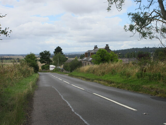
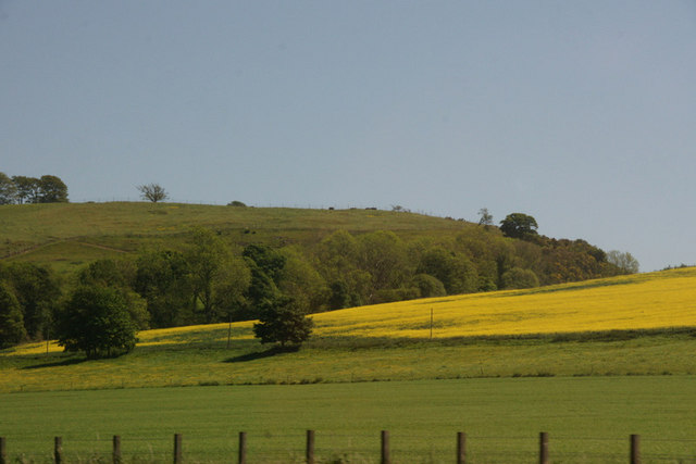
Blackgate is a small village located in the Angus region of Scotland. Situated along the banks of the River Isla, Blackgate is known for its picturesque countryside views and charming rural atmosphere. The village is surrounded by rolling hills and lush green farmland, making it a popular destination for outdoor enthusiasts and nature lovers.

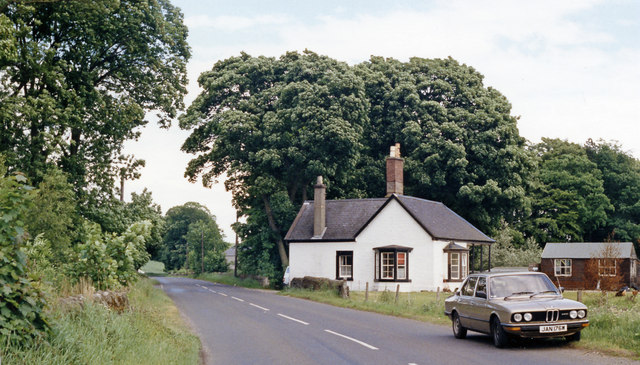
Blackgate is home to a tight-knit community of residents who take pride in their village and its history. The village features a mix of traditional stone cottages and modern homes, giving it a unique blend of old-world charm and contemporary living. The village also has a small primary school, a village hall, and a few local shops and businesses.

In terms of amenities, Blackgate is relatively quiet and peaceful, making it an ideal place for those looking to escape the hustle and bustle of city life. The village is well-connected to nearby towns and cities via a network of roads, making it easy to travel to and from Blackgate.

Overall, Blackgate is a quaint and idyllic village that offers a tranquil setting for residents and visitors alike. Its beautiful surroundings and friendly community make it a hidden gem in the Angus region of Scotland.

If you have any feedback on the listing, please let us know in the comments section below.

Blackgate Images

Images are sourced within 2km of 56.665268/-2.8436299 or Grid Reference NO4852. Thanks to Geograph Open Source API. All images are credited.

Path towards Restenneth Priory Pleasant green path with the line of trees following the embankment of an old railway line. Beyond the bridge the path rapidly becomes waterlogged due to the high water table and marshy ground.
Path towards Restenneth Priory
Pleasant green path with the line of trees following the embankment of an old railway line. Beyond the bridge the path rapidly becomes waterlogged due to the high water table and marshy ground.
Pitscandly House A small, but historically important grade 'A' listed house which dates back to the late 17th century.
Pitscandly House
A small, but historically important grade 'A' listed house which dates back to the late 17th century.
Walled garden at Pitscandly The walled garden to the east of the house is grade 'C' listed. Note that this is private property and not open to the public.
Walled garden at Pitscandly
The walled garden to the east of the house is grade 'C' listed. Note that this is private property and not open to the public.
Restenneth Priory tower Hard to believe that the tower and spire are medieval in date as the spire almost looks Victorian, but research confirms that the structure is medieval with the lower part of the tower being 11th/12th century and the spire 15th century. I can't think of another medieval monastic building with a spire, but I'm sure there will be another contributor who knows of one.
Restenneth Priory tower
Hard to believe that the tower and spire are medieval in date as the spire almost looks Victorian, but research confirms that the structure is medieval with the lower part of the tower being 11th/12th century and the spire 15th century. I can't think of another medieval monastic building with a spire, but I'm sure there will be another contributor who knows of one.
Choir of the original church at Restenneth Priory Apart from the notable tower and spire, there's not a lot else left standing on this site. The walls of the choir are still in situ and rise to around 5m in height.
Choir of the original church at Restenneth Priory
Apart from the notable tower and spire, there's not a lot else left standing on this site. The walls of the choir are still in situ and rise to around 5m in height.
Restenneth Priory - old doorway An old arched doorway at the base of the tower at Restenneth Priory. This looks to be very old and could be as early as 11th century, with the tower decreasing in age as it increases in height. The spire above could be 400 years newer than this doorway.
Restenneth Priory - old doorway
An old arched doorway at the base of the tower at Restenneth Priory. This looks to be very old and could be as early as 11th century, with the tower decreasing in age as it increases in height. The spire above could be 400 years newer than this doorway.
Restenneth Priory Remains in 1992 The evening sunshine gave the remains a typical red sandstone glow of Arbroath & Montrose etc
Restenneth Priory Remains in 1992
The evening sunshine gave the remains a typical red sandstone glow of Arbroath & Montrose etc
B9134 at Myrestone The B9134 heading down the hill towards Forfar at Myrestone.
B9134 at Myrestone
The B9134 heading down the hill towards Forfar at Myrestone.
Trees along burn at Parkford, north of Forfar
Pond and pens at Murton Farm Nature Reserve Tea room and farm walks just outside Forfar.
Pond and pens at Murton Farm Nature Reserve
Tea room and farm walks just outside Forfar.
Pond at Murton Looking towards Thistlebank on the Forfar Friockeim road [A932].
Pond at Murton
Looking towards Thistlebank on the Forfar Friockeim road [A932].
Pond at Murton Farm Looking east across one of the ponds that have been created as part of the farm nature reserve.
Pond at Murton Farm
Looking east across one of the ponds that have been created as part of the farm nature reserve.
Spring Scene near Restenneth, Forfar The picture was taken from the road that joins the Forfar / Aberlemno Road and the Forfar / Montrose Road, about 200 yards east of Bowman's Crossing. Part of Restenneth Priory can be seen in the background.
Spring Scene near Restenneth, Forfar
The picture was taken from the road that joins the Forfar / Aberlemno Road and the Forfar / Montrose Road, about 200 yards east of Bowman's Crossing. Part of Restenneth Priory can be seen in the background.
Remains of the Augustinian Priory of Restenneth
Clocksbriggs station, remains, 1988 View eastward, towards Bridge of Dun and Aberdeen: ex-Caledonian former Perth - Aberdeen main line, closed from 4/9/67. The station was closed 5/12/55 (goods 15/6/64). As can be seen the station became a private house - and is advertised as a B&B.
Clocksbriggs station, remains, 1988
View eastward, towards Bridge of Dun and Aberdeen: ex-Caledonian former Perth - Aberdeen main line, closed from 4/9/67. The station was closed 5/12/55 (goods 15/6/64). As can be seen the station became a private house - and is advertised as a B&B.
Road to Baggerton, Lunanhead
Barn near Lunanhead
Barn near Lunanhead
Show me another place!

Blackgate is located at Grid Ref: NO4852 (Lat: 56.665268, Lng: -2.8436299)

Unitary Authority: Angus

Police Authority: Tayside

What 3 Words

///bloomers.rang.translated. Near Forfar, Angus

Nearby Locations

Blackgate

Related Wikis

Restenneth Priory

Restenneth Priory was a monastic house of Augustinian canons founded by Jedburgh Abbey, with the patronage of King Malcolm IV of Scotland, in 1153. Although...

Clocksbriggs railway station

Clocksbriggs railway station served the town of Forfar, Angus, Scotland from 1848 to 1964 on the Arbroath and Forfar Railway. == History == The station...

Loch Fithie

Loch Fithie is a small, lowland freshwater loch lying approximately 2 miles (3.2 km) east of Forfar, Scotland. It is approximately 800 m (2,600 ft) in...

Whitehills Hospital

Whitehills Hospital is a health facility in Station Road in Forfar, Angus, Scotland. Formerly an isolation hospital and then a geriatric hospital, in its...

Nearby Amenities

Located within 500m of 56.665268,-2.8436299
Blackgate
Place: hamlet
Lat/Long: 56.6649308/-2.8426843
Pitscandly
Place: hamlet
Lat/Long: 56.6612916/-2.8425697
Clochtow
Place: hamlet
Lat/Long: 56.6635992/-2.8466049
Chapelcroft
Place: isolated_dwelling
Lat/Long: 56.6621133/-2.8493085
Power: pole
Lat/Long: 56.6694942/-2.8423187
Power: pole
Lat/Long: 56.669221/-2.8430893
Power: pole
Lat/Long: 56.6688584/-2.8441333
Power: pole
Lat/Long: 56.6685127/-2.8451608
Power: pole
Lat/Long: 56.6683741/-2.8455826
Power: pole
Lat/Long: 56.6681553/-2.8461788
Power: pole
Lat/Long: 56.6677927/-2.8472134
Power: pole
Lat/Long: 56.6674405/-2.8482291
Power: pole
Lat/Long: 56.6671012/-2.8492542
Power: pole
Lat/Long: 56.6665534/-2.8496313
Power: pole
Lat/Long: 56.6660147/-2.8499659
Power: pole
Lat/Long: 56.6653646/-2.8504137
Power: pole
Lat/Long: 56.6647456/-2.8508544
Power: pole
Lat/Long: 56.6640527/-2.8513045
Power: pole
Lat/Long: 56.6690561/-2.8461536
Power: pole
Lat/Long: 56.6634143/-2.8476965
Power: pole
Lat/Long: 56.6637557/-2.8472362
Power: pole
Lat/Long: 56.6640885/-2.846472
Power: pole
Lat/Long: 56.6642924/-2.8459849
Power: pole
Lat/Long: 56.664522/-2.845348
Power: pole
Lat/Long: 56.66658/-2.8484809
Power: pole
Lat/Long: 56.6660643/-2.8476921
Power: pole
Lat/Long: 56.6655584/-2.8469122
Power: pole
Lat/Long: 56.6650328/-2.8461212
Power: pole
Lat/Long: 56.6641425/-2.8447715
Power: pole
Lat/Long: 56.6639682/-2.8444922
Power: pole
Lat/Long: 56.6637668/-2.8429972
Power: pole
Lat/Long: 56.6635801/-2.8415649
Power: pole
Lat/Long: 56.663574/-2.8414844
Power: pole
Lat/Long: 56.6641696/-2.8417727
Power: pole
Lat/Long: 56.6647639/-2.8419693
Bus Stop
Clochtow Farm Road End
Bus: yes
Public Transport: platform
Lat/Long: 56.6633707/-2.8463894
Bus Stop
Clochtow Farm Road End
Bus: yes
Public Transport: platform
Lat/Long: 56.6634709/-2.8463733
The data included in this document is from www.openstreetmap.org. The data is made available under ODbL.

Have you been to Blackgate?

Leave your review of Blackgate below (or comments, questions and feedback).